Signs Tagged With Big Green Sign
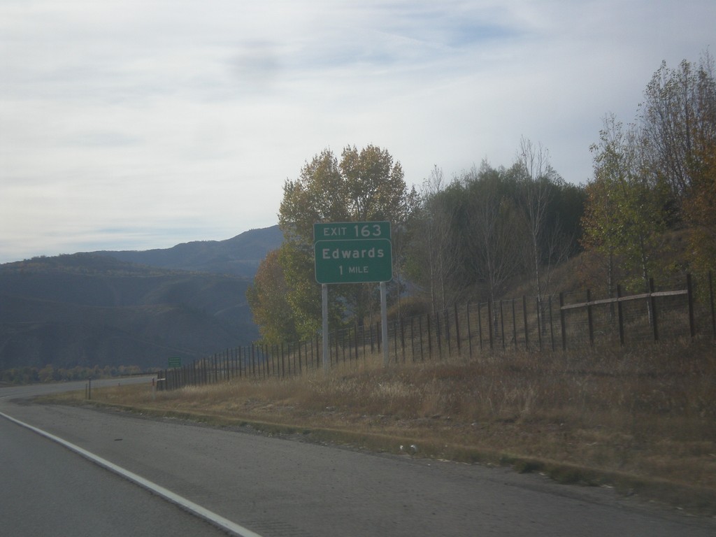
I-70 West - Exit 163
I-70 west approaching Exit 163 - Edwards.
Taken 10-08-2016
 Edwards
Eagle County
Colorado
United States
Edwards
Eagle County
Colorado
United States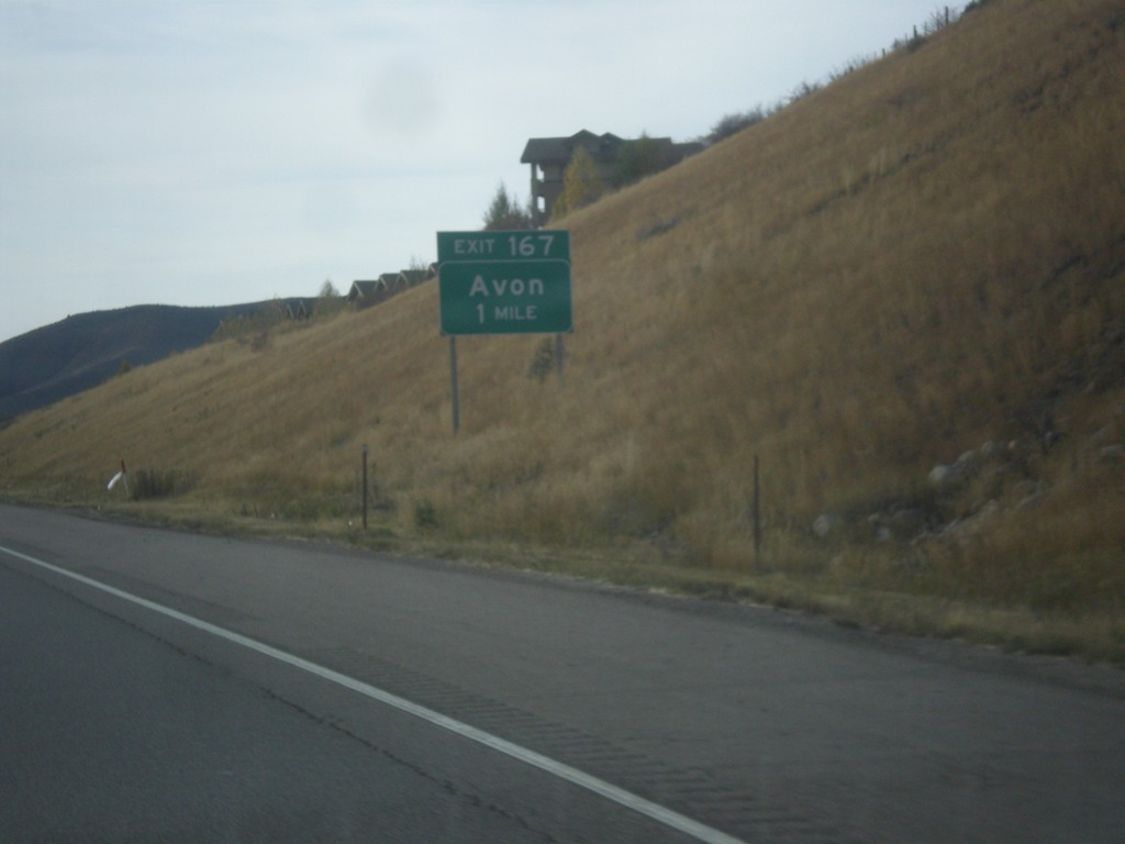
I-70 West - Exit 167
I-70 west approaching Exit 167 - Avon.
Taken 10-08-2016
Edwards
Eagle County
Colorado
United States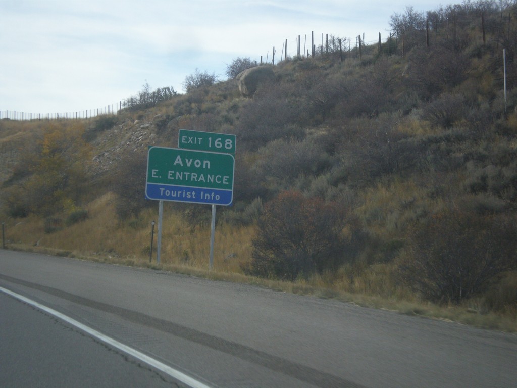
I-70 West - Exit 168
I-70 west at Exit 168 - Avon/East Entrance.
Taken 10-08-2016
Avon
Eagle County
Colorado
United States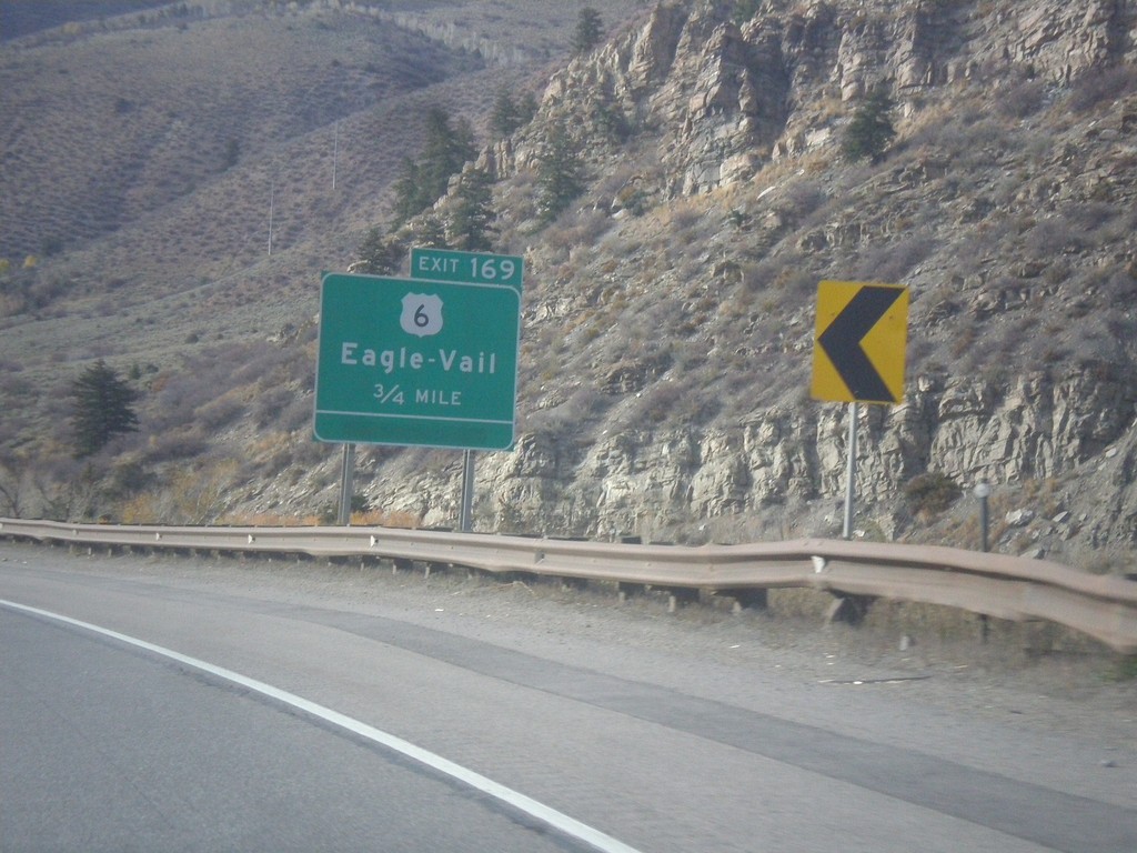
I-70 West - Exit 169
I-70 west approaching Exit 169 - US-6/Eagle - Vail
Taken 10-08-2016
 Avon
Eagle County
Colorado
United States
Avon
Eagle County
Colorado
United States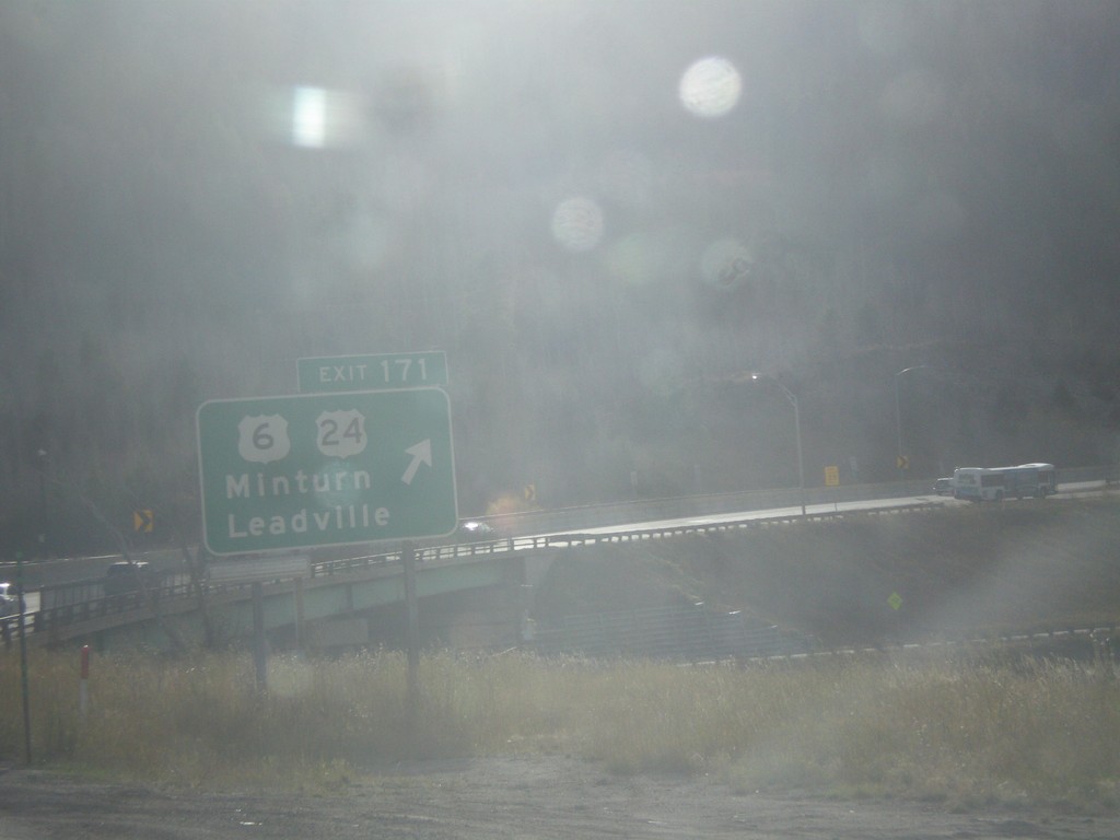
I-70 West - Exit 171
I-70 west at Exit 171 - US-6/US-24/Minturn/Leadville. This is the eastern end of US-24. US-6 leaves I-70 westbound here.
Taken 10-08-2016
 Vail
Eagle County
Colorado
United States
Vail
Eagle County
Colorado
United States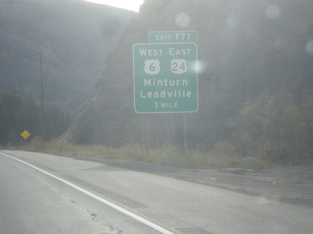
I-70 West - Exit 171
I-70 west approaching Exit 171 - US-6 West/US-24 East/Minturn/Leadville.
Taken 10-08-2016
Vail
Eagle County
Colorado
United States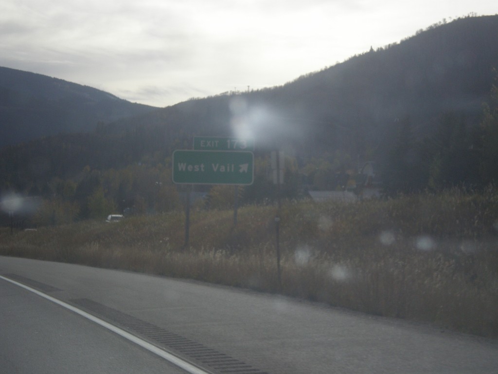
I-70 West - Exit 173
I-70 west at Exit 173 - West Vail.
Taken 10-08-2016
Vail
Eagle County
Colorado
United States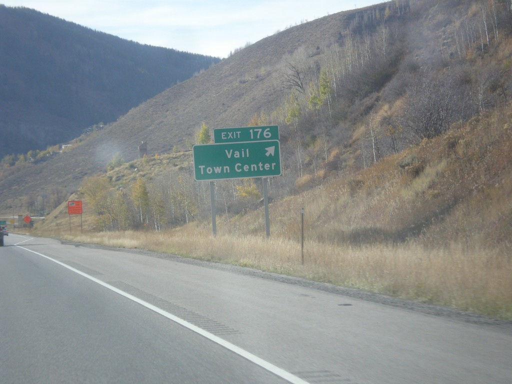
I-70 West - Exit 176
I-70 west at Exit 176 - Vail Town Center.
Taken 10-08-2016
Vail
Eagle County
Colorado
United States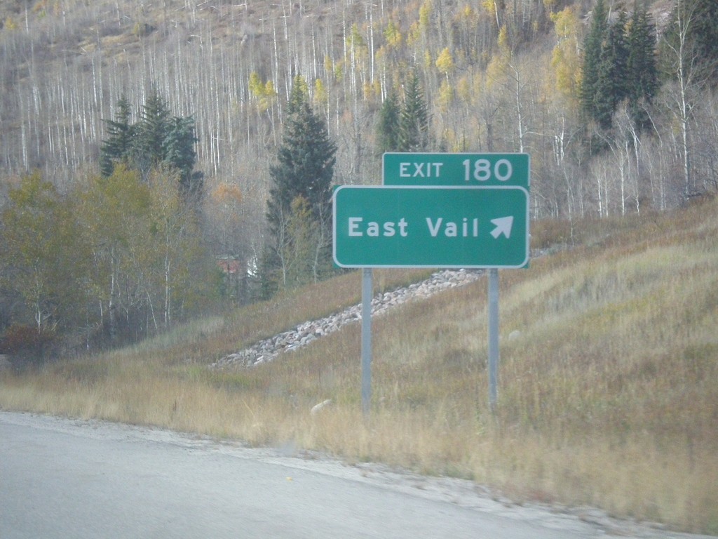
I-70 West - Exit 180
I-70 west at Exit 180 - East Vail.
Taken 10-08-2016
Vail
Eagle County
Colorado
United States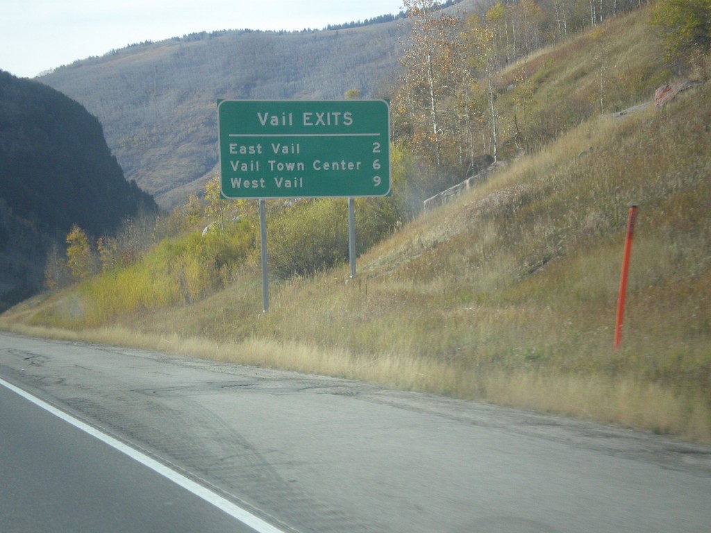
I-70 West - Vail Exits
Vail Exits on I-70 East - East Vail, Vail Town Center, and West Vail.
Taken 10-08-2016
Vail
Eagle County
Colorado
United States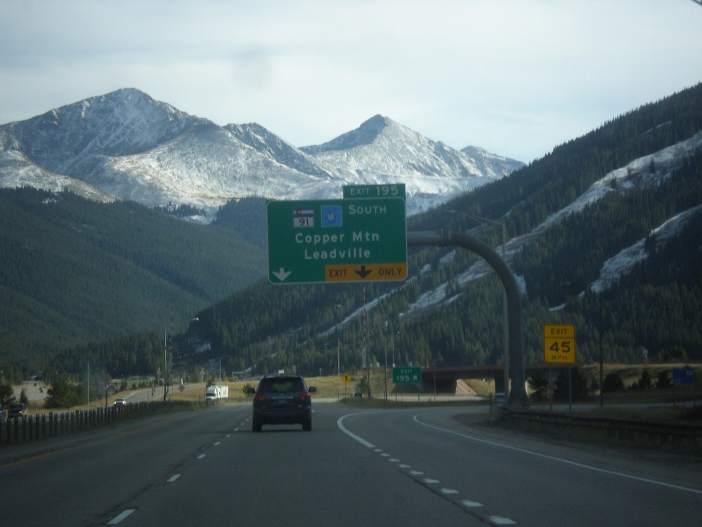
I-70 West - Exit 195
I-70 west at Exit 195 - CO-91 South/Cooper Mountain/Leadville.
Taken 10-08-2016
 Frisco
Summit County
Colorado
United States
Frisco
Summit County
Colorado
United States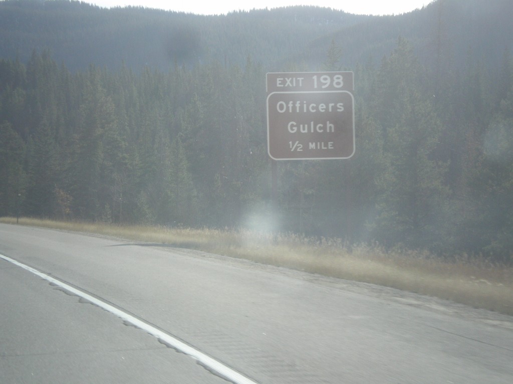
I-70 West - Exit 198
I-70 west approaching Exit 198 - Officers Gulch.
Taken 10-08-2016
Frisco
Summit County
Colorado
United States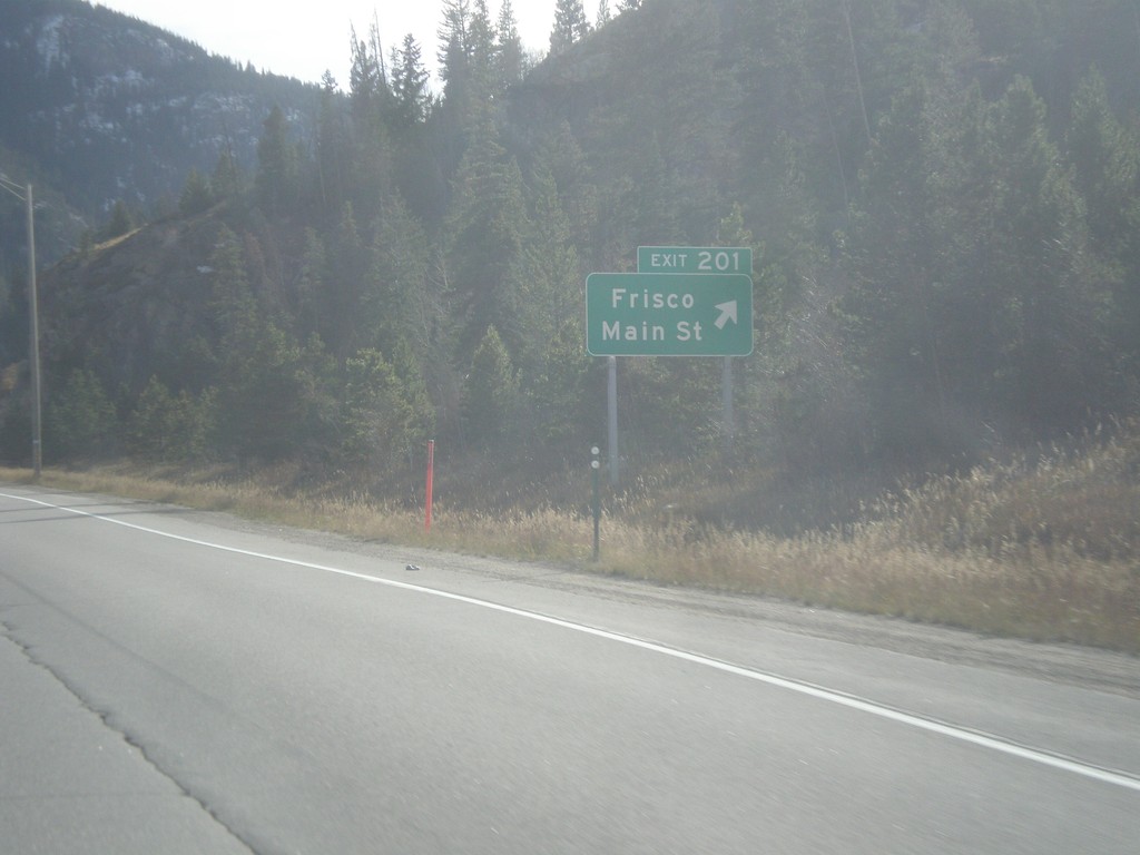
I-70 West - Exit 201
I-70 west at Exit 201 - Frisco/Main St.
Taken 10-08-2016
Frisco
Summit County
Colorado
United States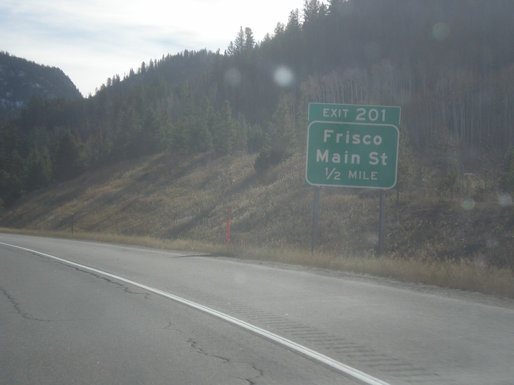
I-70 West - Exit 201
I-70 west approaching Exit 201 - Frisco/Main St.
Taken 10-08-2016
Frisco
Summit County
Colorado
United States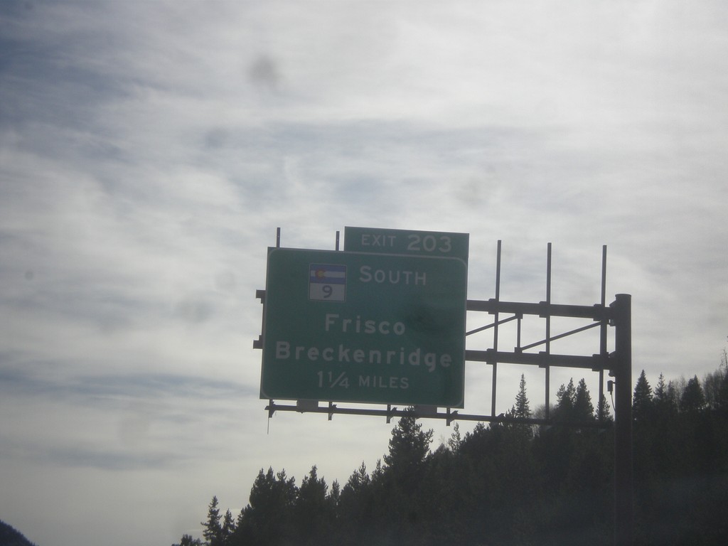
I-70 West - Exit 203
I-70 west approaching Exit 203 - CO-9 South/Frisco/Breckenridge. CO-9 south leaves I-70 westbound here.
Taken 10-08-2016
 Frisco
Summit County
Colorado
United States
Frisco
Summit County
Colorado
United States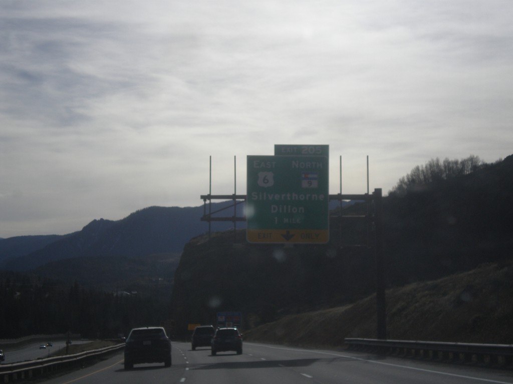
I-70 West - Exit 205
I-70 West at Exit 205 - US-6 East/CO-9 North/Silverthorne/Dillon. CO-9 south and US-6 west join I-70 westbound.
Taken 10-08-2016
Silverthorne
Summit County
Colorado
United States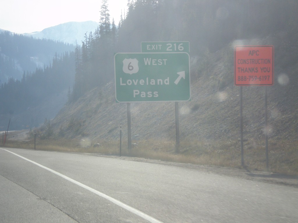
I-70 West - Exit 216
I-70 west at Exit 216 - US-6 West/Loveland Pass. US-6 leaves I-70 westbound here, and crosses Loveland Pass, while I-70 enters the Eisenhower Tunnel. This is the last exit before the Eisenhower Tunnel.
Taken 10-08-2016
Keystone
Summit County
Colorado
United States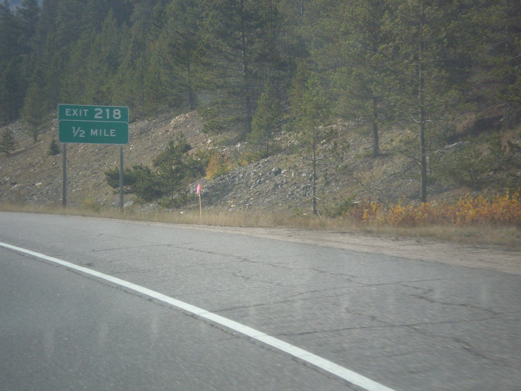
I-70 West - Exit 218
I-70 west approaching Exit 218.
Taken 10-08-2016
Dillon
Clear Creek County
Colorado
United States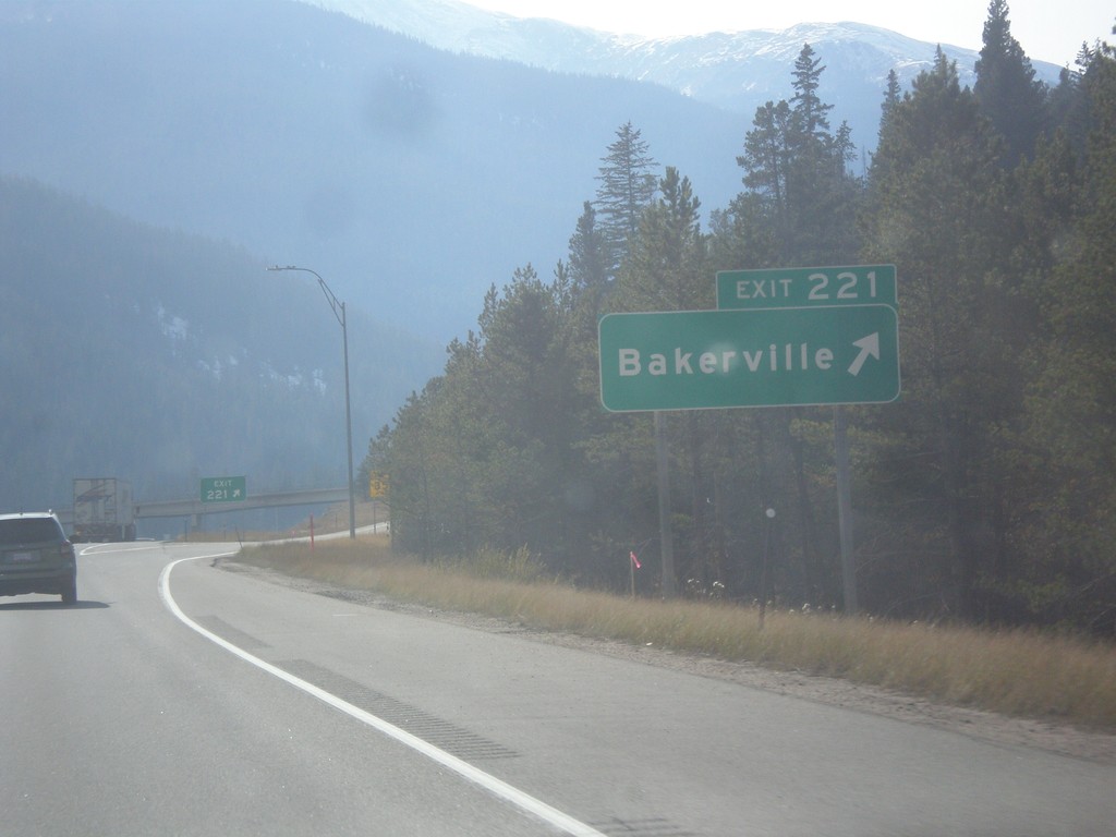
I-70 West - Exit 221
I-70 west at Exit 221 - Bakerville.
Taken 10-08-2016
Silver Plume
Clear Creek County
Colorado
United States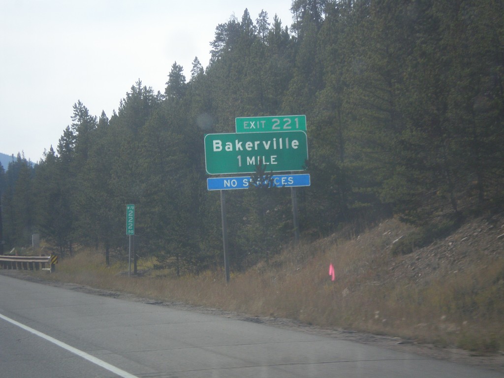
I-70 West - Exit 221
I-70 west approaching Exit 221 - Bakerville.
Taken 10-08-2016
Silver Plume
Clear Creek County
Colorado
United States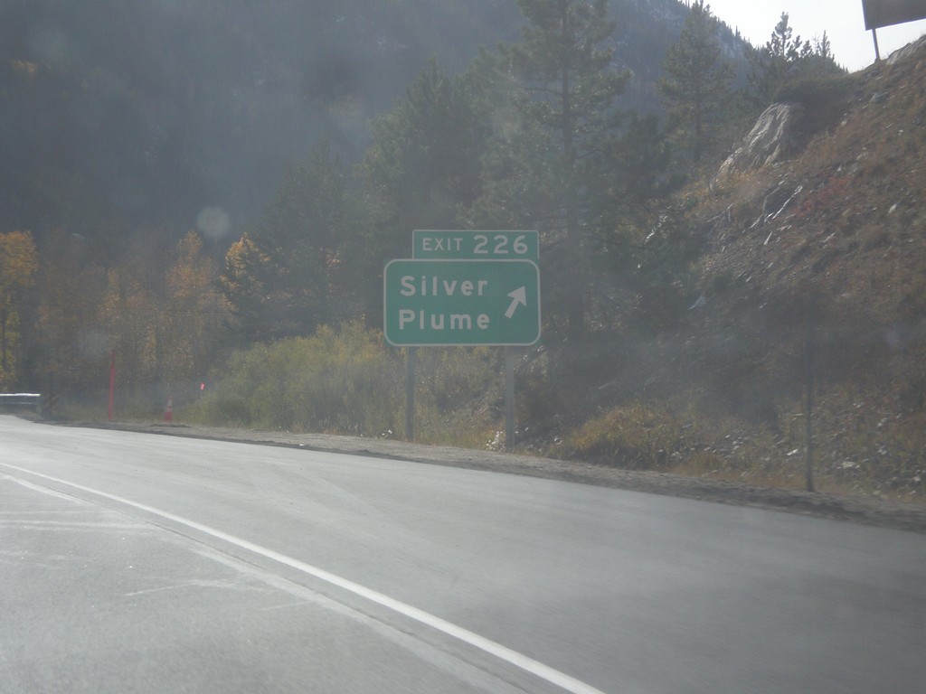
I-70 West - Exit 226
I-70 west at Exit 226 - Silver Plume.
Taken 10-08-2016
Silver Plume
Clear Creek County
Colorado
United States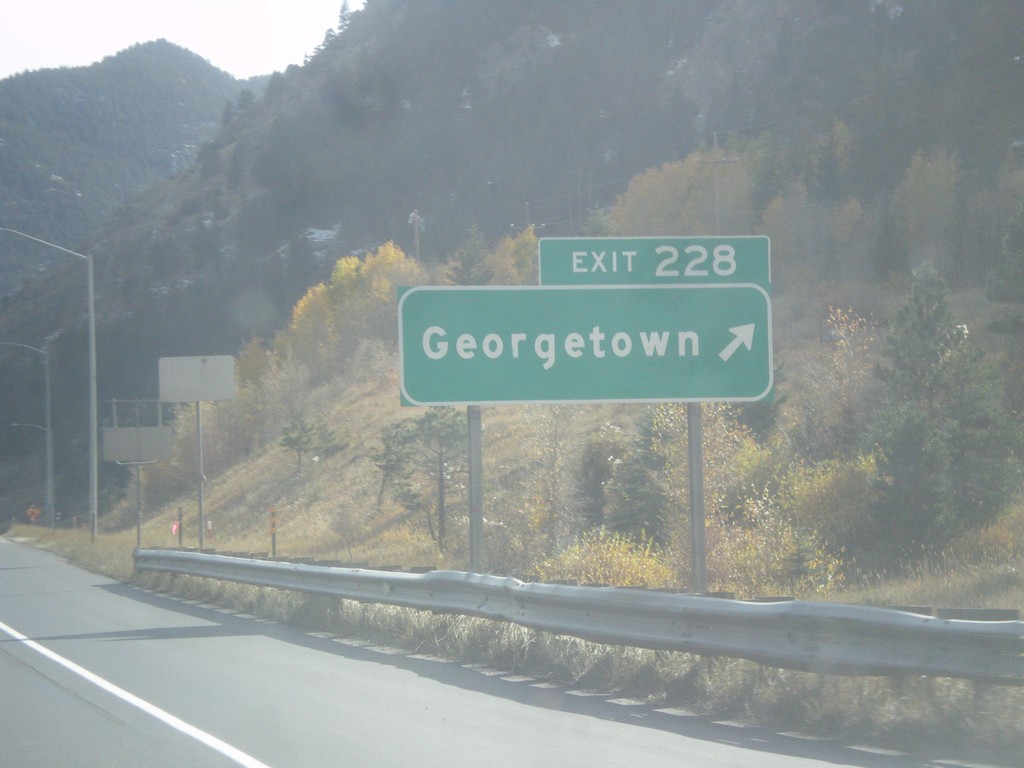
I-70 West - Exit 228
I-70 west at Exit 228 - Georgetown.
Taken 10-08-2016
Georgetown
Clear Creek County
Colorado
United States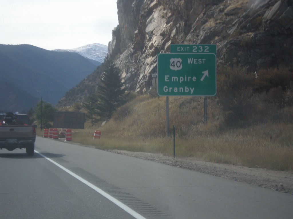
I-70 West - Exit 232
I-70 west at Exit 232 - US-40 West/Empire/Granby. US-40 leaves I-70 westbound, and begins climb to Berthoud Pass.
Taken 10-08-2016
 Empire
Clear Creek County
Colorado
United States
Empire
Clear Creek County
Colorado
United States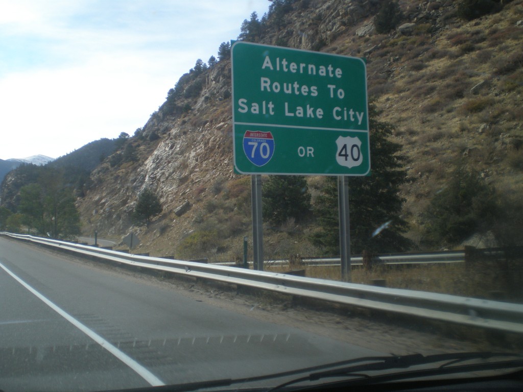
I-70 West - Routes to Salt Lake City
I-70 west approaching Exit 232 - US-40 West. Alternate routes to Salt Lake City via either US-40 West (and I-80) or I-70 West (and US-191/US-89/I-15).
Taken 10-08-2016
Idaho Springs
Clear Creek County
Colorado
United States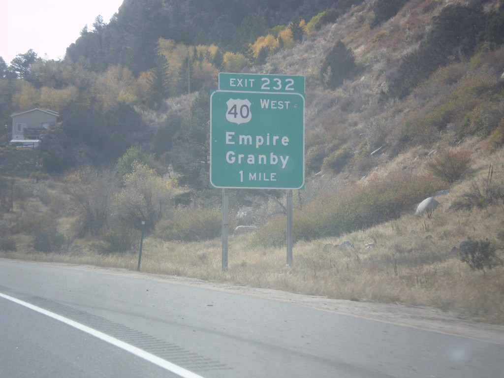
I-70 West - Exit 232
I-70 west approaching Exit 232 - US-40 West/Empire/Granby.
Taken 10-08-2016
Downieville-Lawson-Dumont
Clear Creek County
Colorado
United States