Signs Tagged With Big Green Sign
I-225 South Approaching I-25
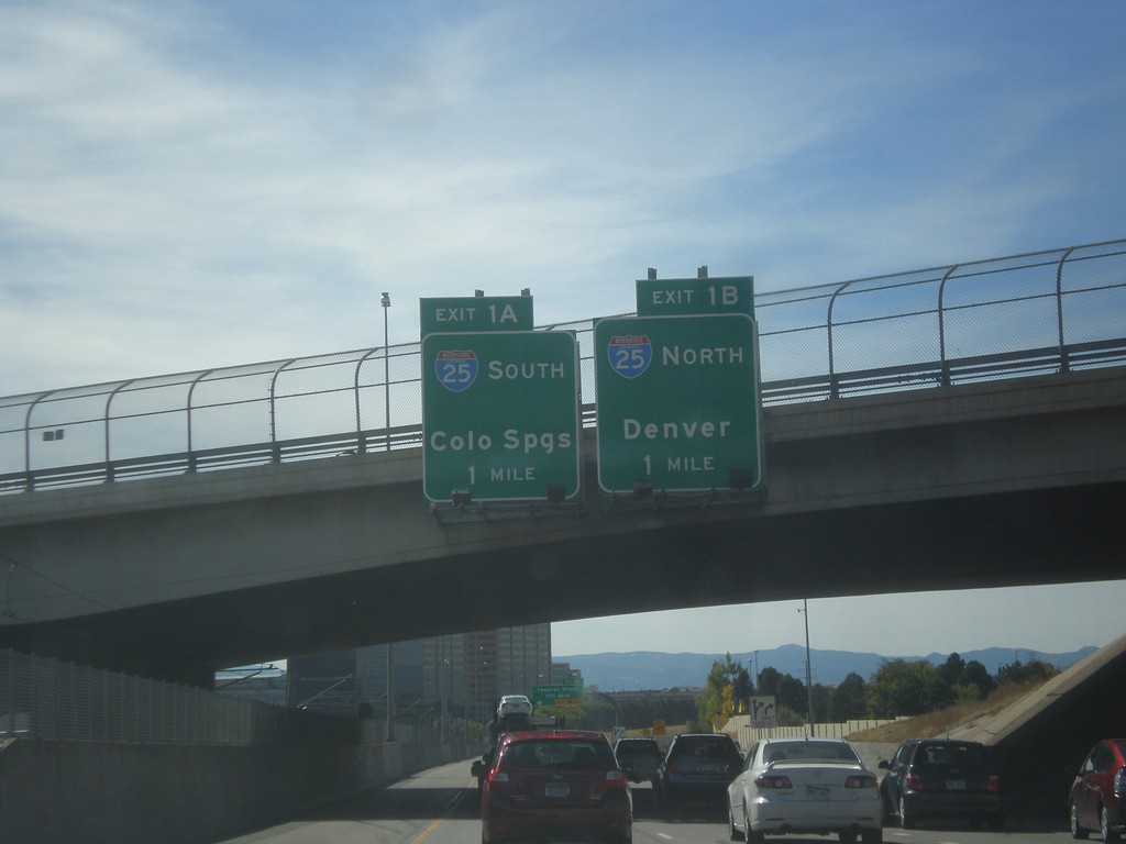
I-225 South approaching Exit 1A - I-25 South/Colorado Springs, and Exit 1B - I-25 north/Denver. This is the southern end of I-225.
Taken 10-08-2016


 Denver
 County
Colorado
United States
Denver
Denver County
Colorado
United States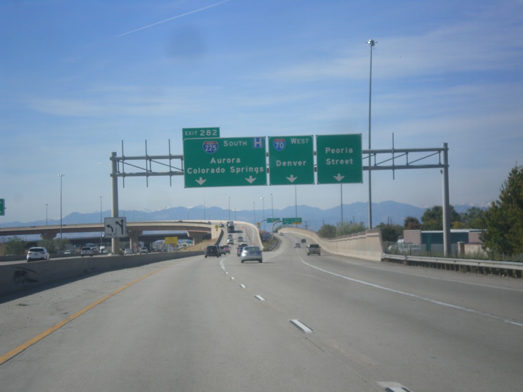
I-70 West/I-225 South Separation - Aurora
I-70 West/I-225 South Separation in Aurora. Merge left for (I-70) Exit 282 - I-225 South/Aurora/Colorado Springs. Merge right for ramp for I-70 west to Denver. Use far right lane for Peoria St.
Taken 10-08-2016

 Denver
Adams County
Colorado
United States
Denver
Adams County
Colorado
United States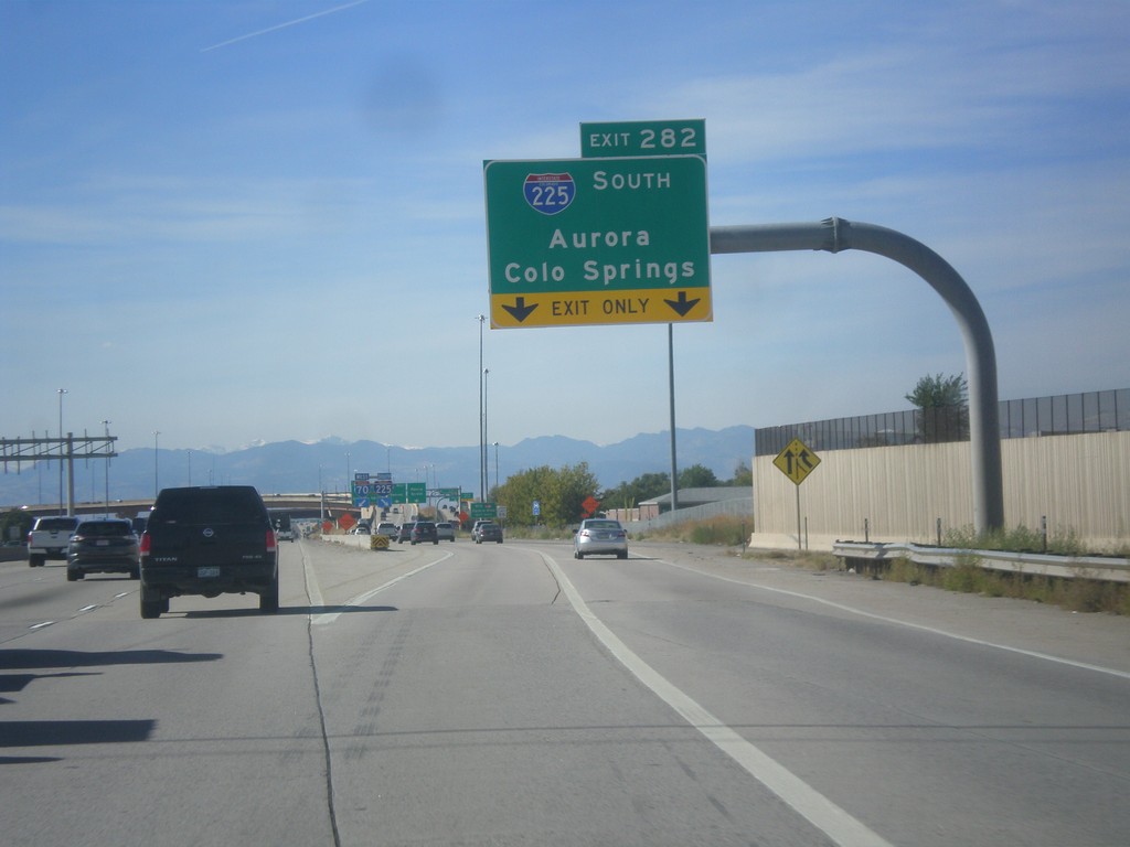
I-70 West - Exit 282
I-70 west at Exit 282 - I-225 South/Aurora/Colorado Springs.
Taken 10-08-2016
Aurora
Adams County
Colorado
United States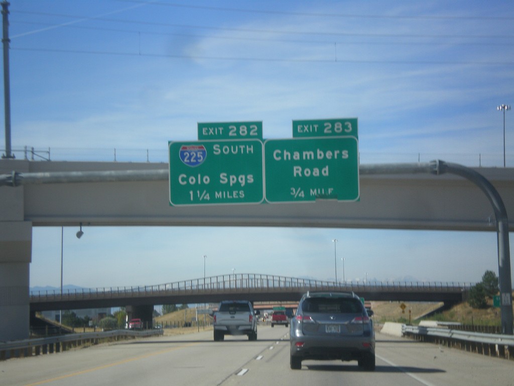
I-70 West - Exits 283 and 282
I-70 west approaching Exit 283 - Chambers Road. Approaching Exit 282 - I-225 South/Colorado Springs.
Taken 10-08-2016
Aurora
Adams County
Colorado
United States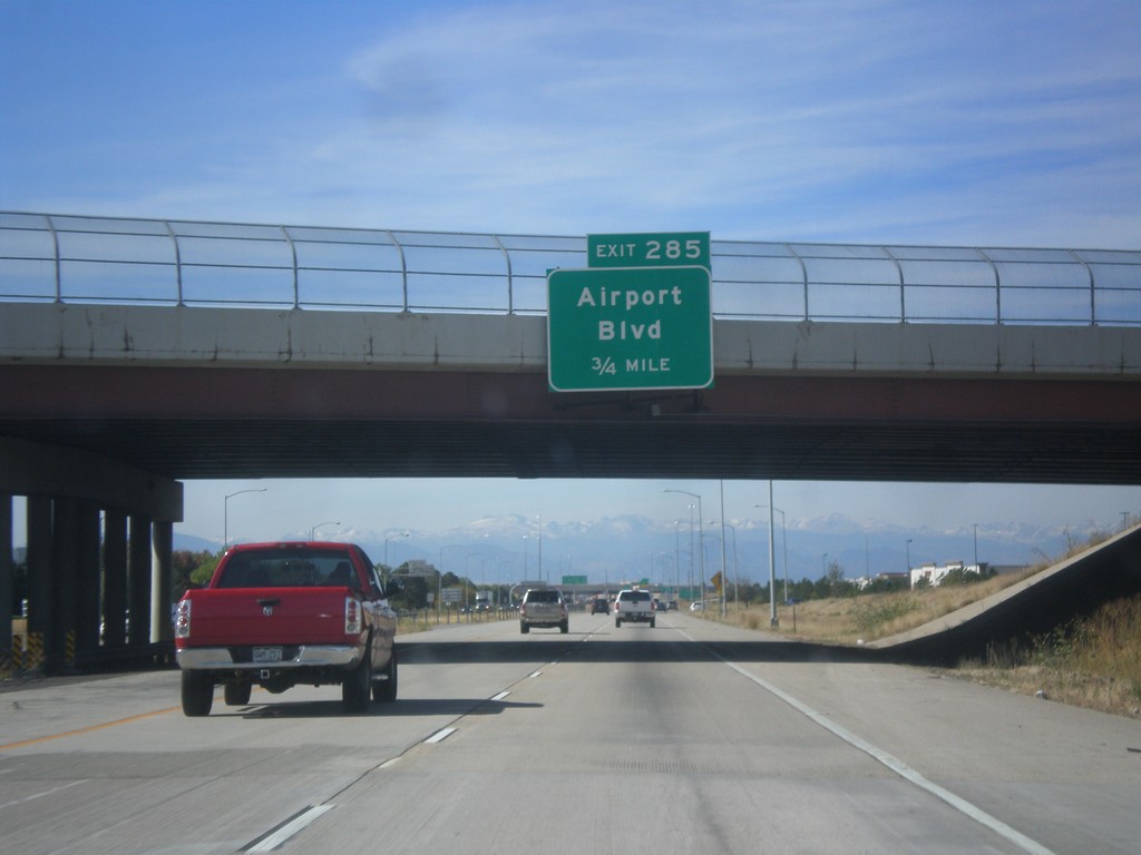
I-70 West - Exit 285
I-70 west approaching Exit 285 - Airport Blvd. Use Exit 285 for access to Denver International Airport.
Taken 10-08-2016
Aurora
Adams County
Colorado
United States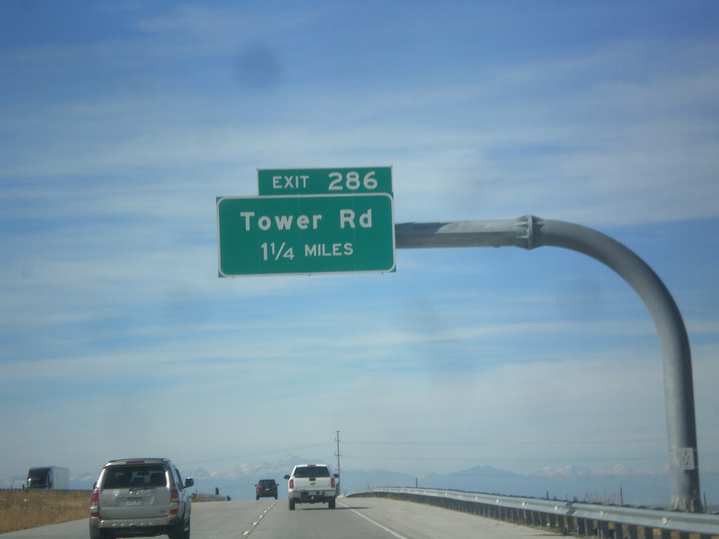
I-70 West - Exit 286
I-70 west approaching Exit 286 - Tower Road.
Taken 10-08-2016
Aurora
Adams County
Colorado
United States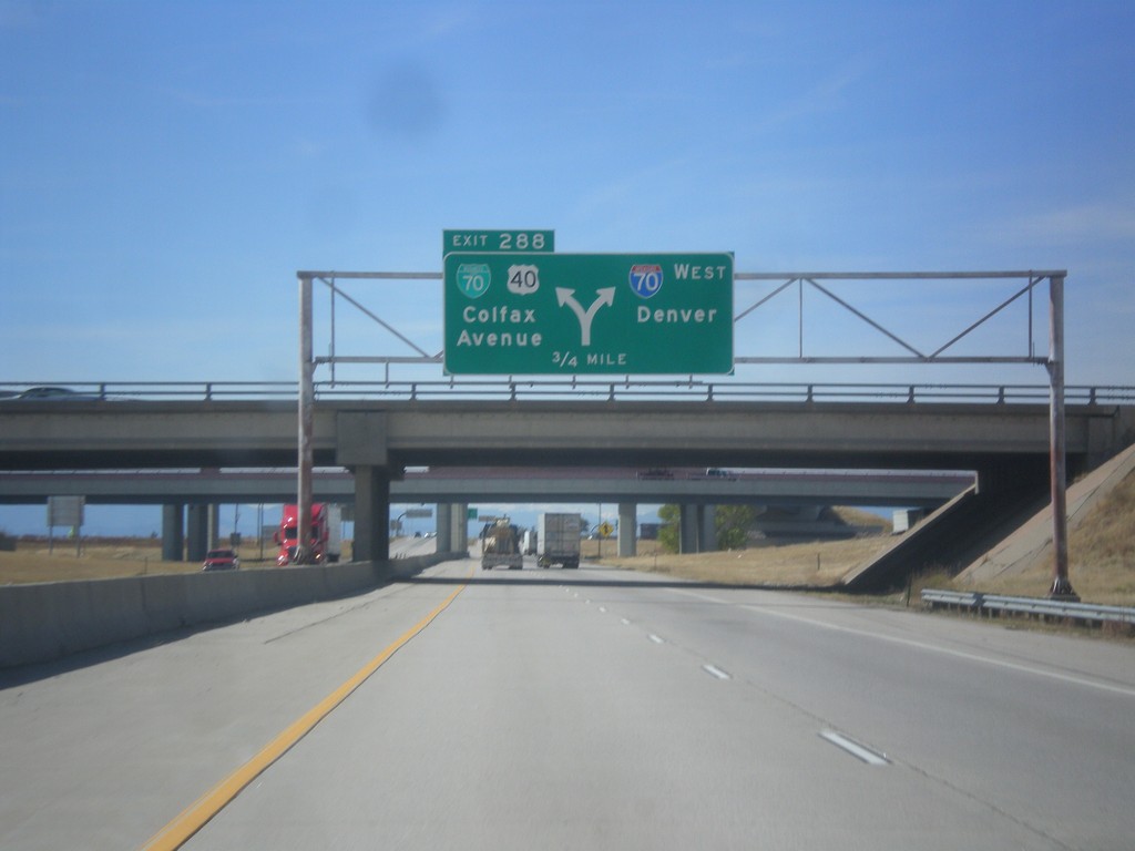
I-70 West - Exit 288
I-70 west approaching Exit 288 - BL-70/US-40/Colfax Ave. Exit 288 is a left exit; merge right to continue west on I-70 to Denver. US-40 leaves I-70 westbound here, and follows Colfax Ave. through Denver. US-40 rejoins I-70 near Golden. This is the eastern end of the Denver business loop.
Taken 10-08-2016


 Adams County
Colorado
United States
Adams County
Colorado
United States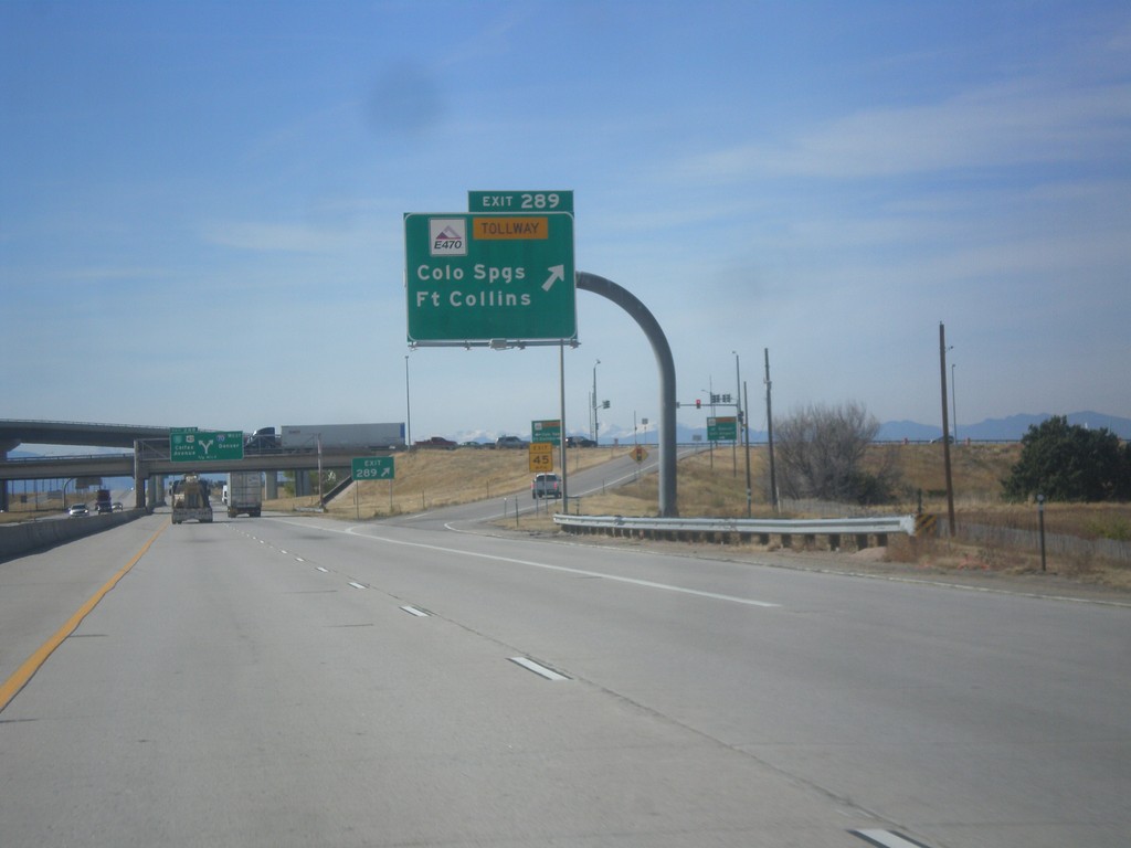
I-70 West - Exit 289
I-70 west at Exit 289 - E-470 Tollway/Colorado Springs/Fort Collins. E-470 is the tolled section of the beltway around Denver.
Taken 10-08-2016
 Aurora
Adams County
Colorado
United States
Aurora
Adams County
Colorado
United States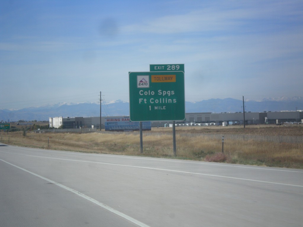
I-70 West - Exit 287
I-70 West at E-470 Junction to Colorado Springs and Fort Collins. E-470 is part of the beltway around Denver. The eastern part of the beltway is tolled and is signed as E-470. The western part of the beltway is free and is signed as CO-470.
Taken 10-08-2016
Aurora
Adams County
Colorado
United States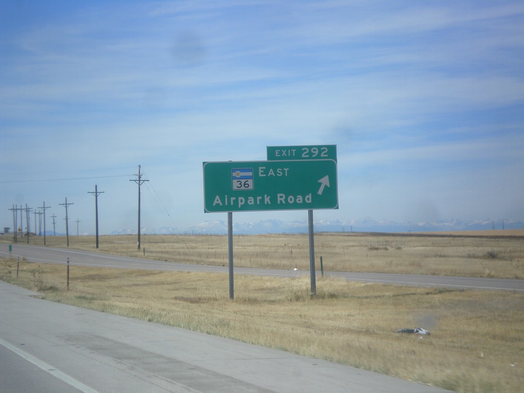
I-70 West - Exit 292
I-70 west at Exit 292 - CO-36 East/Airpark Road.
Taken 10-08-2016
 Watkins
Adams County
Colorado
United States
Watkins
Adams County
Colorado
United States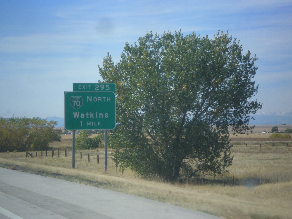
I-70 West - Exit 295
I-70 west approaching Exit 295 - BL-70 North/Watkins.
Taken 10-08-2016
Watkins
Adams County
Colorado
United States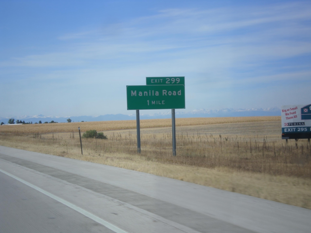
I-70 West - Exit 299
I-70 west approaching Exit 299 - Manilla Road.
Taken 10-08-2016
Bennett
Adams County
Colorado
United States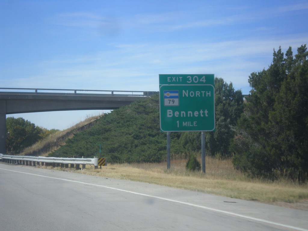
I-70 West - Exit 304
I-70 West approaching Exit 304 - CO-79 North/Bennett
Taken 10-08-2016
 Bennett
Adams County
Colorado
United States
Bennett
Adams County
Colorado
United States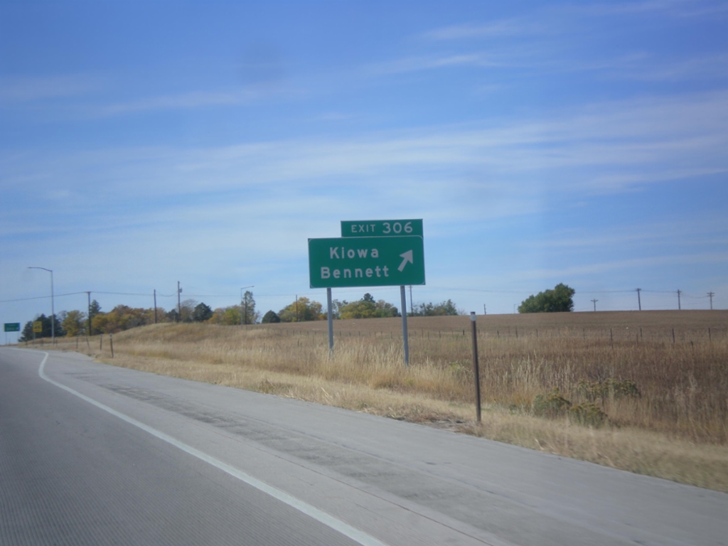
I-70 West - Exit 306
I-70 west at Exit 306 - Kiowa/Bennett.
Taken 10-08-2016
Bennett
Arapahoe County
Colorado
United States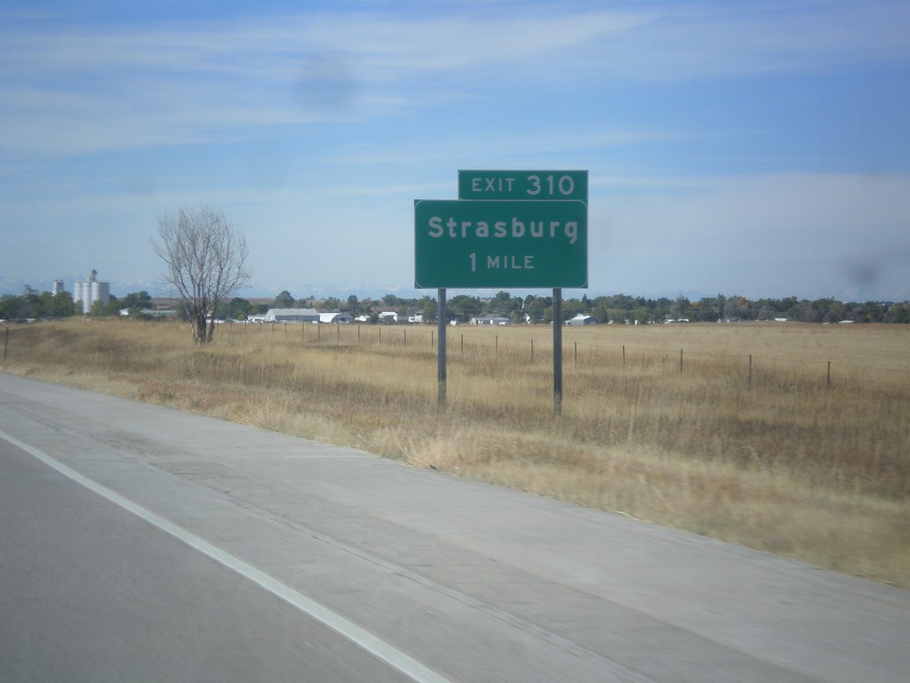
I-70 West - Exit 310
I-70 west approaching Exit 310 - Strasburg.
Taken 10-08-2016
Strasburg
Arapahoe County
Colorado
United States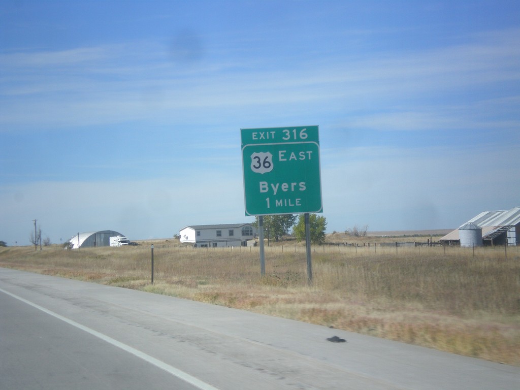
I-70 West - Exit 316
I-70 west approaching Exit 316 - US-36 East/Byers. US-36 joins I-70 westbound to Denver.
Taken 10-08-2016
Byers
Arapahoe County
Colorado
United States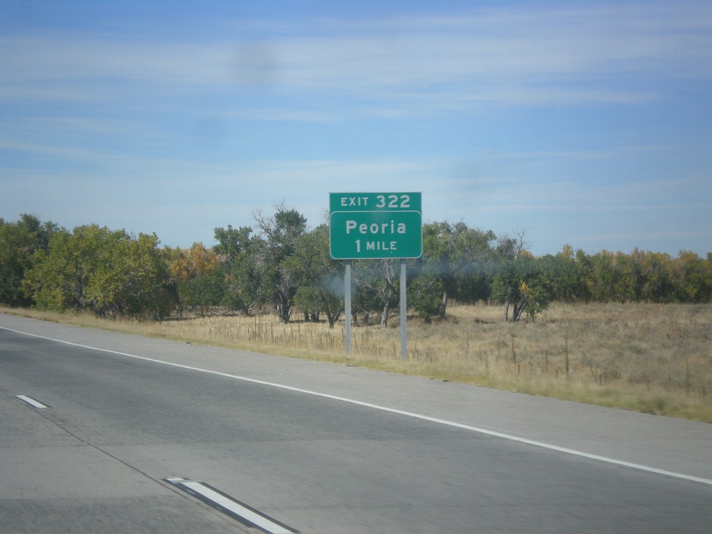
I-70 West - Exit 322
I-70 west approaching Exit 322 - Peoria.
Taken 10-08-2016
Deer Trail
Arapahoe County
Colorado
United States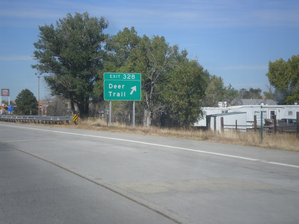
I-70 West - Exit 328
I-70 west at Exit 328 - Deer Trail
Taken 10-08-2016
Deer Trail
Arapahoe County
Colorado
United States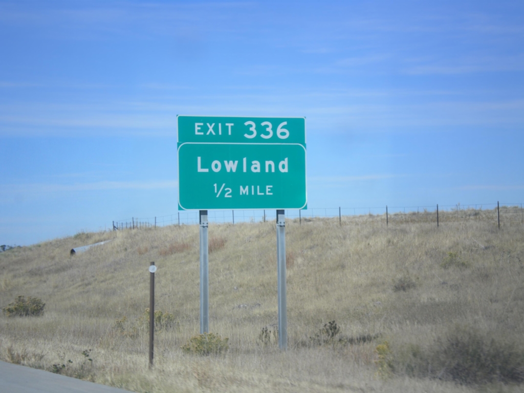
I-70 West - Exit 336
I-70 west approaching Exit 336 - Lowland.
Taken 10-08-2016
Agate
Elbert County
Colorado
United States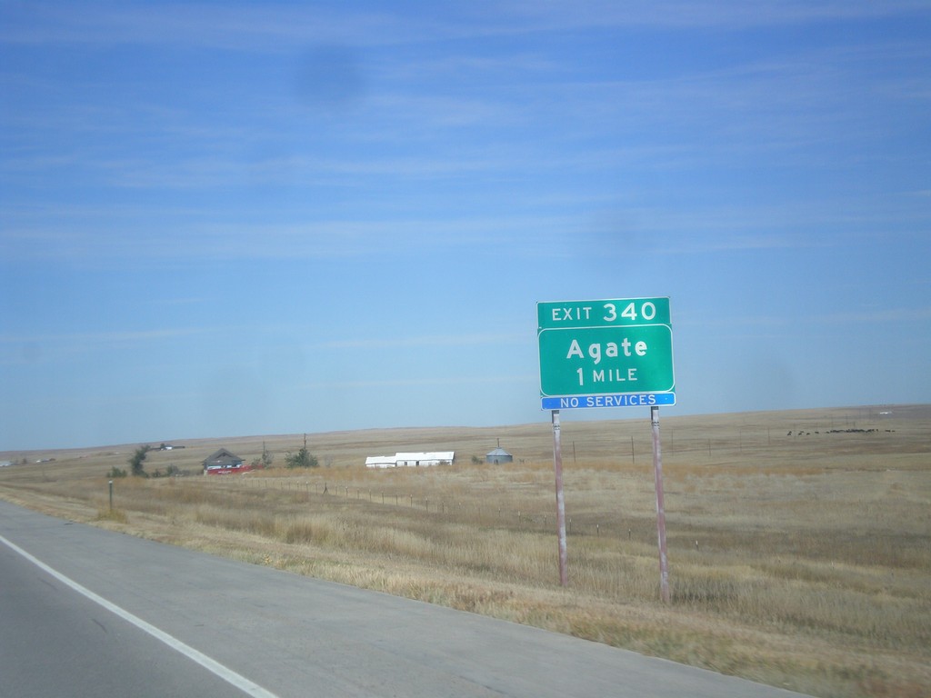
I-70 West - Exit 340
I-70 west approaching Exit 340 - Agate.
Taken 10-08-2016
Agate
Elbert County
Colorado
United States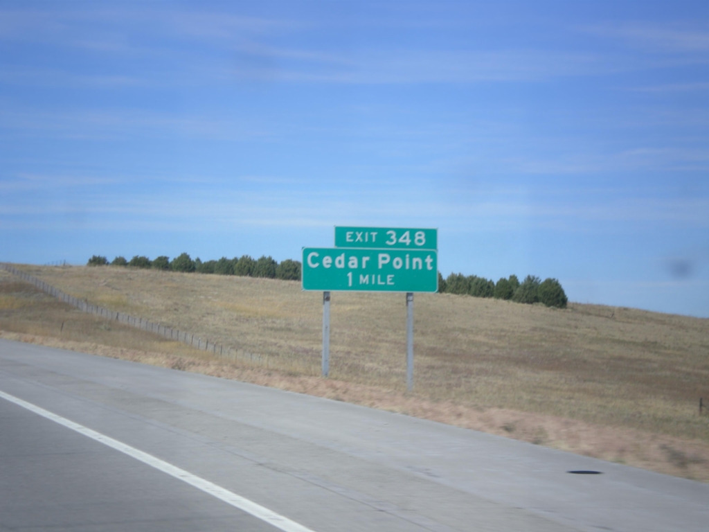
I-70 West - Exit 348
I-70 west approaching Exit 348 - Cedar Point
Taken 10-08-2016
Matheson
Elbert County
Colorado
United States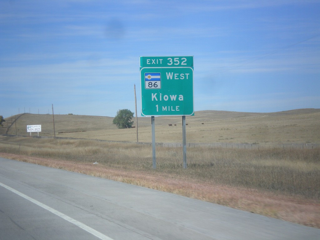
I-70 West - Exit 352
I-70 west approaching Exit 352 - CO-86 West/Kiowa.
Taken 10-08-2016
 Limon
Elbert County
Colorado
United States
Limon
Elbert County
Colorado
United States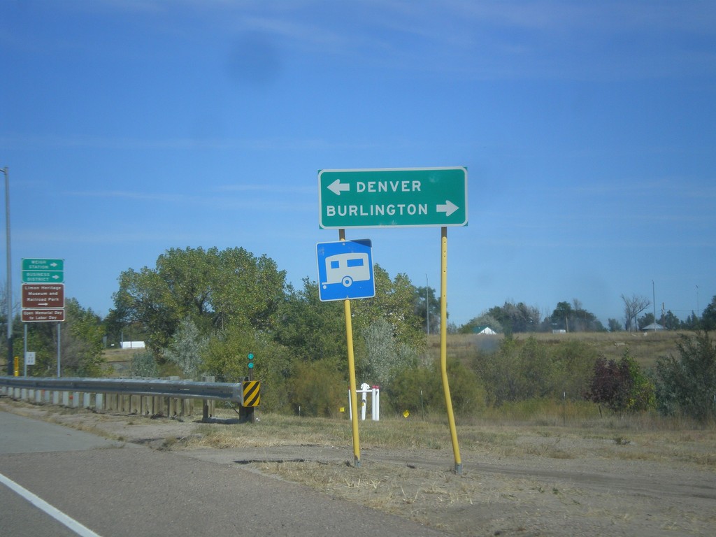
CO-71 North at US-24/US-40/US-287
CO-71 North at US-24/US-40/US-287 in Limon. Turn right for Burlington (via I-70); turn left for Denver (via I-70).
Taken 10-08-2016

 Limon
Lincoln County
Colorado
United States
Limon
Lincoln County
Colorado
United States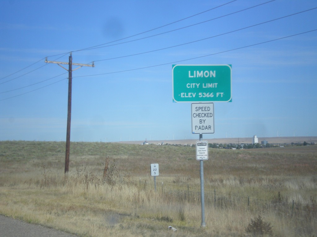
CO-71 North - Limon
Entering Limon on CO-71 north. Limon is the county seat of Lincoln County.
Taken 10-08-2016
Limon
Lincoln County
Colorado
United States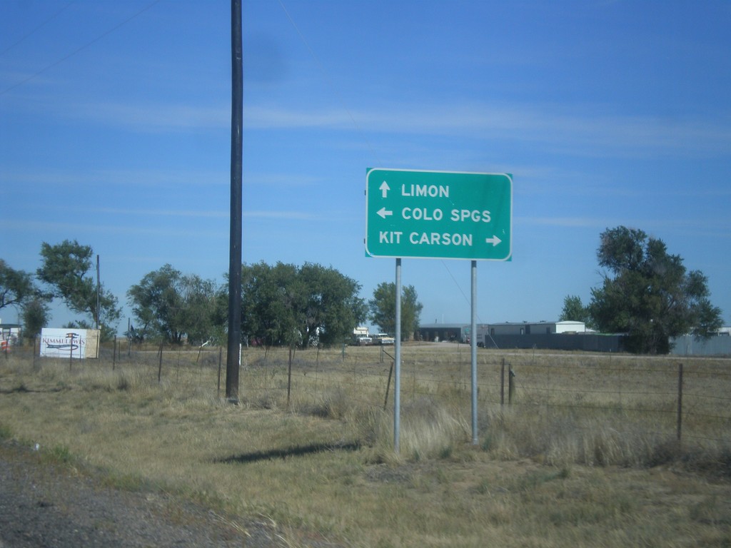
CO-71 North at CO-94
CO-71 North at CO-94 in Punkin Center. Turn right for CO-94 east to Kit Carson; left for CO-94 west to Limon. Continue straight on CO-71 north for Limon.
Taken 10-08-2016
 Hugo
Lincoln County
Colorado
United States
Hugo
Lincoln County
Colorado
United States