Signs Tagged With Big Green Sign
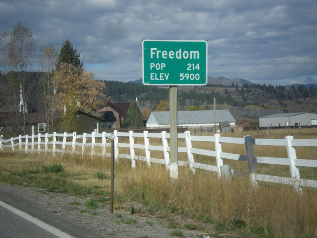
WY-239 West - Entering Freedom
Entering Freedom on WY-239 west - Elevation 5900; Population 214. Freedom is the oldest community in the Star Valley, and is named because of the settlers who were free to practice polygamy in Wyoming. The western boundary of the town is the Idaho stateline, where at the time had banned polygamy.
Taken 10-04-2015
 Freedom
Lincoln County
Wyoming
United States
Freedom
Lincoln County
Wyoming
United States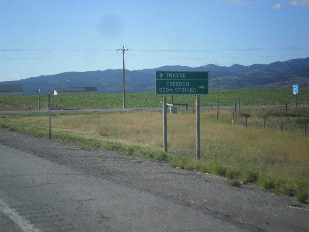
US-89 South at WY-239 West
US-89 South at WY-239 West to Freedom and Soda Springs (Idaho). Continue south on US-89 for Thayne. WY-239 is a short connecting route between US-89 and ID-34. There is no direct connection between ID-34 and WY-239 on the state highway system. There is a short stretch of county road running along the stateline between these two highways.
Taken 10-04-2015
 Freedom
Lincoln County
Wyoming
United States
Freedom
Lincoln County
Wyoming
United States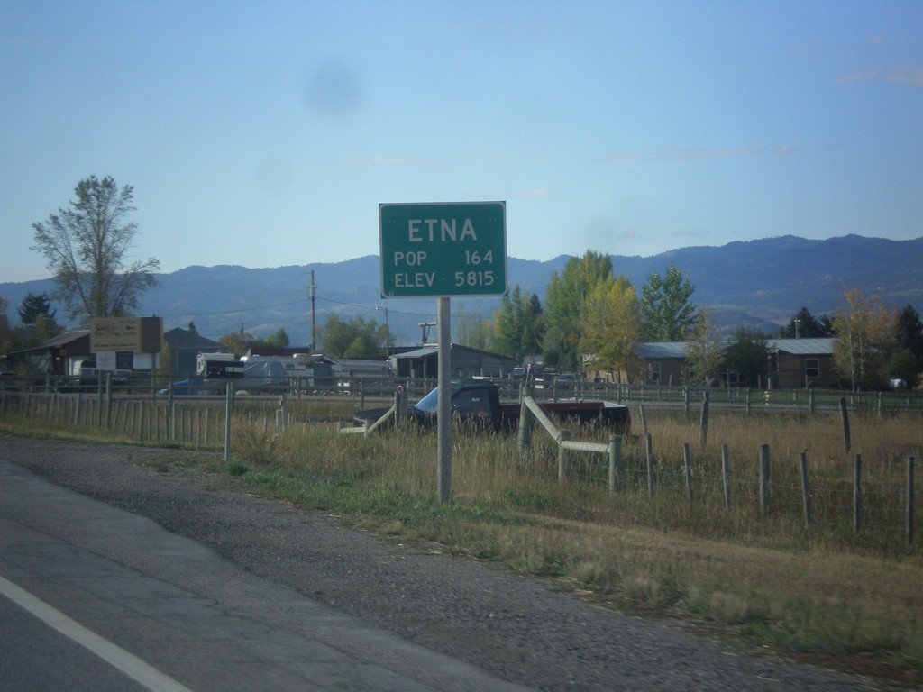
US-89 South - Entering Etna
Entering Etna on US-89 south. Elevation 5815 Feet; Population 164.
Taken 10-04-2015
Freedom
Lincoln County
Wyoming
United States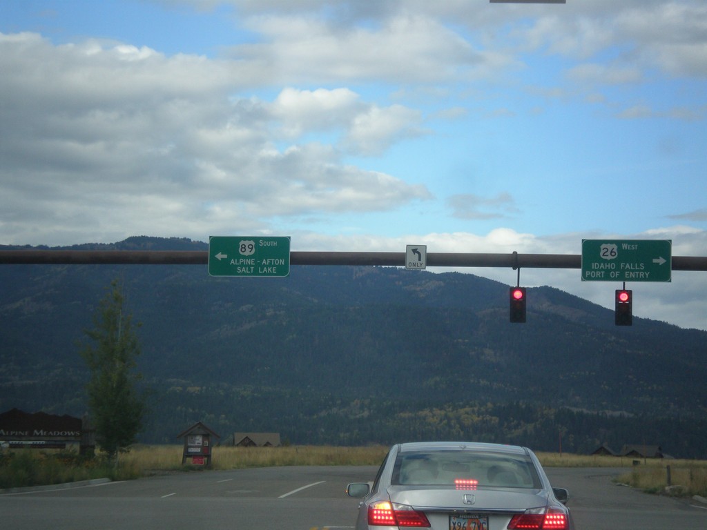
US-26 West/US-89 South - Alpine Junction
US-26 West/US-89 South at Alpine Junction. Turn right for US-26 West to Idaho Falls (ID) and the (Wyoming) Port of Entry. Turn left for US-89 south to Alpine, Afton, and Salt Lake (Utah).
Taken 10-04-2015
 Alpine
Lincoln County
Wyoming
United States
Alpine
Lincoln County
Wyoming
United States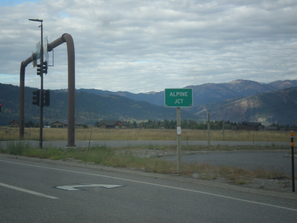
US-26 West/US-89 South - Alpine Junction
US-26 West/US-89 South at Alpine Junction. Alpine Junction is the name of the intersection of US-89 and US-26, which is across the Snake River from the town of Alpine.
Taken 10-04-2015
Alpine
Lincoln County
Wyoming
United States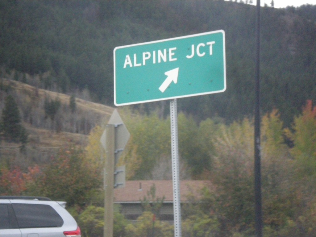
US-26 West - US-89/US-189/US-191 South in Hoback Jct. Roundabout
US-26 West - US-89/US-189/US-191 South in Hoback Jct. roundabout. Merge right for (US-26 West/US-89 South) Alpine Junction.
Taken 10-04-2015

 Jackson
Teton County
Wyoming
United States
Jackson
Teton County
Wyoming
United States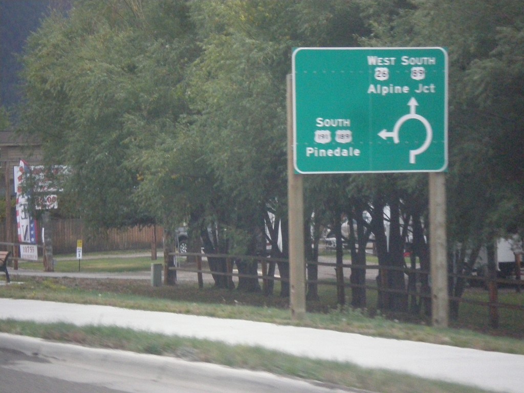
US-26 West - US-89/US-189/US-191 South - Roundabout
US-26 West - US-89/US-189/US-191 South entering roundabout at Hoback Junction. Use US-26 West/US-89 South for Alpine Jct.; use US-189/US-191 South for Pinedale. This intersection was converted to a roundabout in 2012.
Taken 10-04-2015
Jackson
Teton County
Wyoming
United States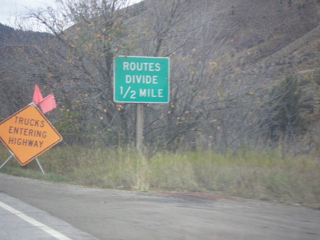
US-26 West - US-89/US-189/US-191 South - Routes Divide
US-26 West - US-89/US-189/US-191 South - Routes Divide. Approaching Hoback Jct., where US-189/US-191 separate from US-26/US-89. The Routes Divide sign in Wyoming is common in this situation where one route splits from another route.
Taken 10-04-2015
Jackson
Teton County
Wyoming
United States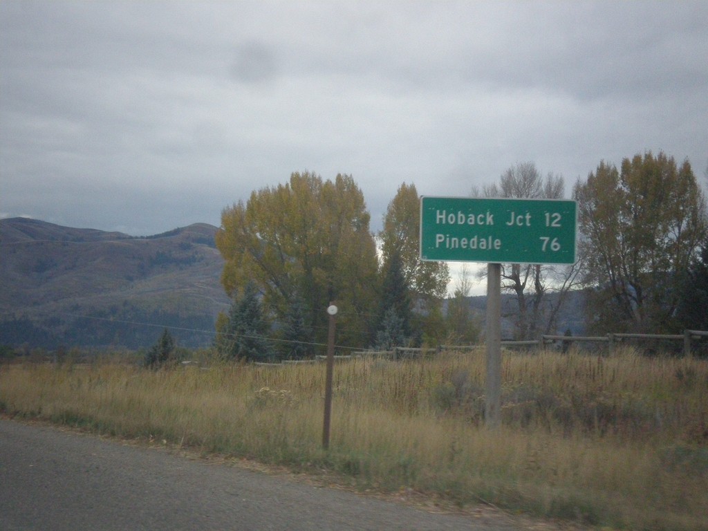
US-26 West - US-89/US-189/US-191 South - Distance Marker
Distance Marker on US-26 West - US-89/US-189/US-191 South. Distance to Hoback Jct. and Pinedale (via US-191 South).
Taken 10-04-2015
Jackson
Teton County
Wyoming
United States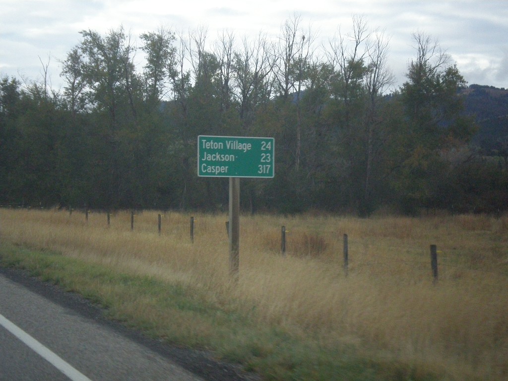
ID-33 East - Distance Marker
Last distance marker on ID-33 east in Idaho. Distance to Teton Village, Jackson, and Casper.
Taken 10-04-2015
 Victor
Teton County
Idaho
United States
Victor
Teton County
Idaho
United States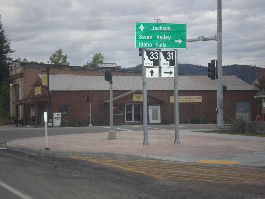
ID-33 East at ID-31
ID-33 East at ID-31 in Victor. Turn right on ID-31 south for Swan Valley and Idaho Falls. Continue straight on ID-33 for Jackson (Wyoming). Teton Scenic Byway leaves ID-33 here and follows ID-31 south.
Taken 10-04-2015
 Victor
Teton County
Idaho
United States
Victor
Teton County
Idaho
United States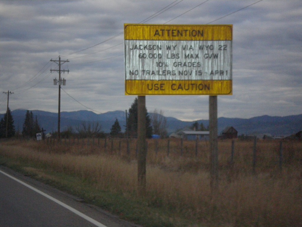
ID-33 East - Teton Pass Restrictions
Sign listing restrictions on Teton Pass in Wyoming. 60,000 lbs GVW over Teton Pass; no trailers 11-15 to 4-1. 10% grades over Teton Pass.
Taken 10-04-2015
Tetonia
Teton County
Idaho
United States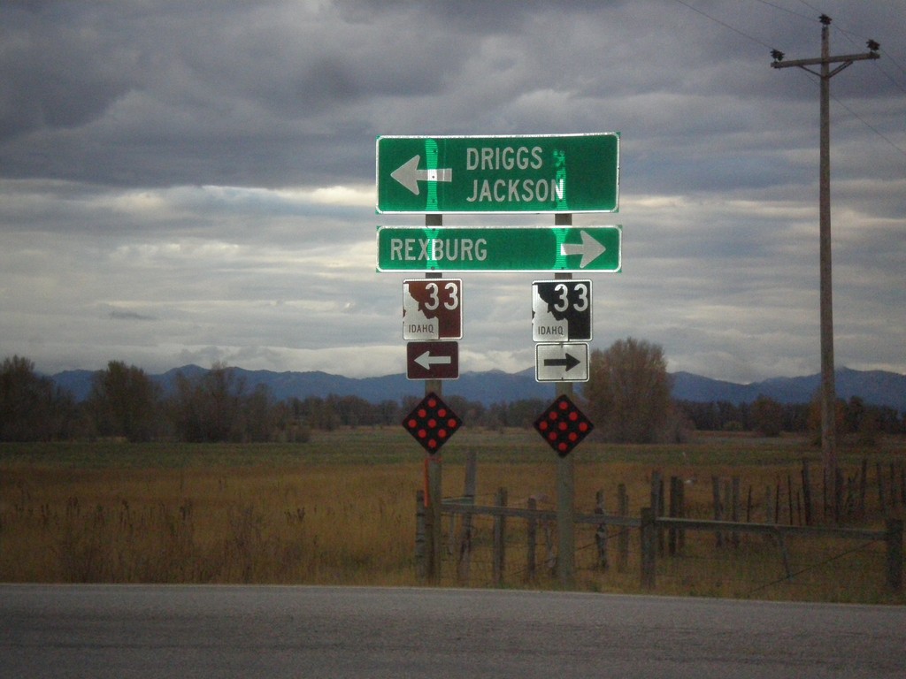
End ID-32 South at ID-33
End ID-32 south at ID-33. Use ID-33 west for Rexburg. Use ID-33 east for Driggs and Jackson (Wyoming). Use ID-33 east to continue on the Teton Scenic Byway.
Taken 10-04-2015
 Tetonia
Teton County
Idaho
United States
Tetonia
Teton County
Idaho
United States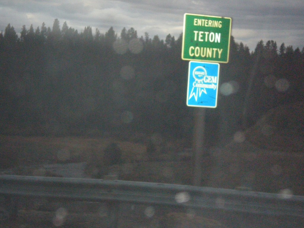
ID-32 South - Teton County
Entering Teton County on ID-32 South. The Fremont-Teton County Line on ID-32 is at Bitch Creek. The bridge over Bitch Creek was not signed with the creek name.
Taken 10-04-2015
Felt
Teton County
Idaho
United States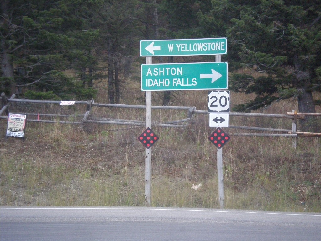
End ID-87 South at US-20
End ID-87 south at US-20, to Ashton, Idaho Falls, and W. Yellowstone.
Taken 10-03-2015

 Island Park
Fremont County
Idaho
United States
Island Park
Fremont County
Idaho
United States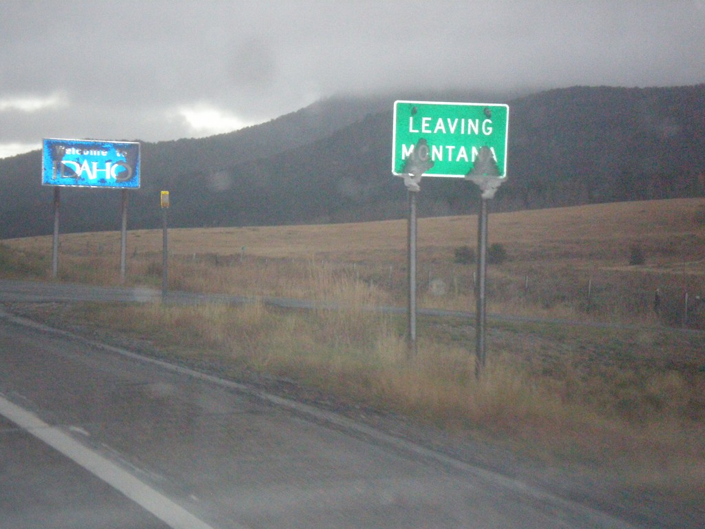
MT-87 South - Raynolds Pass
MT-87 at Raynolds Pass - Leaving Montana. The Idaho welcome sign is in the background. An early season snow storm had just passed through the area, leaving wet snow on all of the signs.
Taken 10-03-2015
 Madison County
Montana
United States
Madison County
Montana
United States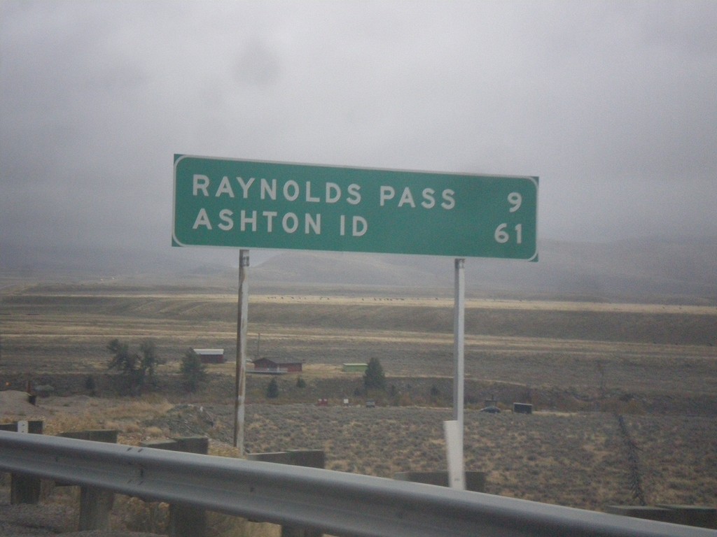
MT-87 South - Distance Marker
Distance marker on MT-87 south. Distance to Raynolds Pass (State Line - Continental Divide) and Ashton, ID.
Taken 10-03-2015
Schusters Place
Madison County
Montana
United States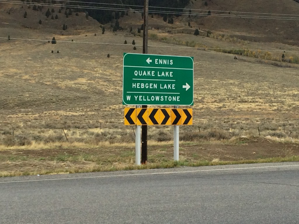
End MT-87 North at US-287
End MT-87 North at US-287. Use US-287 north for Ennis; use US-287 south for Quake Lake, Hebgen Lake, and West Yellowstone.
Taken 10-03-2015
 Schusters Place
Madison County
Montana
United States
Schusters Place
Madison County
Montana
United States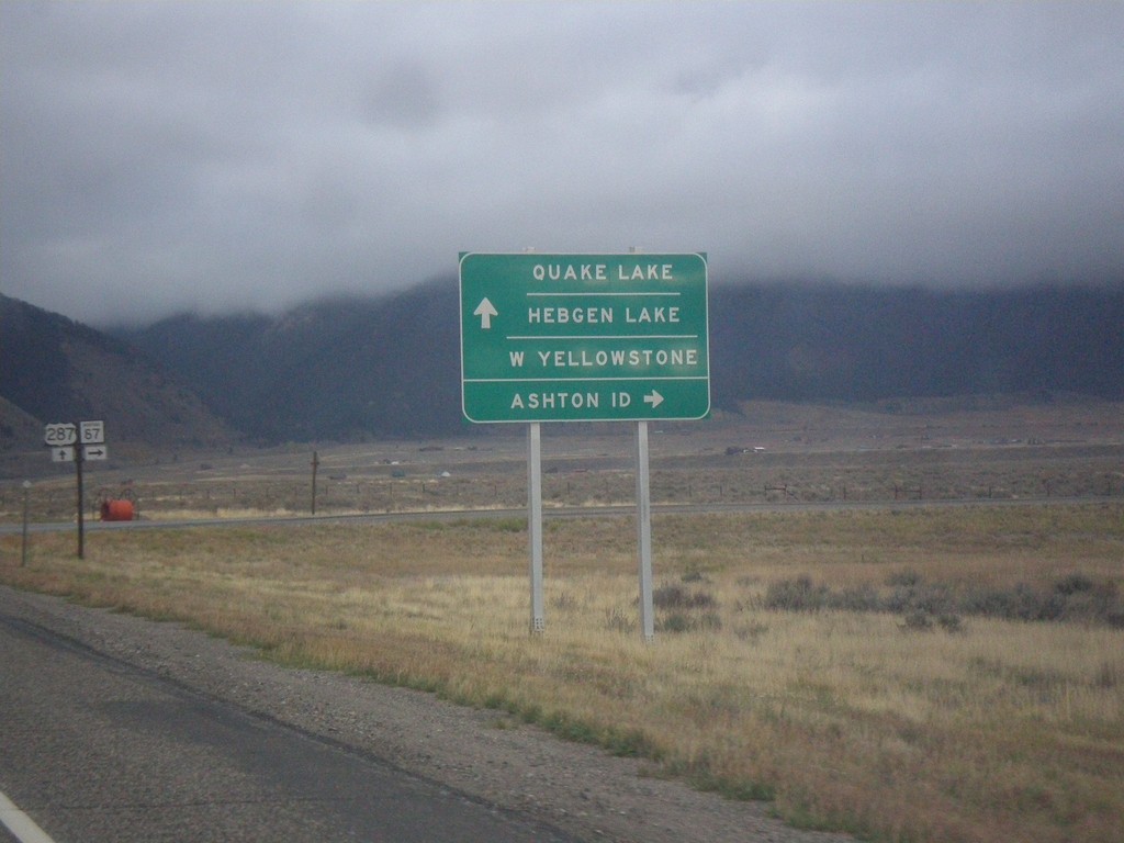
US-287 South at MT-87
US-287 South at MT-87 South. Turn right for MT-87 south to Ashton, ID. Continue south on US-287 for Quake Lake, Hebgen Lake, and West Yellowstone.
Taken 10-03-2015
Schusters Place
Madison County
Montana
United States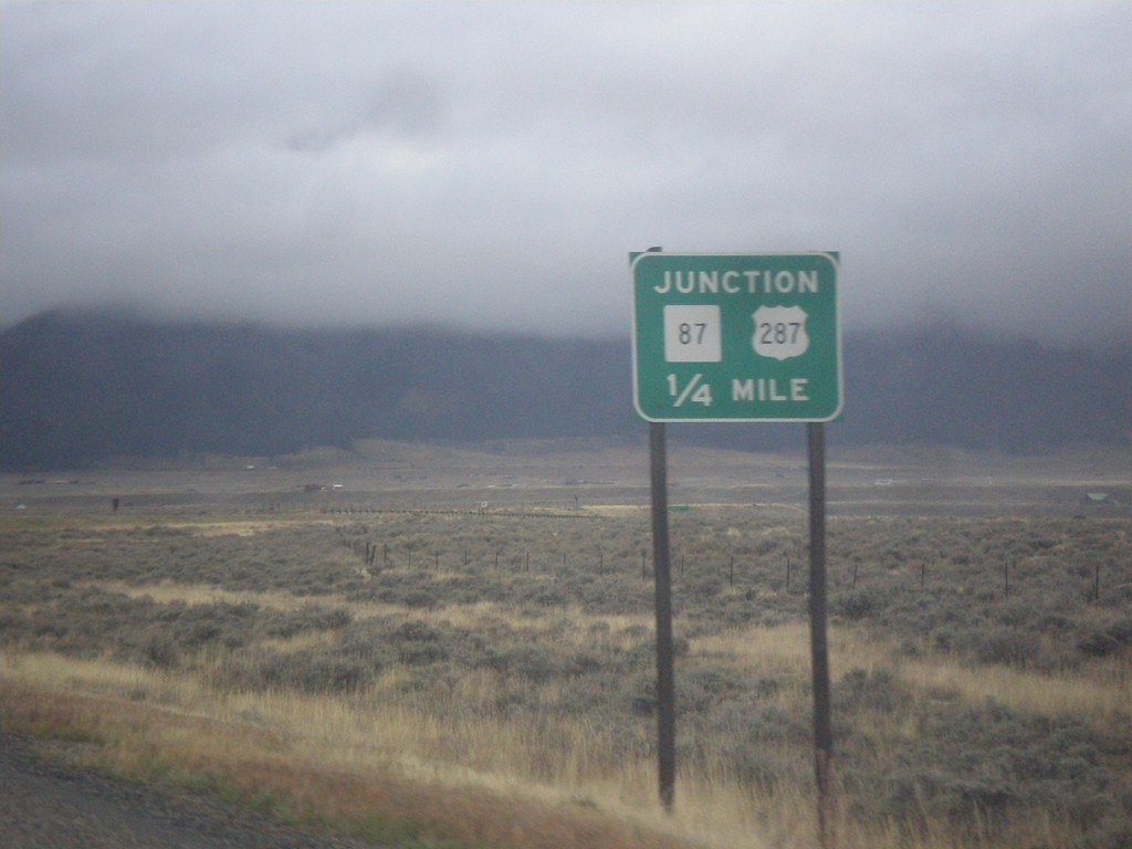
US-287 South Approaching MT-87
US-287 South approaching MT-87 in Madison County.
Taken 10-03-2015
Schusters Place
Madison County
Montana
United States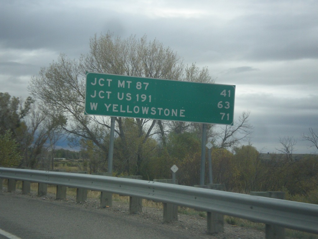
US-287 South - Distance Marker
Distance marker on US-287 south. Distance to Jct. MT-87, Jct. US-191, and West Yellowstone.
Taken 10-03-2015
Ennis
Madison County
Montana
United States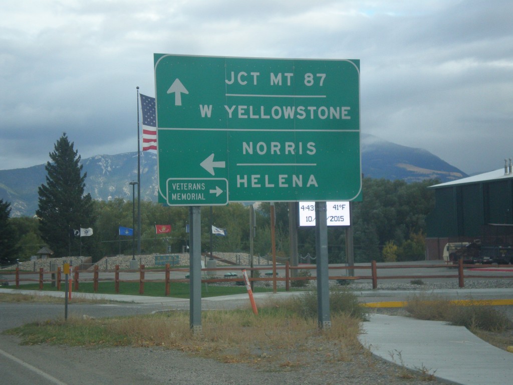
End MT-287 South at US-287
End MT-287 South at US-287. Turn left for US-287 north to Norris and Helena. Continue straight for US-287 south to West Yellowstone and Jct. MT-87. Turn right for the Madison Valley Veterans’ Memorial.
Taken 10-03-2015
 Ennis
Madison County
Montana
United States
Ennis
Madison County
Montana
United States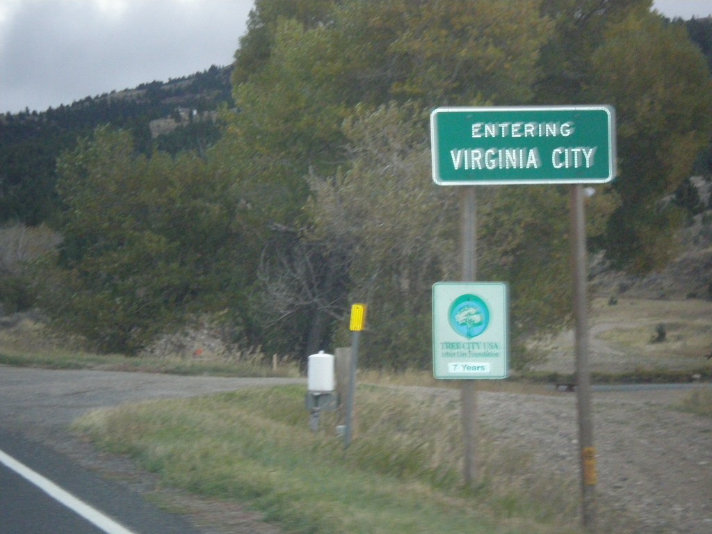
MT-287 South - Virginia City
Entering Virginia City on MT-287 south. Virginia City is the county seat of Madison County, and was the capitol of Montana Territory from 1865 to 1875.
Taken 10-03-2015
Ennis
Madison County
Montana
United States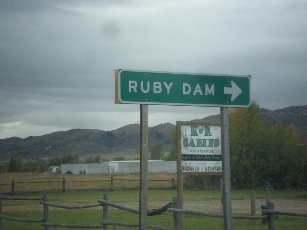
MT-287 South at MTS-357
MT-287 south at MTS-357 to Ruby Dam.
Taken 10-03-2015
 Alder
Madison County
Montana
United States
Alder
Madison County
Montana
United States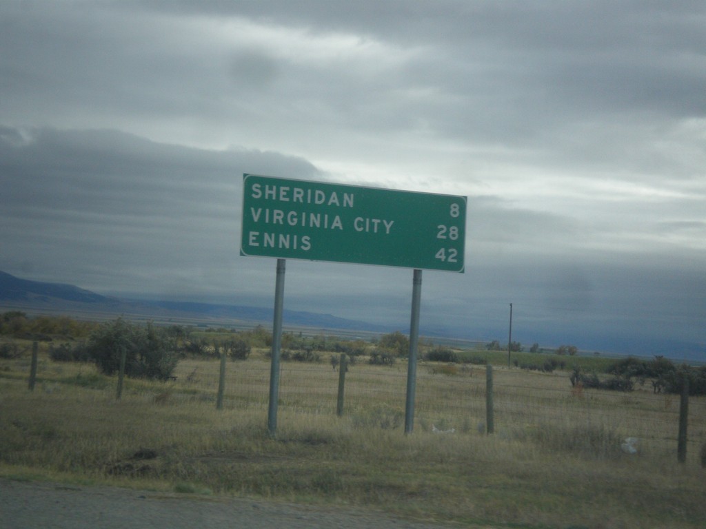
MT-287 South - Distance Marker
Distance marker on MT-287 south. Distance to Sheridan, Virginia City, and Ennis.
Taken 10-03-2015
Twin Bridges
Madison County
Montana
United States