Signs Tagged With Big Green Sign
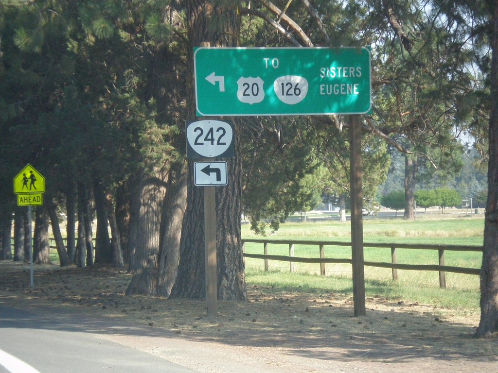
OR-242 East at Hood St. (To US-20/OR-126)
OR-242 East at Hood St. (To US-20/OR-126). Turn left to connect with US-20/OR-126 for Eugene and Sisters. Traffic can also continue east on current street for US-20/OR-126 East.
Taken 08-22-2015


 Sisters
Deschutes County
Oregon
United States
Sisters
Deschutes County
Oregon
United States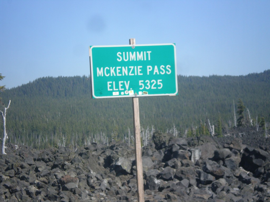
OR-242 East - McKenzie Pass
OR-242 East - McKenzie Pass - Elevation 5325 Feet. McKenzie Pass is closed during the winter months, and is also closed year round to long vehicles. The top of the pass is a lava field, with great views of the area volcanos.
Taken 08-22-2015
Linn County
Oregon
United States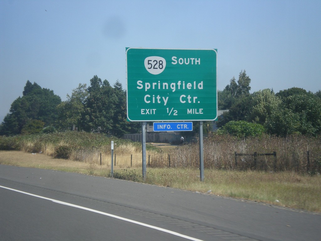
OR-126 East Approaching OR-528 Exit
OR-126 East approaching - OR-528 South/Springfield City Center.
Taken 08-22-2015
 Springfield
Lane County
Oregon
United States
Springfield
Lane County
Oregon
United States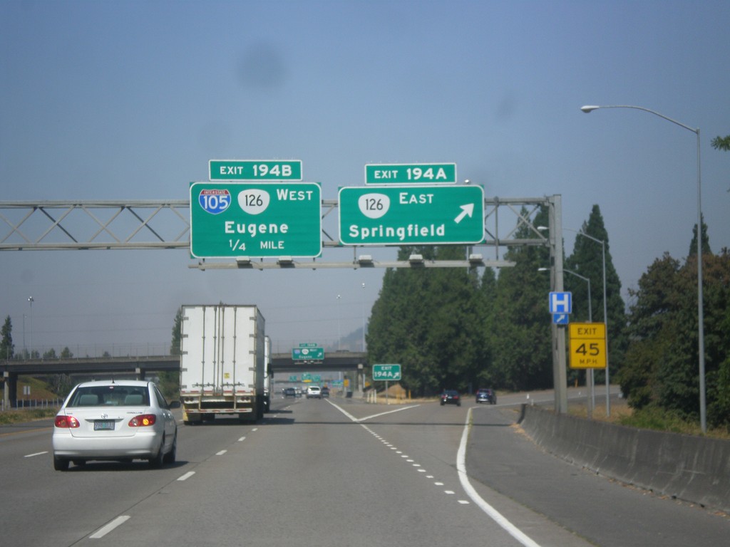
I-5 North - Exits 194 A-B
I-5 north at Exit 194A - OR-126 East/Springfield. Approaching Exit 194B - I-105/OR-126 West/Eugene.
Taken 08-22-2015

 Springfield
Lane County
Oregon
United States
Springfield
Lane County
Oregon
United States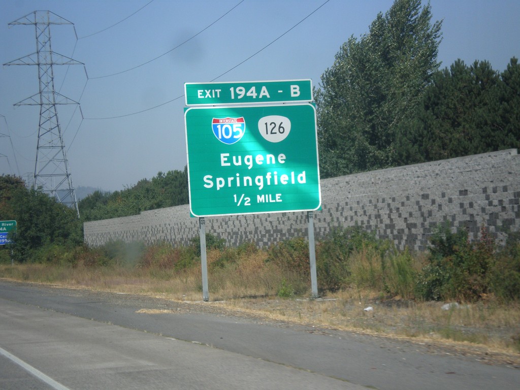
I-5 North - Exits 194A-B
I-5 north approaching Exits 194 A-B - I-105/OR-126/Eugene/Springfield.
Taken 08-22-2015
Springfield
Lane County
Oregon
United States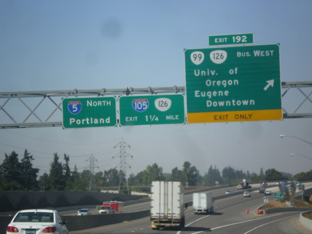
I-5 North - Exits 192 and 194AB
I-5 north at Exit 192 - OR-99/Bus. OR-126 West/University of Oregon/Eugene Downtown. Approaching (Exit 194AB) I-105/OR-126. Continue north on I-5 for Portland.
Taken 08-22-2015

 Eugene
Lane County
Oregon
United States
Eugene
Lane County
Oregon
United States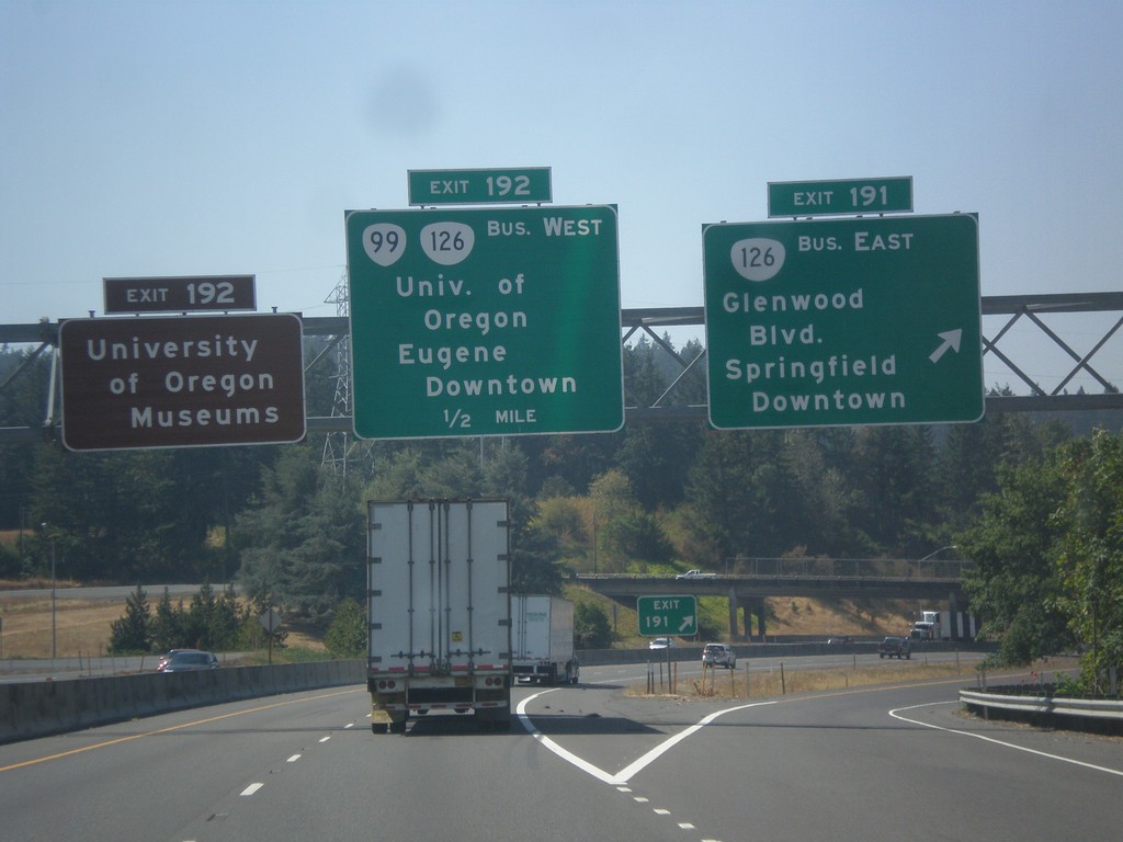
I-5 North - Exits 191 and 192
I-5 north at Exit 191 - Bus. OR-126 East/Glenwood Blvd./Springfield Downtown. Approaching Exit 192 - OR-99/Bus. OR-126 West/University of Oregon/Eugene Downtown. Use Exit 192 for University of Oregon Museums.
Taken 08-22-2015
Eugene
Lane County
Oregon
United States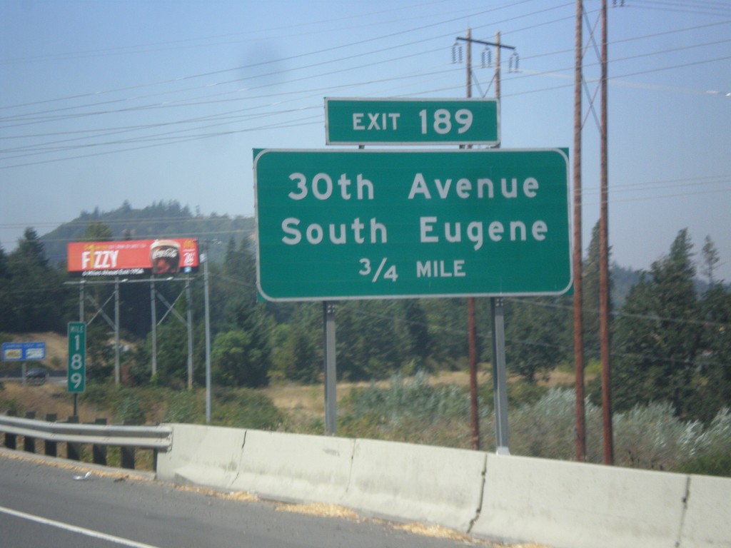
I-5 North - Exit 189
I-5 north approaching Exit 189 30th Ave./South Eugene
Taken 08-22-2015
Eugene
Lane County
Oregon
United States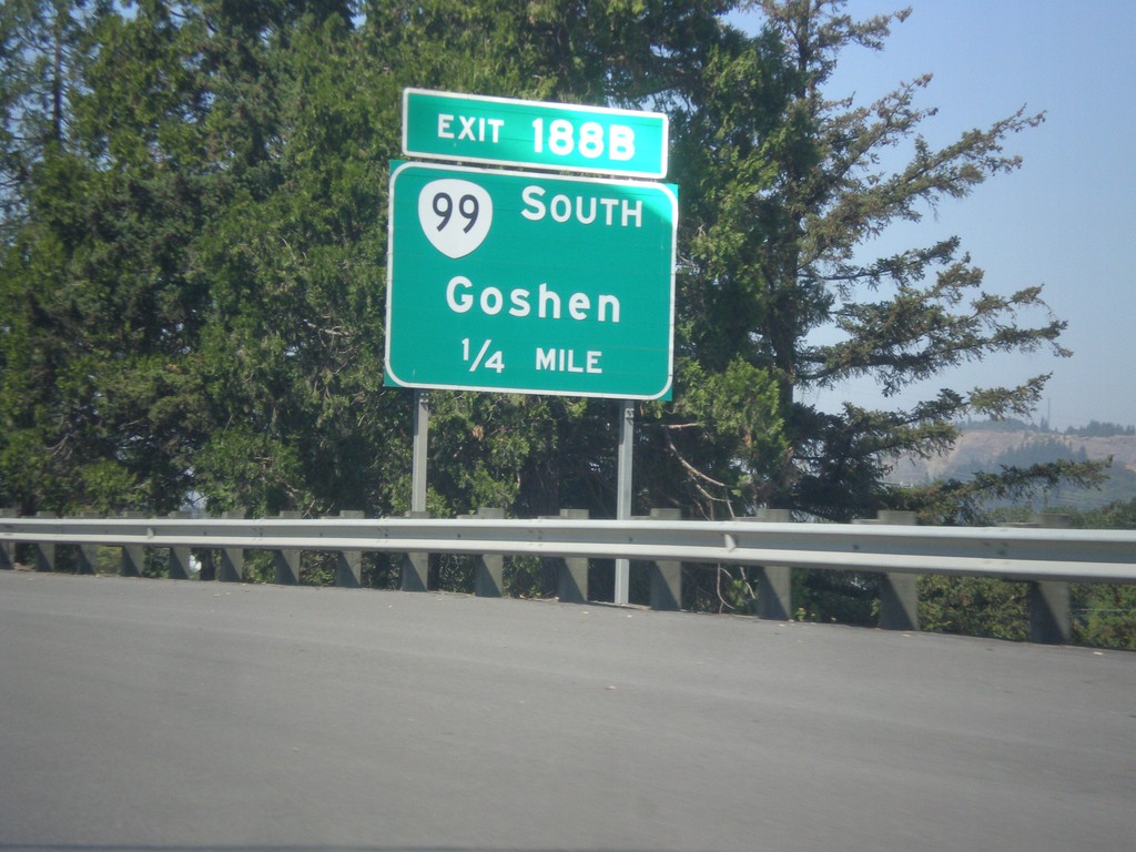
I-5 North - Exit 188B
I-5 north approaching Exit 188B - OR-99 South/Goshen.
Taken 08-22-2015
Eugene
Lane County
Oregon
United States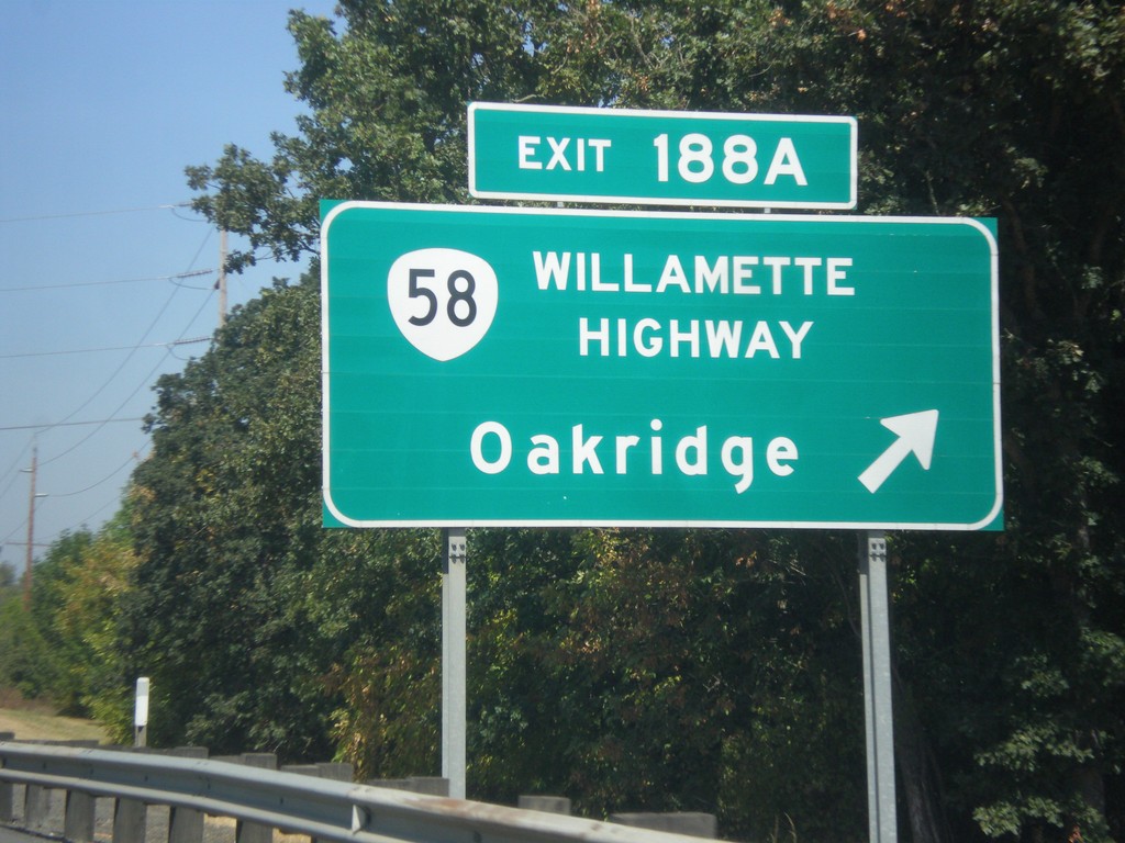
I-5 North - Exit 188A
I-5 north at Exit 188A - OR-58/Willamette Highway/Oakridge. OR-58 follows the Willamette River east to Willamette Pass where it crosses the Cascades.
Taken 08-22-2015
 Goshen
Lane County
Oregon
United States
Goshen
Lane County
Oregon
United States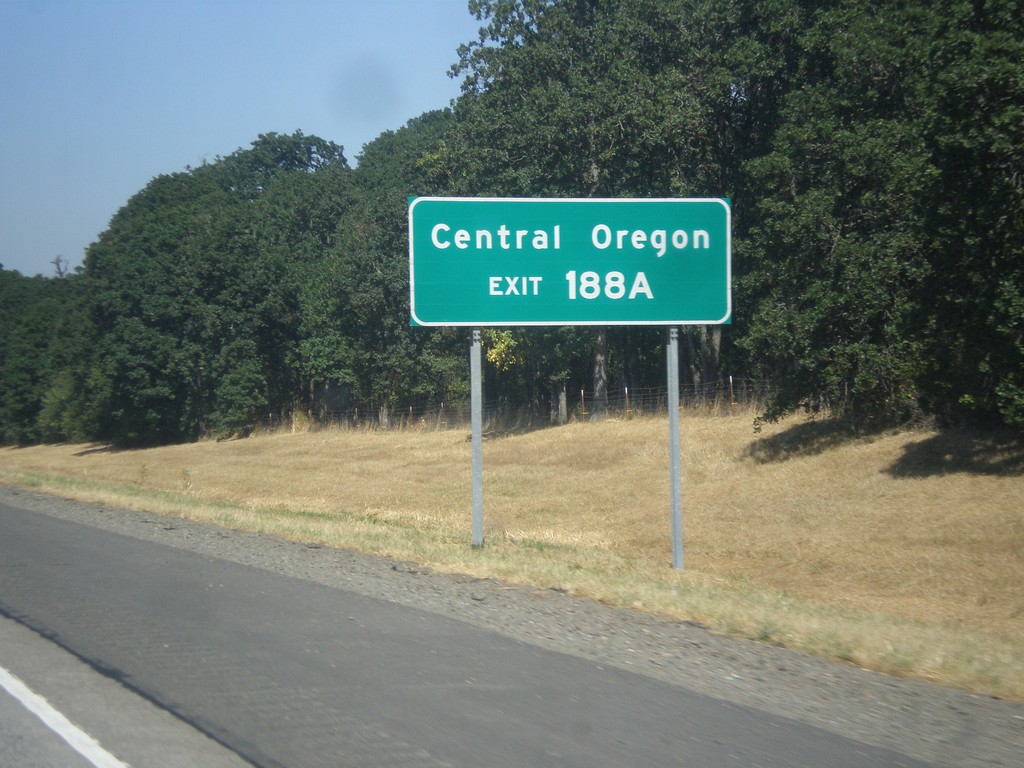
I-5 North - Exit 188A - Central Oregon
I-5 North approachign Exit 188A. Use Exit 188A for Central Oregon (via OR-58 and Willamette Pass).
Taken 08-22-2015
Eugene
Lane County
Oregon
United States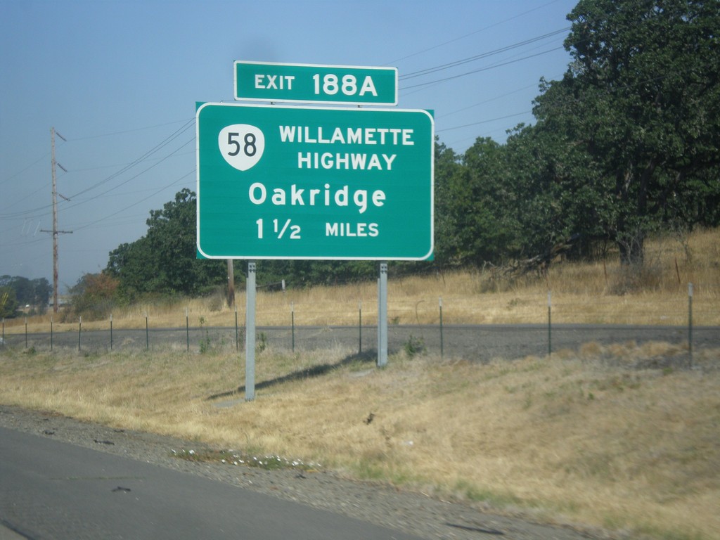
I-5 North - Exit 188A
I-5 north approaching Exit 188A - OR-58/Willamette Highway/Oakridge.
Taken 08-22-2015
Pleasant Hill
Lane County
Oregon
United States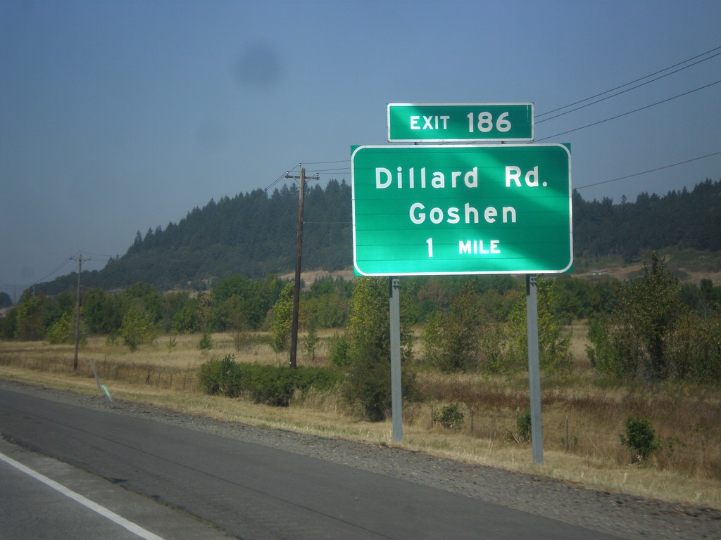
I-5 North - Exit 186
I-5 north approaching Exit 186 - Dillard Road/Goshen.
Taken 08-22-2015
Eugene
Lane County
Oregon
United States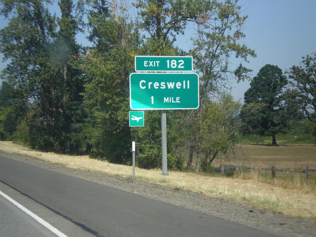
I-5 North - Exit 182
I-5 north approaching Exit 182 - Creswell.
Taken 08-22-2015
Creswell
Lane County
Oregon
United States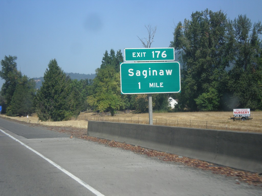
I-5 North - Exit 176
I-5 north approaching Exit 176 - Saginaw.
Taken 08-22-2015
Cottage Grove
Lane County
Oregon
United States
Row River Road East at I-5 North
Row River Road East at I-5 North to Eugene.
Taken 08-22-2015
Cottage Grove
Lane County
Oregon
United States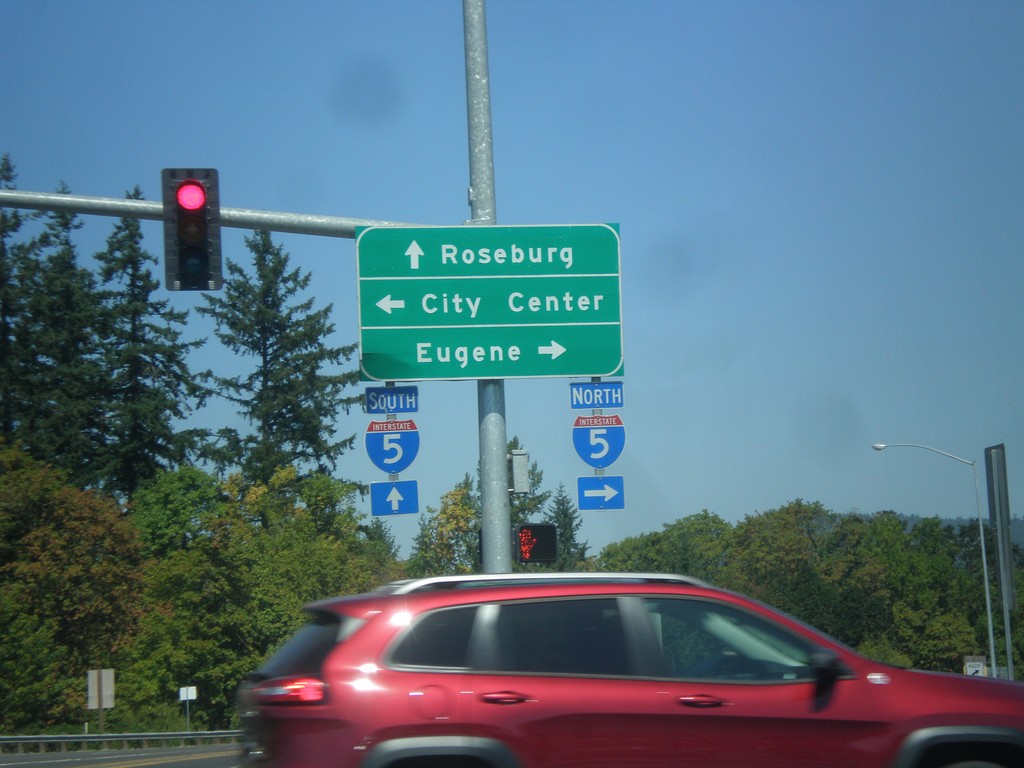
Gateway Blvd. north at I-5/Row River Road.
Gateway Blvd. north at I-5 and Row River Road. Continue straight for I-5 south to Roseburg; turn right on Row River Road for I-5 north to Eugene; left for (Cottage Grove) City Center.
Taken 08-22-2015
Cottage Grove
Lane County
Oregon
United States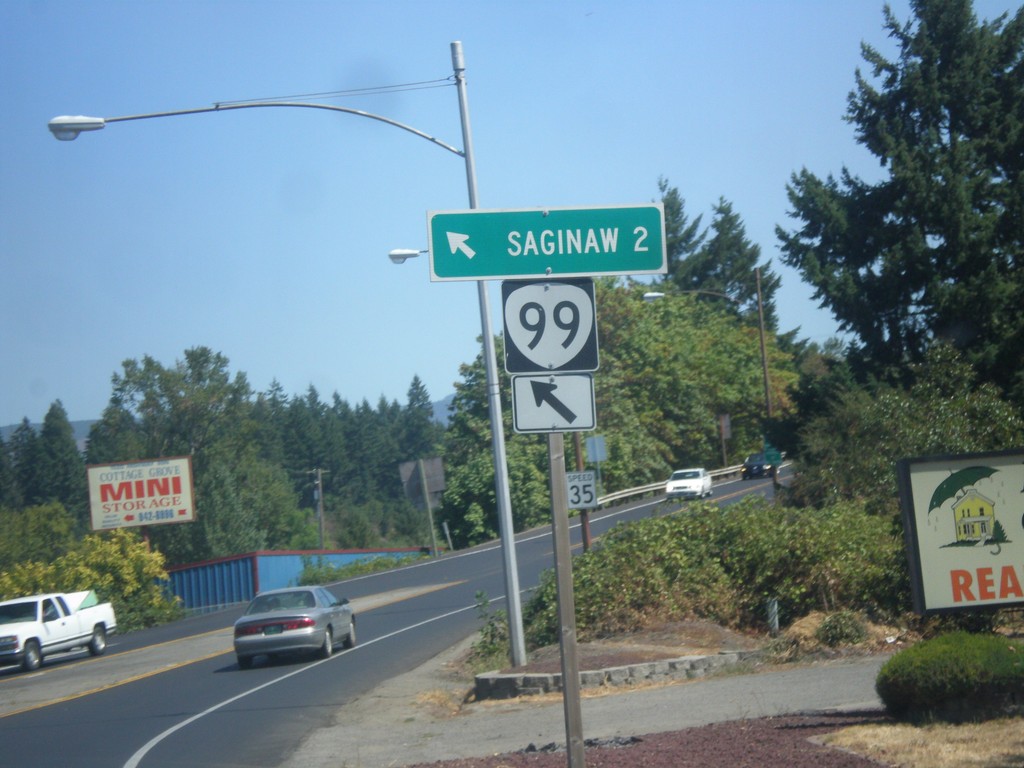
OR-99 North at Row River Road
OR-99 North at Row River Road in Cottage Grove. Merge left to continue north to OR-99 to Saginaw.
Taken 08-22-2015
Cottage Grove
Lane County
Oregon
United States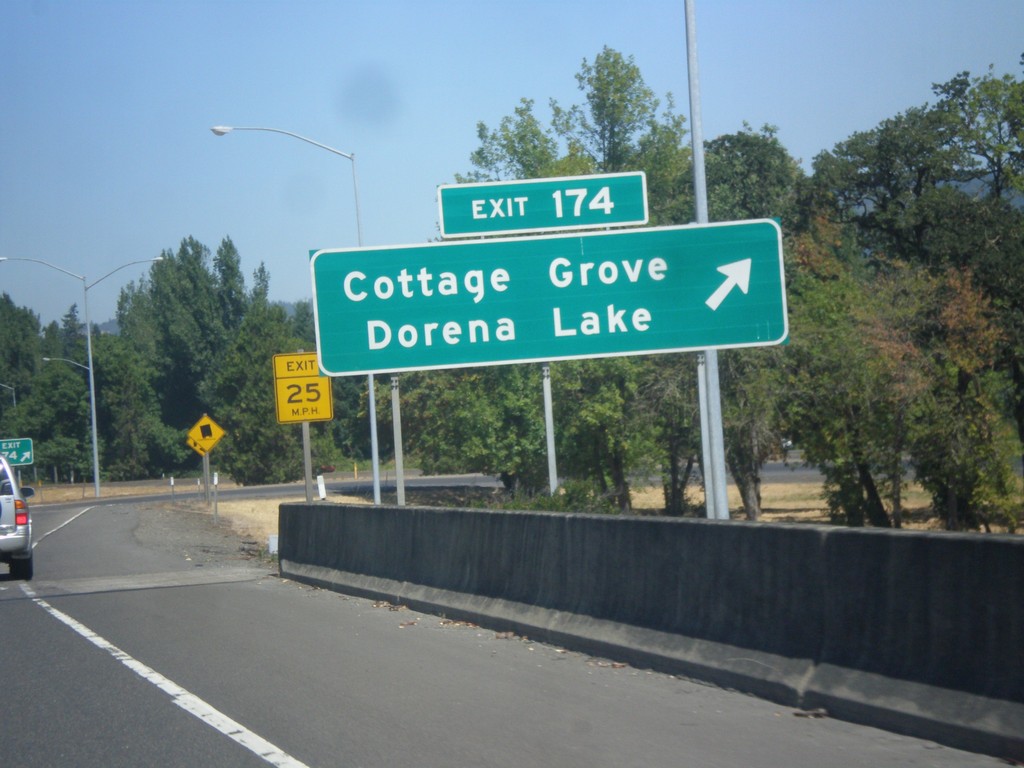
I-5 North - Exit 174
I-5 north at Exit 174 - Cottage Grove/Dorena Lake.
Taken 08-22-2015
Cottage Grove
Lane County
Oregon
United States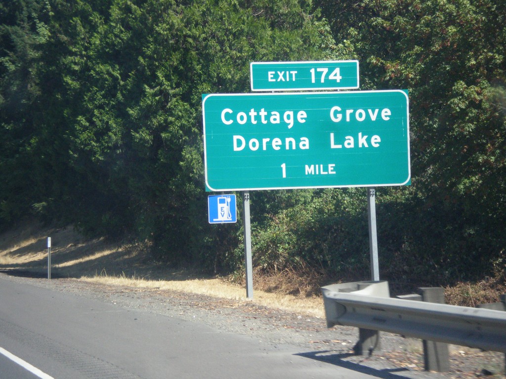
I-5 North - Exit 174
I-5 north approaching Exit 174 - Cottage Grove/Dorena Lake.
Taken 08-22-2015
Cottage Grove
Lane County
Oregon
United States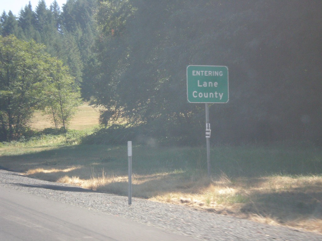
I-5 North - Lane County
Entering Lane County on I-5 north.
Taken 08-22-2015
Cottage Grove
Lane County
Oregon
United States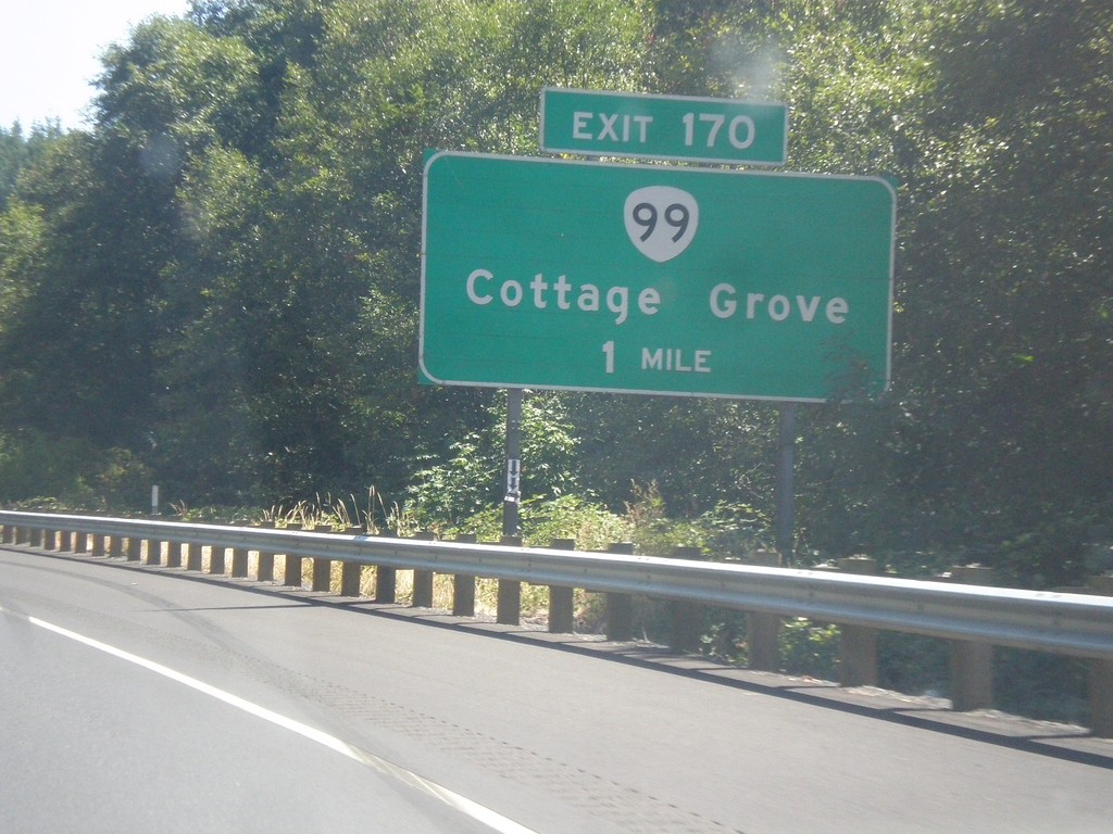
I-5 North - Exit 170
I-5 north approaching Exit 170 - OR-99/Cottage Grove. At the sign at the interchange, this is labeled Business OR-99. Signs through the town of Cottage Grove, do not include the word Business.
Taken 08-22-2015
Cottage Grove
Douglas County
Oregon
United States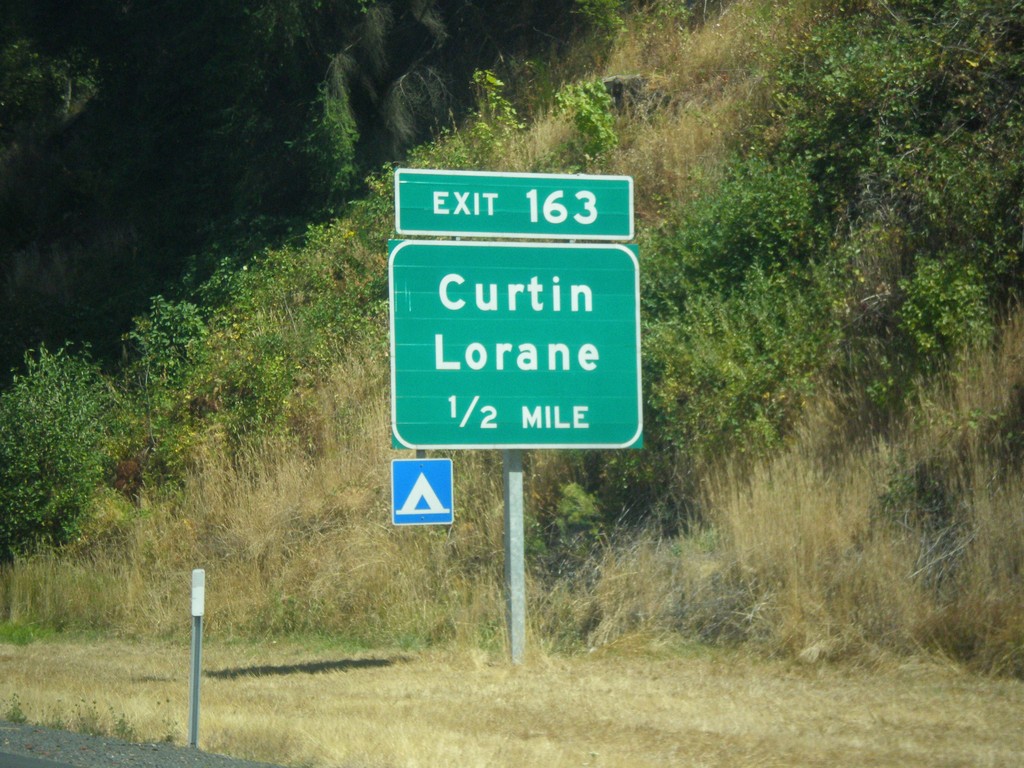
I-5 North - Exit 163
I-5 north approaching Exit 163 - Curtin/Lorane.
Taken 08-22-2015
Curtin
Douglas County
Oregon
United States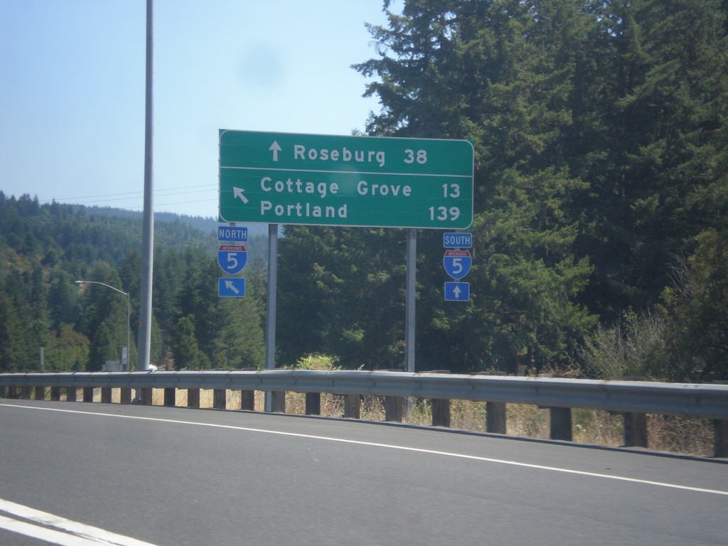
OR-38 East/OR-99 North at I-5
OR-38 East/OR-99 North at I-5. Use I-5 South to Roseburg; I-5 north to Cottage Grove and Portland. This is the eastern end of OR-38. This segment of OR-99 ends here, and re-appears in Cottage Grove.
Taken 08-22-2015
 Drain
Douglas County
Oregon
United States
Drain
Douglas County
Oregon
United States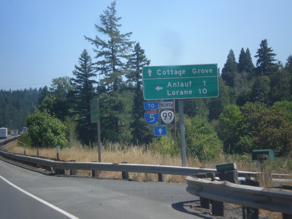
OR-38 East/OR-99 North at Curtin Road Jct.
OR-38 East/OR-99 North at Curtin Road Jct north to Anlauf and Lorane. Continue east on OR-38/OR-99 for Cottage Grove and I-5. The OR-38 shield is not displayed on this sign post, only OR-99.
Taken 08-22-2015
Drain
Douglas County
Oregon
United States