Signs Tagged With Big Green Sign
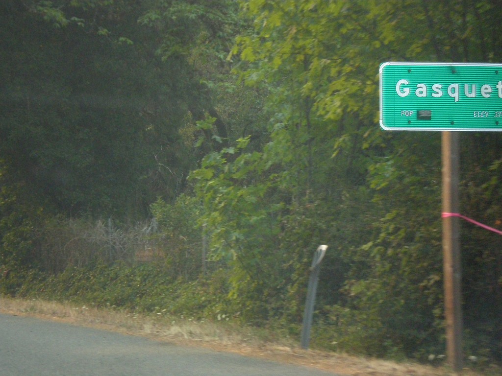
US-199 South - Gasquet
Entering the community of Gasquet on US-199 south.
Taken 08-17-2015
 Gasquet
Del Norte County
California
United States
Gasquet
Del Norte County
California
United States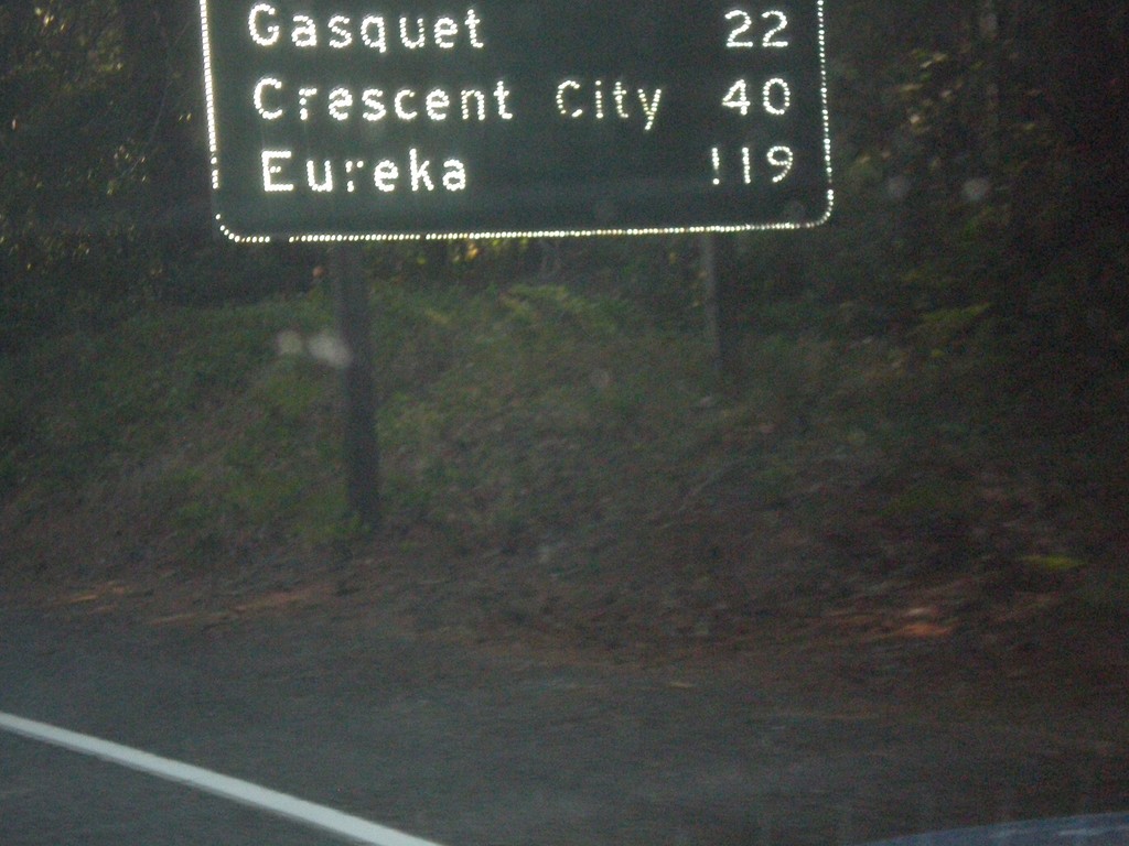
US-199 South - Distance Marker
First distance marker in California along US-199 south. Distance to Gasquet, Crescent City, and Eureka.
Taken 08-17-2015
Gasquet
Del Norte County
California
United States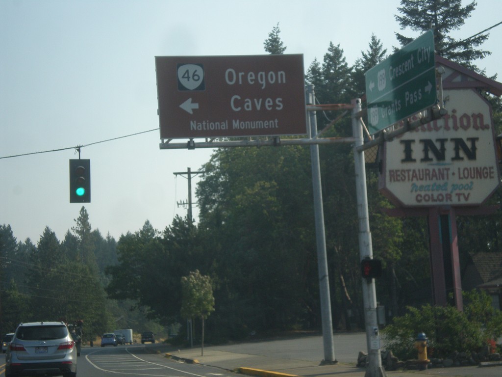
US-199 South at OR-46
US-199 south at OR-46 east to Oregon Cavess National Monument.
Taken 08-17-2015
 Cave Junction
Josephine County
Oregon
United States
Cave Junction
Josephine County
Oregon
United States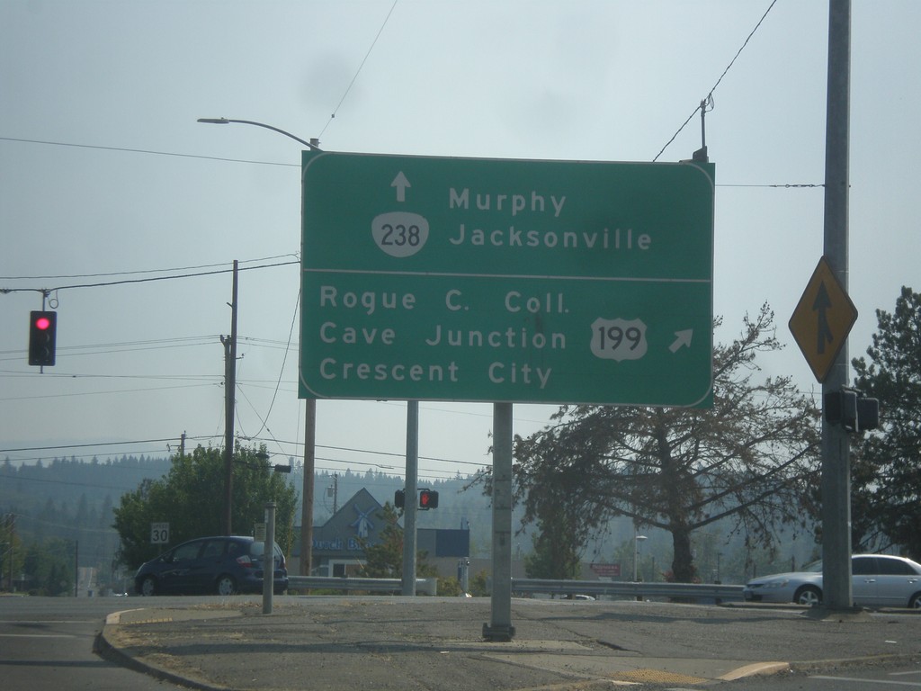
OR-238 South at US-199
OR-238 south at US-199. Turn right for US-199 south to Rogue Community College, Cave Junction, and Crescent City (CA). Continue south on OR-238 for Murphy and Jacksonville.
Taken 08-17-2015
 Grants Pass
Josephine County
Oregon
United States
Grants Pass
Josephine County
Oregon
United States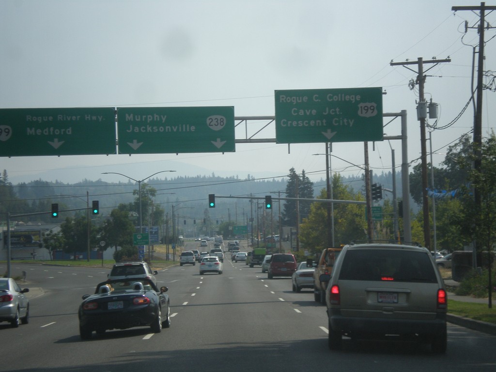
OR-99 South at US-199/OR-238
OR-99 south at US-199/OR-238 junction. Use left lane for OR-99 South/Rogue River Highway/Medford. Use middle lanes for OR-238/Murphy/Jacksonville. Use right lane for US-199 South/Rogue Community College/Cave Junction/Crescent City (CA).
Taken 08-17-2015
 Grants Pass
Josephine County
Oregon
United States
Grants Pass
Josephine County
Oregon
United States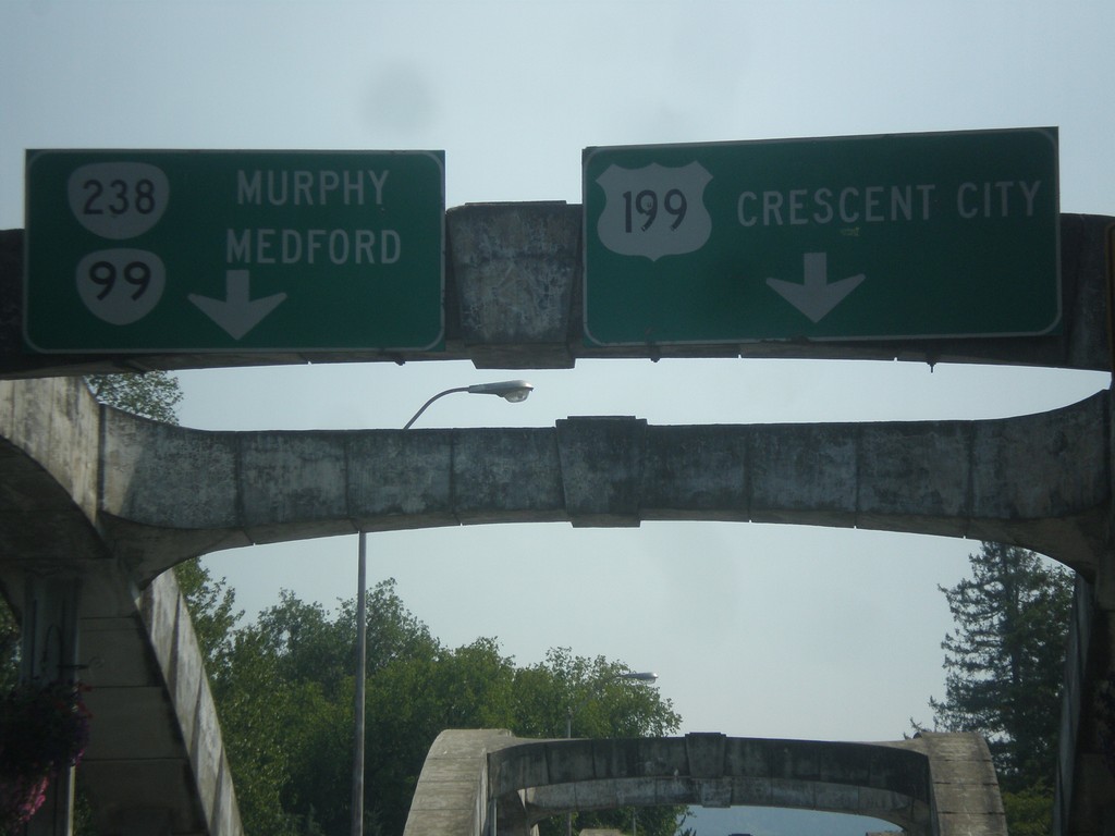
OR-99 South at US-199/OR-238
OR-99 south approaching US-199 and OR-238. Use left lane to continue south on OR-99 and for OR-238 to Murphy (and US-199 North to Medford). Use right lane for US-199 south to Crescent City (California).
Taken 08-17-2015
Grants Pass
Josephine County
Oregon
United States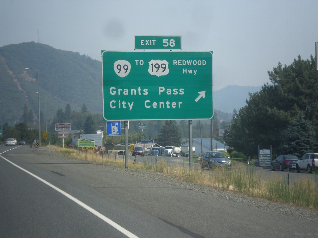
I-5 South - Exit 58
I-5 south at Exit 58 - OR-99/To US-191/Redwood Highway/Grants Pass/City Center.
Taken 08-17-2015
 Grants Pass
Josephine County
Oregon
United States
Grants Pass
Josephine County
Oregon
United States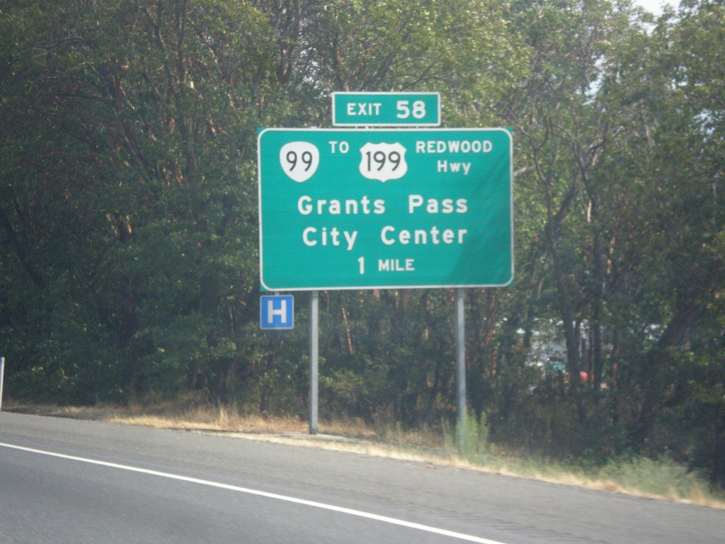
I-5 South - Exit 58
I-5 south approaching Exit 58 - OR-99/To US-199/Redwood Highway/Grants Pass/City Center. The name of the highway is common on many interstate exit signs, especially in western Oregon.
Taken 08-17-2015
Grants Pass
Josephine County
Oregon
United States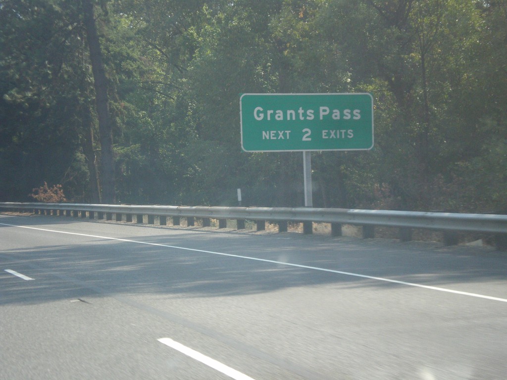
I-5 South - Grants Pass Exits
Grants Pass - Next 2 Exits on I-5 south.
Taken 08-17-2015
Grants Pass
Josephine County
Oregon
United States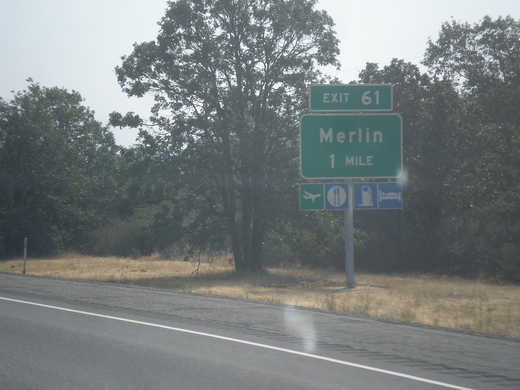
I-5 South - Exit 61
I-5 south approaching Exit 61 - Merlin.
Taken 08-17-2015
Grants Pass
Josephine County
Oregon
United States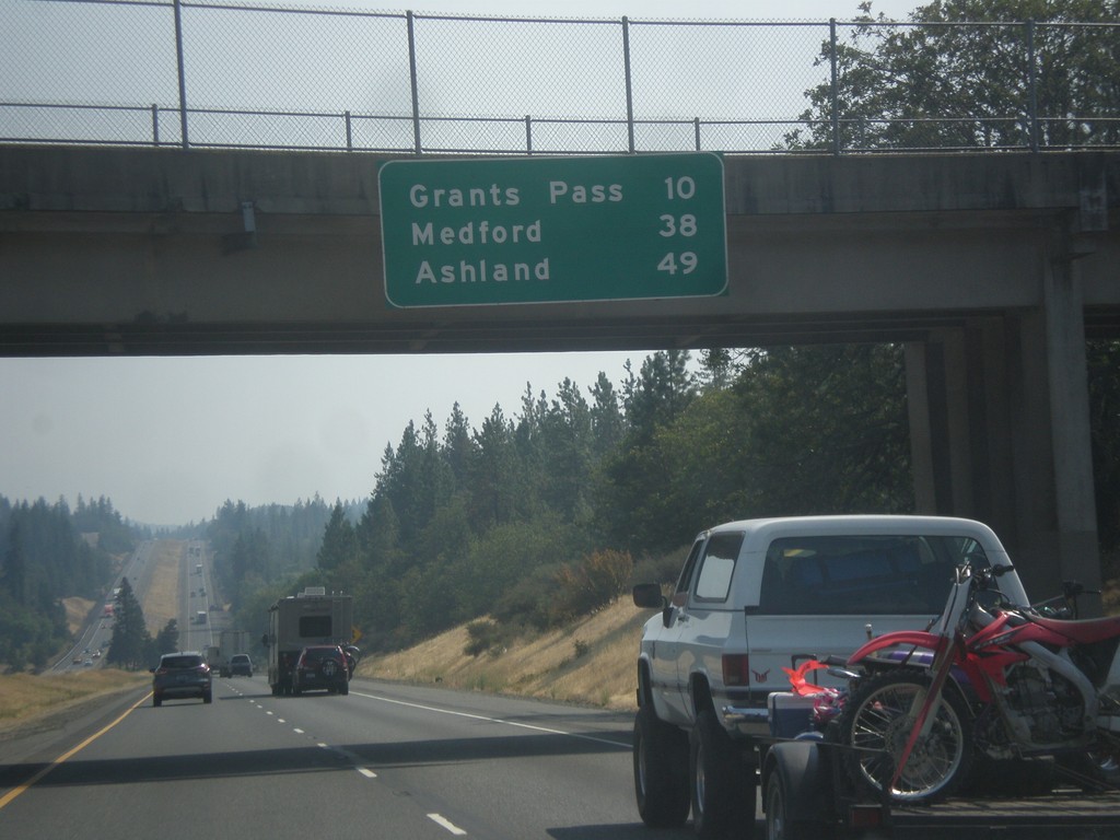
I-5 South - Distance Marker
Distance marker on I-5 south. Distance to Grants Pass, Medford, and Ashland.
Taken 08-17-2015
Grants Pass
Josephine County
Oregon
United States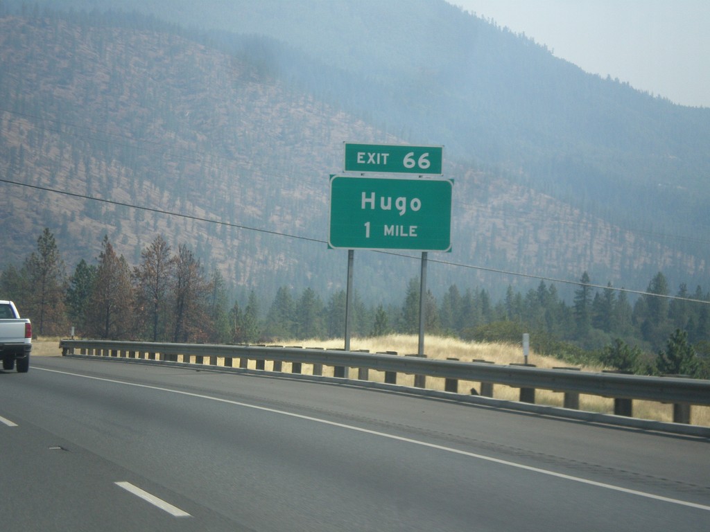
I-5 South - Exit 66
I-5 south approaching Exit 66 - Hugo.
Taken 08-17-2015
Grants Pass
Josephine County
Oregon
United States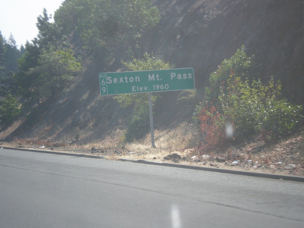
I-5 South - Sexton Mountain Summit
I-5 south at Sexton Mountain Summit - Elevation 1960 Feet. This summit is one a series of passes I-5 crosses between Canyonville and Grants Pass in the Klamath Mountains. The milepost is also attached to the main sign.
Taken 08-17-2015
Wolf Creek
Josephine County
Oregon
United States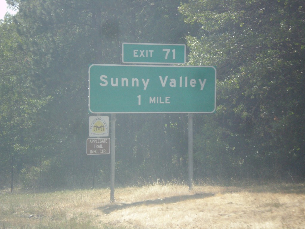
I-5 South - Exit 71
I-5 south approaching Exit 71 - Sunny Valley.
Taken 08-17-2015
Wolf Creek
Josephine County
Oregon
United States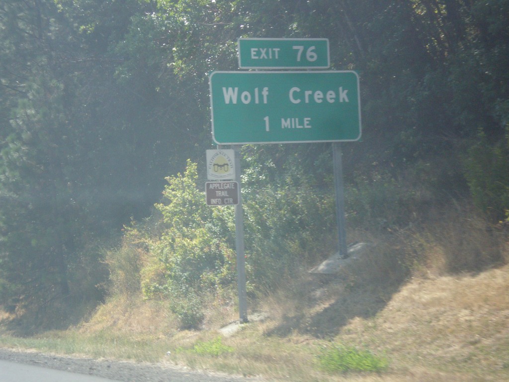
I-5 South - Exit 76
I-5 south approaching Exit 76 - Wolf Creek
Taken 08-17-2015
Wolf Creek
Josephine County
Oregon
United States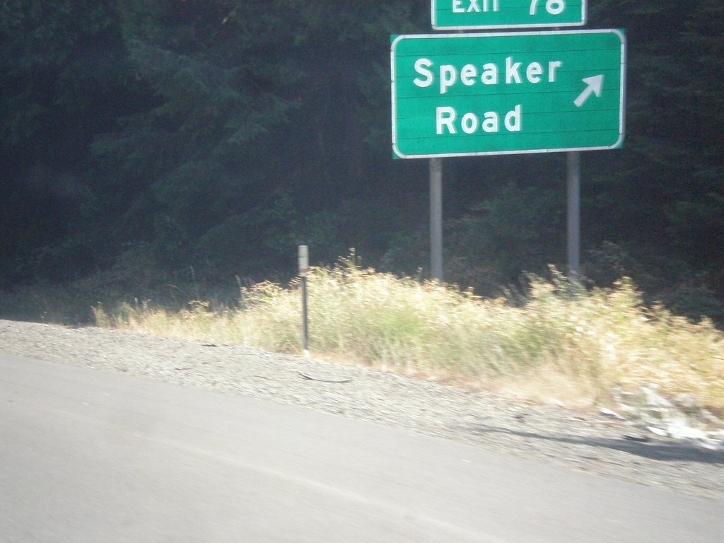
I-5 South - Exit 78
I-5 south at Exit 78 - Speaker Road.
Taken 08-17-2015
Wolf Creek
Josephine County
Oregon
United States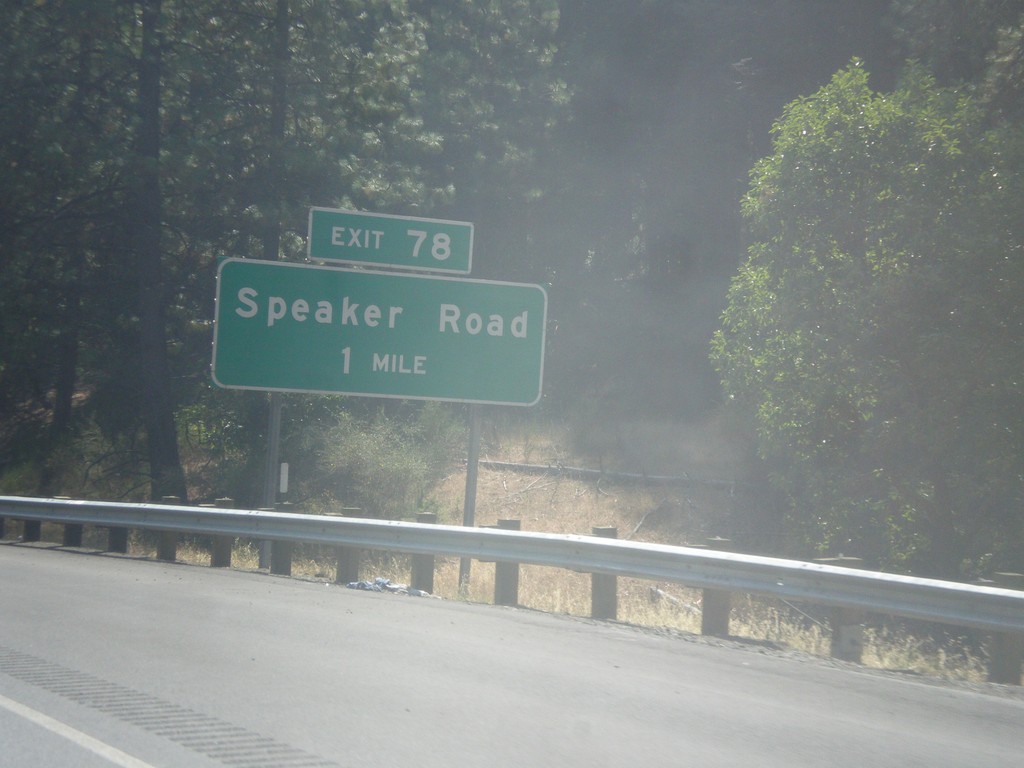
I-5 South - Exit 78
I-5 south approaching Exit 78 - Speaker Road.
Taken 08-17-2015
Wolf Creek
Josephine County
Oregon
United States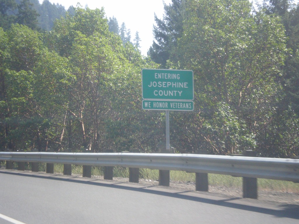
I-5 South - Entering Josephine County
Entering Josephine County on I-5 south. Many of the county line signs in southern Oregon (and Del Norte County California) contain the phrase We Honor Veterans.
Taken 08-17-2015
Glendale
Josephine County
Oregon
United States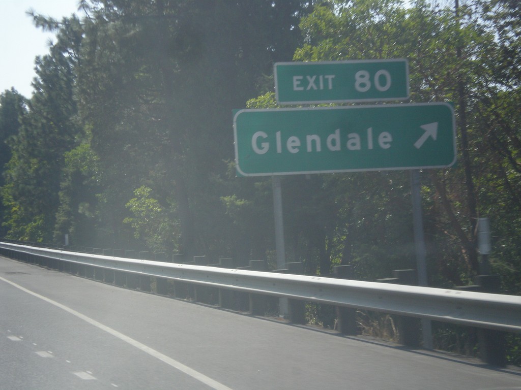
I-5 South - Exit 80
I-5 south at Exit 80 - Glendale.
Taken 08-17-2015
Glendale
Douglas County
Oregon
United States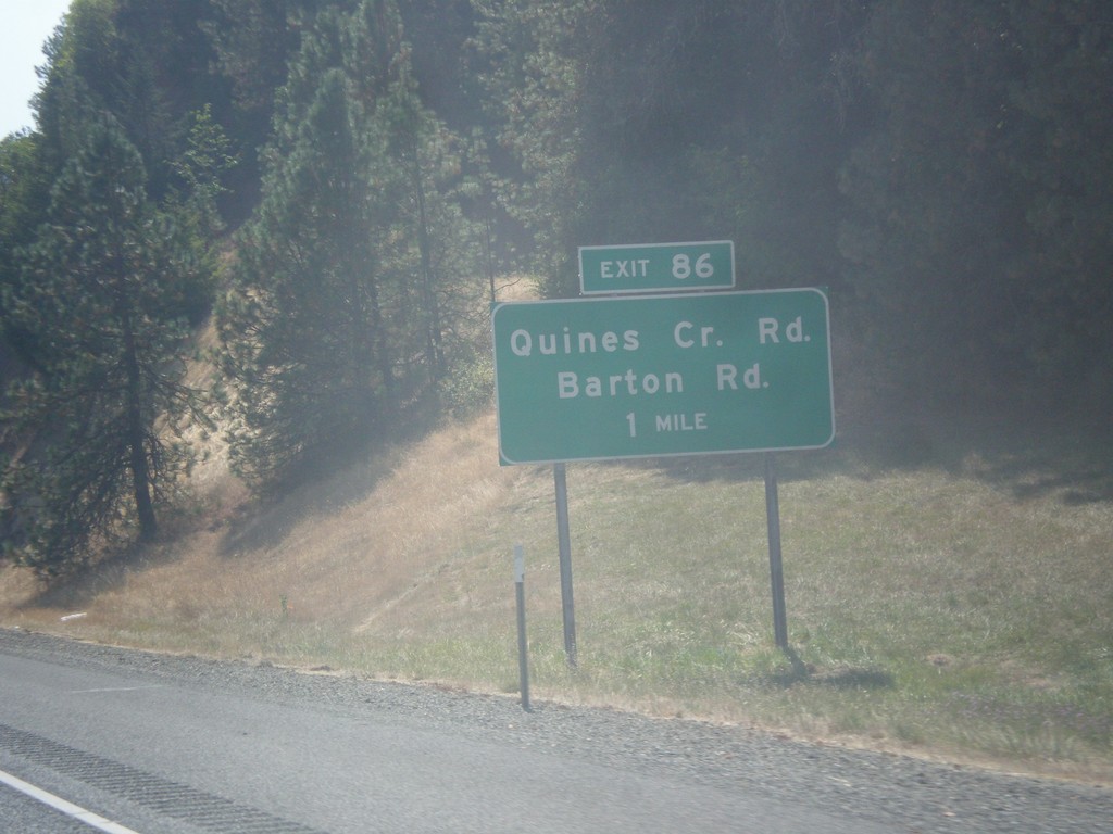
I-5 South - Exit 86
I-5 south approaching Exit 86 - Quines Creek Road/Barton Road.
Taken 08-17-2015
Azalea
Douglas County
Oregon
United States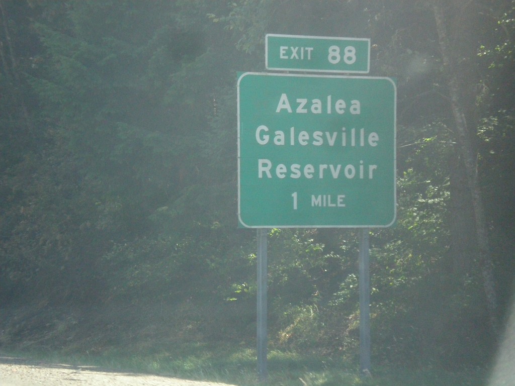
I-5 South - Exit 88
I-5 south approaching Exit 88 - Azalea/Galesville Reservoir.
Taken 08-17-2015
Azalea
Douglas County
Oregon
United States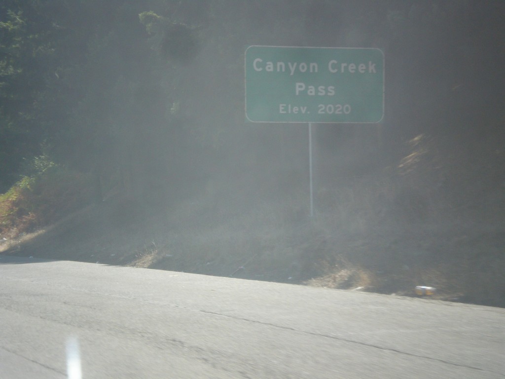
I-5 South - Canyon Creek Summit
I-5 south at Canyon Creek Summit - Elevation 2020 Feet. Canyon Creek Summit is the highest of the series of passes in the Klamath Mountains between Canyonville and Grants Pass along I-5.
Taken 08-17-2015
Glendale
Douglas County
Oregon
United States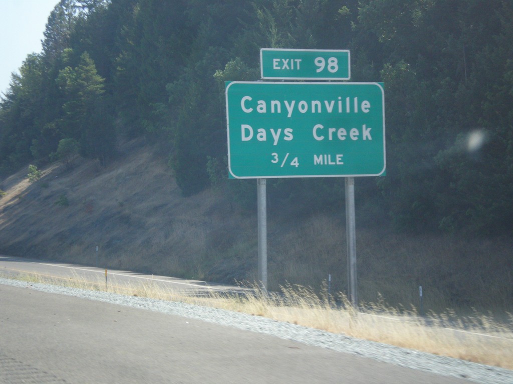
I-5 South - Exit 98
I-5 south approaching Exit 98 - Canyonville/Days Creek.
Taken 08-17-2015
Canyonville
Douglas County
Oregon
United States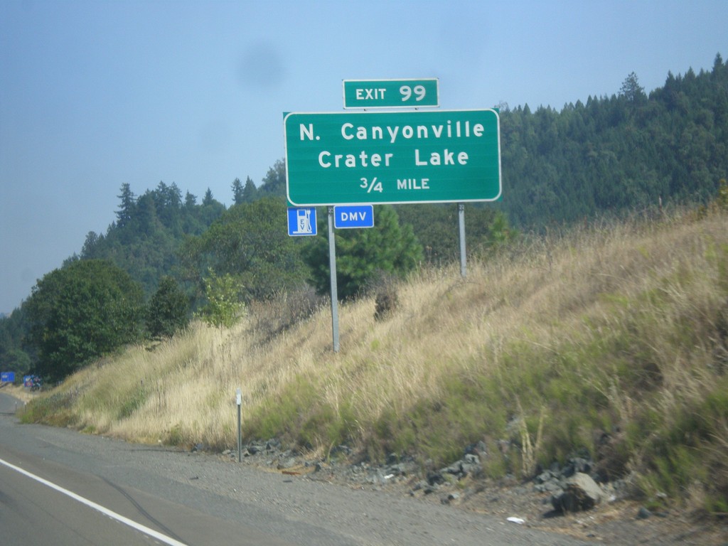
I-5 South - Exit 99
I-5 south approaching Exit 99 - North Canyonville/Crater Lake.
Taken 08-17-2015
Myrtle Creek
Douglas County
Oregon
United States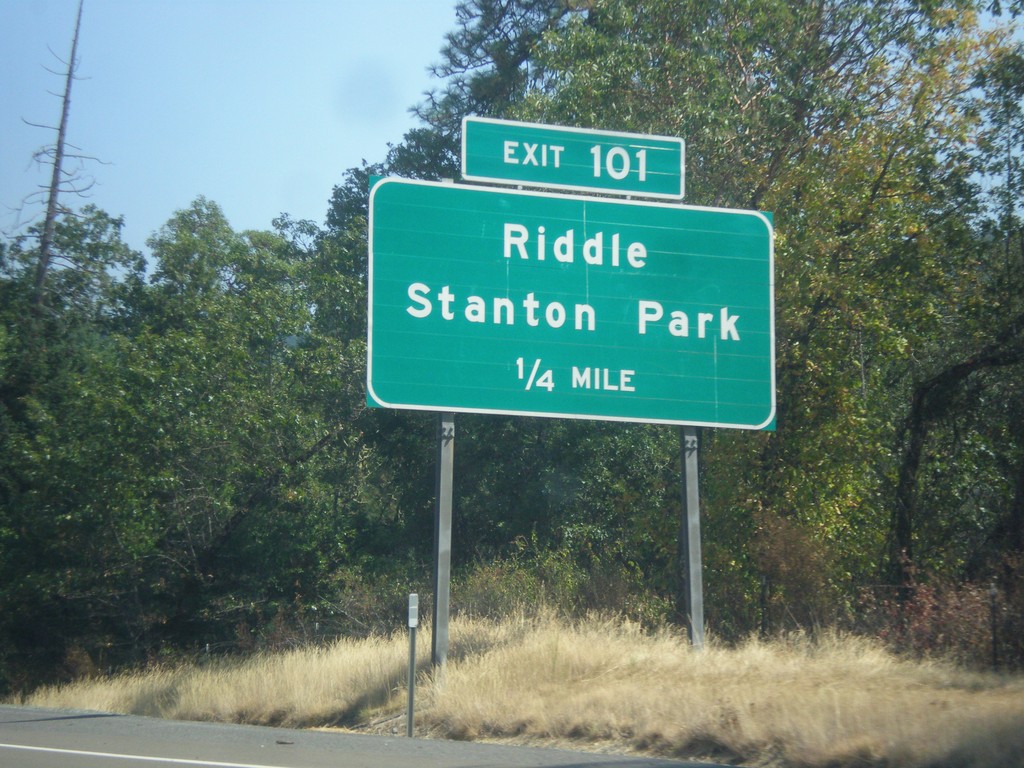
I-5 South - Exit 101
I-5 south approaching Exit 101 - Riddle/Stanton Park.
Taken 08-17-2015
Myrtle Creek
Douglas County
Oregon
United States