Signs Tagged With Big Green Sign
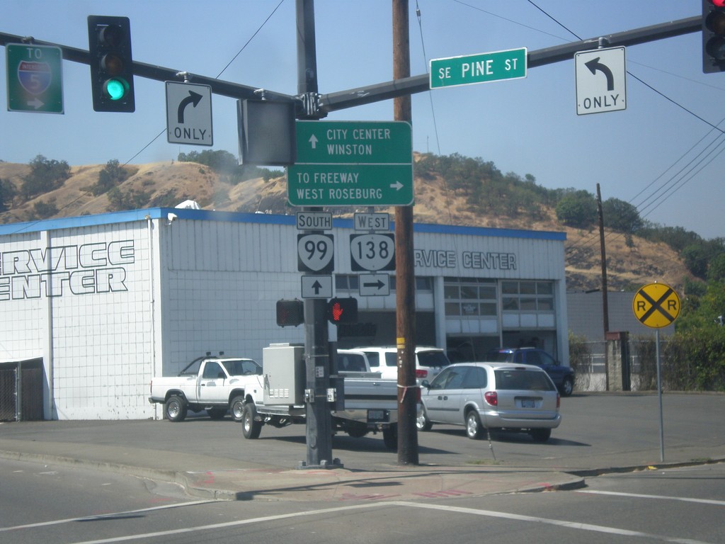
OR-99 South/OR-138 West at OR-99/OR-138 Split
OR-99 South/OR-138 West at OR-99/OR-138 Split. Turn right for OR-138 West (Pine St.) to Freeway (I-5) and West Roseburg. Continue south on OR-99 (Stephen St.) for City Center and Winston.
Taken 08-17-2015

 Roseburg
Douglas County
Oregon
United States
Roseburg
Douglas County
Oregon
United States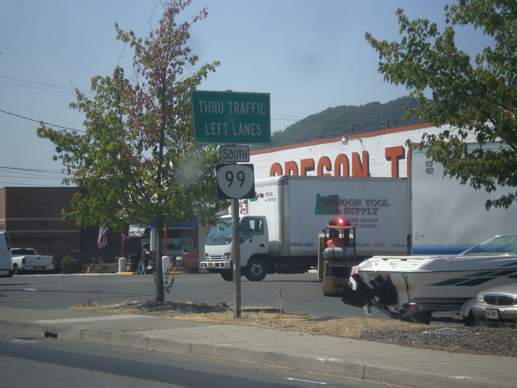
OR-99 South/OR-138 West Approaching OR-99/OR-138 Split
OR-99 South/OR-138 West approaching OR-99/OR-138 split. Use left lanes to continue south on OR-99 (Stephens St.)
Taken 08-17-2015
Roseburg
Douglas County
Oregon
United States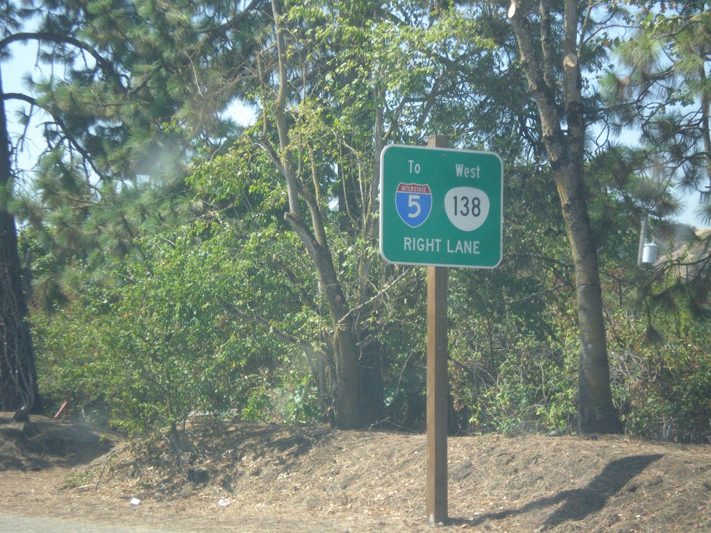
OR-138 West/OR-99 South - Use Right Lanes for I-5/OR-138
OR-138 West/OR-99 South (Stephens St.) in Roseburg. Use right lanes for I-5/OR-138 West.
Taken 08-17-2015
 Roseburg
Douglas County
Oregon
United States
Roseburg
Douglas County
Oregon
United States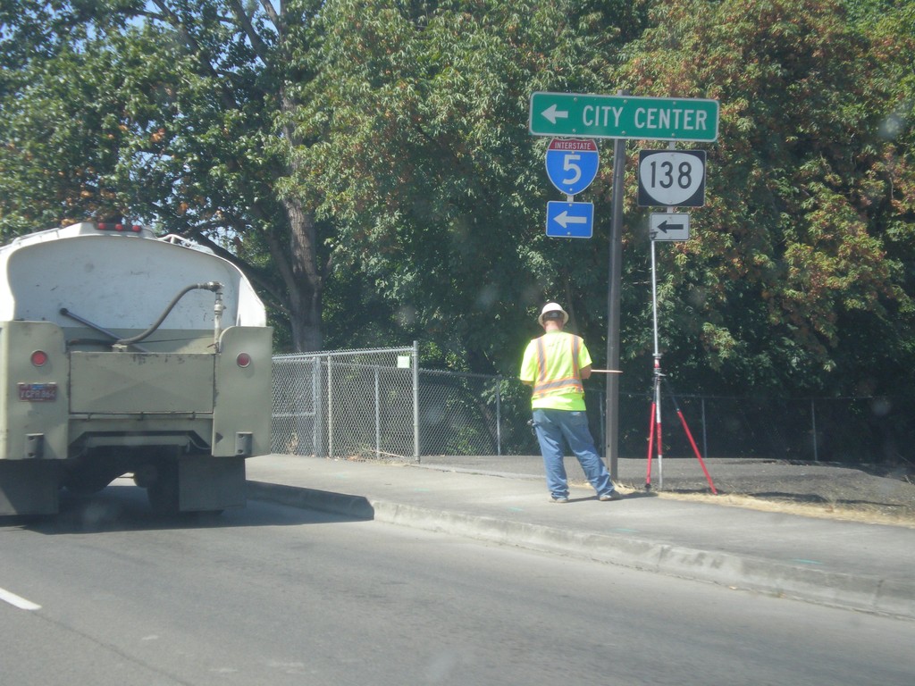
OR-138 West Approaching OR-99 In Roseburg
OR-138 West (Diamond Lake Blvd.) approaching OR-99 (Stephens St.) in Roseburg. Turn left to continue west on OR-138 and for access to I-5 and the Roseburg City Center. OR-138 joins OR-99 for a few blocks into Roseburg.
Taken 08-17-2015
Roseburg
Douglas County
Oregon
United States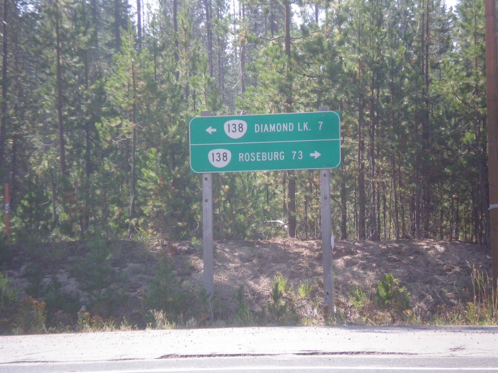
Birds Point Road at OR-138
Birds Point Road at OR-138. Birds Point Road connects the Lemolo Lake area with OR-138. Use OR-138 west to Roseburg; east to Diamond Lake.
Taken 08-17-2015
Diamond Lake
Douglas County
Oregon
United States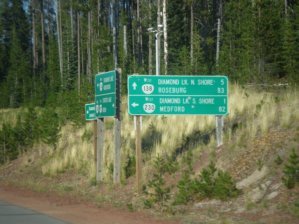
OR-138 West at OR-230
OR-138 West at OR-230 west to Diamond Lake South Shore and Medford. On the day this photograph was taken a forest fire had closed down OR-230 west, as well as the campgrounds at nearby Diamond Lake. Continue west on OR-138 for Diamond Lake North Shore and Roseburg.
Taken 08-15-2015
 Chemult
Douglas County
Oregon
United States
Chemult
Douglas County
Oregon
United States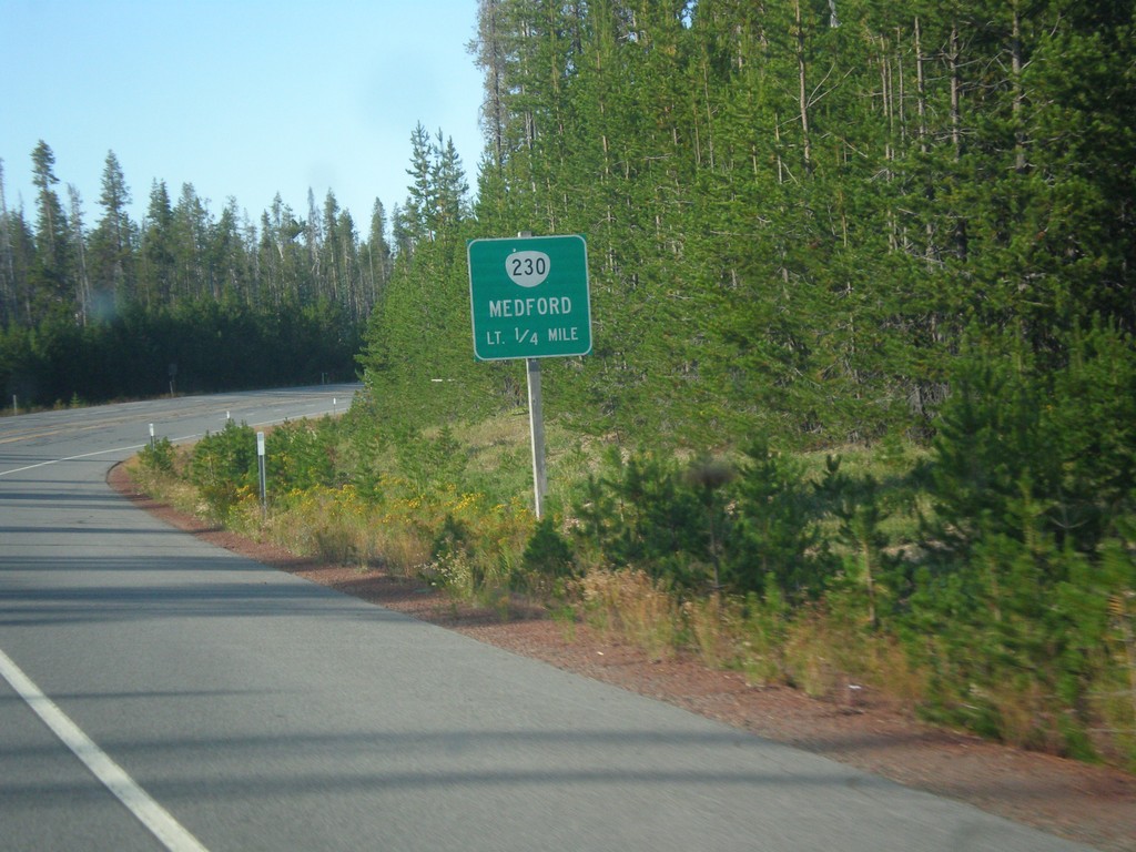
OR-138 West Approaching OR-230
OR-138 West approaching OR-230 south to Medford.
Taken 08-15-2015
Crescent
Douglas County
Oregon
United States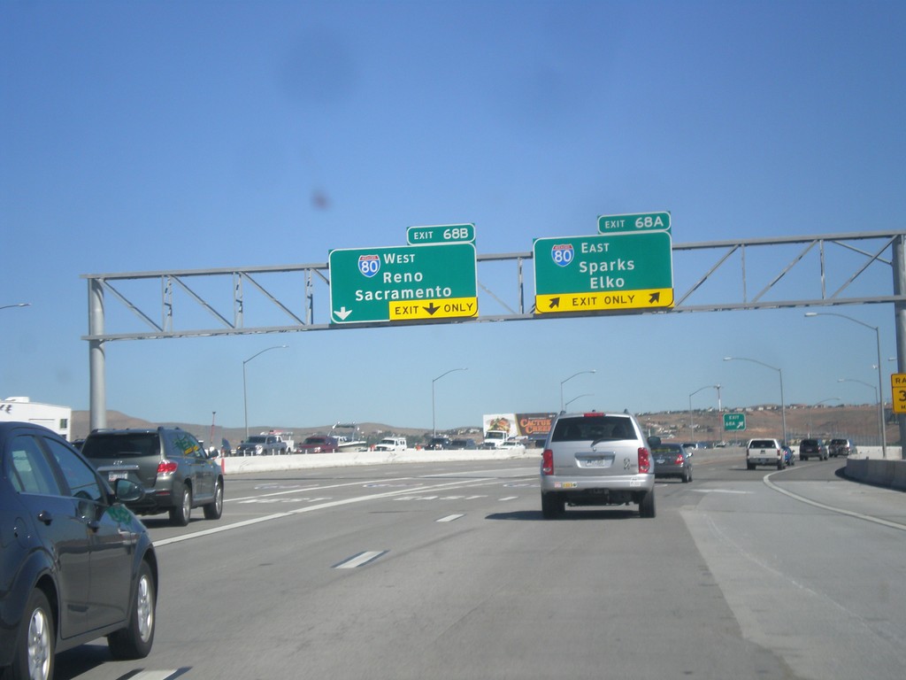
I-580/US-395 North - Exits 68A and 68B
I-580/US-395 north at Exits 68A and 68B. Exit 68A - I-80 East/Sparks/Elko. Exit 68B - I-80 West/Reno/Sacramento (California). US-395 continues north towards Susanville (California). This is the north end of I-580.
Taken 06-15-2015


 Reno
Washoe County
Nevada
United States
Reno
Washoe County
Nevada
United States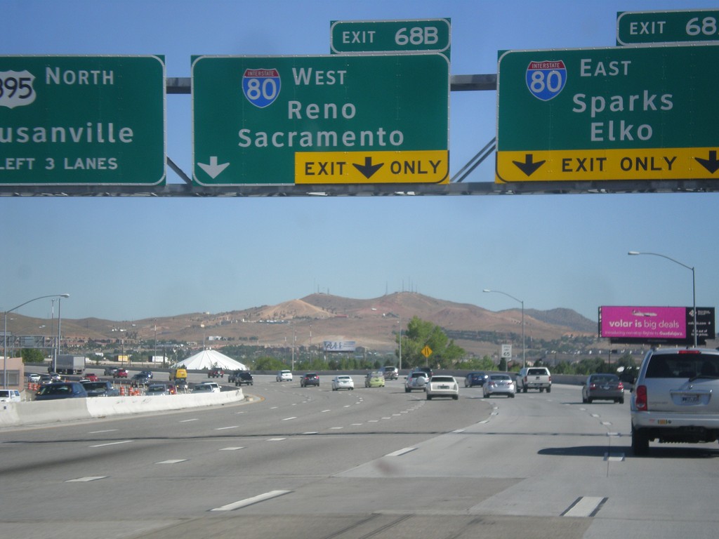
I-580/US-395 North - Exits 68A and 68B
I-580/US-395 north approaching Exits 68A and 68B. Exit 68A - I-80 East/Sparks/Elko. Exit 68B - I-80 West/Reno/Sacramento (California). US-395 continues north towards Susanville (California). I-580 ends at I-80. The freeway continues as US-395.
Taken 06-15-2015
Reno
Washoe County
Nevada
United States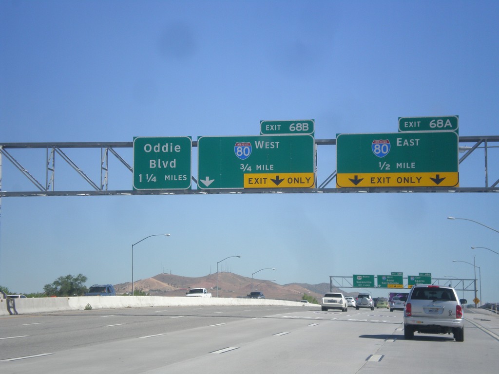
I-580/US-395 North Approaching Exits 68AB and 69
I-580/US-395 north approaching Exit 68A - I-80 East; Exit 68B - I-80 West, and Exit 69 (exit number not shown) - Oddie Blvd.
Taken 06-15-2015
Reno
Washoe County
Nevada
United States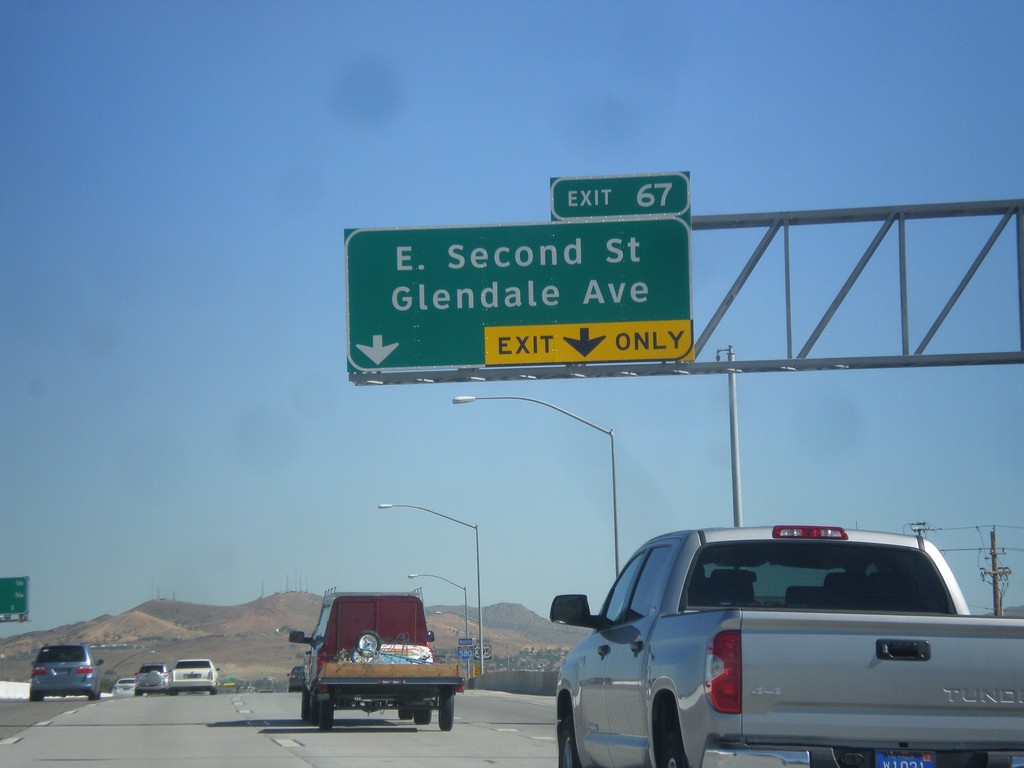
I-580/US-395 North - Exit 67
I-580/US-395 north at Exit 67 - E. Second St./Glendale Ave.
Taken 06-15-2015
Reno
Washoe County
Nevada
United States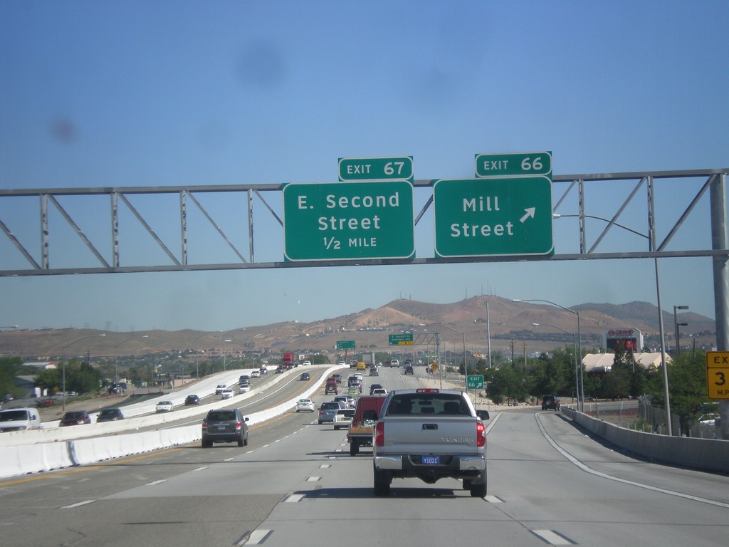
I-580/US-395 North - Exits 66 and 67
I-580/US-395 north at Exit 66 - Mill St. Approaching Exit 67 - E. Second St.
Taken 06-15-2015
Reno
Washoe County
Nevada
United States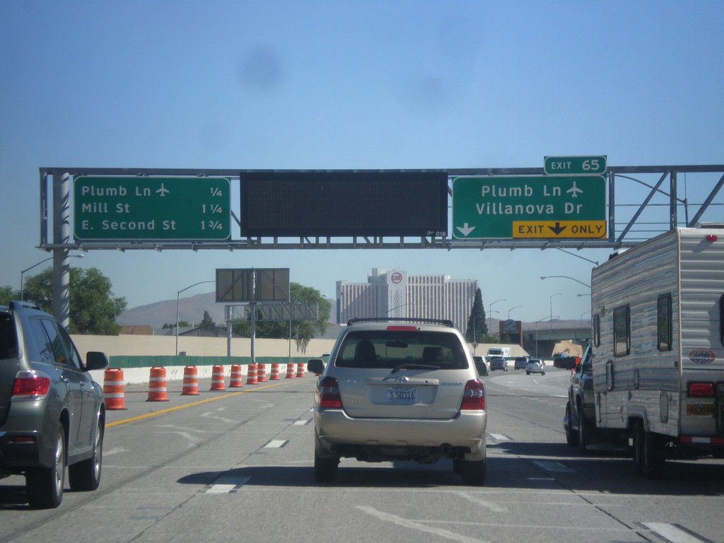
I-580/US-395 North Approaching Exit 65
I-580/US-395 north approaching Exit 65 - Plumb Lane/Villanova Drive. A distance marker showing the next three Reno exits is on the left side of the picture. The next three exits are: Plumb Lane, Mill St., and E. Second St. Use the Plumb Lane exit for the Reno-Tahoe International Airport.
Taken 06-15-2015
Reno
Washoe County
Nevada
United States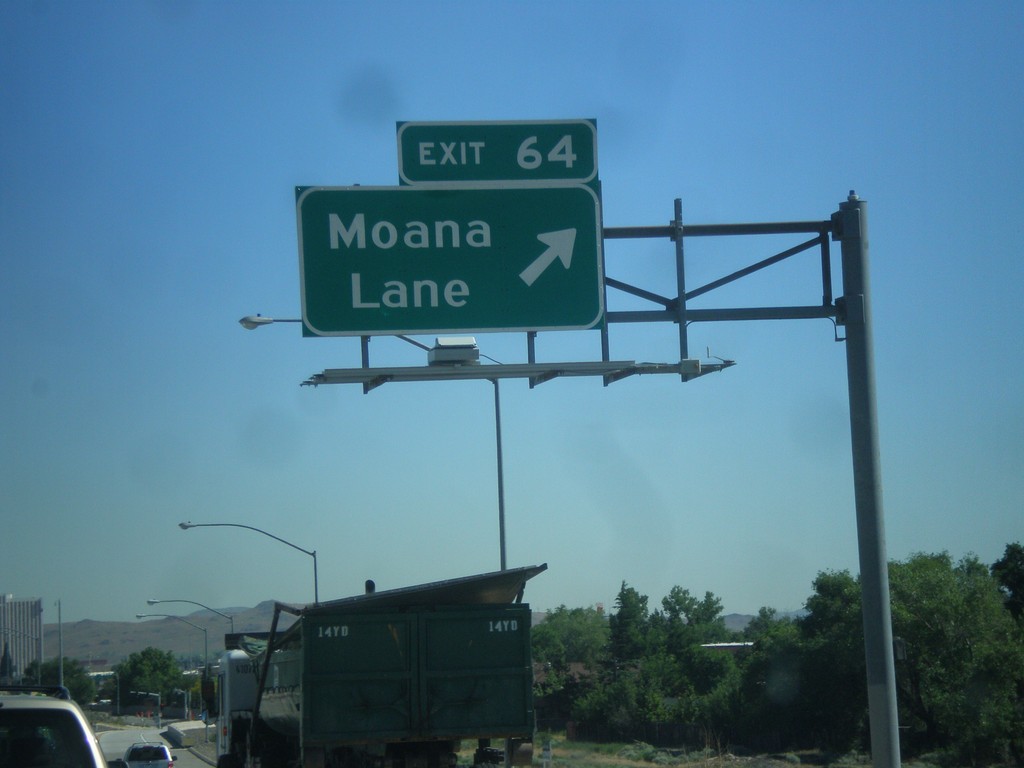
I-580/US-395 North - Exit 64
I-580/US-395 north at Exit 64 - Moana Lane.
Taken 06-15-2015
Reno
Washoe County
Nevada
United States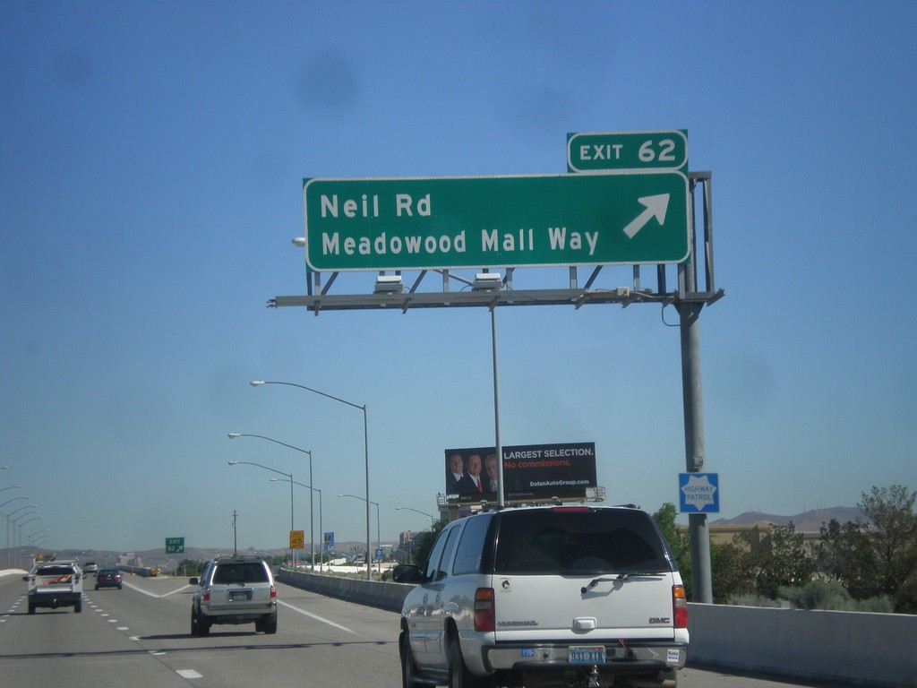
I-580/US-395 North - Exit 62
I-580/US-395 north at Exit 62 - Neil Road/Meadowood Mall Way.
Taken 06-15-2015
Reno
Washoe County
Nevada
United States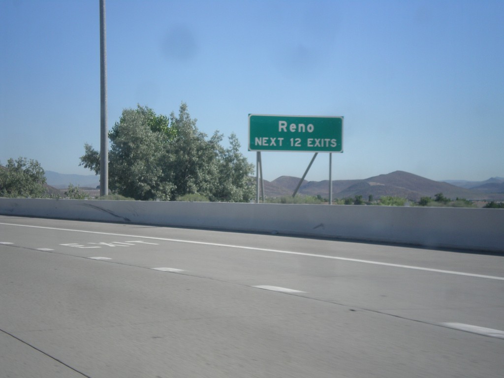
I-580/US-395 North - Reno Exits
Reno - Next 12 Exits on I-580/US-395 North.
Taken 06-15-2015
Reno
Washoe County
Nevada
United States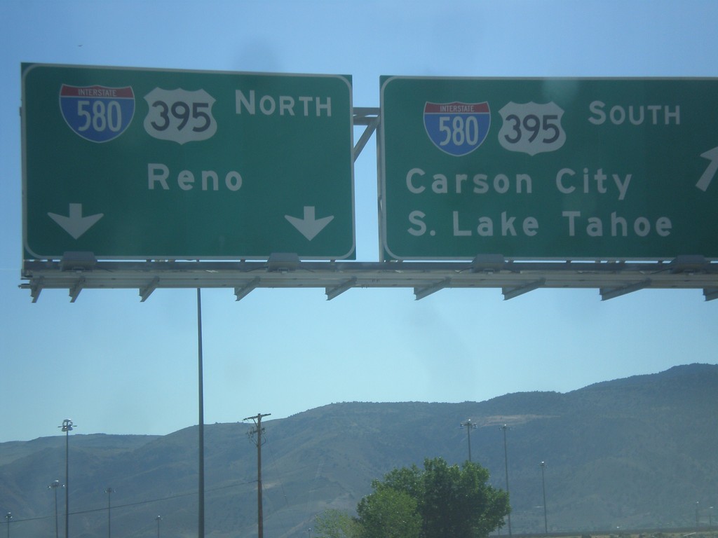
NV-431 East at US-395
NV-431 east at I-580/US-395. For I-580/US-395 north to Reno continue straight. Merge right for I-580/US-395 south to Carson City and South Lake Tahoe.
Taken 06-15-2015
 Reno
Washoe County
Nevada
United States
Reno
Washoe County
Nevada
United States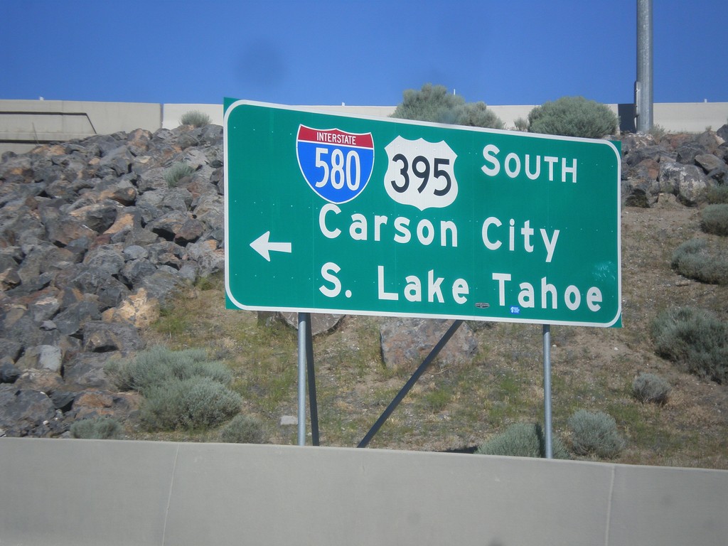
NV-431 East at I-580/US-395 South
NV-431 East at I-580/US-395 South to South Lake Tahoe and Carson City.
Taken 06-15-2015
Reno
Washoe County
Nevada
United States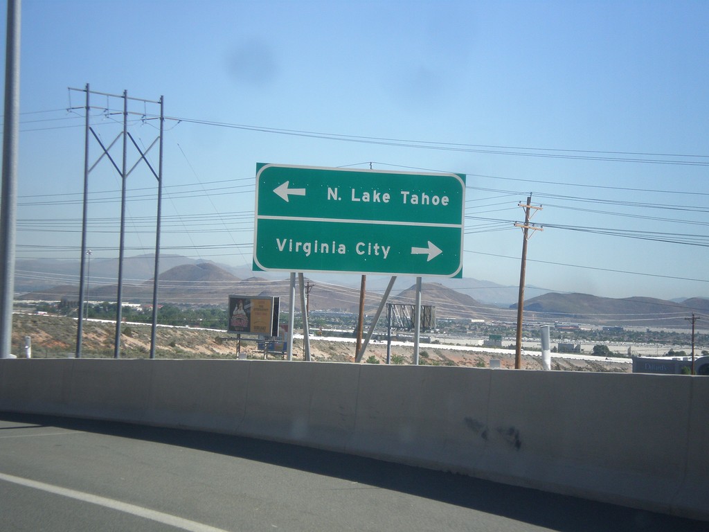
I-580/US-395 North - Exit 56 Offramp
I-580/US-395 North on Exit 56 Offramp. Turn right for NV-431 East (via NV-341) to Virginia City. Turn left for NV-431 West to North Lake Tahoe.
Taken 06-15-2015
Reno
Washoe County
Nevada
United States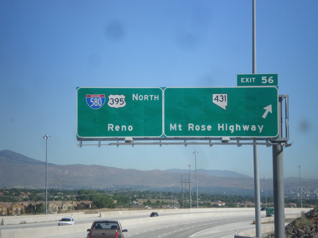
I-580/US-395 North - Exit 56
I-580/US-395 North at Exit 56 - NV-431/Mount Rose Highway. Continue north on I-580/US-395 for Reno.
Taken 06-15-2015
Reno
Washoe County
Nevada
United States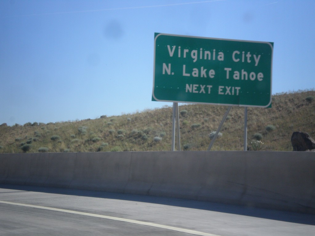
I-580/US-395 North - N. Lake Tahoe/Virginia City
I-580/US-395 North - Use Exit 56 for N. Lake Tahoe and Virginia City (via NV-341).
Taken 06-15-2015
Reno
Washoe County
Nevada
United States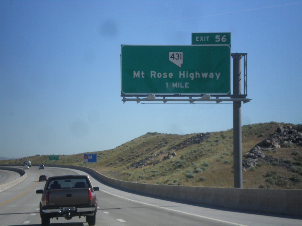
I-580/US-395 North - Exit 56
I-580/US-395 North approaching Exit 56 - NV-431/Mount Rose Highway.
Taken 06-15-2015
Reno
Washoe County
Nevada
United States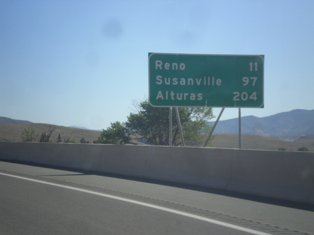
I-580/US-395 North - Distance Marker
Distance marker on I-580/US-395 North. Distance to Reno, Susanville (CA), and Alturas (CA).
Taken 06-15-2015
New Washoe City
Washoe County
Nevada
United States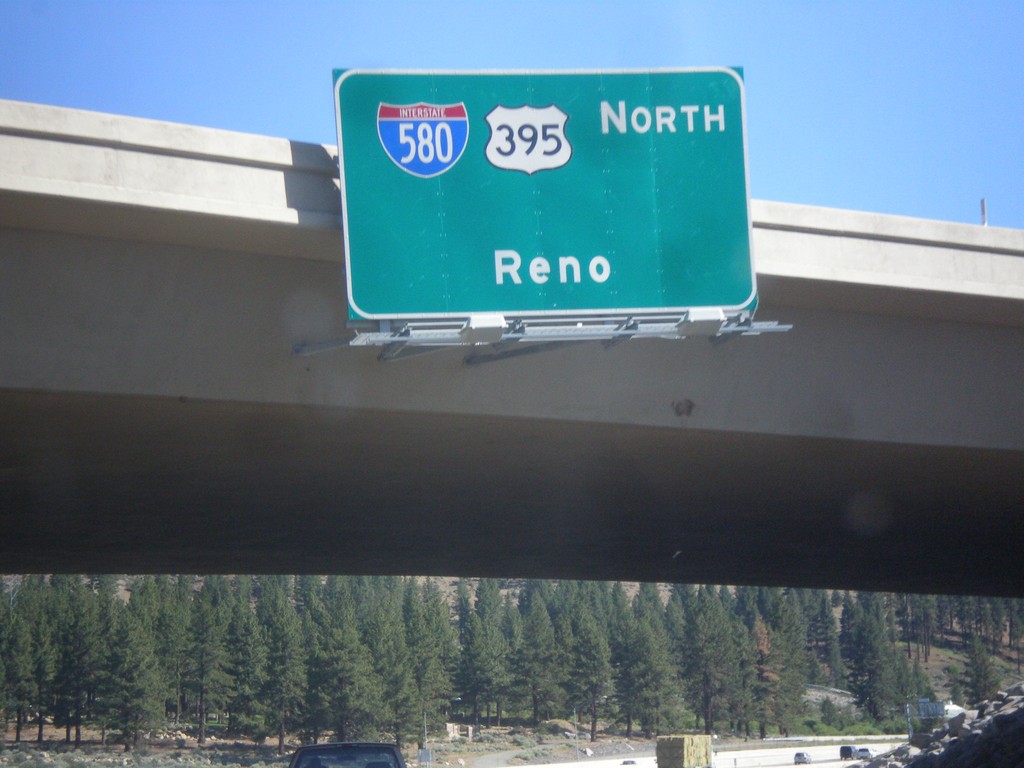
I-580/US-395 North - Reno
I-580/US-395 North - Reno, on overpass of Exit 50.
Taken 06-15-2015
New Washoe City
Washoe County
Nevada
United States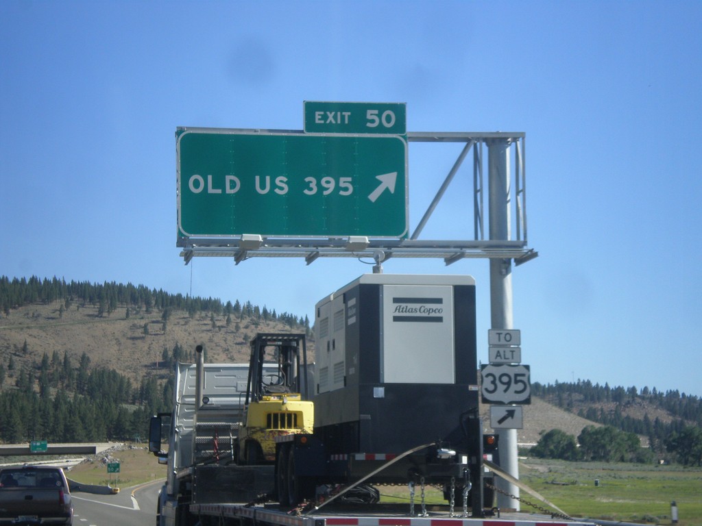
I-580/US-395 North - Exit 50
I-580/US-395 North at Exit 50 - Old US 395. Use Exit 50 for Alt. US-395.
Taken 06-15-2015
 New Washoe City
Washoe County
Nevada
United States
New Washoe City
Washoe County
Nevada
United States