Signs Tagged With Big Green Sign
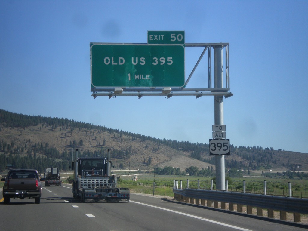
I-580/US-395 North - Exit 50
I-580/US-395 North approaching Exit 50 - Old US 395. Use Exit 50 for Alt. US-395.
Taken 06-15-2015


 New Washoe City
Washoe County
Nevada
United States
New Washoe City
Washoe County
Nevada
United States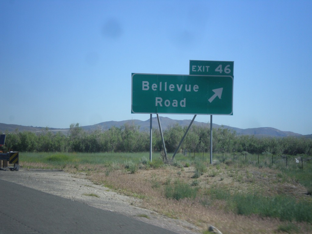
I-580/US-395 North - Exit 46
I-580/US-395 north at Exit 46 - Bellevue Road.
Taken 06-15-2015
New Washoe City
Washoe County
Nevada
United States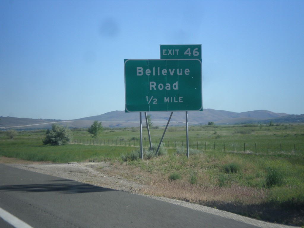
I-580/US-395 North - Exit 46
I-580/US-395 North approaching Exit 46 - Bellevue Road.
Taken 06-15-2015
New Washoe City
Washoe County
Nevada
United States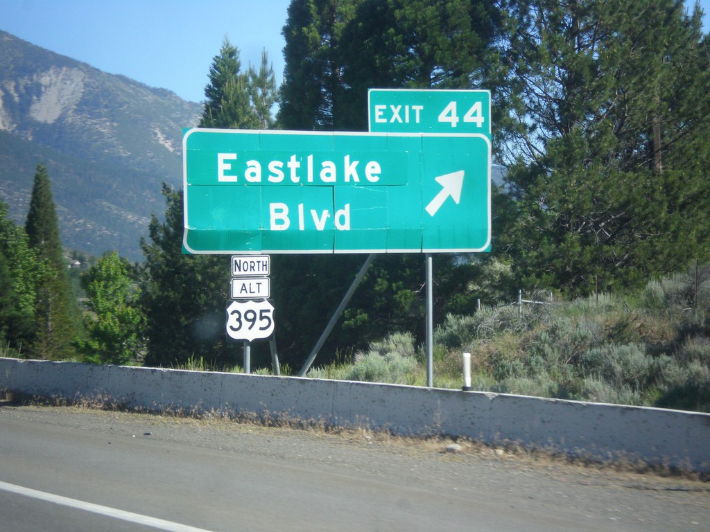
I-580/US-395 North - Exit 44
I-580/US-395 North at Exit 44 - Alt. US-395 North/Eastlake Blvd. Alt. US-395 north was created when the new I-580 freeway was completed. Alt. US-395 follows the old route of US-395 to Reno.
Taken 06-15-2015
Carson City
Washoe County
Nevada
United States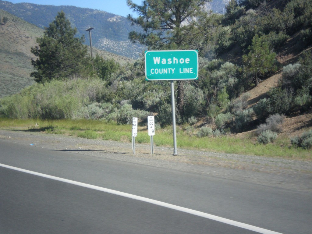
I-580/US-395 North - Washoe County Line
Washoe County Line on I-580/US-395 North.
Taken 06-15-2015
Carson City
Washoe County
Nevada
United States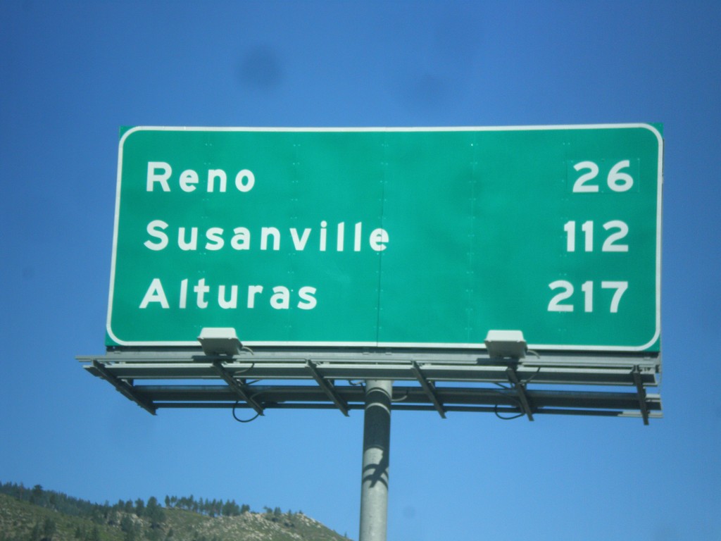
I-580/US-395 North - Distance Marker
Distance marker on I-580/US-395 North. Distance to Reno, Susanville (CA), and Alturas (CA).
Taken 06-15-2015
Carson City
Nevada
United States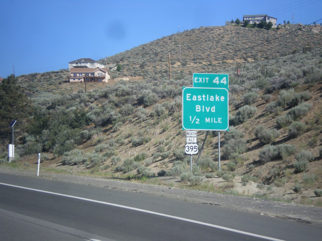
I-580/US-395 North - Exit 44
I-580/US-395 North approaching Exit 44 - Alt. US-395 North/Eastlake Blvd.
Taken 06-15-2015
Carson City
Nevada
United States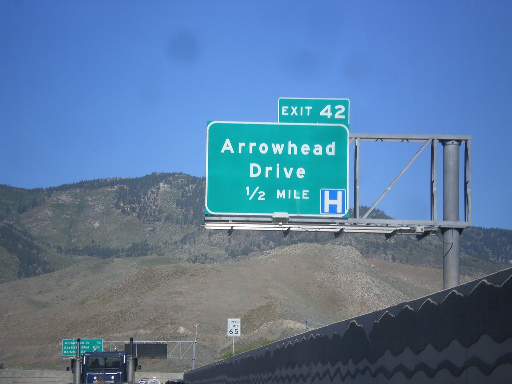
I-580/US-395 North - Exit 43
I-580/US-395 North approaching Exit 43 - Arrowhead Drive. This is the northern end of the Carson City business loop.
Taken 06-15-2015
 Carson City
Nevada
United States
Carson City
Nevada
United States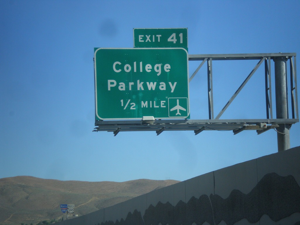
I-580/US-395 North - Exit 41
I-580/US-395 North approaching Exit 41 - College Parkway.
Taken 06-15-2015
Carson City
Nevada
United States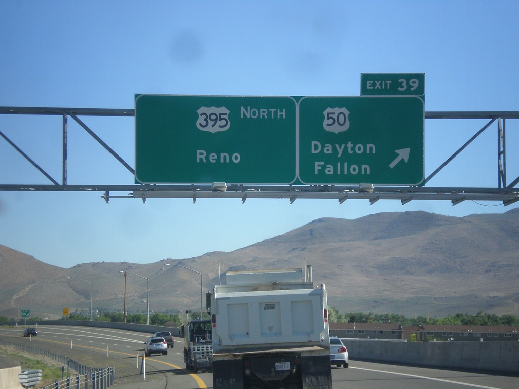
US-395 North - Exit 39
US-395 north at Exit 39 - US-50/Dayton/Fallon. Continue north on I-580/US-395 for Reno. The US-50/US-395 split ends here. I-580 begins here northbound, although it is not listed on the overhead. The first I-580 shield is north of this interchange.
Taken 06-15-2015
 Carson City
Nevada
United States
Carson City
Nevada
United States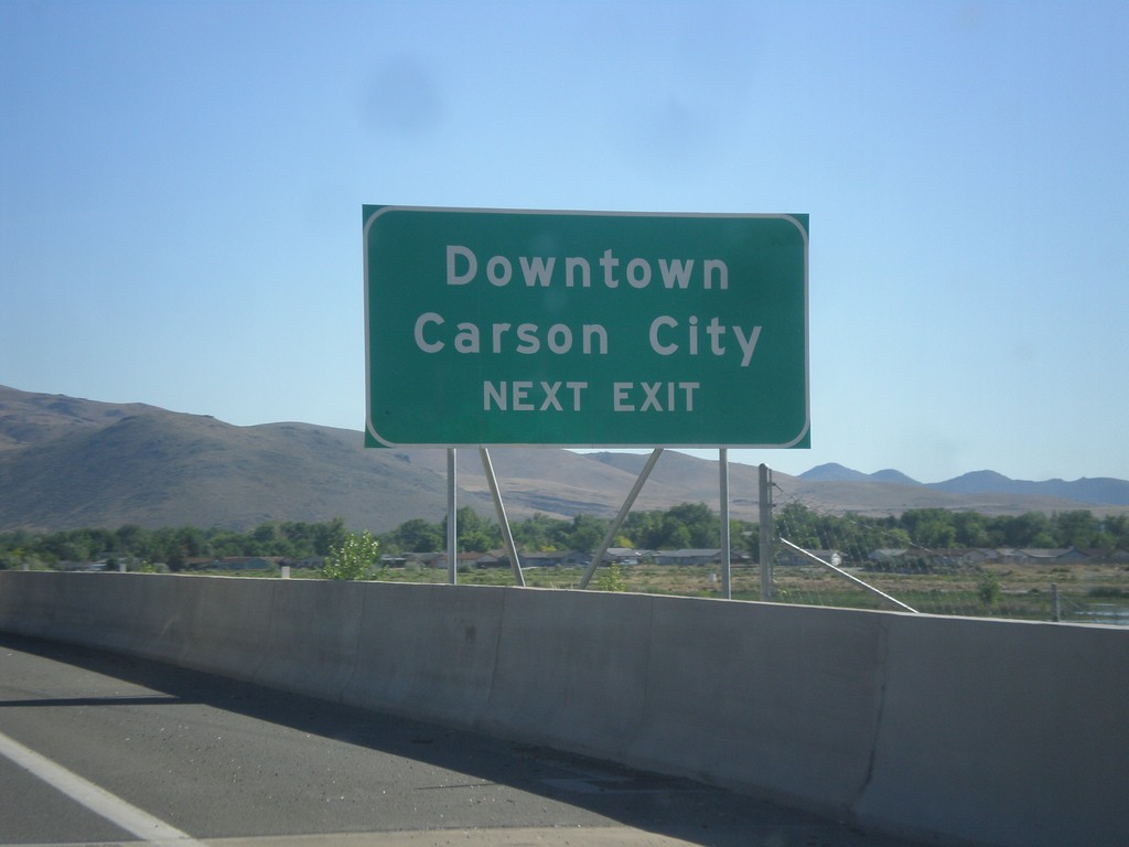
US-395 North/US-50 East - Downtown Carson City
US-395 North/US-50 East approaching Exit 39. Use Exit 39 for Downtown Carson City.
Taken 06-15-2015
Carson City
Nevada
United States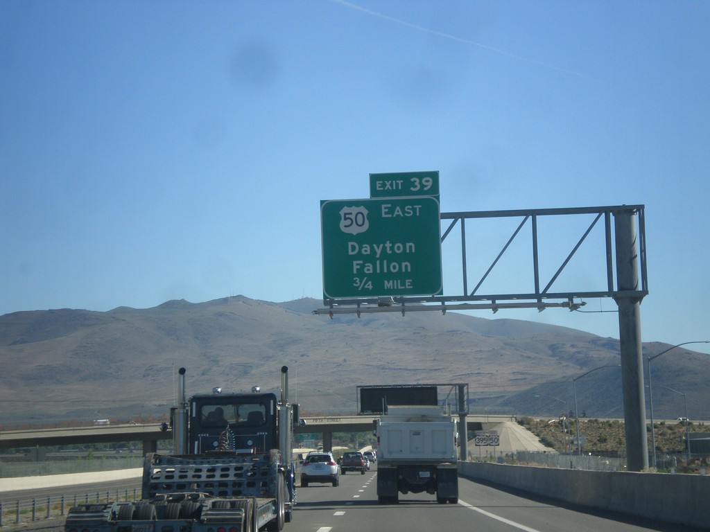
US-395 North/US-50 East - Exit 39
US-395 North/US-50 East approaching Exit 39 - US-50 East/Dayton/Fallon.
Taken 06-15-2015
Carson City
Nevada
United States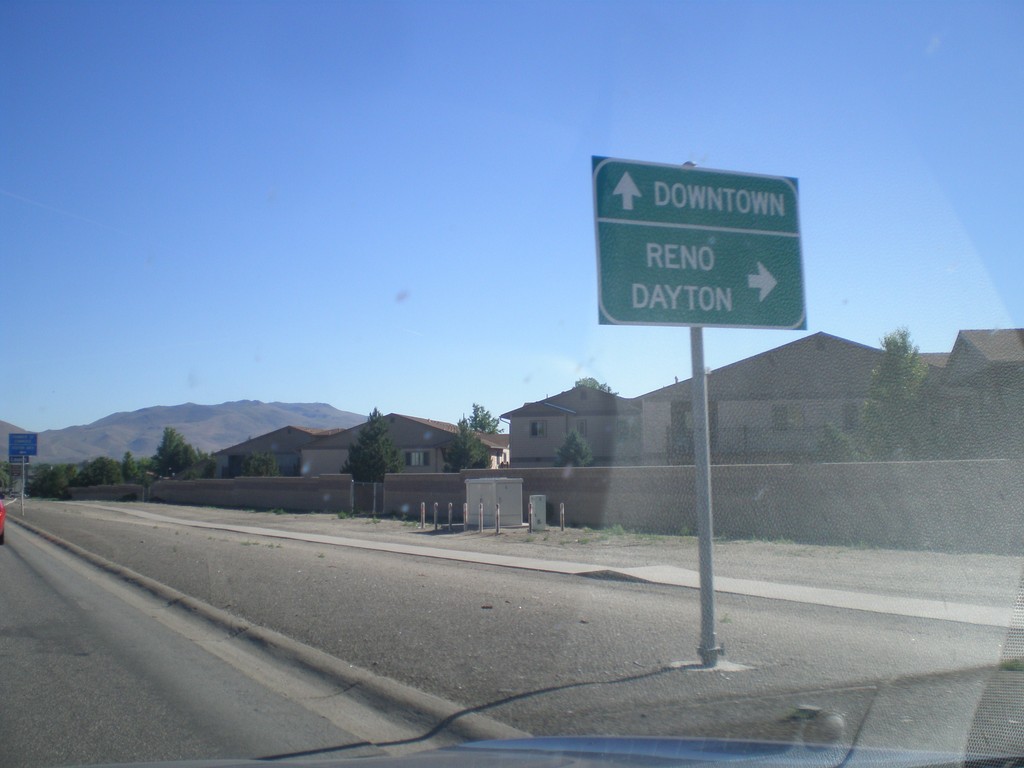
US-395 North/US-50 East Approaching Bus. US-395 and Fairview Ave.
US-395 North/US-50 East (Carson St.) approaching Bus. US-395 and Fairview Ave. Turn right on Fairview Ave. to continue on US-395 North/US-50 East to Dayton and Reno. Continue north on Carson St. for Bus. US-395 and Downtown (Carson City). The routing of US-395/US-50 along Fairview Ave. is temporary until the Carson City Freeway is completed.
Taken 06-15-2015
Carson City
Nevada
United States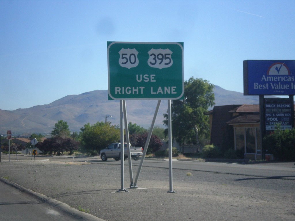
US-395 North/US-50 East Approaching Fairview Lane
US-395 North/US-50 East approaching Fairview Lane. Use right lane to continue on US-395/US-50.
Taken 06-15-2015
Carson City
Nevada
United States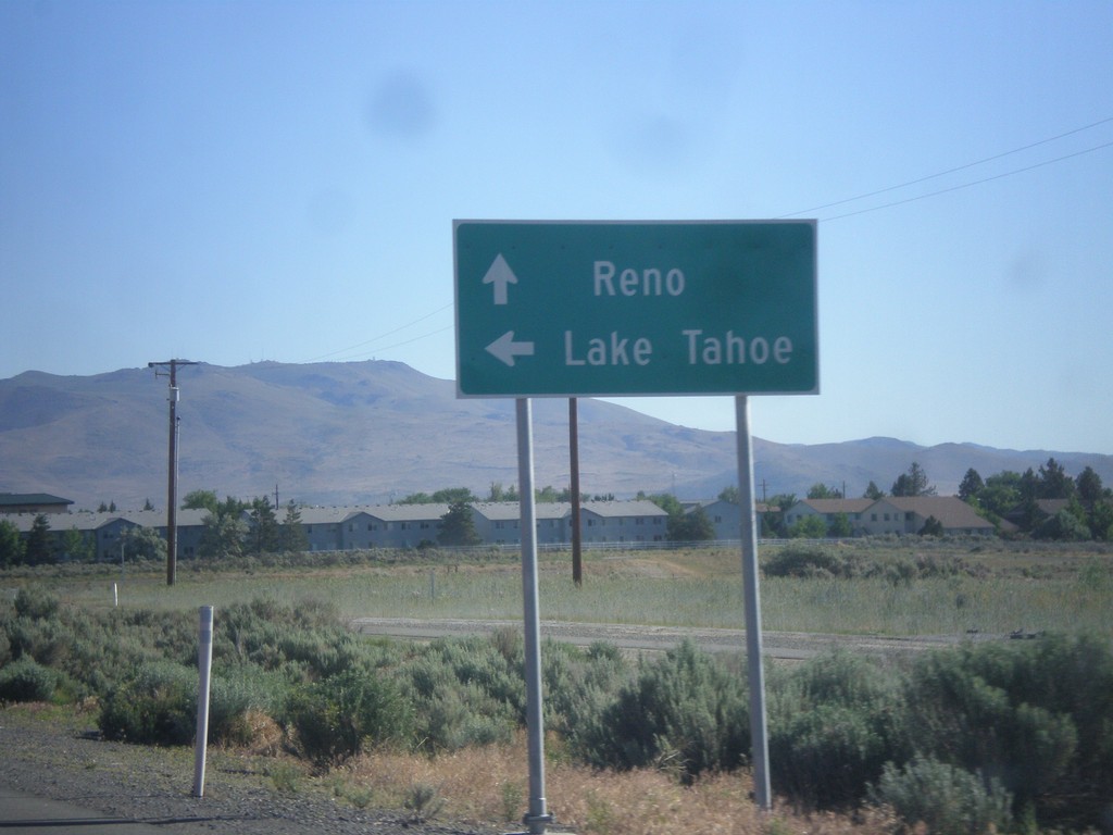
US-395 North at US-50
US-395 north at US-50. Use US-50 west for Lake Tahoe. Use US-50 East/US-395 North for Reno. US-50 East joins US-395 for a short distance north of this intersection. This will be the southern terminus of the Carson City Freeway.
Taken 06-15-2015
Carson City
Nevada
United States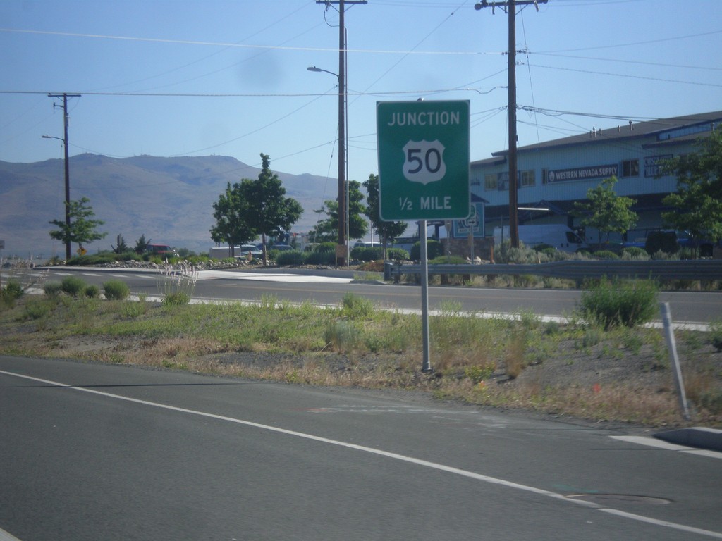
US-395 North Approaching US-50
US-395 North approaching US-50 in Carson City.
Taken 06-15-2015
Carson City
Nevada
United States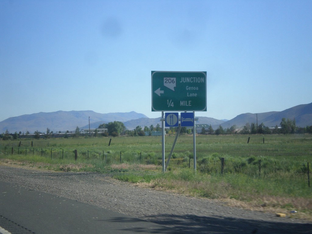
US-395 North Approaching NV-206
US-395 north approaching NV-206 - Genoa Lane.
Taken 06-15-2015
 Minden
Douglas County
Nevada
United States
Minden
Douglas County
Nevada
United States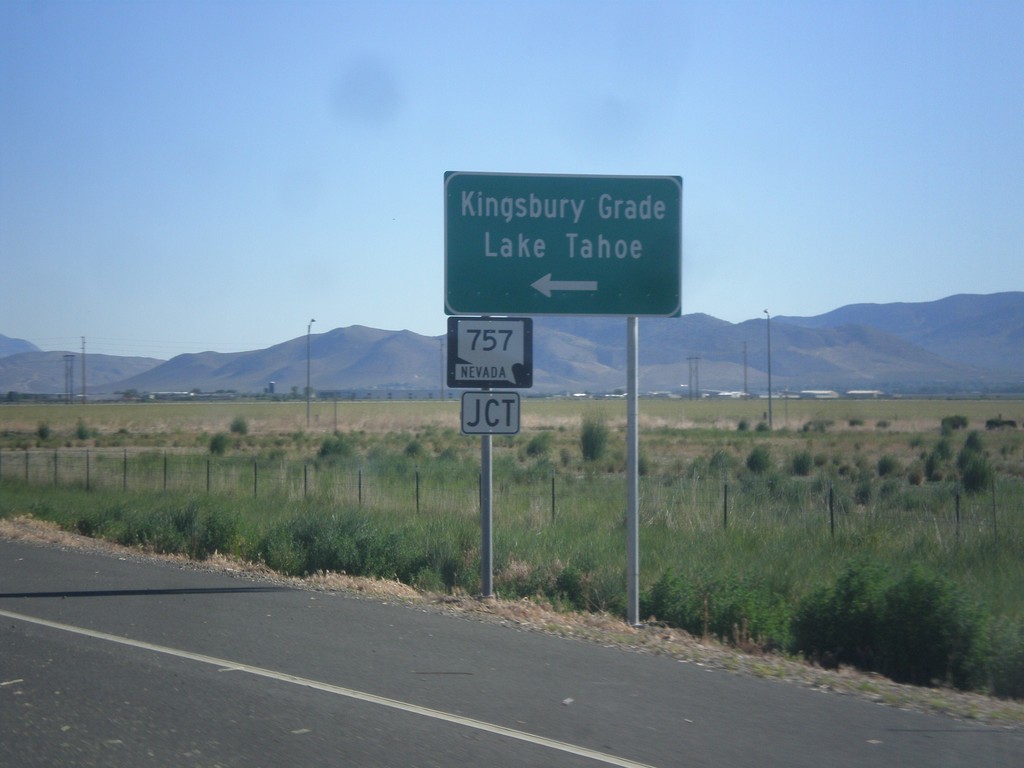
US-395 North Approaching NV-757
US-395 North approaching NV-757 west to Kingsbury Grade and Lake Tahoe.
Taken 06-15-2015
 Minden
Douglas County
Nevada
United States
Minden
Douglas County
Nevada
United States
End NV-88 North at US-395
End NV-88 North at US-395 in Minden. Use US-395 north for Carson City; US-395 south for Minden.
Taken 06-15-2015
 Minden
Douglas County
Nevada
United States
Minden
Douglas County
Nevada
United States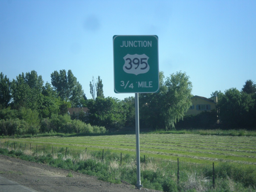
NV-88 North Approaching US-395
NV-88 North approaching US-395 in Minden.
Taken 06-15-2015
Minden
Douglas County
Nevada
United States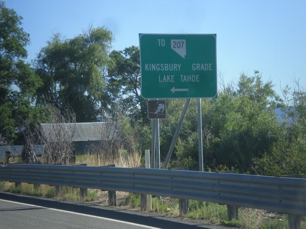
NV-88 North at Mottsville Lane/Waterloo Lane
NV-88 North at Mottsville Lane/Waterloo Lane. Use Mottsville Lane west for NV-207/Kingsbury Grade/Lake Tahoe.
Taken 06-15-2015
 Gardnerville
Douglas County
Nevada
United States
Gardnerville
Douglas County
Nevada
United States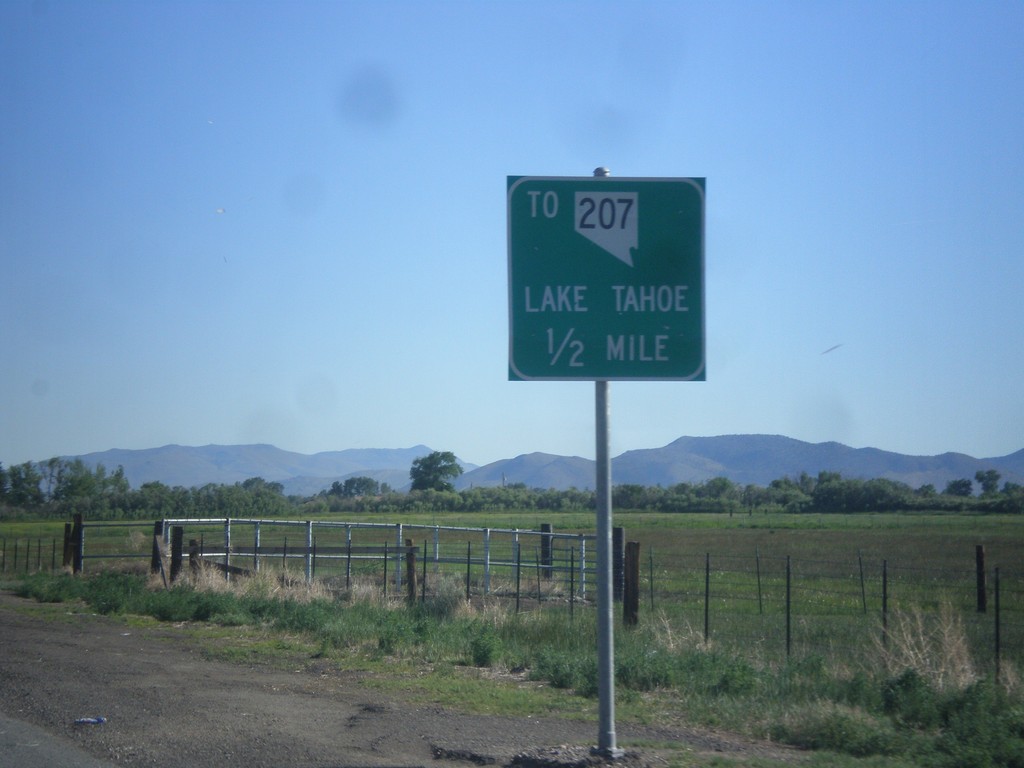
NV-88 North approaching Mottsville Lane/Waterloo Lane Jct.
NV-88 North approaching Mottsville Lane/Waterloo Lane junction. Use Mottsville Lane west for NV-207 and Lake Tahoe (via Kingsbury Grade).
Taken 06-15-2015
Gardnerville
Douglas County
Nevada
United States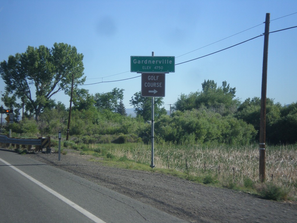
NV-88 North - Gardnerville
Gardnerville - Elevation 4750 Feet on NV-88 North. Approaching NV-756 junction (Centerville Lane) for access to Golf Course.
Taken 06-15-2015
 Gardnerville
Douglas County
Nevada
United States
Gardnerville
Douglas County
Nevada
United States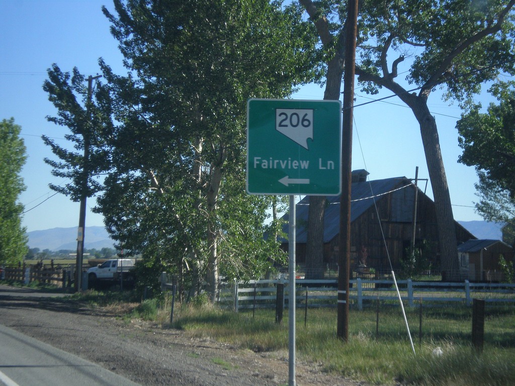
NV-88 North at NV-206
NV-88 north at NV-206/Fairview Lane.
Taken 06-15-2015
Gardnerville
Douglas County
Nevada
United States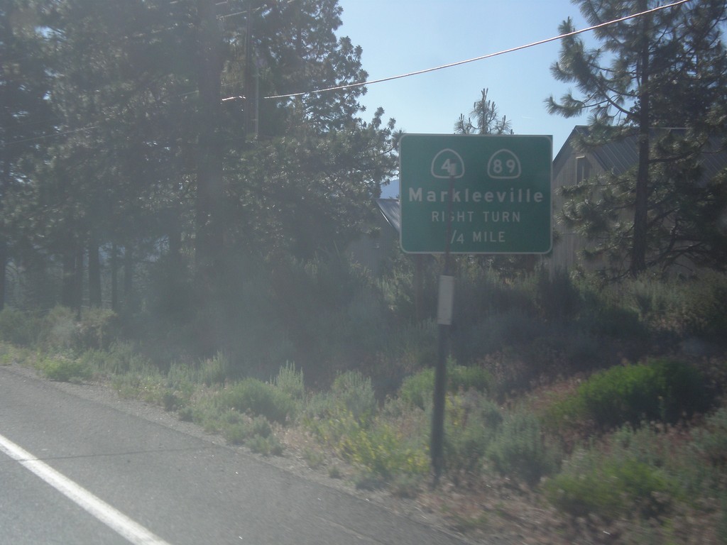
CA-88 East/CA-89 South Approaching CA-89 Jct.
CA-88 East/CA-89 South approaching CA-89/(To) CA-4 junction. Use CA-89 south for CA-4 and Markleeville.
Taken 06-15-2015


 Markleeville
Alpine County
California
United States
Markleeville
Alpine County
California
United States