Signs Tagged With Big Green Sign
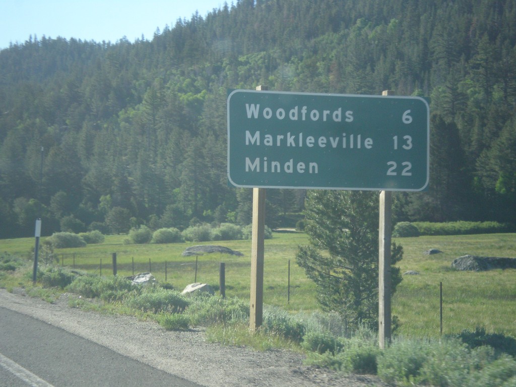
CA-88 East/CA-89 South - Distance Marker
Distance Marker on CA-88 East/CA-89 South. Distance to Woodfords, Markleeville, and Minden (Nevada).
Taken 06-15-2015

 Markleeville
Alpine County
California
United States
Markleeville
Alpine County
California
United States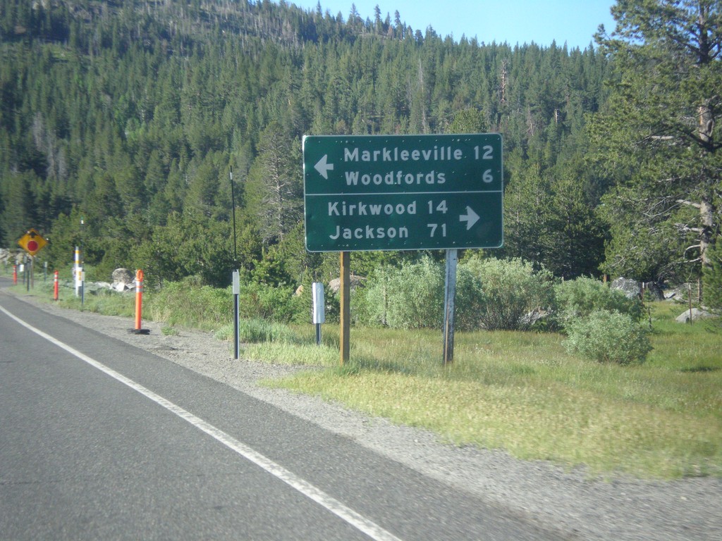
CA-89 South Approaching CA-88
CA-89 South approaching CA-88. Use CA-88 west for Kirkwood and Jackson. Use CA-89 South/CA-89 East for Markleeville and Woodfords. CA-89 south joins CA-88 east to Woodfords.
Taken 06-15-2015
Markleeville
Alpine County
California
United States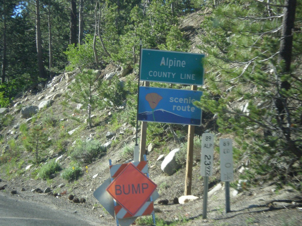
CA-89 South - Alpine County
Alpine County Line on CA-89 south. Alpine County is the smallest county in California by population. CA-89 is posted as a scenic route.
Taken 06-15-2015
Markleeville
Alpine County
California
United States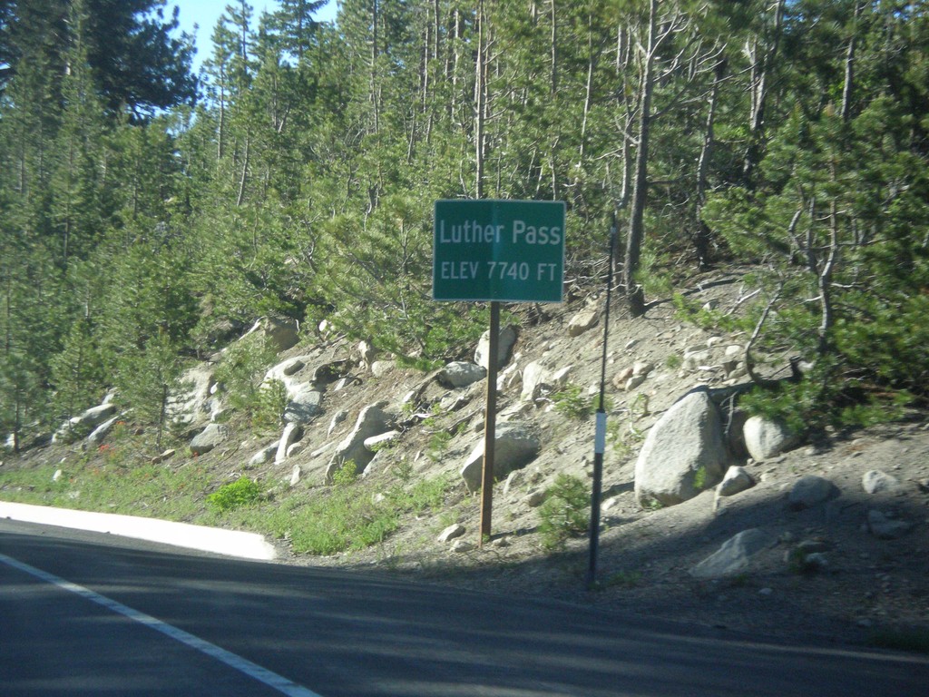
CA-89 South - Luther Pass
Luther Pass - Elevation 7740 Feet. Luther Pass is on the divide between the Lake Tahoe Basin (to the north) and the Carson River.
Taken 06-15-2015
Mesa Vista
Alpine County
California
United States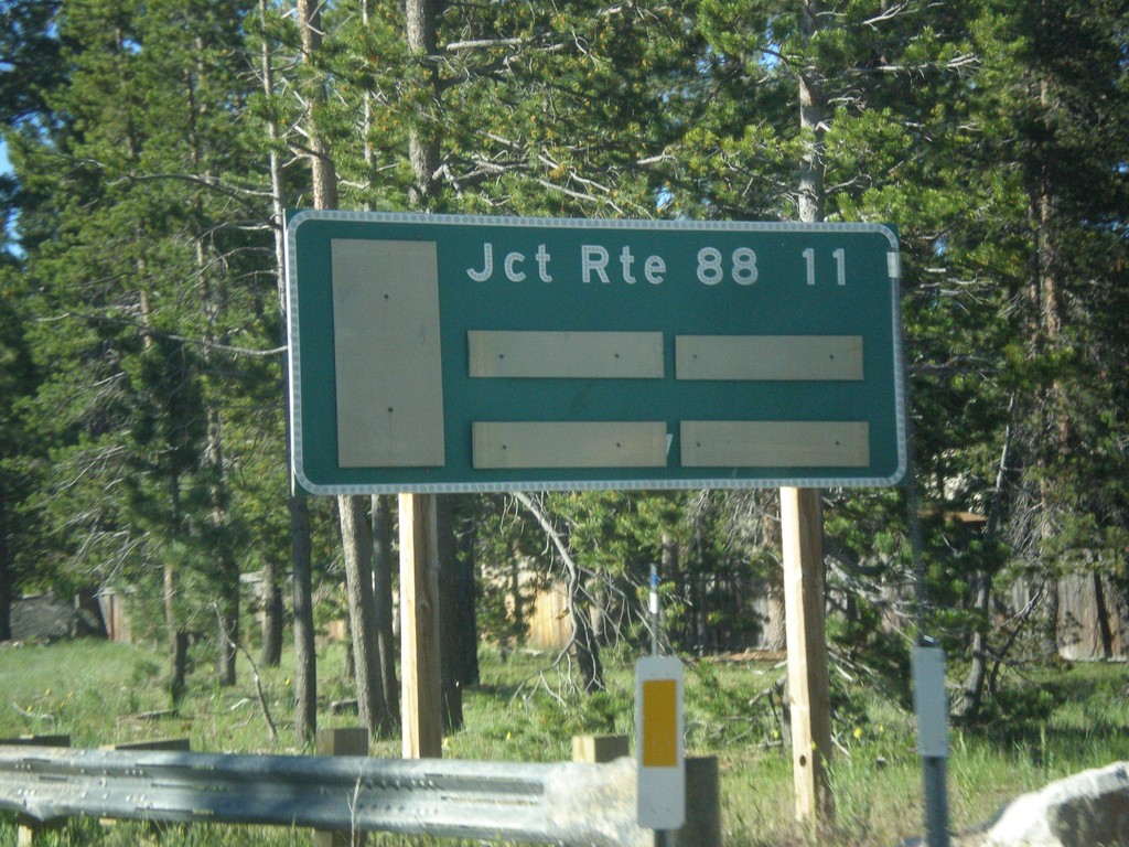
CA-89 South - Distance Marker
Distance marker on CA-89 south. Distance to CA-88 Junction.
Taken 06-15-2015
South Lake Tahoe
El Dorado County
California
United States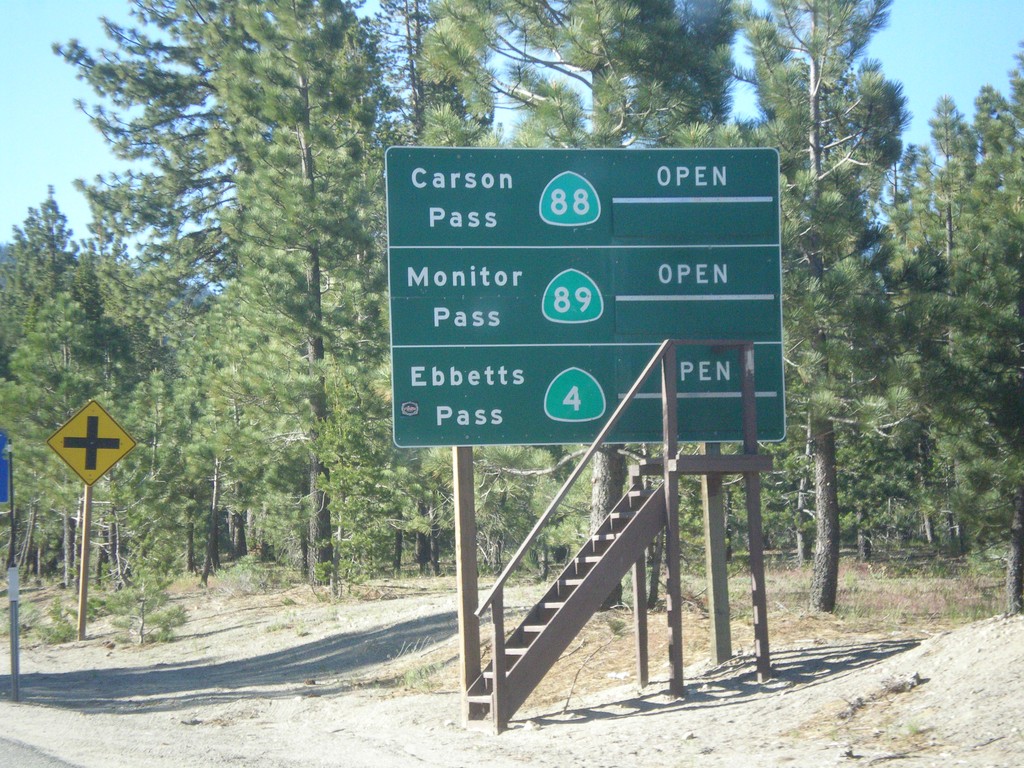
CA-89 South - Summit Information
Summit closure information on CA-89 south. Information for Ebbetts Pass (via CA-4), Monitor Pass (via CA-89) and Carson Pass (via CA-88). This photograph was taken in mid-June, and all of the passes are open. Carson Pass on CA-88 is the only pass that is typically opened year round.
Taken 06-15-2015
 South Lake Tahoe
El Dorado County
California
United States
South Lake Tahoe
El Dorado County
California
United States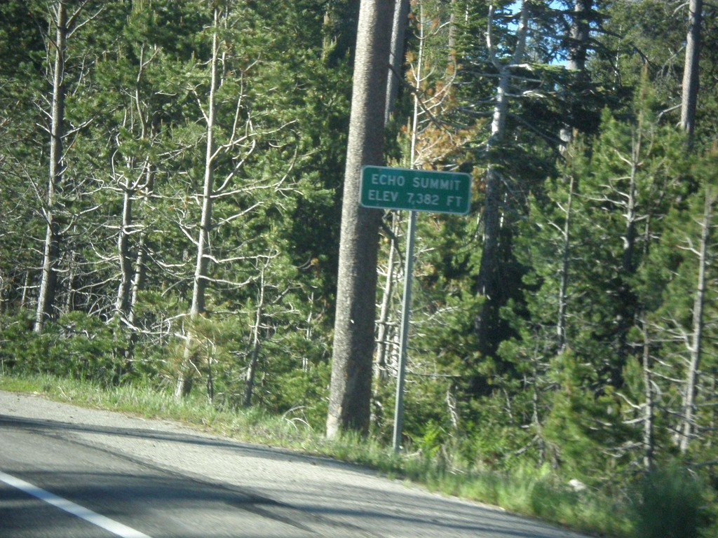
US-50 East - Echo Summit
US-50 each at Echo Summit -Elevation 7382 Feet. This is the summit of the Sierra Nevada on US-50 and the divide between the American River drainage and Lake Tahoe, which drains to the Truckee River.
Taken 06-15-2015
 Nebelhorn
El Dorado County
California
United States
Nebelhorn
El Dorado County
California
United States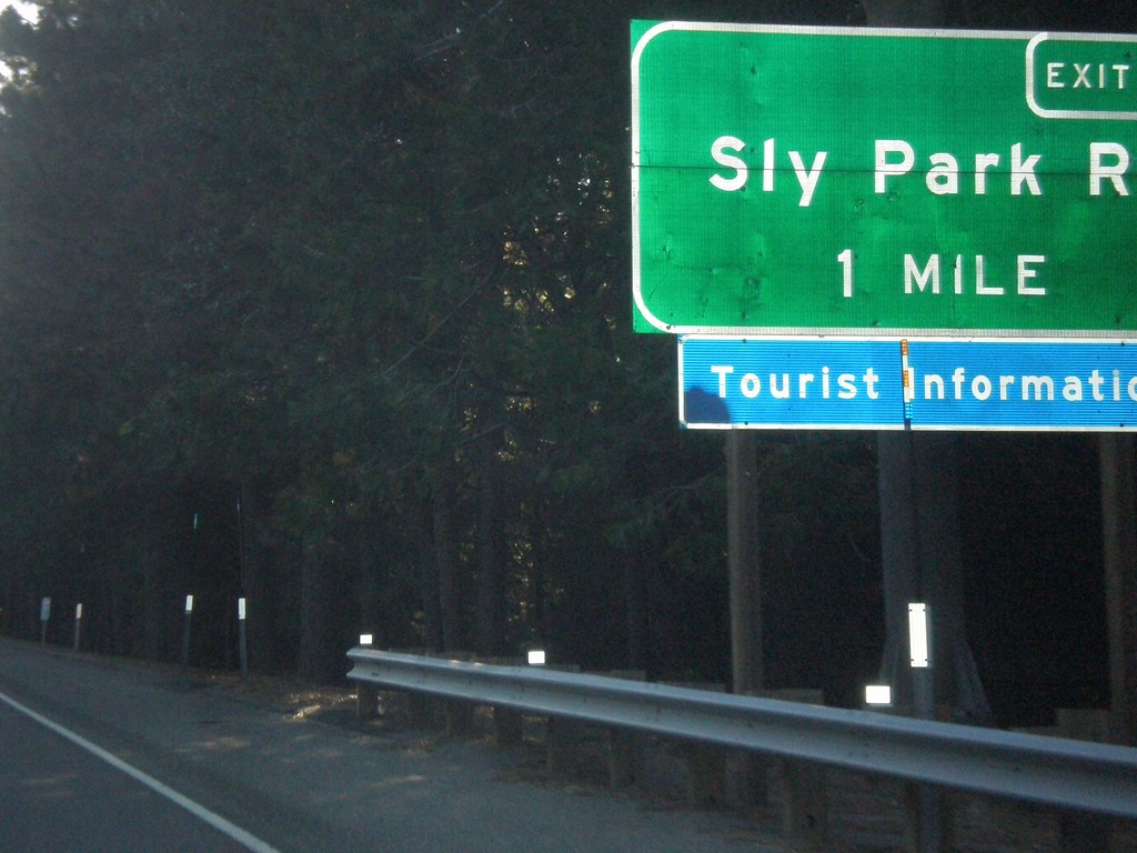
US-50 East - Exit 60
US-50 east approaching Exit 60 - Sly Park Road.
Taken 06-15-2015
Pollock Pines
El Dorado County
California
United States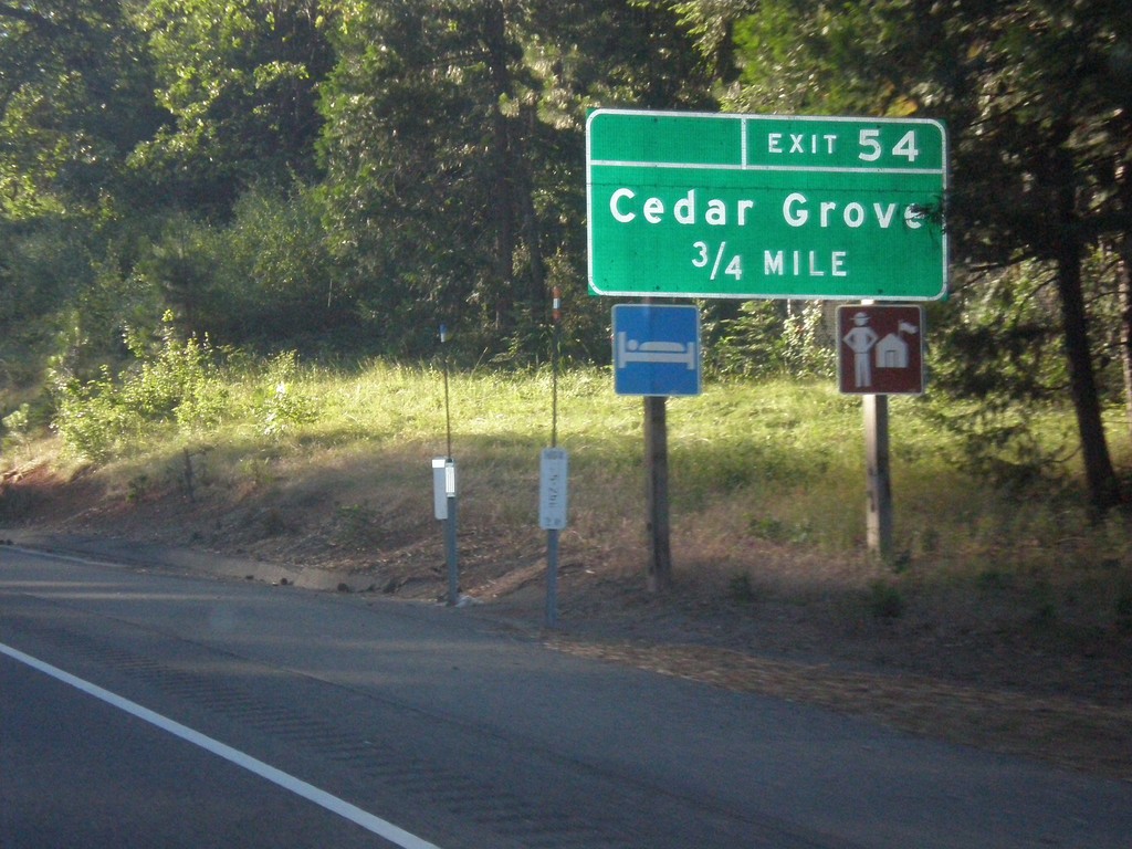
US-50 East - Exit 54
US-50 east approaching Exit 54 - Cedar Grove.
Taken 06-15-2015
Camino
El Dorado County
California
United States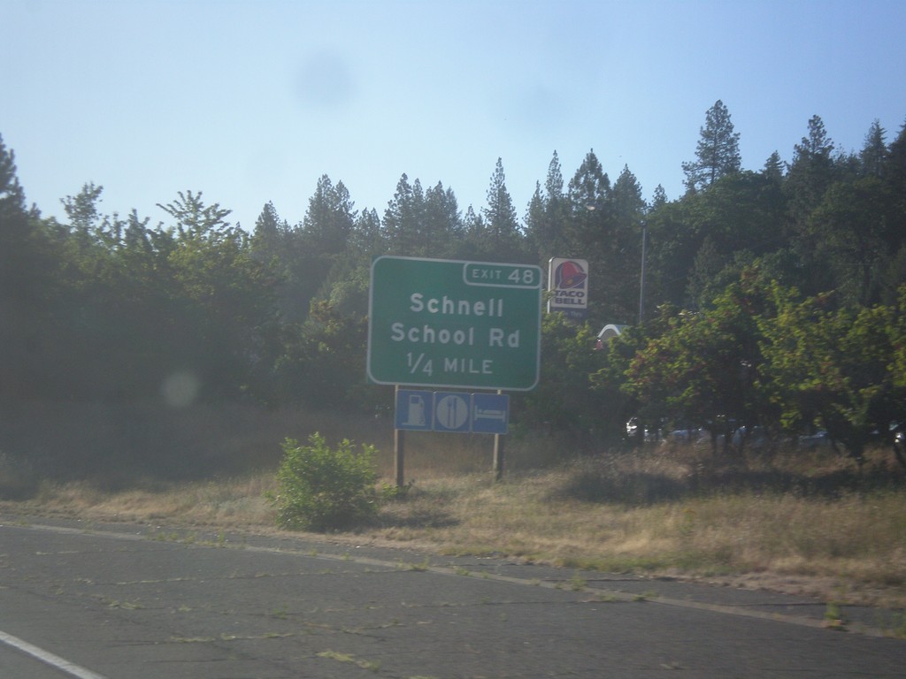
US-50 East - Exit 48
US-50 east approaching Exit 48 - Schnell School Road.
Taken 06-15-2015
Placerville
El Dorado County
California
United States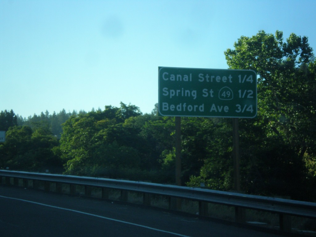
US-50 East - Placerville Intersections
Distance marker showing major cross streets in Placerville.
Taken 06-15-2015
Placerville
El Dorado County
California
United States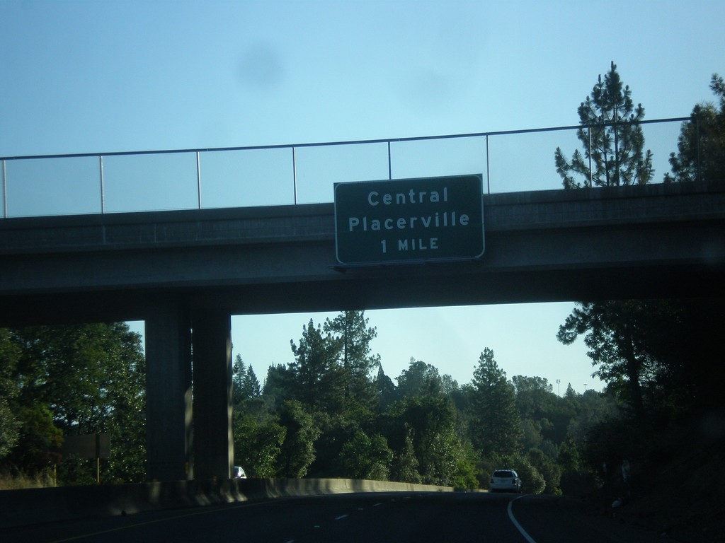
US-50 - Central Placerville
US-50 approaching Central Placerville. The US-50 freeway ends in central Placerville and becomes a city street for a few blocks through central Placerville.
Taken 06-15-2015
Placerville
El Dorado County
California
United States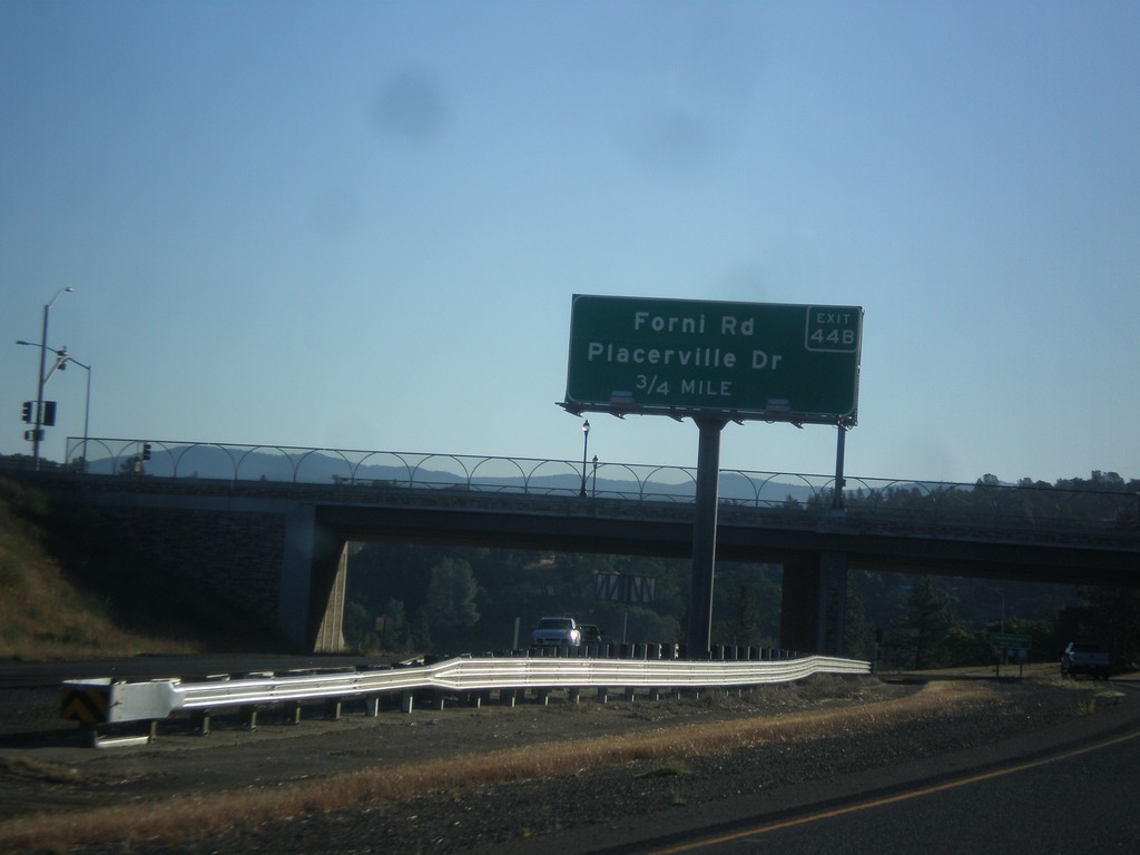
US-50 East - Exit 44B
US-50 east approaching Exit 44B - Forni Road/Placerville Drive.
Taken 06-15-2015
Perks Corner
El Dorado County
California
United States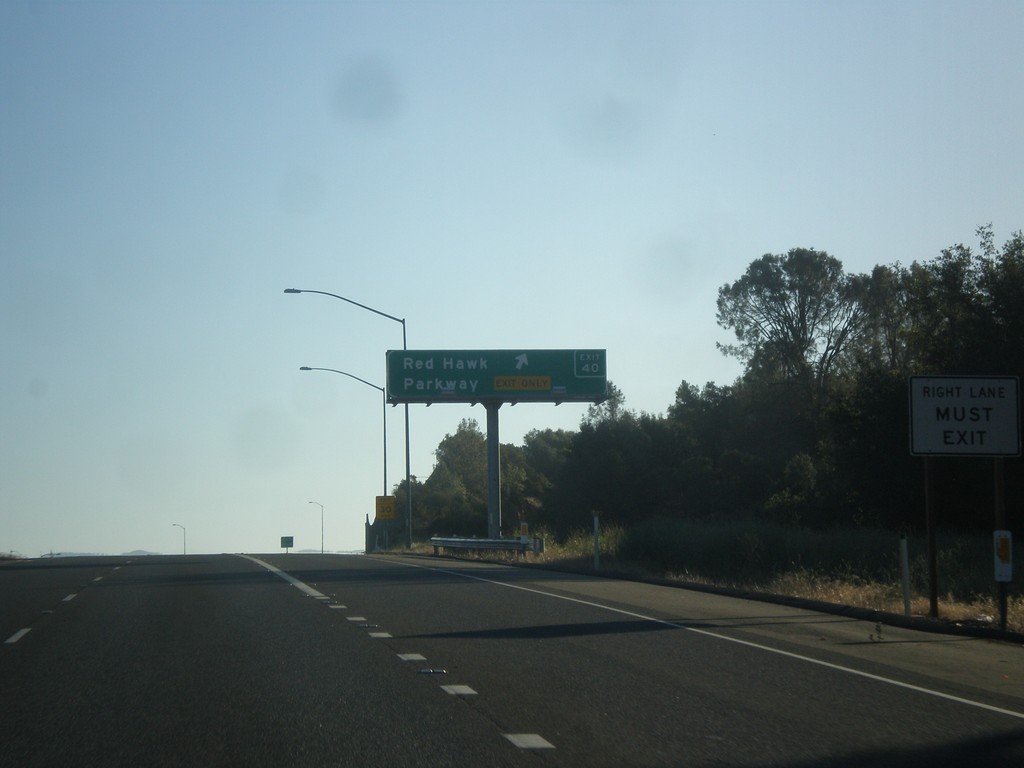
US-50 East - Exit 40
US-50 east at Exit 40 - Red Hawk Parkway.
Taken 06-15-2015
Shingle Springs
El Dorado County
California
United States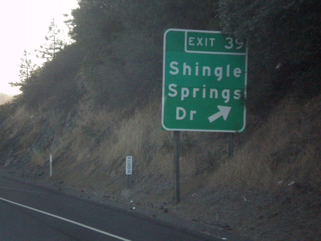
US-50 East - Exit 39
US-50 east at Exit 39 - Shingle Springs Drive.
Taken 06-15-2015
Shingle Springs
El Dorado County
California
United States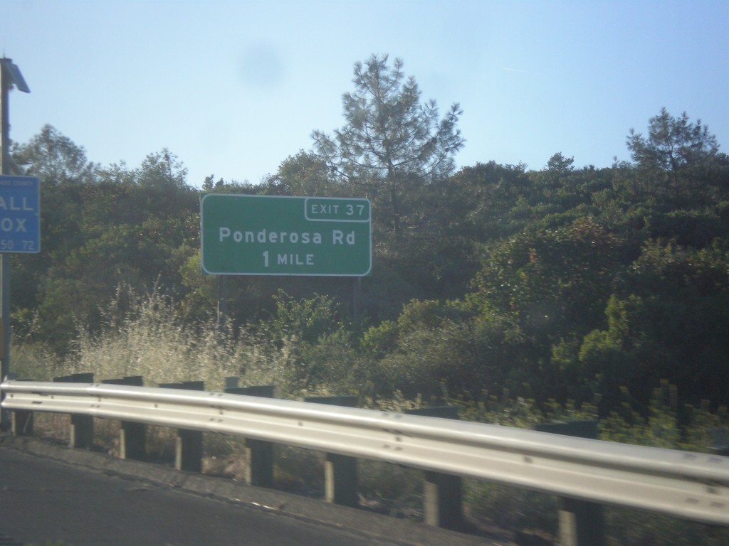
US-50 East - Exit 37
US-50 east approaching Exit 37 - Ponderosa Drive.
Taken 06-15-2015
Shingle Springs
El Dorado County
California
United States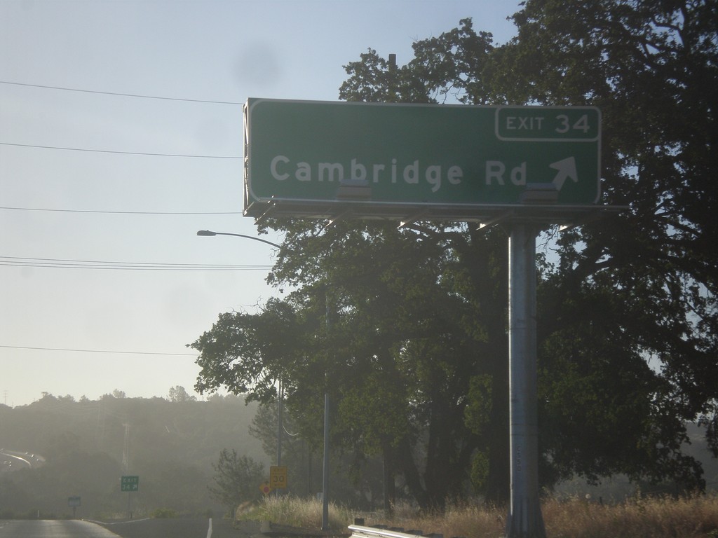
US-50 East - Exit 34
US-50 east at Exit 34 - Cambridge Road.
Taken 06-15-2015
Cameron Park
El Dorado County
California
United States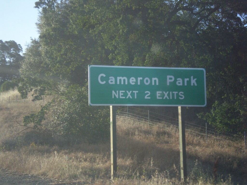
US-50 East - Cameron Park Exits
Cameron Park - Next 2 Exits on US-50 East.
Taken 06-15-2015
Cameron Park
El Dorado County
California
United States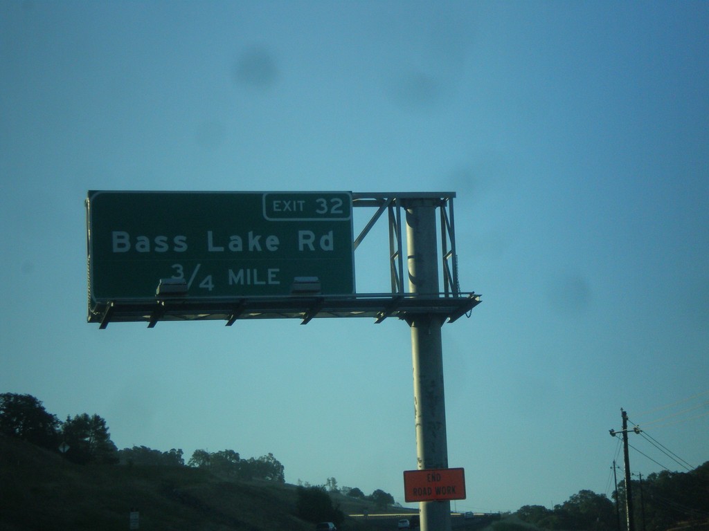
US-50 East - Exit 32
US-50 east approaching Exit 32 - Bass Lake Road.
Taken 06-15-2015
El Dorado Hills
El Dorado County
California
United States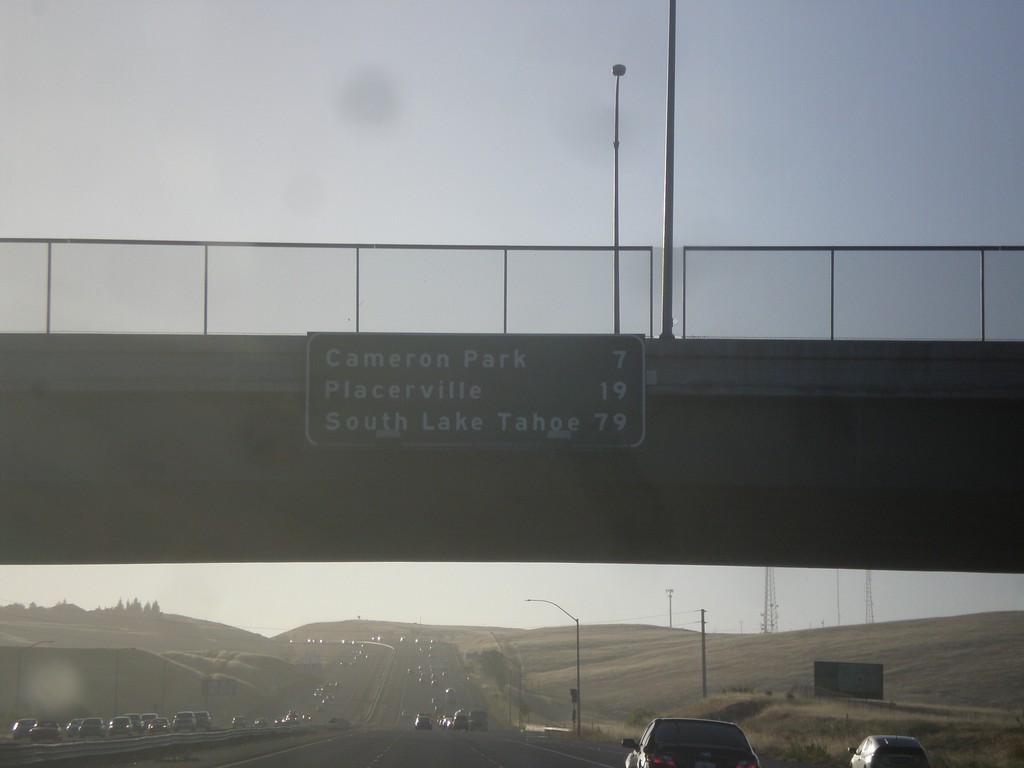
US-50 East - Distance Marker
Distance marker on US-50 east. Distance to Cameron Park, Placerville, and South Lake Tahoe.
Taken 06-15-2015
Folsom
Sacramento County
California
United States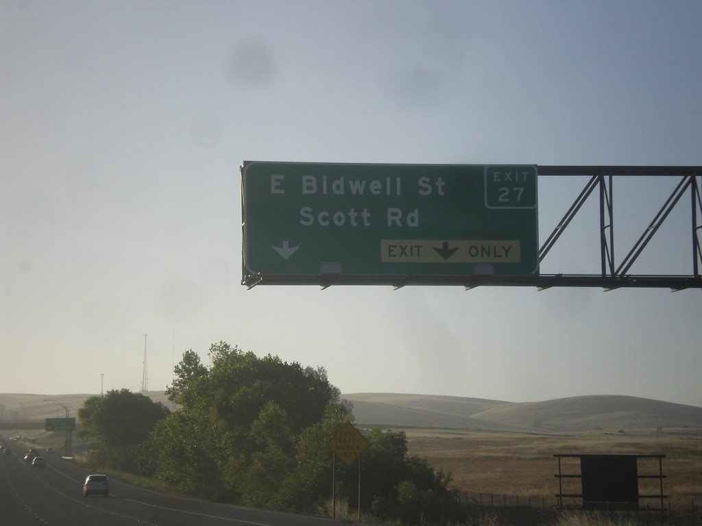
US-50 East - Exit 27
US-50 east at Exit 27 - E. Bidwell St./Scott Rd.
Taken 06-15-2015
Folsom
Sacramento County
California
United States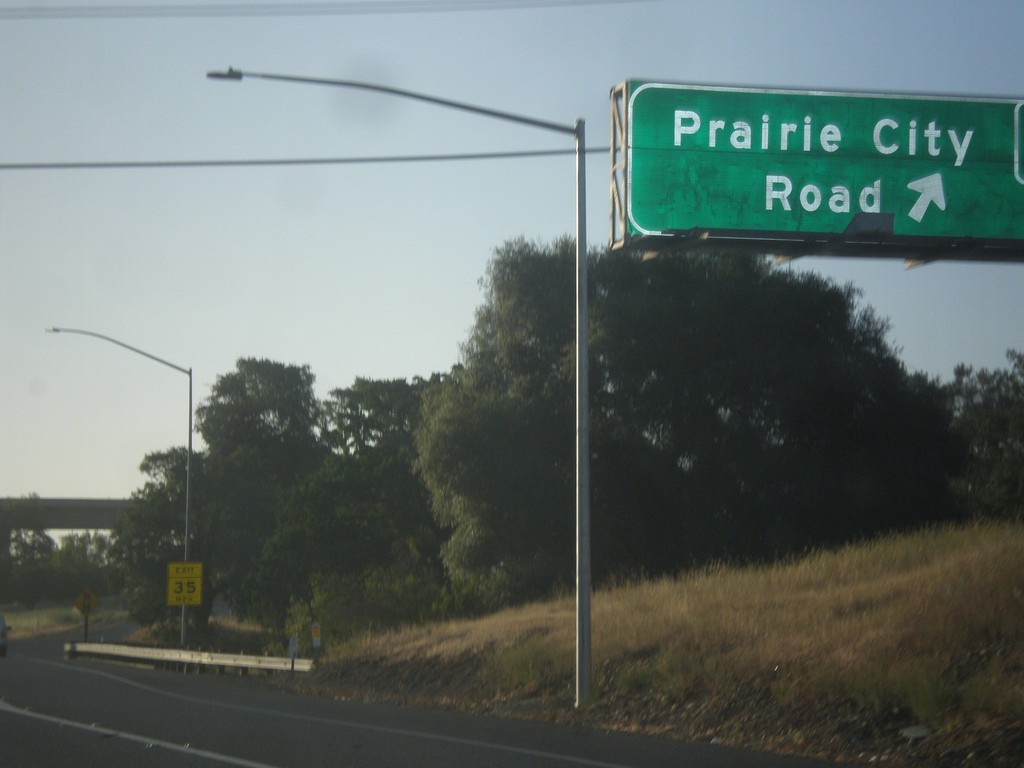
US-50 East - Exit 25
US-50 east at Exit 25 - Prairie City Road.
Taken 06-15-2015
Folsom
Sacramento County
California
United States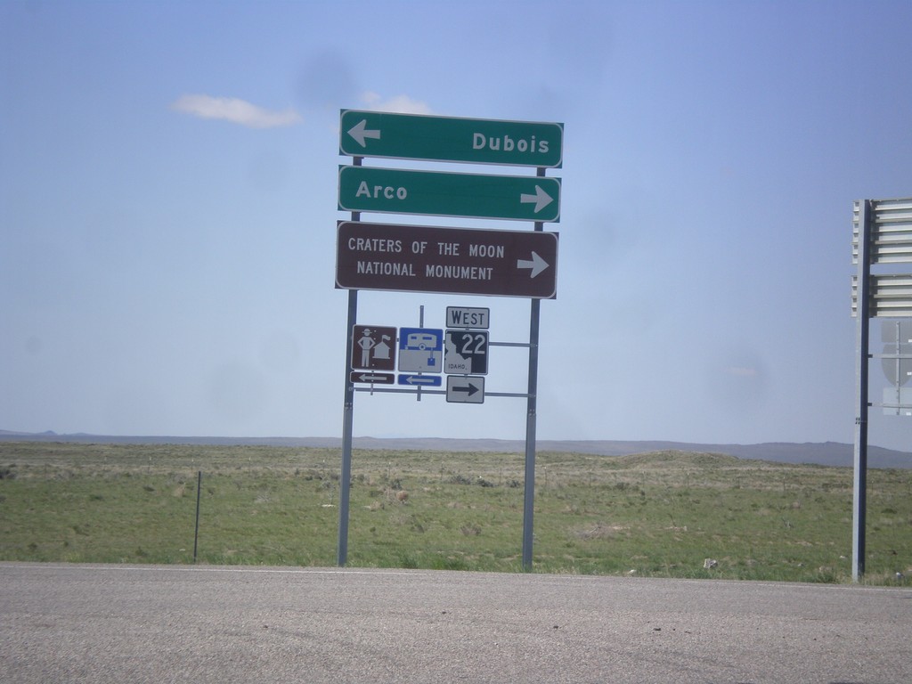
I-15 South Offramp at ID-22
I-15 south (Exit 167) offramp at ID-22. Turn right for ID-22 west to Craters of the Moon National Monument and Arco. Turn left for Dubois.
Taken 05-10-2015


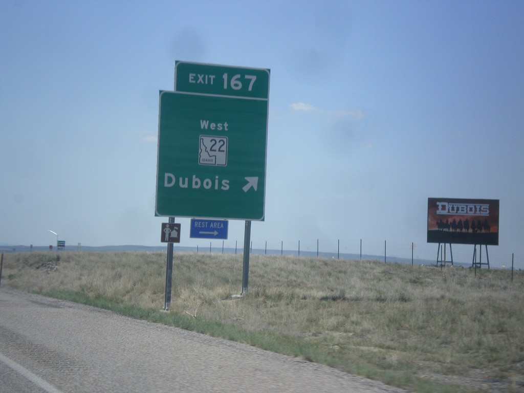
I-15 South - Exit 167
I-15 south at Exit 167 - ID-22 West/Dubois.
Taken 05-10-2015
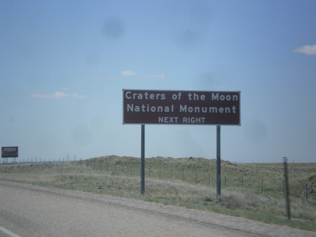
I-15 South Approaching Exit 167
I-15 south approaching Exit 167. Use Exit 167 for Craters of the Moon National Monument.
Taken 05-10-2015
Dubois
Clark County
Idaho
United States