Signs Tagged With Big Green Sign
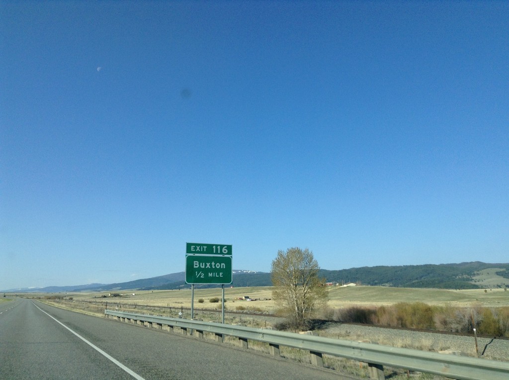
I-15 South - Exit 116
I-15 south approaching Exit 116 - Buxton.
Taken 05-10-2015
 Butte
Silver Bow County
Montana
United States
Butte
Silver Bow County
Montana
United States
I-15 South - Exit 119
I-15 south at Exit 119 - Hub Access/Silver Bow.
Taken 05-10-2015
Butte
Silver Bow County
Montana
United States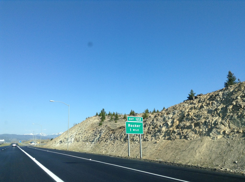
I-15 South/I-90 West - Exit 122
I-15 South/I-90 West approaching Exit 122 - Rocker.
Taken 05-10-2015
 Butte
Silver Bow County
Montana
United States
Butte
Silver Bow County
Montana
United States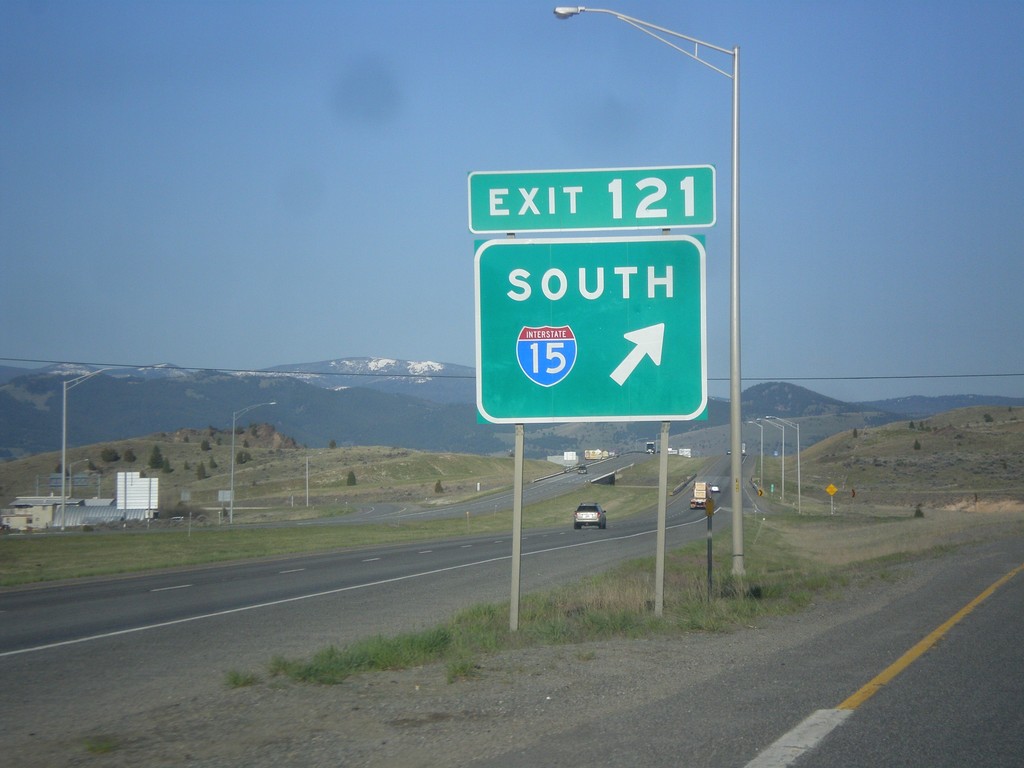
I-15 South/I-90 West Split
I-15 South/I-90 West Split at Exit 121. Merge right for I-15 south; continue straight for I-90 west.
Taken 05-10-2015
Butte
Silver Bow County
Montana
United States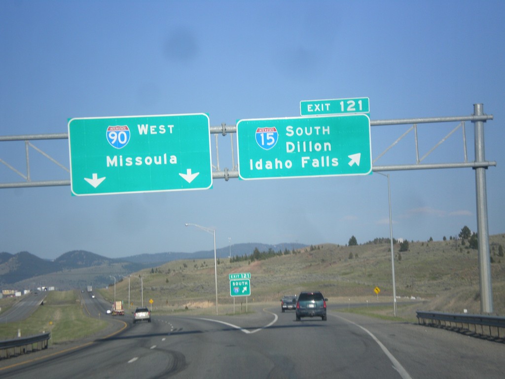
I-15 South/I-90 West - Exit 121
I-15 South/I-90 West at Exit 121 - I-15 South/Dillon/Idaho Falls. Continue west on I-90 for Missoula.
Taken 05-10-2015
Butte
Silver Bow County
Montana
United States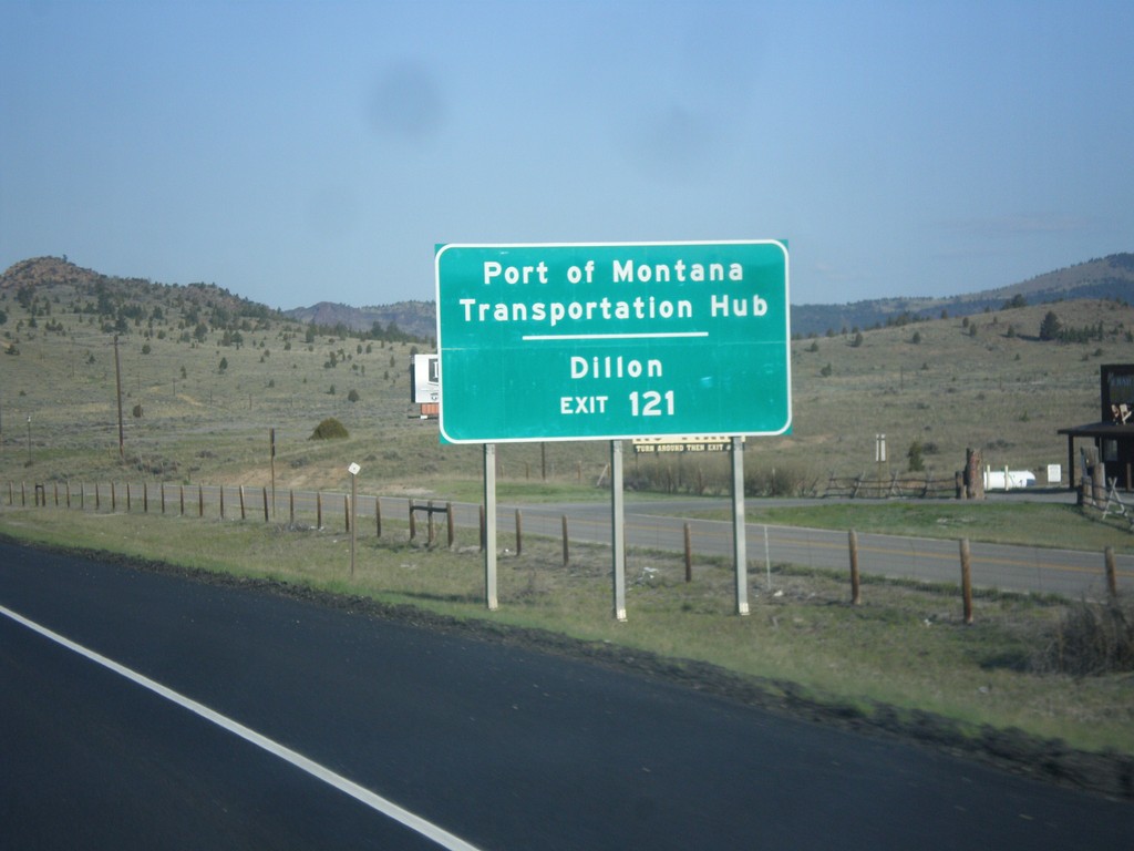
I-15 South/I-90 West - Exit 121
I-15 South/I-90 West approaching Exit 121. Use Exit 121 (I-15 South) for Dillon and Port of Montana Transportation Hub.
Taken 05-10-2015
Butte
Silver Bow County
Montana
United States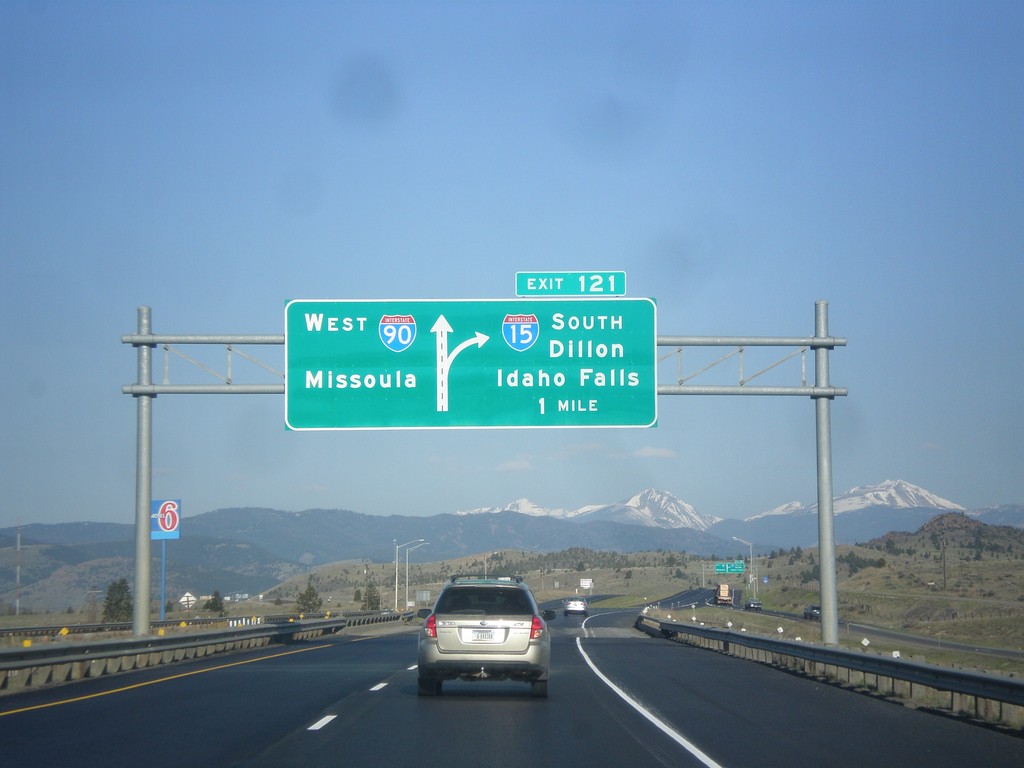
I-15 South/I-90 East - Exit 121
I-15 South/I-90 East approaching Exit 121 - I-15 South/Dillon/Idaho Falls. Continue west on I-90 for Missoula.
Taken 05-10-2015
Butte
Silver Bow County
Montana
United States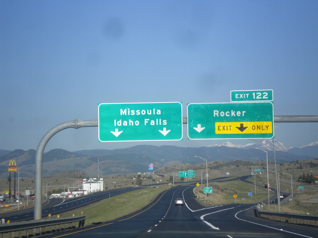
I-15 South/I-90 West - Exit 122
I-15 South/I-90 West at Exit 122 - Rocker. Continue south on I-15 for Idaho Falls; west on I-90 for Missoula.
Taken 05-10-2015
Butte
Silver Bow County
Montana
United States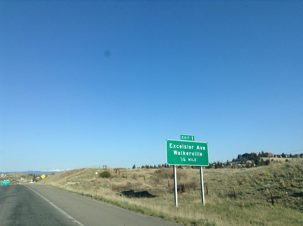
I-115 West - Exit 1
I-115 west approaching Exit 1 - Excelsior Ave./Walkerville.
Taken 05-10-2015
 Butte
Silver Bow County
Montana
United States
Butte
Silver Bow County
Montana
United States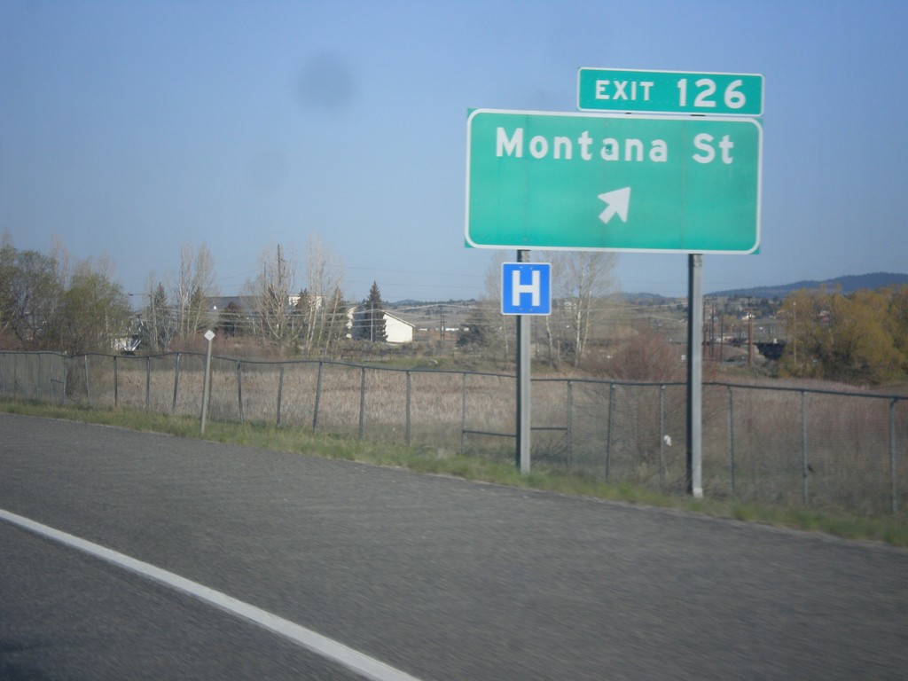
I-15 South/I-90 West - Exit 126
I-15 South/I-90 West at Exit 126 - Montana St.
Taken 05-10-2015
Butte
Silver Bow County
Montana
United States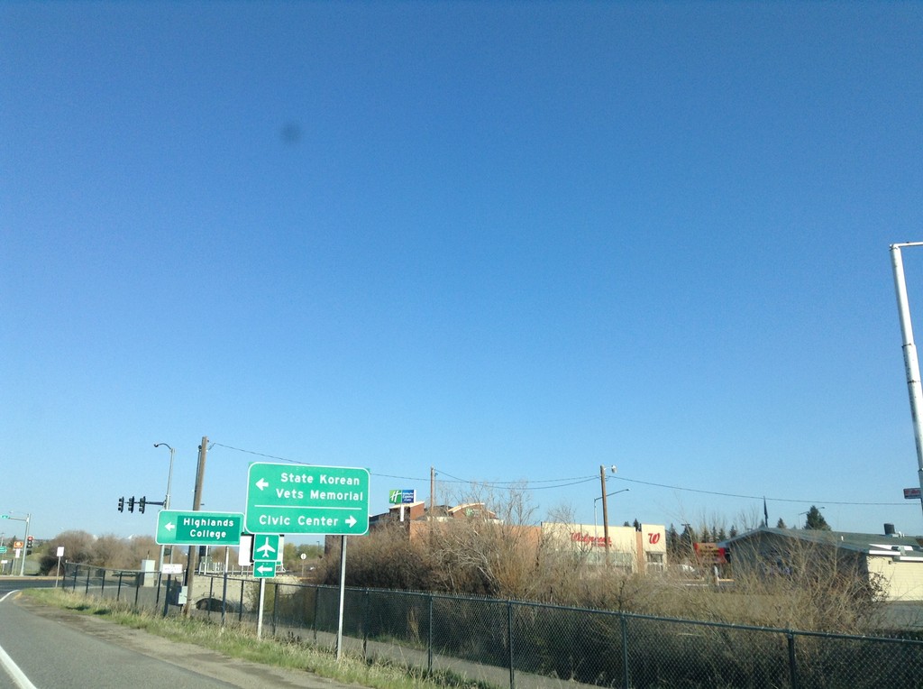
I-15 South/I-90 West - BL-15/BL-90/MT-2 Jct
I-15 South/I-90 West offramp at BL-15/BL-90/MT-2 Jct (Harrison Ave.) in Butte. Turn right for BL-15/BL-90 to Civic Center; left for MT-2 (not signed) to State Korean Veteran Memorial and Highlands College.
Taken 05-10-2015


 Butte
Silver Bow County
Montana
United States
Butte
Silver Bow County
Montana
United States
BL-15 South/BL-90 East/MT-2 South Approaching I-15/I-90
BL-15 South/BL-90 East/MT-2 South approaching I-15 North/I-90 East onramp in Butte.
Taken 05-10-2015
Butte
Silver Bow County
Montana
United States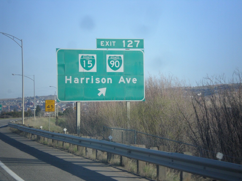
I-15 South/I-90 West - Exit 127
I-15 South/I-90 West at Exit 127 - BL-15/BL-90/Harrison Blvd.
Taken 05-10-2015
Butte
Silver Bow County
Montana
United States
I-15 South Approaching I-90
I-15 south approaching I-90 (Exit 129) to Billings and Butte. I-15 joins I-90 westbound through Butte.
Taken 05-10-2015
Butte
Silver Bow County
Montana
United States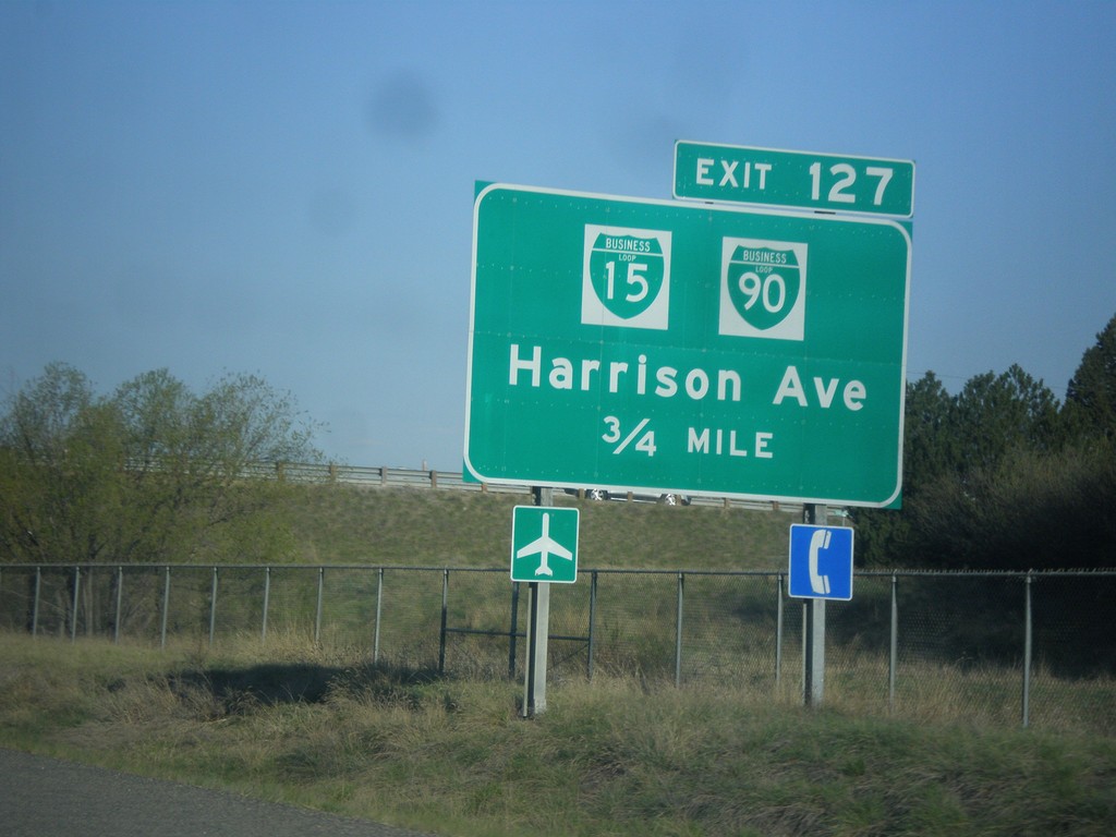
I-15 South/I-90 West - Exit 127
I-15 South/I-90 West approaching Exit 127 - BL-15/BL-90/Harrison Ave.
Taken 05-10-2015
Butte
Silver Bow County
Montana
United States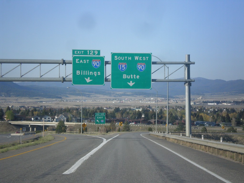
I-15 South at I-90
I-15 south at I-90. Use left Exit 129 for I-90 East to Billings. Use right lane for I-15 South/I-90 West to Butte. I-15 joins I-90 west through Butte.
Taken 05-10-2015
Butte
Silver Bow County
Montana
United States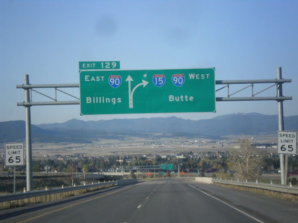
I-15 South - Exit 129
I-15 south approaching Exit 129 - I-90 East/Billings. Continue south on I-15/I-90 West to Butte. I-15 joins I-90 through Butte.
Taken 05-10-2015
Butte
Silver Bow County
Montana
United States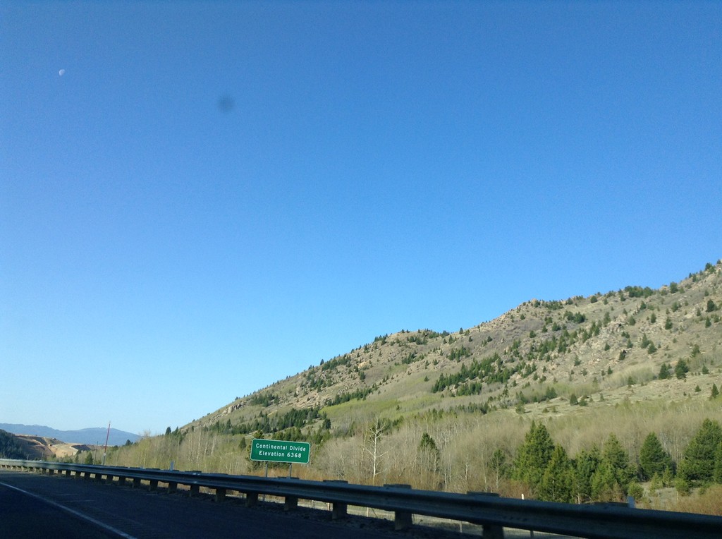
I-15 South - Elk Park Pass
I-15 south at Elk Park Pass (Continental Divide). Elevation 6368 Feet. This is also the county boundary between Silver Bow and Jefferson County.
Taken 05-10-2015
Woodville
Jefferson County
Montana
United States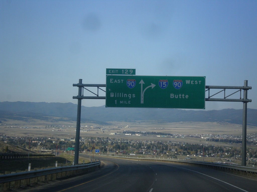
I-15 South - Exit 129
I-15 south approaching Exit 129 - I-90 East/Billings. I-15 South joins I-90 West to Butte.
Taken 05-10-2015
Butte
Silver Bow County
Montana
United States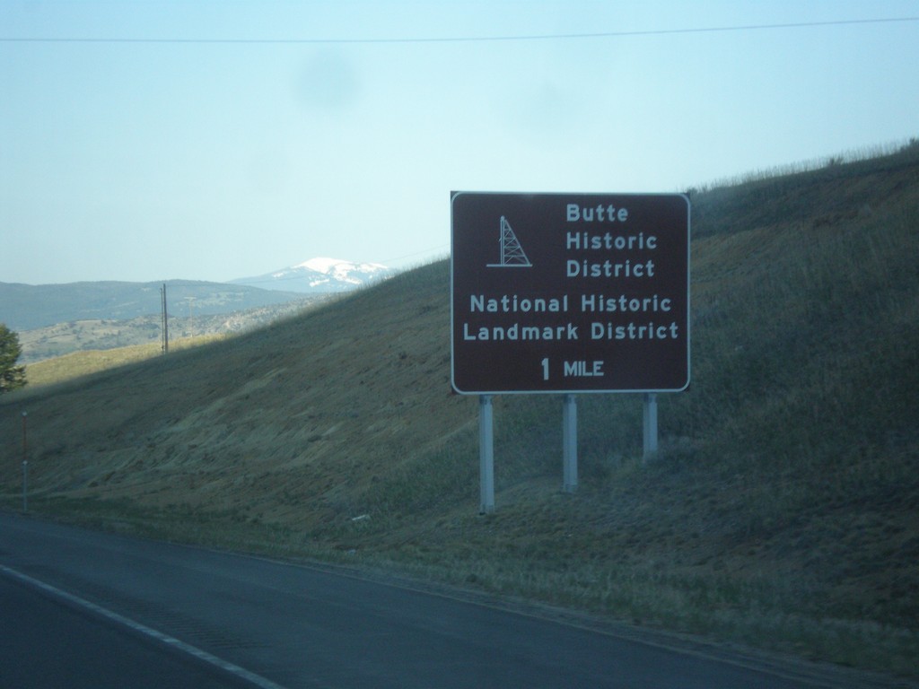
I-15 South - Butte Historic District
I-15 south approaching I-90. Use I-90 West (next exit) for the Butte Historic District.
Taken 05-10-2015
Butte
Silver Bow County
Montana
United States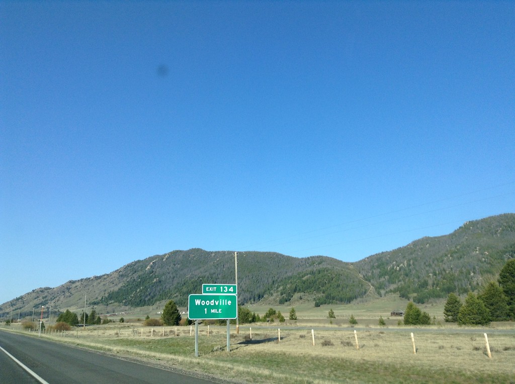
I-15 South - Exit 134
I-15 south approaching Exit 134 - Woodville.
Taken 05-10-2015
Butte
Jefferson County
Montana
United States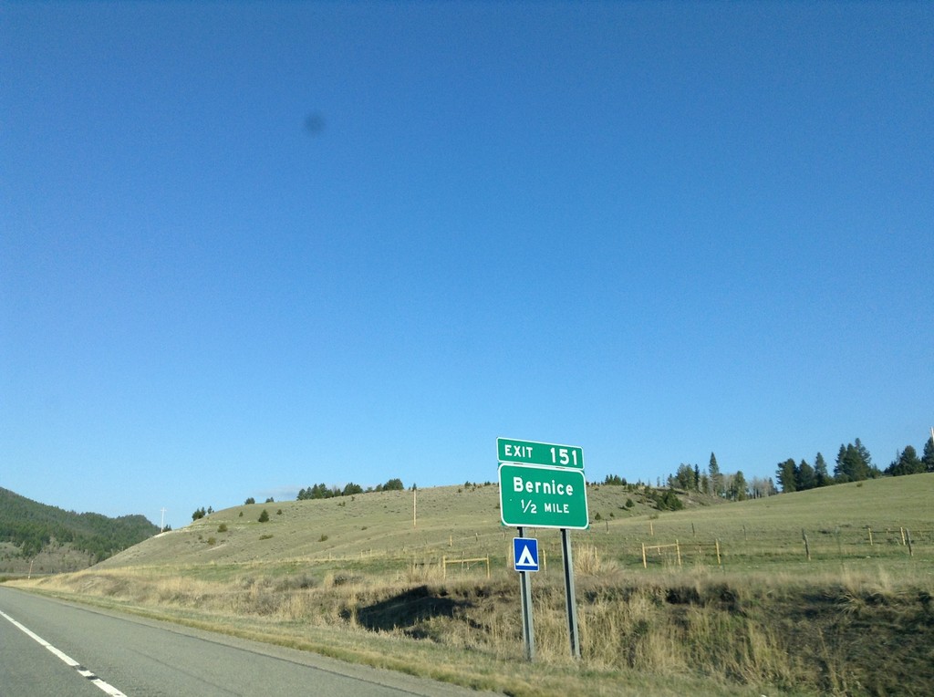
I-15 South - Exit 151
I-15 south approaching Exit 151 - Bernice.
Taken 05-10-2015
Basin
Jefferson County
Montana
United States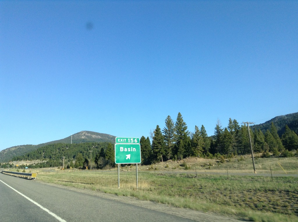
I-15 South - Exit 156
I-15 south at Exit 156 - Basin.
Taken 05-10-2015
Boulder
Jefferson County
Montana
United States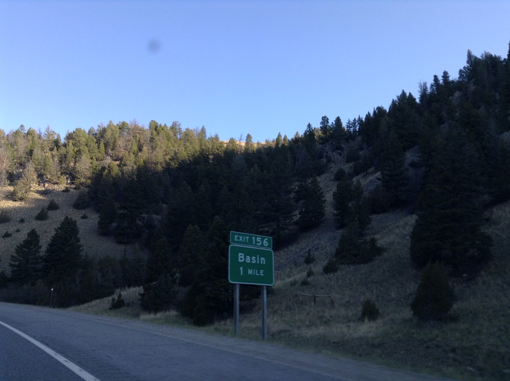
I-15 South - Exit 156
I-15 south approaching Exit 156 - Basin.
Taken 05-10-2015
Boulder
Jefferson County
Montana
United States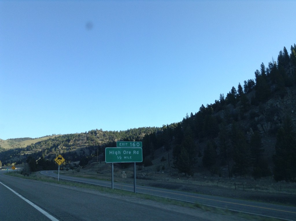
I-15 South - Exit 160
I-15 south approaching Exit 160 - High Ore Road.
Taken 05-10-2015
Boulder
Jefferson County
Montana
United States