Signs Tagged With Big Green Sign
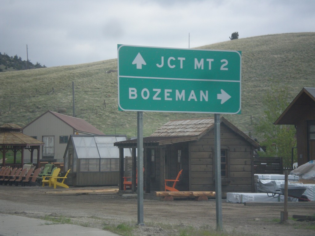
US-287 North Approaching MT-84
US-287 North approaching MT-84. Turn right on MT-84 east to Bozeman. Continue north on US-287 to MT-2 Jct.
Taken 05-14-2016

 Norris
Madison County
Montana
United States
Norris
Madison County
Montana
United States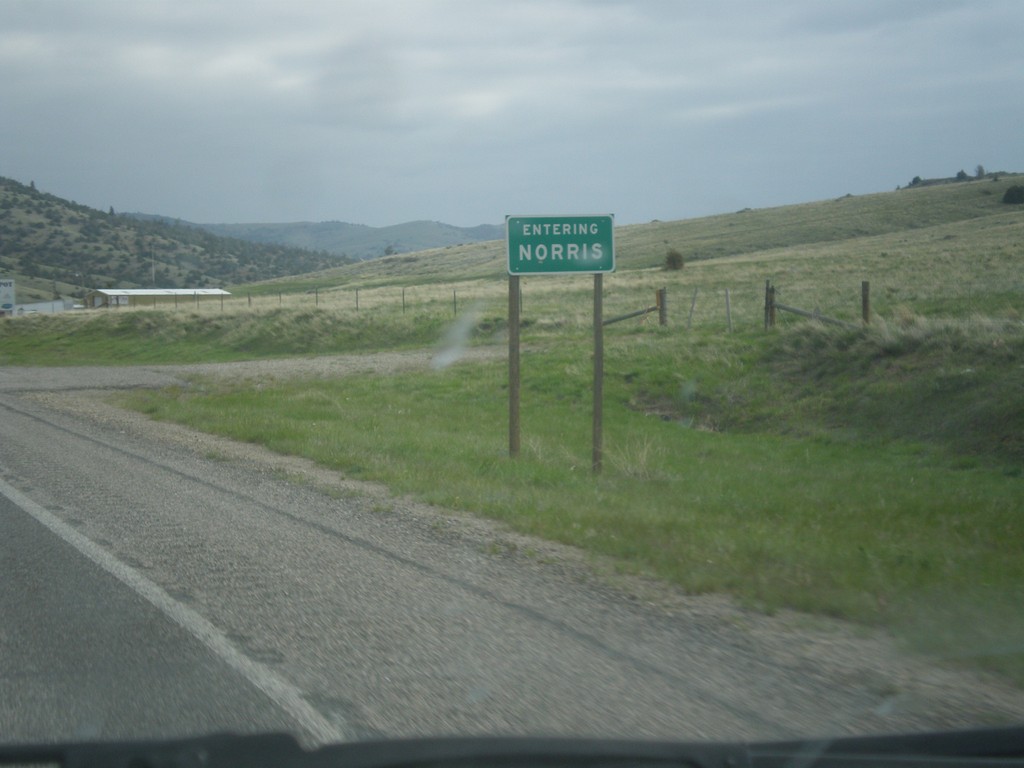
US-287 North - Norris
Entering Norris on US-287 north.
Taken 05-14-2016
Norris
Madison County
Montana
United States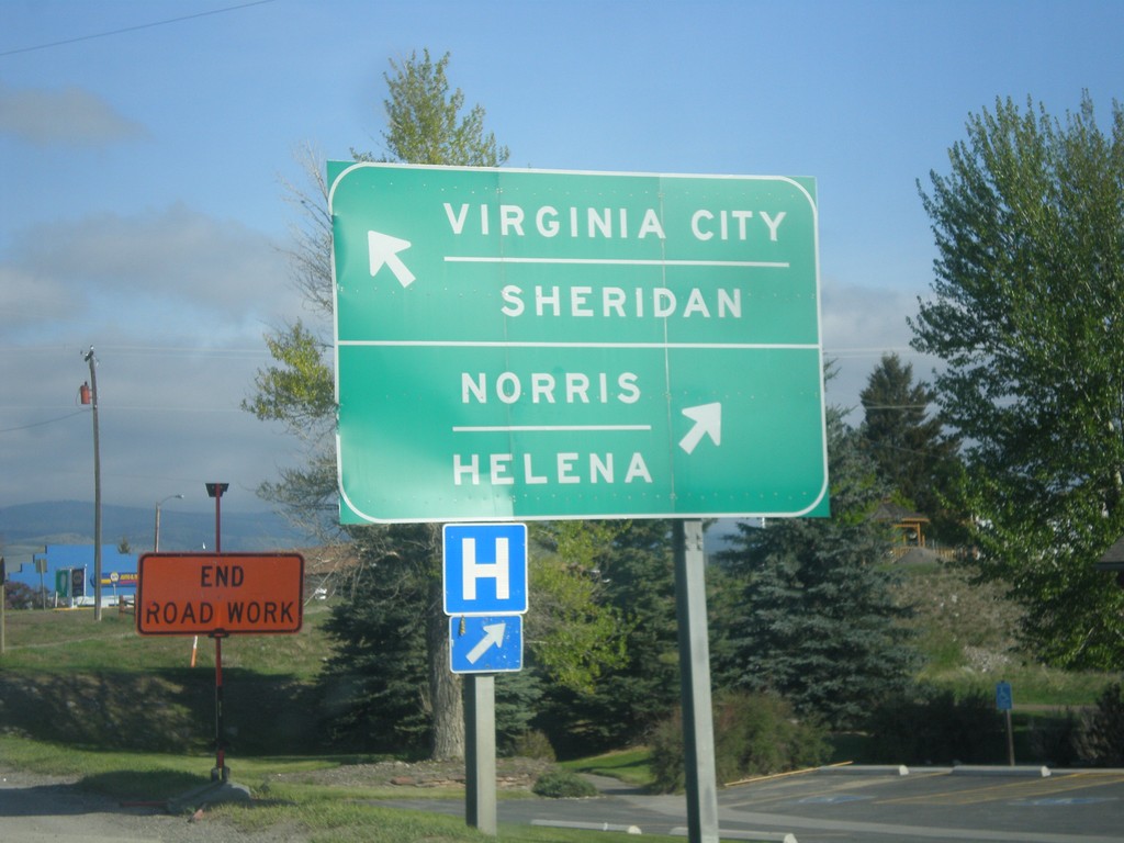
US-287 North at MT-287
US-287 North at MT-287 in Ennis. Merge left on MT-287 for Virginia City and Sheridan. Merge right to continue north on US-287 for Norris and Helena.
Taken 05-14-2016
 Ennis
Madison County
Montana
United States
Ennis
Madison County
Montana
United States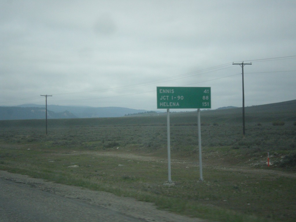
US-287 North - Distance Marker
Distance Marker on US-287 north. Distance to Ennis, Jct. I-90, and Helena.
Taken 05-14-2016
 Schusters Place
Madison County
Montana
United States
Schusters Place
Madison County
Montana
United States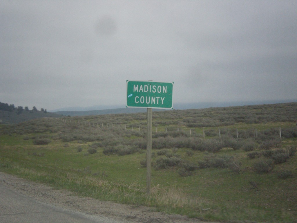
MT-87 North - Madison County
Madison County on MT-87 north at the Montana-Idaho state line. The stateline is on Raynolds Pass which is on the continental divide.
Taken 05-14-2016
Madison County
Montana
United States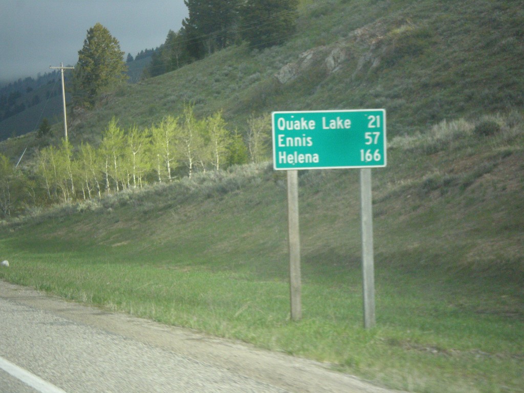
ID-87 North - Distance Marker
Distance marker on ID-87 north. Distance to Quake Lake, Ennis, and Helena. All three of these destinations are in Montana. ID-87 is a short state highway that follows the east shore of Henrys Lake, before climbing to the Continental Divide at Raynolds Pass on the Idaho-Montana line.
Taken 05-14-2016
 Island Park
Fremont County
Idaho
United States
Island Park
Fremont County
Idaho
United States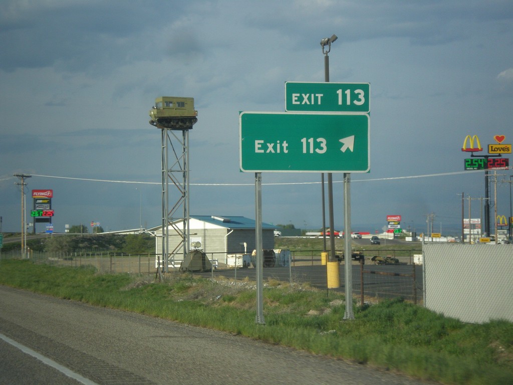
I-15 North - Exit 113
I-15 north at Exit 113 - Exit 113. This is the only instance of an interchange in Idaho with simply the name of its exit. The advanced signage at this interchange is Shelley, and same as the southbound exit name. This sign has been in place since BL-15 and US-26 was routed to the newer Exit 116 interchange.
Taken 05-13-2016

 Idaho Falls
Bonneville County
Idaho
United States
Idaho Falls
Bonneville County
Idaho
United States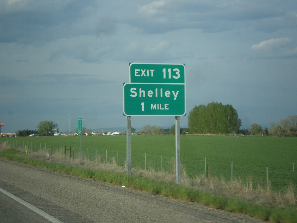
I-15 North - Exit 113
I-15 north approaching Exit 113 - Shelley.
Taken 05-13-2016
Idaho Falls
Bonneville County
Idaho
United States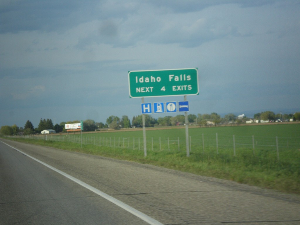
I-15 North - Idaho Falls Exits
Idaho Falls - Next 4 Exits on I-15 north. Idaho Falls is the 4th biggest city in Idaho behind Boise, Nampa, and Meridian and the biggest city outside of the Boise Metropolitan area.
Taken 05-13-2016
Shelley
Bingham County
Idaho
United States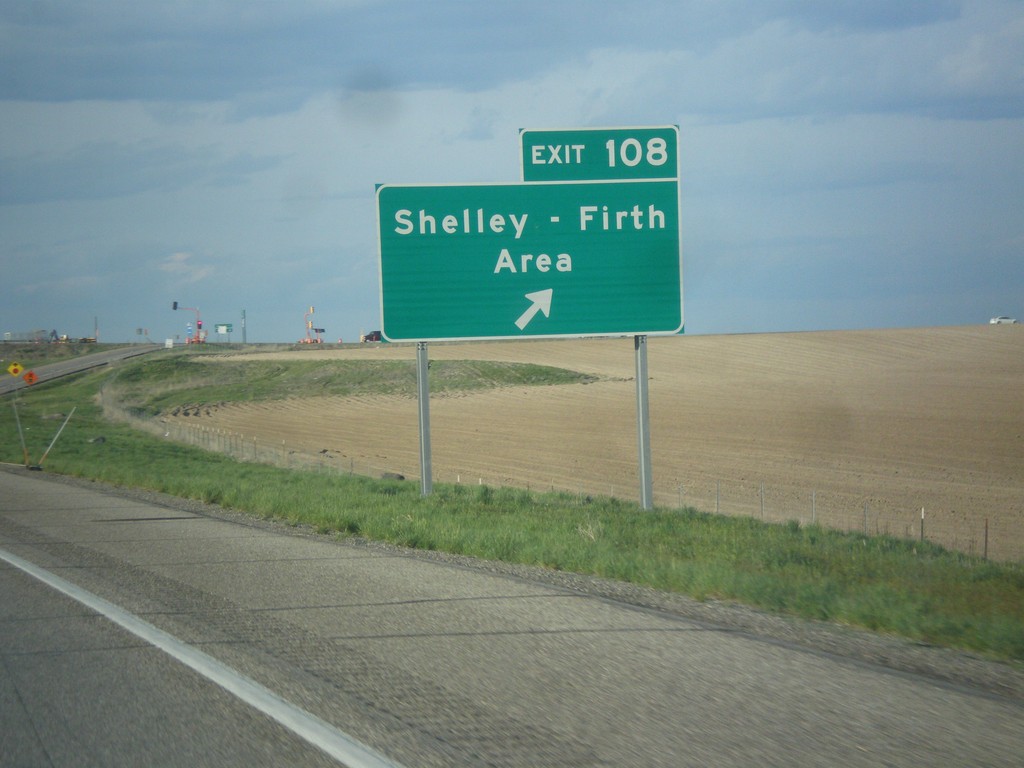
I-15 North - Exit 108
I-15 north at Exit 108 - Shelley - Firth Area.
Taken 05-13-2016
Shelley
Bingham County
Idaho
United States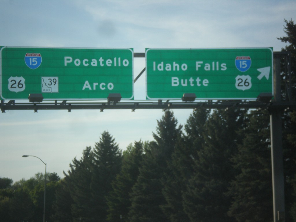
End BL-15 North at I-15/US-26/ID-39 Junction
End BL-15 North at I-15/US-26/ID-39 Junction in Blackfoot. Turn right for I-15 North/US-26 East to Idaho Falls and Butte (Montana). Continue under freeway for I-15 south to Pocatello, and for US-26/ID-39 to Arco. This is the northern end of the Blackfoot business loop.
Taken 05-13-2016

 Blackfoot
Bingham County
Idaho
United States
Blackfoot
Bingham County
Idaho
United States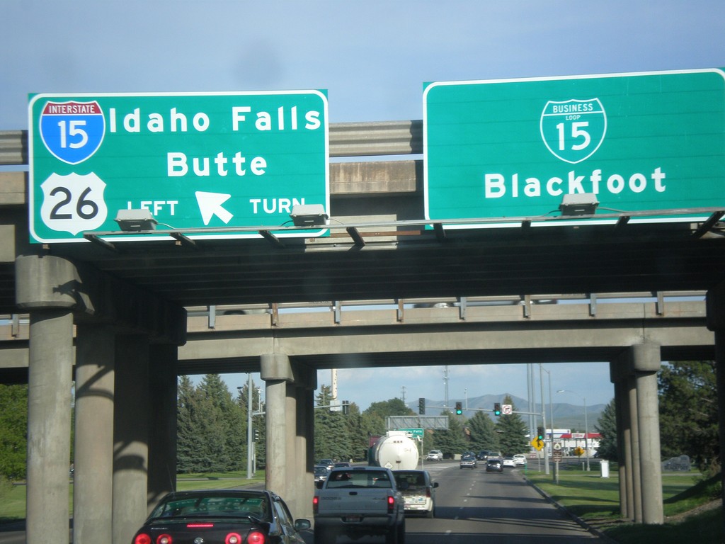
US-26 East at I-15 North and BL-15
US-26 East at I-15 North and BL-15 in Blackfoot. Use I-15 North/US-26 East to Idaho Falls and Butte (Montana). Continue straight for BL-15 to Blackfoot city center.
Taken 05-13-2016
Blackfoot
Bingham County
Idaho
United States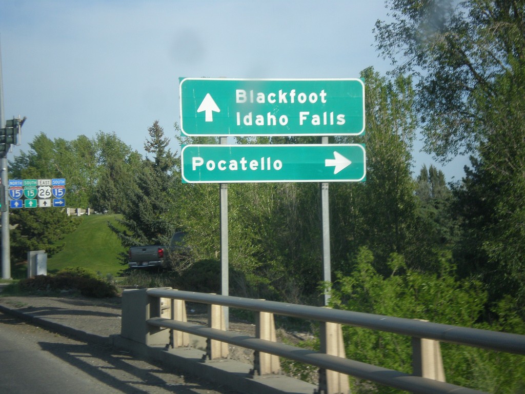
US-26 East at I-15 South
US-26 East at I-15 South in Blackfoot. Use I-15 south for Pocatello. Continue straight for Blackfoot and I-15 north to Idaho Falls.
Taken 05-13-2016
Blackfoot
Bingham County
Idaho
United States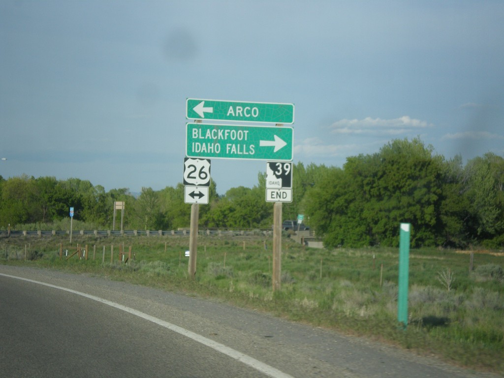
End ID-39 North Approaching US-26
End ID-39 north approaching US-26 in Blackfoot. Turn left for US-26 west to Arco; turn right for US-26 east to Blackfoot and Idaho Falls.
Taken 05-13-2016
Blackfoot
Bingham County
Idaho
United States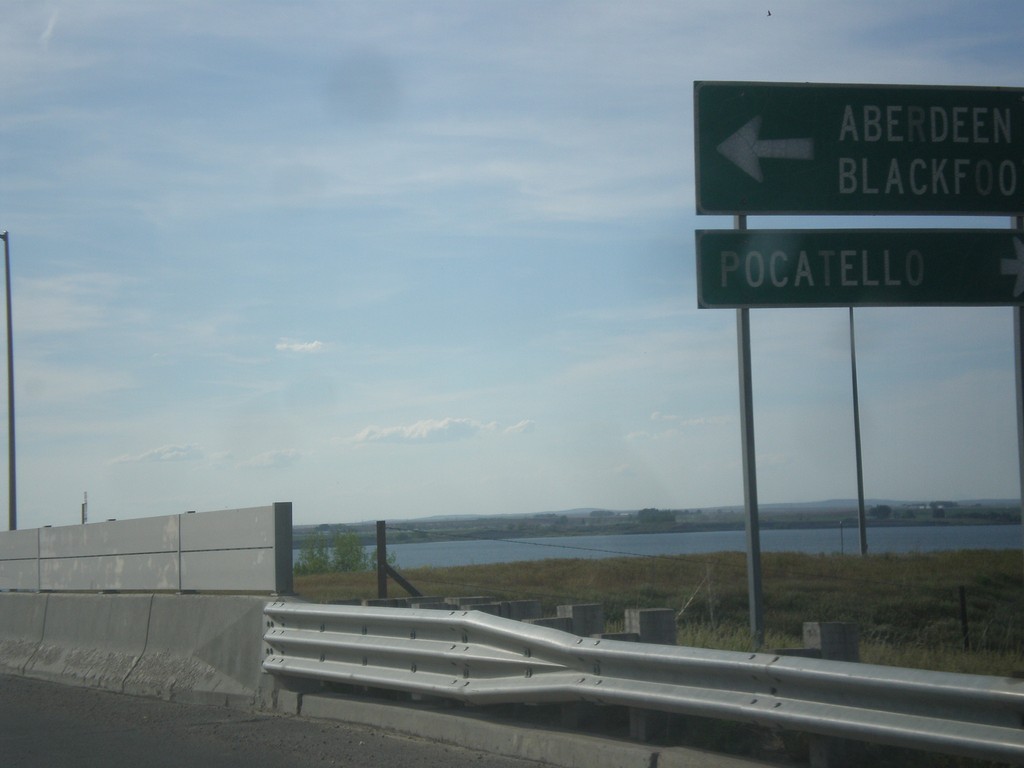
BL-86 East (Idaho St.) at ID-39
BL-86 East (Idaho St.) at ID-39 in American Falls. Turn right for BL-86 East/ID-39 south to Pocatello. Turn left for ID-39 north to Aberdeen and Blackfoot.
Taken 05-13-2016
 American Falls
Power County
Idaho
United States
American Falls
Power County
Idaho
United States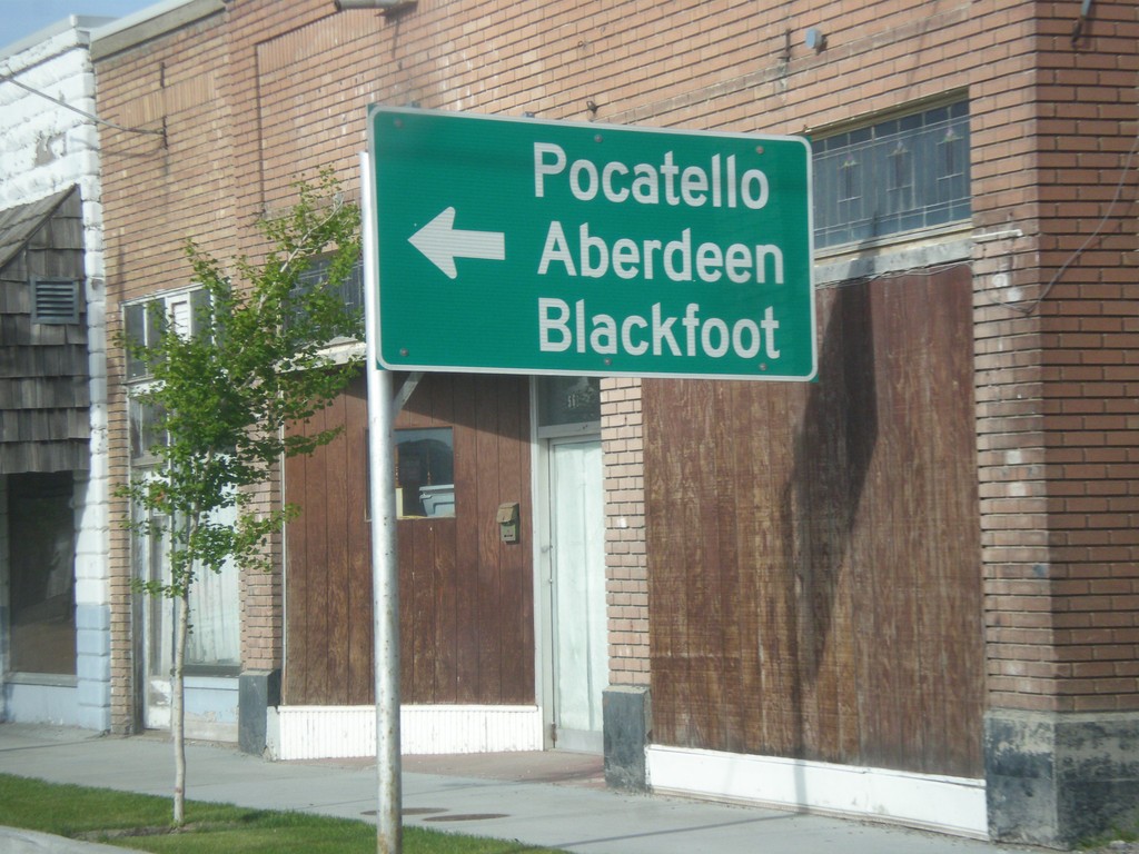
BL-86 East (Fort Hall Ave.) at Idaho St.
BL-86 East (Fort Hall Ave.) at Idaho St. Turn left on Idaho St. to continue east on BL-86 to Pocatello, Blackfoot, and Aberdeen (via ID-39)
Taken 05-13-2016
American Falls
Power County
Idaho
United States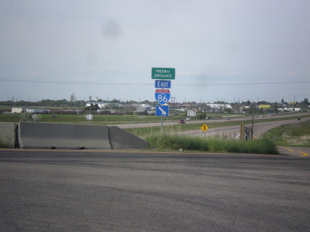
I-86 East - Freeway Entrance
Freeway Entrance on I-86 east. This style sign assembly for freeway entrances is not very common in Idaho. Also, note that the I-86 shield has the text IDAHO in it, which is also pretty rare. Most of the interstate shields that have the text IDAHO in them are older. This sign appears to be newer.
Taken 05-13-2016


 American Falls
Power County
Idaho
United States
American Falls
Power County
Idaho
United States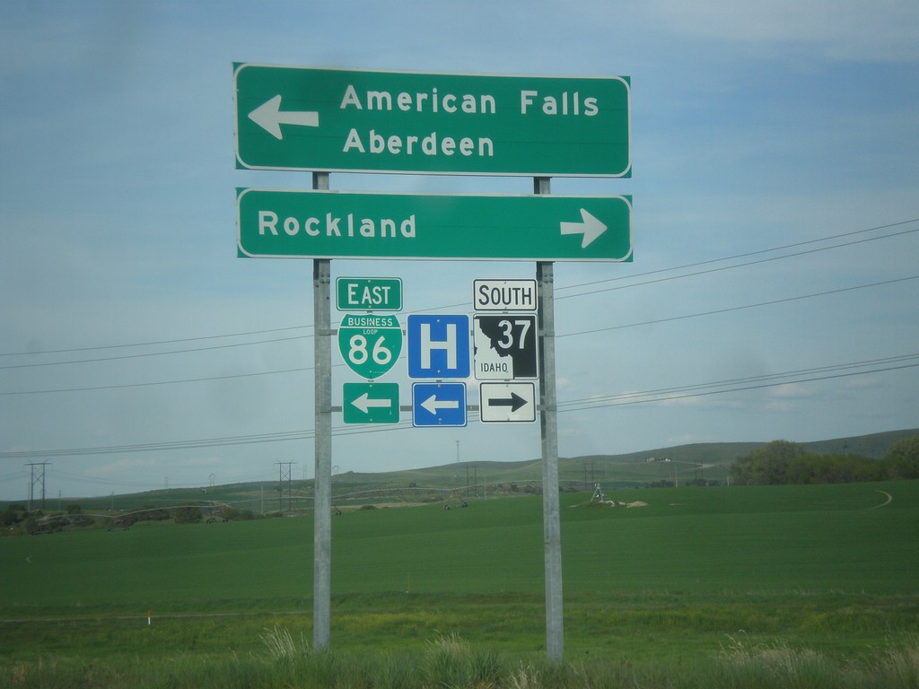
I-86 Exit 36 Offramp at BL-86/ID-37
I-86 Exit 36 offramp at BL-86/ID-37. Turn right on ID-37 south for Rockland. Turn left for BL-86 East to American Falls and Aberdeen (via ID-39). This is the west end of the American Falls business loop.
Taken 05-13-2016
American Falls
Power County
Idaho
United States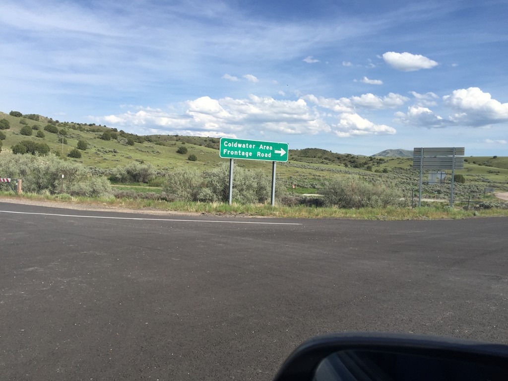
I-86 (Exit 21) Offramp at Coldwater Area
I-86/US-30 East (Exit 21) Offramp at Coldwater Area jct. Turn right for Coldwater Area and Frontage Road.
Taken 05-13-2016
Raft River
Cassia County
Idaho
United States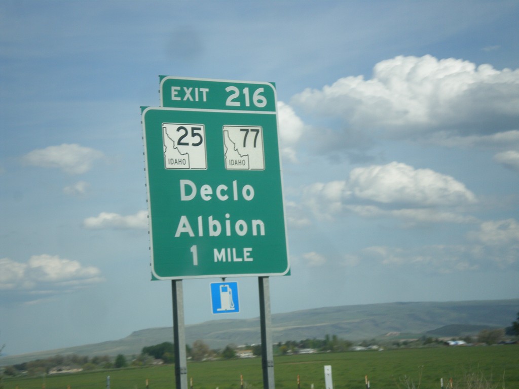
I-84 East - Exit 216
I-84 east approaching Exit 216 - ID-25/ID-77/Declo/Albion.
Taken 05-13-2016


 Rupert
Minidoka County
Idaho
United States
Rupert
Minidoka County
Idaho
United States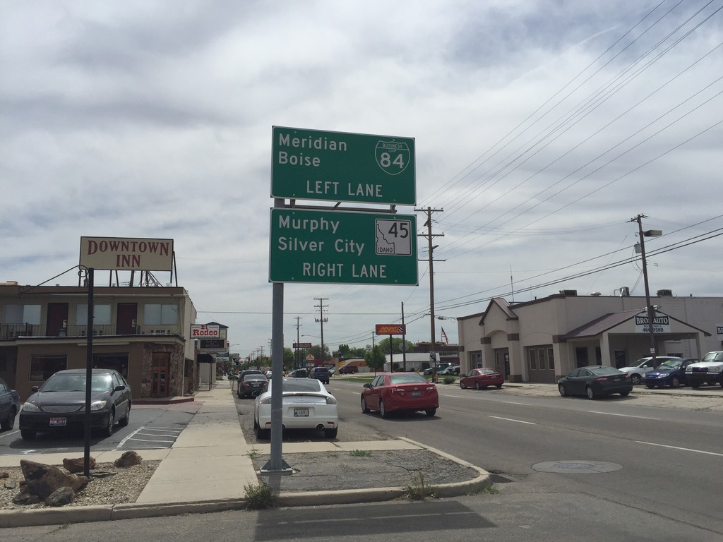
BL-84 East (3rd St.) at ID-45
BL-84 East (3rd St.) at ID-45 in Nampa. Continue straight for ID-45 south to Murphy and Silver City. Turn left on 11th Ave. to continue east on BL-84 to Meridian and Boise.
Taken 05-05-2016

 Nampa
Canyon County
Idaho
United States
Nampa
Canyon County
Idaho
United States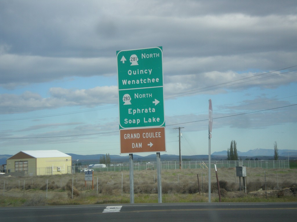
WA-281 Spur North at WA-283
WA-281 Spur North at WA-283. Use WA-283 North to Ephrata, Soap Lake and Grand Coulee Dam. Continue north on WA-281 Spur for WA-281 to Quincy and Wenatchee.
Taken 04-28-2016

 Quincy
Grant County
Washington
United States
Quincy
Grant County
Washington
United States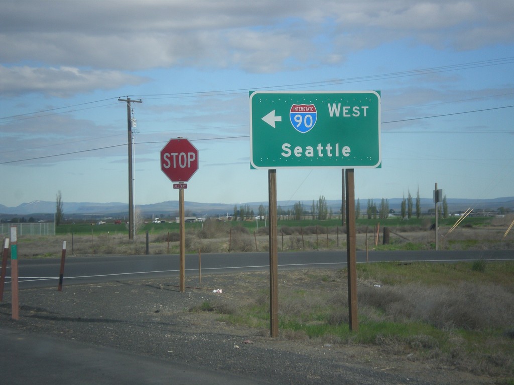
WA-281 Spur North at I-90 Exit 151 Onramp
WA-281 Spur North at I-90 Exit 151 onramp. Use I-90 west for Seattle.
Taken 04-28-2016
 Quincy
Grant County
Washington
United States
Quincy
Grant County
Washington
United States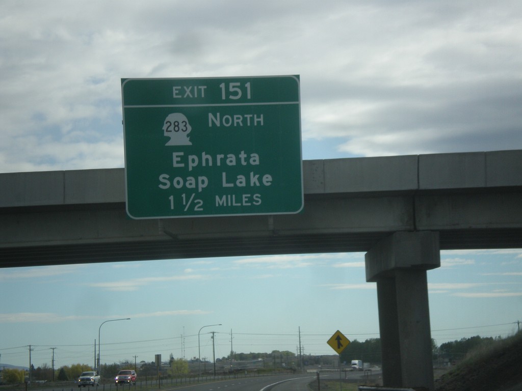
I-90 East - Exit 151
I-90 east approaching Exit 151 - WA-283 North/Ephrata/Soap Lake.
Taken 04-28-2016
Quincy
Grant County
Washington
United States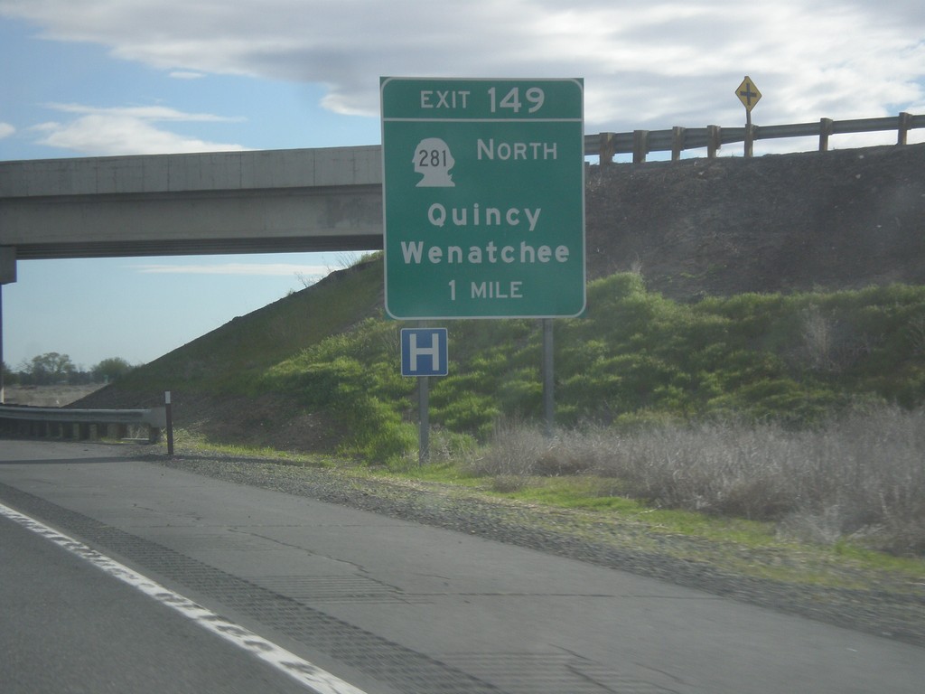
I-90 East - Exit 149
I-90 east approaching Exit 149 - WA-281 North/Quincy/Wenatchee.
Taken 04-28-2016
Quincy
Grant County
Washington
United States