Signs Tagged With Big Green Sign
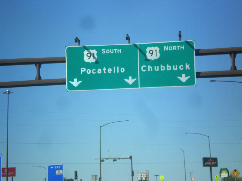
I-86 West - Exit 61 Offramp at US-91
I-86 west at Exit 61 offramp, US-91 jct. Use US-91 north for Chubbuck. Use US-91 south for Pocatello.
Taken 10-04-2015

 Pocatello
Bannock County
Idaho
United States
Pocatello
Bannock County
Idaho
United States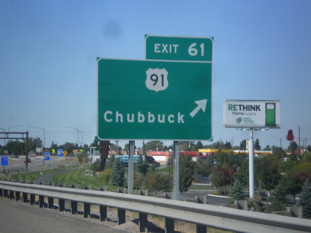
I-86 West - Exit 61
I-86 west at Exit 61 - US-91/Chubbuck.
Taken 10-04-2015
Chubbuck
Bannock County
Idaho
United States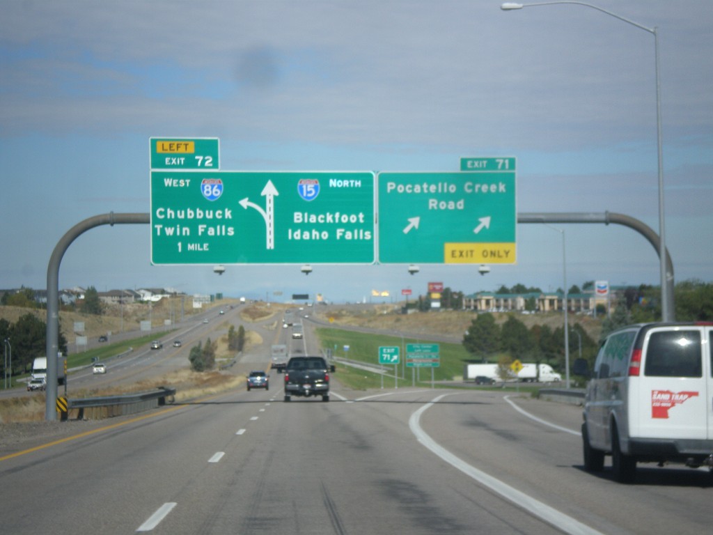
I-15 North - Exits 71 and 72
I-15 north at Exit 71 - Pocatello Creek Road. Approaching Exit 72 - I-86 West/Chubbuck/Twin Falls. Continue north on I-15 for Idaho Falls and Blackfoot.
Taken 10-04-2015

 Pocatello
Bannock County
Idaho
United States
Pocatello
Bannock County
Idaho
United States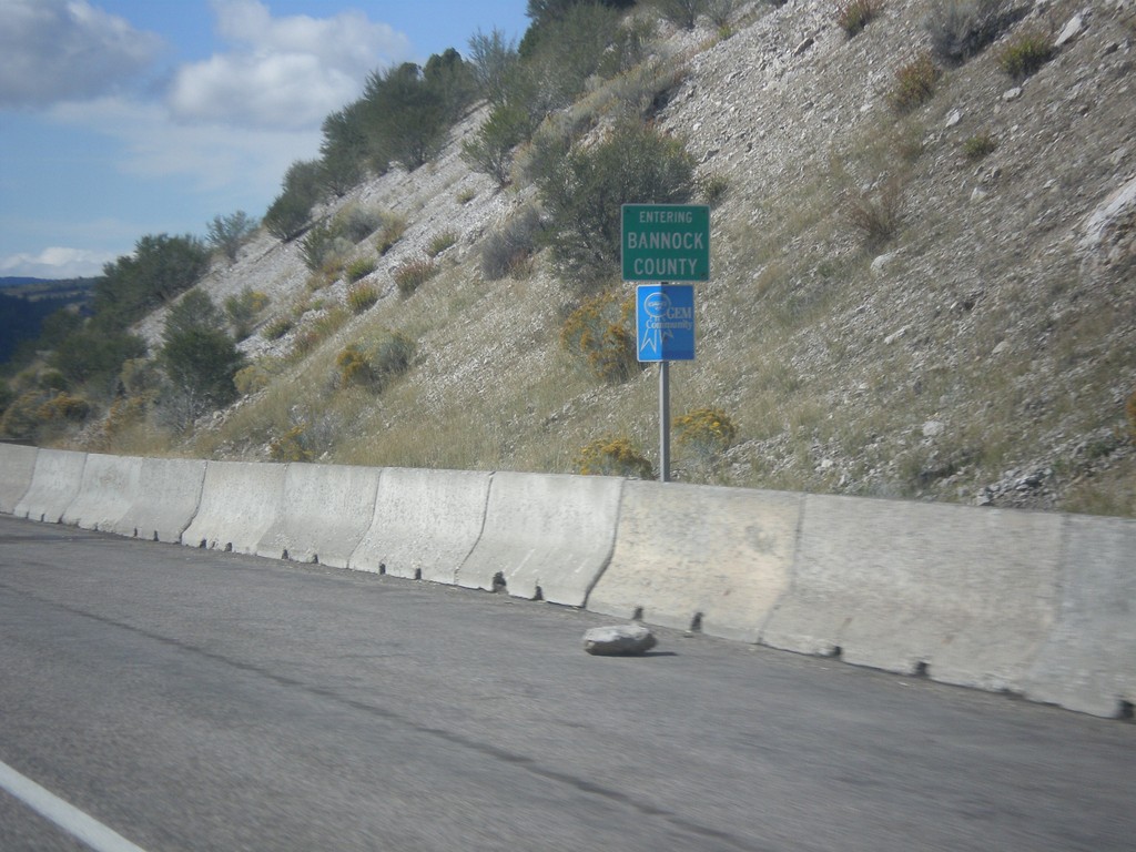
US-30 West - Bannock County
Entering Bannock County on US-30 west.
Taken 10-04-2015
 Lava Hot Springs
Bannock County
Idaho
United States
Lava Hot Springs
Bannock County
Idaho
United States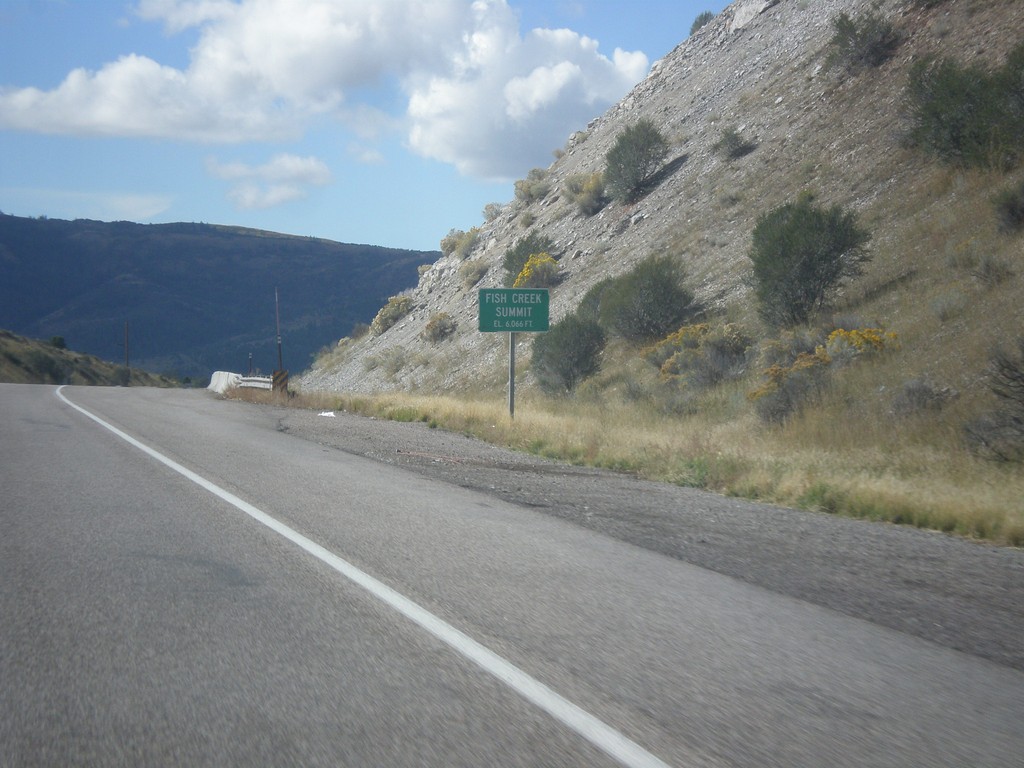
US-30 West - Fish Creek Summit
US-30 west at Fish Creek Summit.
Taken 10-04-2015
Bancroft
Caribou County
Idaho
United States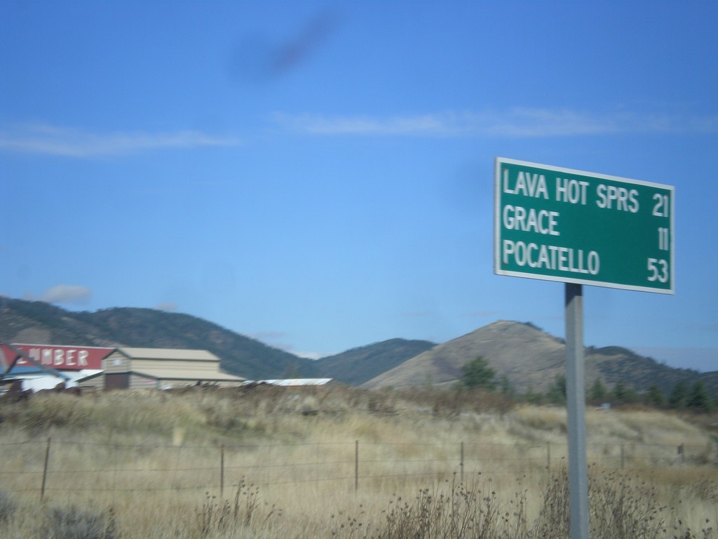
US-30 West/ID-34 South - Distance Marker
US-30 West/ID-34 South Distance Marker. Distance to Lava Hot Springs, Grace, Pocatello.
Taken 10-04-2015
 Soda Springs
Caribou County
Idaho
United States
Soda Springs
Caribou County
Idaho
United States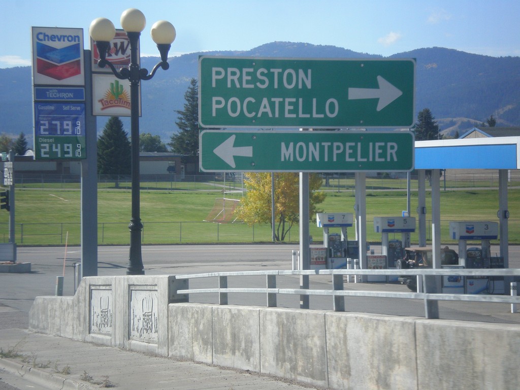
ID-34 South at US-30
ID-34 South at US-30. Turn left for US-30 west to Montpelier. Turn right for US-30 east to Pocatello and ID-34 south to Preston.
Taken 10-04-2015
Soda Springs
Caribou County
Idaho
United States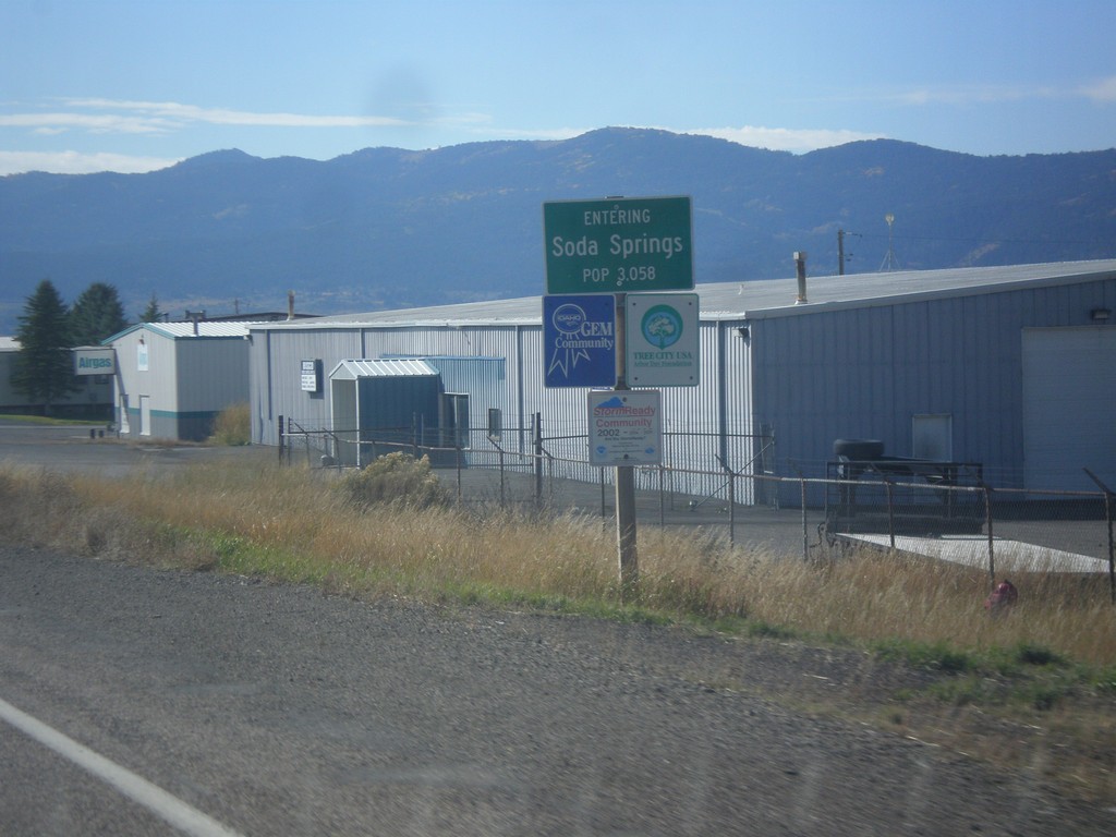
ID-34 South - Soda Springs
Entering Soda Springs on ID-34 south. Population 3058. Soda Springs is the county seat of Caribou County.
Taken 10-04-2015
Soda Springs
Caribou County
Idaho
United States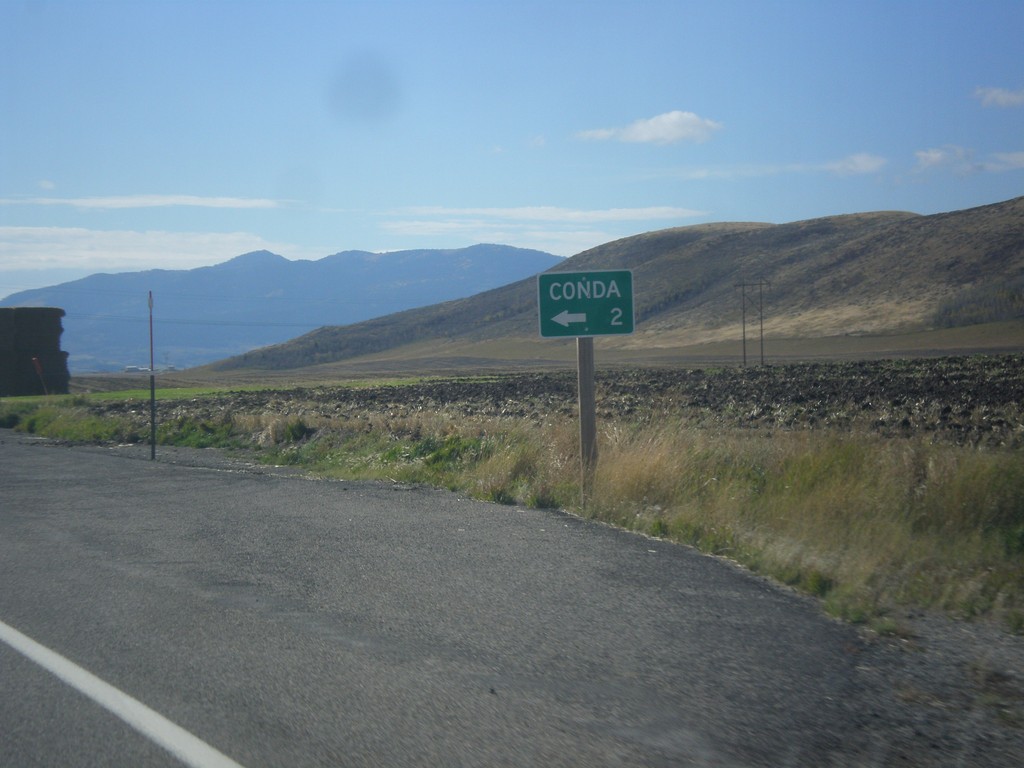
ID-34 South - Conda Jct.
ID-34 south at Conda Jct.
Taken 10-04-2015
Soda Springs
Caribou County
Idaho
United States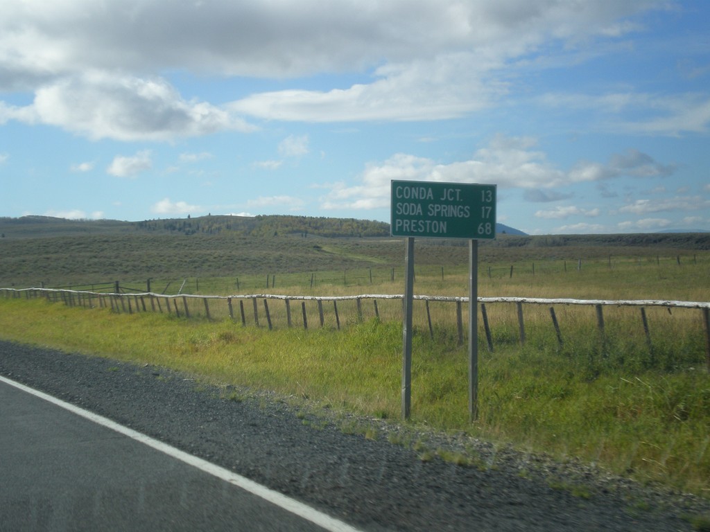
ID-34 South - Distance Marker
Distance marker on ID-34 south. Distance to Conda Jct., Soda Springs, and Preston.
Taken 10-04-2015
Soda Springs
Caribou County
Idaho
United States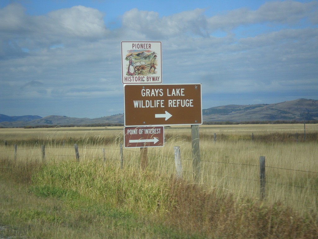
ID-34 South - Grays Lake Road Jct.
ID-34 South at Grays Lake Road Jct. Turn right for Grays Lake National Wildlife Refuge.
Taken 10-04-2015
Wayan
Caribou County
Idaho
United States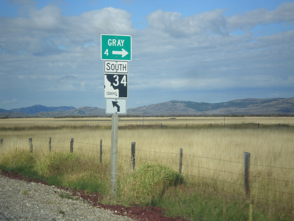
ID-34 South - Gray
ID-34 south at Grays Lake Road north to Gray.
Taken 10-04-2015
Wayan
Caribou County
Idaho
United States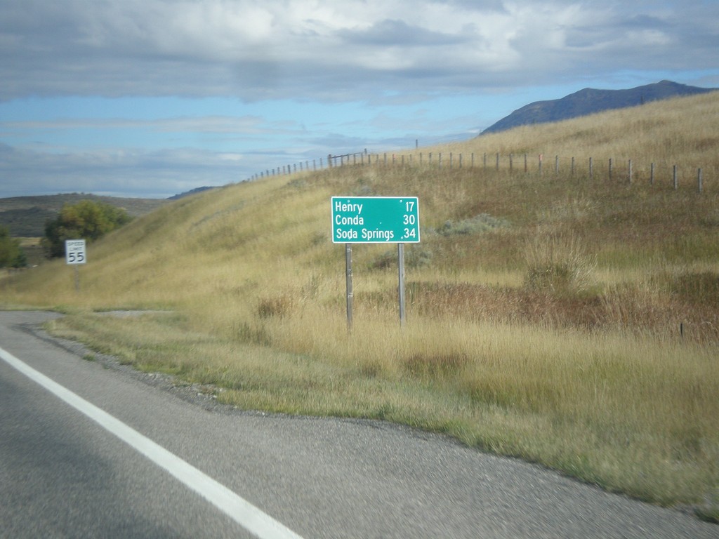
ID-34 South - Distance Marker
Distance marker on ID-34 south. Distance to Henry, Conda, and Soda Springs.
Taken 10-04-2015
Wayan
Caribou County
Idaho
United States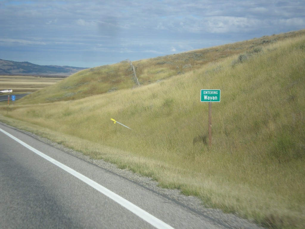
ID-34 South - Wayan
Entering Wayan on ID-34 south.
Taken 10-04-2015
Wayan
Caribou County
Idaho
United States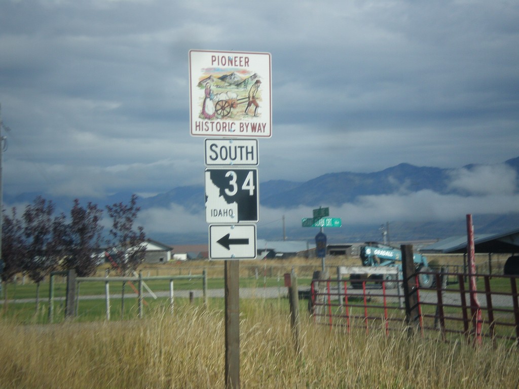
Stateline Road North at ID-34
Stateline Road north at ID-34 south. ID-34 is part of the Pioneer Historic Byway.
Taken 10-04-2015
Freedom
Lincoln County
Wyoming
United States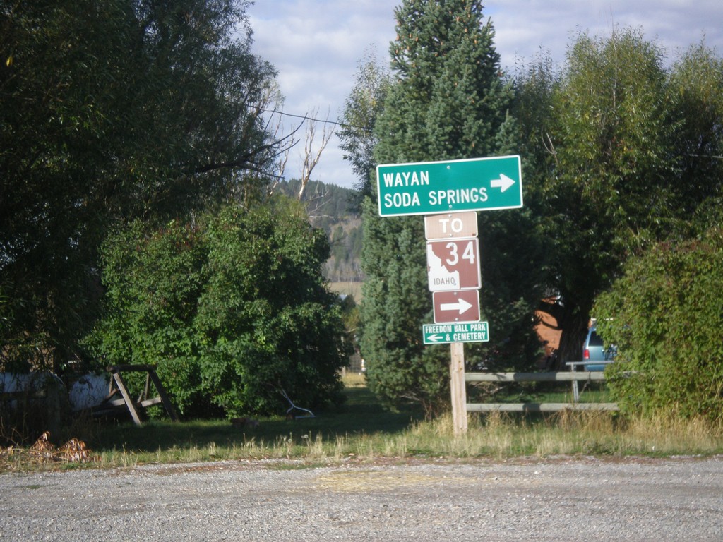
End WY-239 at Stateline Road
Turn right on Stateline Road to access ID-34 to Soda Springs and Wayan (both in Idaho). This sign assembly appears to have been erected by the Idaho Transportation Department. The west side of Stateline Road is in Idaho.
Taken 10-04-2015
 Freedom
Lincoln County
Wyoming
United States
Freedom
Lincoln County
Wyoming
United States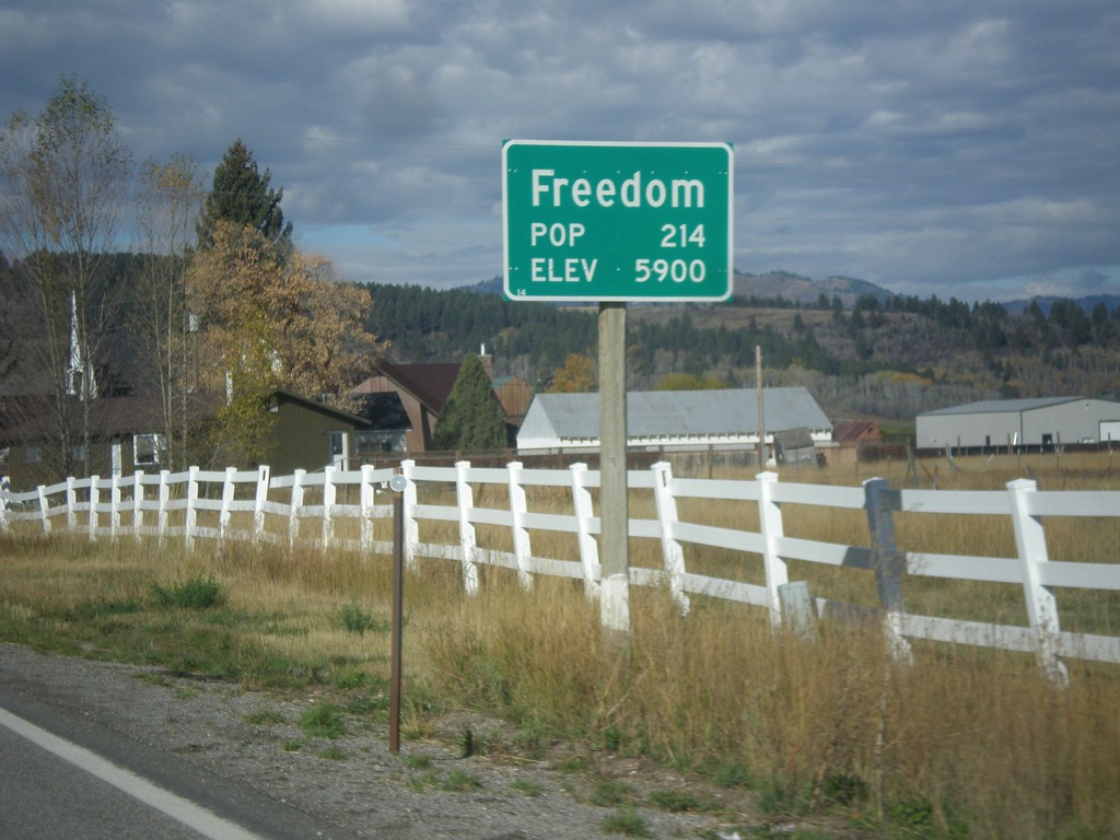
WY-239 West - Entering Freedom
Entering Freedom on WY-239 west - Elevation 5900; Population 214. Freedom is the oldest community in the Star Valley, and is named because of the settlers who were free to practice polygamy in Wyoming. The western boundary of the town is the Idaho stateline, where at the time had banned polygamy.
Taken 10-04-2015
Freedom
Lincoln County
Wyoming
United States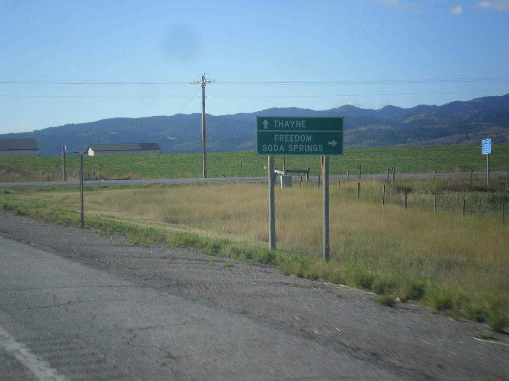
US-89 South at WY-239 West
US-89 South at WY-239 West to Freedom and Soda Springs (Idaho). Continue south on US-89 for Thayne. WY-239 is a short connecting route between US-89 and ID-34. There is no direct connection between ID-34 and WY-239 on the state highway system. There is a short stretch of county road running along the stateline between these two highways.
Taken 10-04-2015
 Freedom
Lincoln County
Wyoming
United States
Freedom
Lincoln County
Wyoming
United States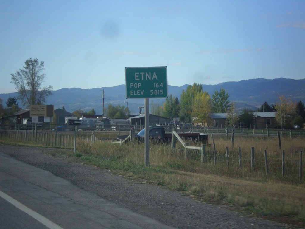
US-89 South - Entering Etna
Entering Etna on US-89 south. Elevation 5815 Feet; Population 164.
Taken 10-04-2015
Freedom
Lincoln County
Wyoming
United States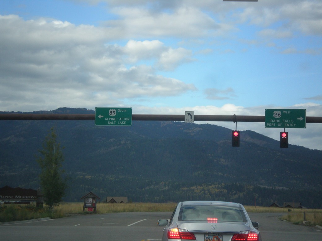
US-26 West/US-89 South - Alpine Junction
US-26 West/US-89 South at Alpine Junction. Turn right for US-26 West to Idaho Falls (ID) and the (Wyoming) Port of Entry. Turn left for US-89 south to Alpine, Afton, and Salt Lake (Utah).
Taken 10-04-2015
 Alpine
Lincoln County
Wyoming
United States
Alpine
Lincoln County
Wyoming
United States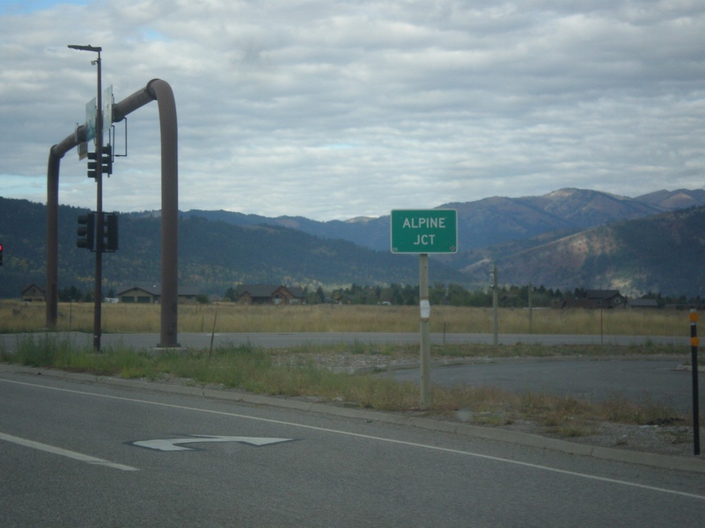
US-26 West/US-89 South - Alpine Junction
US-26 West/US-89 South at Alpine Junction. Alpine Junction is the name of the intersection of US-89 and US-26, which is across the Snake River from the town of Alpine.
Taken 10-04-2015
Alpine
Lincoln County
Wyoming
United States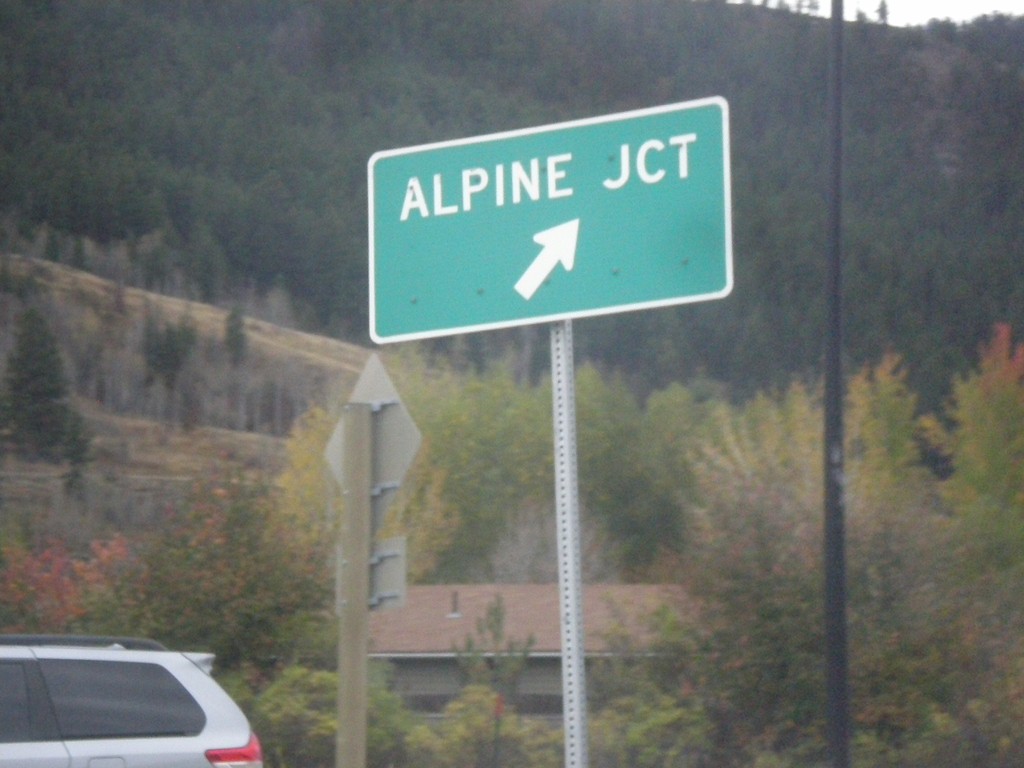
US-26 West - US-89/US-189/US-191 South in Hoback Jct. Roundabout
US-26 West - US-89/US-189/US-191 South in Hoback Jct. roundabout. Merge right for (US-26 West/US-89 South) Alpine Junction.
Taken 10-04-2015

 Jackson
Teton County
Wyoming
United States
Jackson
Teton County
Wyoming
United States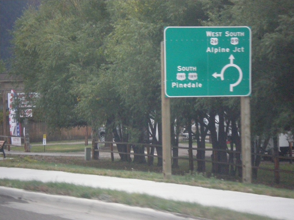
US-26 West - US-89/US-189/US-191 South - Roundabout
US-26 West - US-89/US-189/US-191 South entering roundabout at Hoback Junction. Use US-26 West/US-89 South for Alpine Jct.; use US-189/US-191 South for Pinedale. This intersection was converted to a roundabout in 2012.
Taken 10-04-2015
Jackson
Teton County
Wyoming
United States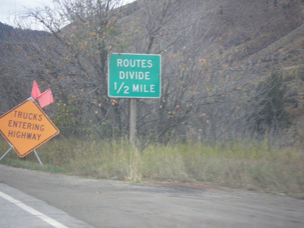
US-26 West - US-89/US-189/US-191 South - Routes Divide
US-26 West - US-89/US-189/US-191 South - Routes Divide. Approaching Hoback Jct., where US-189/US-191 separate from US-26/US-89. The Routes Divide sign in Wyoming is common in this situation where one route splits from another route.
Taken 10-04-2015
Jackson
Teton County
Wyoming
United States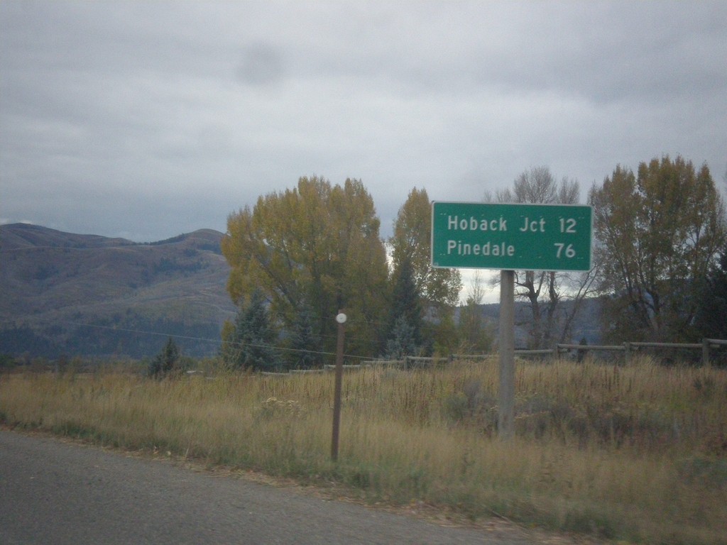
US-26 West - US-89/US-189/US-191 South - Distance Marker
Distance Marker on US-26 West - US-89/US-189/US-191 South. Distance to Hoback Jct. and Pinedale (via US-191 South).
Taken 10-04-2015
Jackson
Teton County
Wyoming
United States