Signs Tagged With Big Green Sign
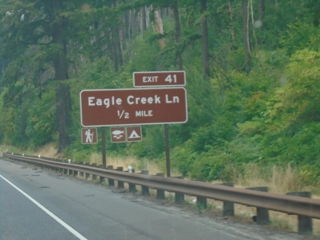
I-84 East - Exit 41
I-84 east approaching Exit 41 - Eagle Creek Lane.
Taken 08-09-2024

 Cascade Locks
Multnomah County
Oregon
United States
Cascade Locks
Multnomah County
Oregon
United States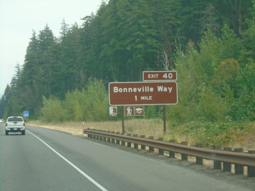
I-84 East - Exit 40
I-84 east approaching Exit 40 - Bonneville Way.
Taken 08-09-2024
Cascade Locks
Multnomah County
Oregon
United States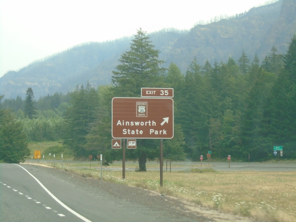
I-84 East - Exit 35
I-84 east at Exit 35 - Historic Route 30/Ainsworth State Park.
Taken 08-09-2024
Dodson
Multnomah County
Oregon
United States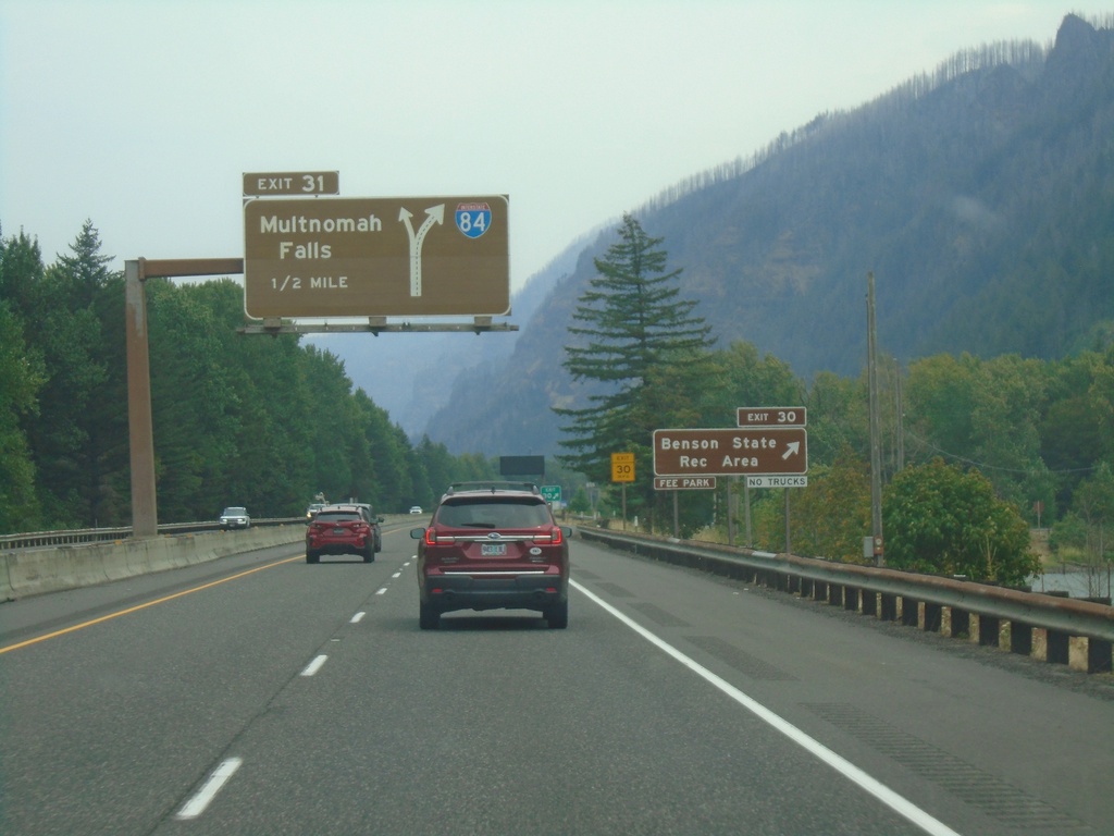
I-84 East - Exits 30 and 31
I-84 east at Exit 30 - Benson State Recreation Area. Approaching Exit 31 - Multnomah Falls. Exit 31 is a left exit.
Taken 08-09-2024
Bridal Veil
Multnomah County
Oregon
United States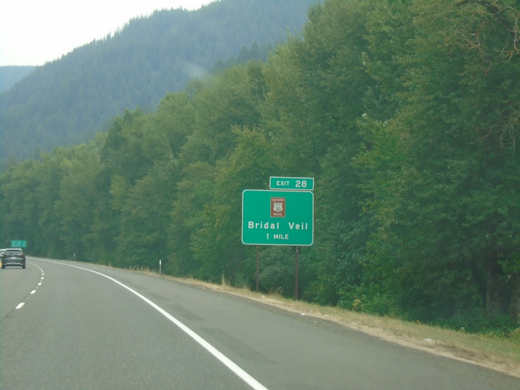
I-84 East - Exit 28
I-84 east approaching Exit 28 - Historic Route 30/Bridal Veil.
Taken 08-09-2024
Corbett
Multnomah County
Oregon
United States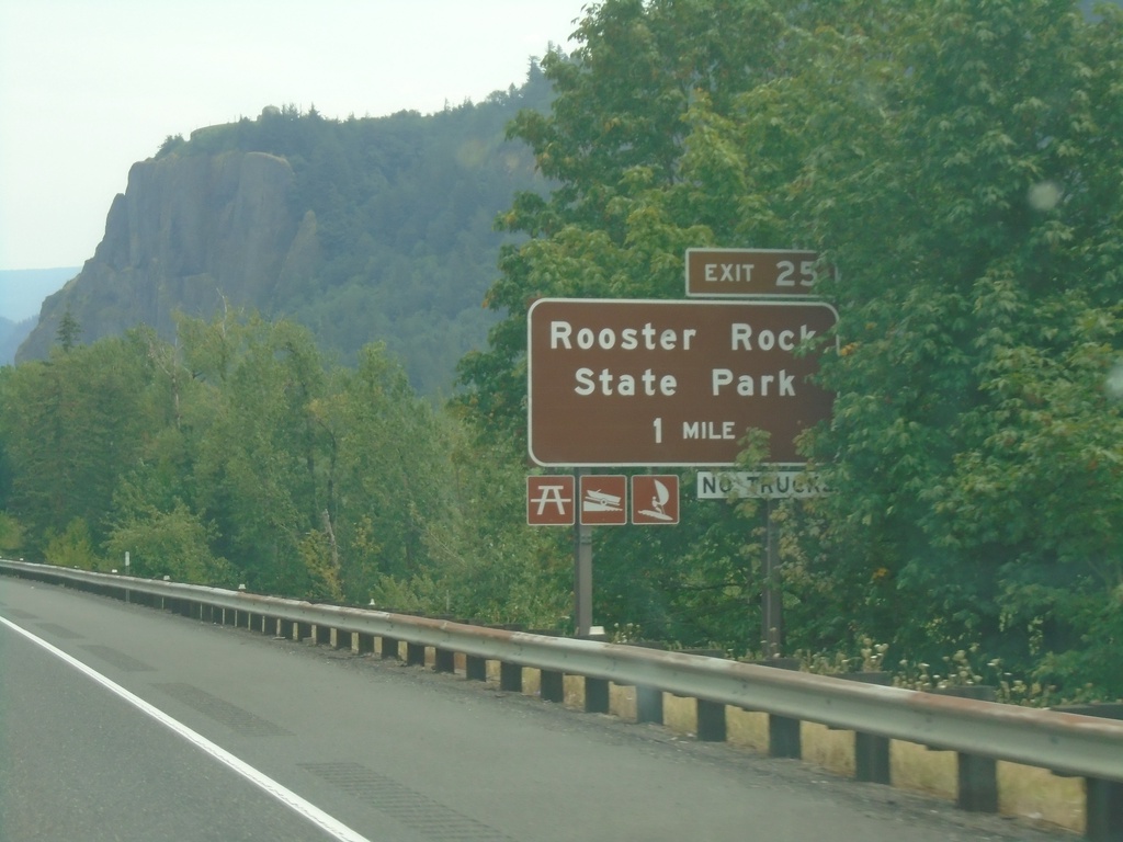
I-84 East - Exit 25
I-84 east approaching Exit 25 - Rooster Rock State Park.
Taken 08-09-2024
Corbett
Multnomah County
Oregon
United States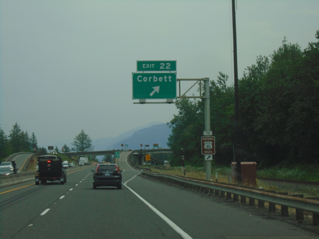
I-84 East - Exit 22
I-84 east at Exit 22 - Corbett. Use Exit 22 for access to Historic Route 30.
Taken 08-09-2024
Corbett
Multnomah County
Oregon
United States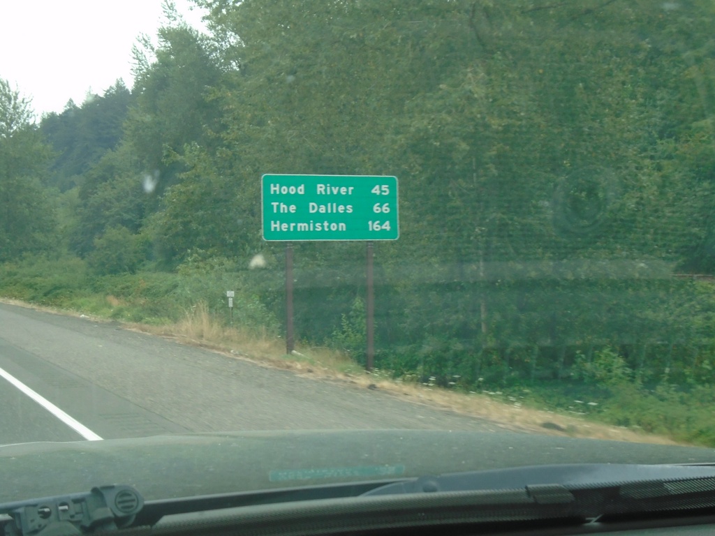
I-84 East - Distance Marker
First distance marker eastbound on I-84 after the Portland metro area. Distance to Hood River, The Dalles, and Hermiston.
Taken 08-09-2024
Troutdale
Multnomah County
Oregon
United States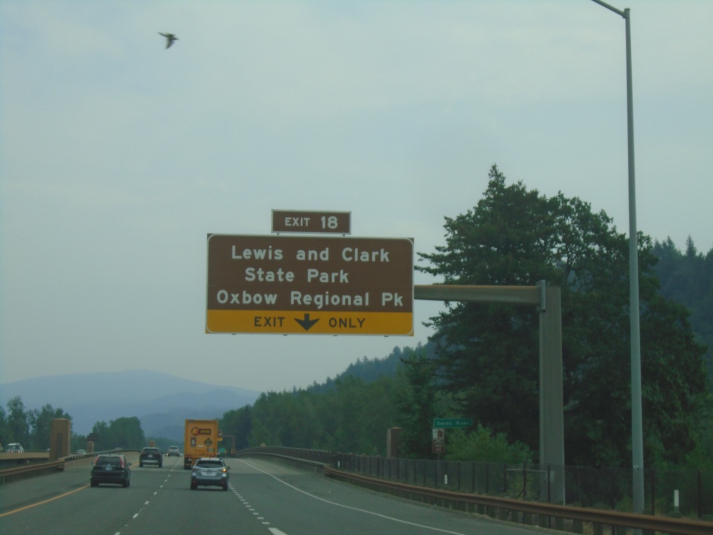
I-84 East - Exit 18
I-84 east approaching Exit 18 - Lewis and Clark State Park/Oxbow Regional Park.
Taken 08-09-2024
Troutdale
Multnomah County
Oregon
United States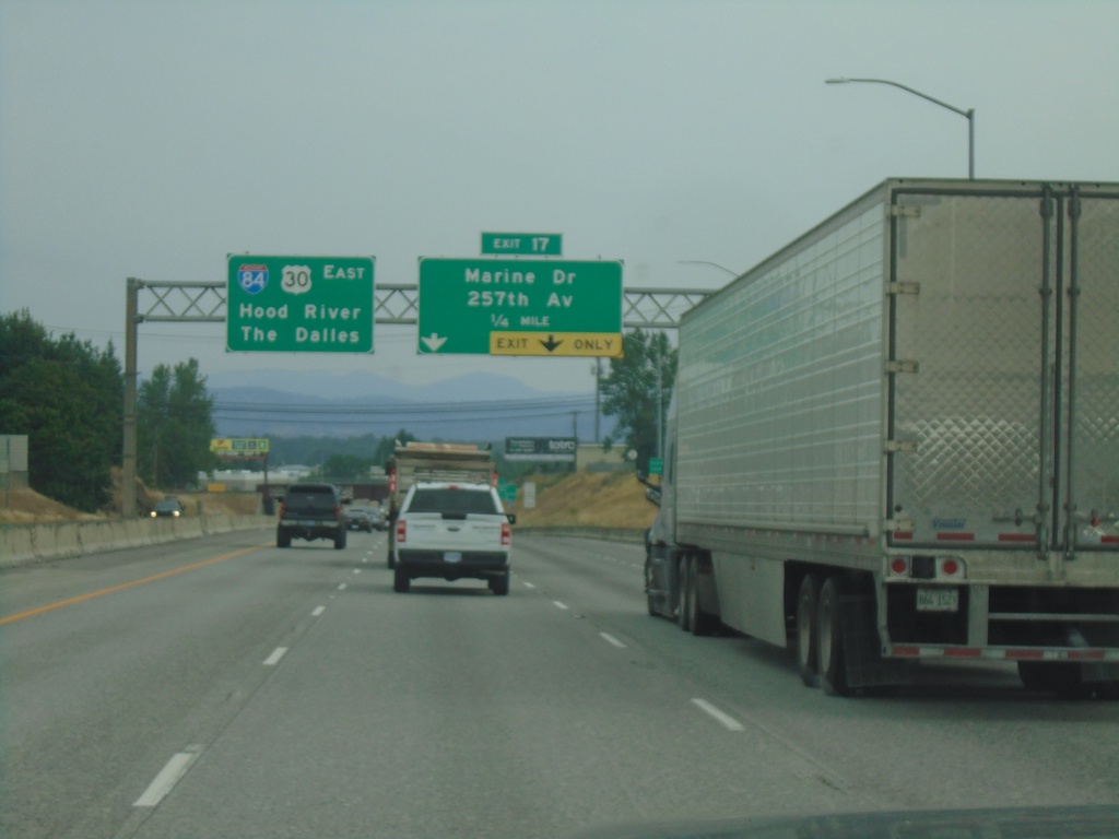
I-84 East Approaching Exit 17
I-84 east approaching Exit 17 - Marine Drive/257th Ave. Continue east on I-84/US-30 for The Dalles and Hood River.
Taken 08-09-2024
Troutdale
Multnomah County
Oregon
United States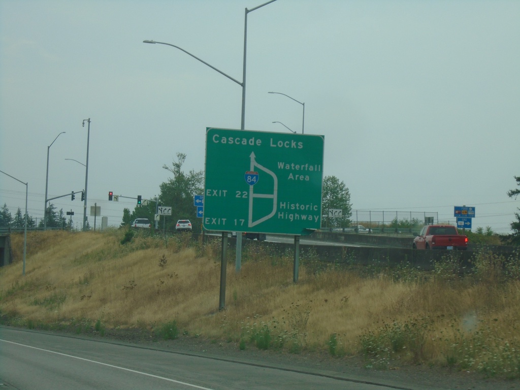
I-84/US-30 East - Historic Columbia River Highway Diagram
Route diagram for the Historic Columbia River Highway on I-84/US-30 East. Use Exit 17 (last Portland Metro. Area exit) on I-84/US-30 East for the Historic Highway. The Historic Columbia River Highway and I-84/US-30 rejoin before Cascade Locks.
Taken 08-09-2024
Fairview
Multnomah County
Oregon
United States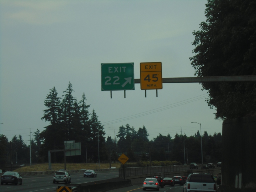
I-205 South - Exit 22
I-205 south at I-84 east - Exit 22.
Taken 08-09-2024
 Portland
Multnomah County
Oregon
United States
Portland
Multnomah County
Oregon
United States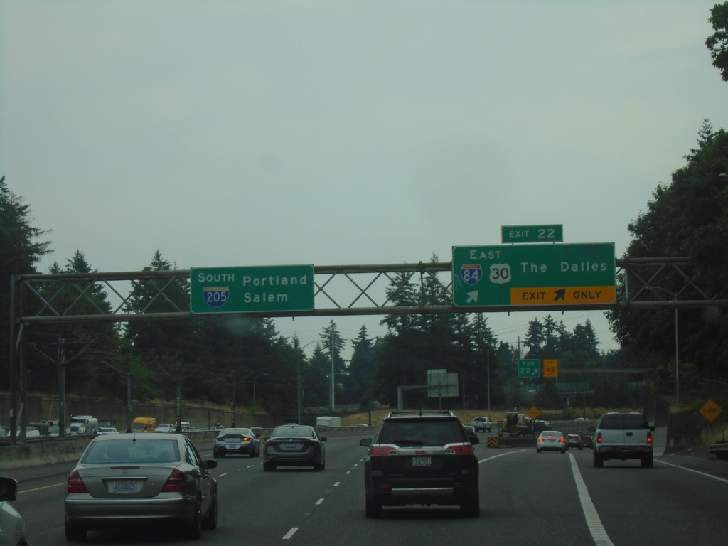
I-205 South - Exit 22
I-205 south at Exit 22 - I-84/US-30 East/The Dalles. Continue south on I-205 for Portland and Salem.
Taken 08-09-2024
Portland
Multnomah County
Oregon
United States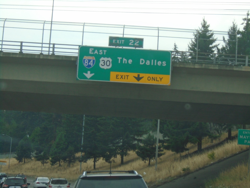
I-205 South - Exit 22
I-205 south approaching Exit 22 - I-84/US-30 East/The Dalles.
Taken 08-09-2024
Maywood Park
Multnomah County
Oregon
United States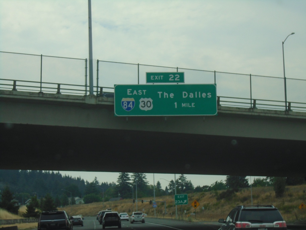
I-205 South - Exit 22
I-205 south approaching Exit 22 - I-84/US-30 East/The Dalles.
Taken 08-09-2024
Portland
Multnomah County
Oregon
United States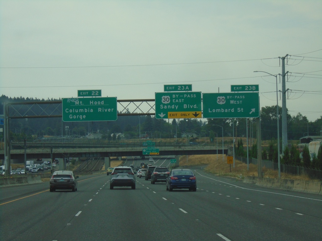
I-205 South - Exits 23B, 23A, and 22
I-205 South at Exit 23B - US-30 By-Pass West/Lombard St. Approaching Exit 23A - US-30 By-Pass East/Sandy Blvd. Use Exit 22 (I-84 East) to Mount Hood and Columbia River Gorge.
Taken 08-09-2024
 Portland
Multnomah County
Oregon
United States
Portland
Multnomah County
Oregon
United States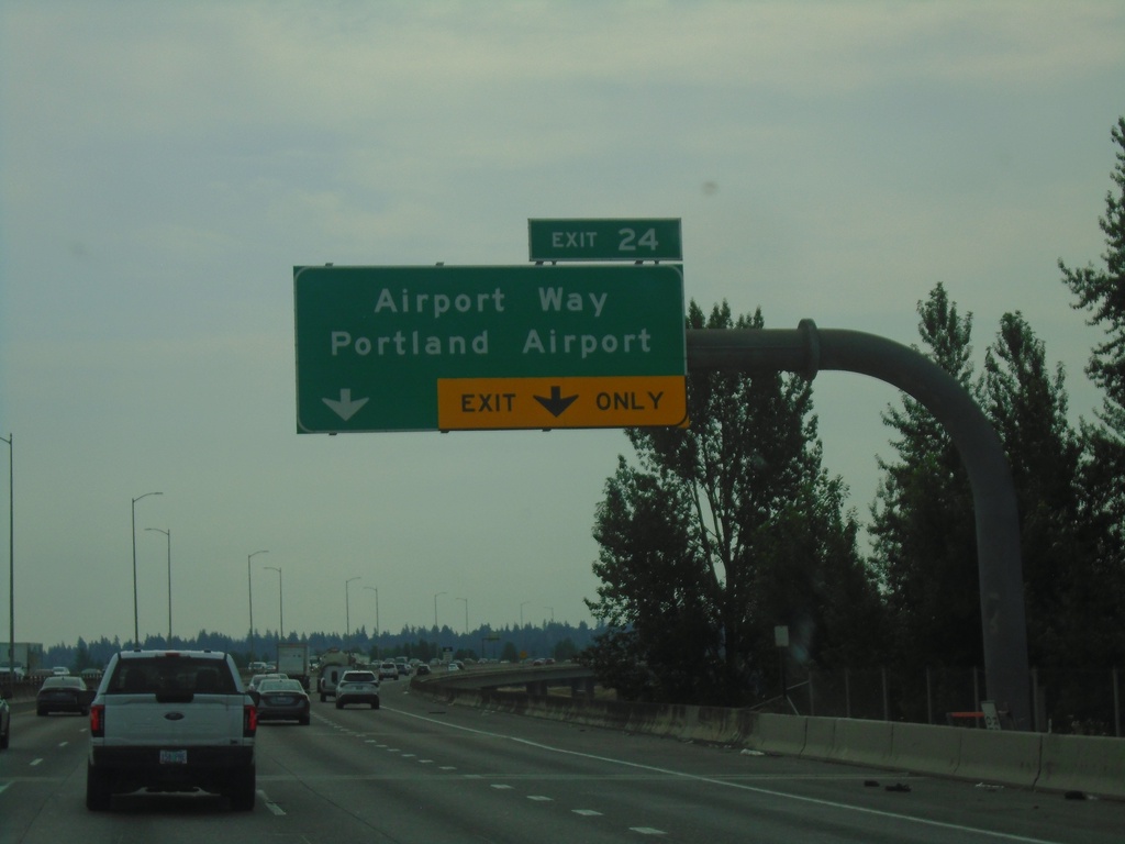
I-205 South - Exit 24
I-205 south at Exit 24 - Airport Way/Portland Airport.
Taken 08-09-2024
Portland
Multnomah County
Oregon
United States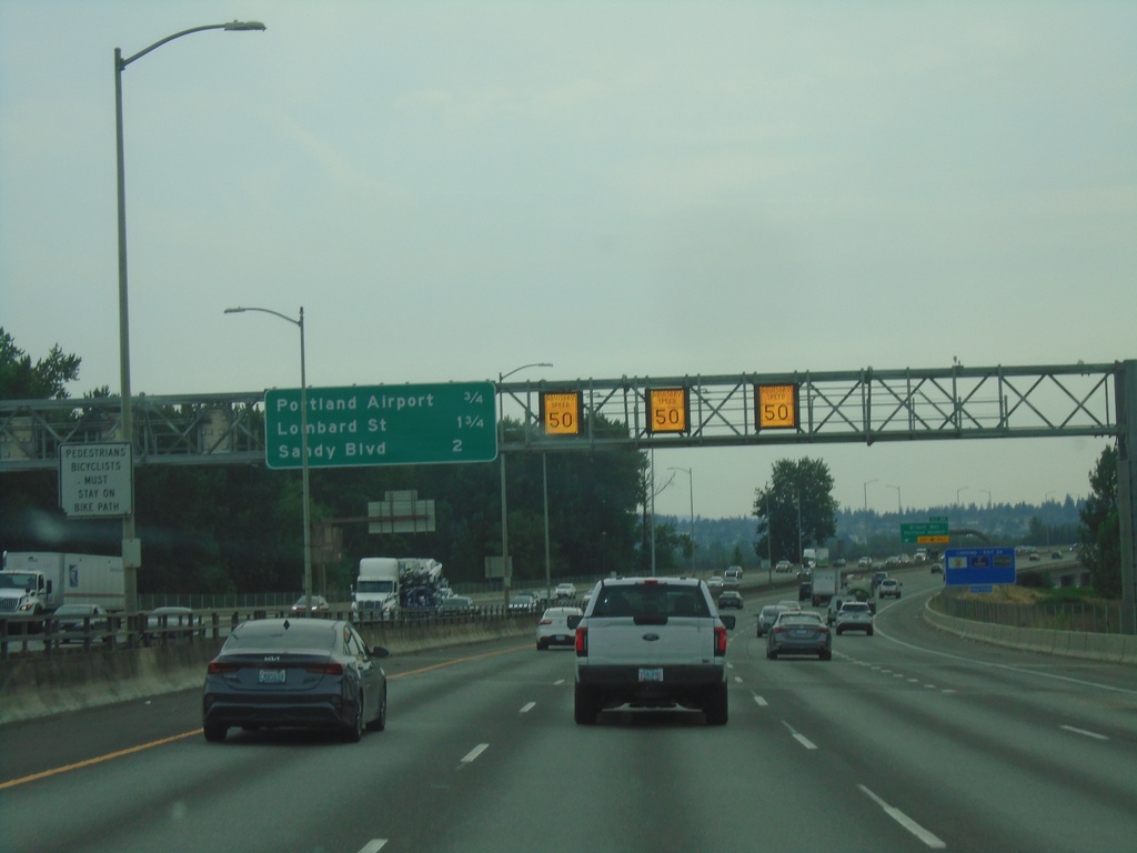
I-205 South - Distance Marker
Distance marker on I-205 south in Portland. Distance to Portland Airport, Lombard St., and Sandy Blvd. Electronic variable speed limit advisory signs showing an advised speed of 50 MPH.
Taken 08-09-2024
Portland
Multnomah County
Oregon
United States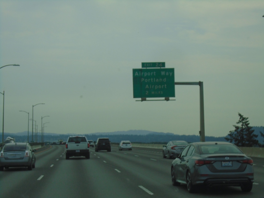
I-205 South - Exit 24
I-205 south approaching Exit 24 - Airport Way/Portland Airport. The actual interchange is in Oregon.
Taken 08-09-2024
Vancouver
Clark County
Washington
United States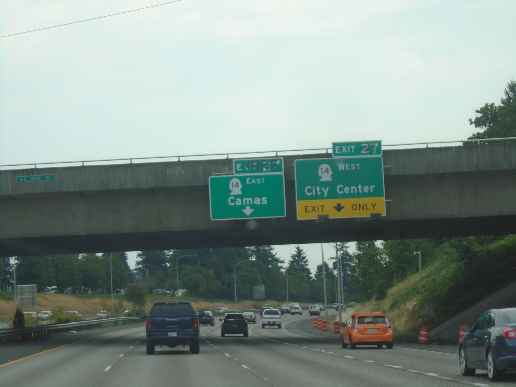
I-205 South - Exit 27
I-205 south approaching Exit 27 - WA-14 East/Camas and WA-14 West/(Vancouver)City Center.
Taken 08-09-2024
 Vancouver
Clark County
Washington
United States
Vancouver
Clark County
Washington
United States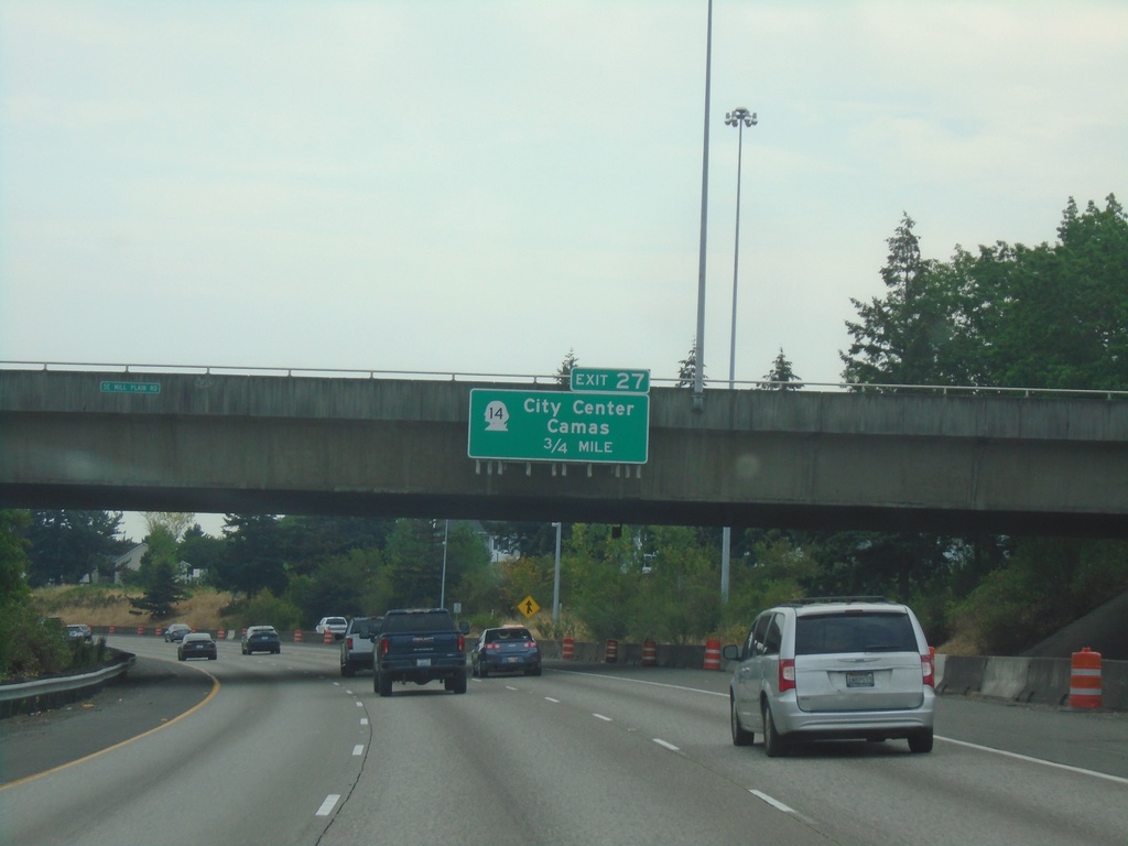
I-205 South - Exit 27
I-205 south approaching Exit 27 - WA-14/Camas/(Vancouver)City Center. WA-14 is the last exit on I-205 southbound in Washington.
Taken 08-09-2024
Vancouver
Clark County
Washington
United States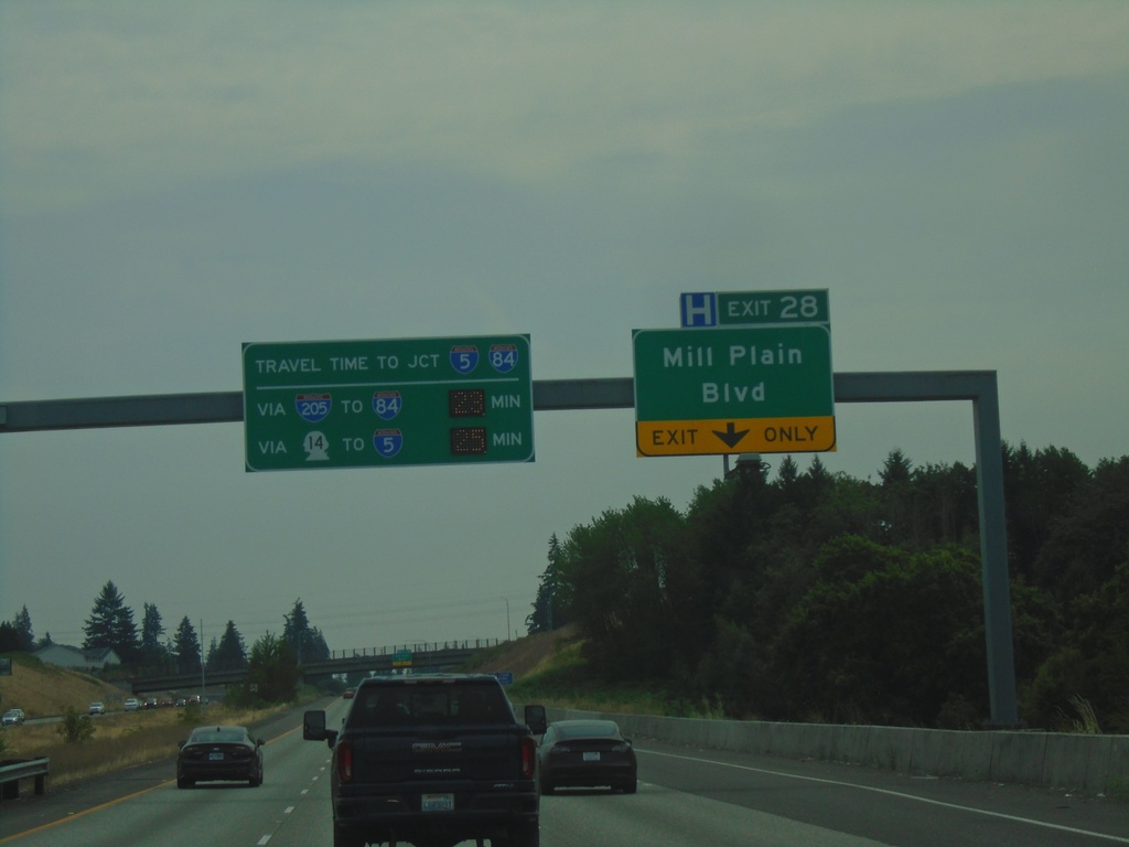
I-205 South - Exit 28
I-205 South approaching Exit 28 - Mill Plain Blvd. Travel times to I-84/I-5 Junction (Downtown Portland, Oregon) via I-84 and WA-14.
Taken 08-09-2024
 Vancouver
Clark County
Washington
United States
Vancouver
Clark County
Washington
United States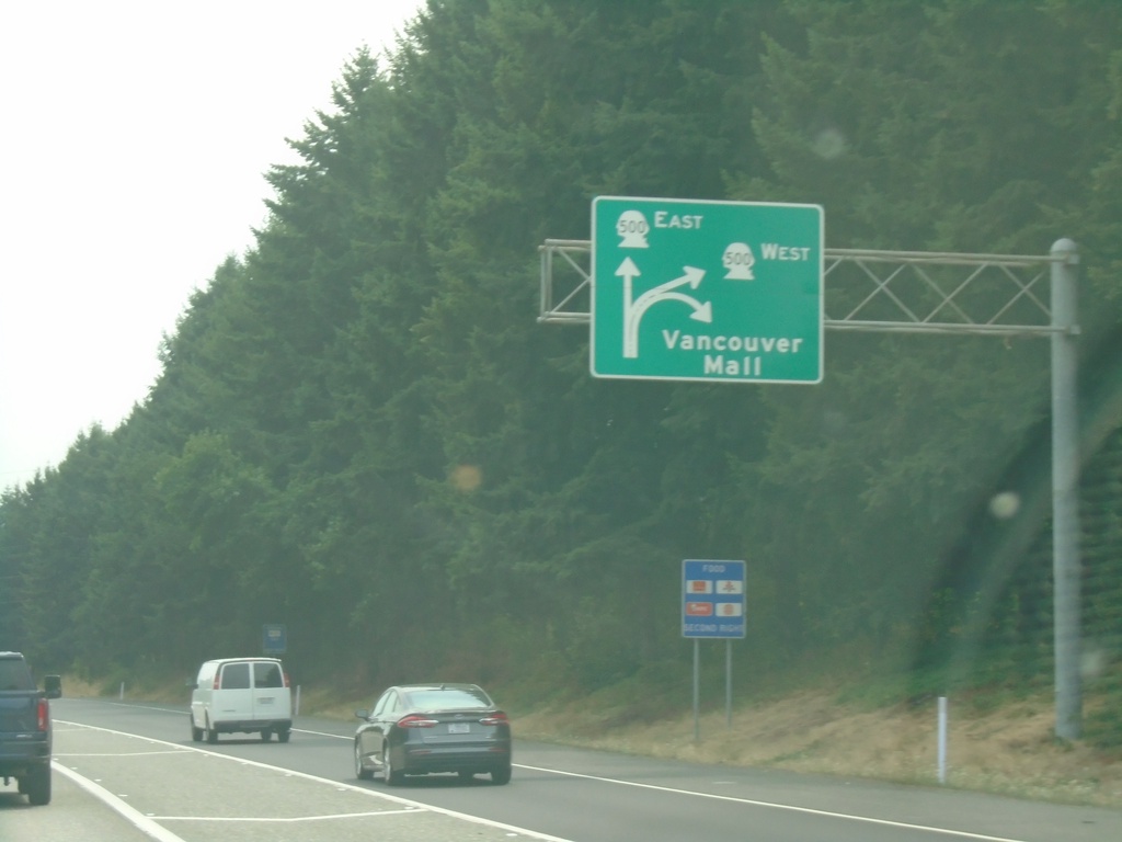
I-5 South - Exit 30
I-5 south at Exit 30. Exit diagram showing access to WA-500 and Vancouver Mall.
Taken 08-09-2024
 Vancouver
Clark County
Washington
United States
Vancouver
Clark County
Washington
United States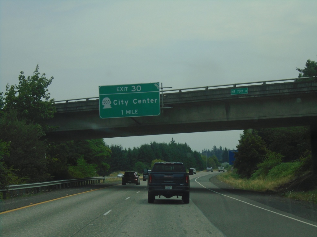
I-205 South - Exit 30
I-205 south approaching Exit 30 - WA-500/(Vancouver)City Center.
Taken 08-09-2024
Vancouver
Clark County
Washington
United States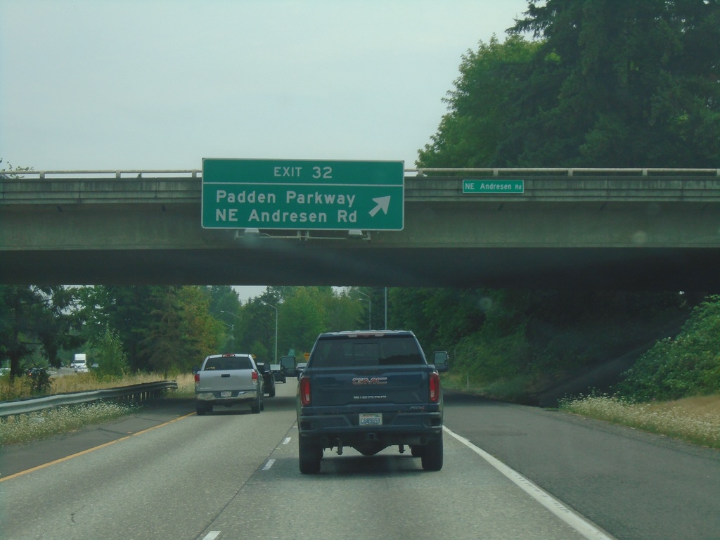
I-205 South - Exit 32
I-205 south at Exit 32 - Padden Parkway/NE Andresen Road.
Taken 08-09-2024
Vancouver
Clark County
Washington
United States