Signs Tagged With Big Green Sign
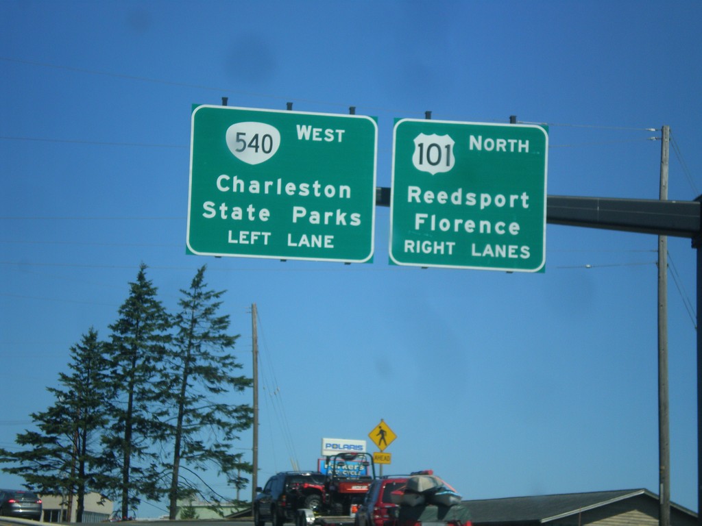
US-101 North Approaching OR-540
US-101 North approaching OR-540 west to Charleston and State Parks. Continue north on US-101 to Florence and Reedsport.
Taken 08-22-2015

 North Bend
Coos County
Oregon
United States
North Bend
Coos County
Oregon
United States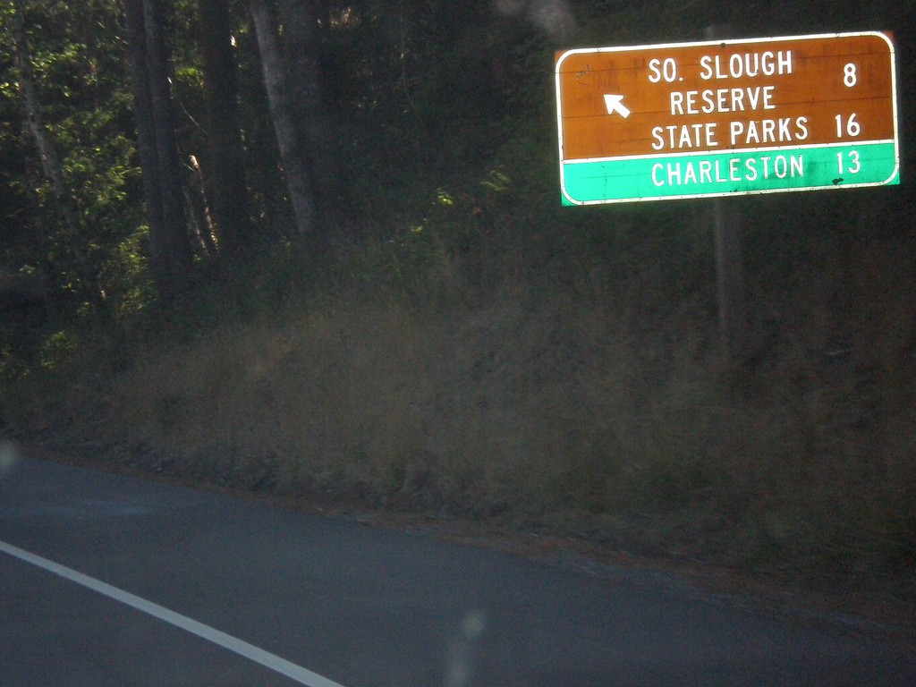
US-101 North - Beaver Hill Road
US-101 north at Beaver Hill Road to South Slough Reserve State Parks and Charleston.
Taken 08-22-2015
Bandon
Coos County
Oregon
United States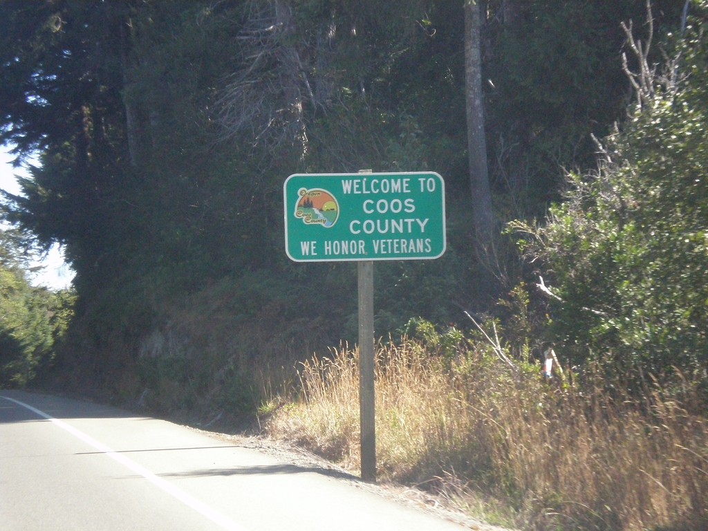
US-101 North - Coos County
Entering Coos County on US-101 north.
Taken 08-22-2015
Langlois
Coos County
Oregon
United States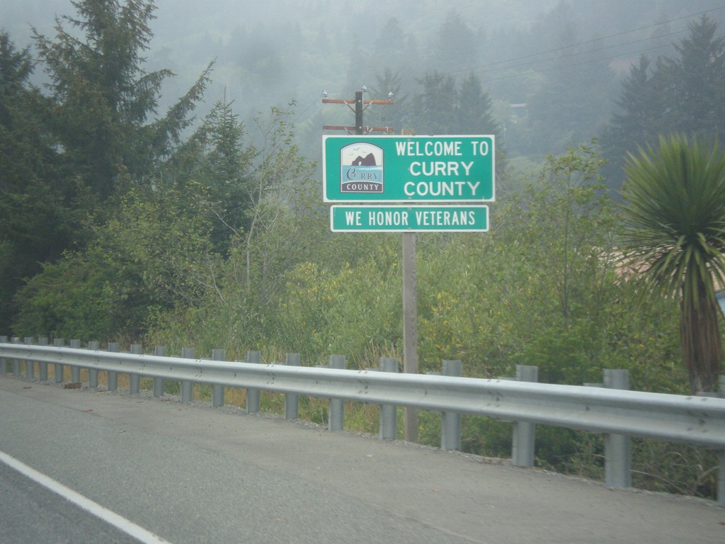
US-101 North - Curry County
Entering Curry County on US-101 north. Many Oregon counties, especially in western Oregon have graphics on the county line signs.
Taken 08-20-2015
Brookings
Curry County
Oregon
United States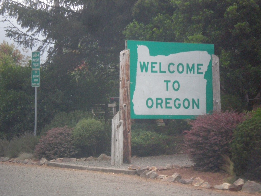
US-101 North - Welcome To Oregon
Welcome to Oregon on US-101 north at the California line.
Taken 08-20-2015
Brookings
Curry County
Oregon
United States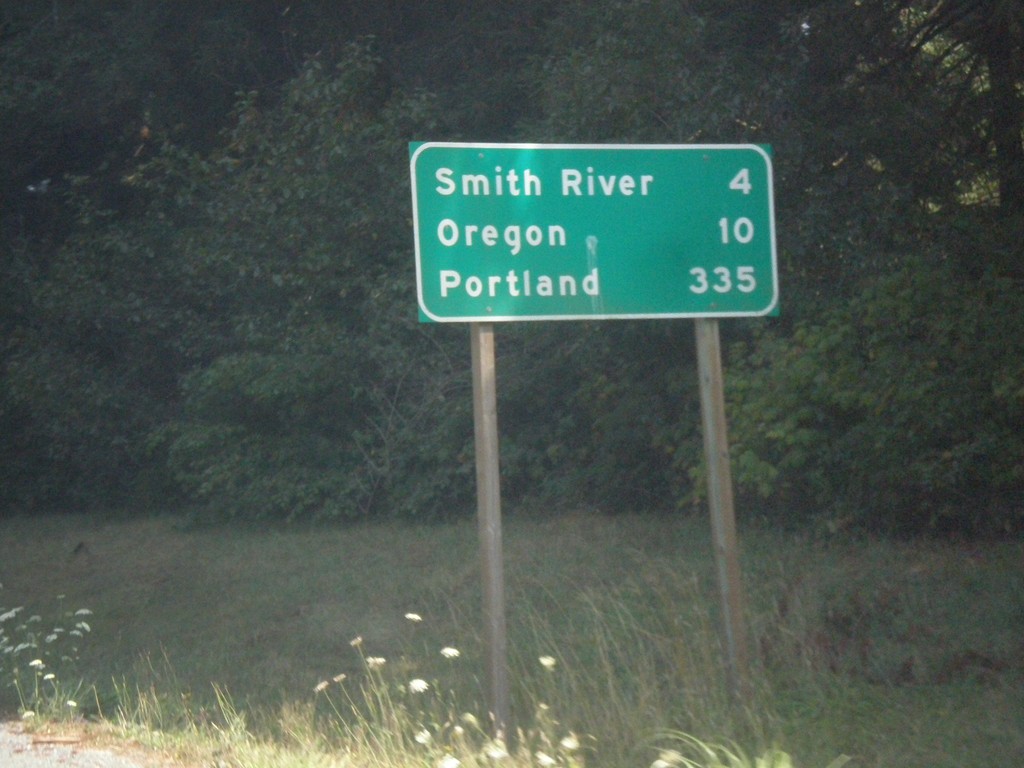
US-101 North - Distance Marker
Distance marker on US-101 north. Distance to Smith River, Oregon (state line), and Portland. Portland is not located along US-101.
Taken 08-20-2015
Smith River
Del Norte County
California
United States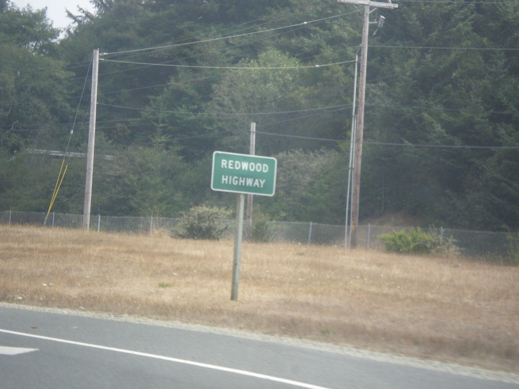
US-101 North - Redwood Highway
US-101 North is signed as Redwood Highway from the north side of the Golden Gate Bridge, to the junction with US-199. The Redwood Highway then follows US-199 into Oregon ending at Grants Pass.
Taken 08-20-2015
Crescent City
Del Norte County
California
United States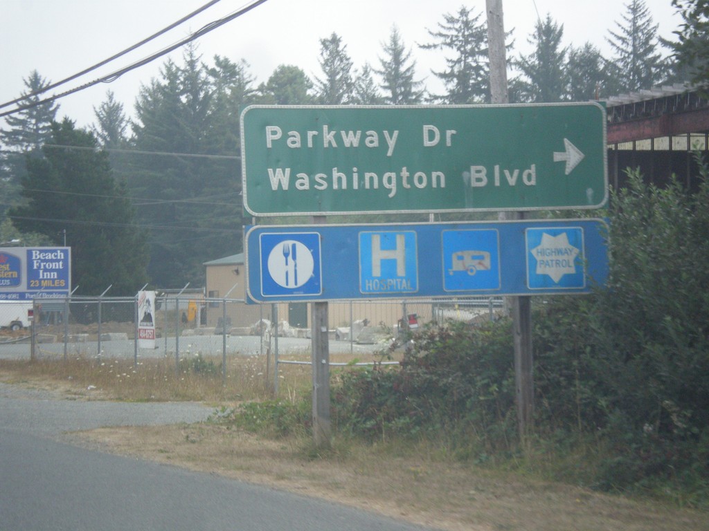
US-101 North - Parkway Dr./Washington Blvd. Jct.
US-101 North at Parkway Dr./Washington Blvd. Jct. in Crescent City. Southbound traffic, has an actual ramp and exit number for Washington Blvd. Freeway begins north of this intersection.
Taken 08-20-2015
Crescent City
Del Norte County
California
United States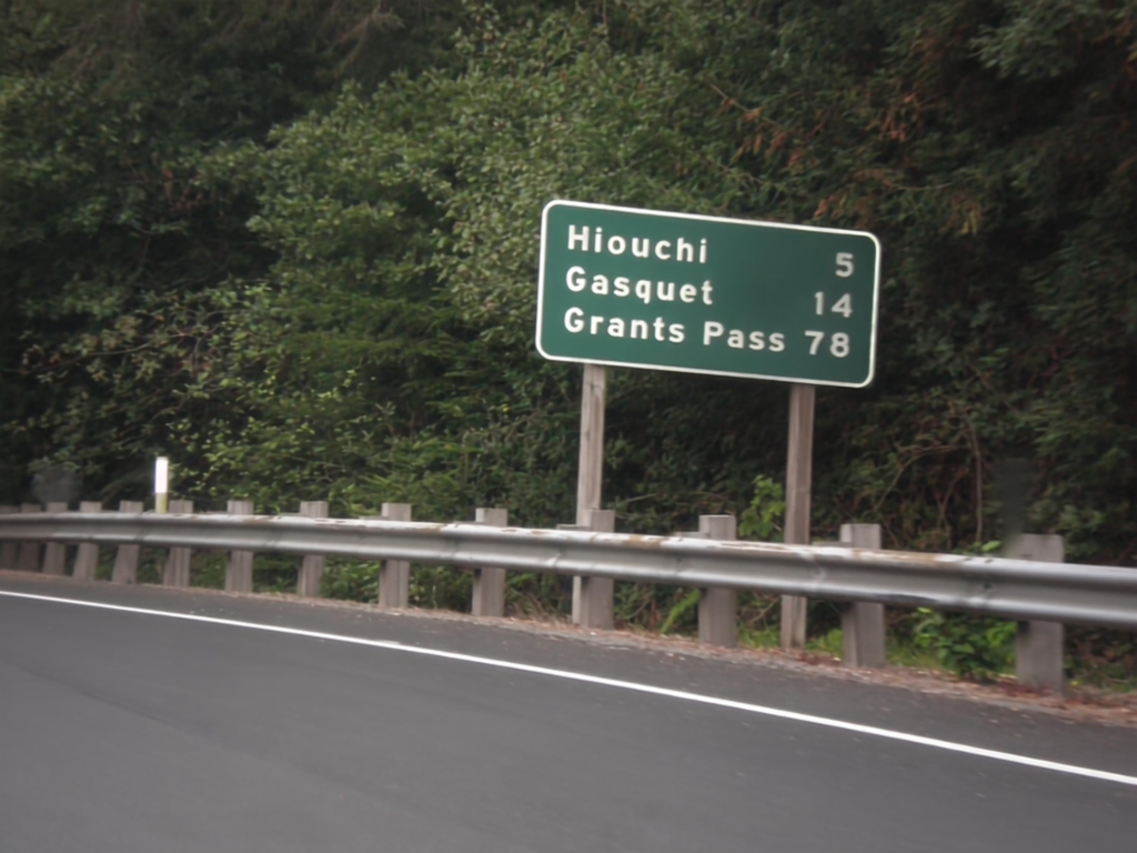
US-199 North - Distance Marker
Distance marker on US-199 north. Distance to Hiouchi, Gasquet, and Grants Pass (Oregon).
Taken 08-19-2015
 Crescent City
Del Norte County
California
United States
Crescent City
Del Norte County
California
United States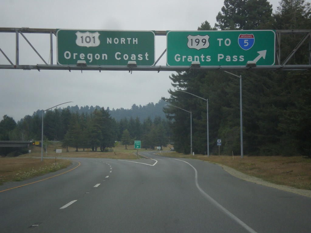
US-101 North at US-199/Grants Pass
US-101 north to Oregon Coast at US-199 to I-5 and Grants Pass. The is the end of the freeway for US-101 northbound.
Taken 08-19-2015
 Crescent City
Del Norte County
California
United States
Crescent City
Del Norte County
California
United States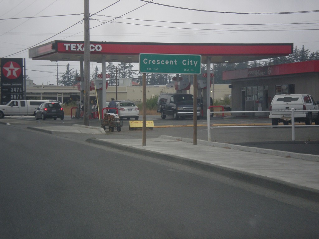
US-101 South - Crescent City
US-101 South - Entering Crescent City. Crescent City is the county seat of Del Norte County.
Taken 08-19-2015
Crescent City
Del Norte County
California
United States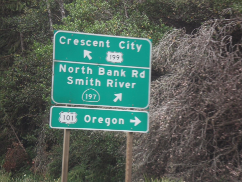
US-199 South At CA-197
US-199 west at CA-197/North Bank Road/Smith River. Use CA-197 for US-101 north access to Oregon, as a shortcut. US-199 continues west towards Crescent City.
Taken 08-19-2015
 Crescent City
Del Norte County
California
United States
Crescent City
Del Norte County
California
United States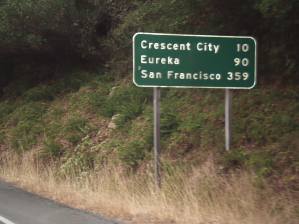
US-199 South - Distance Marker
Distance marker on US-199 south. Distance to Crescent City, Eureka, and San Francisco.
Taken 08-19-2015
Crescent City
Del Norte County
California
United States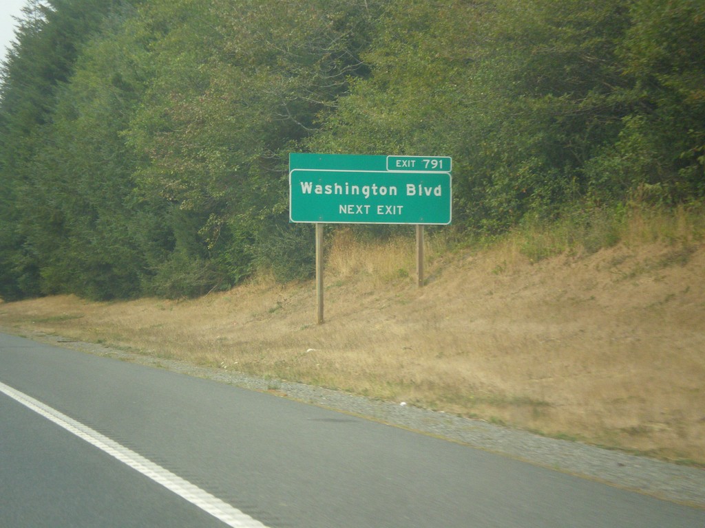
US-101 South - Exit 791
US-101 south approaching Exit 791 - Washington Blvd.
Taken 08-18-2015
Crescent City
Del Norte County
California
United States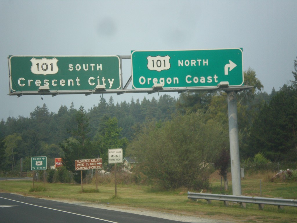
US-199 West Approaching US-101
US-199 west approaching US-101. Use US-101 north for the Oregon Coast. Use US-101 south for Crescent City. There is no direct connection to US-101 north from US-199 west. Traffic follows the Elk Valley Cross Road to reach US-101. This is the western terminus of US-199.
Taken 08-18-2015
Crescent City
Del Norte County
California
United States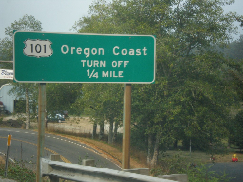
US-199 South Approaching Elk Valley Cross Road
US-199 South approaching Elk Valley Cross Road junction. Use Elk Valley Cross Road for US-101 north to the Oregon Coast. There is not a direct ramp from US-199 south to US-101 north.
Taken 08-18-2015
Crescent City
Del Norte County
California
United States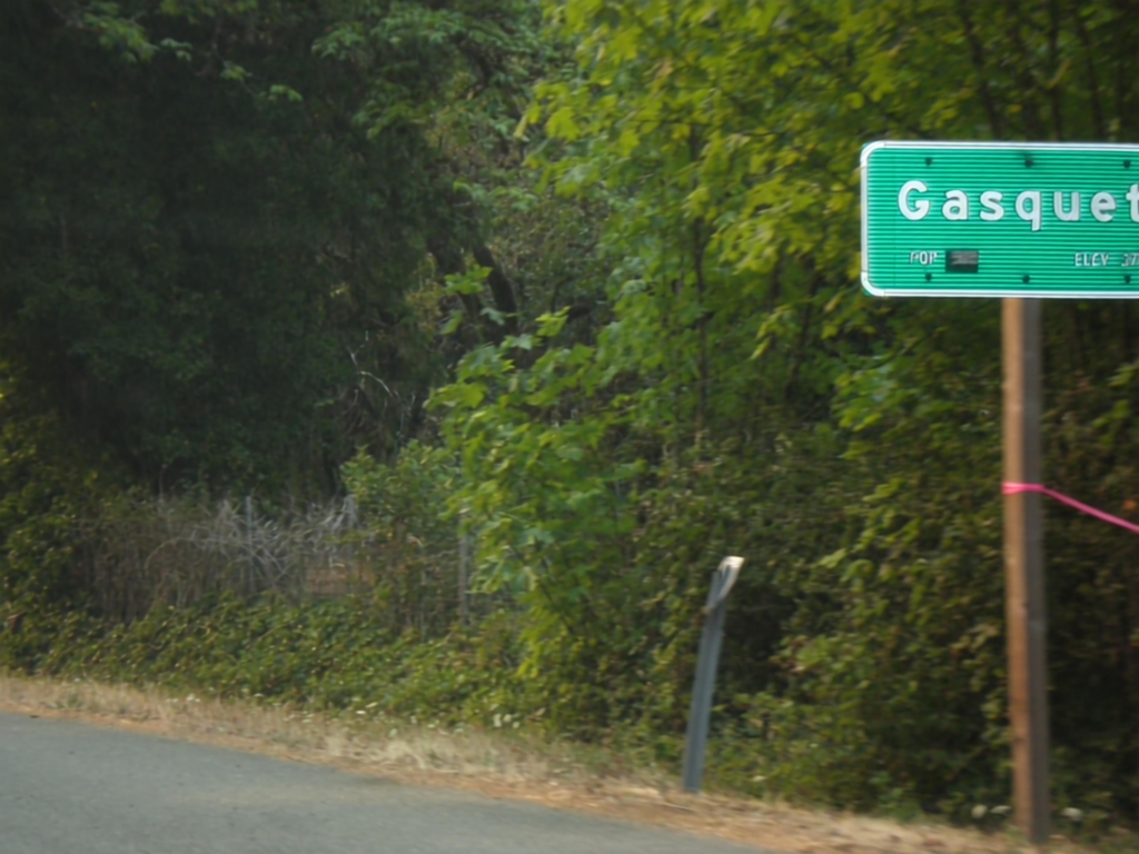
US-199 South - Gasquet
Entering the community of Gasquet on US-199 south.
Taken 08-17-2015
Gasquet
Del Norte County
California
United States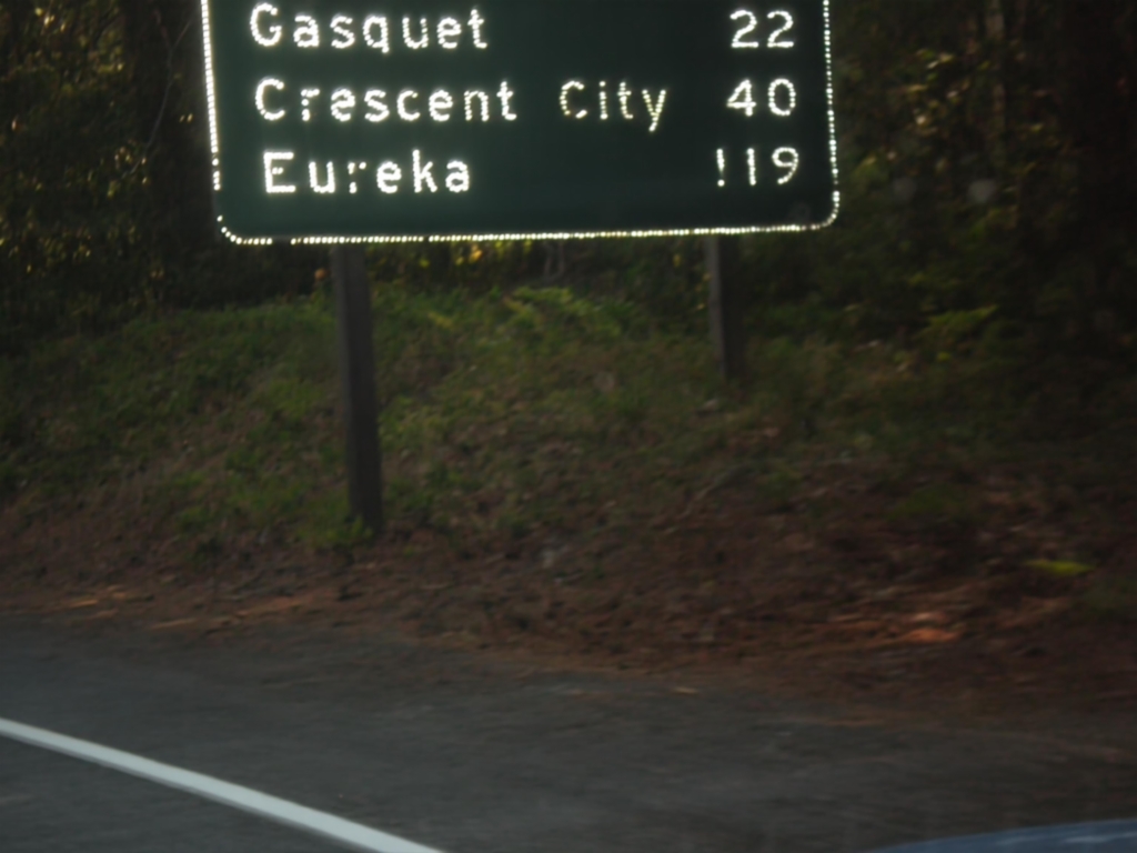
US-199 South - Distance Marker
First distance marker in California along US-199 south. Distance to Gasquet, Crescent City, and Eureka.
Taken 08-17-2015
Gasquet
Del Norte County
California
United States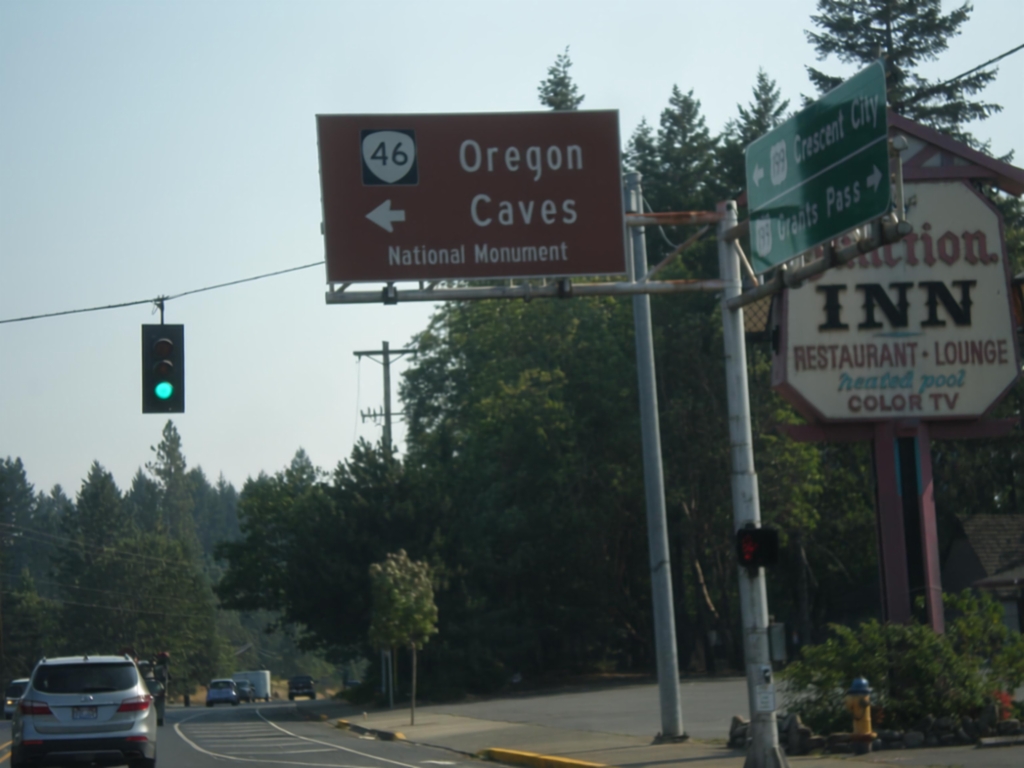
US-199 South at OR-46
US-199 south at OR-46 east to Oregon Cavess National Monument.
Taken 08-17-2015
 Cave Junction
Josephine County
Oregon
United States
Cave Junction
Josephine County
Oregon
United States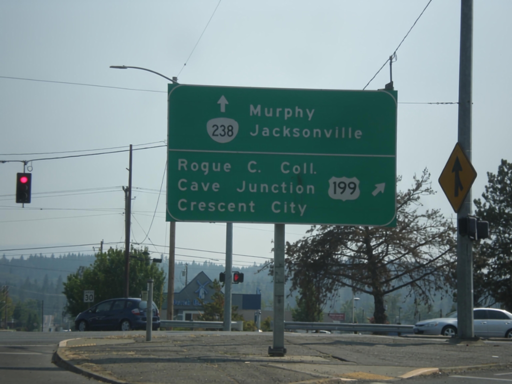
OR-238 South at US-199
OR-238 south at US-199. Turn right for US-199 south to Rogue Community College, Cave Junction, and Crescent City (CA). Continue south on OR-238 for Murphy and Jacksonville.
Taken 08-17-2015
 Grants Pass
Josephine County
Oregon
United States
Grants Pass
Josephine County
Oregon
United States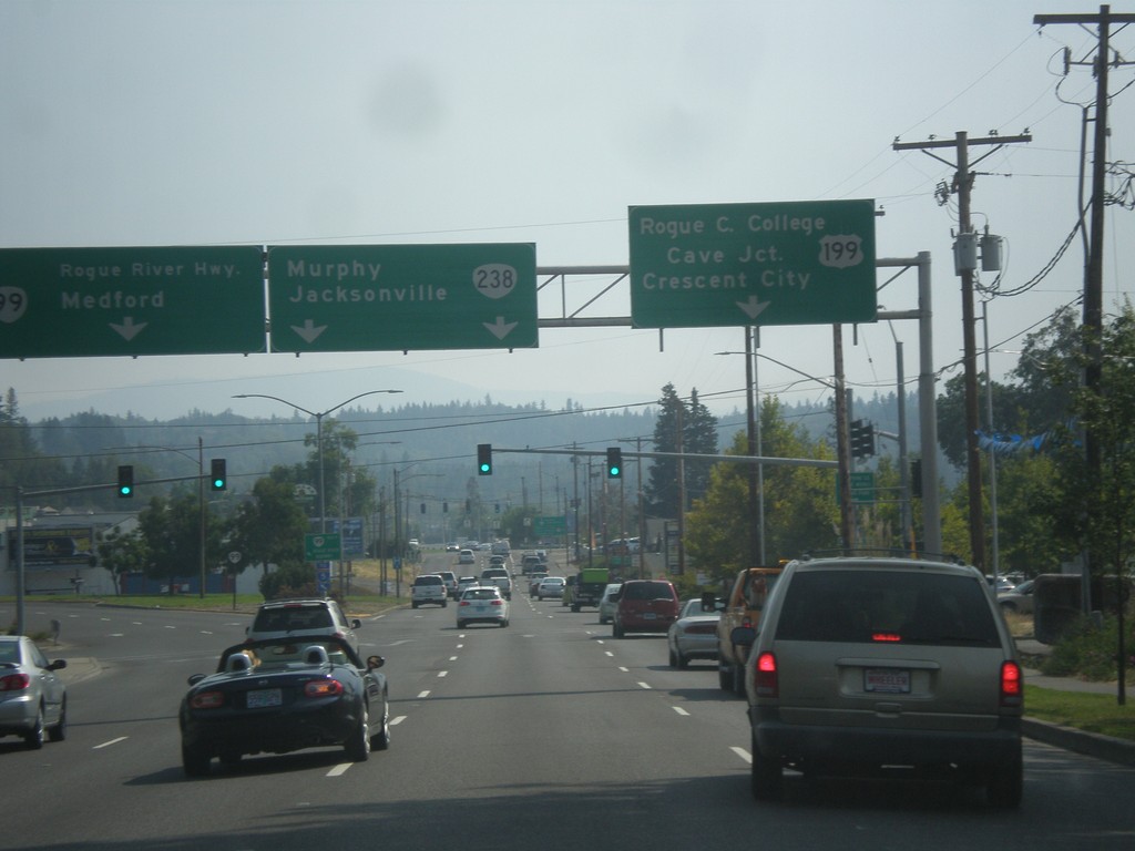
OR-99 South at US-199/OR-238
OR-99 south at US-199/OR-238 junction. Use left lane for OR-99 South/Rogue River Highway/Medford. Use middle lanes for OR-238/Murphy/Jacksonville. Use right lane for US-199 South/Rogue Community College/Cave Junction/Crescent City (CA).
Taken 08-17-2015
 Grants Pass
Josephine County
Oregon
United States
Grants Pass
Josephine County
Oregon
United States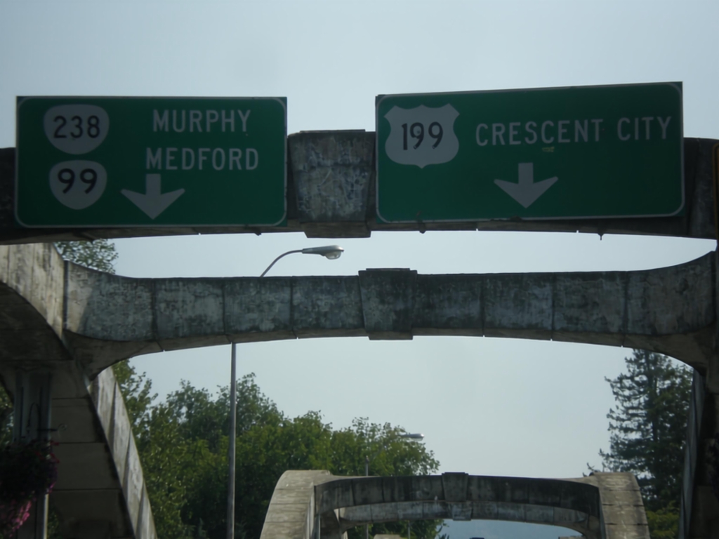
OR-99 South at US-199/OR-238
OR-99 south approaching US-199 and OR-238. Use left lane to continue south on OR-99 and for OR-238 to Murphy (and US-199 North to Medford). Use right lane for US-199 south to Crescent City (California).
Taken 08-17-2015
Grants Pass
Josephine County
Oregon
United States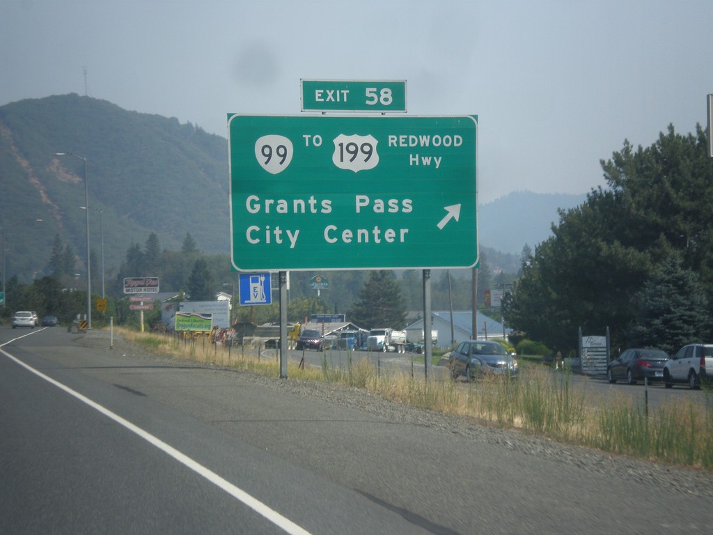
I-5 South - Exit 58
I-5 south at Exit 58 - OR-99/To US-191/Redwood Highway/Grants Pass/City Center.
Taken 08-17-2015
Grants Pass
Josephine County
Oregon
United States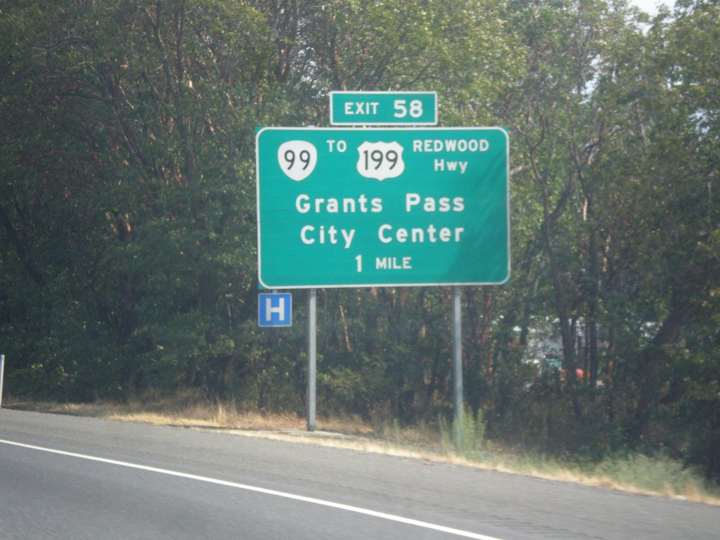
I-5 South - Exit 58
I-5 south approaching Exit 58 - OR-99/To US-199/Redwood Highway/Grants Pass/City Center. The name of the highway is common on many interstate exit signs, especially in western Oregon.
Taken 08-17-2015
Grants Pass
Josephine County
Oregon
United States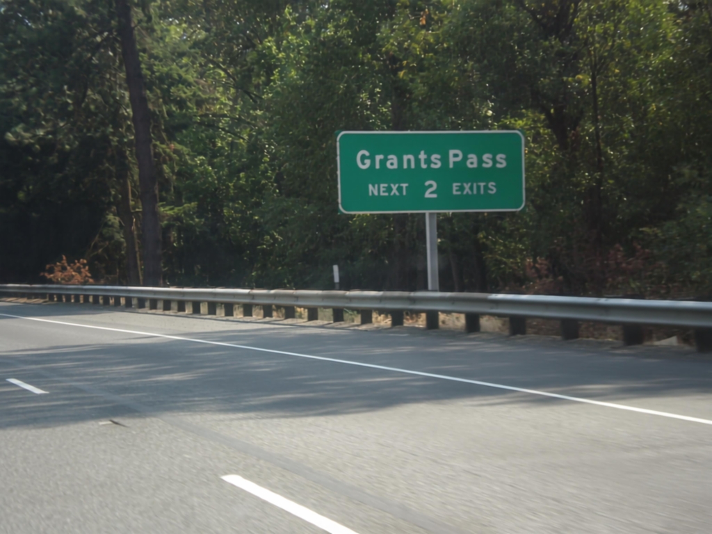
I-5 South - Grants Pass Exits
Grants Pass - Next 2 Exits on I-5 south.
Taken 08-17-2015
Grants Pass
Josephine County
Oregon
United States