Signs Tagged With Big Green Sign
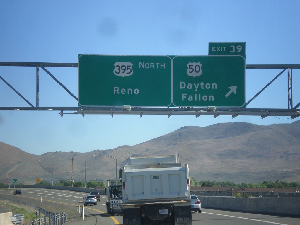
US-395 North - Exit 39
US-395 north at Exit 39 - US-50/Dayton/Fallon. Continue north on I-580/US-395 for Reno. The US-50/US-395 split ends here. I-580 begins here northbound, although it is not listed on the overhead. The first I-580 shield is north of this interchange.
Taken 06-15-2015


 Carson City
Nevada
United States
Carson City
Nevada
United States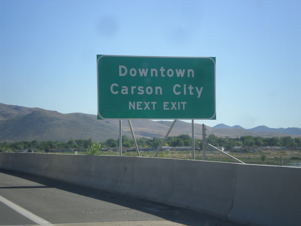
US-395 North/US-50 East - Downtown Carson City
US-395 North/US-50 East approaching Exit 39. Use Exit 39 for Downtown Carson City.
Taken 06-15-2015
Carson City
Nevada
United States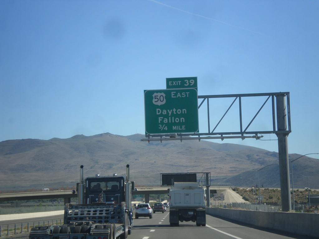
US-395 North/US-50 East - Exit 39
US-395 North/US-50 East approaching Exit 39 - US-50 East/Dayton/Fallon.
Taken 06-15-2015
Carson City
Nevada
United States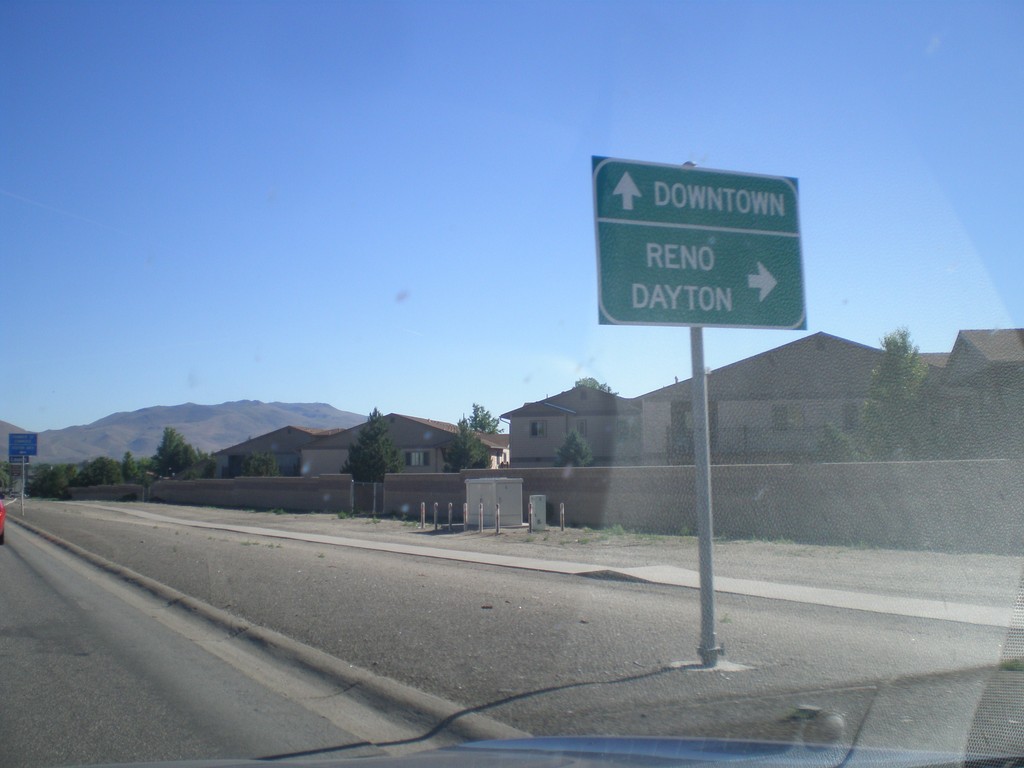
US-395 North/US-50 East Approaching Bus. US-395 and Fairview Ave.
US-395 North/US-50 East (Carson St.) approaching Bus. US-395 and Fairview Ave. Turn right on Fairview Ave. to continue on US-395 North/US-50 East to Dayton and Reno. Continue north on Carson St. for Bus. US-395 and Downtown (Carson City). The routing of US-395/US-50 along Fairview Ave. is temporary until the Carson City Freeway is completed.
Taken 06-15-2015
 Carson City
Nevada
United States
Carson City
Nevada
United States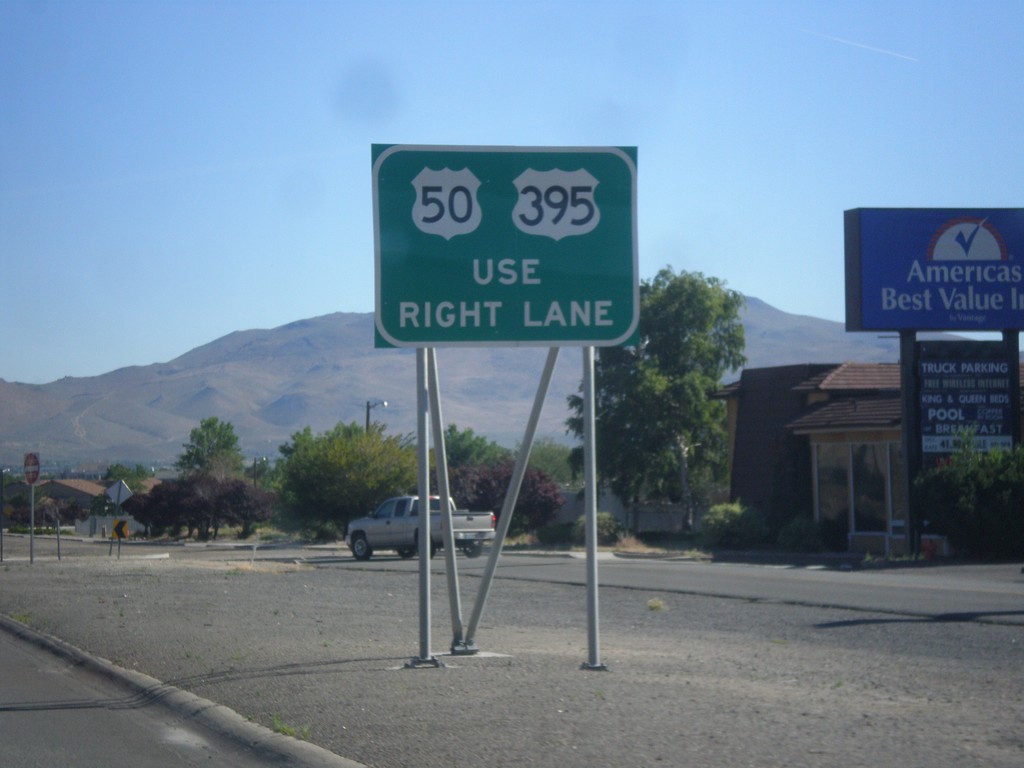
US-395 North/US-50 East Approaching Fairview Lane
US-395 North/US-50 East approaching Fairview Lane. Use right lane to continue on US-395/US-50.
Taken 06-15-2015
Carson City
Nevada
United States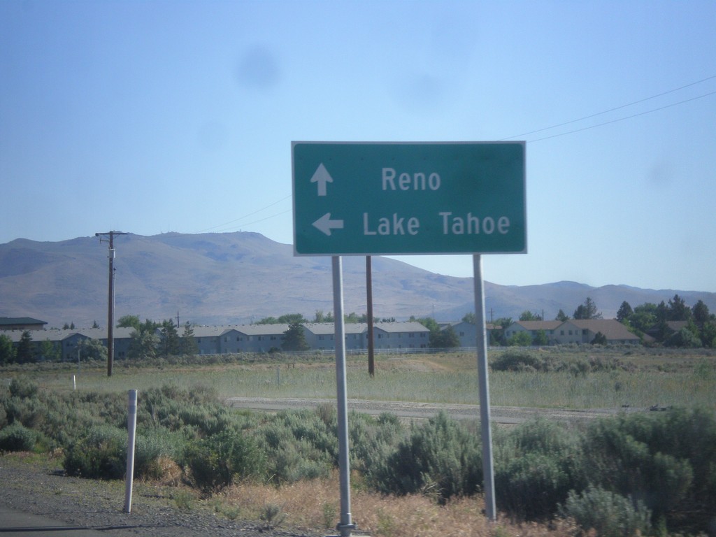
US-395 North at US-50
US-395 north at US-50. Use US-50 west for Lake Tahoe. Use US-50 East/US-395 North for Reno. US-50 East joins US-395 for a short distance north of this intersection. This will be the southern terminus of the Carson City Freeway.
Taken 06-15-2015
Carson City
Nevada
United States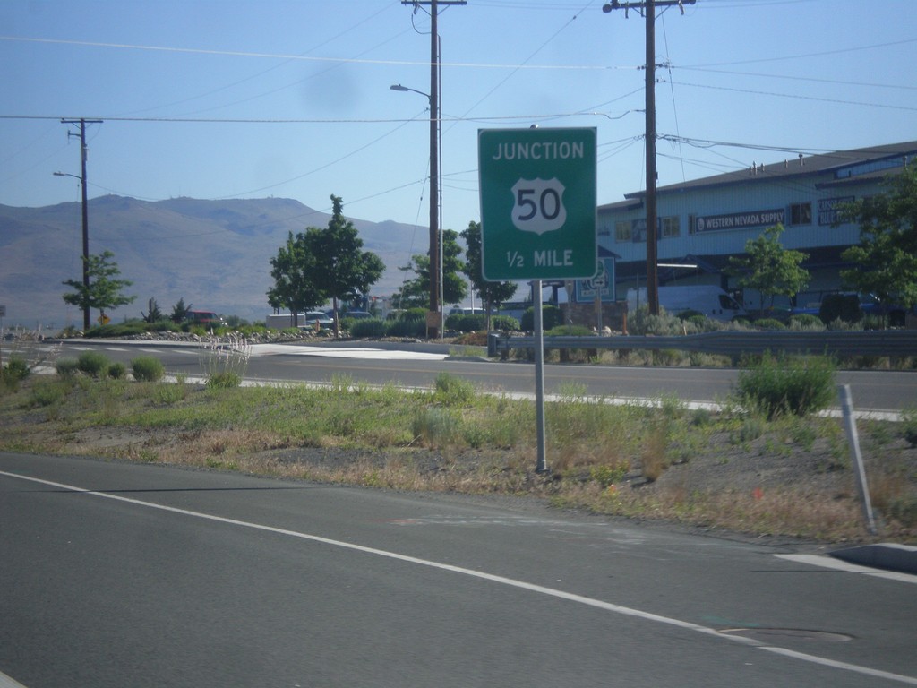
US-395 North Approaching US-50
US-395 North approaching US-50 in Carson City.
Taken 06-15-2015
Carson City
Nevada
United States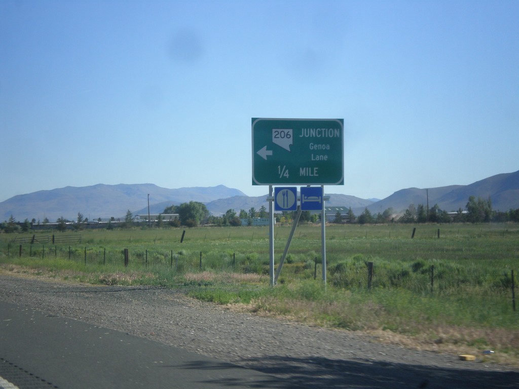
US-395 North Approaching NV-206
US-395 north approaching NV-206 - Genoa Lane.
Taken 06-15-2015
 Minden
Douglas County
Nevada
United States
Minden
Douglas County
Nevada
United States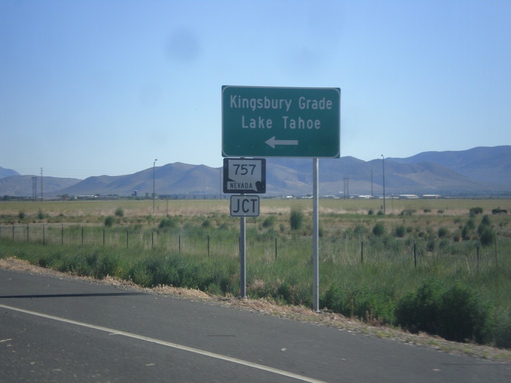
US-395 North Approaching NV-757
US-395 North approaching NV-757 west to Kingsbury Grade and Lake Tahoe.
Taken 06-15-2015
 Minden
Douglas County
Nevada
United States
Minden
Douglas County
Nevada
United States
End NV-88 North at US-395
End NV-88 North at US-395 in Minden. Use US-395 north for Carson City; US-395 south for Minden.
Taken 06-15-2015
 Minden
Douglas County
Nevada
United States
Minden
Douglas County
Nevada
United States
NV-88 North Approaching US-395
NV-88 North approaching US-395 in Minden.
Taken 06-15-2015
Minden
Douglas County
Nevada
United States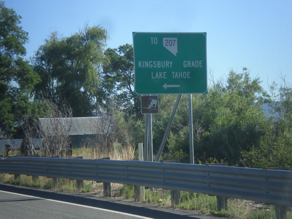
NV-88 North at Mottsville Lane/Waterloo Lane
NV-88 North at Mottsville Lane/Waterloo Lane. Use Mottsville Lane west for NV-207/Kingsbury Grade/Lake Tahoe.
Taken 06-15-2015
 Gardnerville
Douglas County
Nevada
United States
Gardnerville
Douglas County
Nevada
United States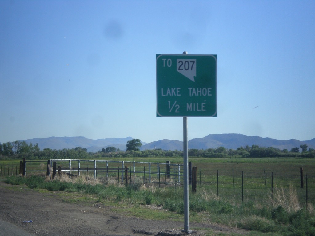
NV-88 North approaching Mottsville Lane/Waterloo Lane Jct.
NV-88 North approaching Mottsville Lane/Waterloo Lane junction. Use Mottsville Lane west for NV-207 and Lake Tahoe (via Kingsbury Grade).
Taken 06-15-2015
Gardnerville
Douglas County
Nevada
United States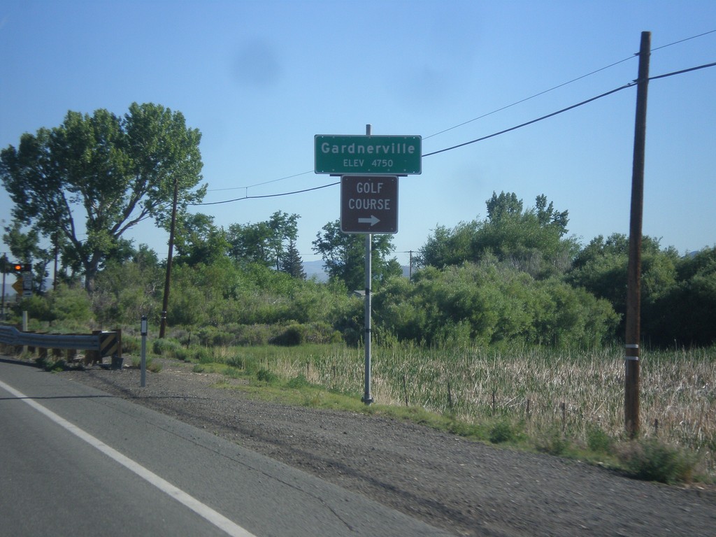
NV-88 North - Gardnerville
Gardnerville - Elevation 4750 Feet on NV-88 North. Approaching NV-756 junction (Centerville Lane) for access to Golf Course.
Taken 06-15-2015
 Gardnerville
Douglas County
Nevada
United States
Gardnerville
Douglas County
Nevada
United States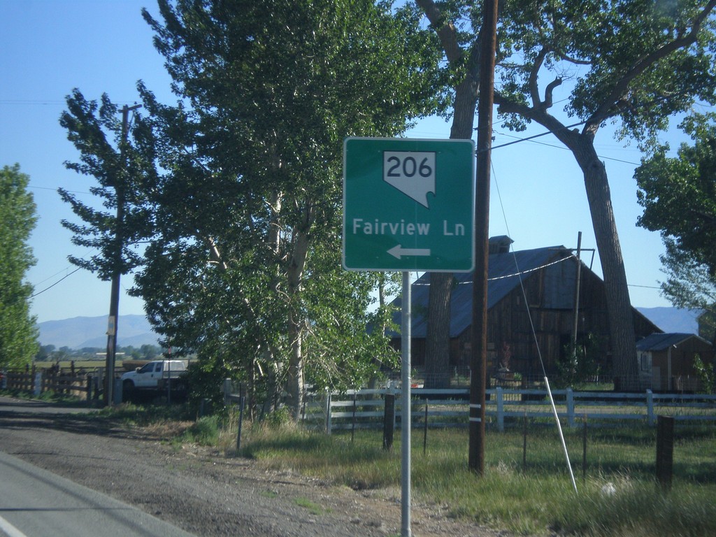
NV-88 North at NV-206
NV-88 north at NV-206/Fairview Lane.
Taken 06-15-2015
Gardnerville
Douglas County
Nevada
United States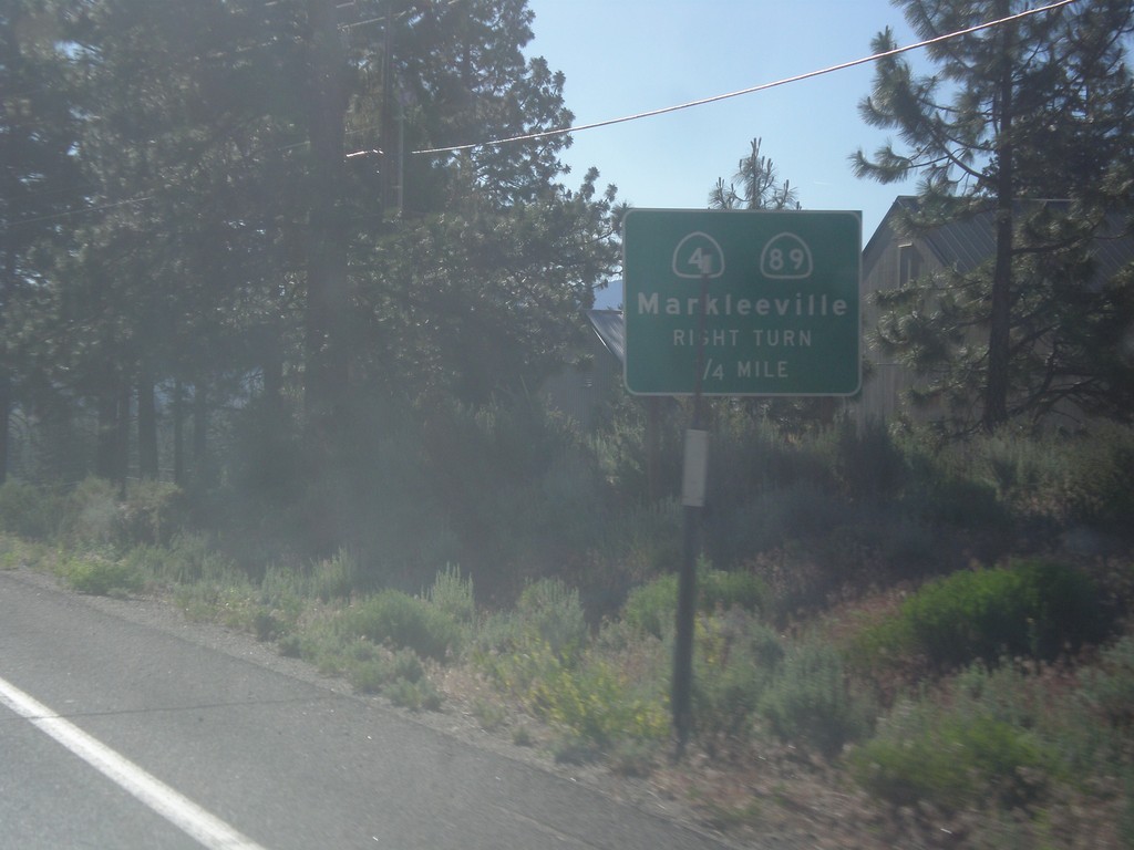
CA-88 East/CA-89 South Approaching CA-89 Jct.
CA-88 East/CA-89 South approaching CA-89/(To) CA-4 junction. Use CA-89 south for CA-4 and Markleeville.
Taken 06-15-2015


 Markleeville
Alpine County
California
United States
Markleeville
Alpine County
California
United States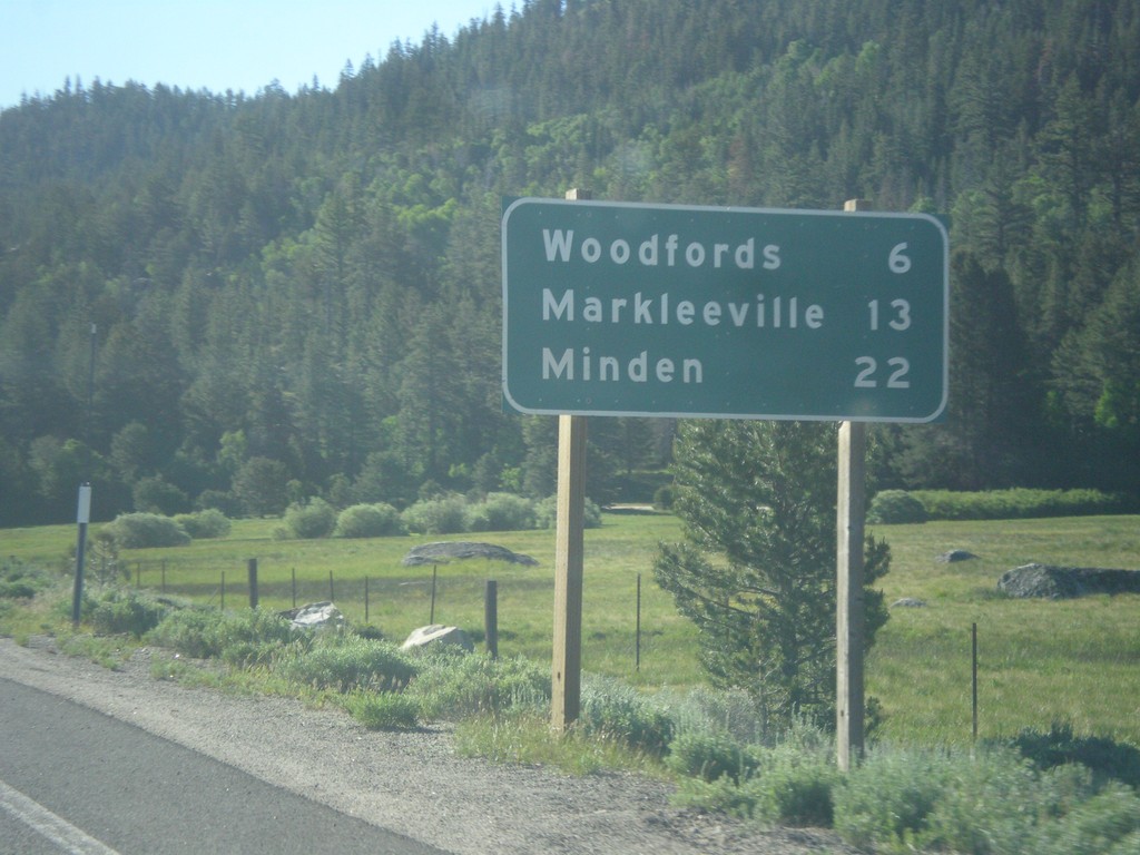
CA-88 East/CA-89 South - Distance Marker
Distance Marker on CA-88 East/CA-89 South. Distance to Woodfords, Markleeville, and Minden (Nevada).
Taken 06-15-2015
Markleeville
Alpine County
California
United States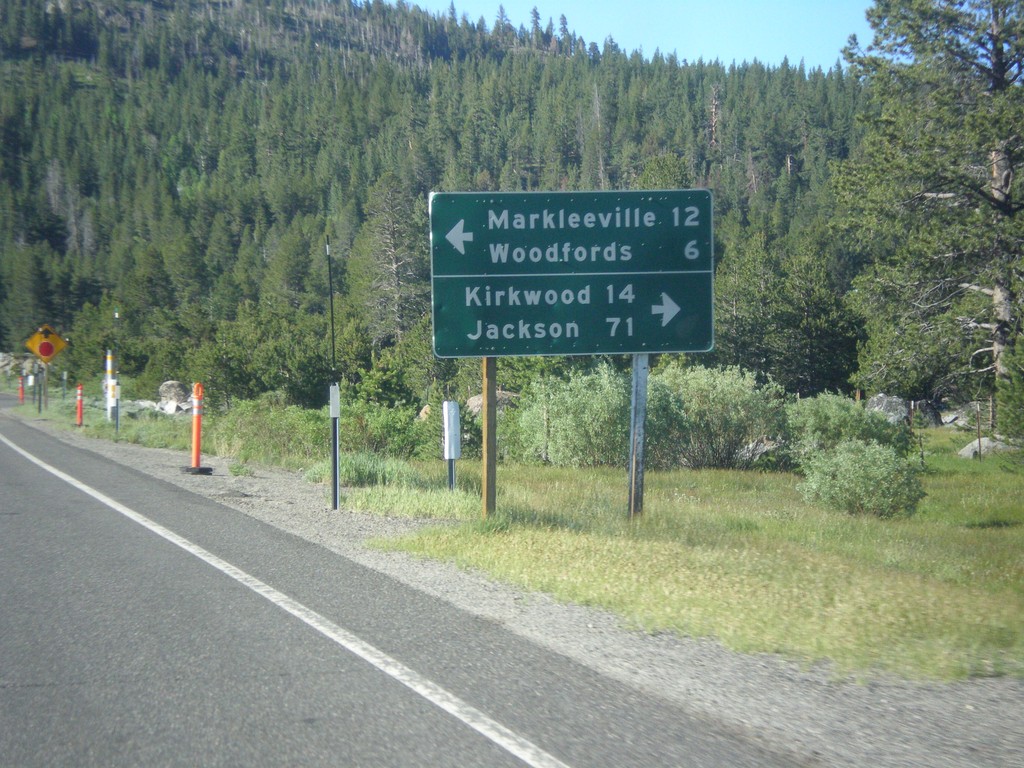
CA-89 South Approaching CA-88
CA-89 South approaching CA-88. Use CA-88 west for Kirkwood and Jackson. Use CA-89 South/CA-89 East for Markleeville and Woodfords. CA-89 south joins CA-88 east to Woodfords.
Taken 06-15-2015
Markleeville
Alpine County
California
United States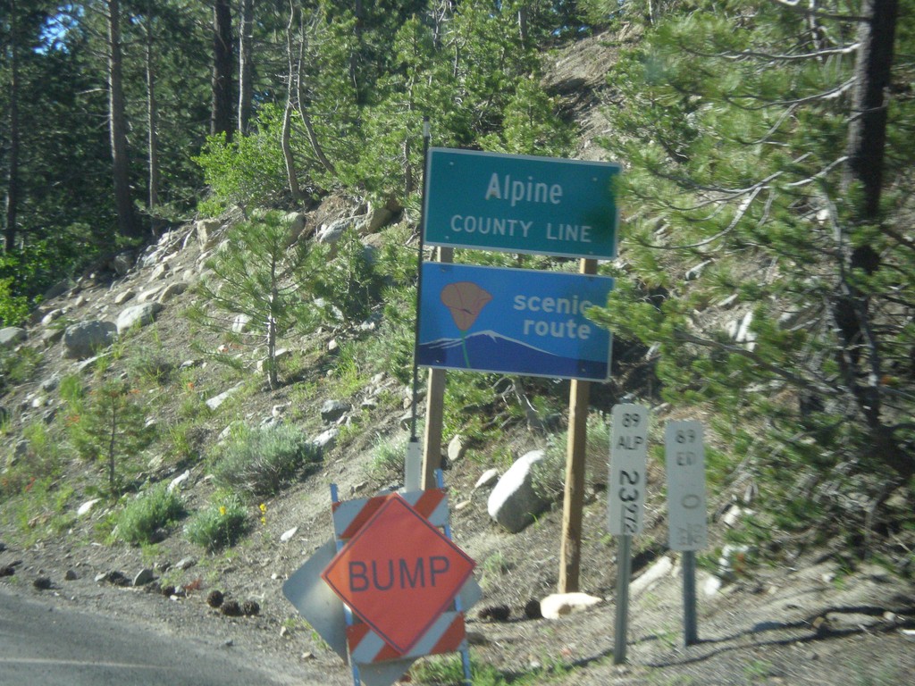
CA-89 South - Alpine County
Alpine County Line on CA-89 south. Alpine County is the smallest county in California by population. CA-89 is posted as a scenic route.
Taken 06-15-2015
Markleeville
Alpine County
California
United States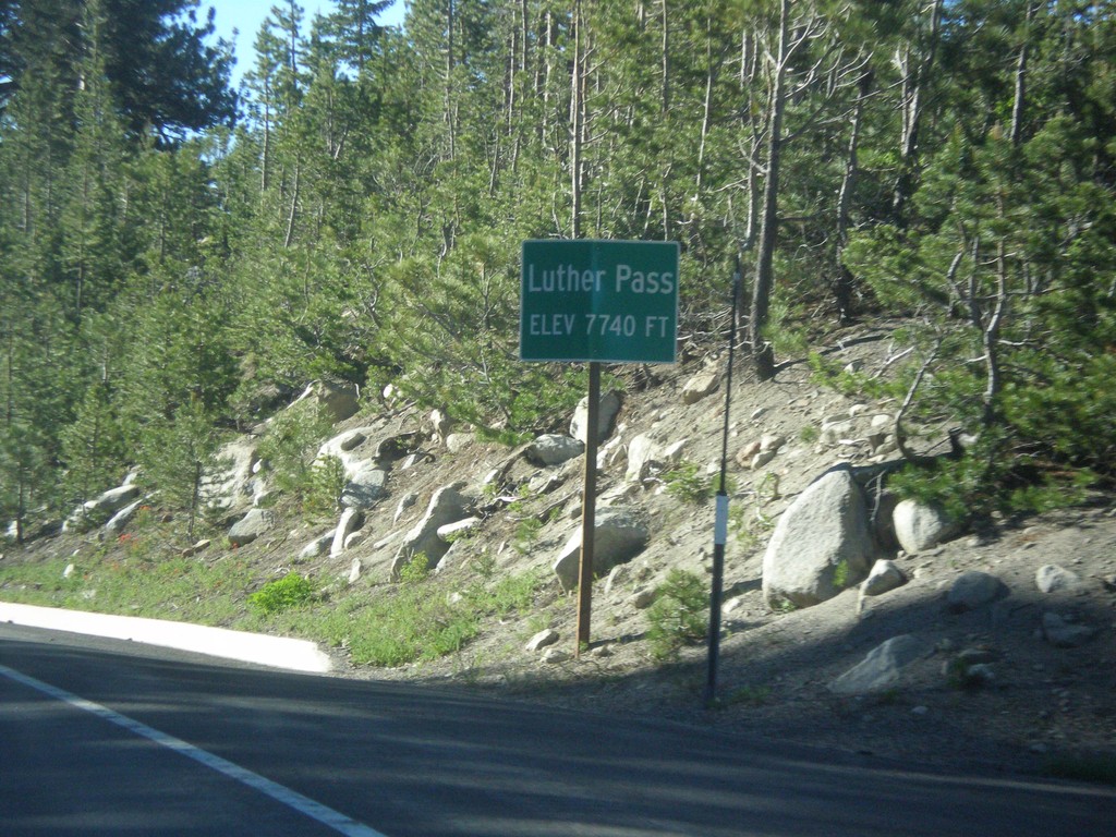
CA-89 South - Luther Pass
Luther Pass - Elevation 7740 Feet. Luther Pass is on the divide between the Lake Tahoe Basin (to the north) and the Carson River.
Taken 06-15-2015
Mesa Vista
Alpine County
California
United States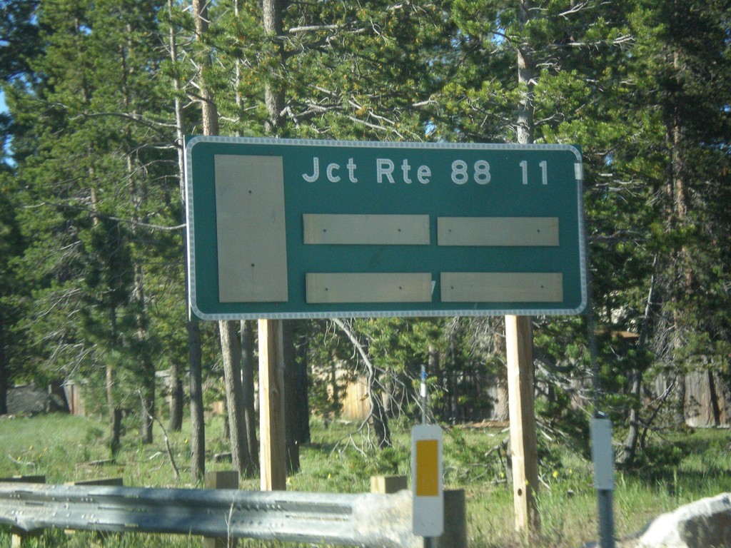
CA-89 South - Distance Marker
Distance marker on CA-89 south. Distance to CA-88 Junction.
Taken 06-15-2015
South Lake Tahoe
El Dorado County
California
United States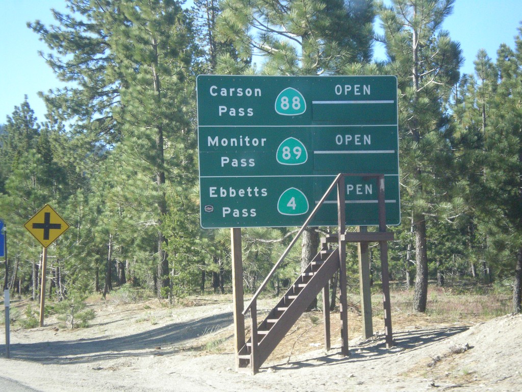
CA-89 South - Summit Information
Summit closure information on CA-89 south. Information for Ebbetts Pass (via CA-4), Monitor Pass (via CA-89) and Carson Pass (via CA-88). This photograph was taken in mid-June, and all of the passes are open. Carson Pass on CA-88 is the only pass that is typically opened year round.
Taken 06-15-2015
South Lake Tahoe
El Dorado County
California
United States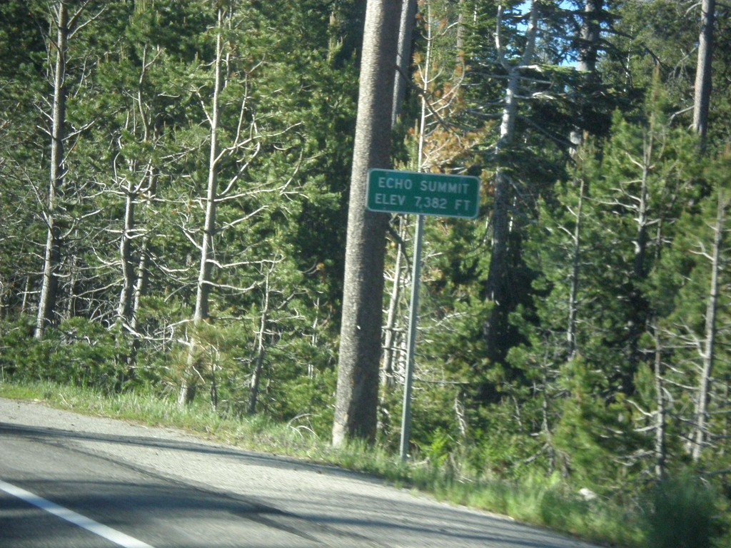
US-50 East - Echo Summit
US-50 each at Echo Summit -Elevation 7382 Feet. This is the summit of the Sierra Nevada on US-50 and the divide between the American River drainage and Lake Tahoe, which drains to the Truckee River.
Taken 06-15-2015
Nebelhorn
El Dorado County
California
United States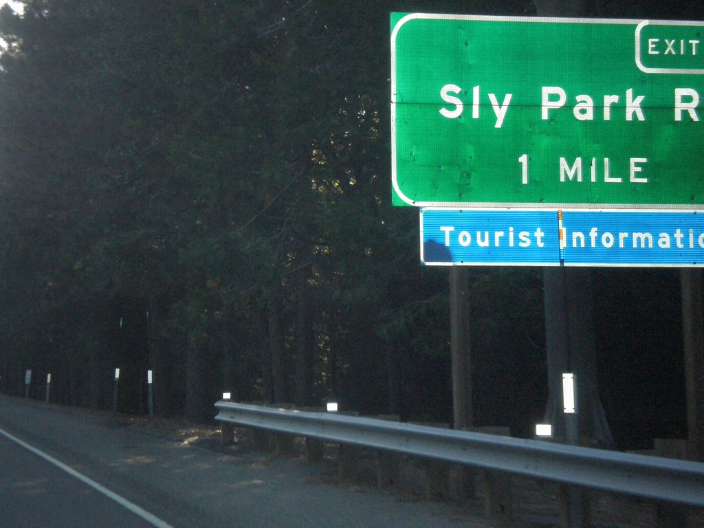
US-50 East - Exit 60
US-50 east approaching Exit 60 - Sly Park Road.
Taken 06-15-2015
Pollock Pines
El Dorado County
California
United States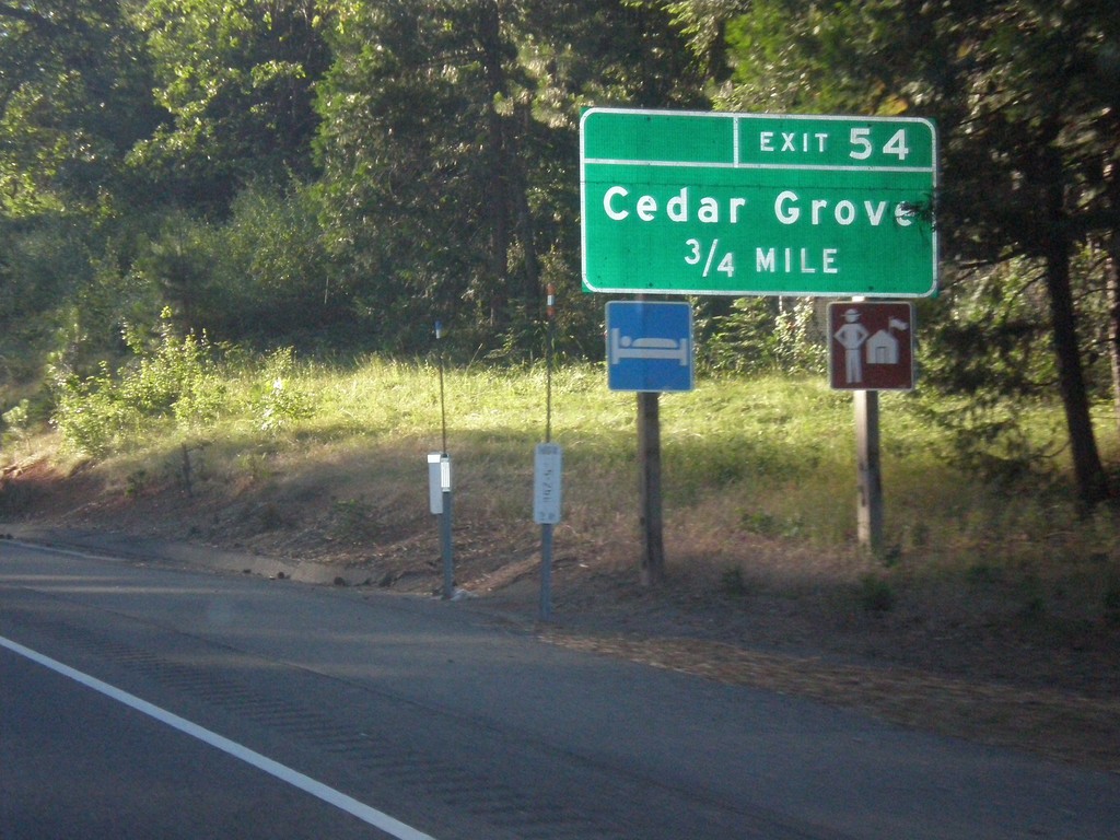
US-50 East - Exit 54
US-50 east approaching Exit 54 - Cedar Grove.
Taken 06-15-2015
Camino
El Dorado County
California
United States