Signs Tagged With Big Green Sign
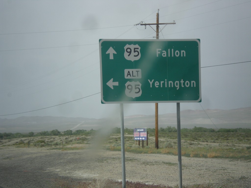
US-95 North at Alt. US-95 North
US-95 North at Alt. US-95 North to Yerington. Continue north on US-95 for Fallon. Alt. US-95 rejoins US-95 north of Fallon at I-80.
Taken 05-05-2014

 Schurz
Mineral County
Nevada
United States
Schurz
Mineral County
Nevada
United States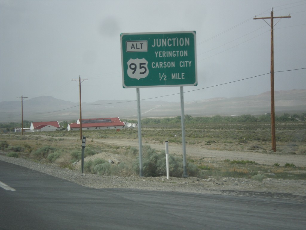
US-95 North Approaching Alt. US-95
US-95 north Approaching Alt. US-95 to Carson City and Yerington.
Taken 05-05-2014
Schurz
Mineral County
Nevada
United States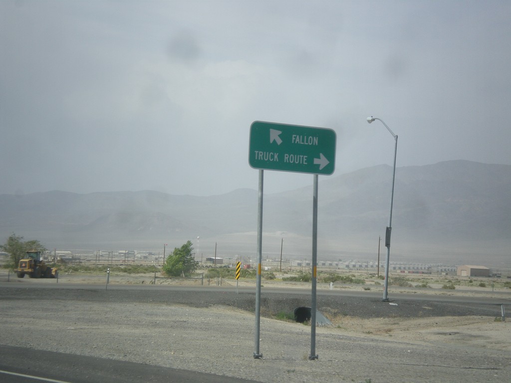
US-95 North at Hawthorne Truck Route
US-95 north at Hawthorne Truck Route. Merge right for the Truck Route, merge left for US-95 north towards Fallon.
Taken 05-05-2014
 Hawthorne
Mineral County
Nevada
United States
Hawthorne
Mineral County
Nevada
United States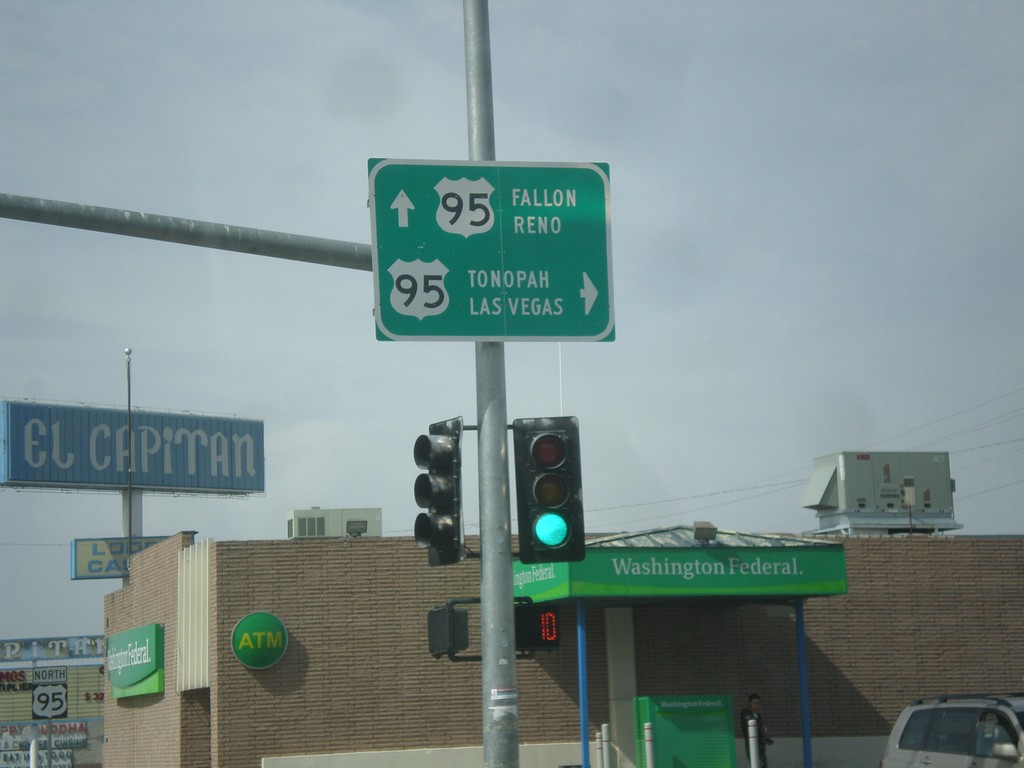
End NV-359 at US-95
End NV-359 at US-95. Turn right for US-95 south to Tonopah and Las Vegas. Continue straight for US-95 north to Fallon and Reno.
Taken 05-05-2014
 Hawthorne
Mineral County
Nevada
United States
Hawthorne
Mineral County
Nevada
United States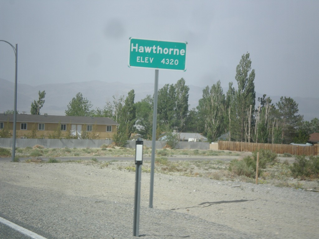
NV-359 North - Hawthorne
Hawthorne - Elevation 4,320 Feet on NV-359 North.
Taken 05-05-2014
Hawthorne
Mineral County
Nevada
United States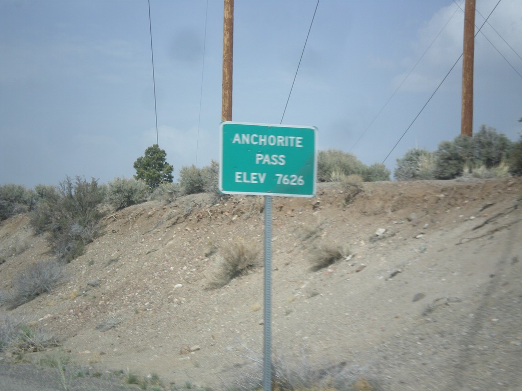
NV-359 North - Anchorite Pass
Anchorite Pass - Elevation 7,626 Feet on NV-359 North.
Taken 05-05-2014
Mina
Mineral County
Nevada
United States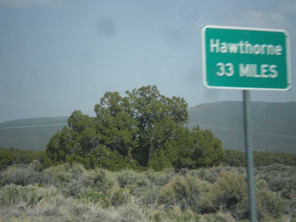
NV-359 North - Distance Marker
Distance marker on NV-359 north. Distance to Hawthorne. This sort of sign is common in Nevada where there is only one city listed as a destination.
Taken 05-05-2014
Mina
Mineral County
Nevada
United States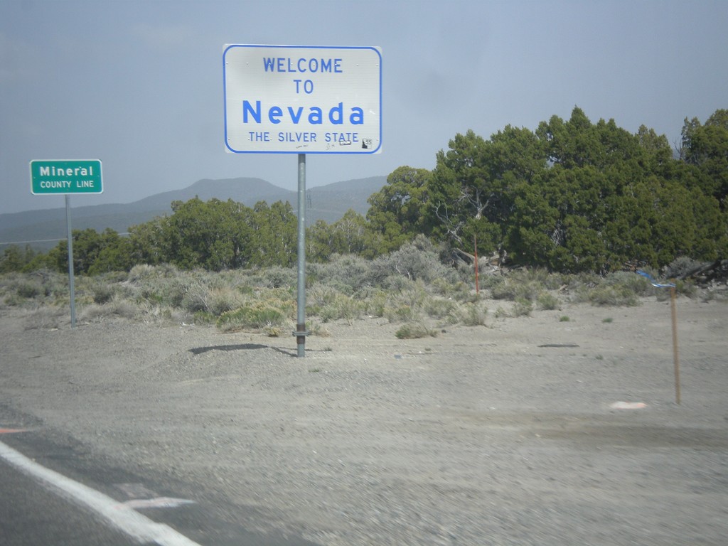
Welcome To Nevada - NV-359 North
Welcome to Nevada - The Silver State, Mineral County Line on NV-359 north. Taken at the Nevada - California state line.
Taken 05-05-2014
Mina
Mineral County
Nevada
United States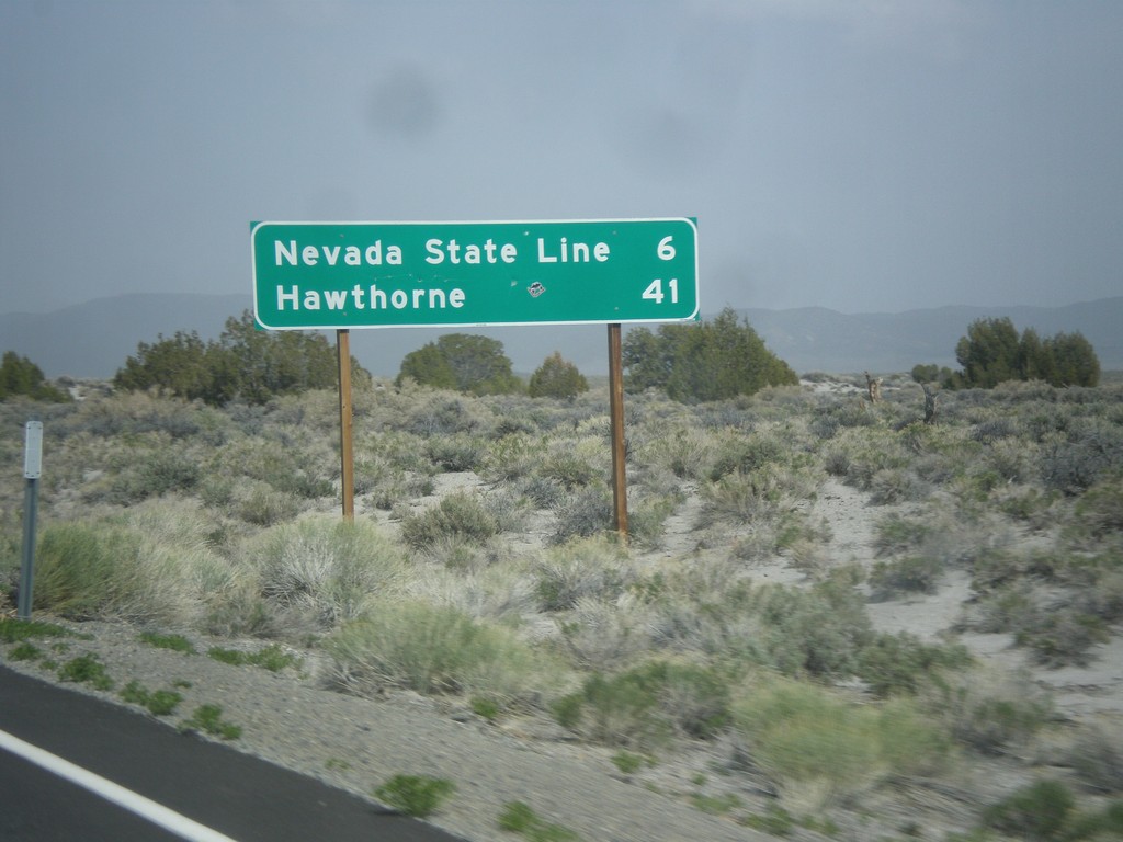
CA-167 East - Distance Marker
Distance marker on CA-167 east. Distance to Nevada State Line and Hawthorne (Nevada).
Taken 05-05-2014
 Lee Vining
Mono County
California
United States
Lee Vining
Mono County
California
United States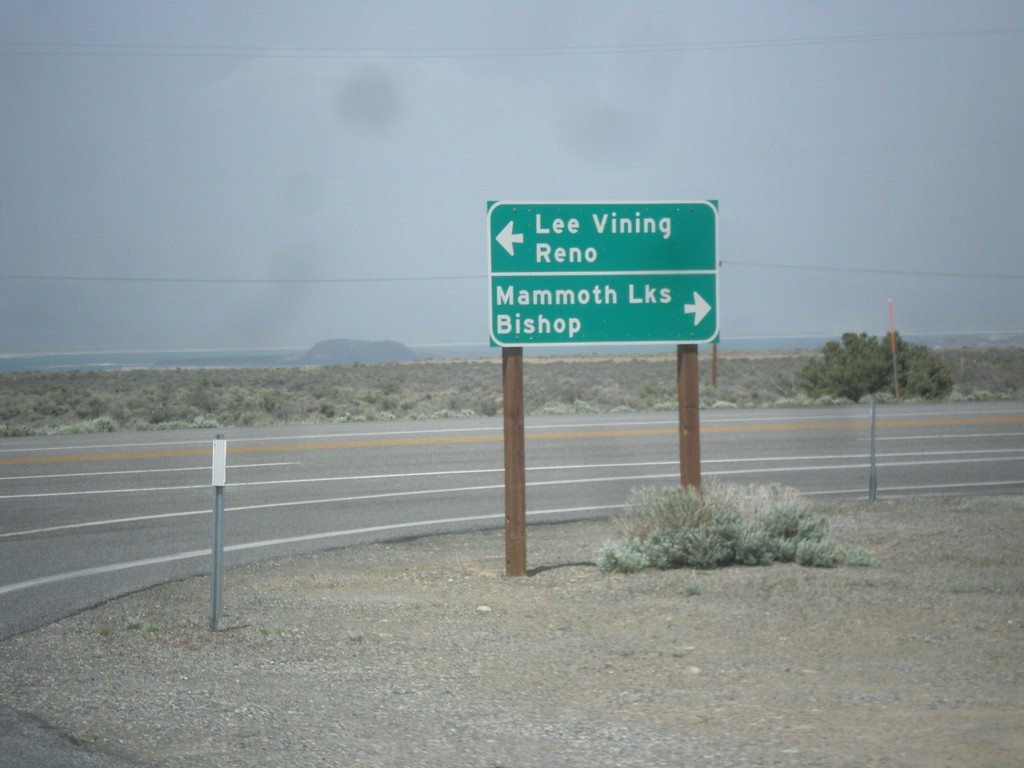
CA-120 East at US-395
CA-120 east at US-395. Turn right for US-395 south to Bishop and Mammoth Lakes. Turn left for US-395 north to Lee Vining and Reno. Turn right to continue east on CA-120.
Taken 05-05-2014

 Lee Vining
Mono County
California
United States
Lee Vining
Mono County
California
United States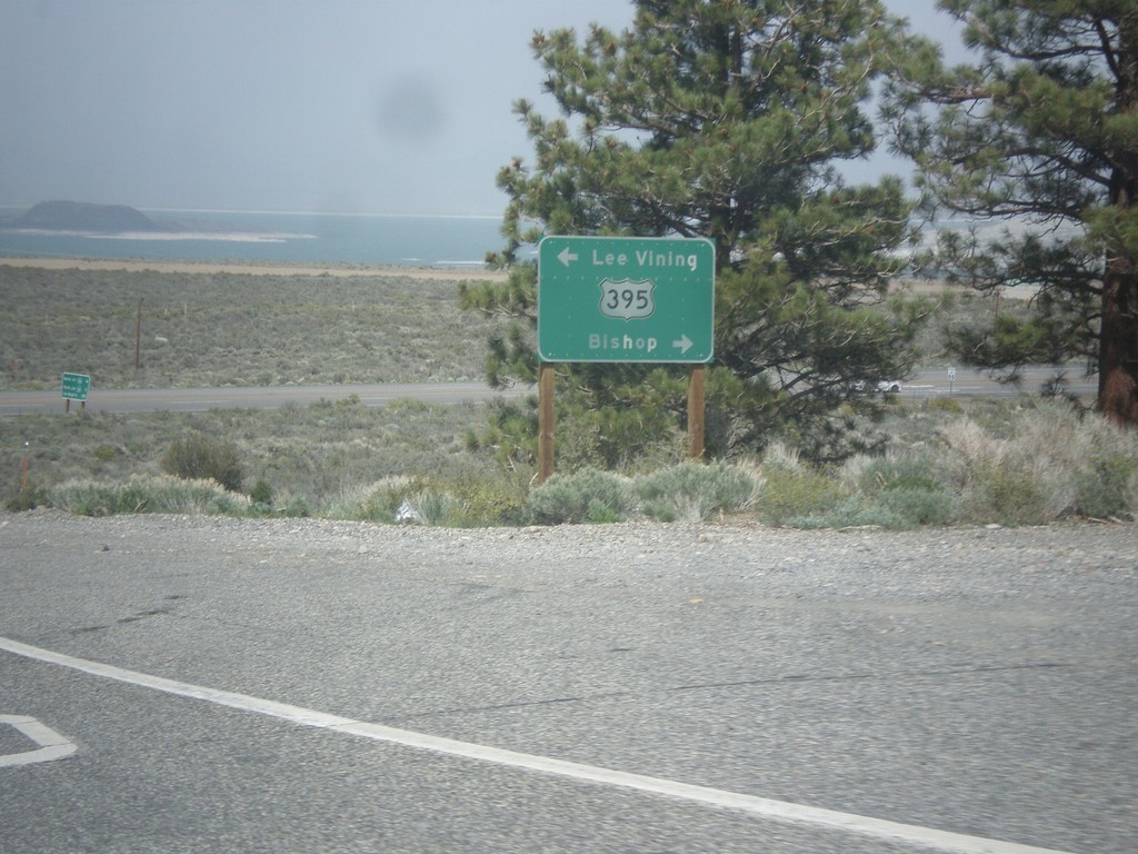
CA-120 East at US-395
CA-120 east at US-395. Turn right for US-395 north to Lee Vining; left for US-395 south to Bishop. Turn right on US-395 to continue east on CA-120.
Taken 05-05-2014
Lee Vining
Mono County
California
United States
CA-120 East - Mono County Line
Mono County Line on CA-120 east at Tioga Pass.
Taken 05-05-2014
Lee Vining
Mono County
California
United States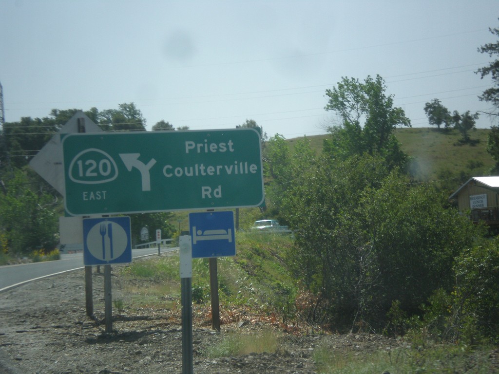
CA-120 East - Priest Coulterville Road
CA-120 East at Priest Coulterville Road in Tuolumne County.
Taken 05-05-2014
Jamestown
Tuolumne County
California
United States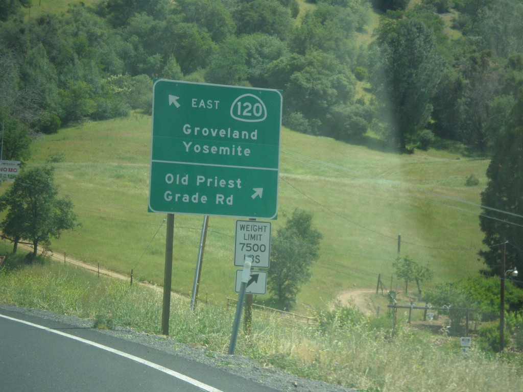
CA-120 East - Old Priest Grade Road
CA-120 East at Old Priest Grade Road. Continue east on CA-120 for Groveland and Yosemite.
Taken 05-05-2014
Moccasin
Tuolumne County
California
United States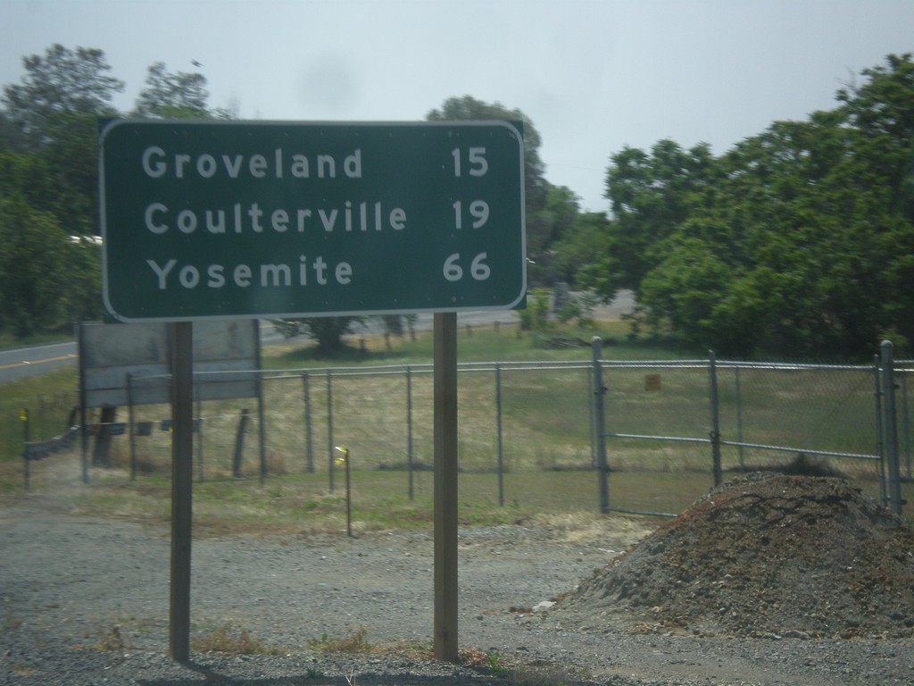
CA-49 South/CA-120 East - Distance Marker
Distance marker on CA-49 South/CA-120 East. Distance to Groveland, Coulterville, and Yosemite.
Taken 05-05-2014
 Chinese Camp
Tuolumne County
California
United States
Chinese Camp
Tuolumne County
California
United States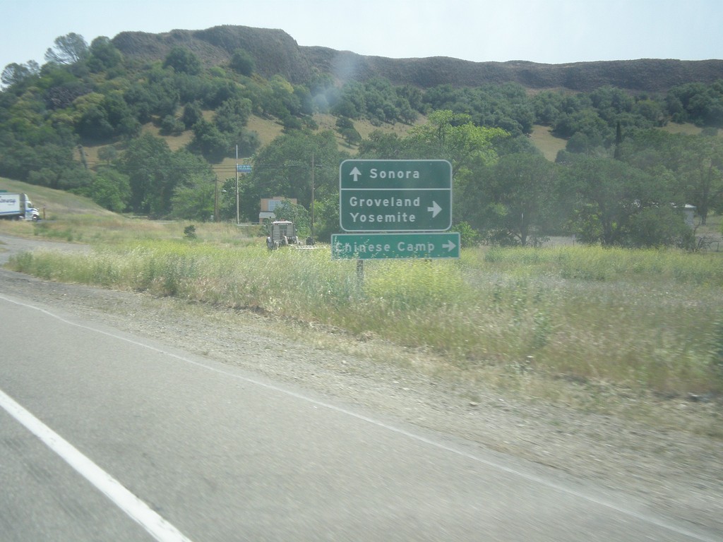
CA-108/CA-120 East at CA-120
CA-108/CA-120 East at CA-120 east to Groveland, Yosemite, and Chinese Camp. Continue east on CA-108 for Sonora.
Taken 05-05-2014
 Jamestown
Tuolumne County
California
United States
Jamestown
Tuolumne County
California
United States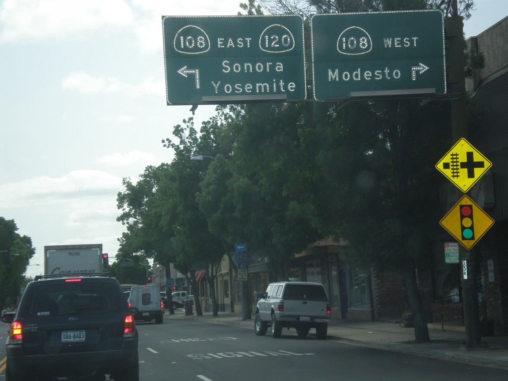
CA-120 East at CA-108
CA-120 east at CA-108 in Oakdale. Turn right for CA-108 west to Modesto. Turn left for CA-108/CA-120 east to Sonora and Yosemite. CA-120 joins CA-108 eastbound to the Chinese Camp area.
Taken 05-05-2014
Oakdale
Stanislaus County
California
United States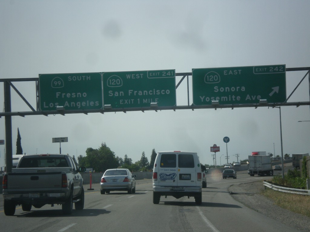
CA-99 South - Exits 242 and 241
CA-99 south at Exit 242 - CA-120 East/Sonora/Yosemite Ave. Approaching Exit 241 - CA-120 West/San Francisco. Continue south on CA-99 for Fresno and Los Angeles. CA-120 joins CA-99 south briefly through Manteca.
Taken 05-05-2014
 Manteca
San Joaquin County
California
United States
Manteca
San Joaquin County
California
United States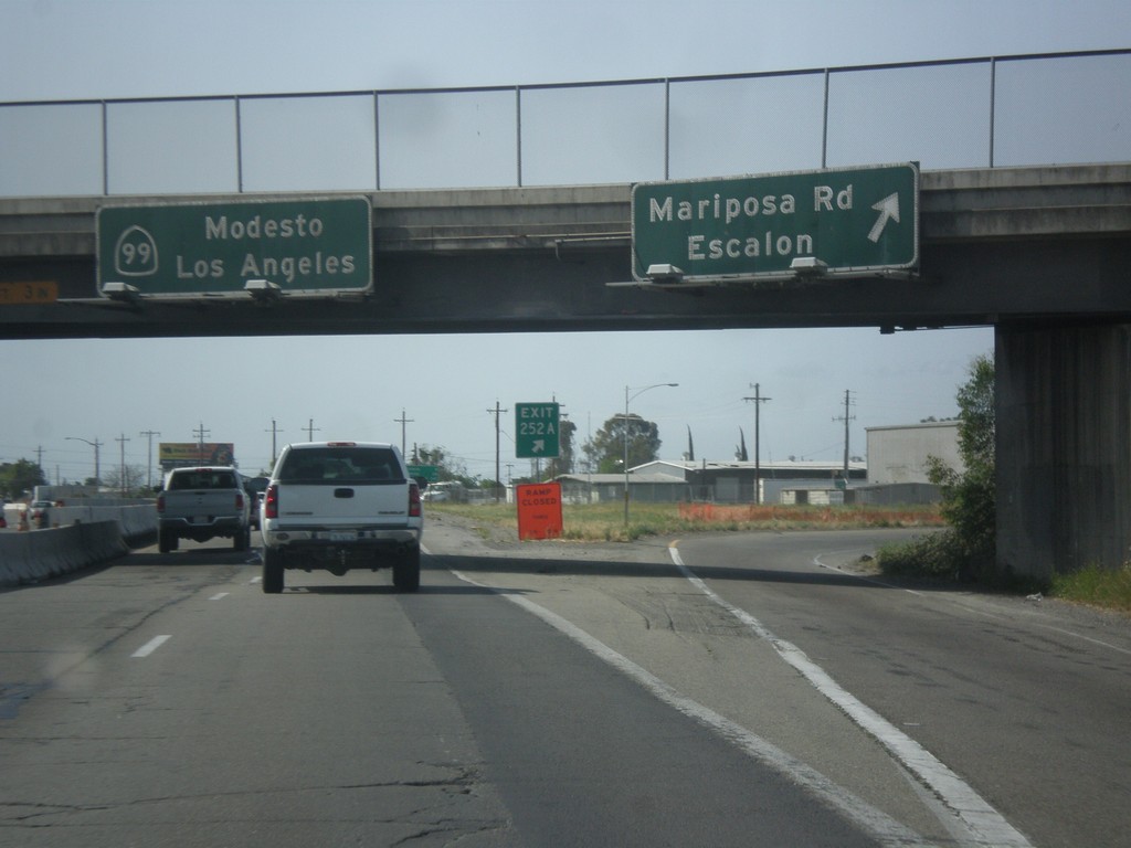
CA-99 South - Exit 252A
CA-99 south at Exit 252A - Mariposa Road/Escalon. Continue south on CA-99 for Modesto and Los Angeles.
Taken 05-05-2014
Stockton
San Joaquin County
California
United States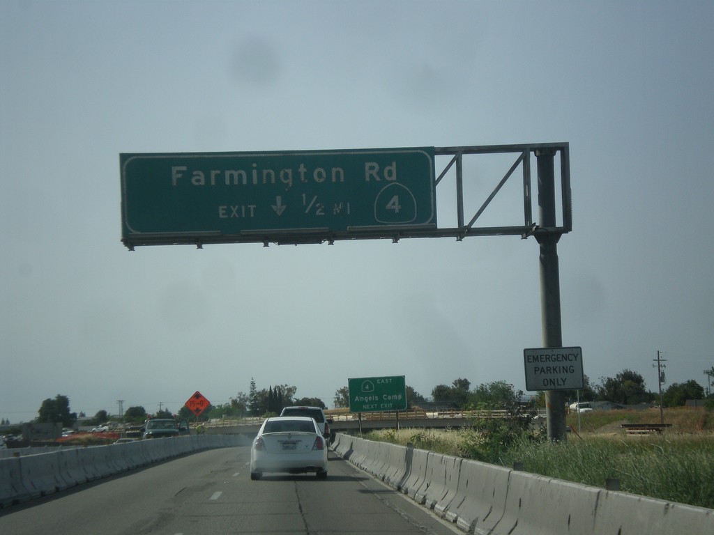
CA-99 South/CA-4 East - Exit 252B
CA-99 South/CA-4 East approaching Exit 252B - CA-4/Farmington Road. CA-4 leaves CA-99 southbound here.
Taken 05-05-2014
 Stockton
San Joaquin County
California
United States
Stockton
San Joaquin County
California
United States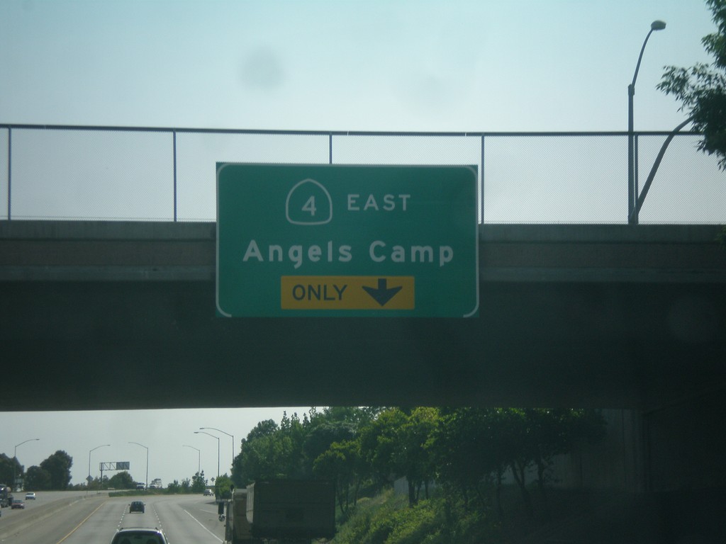
CA-99 South/CA-4 East Approaching CA-4 East
CA-99 South/CA-4 East Approaching CA-4 East/Angels Camp. This is Exit 252B (not signed). CA-4 east leaves CA-99 at Exit 252B.
Taken 05-05-2014
Stockton
San Joaquin County
California
United States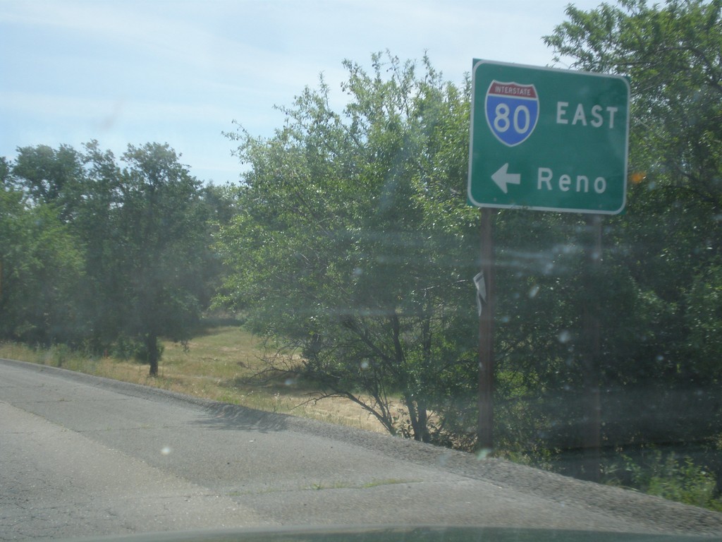
Horseshoe Bar Road East at I-80 East
Horseshoe Bar Road East at I-80 East to Reno.
Taken 05-04-2014
 Loomis
Placer County
California
United States
Loomis
Placer County
California
United States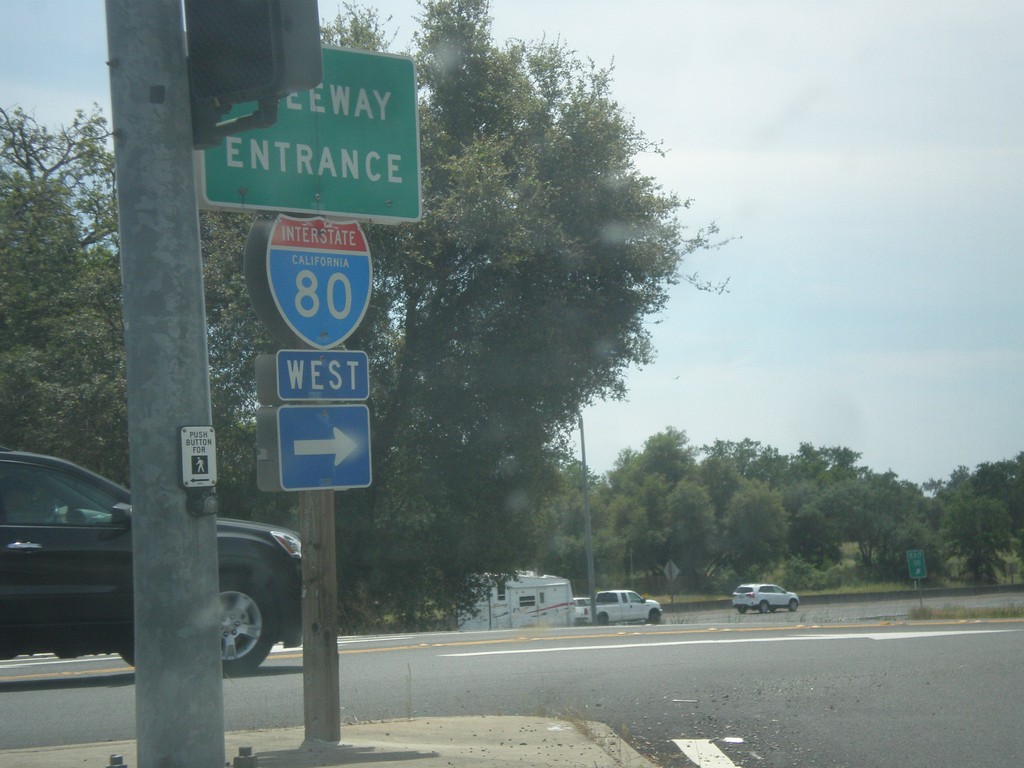
Horseshoe Bar Road East at I-80 West
Horseshoe Bar Road east at I-80 west onramp (Exit 110) in Loomis.
Taken 05-04-2014
Loomis
Placer County
California
United States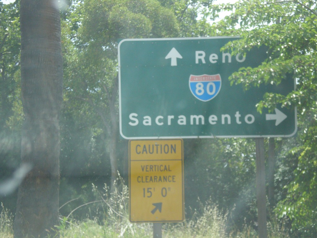
Horseshoe Bar Road East at I-80
Horseshoe Bar Road East at I-80. Turn right for I-80 west to Sacramento; continue over freeway for I-80 east to Reno.
Taken 05-04-2014
Loomis
Placer County
California
United States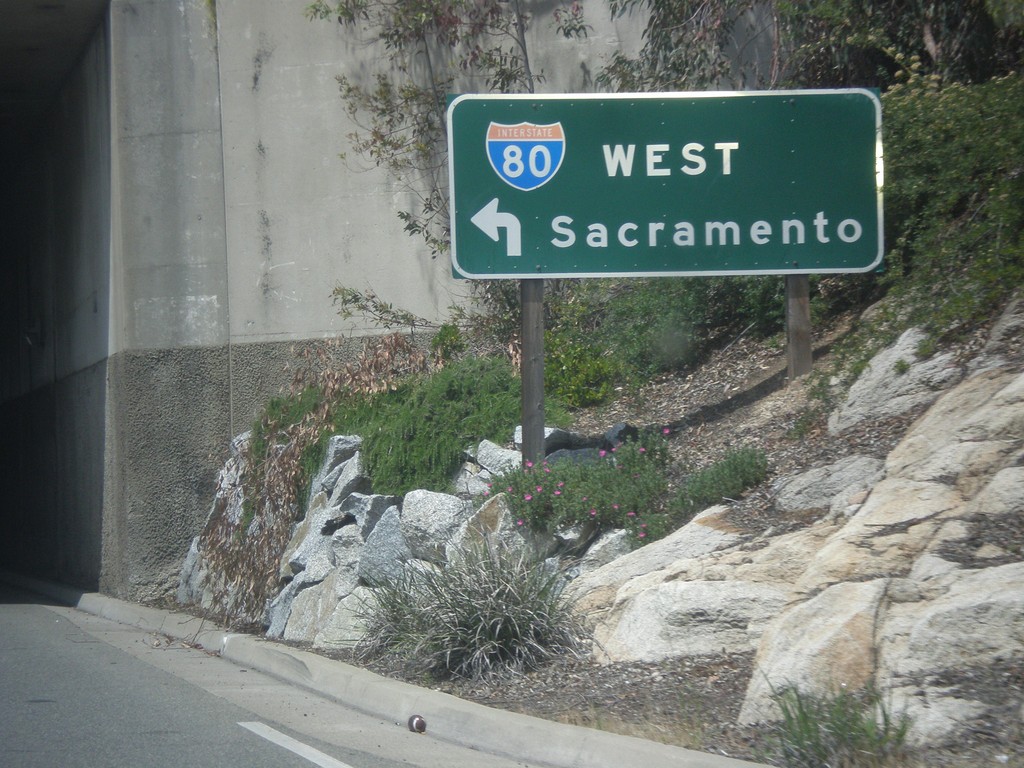
Rocklin Road West at I-80 West
Rocklin Road West at I-80 West to Sacramento (Exit 108).
Taken 05-04-2014
Rocklin
Placer County
California
United States