Signs Tagged With Big Green Sign
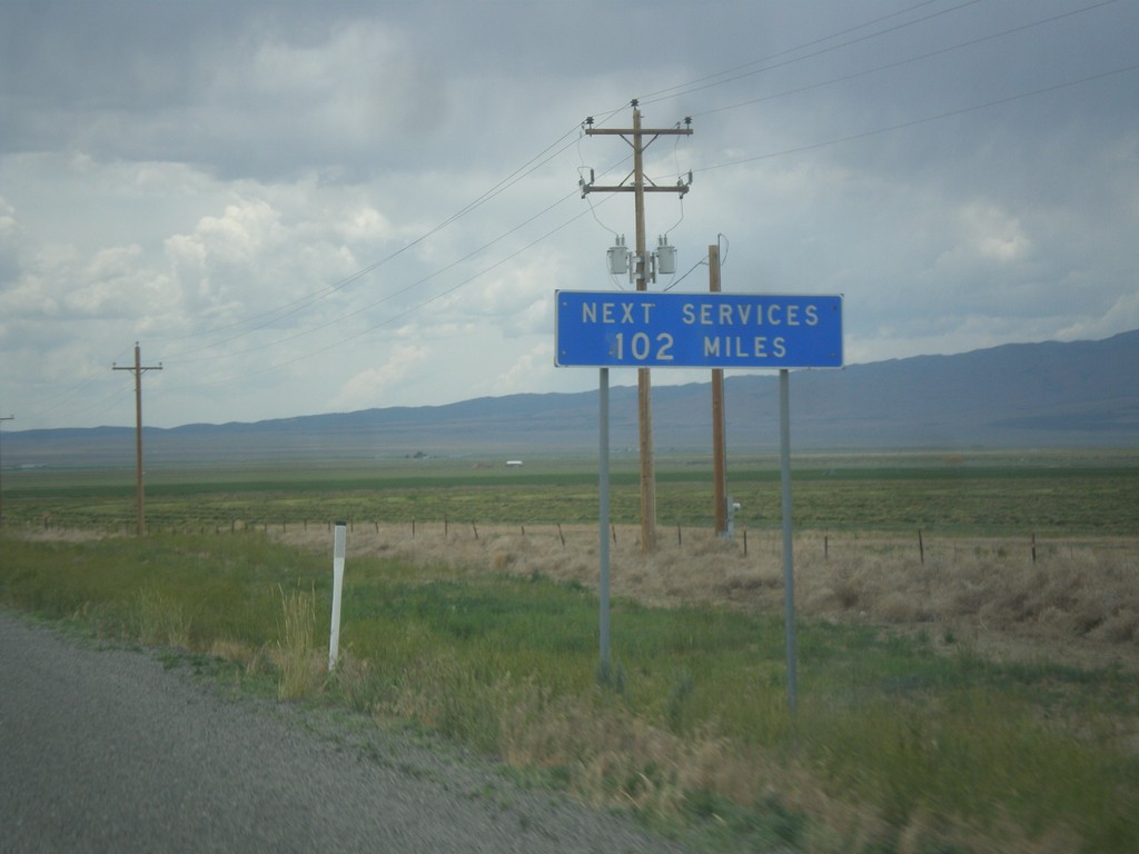
UT-30 East - Next Services 102 Miles
UT-30 west - Next Services 102 Miles. The next town with services is Montello, Nevada.
Taken 06-21-2014
 Snowville
Box Elder County
Utah
United States
Snowville
Box Elder County
Utah
United States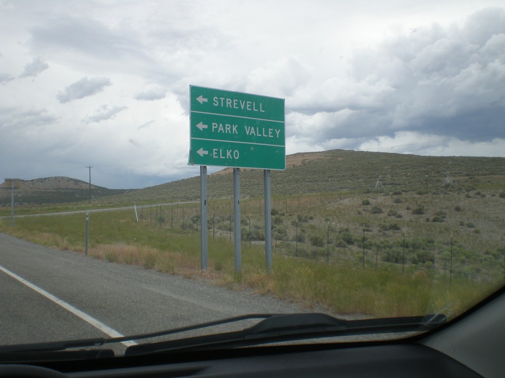
I-84 East at UT-30 - Exit 5
I-84 east at UT-30 junction. Turn left on UT-30 west for Strevell (Idaho), Park Valley, and Elko (Nevada).
Taken 06-21-2014
 Snowville
Box Elder County
Utah
United States
Snowville
Box Elder County
Utah
United States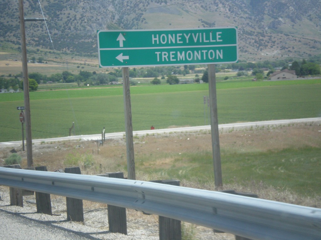
Begin UT-240 East at I-15 North
Begin UT-240 at I-15 north. Turn left for I-15 north to Tremonton; use UT-240 east to Honeyville.
Taken 06-21-2014

 Honeyville
Box Elder County
Utah
United States
Honeyville
Box Elder County
Utah
United States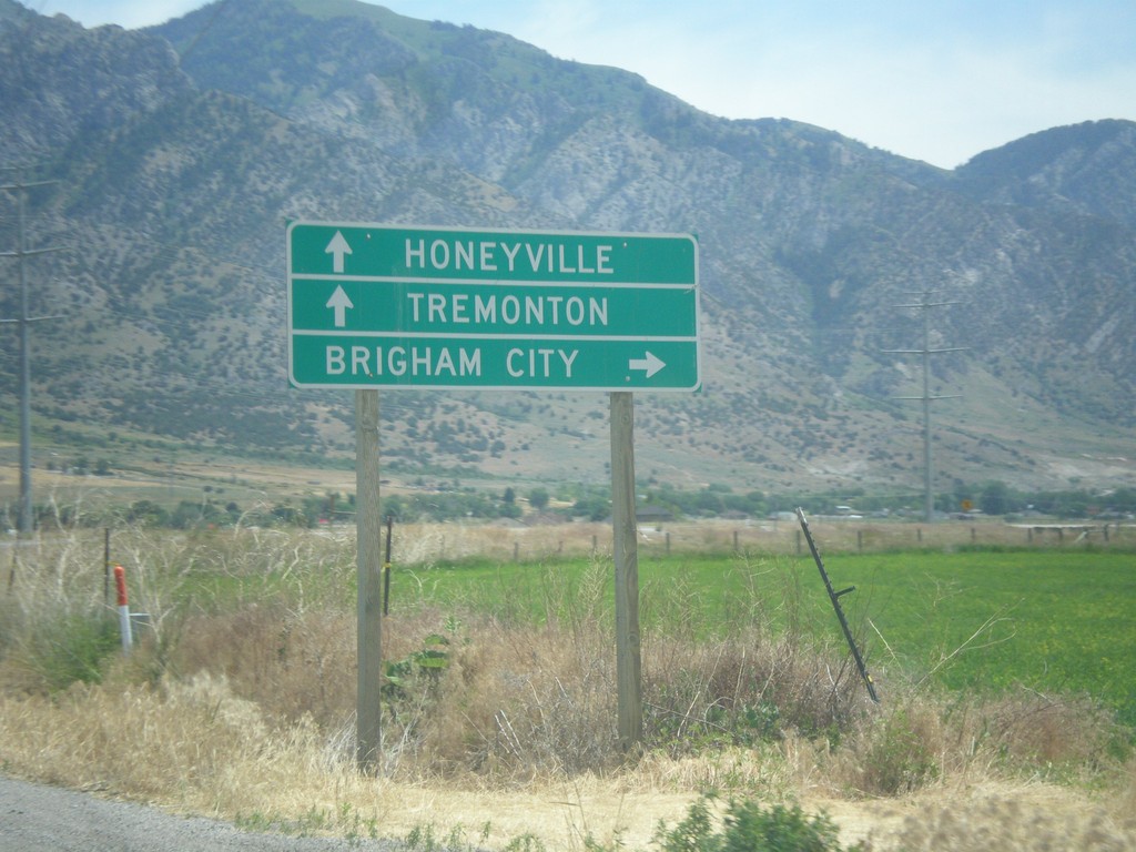
W 6900 North at I-15/I-84 (Exit 372)
W 6900 North at I-15/I-84 (Exit 372) in Honeyville. Turn right for I-15 South/I-84 East to Brigham City. Continue over freeway for I-15 North/I-84 West to Tremonton and Honeyville (via UT-240).
Taken 06-21-2014
Honeyville
Box Elder County
Utah
United States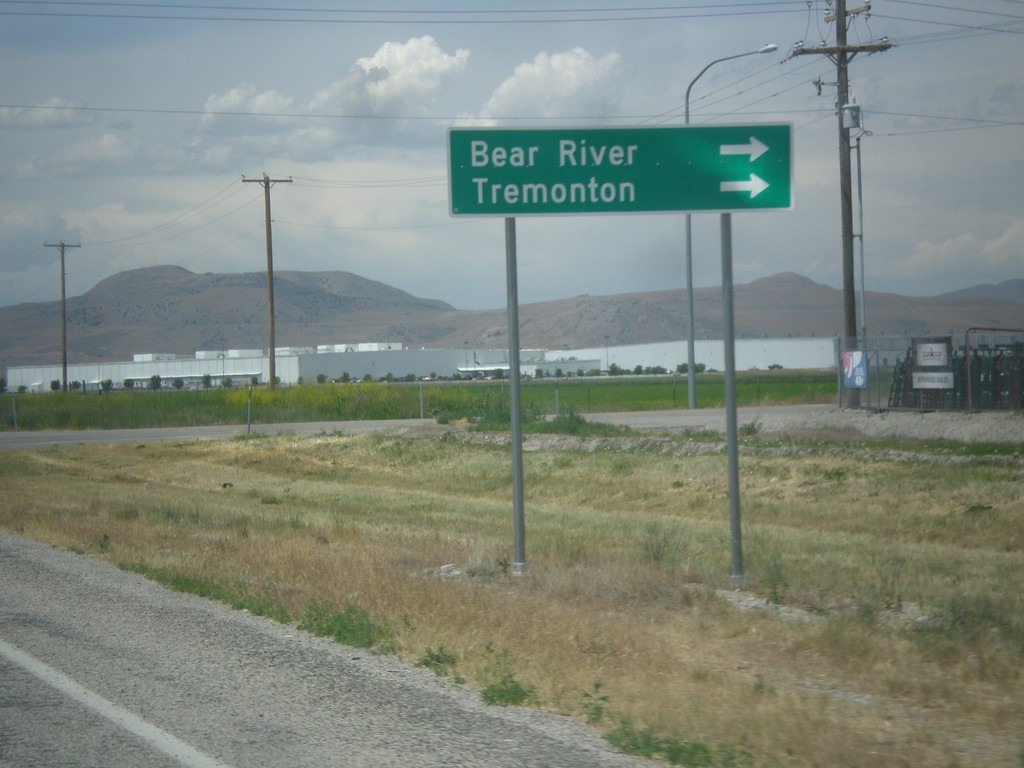
UT-13 North at UT-83
UT-13 north at UT-83. Turn right to continue north on UT-13 to Bear River and Tremonton.
Taken 06-21-2014

 Corinne
Box Elder County
Utah
United States
Corinne
Box Elder County
Utah
United States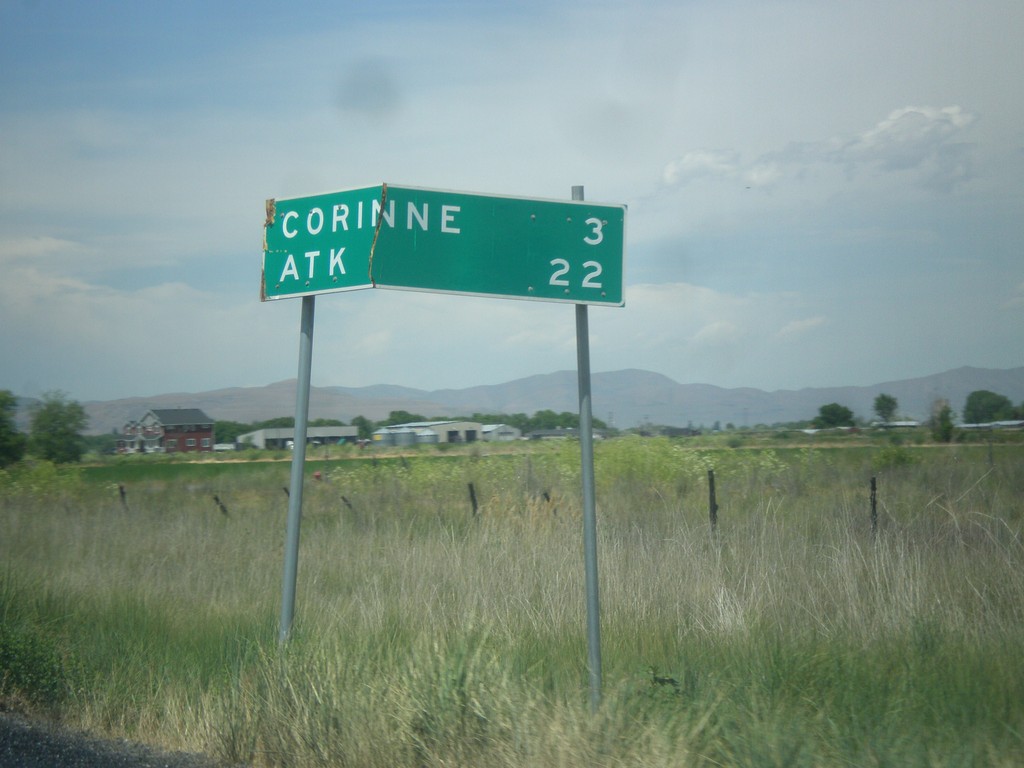
UT-13 North - Distance Marker
Distance marker on UT-13 north. Distance to Corrine, and ATK (an aerospace company).
Taken 06-21-2014
Brigham City
Box Elder County
Utah
United States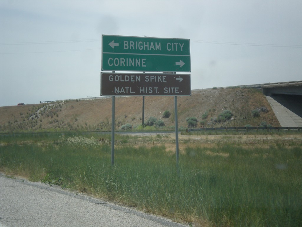
I-15 North at UT-13 - Exit 368 Offramp
I-15 North Exit 368 offramp at UT-13. Turn left for Brigham City; turn right for Corrine and Golden Spike National Historic Site.
Taken 06-21-2014
Brigham City
Box Elder County
Utah
United States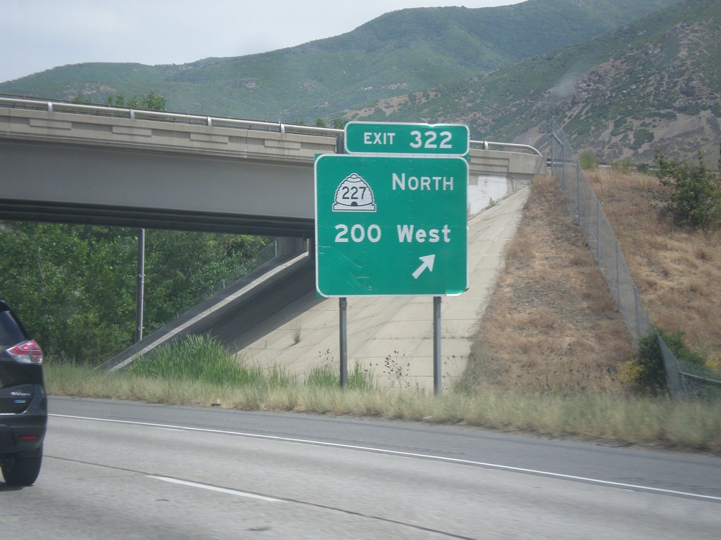
I-15 North - Exit 322
I-15 north at Exit 322 - UT-227 North/200 West.
Taken 06-21-2014

 Farmington
Davis County
Utah
United States
Farmington
Davis County
Utah
United States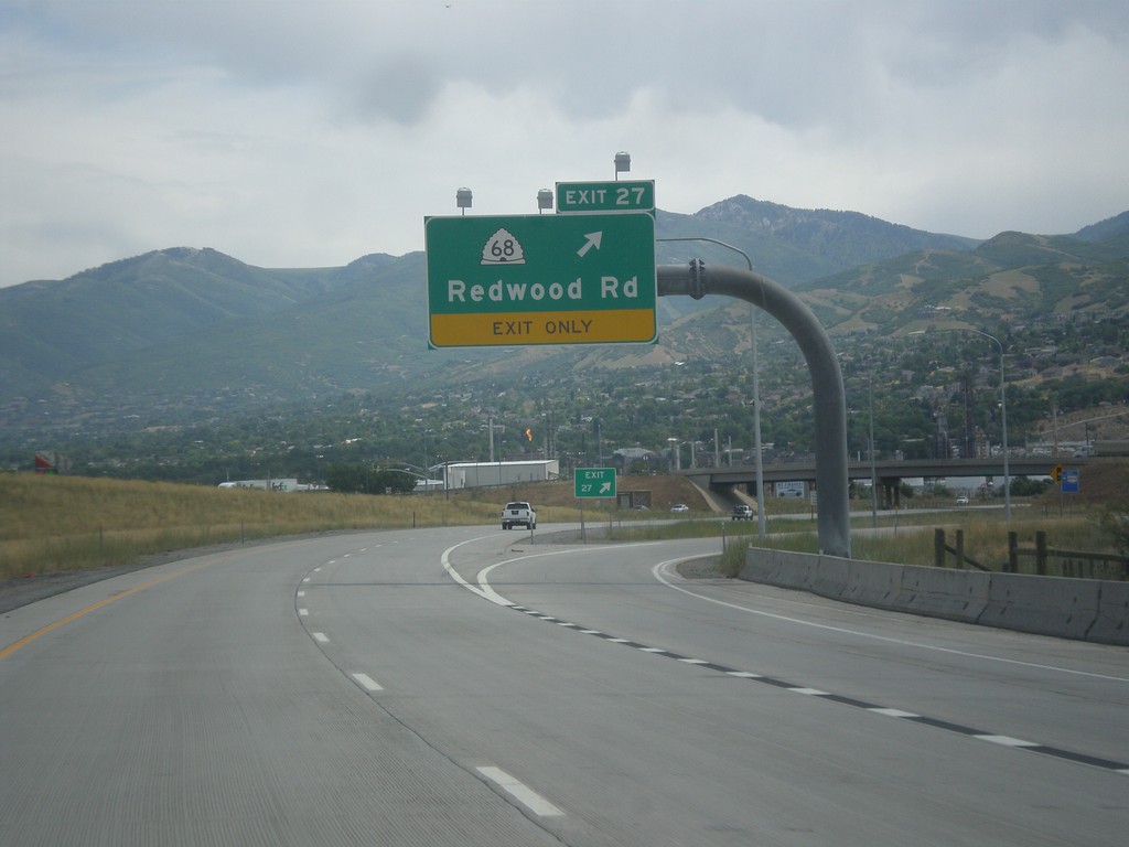
I-215 North - Exit 27
I-215 north at Exit 27 - UT-68/Redwood Road.
Taken 06-20-2014

 North Salt Lake
Davis County
Utah
United States
North Salt Lake
Davis County
Utah
United States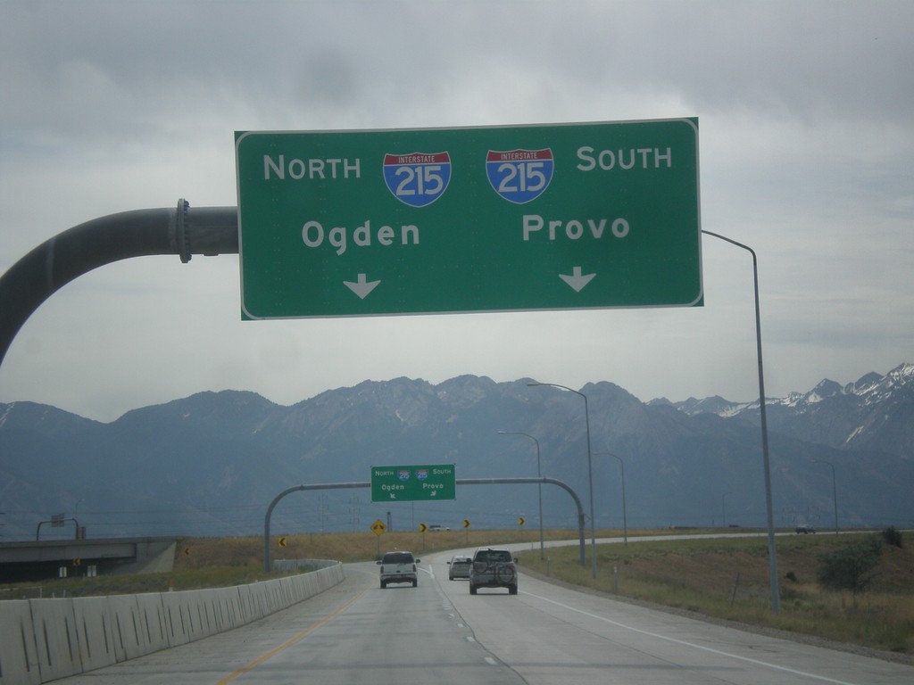
I-80 Exit 117 - I-215 Ramps
I-215/I-80 interchange, from I-80 east. Use left lanes for I-215 north to Ogden; right lanes for I-215 south to Provo.
Taken 06-20-2014
 Salt Lake City
Salt Lake County
Utah
United States
Salt Lake City
Salt Lake County
Utah
United States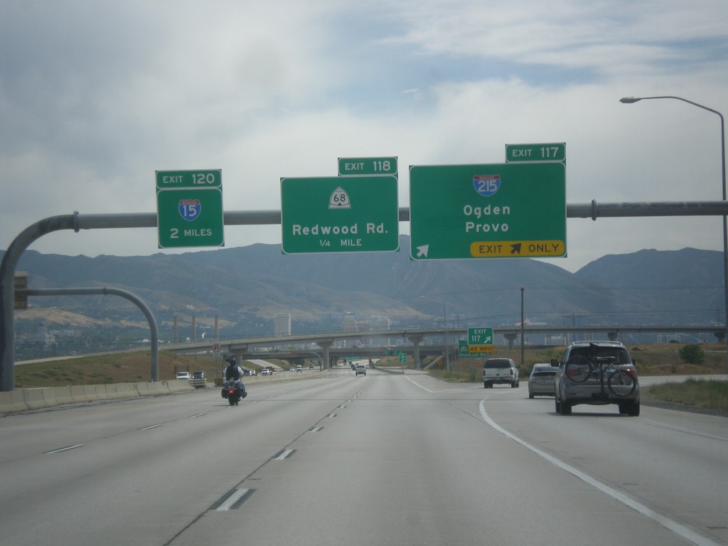
I-80 East - Exits 117, 118, and 120
I-80 east at Exit 117 - I-215/Odgen/Provo. I-215 is the Salt Lake City Belt Route. Approaching Exit 118 - UT-68/Redwood Road, and Exit 120 - I-15.
Taken 06-20-2014
Salt Lake City
Salt Lake County
Utah
United States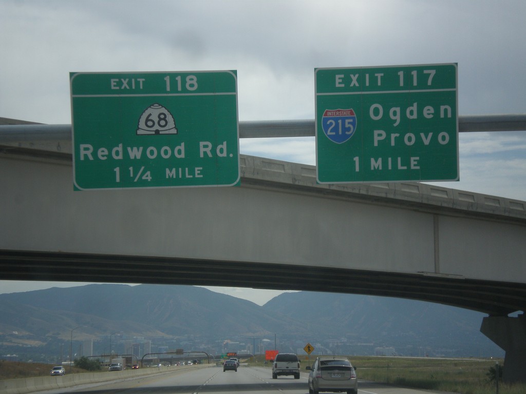
I-80 East - Exits 117 and 118
I-80 east at Exit 117 - I-215/Ogden/Provo. Approaching Exit 118 - UT-68/Redwood Road.
Taken 06-20-2014
Salt Lake City
Salt Lake County
Utah
United States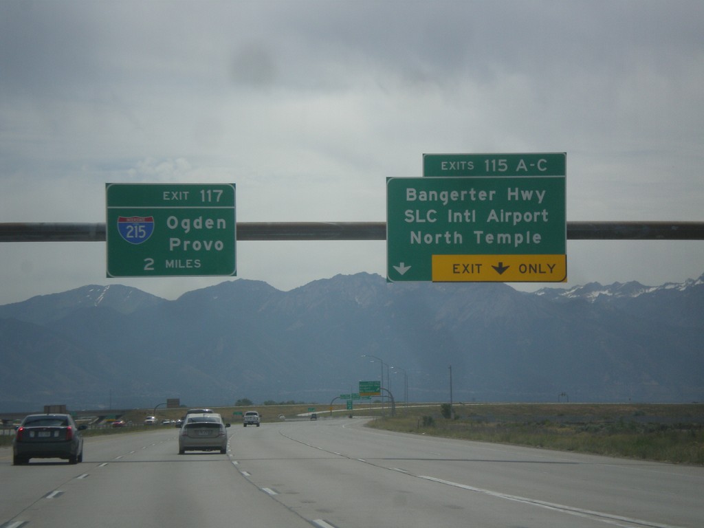
I-80 East - Exits 115 and Exit 117.
I-80 east at Exit 115 A-C - Bangerter Highway/SLC International Airport/North Temple. Approaching Exit 117 - I-215/Ogden/Provo. In the I-215 shield is the text UTAH. More and more of these types of shields with the state names are appearing around Utah.
Taken 06-20-2014
Salt Lake City
Salt Lake County
Utah
United States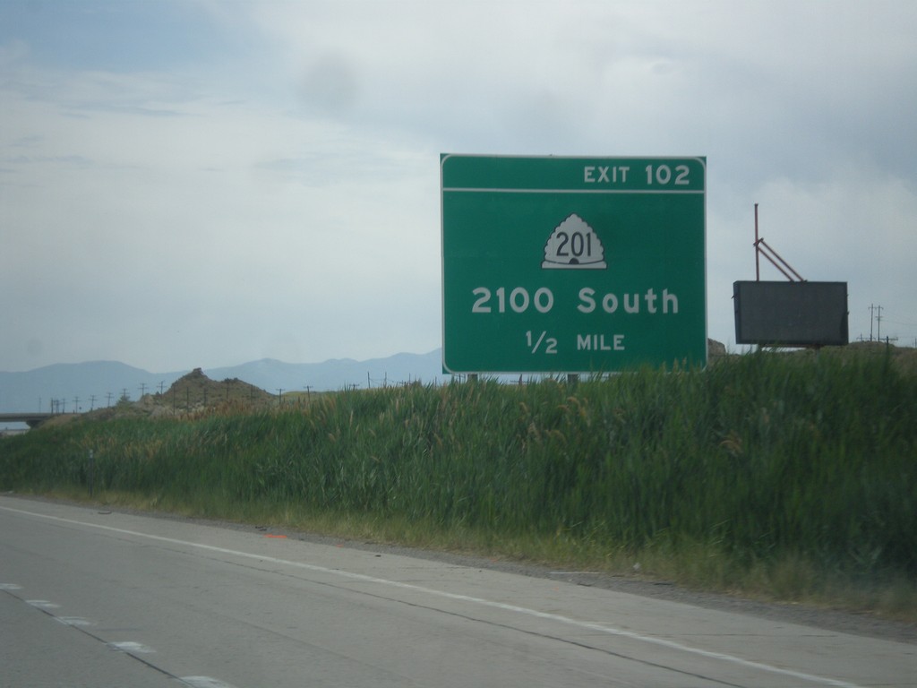
I-80 East - Exit 102
I-80 east approaching Exit 102 - UT-201/2100 South.
Taken 06-20-2014
 Tooele
 County
Utah
United States
Tooele
Tooele County
Utah
United States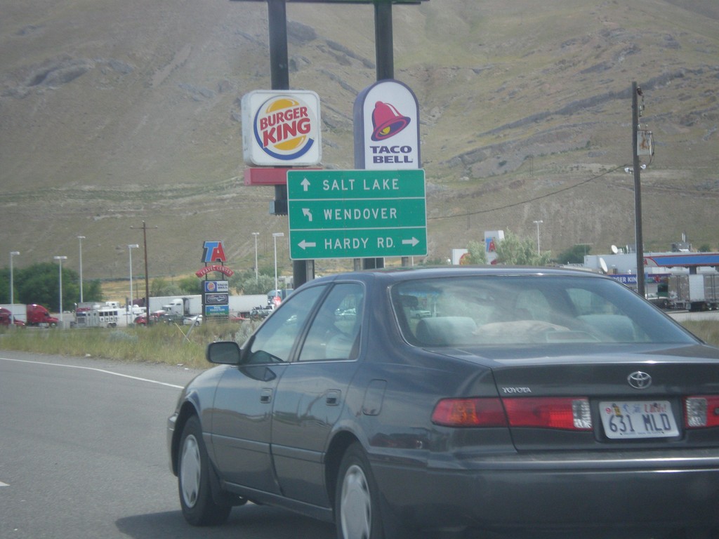
End UT-36 North at I-80
End UT-36 north at Hardy Road and I-80 freeway entrance. Use left lane for I-80 west to Wendover; right lane for I-80 east to Salt Lake.
Taken 06-20-2014
 Tooele
 County
Utah
United States
Tooele
Tooele County
Utah
United States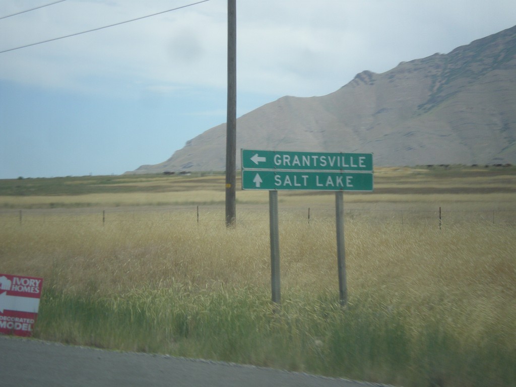
UT-38 North at UT-112 West
UT-38 North at UT-112 West to Grantsville. Continue north on UT-36 to Salt Lake.
Taken 06-20-2014
 Stansbury Park
Tooele County
Utah
United States
Stansbury Park
Tooele County
Utah
United States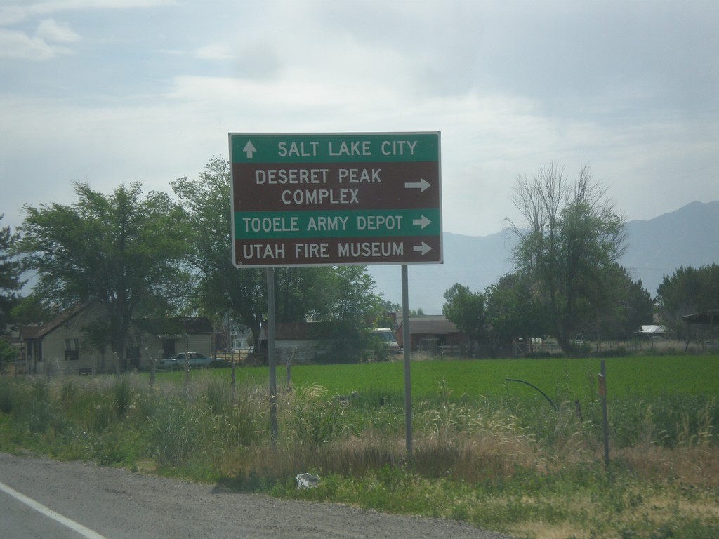
UT-138 East at UT-112
UT-138 east at UT-112 east to Deseret Peak Complex, Utah Fire Museum, and Tooele Army Depot.
Taken 06-20-2014
 Grantsville
Tooele County
Utah
United States
Grantsville
Tooele County
Utah
United States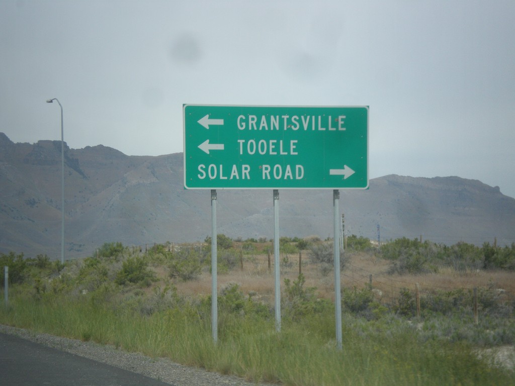
I-80 East Exit 84 Offramp at UT-138
I-80 East Exit 84 Offramp at UT-138. Turn left on UT-138 to Grantsville and Tooele. Right for Solar Road.
Taken 06-20-2014
Grantsville
Tooele County
Utah
United States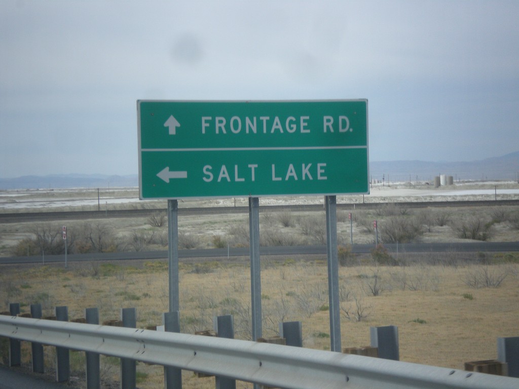
I-80 East Onramp at Exit 4 Interchange
I-80 East onramp at Exit 4 interchange. Turn left for Salt Lake; continue straight for Frontage Road. The next exit eastbound is 37 miles at the other end of the Salt Flats.
Taken 06-20-2014
Wendover
Tooele County
Utah
United States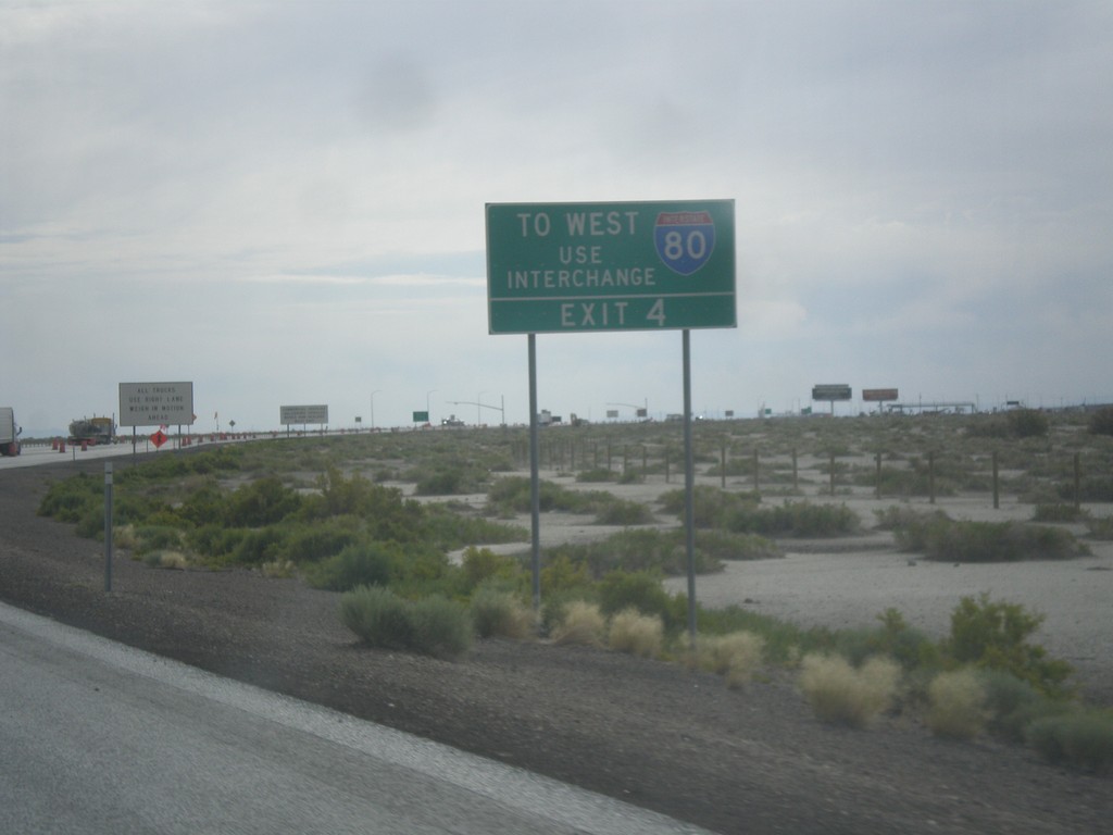
I-80 West Traffic Use Exit 4
End BL-80/UT-58 east at I-80. The Exit 2 ramp only has eastbound interstate access. To use I-80 westbound, take Exit 4.
Taken 06-20-2014

 Wendover
Tooele County
Utah
United States
Wendover
Tooele County
Utah
United States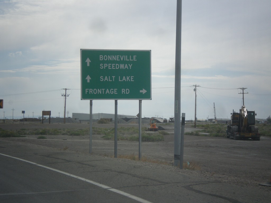
BL-80/UT-58 East at Frontage Road
BL-80/UT-58 East at Frontage Road. Continue on BL-80/UT-58 for I-80 east to Bonneville Speedway and Salt Lake.
Taken 06-20-2014
Wendover
Tooele County
Utah
United States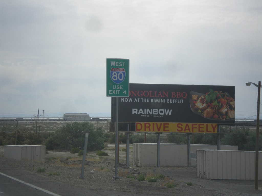
BL-80/UT-58 East Approaching I-80
BL-80/UT-58 East approaching I-80 in Wendover. For I-80 westbound, go east on I-80 to Exit 4.
Taken 06-20-2014
Wendover
Tooele County
Utah
United States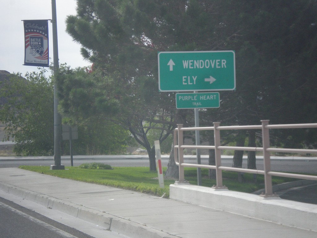
BL-80 East at Alt. US-93 South
BL-80 East/Alt. US-93 South (Wendover Blvd.) at Alt. US-93 south to Ely. Continue straight for BL-80 east to Wendover (Utah).
Taken 06-20-2014
 West Wendover
Elko County
Nevada
United States
West Wendover
Elko County
Nevada
United States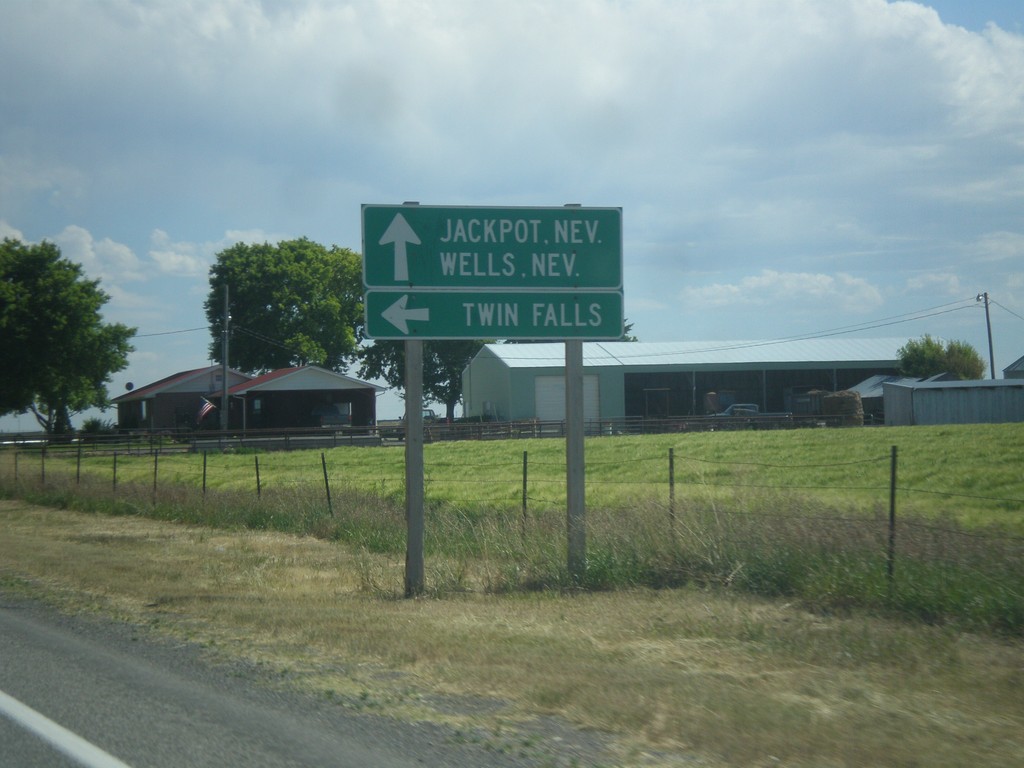
US-93 South at ID-74
US-93 south at ID-74. Turn left on ID-74 north for Twin Falls. Continue south on US-93 for Jackpot, NV and Wells, NV.
Taken 06-20-2014

 Twin Falls
 County
Idaho
United States
Twin Falls
Twin Falls County
Idaho
United States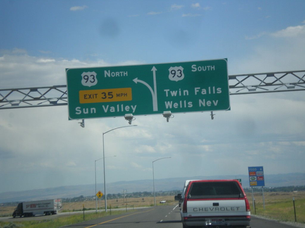
I-84 East at Exit 173 Offramp
I-84 east - Exit 173 offramp. Use right lane for US-93 south to Twin Falls and Wells, Nev. Use left lane for US-93 north to Sun Valley.
Taken 06-20-2014
Twin Falls
Twin Falls County
Idaho
United States