Signs Tagged With Big Green Sign
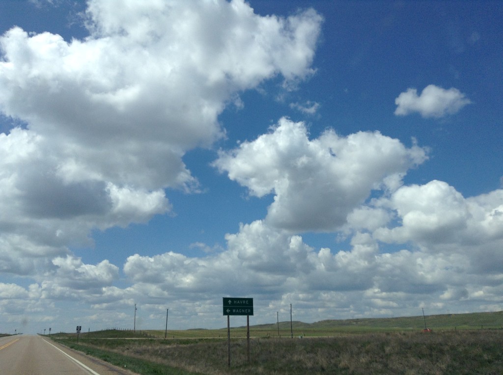
US-2 West at MTS-363 South
US-2 West at MTS-363 South to Wagner. Continue west on US-2 for Havre.
Taken 05-09-2015

 Wagner
Phillips County
Montana
United States
Wagner
Phillips County
Montana
United States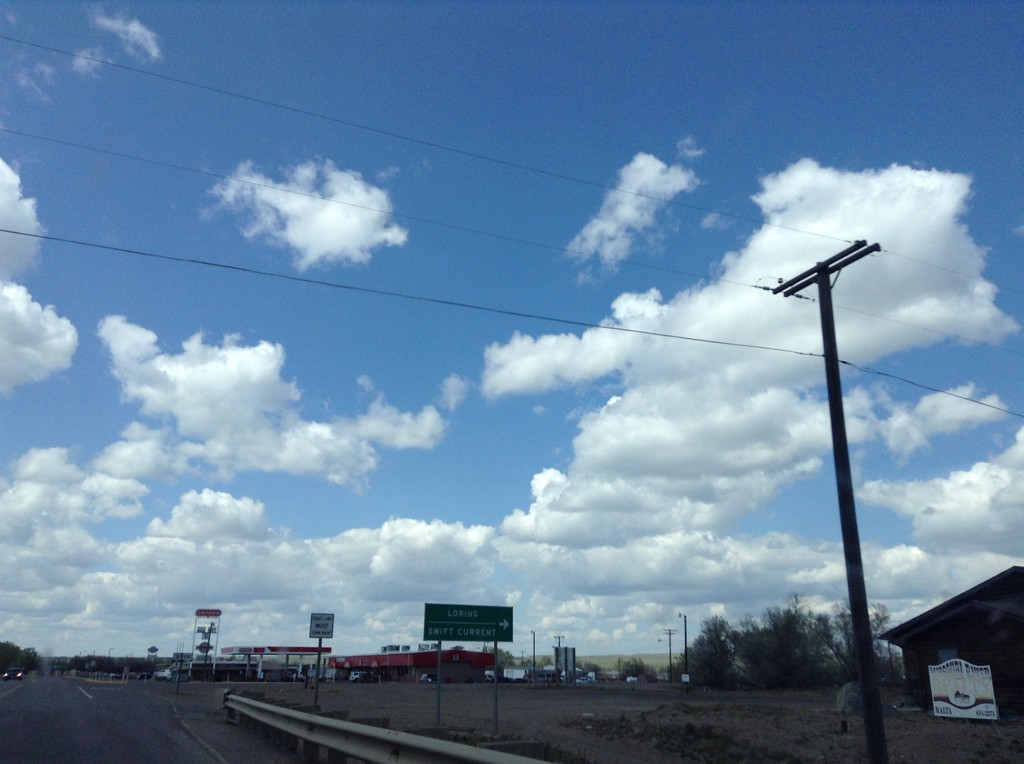
US-2 West/US-191 North at US-2/US-191 Split
US-2 West/US-191 North at US-2/US-191 split. Turn right for US-191 north to Loring and Swift Current (SK, Canada).
Taken 05-09-2015
 Malta
Phillips County
Montana
United States
Malta
Phillips County
Montana
United States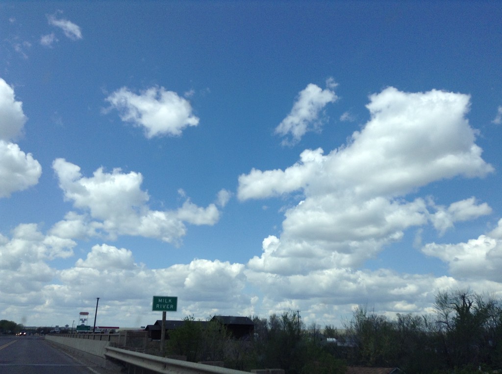
US-2 West/US-191 North - Milk River
US-2 West/US-191 North crossing the Milk River
Taken 05-09-2015
Malta
Phillips County
Montana
United States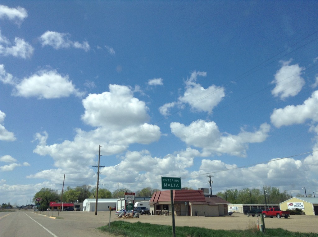
US-2 West - Malta
Entering Malta on US-2 west. Malta is the county seat of Phillips County.
Taken 05-09-2015
Malta
Phillips County
Montana
United States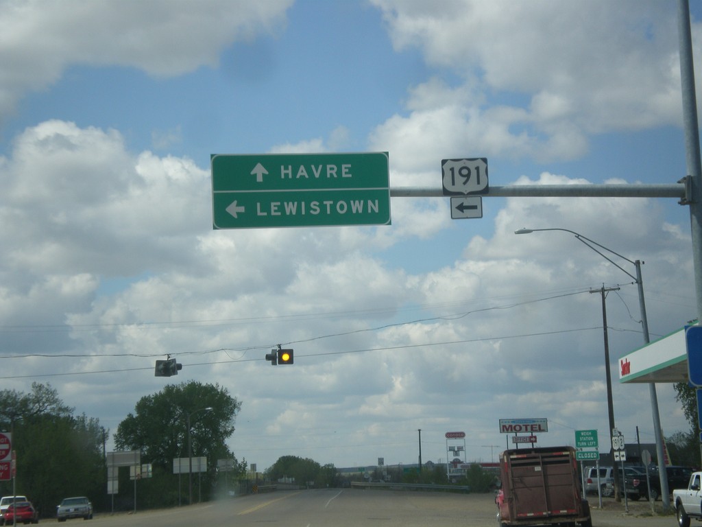
US-2 West at US-191
US-2 west at US-191 south to Lewistown. Continue east on US-2 to Havre. US-191 joins US-2 west through Malta.
Taken 05-09-2015
Malta
Phillips County
Montana
United States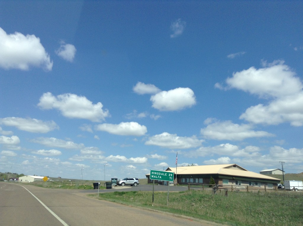
US-2 West - Distance Marker
Distance marker on US-2 west, on the west edge of Glasgow. Distance to Hinsdale and Malta.
Taken 05-09-2015
Glasgow
Valley County
Montana
United States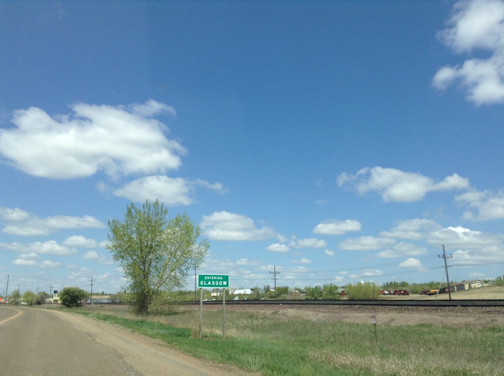
MT-42 West - Entering Glasgow
Entering Glasgow on MT-42 west. Glasgow is the county seat of Valley County.
Taken 05-09-2015
 Glasgow
Valley County
Montana
United States
Glasgow
Valley County
Montana
United States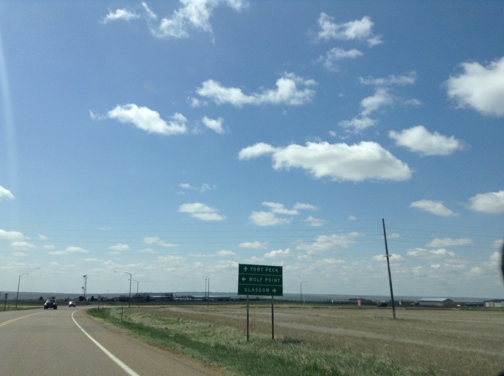
MT-24 South at US-2
MT-24 south at US-2. Use US-2 east for Wolf Point; US-2 west for Glasgow. Continue south on MT-24 for Fort Peck.
Taken 05-09-2015
 Glasgow
Valley County
Montana
United States
Glasgow
Valley County
Montana
United States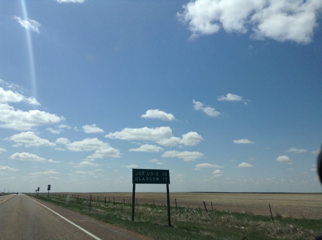
MT-24 South - Distance Marker
Distance marker on MT-24 south. Distance to US-2 and Glasgow.
Taken 05-09-2015
Saint Marie
Valley County
Montana
United States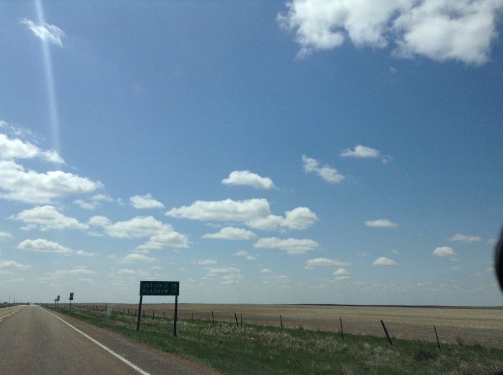
MT-24 South - Distance Marker
Distance marker on MT-24 south. Distance to US-2 and Glasgow.
Taken 05-09-2015
Saint Marie
Valley County
Montana
United States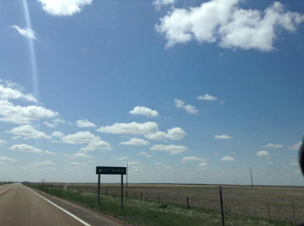
MT-24 South - St. Marie
St. Marie junction on MT-24 south. St. Marie is on the site of the former Glasgow Air Force Base.
Taken 05-09-2015
Saint Marie
Valley County
Montana
United States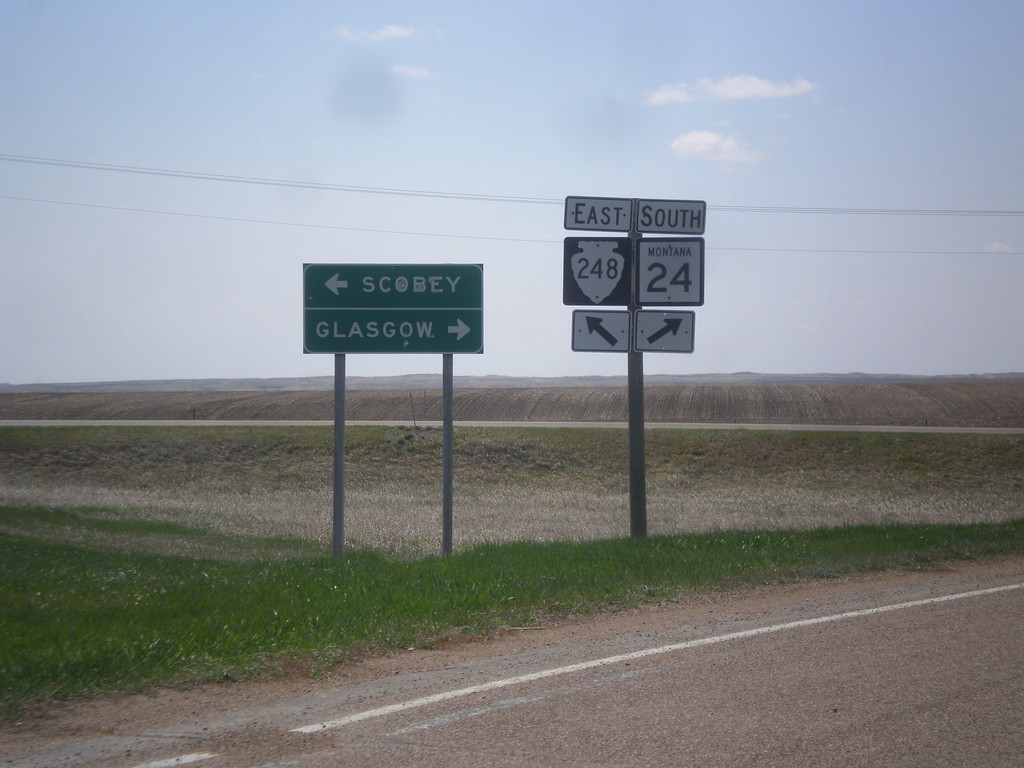
MT-24 South at MTS-248
MT-24 South at MTS-248 East to Scobey. Continue south on MT-24 for Glasgow.
Taken 05-09-2015
 Opheim
Valley County
Montana
United States
Opheim
Valley County
Montana
United States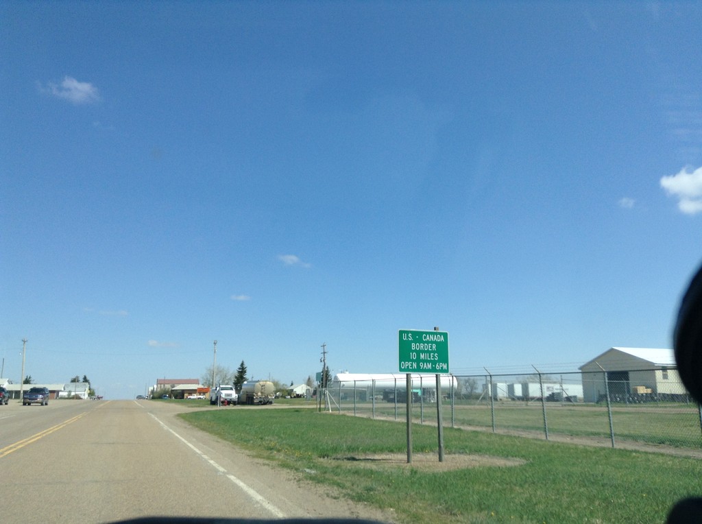
MT-24 North - Port of Entry Hours
MT-24 North - Canada Port of Entry 10 Miles. Port of Entry Open from 9:00 AM to 6:00 PM.
Taken 05-09-2015
Opheim
Valley County
Montana
United States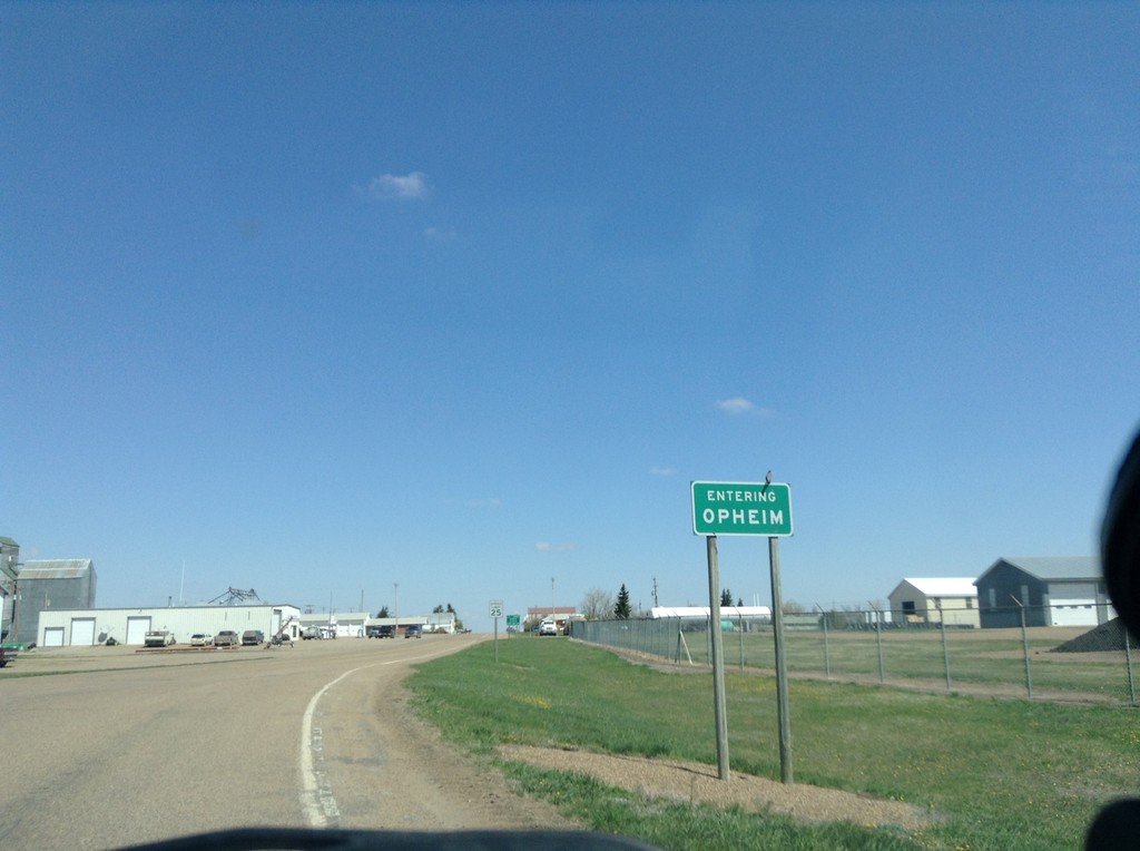
MT-24 North - Entering Opheim
Entering Opheim on MT-24 North.
Taken 05-09-2015
Opheim
Valley County
Montana
United States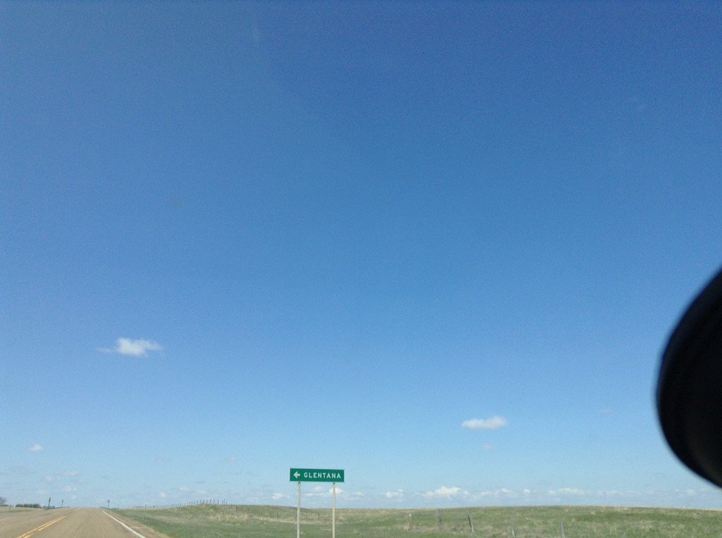
MTS-248 West at MTS-438
MTS-248 west at MTS-438 south to Glentana.
Taken 05-09-2015
 Glentana
Valley County
Montana
United States
Glentana
Valley County
Montana
United States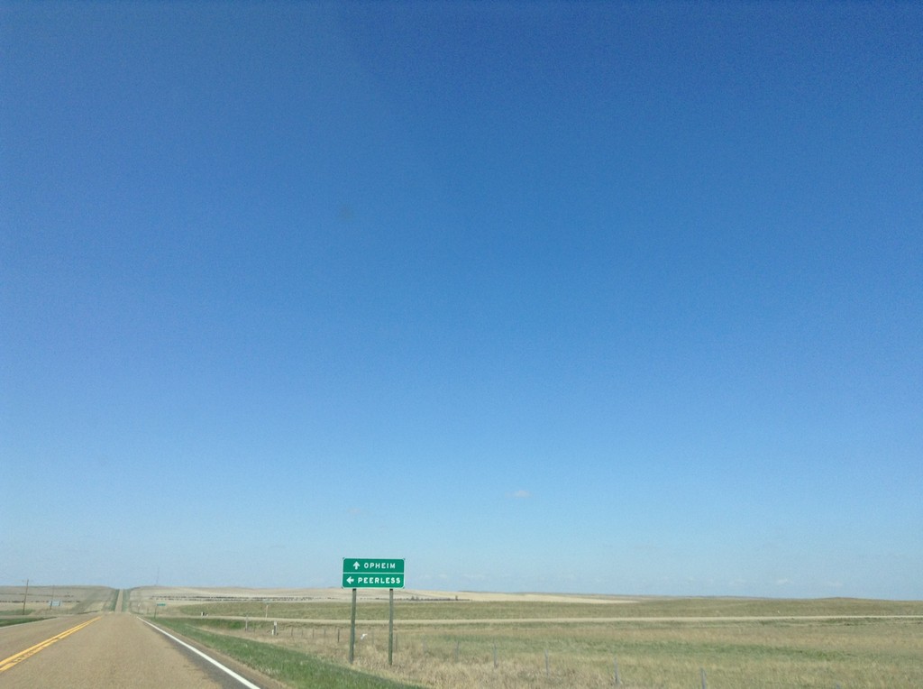
MTS-248 West - Peerless Jct.
MTS-248 West at junction to Peerless. Continue west on MTS-248 for Opheim.
Taken 05-09-2015
Daniels County
Montana
United States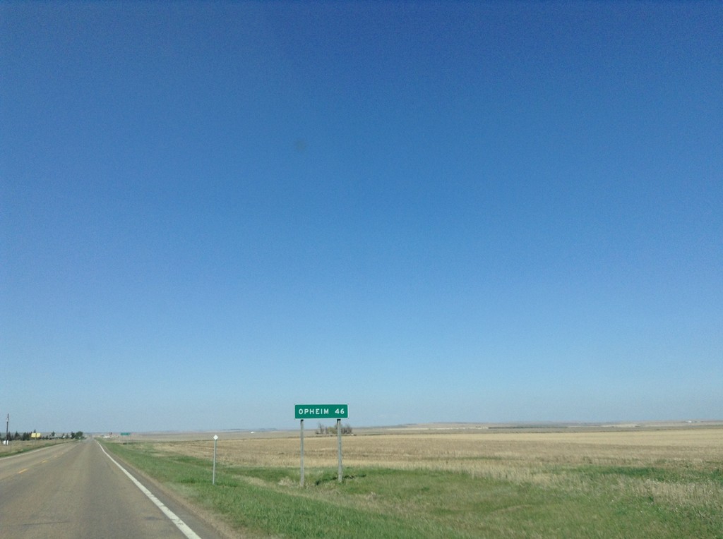
MTS-248 West - Distance Marker
Distance marker on MTS-248 west. Distance to Opheim.
Taken 05-09-2015
Scobey
Daniels County
Montana
United States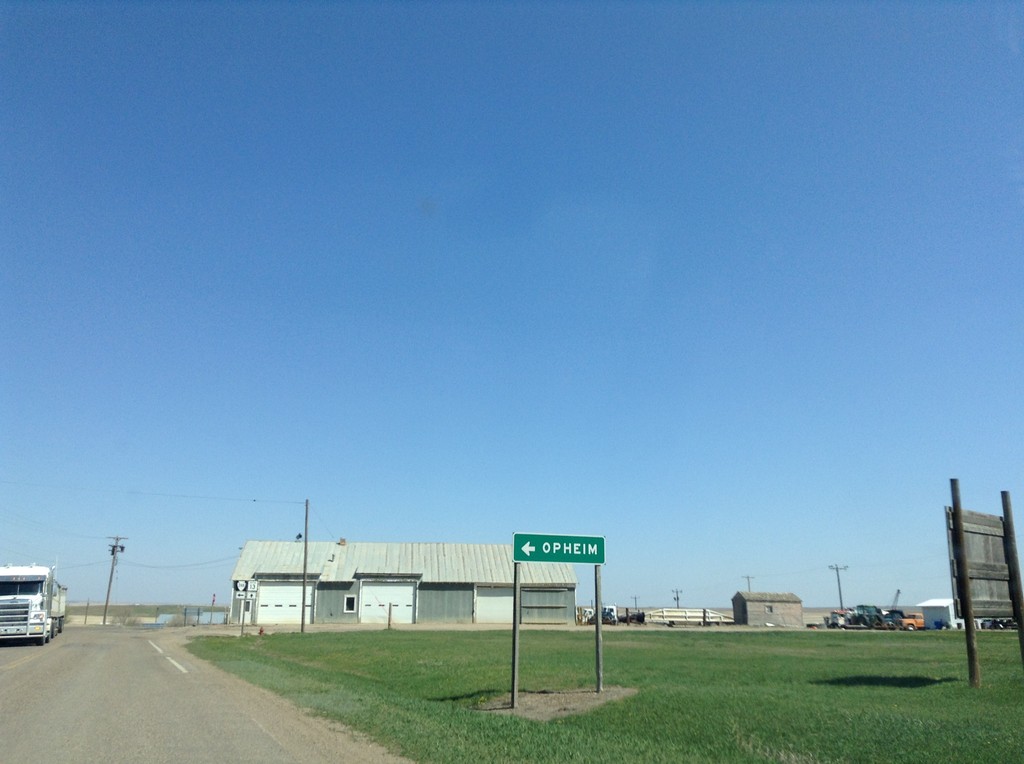
MT-13 North at MTS-248
MT-13 North at MTS-248 west to Opheim.
Taken 05-09-2015
 Scobey
Daniels County
Montana
United States
Scobey
Daniels County
Montana
United States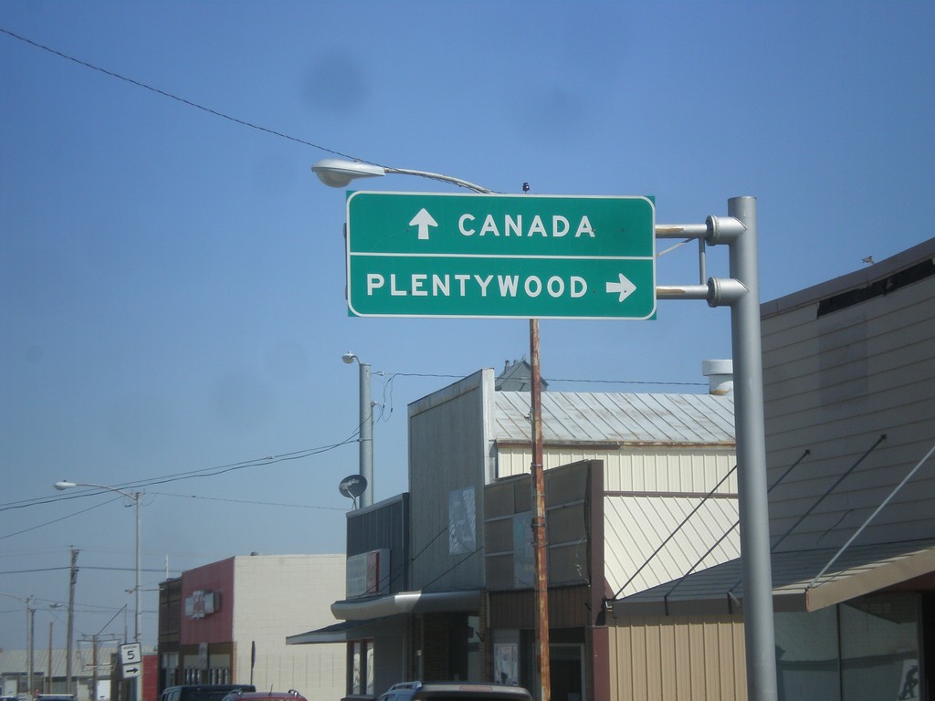
MT-13 North at MT-5
MT-13 north at MT-5. Use MT-5 east for Plentywood. Continue north on MT-13 for Canada.
Taken 05-09-2015
 Scobey
Daniels County
Montana
United States
Scobey
Daniels County
Montana
United States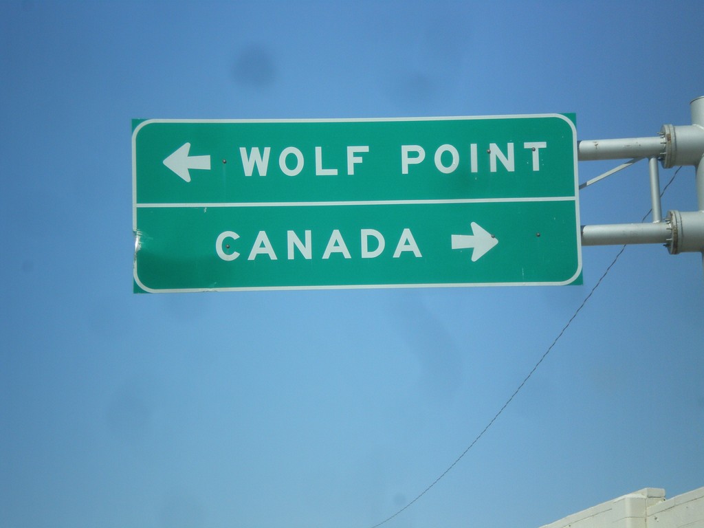
End MT-5 West at MT-13
End MT-5 west at MT-13. Use MT-13 north for Canada; MT-13 south for Wolf Point.
Taken 05-09-2015
Scobey
Daniels County
Montana
United States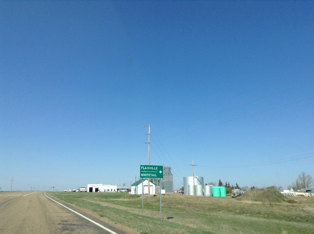
MT-5 West Approaching MTS-511 and MTS-251
MT-5 West approaching MTS-511 and MTS-251. Use MTS-511 north for Flaxville and Whitetail.
Taken 05-09-2015

 Flaxville
Daniels County
Montana
United States
Flaxville
Daniels County
Montana
United States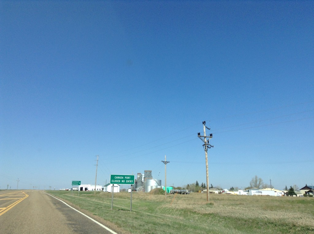
MT-5 West - Port of Big Beaver Status
MT-5 west approaching MTS-511 and MTS-251 in Flaxville. The Canadian Port of Big Beaver has been permanently closed, along with the US Port of Whitetail. This sign is warning northbound traffic of MTS-511 of the Port of Big Beaver status.
Taken 05-09-2015
Flaxville
Daniels County
Montana
United States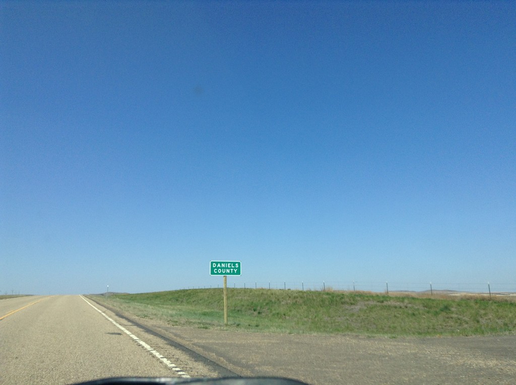
MT-5 West - Daniels County
Entering Daniels County on MT-5 west.
Taken 05-09-2015
Redstone
Sheridan County
Montana
United States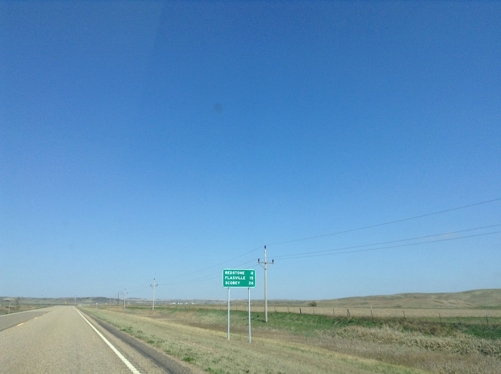
MT-5 West - Distance Marker
Distance marker on MT-5 west. Distance to Redstone, Flaxville, and Scobey.
Taken 05-09-2015
Plentywood
Sheridan County
Montana
United States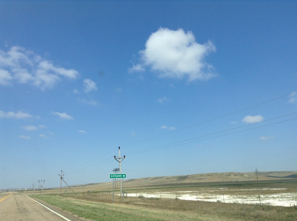
MT-5 West Approaching MTS-374
MT-5 West approaching MTS-374 north to Outlook.
Taken 05-09-2015
 Outlook
Sheridan County
Montana
United States
Outlook
Sheridan County
Montana
United States