Signs Tagged With Big Green Sign
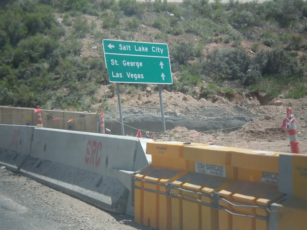
Cross Hollow Road at I-15 South
Cross Hollow Road at I-15 South to Salt Lake City. Continue straight for I-15 north to St. George and Las Vegas.
Taken 05-21-2014
 Cedar City
Iron County
Utah
United States
Cedar City
Iron County
Utah
United States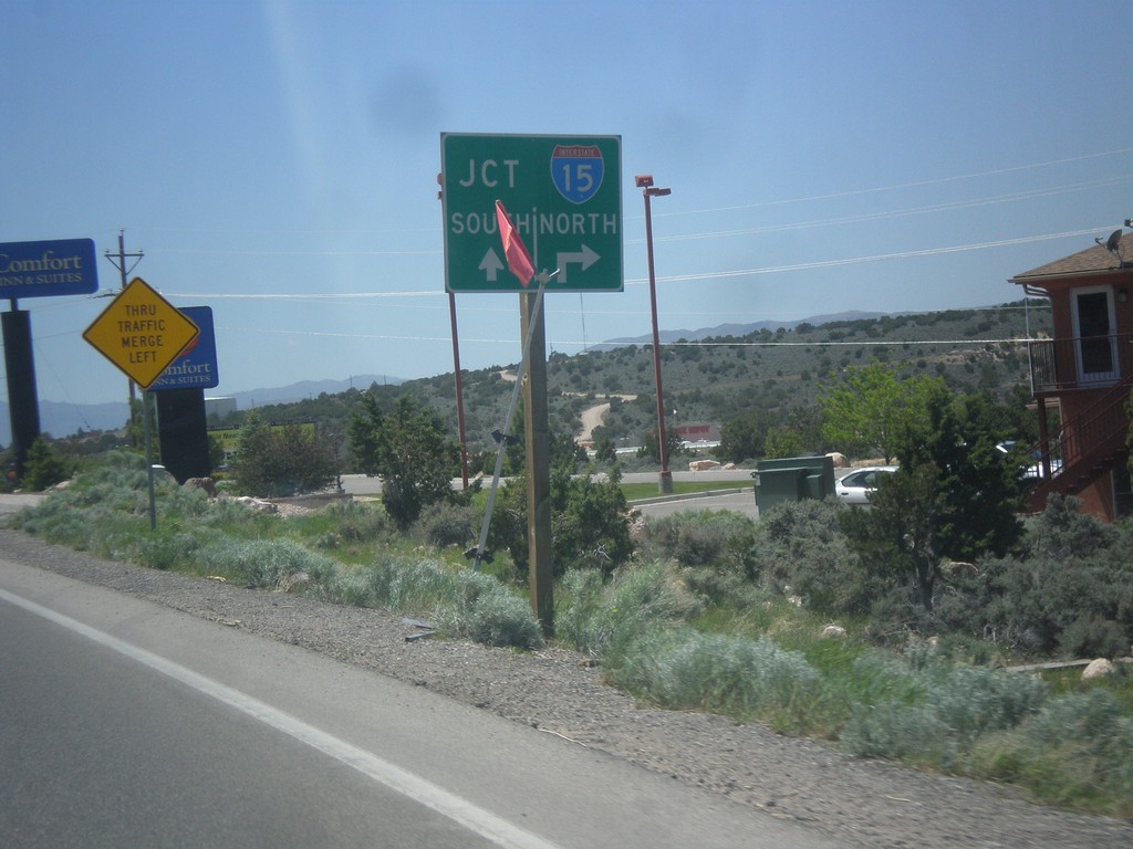
BL-15/UT-130 South at Cross Hollow Road
BL-15/UT-130 South at Cross Hollow Road. Continue straight for I-15 south on ramp. Turn right on Cross Hollow Road for I-15 north on ramp.
Taken 05-21-2014

 Cedar City
Iron County
Utah
United States
Cedar City
Iron County
Utah
United States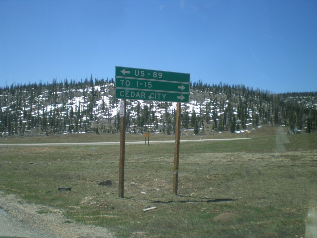
End UT-148 South at UT-14
End UT-148 south at UT-14. Turn right on UT-14 for Cedar City and I-15. Turn left on UT-14 for US-89. UT-14 is part of the Markagunt High Plateau Scenic Byway.
Taken 05-21-2014

 Brian Head
Iron County
Utah
United States
Brian Head
Iron County
Utah
United States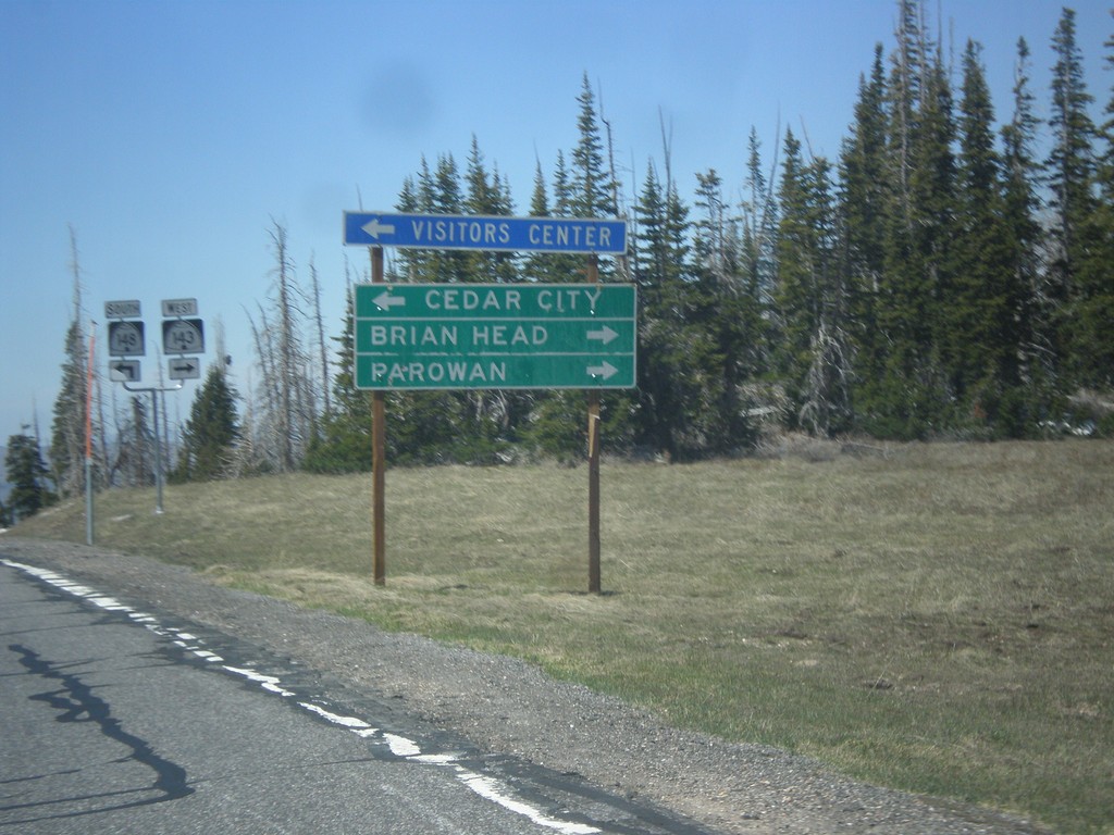
UT-143 West at UT-148
UT-143 west at UT-148. Use UT-148 south to Cedar City. Continue west on UT-143 (right turn) for Brian Head and Parowan. The Utah DOT changed direction on UT-143 between Panguitch Lake and UT-148 junction. At Panguitch UT-143 is a north/south highway. At this junction it is an east/west highway.
Taken 05-21-2014
 Brian Head
Iron County
Utah
United States
Brian Head
Iron County
Utah
United States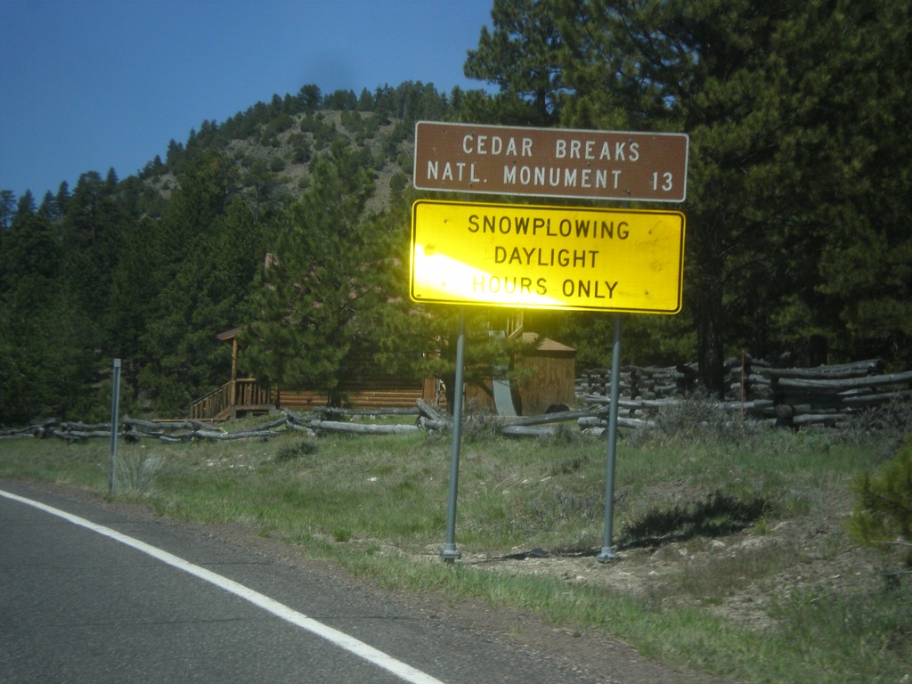
UT-143 - Distance Marker
Distance marker on UT-143 south. Distance to Cedar Breaks National Monument. Below distance marker is another sign reading Snow Plowing Daylight Hours Only.
Taken 05-21-2014
Panguitch
Garfield County
Utah
United States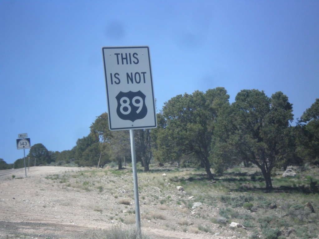
UT-143 South - This is not US-89
This is not US-89 sign on UT-143 south. US-89 southbound traffic in Panguitch who do not turn left at the stoplight in town will end up on UT-143. This sign notifies travelers that they are not on US-89. There are also many oversizes UT-143 signs on the first few miles out of Panguitch as a reminder as well.
Taken 05-21-2014
Panguitch
Garfield County
Utah
United States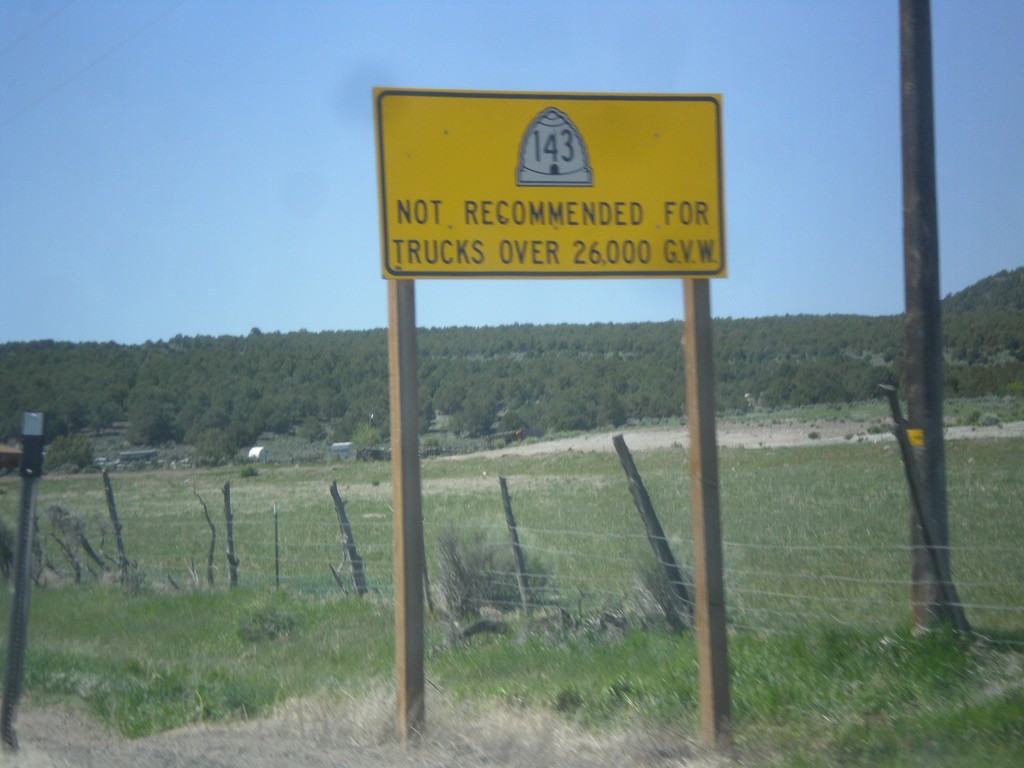
UT-143 - Truck Restrictions
UT-143 not recommended for trucks over 26,000 GVW. UT-143 is a steep, winding mountain road over the Markagunt Plateau.
Taken 05-21-2014
Panguitch
Garfield County
Utah
United States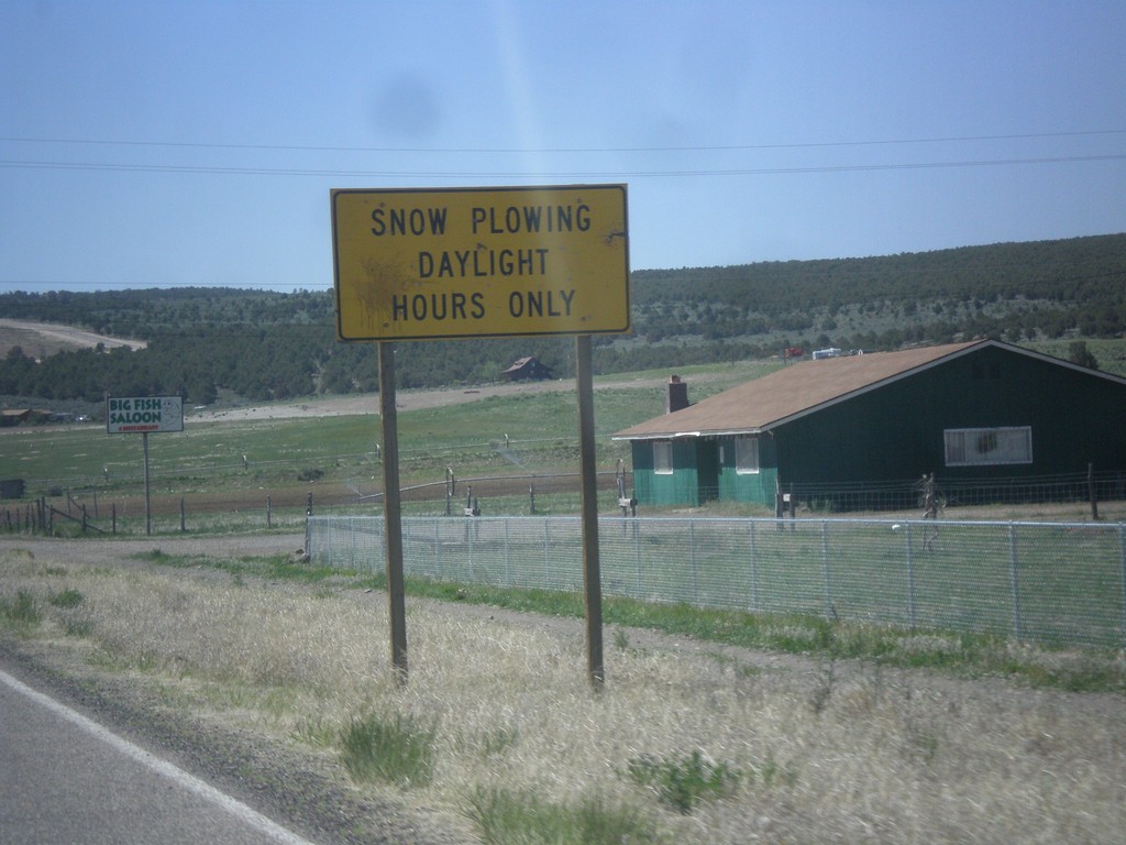
UT-143 South - Snow Plowing Hours
Snow Plowing Daylight Hours Only on UT-143 south. UT-143 south is a very mountainous road that goes over the Markagunt Plateau.
Taken 05-21-2014
Panguitch
Garfield County
Utah
United States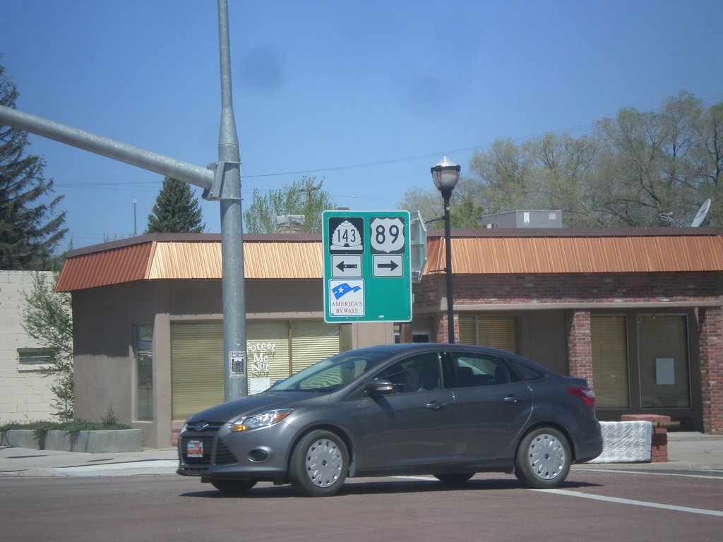
US-89 North at UT-143
US-89 north at UT-143 in Panguitch. Turn left for UT-143 south; right for US-89 north.
Taken 05-21-2014
 Panguitch
Garfield County
Utah
United States
Panguitch
Garfield County
Utah
United States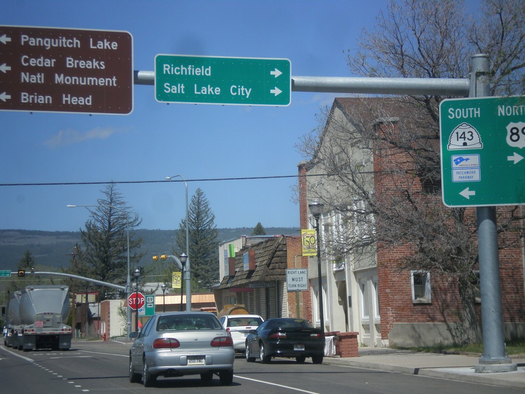
US-89 North at UT-143
US-89 north at UT-143 south. Turn left for UT-143 south to Cedar Breaks National Monument, Brian Head, and Panguitch Lake. Turn right to continue north on US-89 to Richfield and Salt Lake City. UT-143 is part of the Utah’s Patchwork Parkway National Scenic Byway.
Taken 05-21-2014
Panguitch
Garfield County
Utah
United States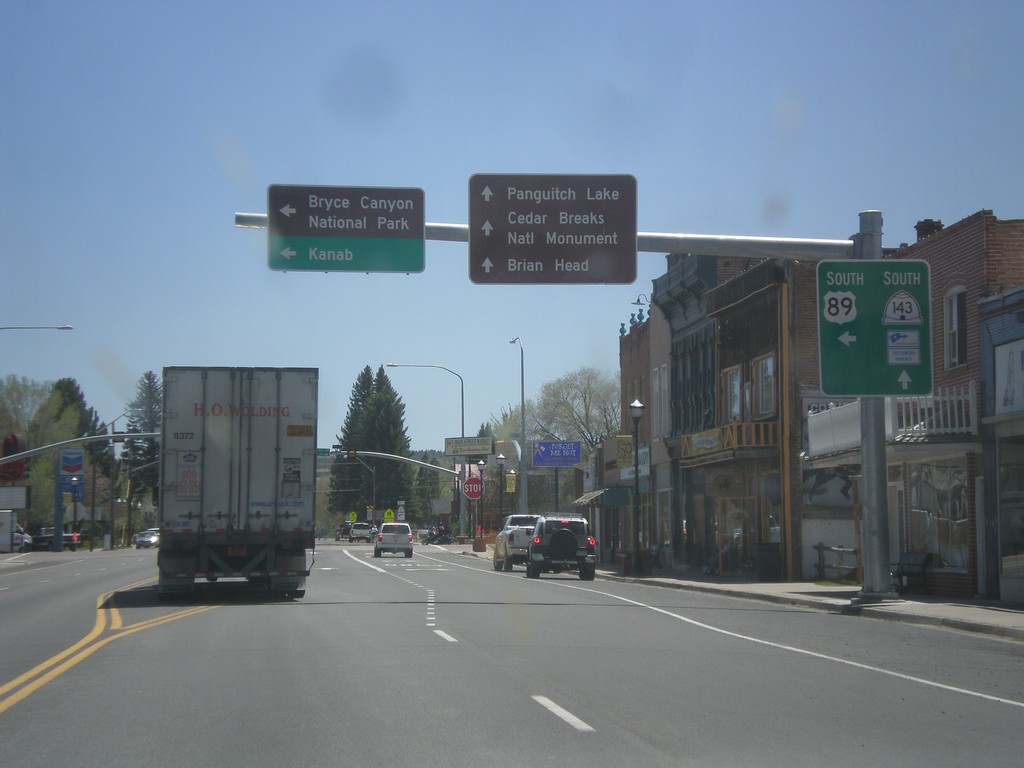
US-89 South at UT-143
US-89 south at UT-143 in Panguitch. Use UT-143 south for Cedar Breaks National Monument, Panguitch Lake, and Brian Head. Turn left to continue south on US-89 towards Bryce Canyon National Park and Kanab. UT-143 is part of Utah’s Patchwork Parkway National Scenic Byway.
Taken 05-19-2014
Panguitch
Garfield County
Utah
United States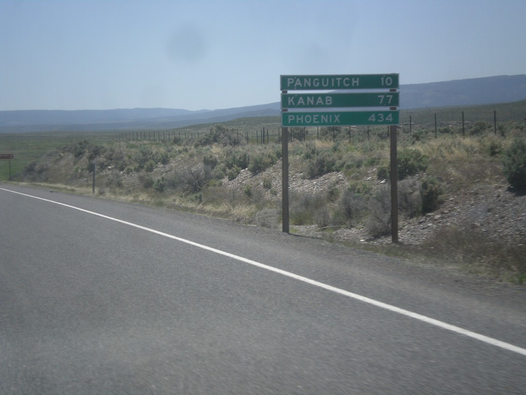
US-89 South - Distance Marker
Distance marker on US-89 south. Distance to Panguitch, Kanab, and Phoenix (Arizona).
Taken 05-19-2014
Spry
Garfield County
Utah
United States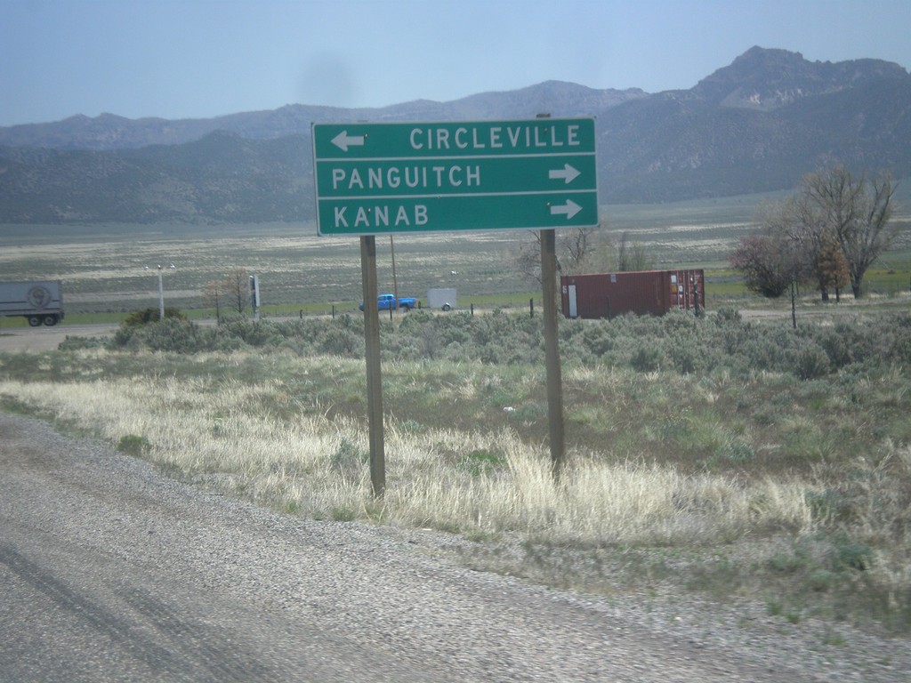
End UT-20 at US-89
End UT-20 East at US-89. Use US-89 north for Circleville; use US-89 south for Panguitch and Kanab.
Taken 05-19-2014
 Spry
Garfield County
Utah
United States
Spry
Garfield County
Utah
United States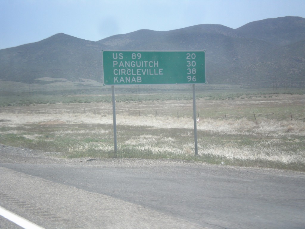
UT-20 East - Distance Marker
Distance marker on UT-20 east. Distance to US-89, Panguitch, Circleville, and Kanab.
Taken 05-19-2014
Paragonah
Iron County
Utah
United States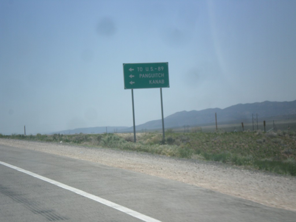
I-15 South at UT-20 Junction
I-15 south offramp at UT-20. Turn left for US-89, Panguitch, and Kanab.
Taken 05-19-2014
Paragonah
Iron County
Utah
United States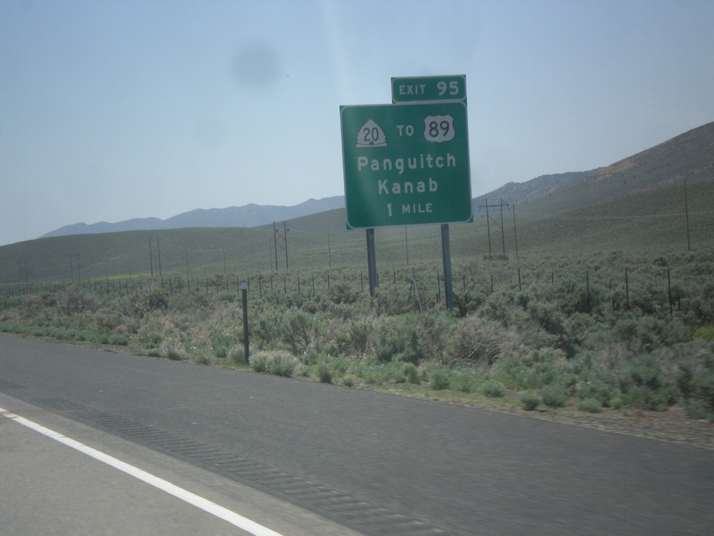
I-15 South - Exit 95
I-15 south at Exit 95 - UT-20/To US-89/Panguitch/Kanab. UT-20 is a short highway that connects I-15 with US-89.
Taken 05-19-2014
Paragonah
Iron County
Utah
United States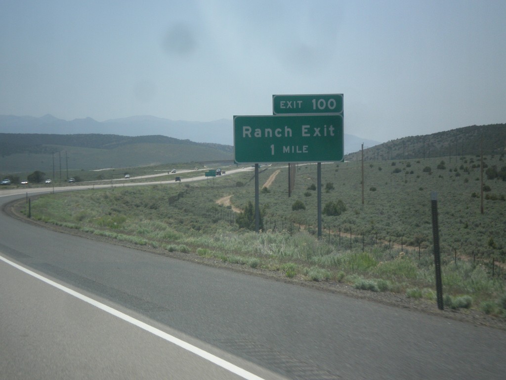
I-15 South - Exit 100
I-15 south approaching Exit 100 - Ranch Exit.
Taken 05-19-2014
Beaver
Beaver County
Utah
United States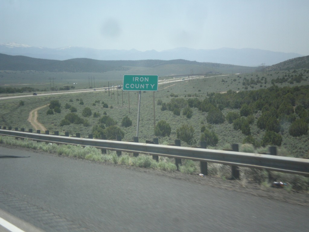
I-15 South - Iron County
Iron County on I-15 south.
Taken 05-19-2014
Beaver
Beaver County
Utah
United States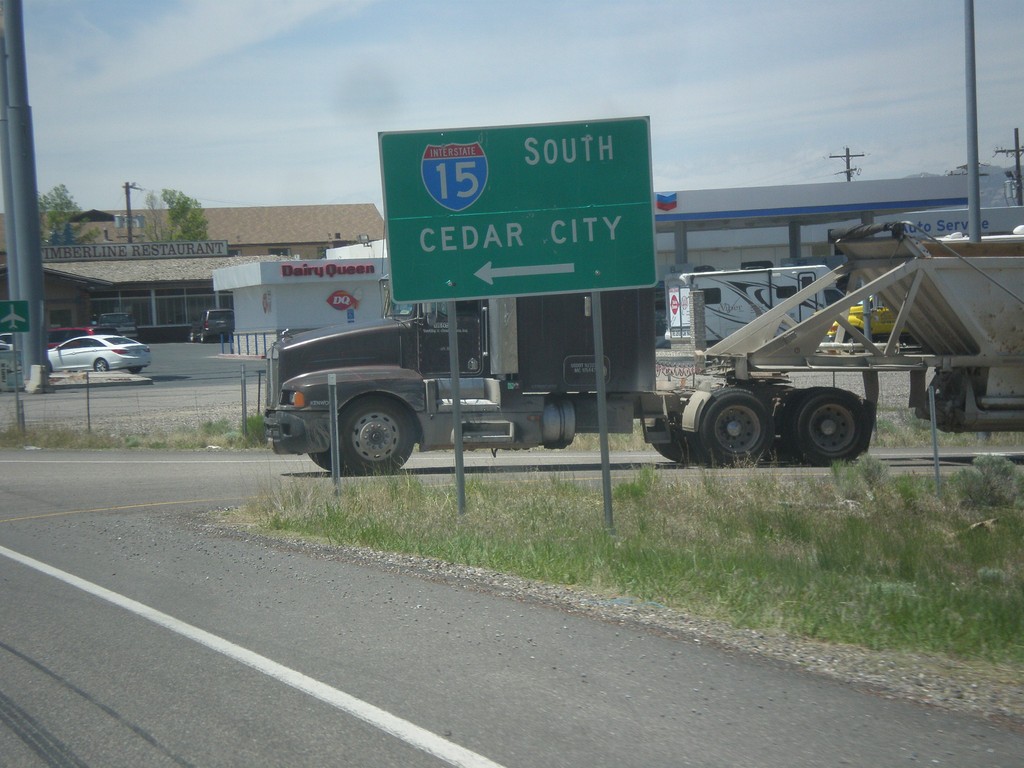
BL-15/UT-160 South at I-15
BL-15/UT-160 South at I-15 to Cedar City. This is the end of the Beaver business loop and UT-160.
Taken 05-19-2014
 Beaver
 County
Utah
United States
Beaver
Beaver County
Utah
United States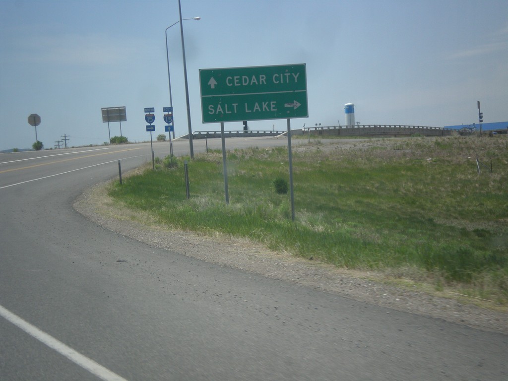
BL-15/UT-160 South Approaching I-15
BL-15/UT-160 South approaching I-15 (Exit 109) in Beaver. Use I-15 north for Salt Lake; I-15 south for Cedar City.
Taken 05-19-2014
Beaver
Beaver County
Utah
United States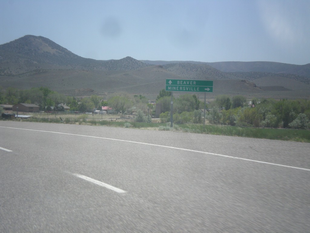
UT-21 East at UT-130
UT-21 east at UT-130 south to Minersville. Continue east on UT-21 for Beaver.
Taken 05-19-2014
 Minersville
Beaver County
Utah
United States
Minersville
Beaver County
Utah
United States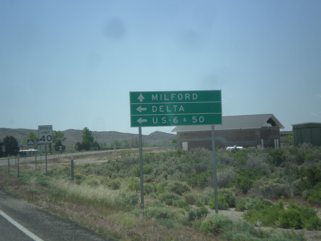
UT-21 East at UT-159
UT-21 east approaching UT-159 north to US-6/US-50 and Delta. Continue east on UT-21 for Milford.
Taken 05-19-2014
 Garrison
Millard County
Utah
United States
Garrison
Millard County
Utah
United States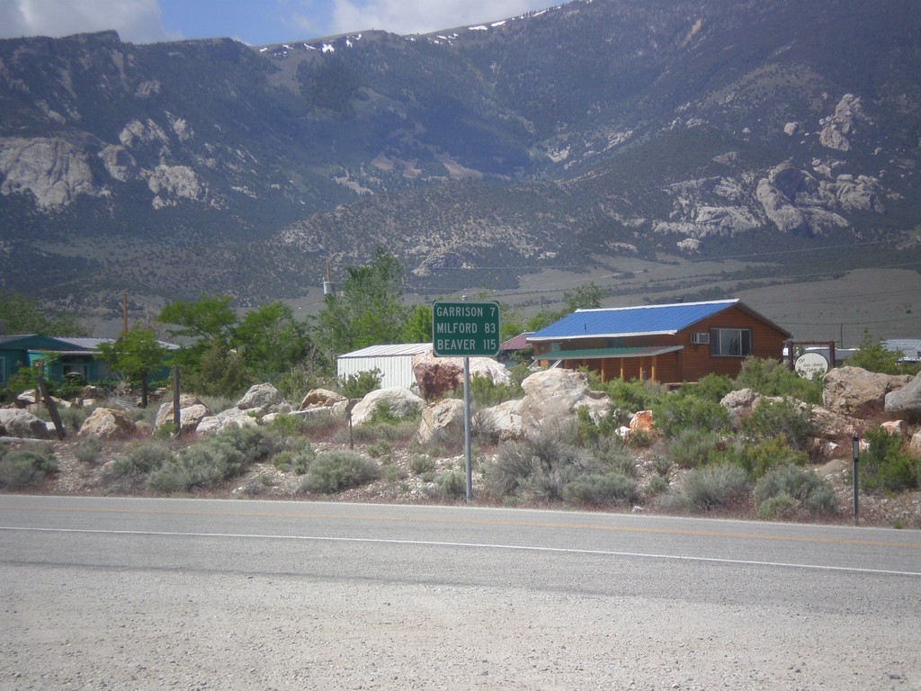
NV-487 South - Distance Marker
Distance marker on NV-487 south. Distance to Gunnison, Milford, and Beaver. All three locations are located in Utah.
Taken 05-19-2014
 Baker
White Pine County
Nevada
United States
Baker
White Pine County
Nevada
United States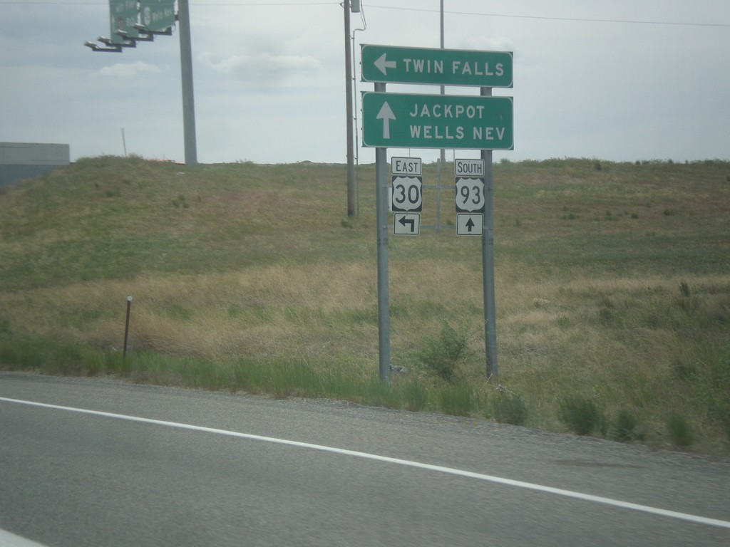
US-93 South at US-30 East
US-93 south at US-30 east to Twin Falls. Continue south on US-93 for Jackpot (NV) and Wells (NV). This sign is not typical in that the font is in all capital letters. Typically this sort of sign is not all upper case.
Taken 05-16-2014

 Filer
Twin Falls County
Idaho
United States
Filer
Twin Falls County
Idaho
United States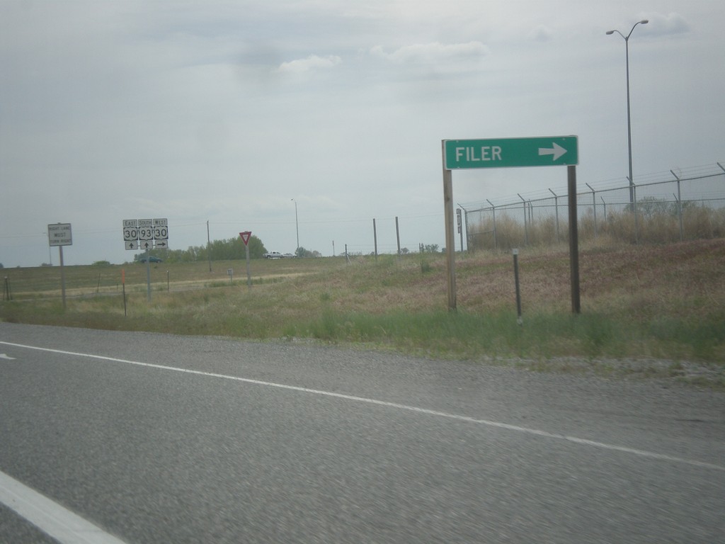
US-93 South Approaching US-30 West
US-93 South approaching US-30 West. Use US-30 west for Filer.
Taken 05-16-2014
Filer
Twin Falls County
Idaho
United States