Signs Tagged With Big Green Sign
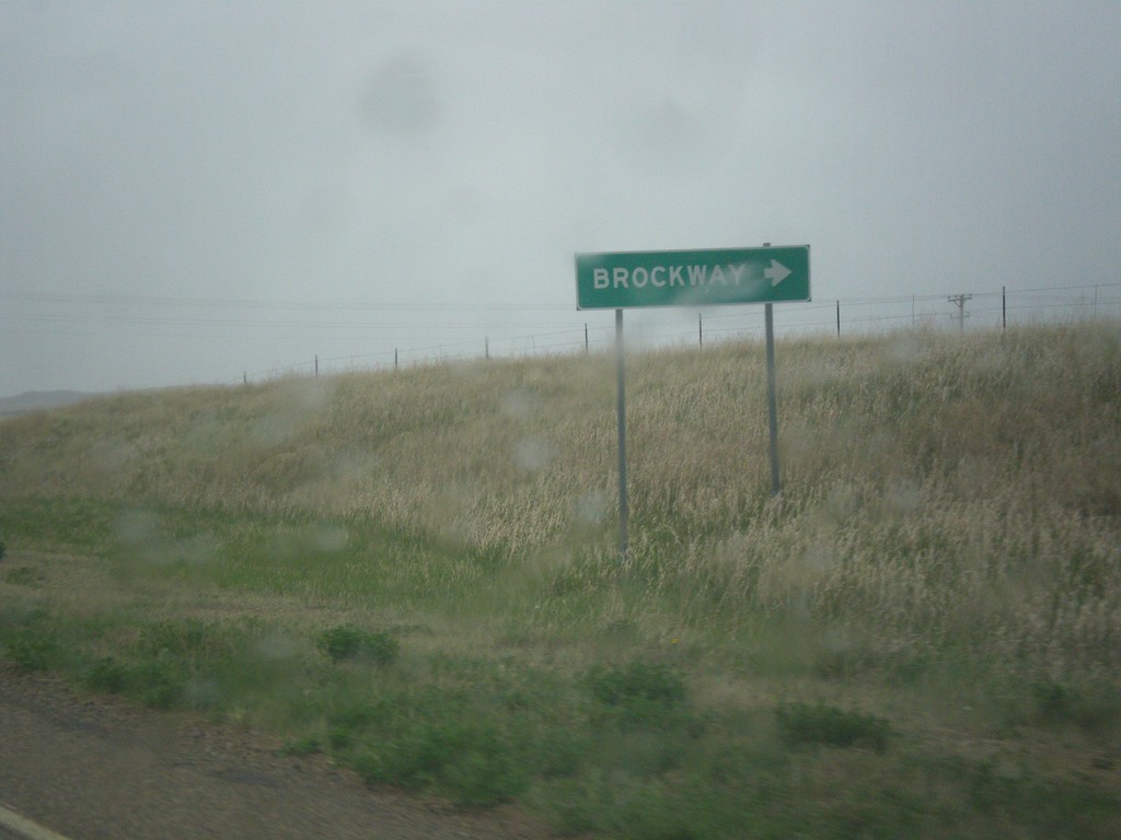
MT-200 East at MTS-253
MT-200 East at MTS-253 south to Brockway.
Taken 05-08-2015

 Brockway
McCone County
Montana
United States
Brockway
McCone County
Montana
United States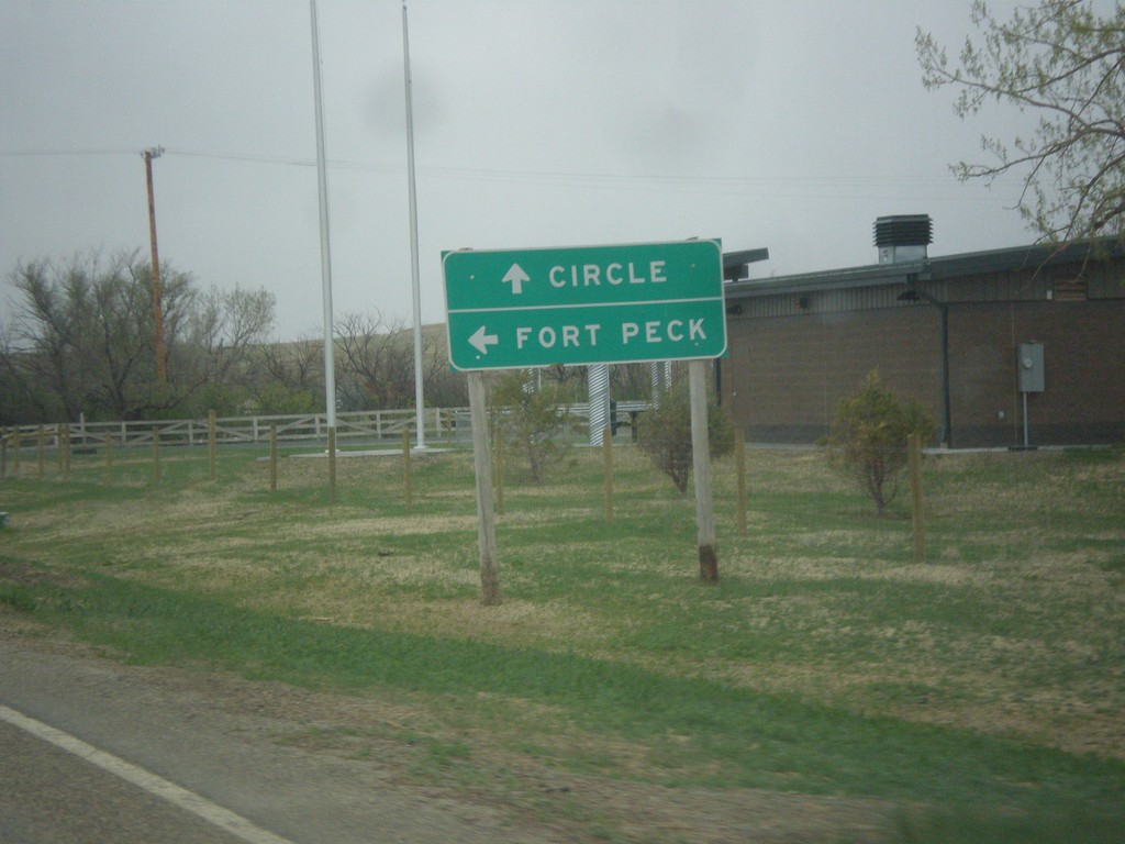
MT-200 East at MT-24
MT-200 East at MT-24 north to Fort Peck. Continue east on MT-200 for Circle.
Taken 05-08-2015
 Brockway
Garfield County
Montana
United States
Brockway
Garfield County
Montana
United States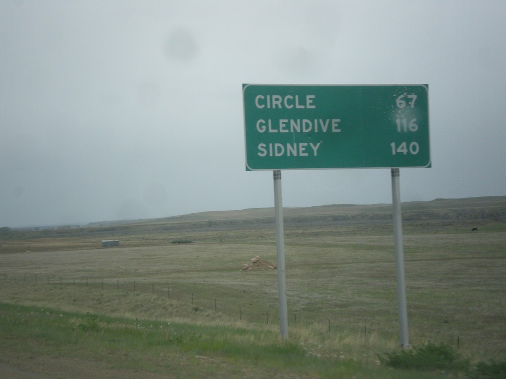
MT-200 East - Distance Marker
Distance marker on MT-200 east. Distance to Circle, Glendive (via MT-200S), and Sidney.
Taken 05-08-2015
Jordan
Garfield County
Montana
United States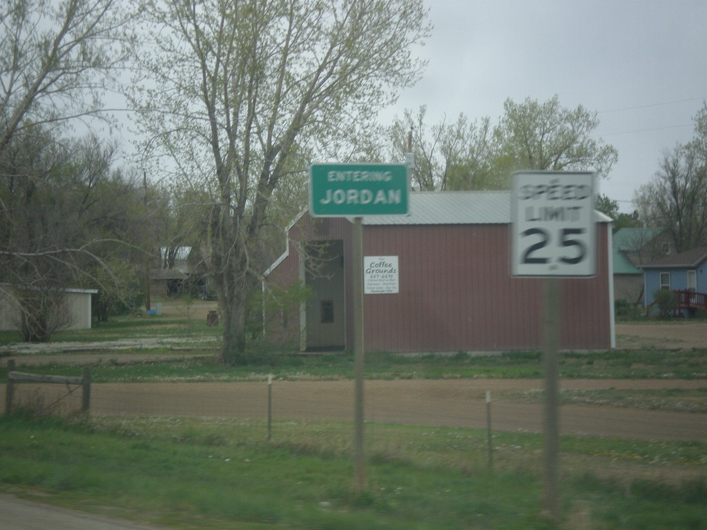
MT-200 East - Entering Jordan
Entering Jordan on MT-200 East. Jordan is the county seat of Garfield County, and one of the more isolated towns in the United States. It is 85 miles to Miles City, the nearest sizable city.
Taken 05-08-2015
Jordan
Garfield County
Montana
United States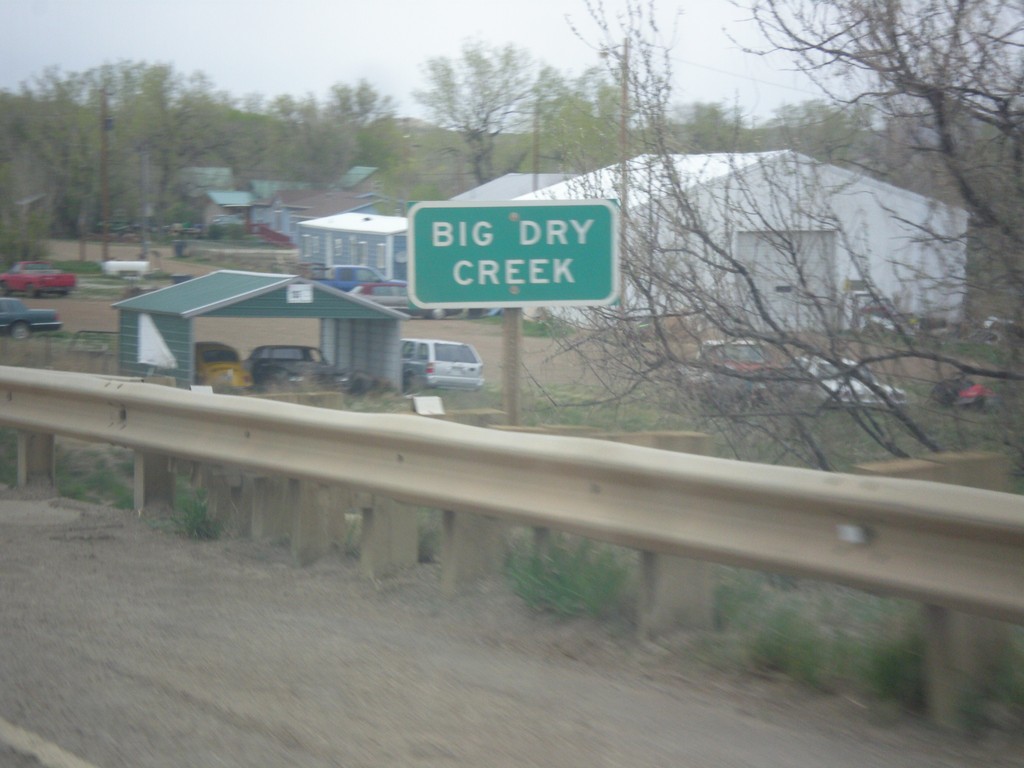
MT-200 East - Big Dry Creek
MT-200 east at Big Dry Creek in Jordan. When this picture was taken, it was a rainy day, and the creek was quite wet.
Taken 05-08-2015
Jordan
Garfield County
Montana
United States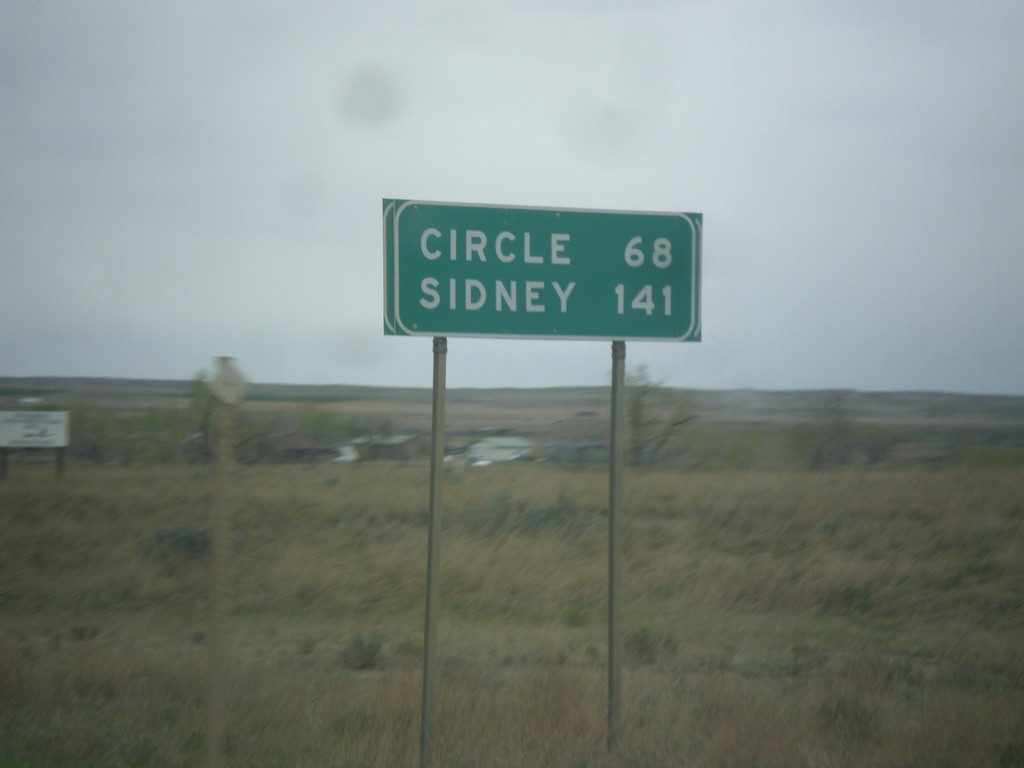
MT-200 East - Distance Marker
Distance marker on MT-200 east. Distance to Circle and Sidney.
Taken 05-08-2015
Jordan
Garfield County
Montana
United States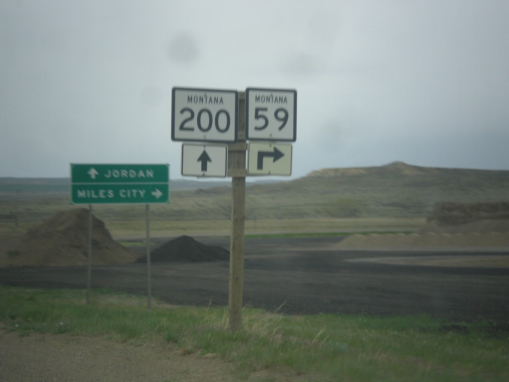
MT-200 East Approaching MT-59
MT-200 East approaching MT-59 south to Miles City. Continue east on MT-200 for Jordan.
Taken 05-08-2015
 Jordan
Garfield County
Montana
United States
Jordan
Garfield County
Montana
United States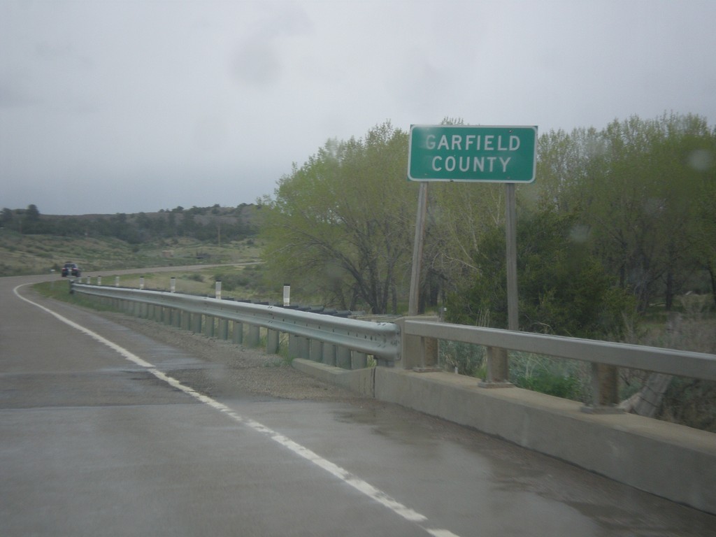
MT-200 East - Garfield County
Entering Garfield County on MT-200 East. Garfield County, Montana has one of the smallest population densities in the Lower-48. It has the lowest population density in Montana.
Taken 05-08-2015
Mosby
Garfield County
Montana
United States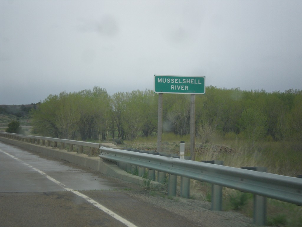
MT-200 East - Musselshell River
MT-200 east at the Musselshell River. The Musselshell River is a tributary of the Missouri River, running east-west through central Montana.
Taken 05-08-2015
Mosby
Petroleum County
Montana
United States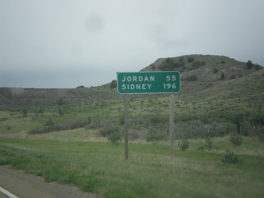
MT-200 East - Distance Marker
Distance marker on MT-200 east. Distance to Jordan and Sidney.
Taken 05-08-2015
Mosby
Petroleum County
Montana
United States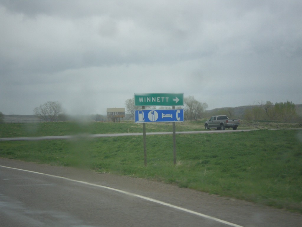
MT-200 East at MTS-244
MT-200 East at MTS-244 South to Winnett. Winnett is the county seat of Petroleum County, Montana. Petroleum County is the smallest county by population in Montana, with 494 residents as of the 2010 Census.
Taken 05-08-2015
Winnett
Petroleum County
Montana
United States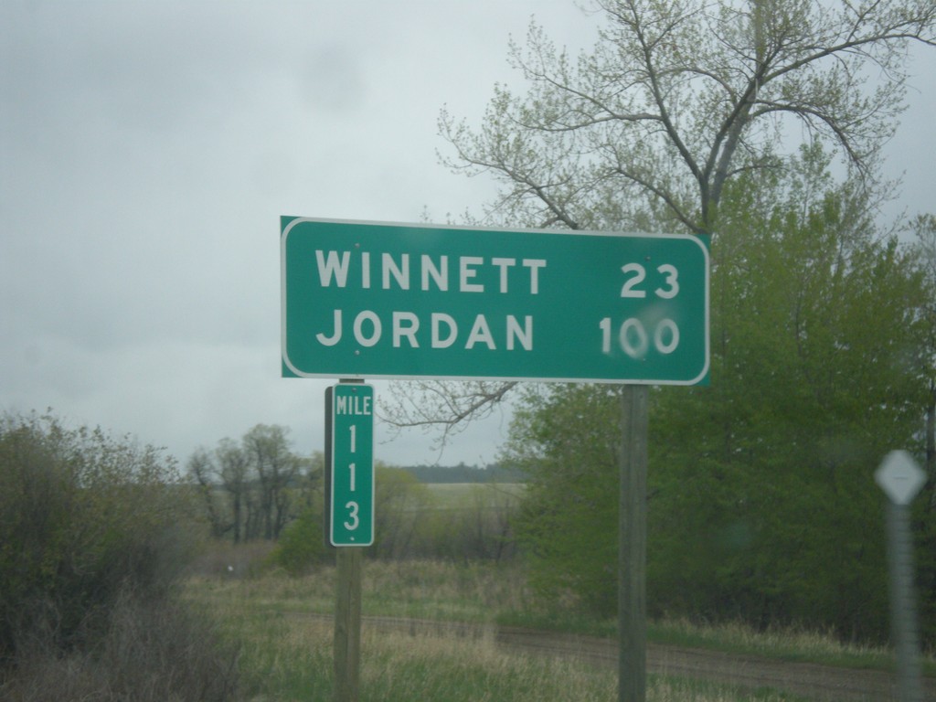
MT-200 East - Distance Marker
Distance marker on MT-200 east. Distance to Winnett and Jordan. Taken at Milepost 113.
Taken 05-08-2015
Grass Range
Fergus County
Montana
United States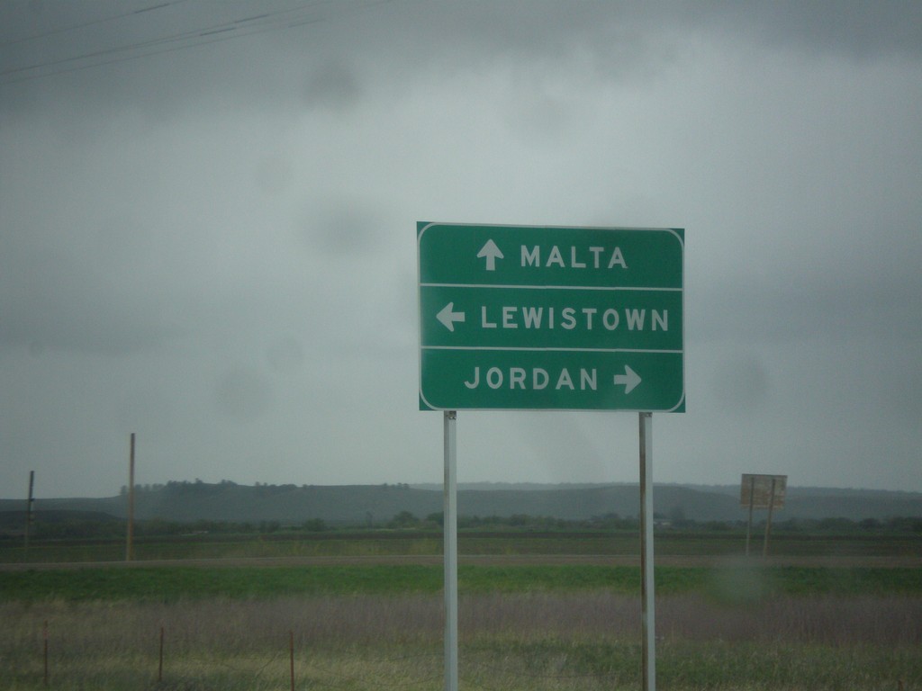
US-87 North at MT-19/MT-200
US-87 north at MT-19 and MT-200. Turn left to continue north on US-87 and MT-200 West to Lewistown; straight for MT-19 to Malta; right for MT-200 East to Jordan.
Taken 05-08-2015

 Grass Range
Fergus County
Montana
United States
Grass Range
Fergus County
Montana
United States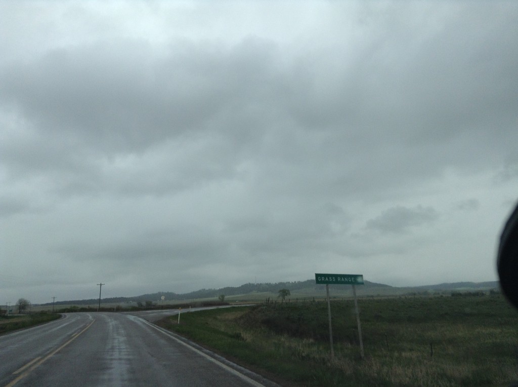
US-87 South/MT-200 East at Grass Range Junction
US-87 South/MT-200 East at Grass Range junction.
Taken 05-08-2015
Grass Range
Fergus County
Montana
United States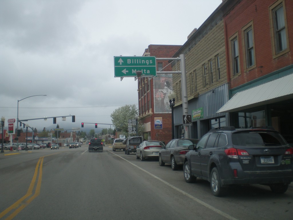
US-87 South/MT-200 East at MTS-238/To US-191
US-87 South/MT-200 East at MTS-238/To US-191. Turn left for US-191 and Malta. Continue straight for US-87 South/MT-200 East to Billings.
Taken 05-08-2015

 Lewistown
Fergus County
Montana
United States
Lewistown
Fergus County
Montana
United States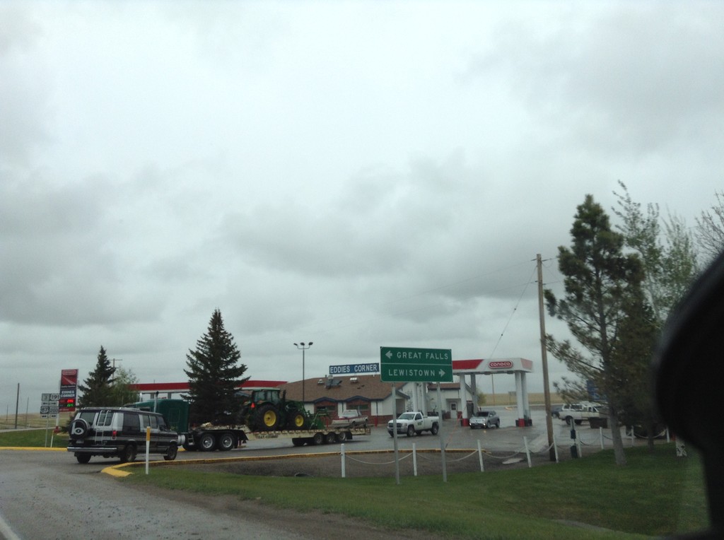
US-191 North/MT-3 West at US-87/MT-200
US-191 North/MT-3 West at US-87/MT-200. Turn left for US-87 North/MT-3/MT-200 West to Great Falls; right for US-191 North/US-87 South/MT-200 East to Lewistown.
Taken 05-08-2015
 Moore
Fergus County
Montana
United States
Moore
Fergus County
Montana
United States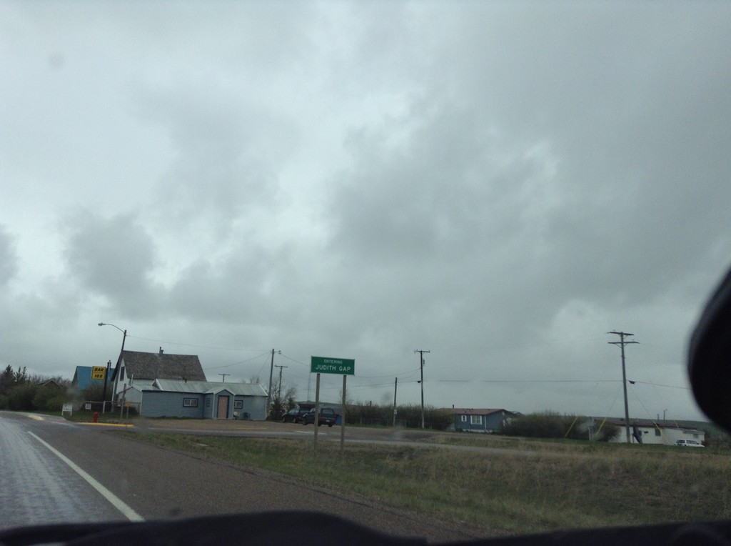
US-191 North - Entering Judith Gap
Entering Judith Gap on US-191 north.
Taken 05-08-2015
Judith Gap
Wheatland County
Montana
United States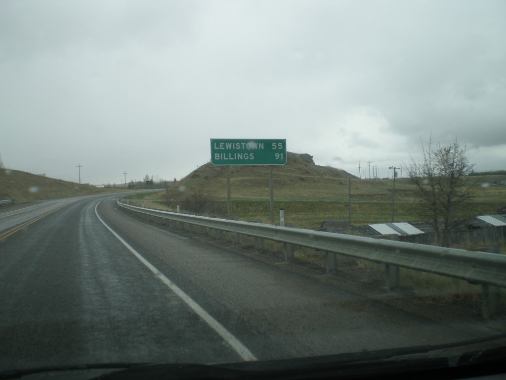
US-12 East/US-191 North - Distance Marker
Distance marker on US-12 East/US-191 North. Distance to Lewistown (via US-191) and Billings (via US-12 and MT-3).
Taken 05-08-2015
 Harlowton
Wheatland County
Montana
United States
Harlowton
Wheatland County
Montana
United States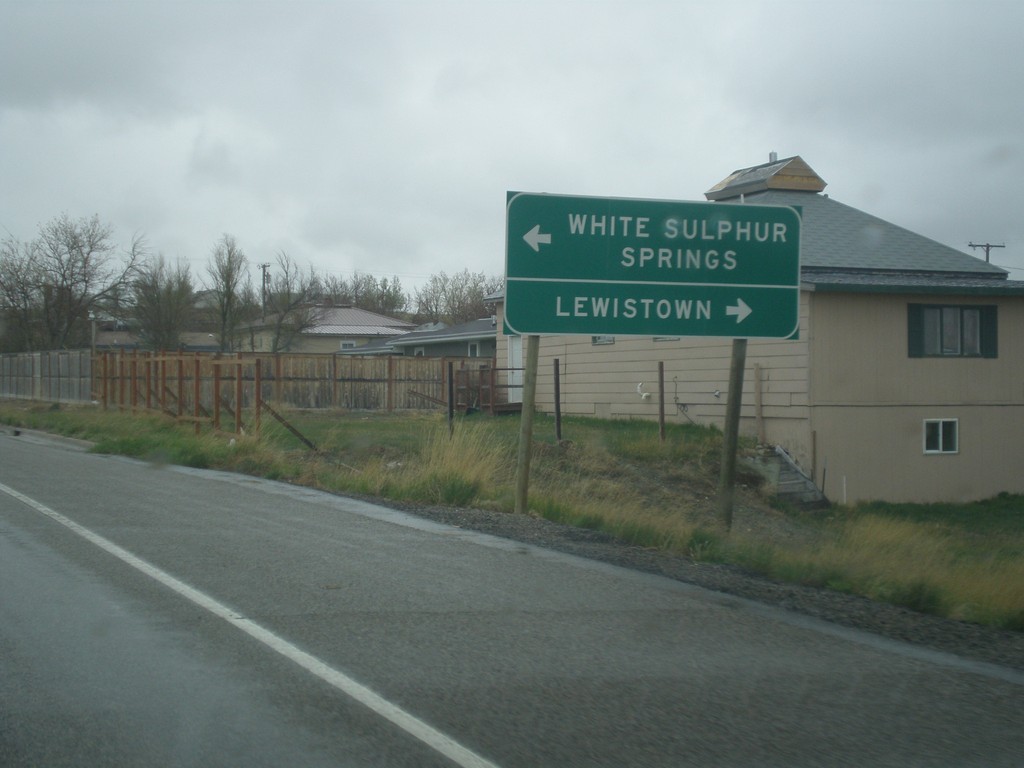
US-191 North Approaching US-12
US-191 north approaching US-12 in Harlowton. Turn left for US-12 west to White Sulphur Springs; right for US-191 North/US-12 East to Lewistown. US-191 North joins US-12 East through Harlowton.
Taken 05-08-2015
Harlowton
Wheatland County
Montana
United States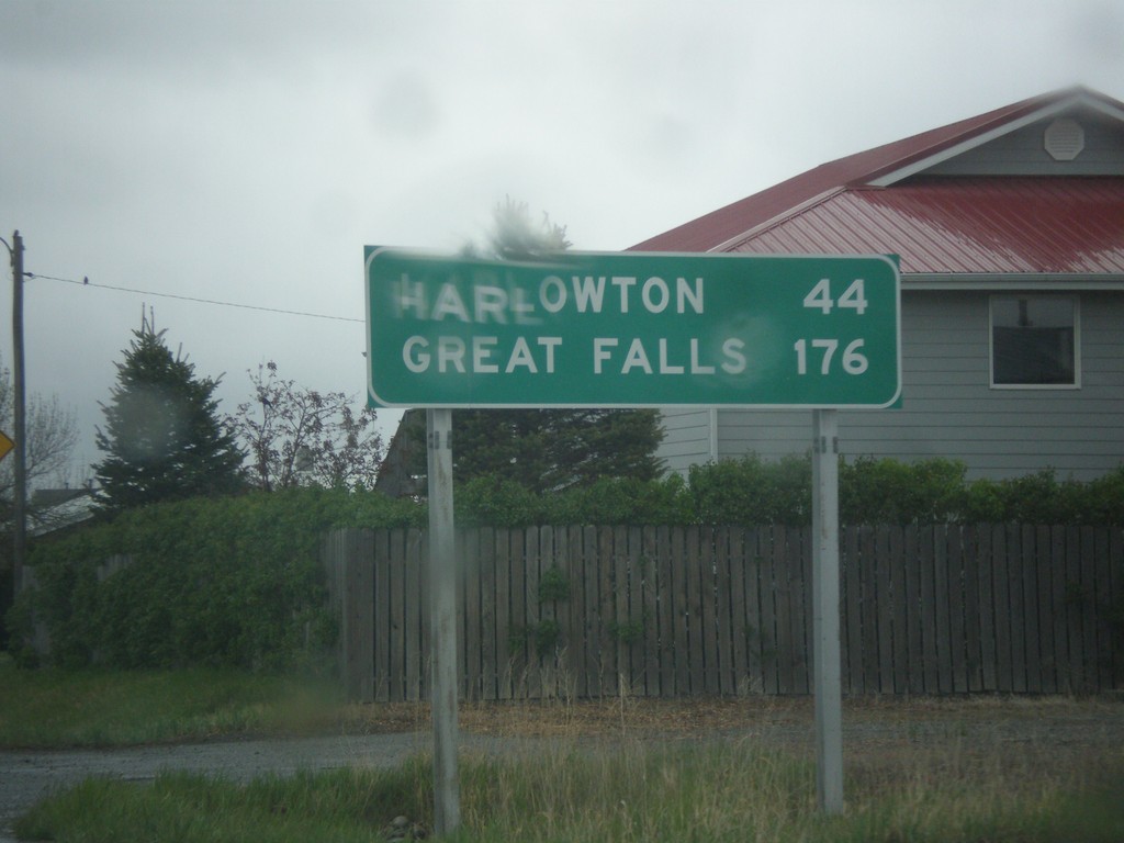
US-191 North - Distance Marker
Distance marker on US-191 north. Distance to Harlowton and Great Falls.
Taken 05-08-2015
Big Timber
Sweet Grass County
Montana
United States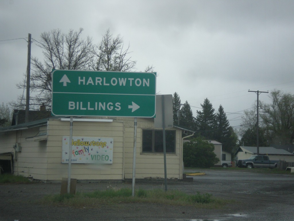
BL-90 East/US-191 North at BL-90/US-191 Split
BL-90 East/US-191 North at BL-90/US-191 split. Merge right on BL-90 for Billings; merge left on US-191 for Harlowton.
Taken 05-08-2015
 Big Timber
Sweet Grass County
Montana
United States
Big Timber
Sweet Grass County
Montana
United States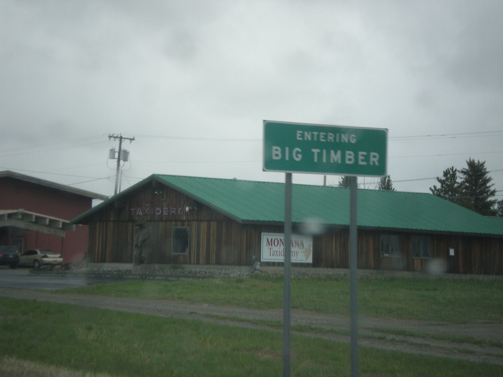
US-191 North/BL-90 East - Big Timber
Entering Big Timber on US-191 North/BL-90 East. Big Timber is the county seat of Sweet Grass County and is situated on the Yellowstone River.
Taken 05-08-2015
Big Timber
Sweet Grass County
Montana
United States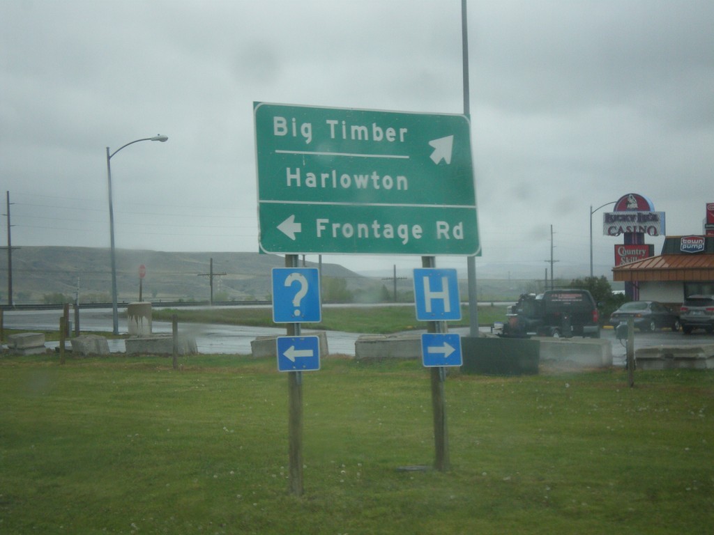
US-191 North/BL-90 East at Frontage Road
US-191 North/BL-90 East at Frontage Road. Turn right to continue on US-191 North/BL-90 east to Big Timber and Harlowton.
Taken 05-08-2015
Big Timber
Sweet Grass County
Montana
United States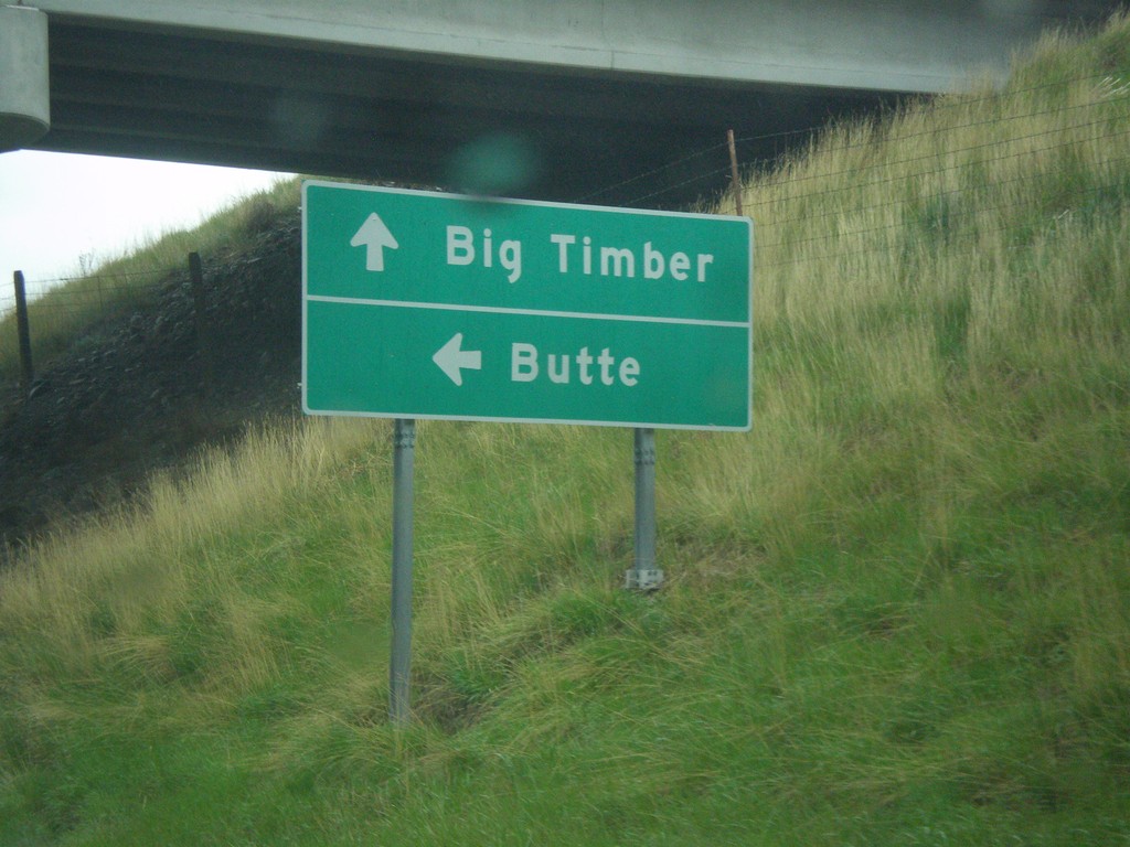
US-191 North/BL-90 East at I-90 West
US-191 North/BL-90 East at I-90 west. Turn left on I-90 West/US-191 South for Butte; continue straight for US-191 North/BL-90 East to Big Timber.
Taken 05-08-2015
 Big Timber
Sweet Grass County
Montana
United States
Big Timber
Sweet Grass County
Montana
United States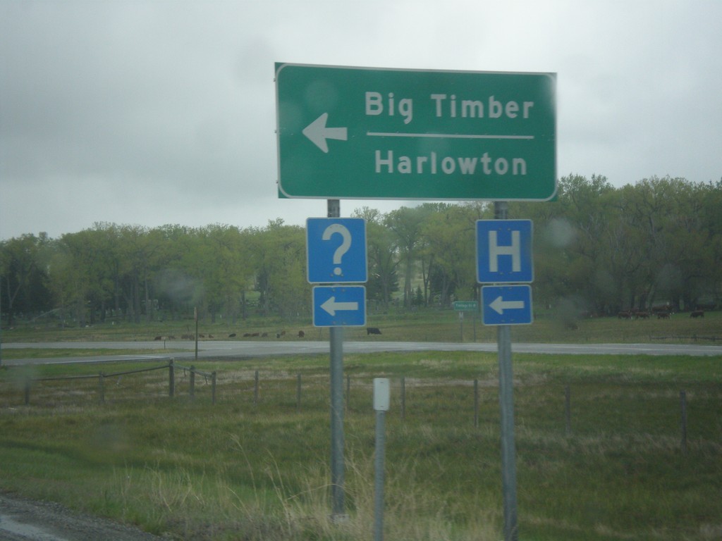
I-90 East - Exit 362 Offramp - Big Timber
I-90 east on Exit 362 offramp in Big Timber. Turn left for BL-90 and to continue north on US-191 for Harlowton and Big Timber.
Taken 05-08-2015
Big Timber
Sweet Grass County
Montana
United States