Signs Tagged With Big Green Sign
I-90 East - Exit 367
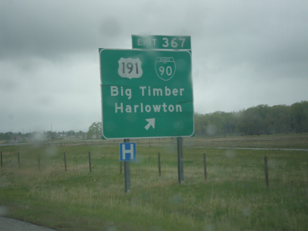
I-90 east at Exit 367 - US-191/BL-90/Big Timber/Harlowton. US-191 leaves I-90 eastbound here. Typically on a freeway junction assembly in Montana, the business loop shield is surrounded in a white box.
Taken 05-08-2015


 Big Timber
Sweet Grass County
Montana
United States
Big Timber
Sweet Grass County
Montana
United States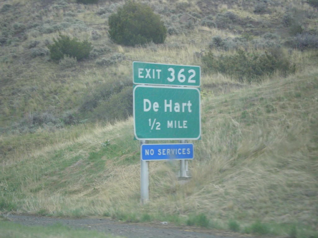
I-90 East - Exit 362
I-90 east approaching Exit 362 - De Hart.
Taken 05-08-2015
Big Timber
Sweet Grass County
Montana
United States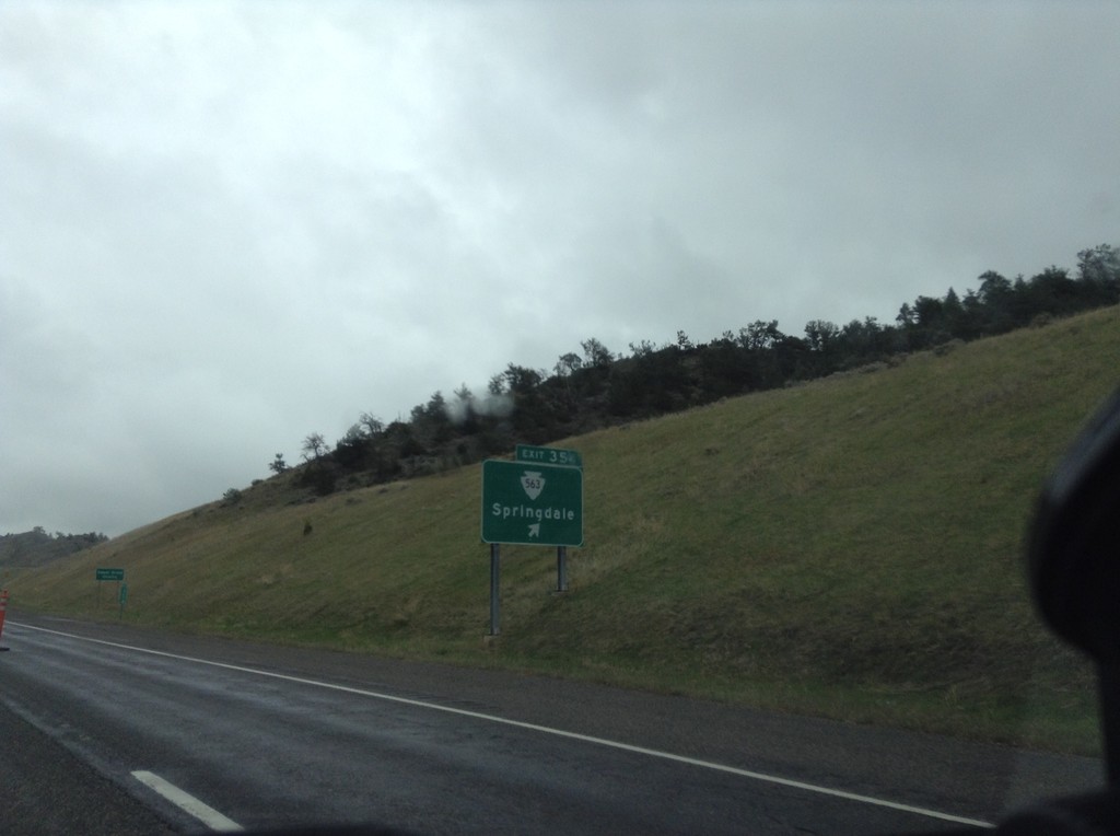
I-90 East - Exit 354
I-90 east at Exit 354 - MTS-563/Springdale.
Taken 05-08-2015
 Springdale
Park County
Montana
United States
Springdale
Park County
Montana
United States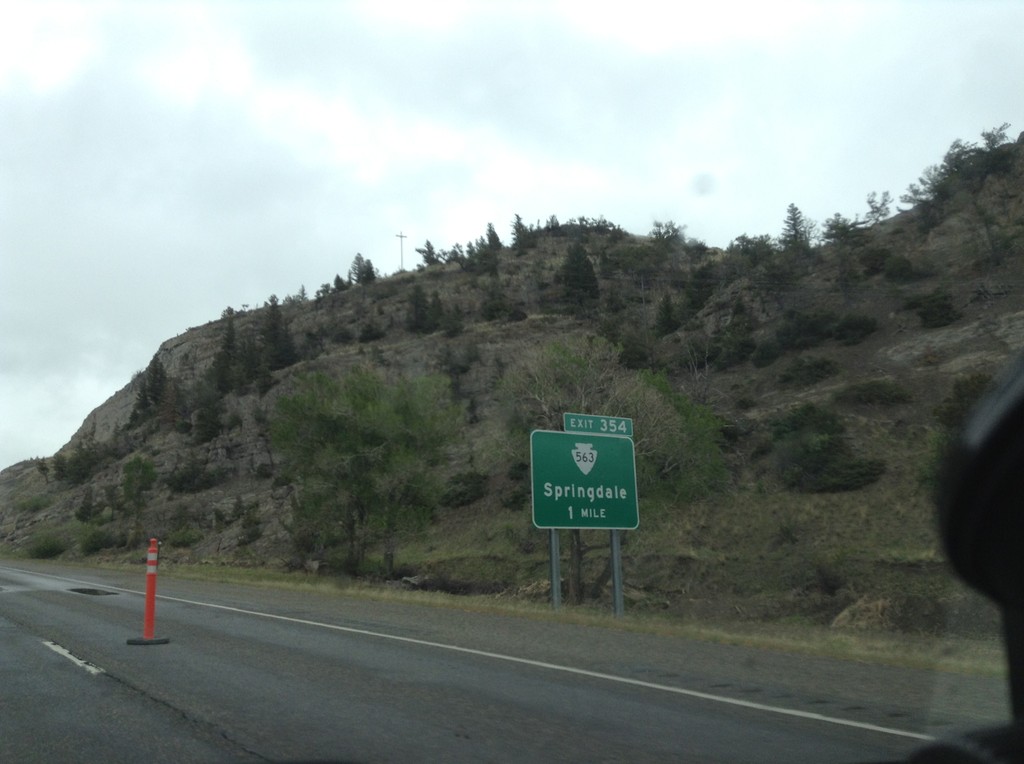
I-90 East - Exit 354
I-90 east approaching Exit 354 - MTS-563/Springdale.
Taken 05-08-2015
Big Timber
Park County
Montana
United States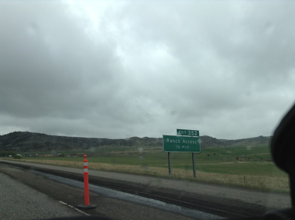
I-90 East - Exit 352
I-90 east approaching Exit 352 - Ranch Access.
Taken 05-08-2015
Big Timber
Park County
Montana
United States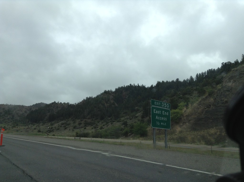
I-90 East - Exit 350
I-90 east approaching Exit 350 - East End Access.
Taken 05-08-2015
Livingston
Park County
Montana
United States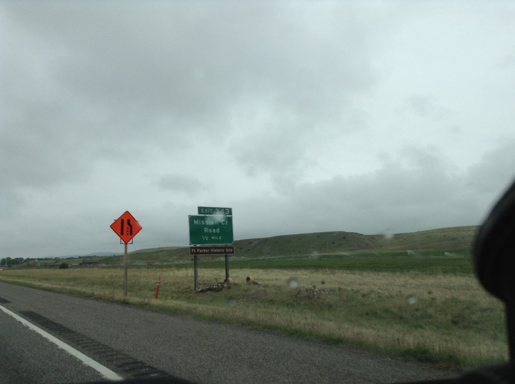
I-90 East - Exit 342
I-90 east approaching Exit 343 - Mission Creek Road.
Taken 05-08-2015
Livingston
Park County
Montana
United States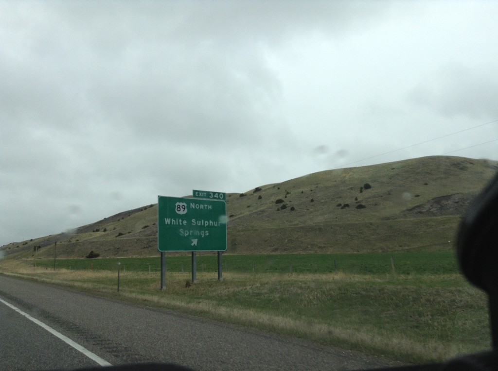
I-90 East - Exit 340
I-90 east at Exit 340 - US-89 North/White Sulphur Springs. US-89 leaves I-90/US-191 here.
Taken 05-08-2015
 Livingston
Park County
Montana
United States
Livingston
Park County
Montana
United States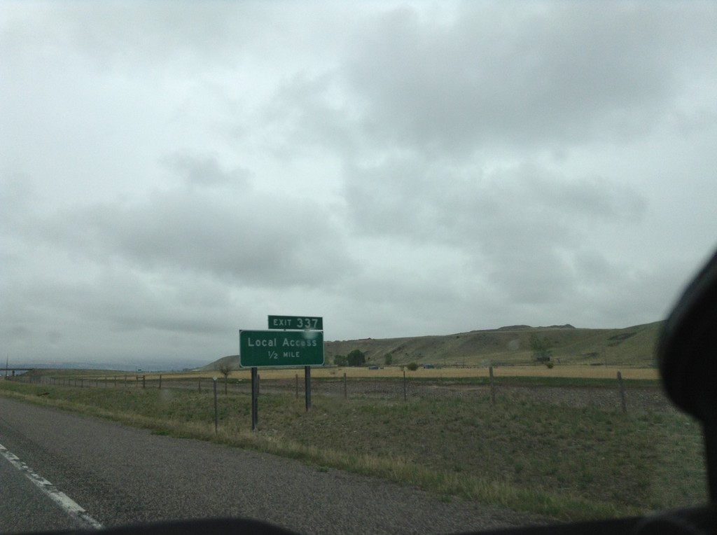
I-90 East - Exit 337
I-90 east approaching Exit 337 - Local Access. This is the eastern end of the Livingston business loop.
Taken 05-08-2015
Livingston
Park County
Montana
United States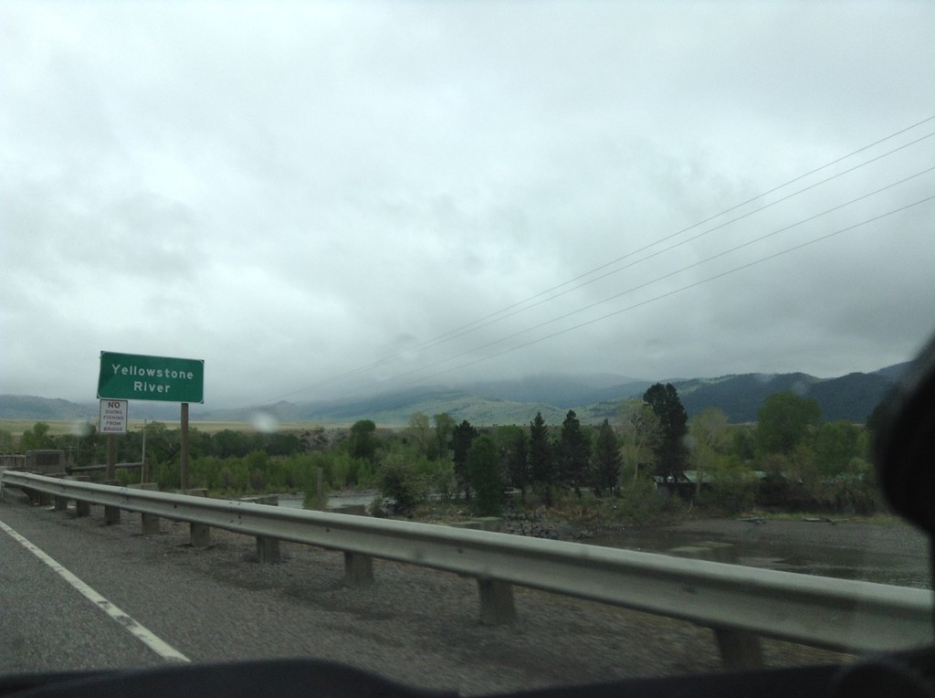
I-90 East - Yellowstone River
I-90 east crossing the Yellowstone River. This is the first crossing of the Yellowstone River on I-90. I-90 follows the Yellowstone River east to Bilings; thence I-94 follows it down to Glendive, Montana near the North Dakota line.
Taken 05-08-2015
Livingston
Park County
Montana
United States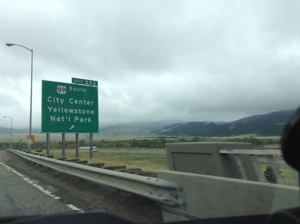
I-90 East - Exit 333
I-90 east at Exit 333 - US-89 South/City Center/Yellowstone National Park. US-89 heads south along the Yellowstone River to the Gardiner, Montana entrance to Yellowstone. US-89 joins I-90/US-191 east through Livingston.
Taken 05-08-2015
Livingston
Park County
Montana
United States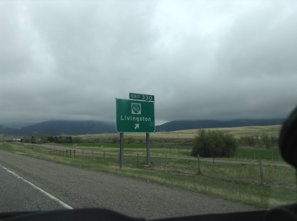
I-90 East - Exit 330
I-90 East at Exit 330 - BL-90/Livingston. This is the west end of the Livingston business loop.
Taken 05-08-2015
Livingston
Park County
Montana
United States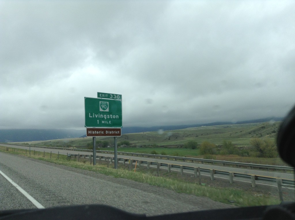
I-90 East - Exit 330
I-90 east approaching Exit 330 - BL-90/Livingston.
Taken 05-08-2015
Livingston
Park County
Montana
United States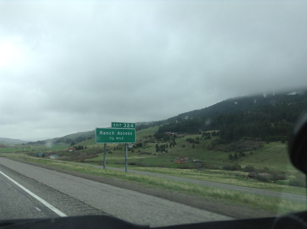
I-90 East - Exit 324
I-90 east approaching Exit 324 - Ranch Access.
Taken 05-08-2015
Livingston
Park County
Montana
United States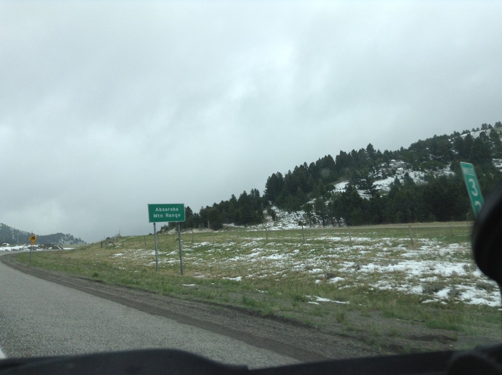
I-90 East - Bozeman Pass
I-90 east at Bozeman Pass. Bozeman Pass is part of the Absaroka Mountain Range. These type of signs are common across Montana, giving name to the many mountain ranges in the state.
Taken 05-08-2015
Muir
Park County
Montana
United States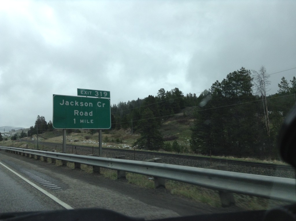
I-90 East - Exit 319
I-90 east approaching Exit 319 - Jackson Creek Road.
Taken 05-08-2015
Bozeman
Gallatin County
Montana
United States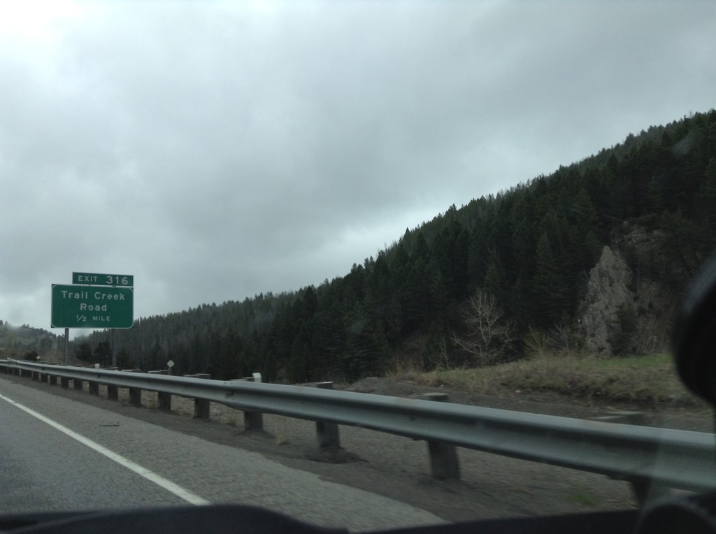
I-90 East - Exit 316
I-90 east approaching Exit 316 - Trail Creek Road.
Taken 05-08-2015
Bozeman
Gallatin County
Montana
United States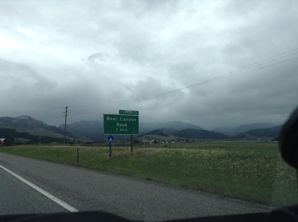
I-90 East - Exit 313
I-90 east approaching Exit 313 - Bear Canyon Road.
Taken 05-08-2015
Bozeman
Gallatin County
Montana
United States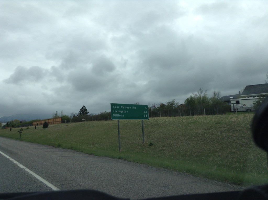
I-90 East - Distance Marker
Distance marker on I-90 east. Distance to Bear Canyon Road, Livingston, and Billings.
Taken 05-08-2015
Bozeman
Gallatin County
Montana
United States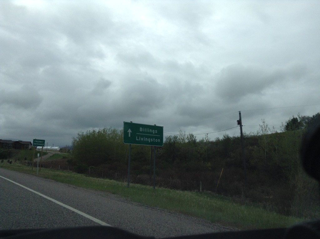
BL-90/US-191 at I-90 East
BL-90/US-191 at I-90 East onramp. US-191 joins I-90 east to Big Timber. Use I-90 east for Livingston and Billings.
Taken 05-08-2015
Bozeman
Gallatin County
Montana
United States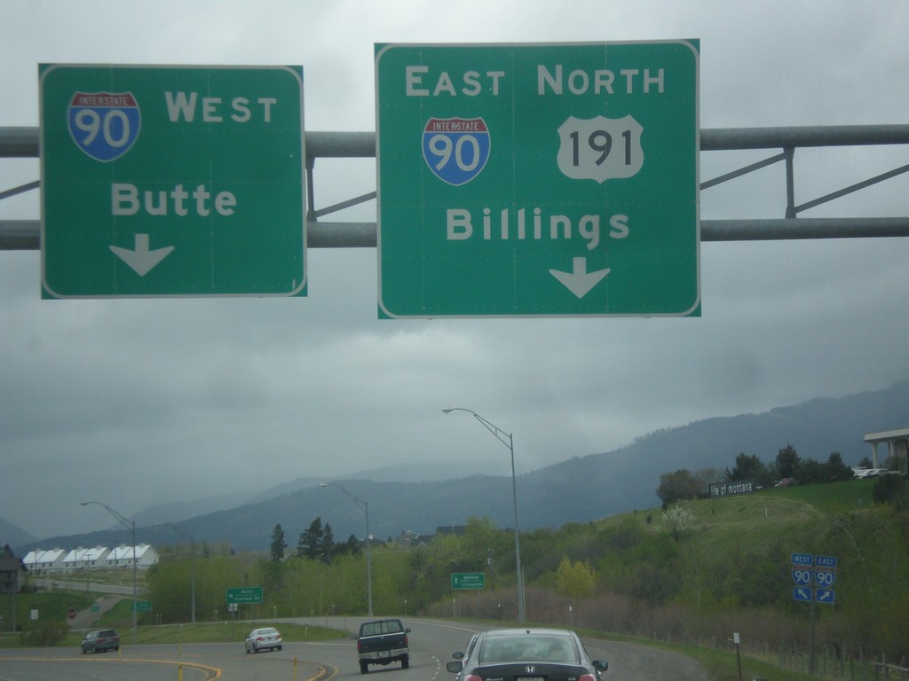
US-191 North/BL-90 East at I-90
US-191 North/BL-90 East at I-90. Merge right for I-90 East/US-191 North to Billings; merge left for I-90 West to Butte.
Taken 05-08-2015
Bozeman
Gallatin County
Montana
United States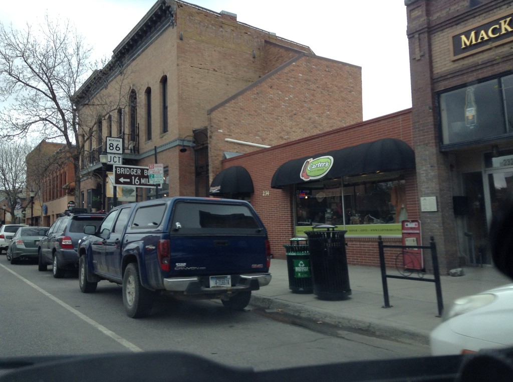
US-191 North/BL-90 East at MT-86
US-191 North/BL-90 East at MT-86 to Bridger Bowl (Ski Area).
Taken 05-08-2015
 Bozeman
Gallatin County
Montana
United States
Bozeman
Gallatin County
Montana
United States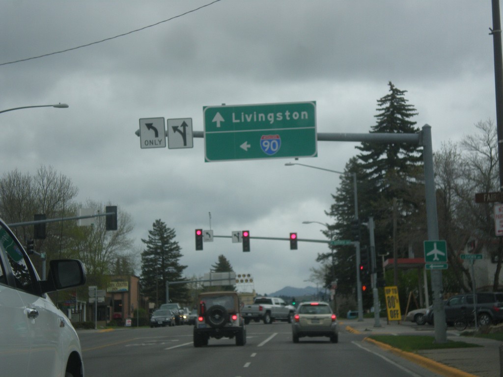
US-191 North at BL-90 - Bozeman
US-191 North (Main St.) at BL-90 (7th St.) in Bozeman. Turn left for BL-90 west to I-90 (West); continue straight for US-191 North/BL-90 East to Livingston (via I-90 east).
Taken 05-08-2015
Bozeman
Gallatin County
Montana
United States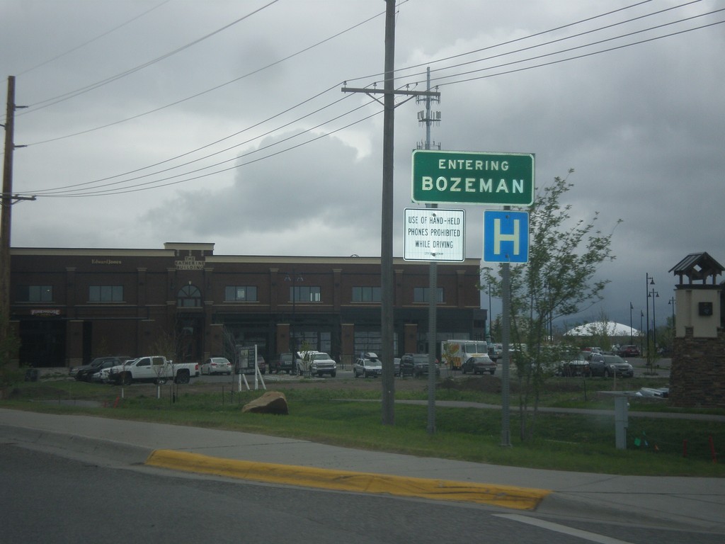
US-191 North - Bozeman
Entering Bozeman on US-191 north. Bozeman is the home of Montana State University and the fourth largest city in Montana.
Taken 05-08-2015
Bozeman
Gallatin County
Montana
United States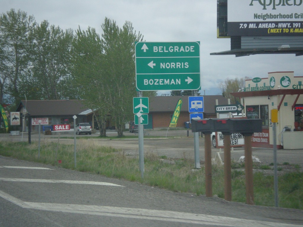
US-191 North at MT-84/MT-85
US-191 North at MT-84/MT-85. Turn right to continue north on US-191 for Bozeman; straight for MT-85 North to Belgrade; left for MT-84 West to Norris.
Taken 05-08-2015

 Bozeman
Gallatin County
Montana
United States
Bozeman
Gallatin County
Montana
United States