Signs Tagged With Big Green Sign
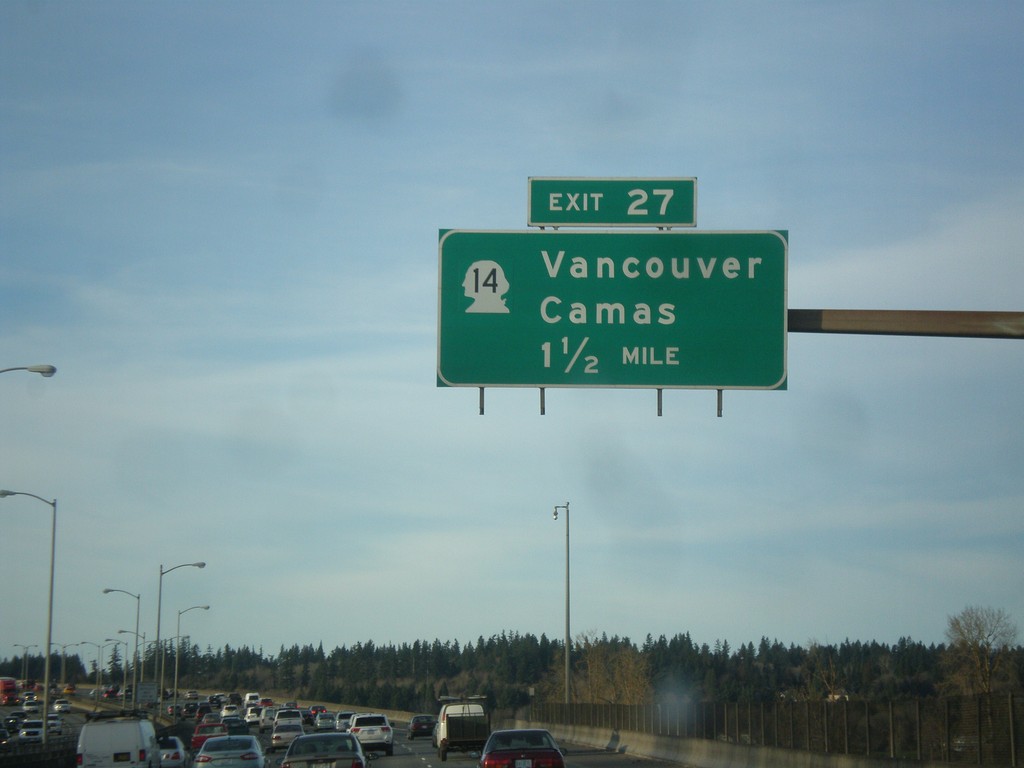
I-205 North - Exit 27
I-205 north approaching Exit 27 - WA-14/Vancouver/Camas. The milemarkers and exit numbers along I-205 do not reset back to zero when crossing into Washington. They continue on the Oregon numbering scheme. Although this is a Washington exit, this sign is still within Oregon.
Taken 02-16-2015

 Portland
Multnomah County
Oregon
United States
Portland
Multnomah County
Oregon
United States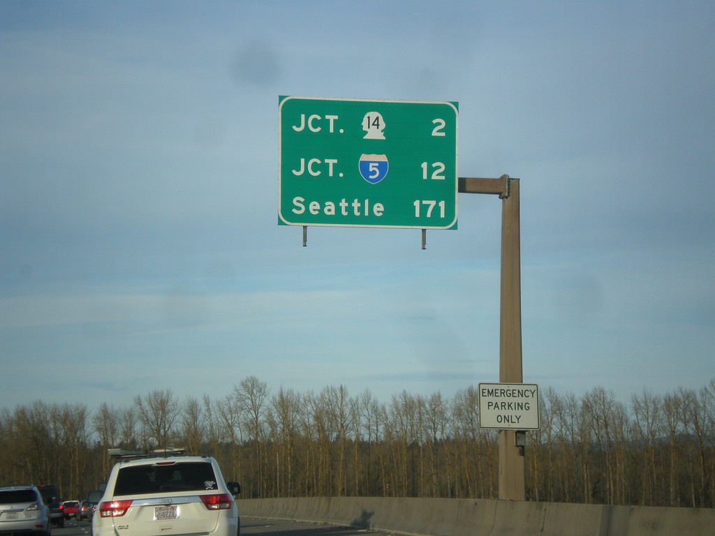
I-205 North - Distance Marker
Last distance marker on I-205 north in Oregon. Distance to WA-14, I-5, and Seattle.
Taken 02-16-2015
Portland
Multnomah County
Oregon
United States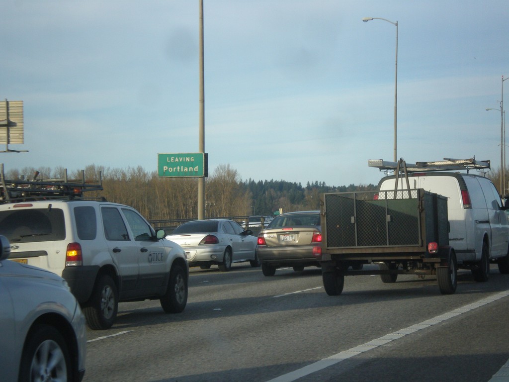
I-205 North - Leaving Portland
Leaving Portland on I-205 north, on bridge over Columbia River.
Taken 02-16-2015
Portland
Multnomah County
Oregon
United States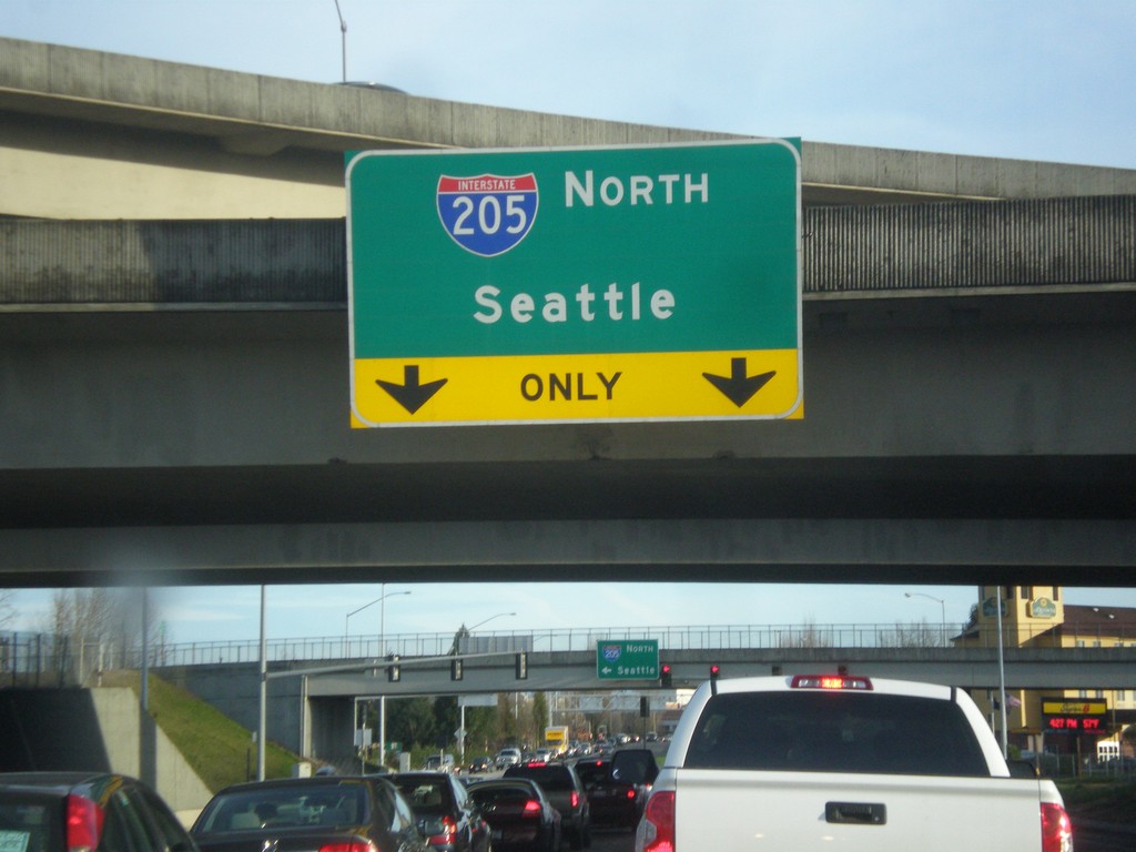
NE Airport Way at I-205 North
NE Airport Way at I-205 North to Seattle.
Taken 02-16-2015
Portland
Multnomah County
Oregon
United States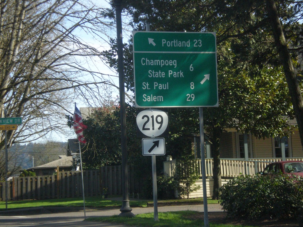
OR-99W North/OR-219 South Split in Newberg
OR-99W North/OR-219 South split in Newberg. Use OR-219 south for Champoeg State Park, St. Paul, and Salem. Continue north on OR-99W for Portland.
Taken 02-16-2015

 Newberg
Yamhill County
Oregon
United States
Newberg
Yamhill County
Oregon
United States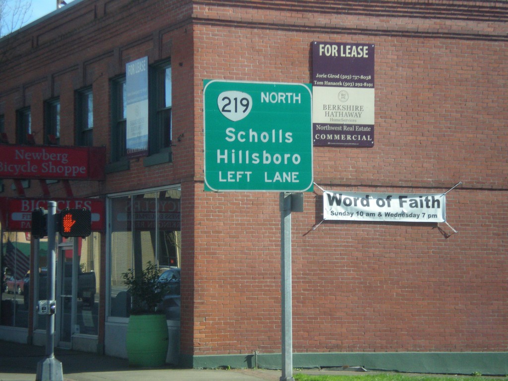
OR-99W North Approaching OR-219
OR-99W North Approaching OR-219 North to Scholls and Hillsboro. OR-219 joins OR-99W through Newberg.
Taken 02-16-2015
Newberg
Yamhill County
Oregon
United States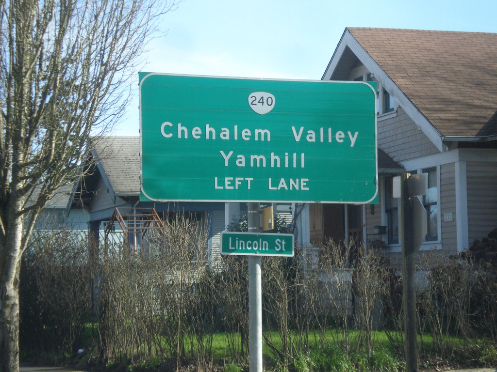
OR-99W North Approaching OR-240
OR-99W north approaching OR-240 north to Chehalem Valley and Yamhill. Use left lanes for OR-240 North.
Taken 02-16-2015
 Newberg
Yamhill County
Oregon
United States
Newberg
Yamhill County
Oregon
United States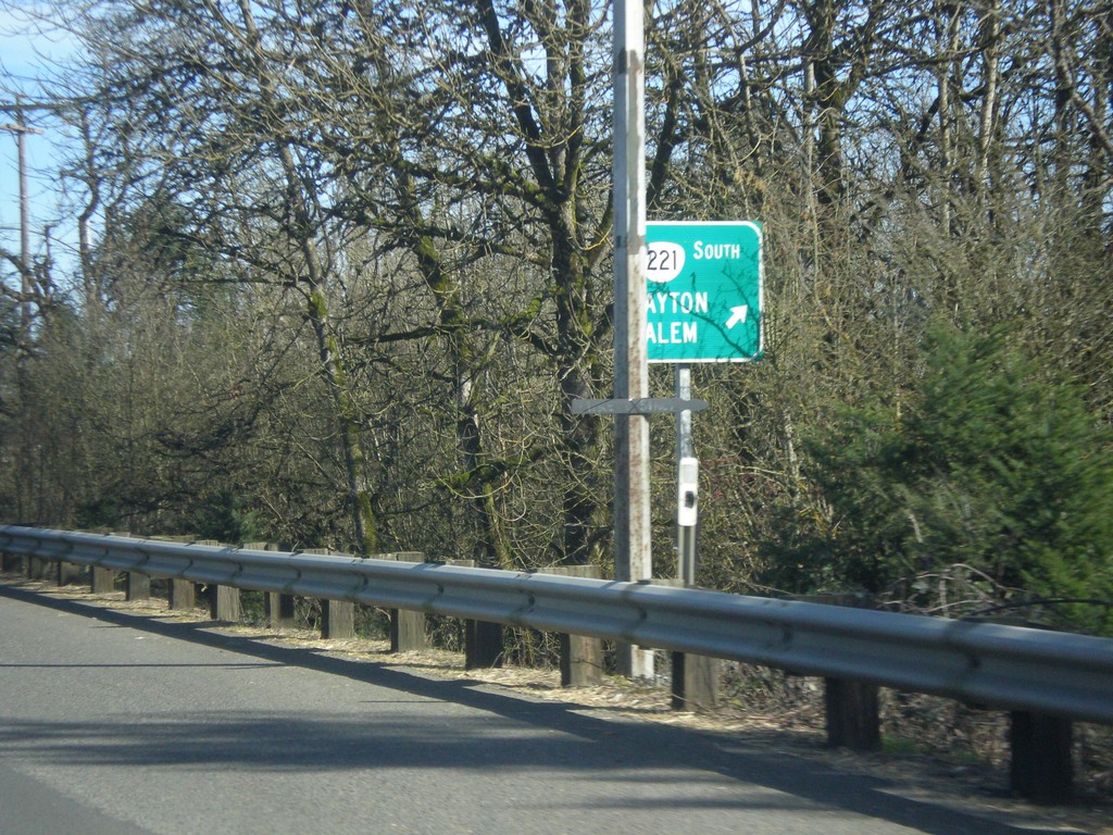
OR-18 East/OR-233 North at OR-221 South
OR-18 East/OR-233 North at OR-221 South to Dayton and Salem.
Taken 02-16-2015


 Dayton
Yamhill County
Oregon
United States
Dayton
Yamhill County
Oregon
United States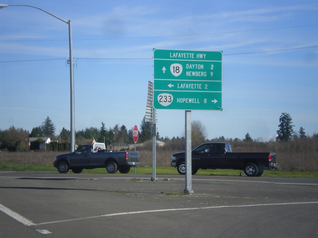
OR-18 East at OR-233 (Lafayette Highway)
OR-18 east at OR-233 (Lafayette Highway). Use OR-233 south for Hopewell. Turn north on Lafayette Highway for Lafayette. Continue east on OR-18 for Dayton and Newberg. OR-233 follows OR-18 north to OR-99W junction.
Taken 02-16-2015
Dayton
Yamhill County
Oregon
United States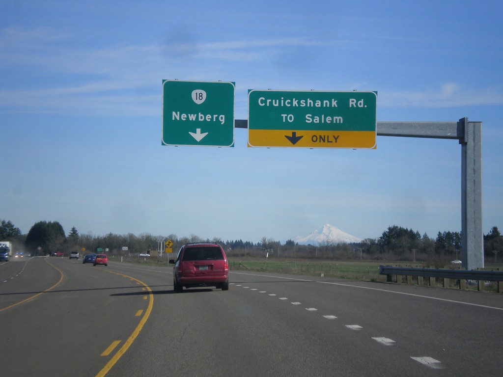
OR-18 East - Cruickshank Road Jct.
OR-18 east at Cruickshank Road/To Salem Jct. Continue east on OR-18 for Newberg.
Taken 02-16-2015
McMinnville
Yamhill County
Oregon
United States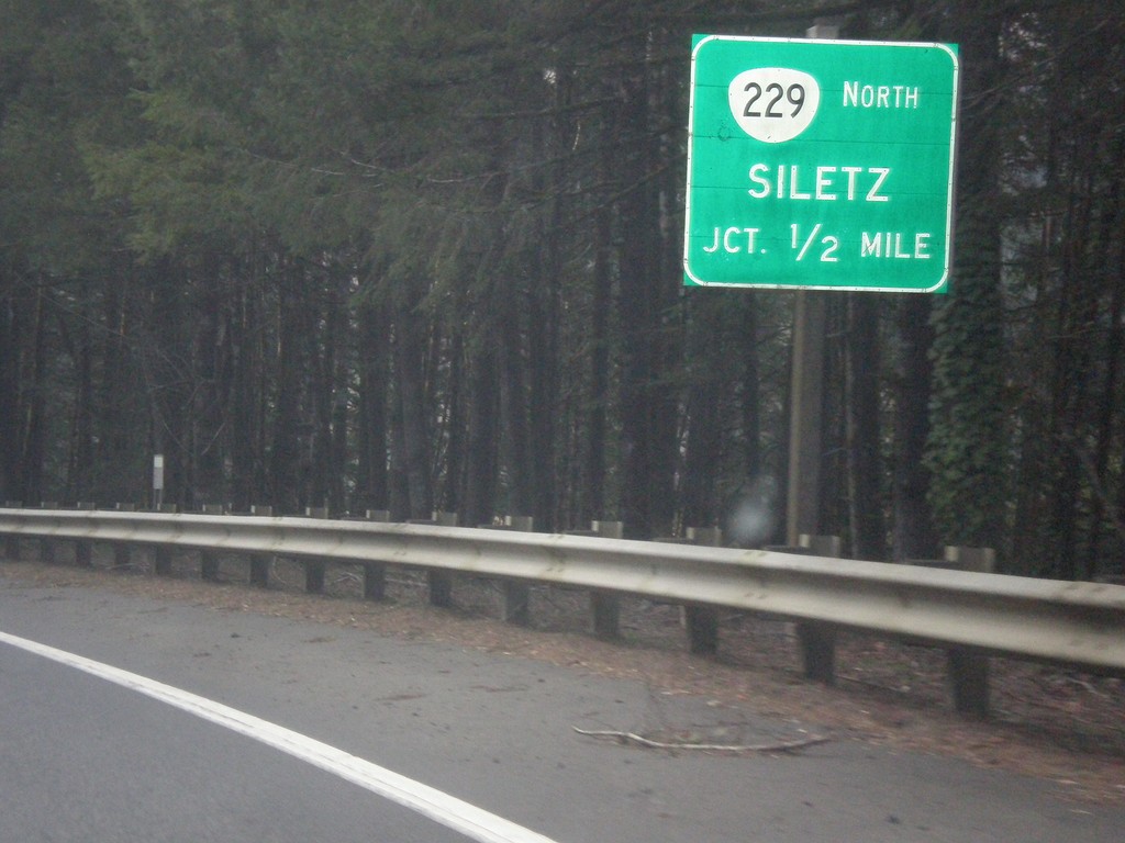
US-20 West Approaching OR-229 North
US-20 west approaching OR-229 north to Siletz.
Taken 02-13-2015

 Toledo
Lincoln County
Oregon
United States
Toledo
Lincoln County
Oregon
United States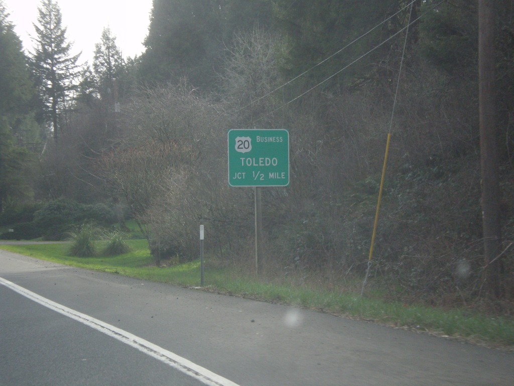
US-20 West Approaching Bus. US-20/Toledo
US-20 West approaching the eastern end of the Toldeo business loop.
Taken 02-13-2015
 Toledo
Lincoln County
Oregon
United States
Toledo
Lincoln County
Oregon
United States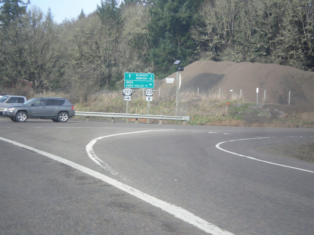
US-20 West at OR-223 North
US-20 west at OR-223 north to Wren and Kings Valley. Continue on US-20 west for Blodgett and Newport.
Taken 02-13-2015
 Philomath
Benton County
Oregon
United States
Philomath
Benton County
Oregon
United States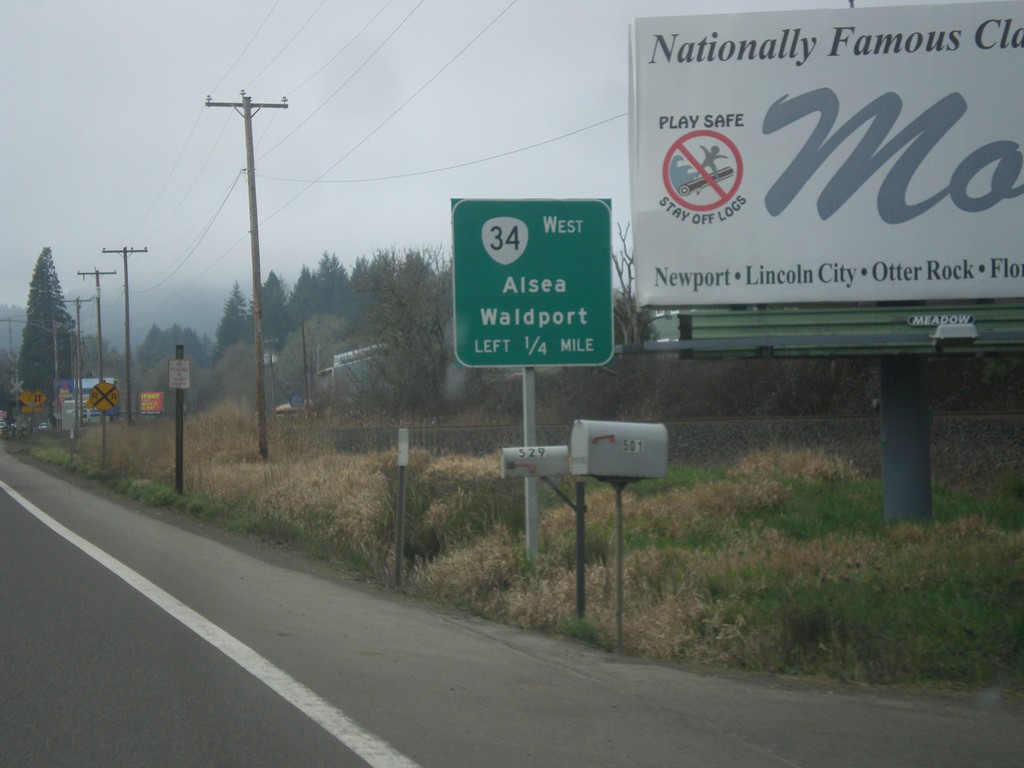
US-20/OR-34 West Approaching US-20/OR-34 Split in Philomath
US-20/OR-34 West Approaching US-20/OR-34 split in Philomath. Turn left for OR-34 west to Alsea and Waldport.
Taken 02-13-2015
 Philomath
Benton County
Oregon
United States
Philomath
Benton County
Oregon
United States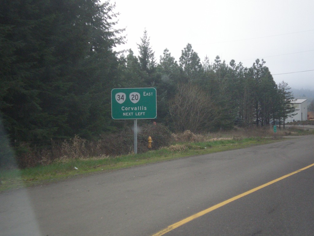
US-20/OR-34 West at Turnaround To US-20/OR-34 East
US-20/OR-34 west at turnaround To US-20/OR-34 East in Philomath and western end of one-way couplet. Use US-20/OR-34 East to Corvallis. Notice the US-20 shield is incorrectly displayed using the Oregon state highway shield.
Taken 02-13-2015
Philomath
Benton County
Oregon
United States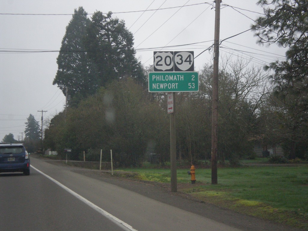
US-20/OR-34 West - Distance Marker
US-20/OR-34 West - distance marker to Philomath and Newport.
Taken 02-13-2015
Corvallis
Benton County
Oregon
United States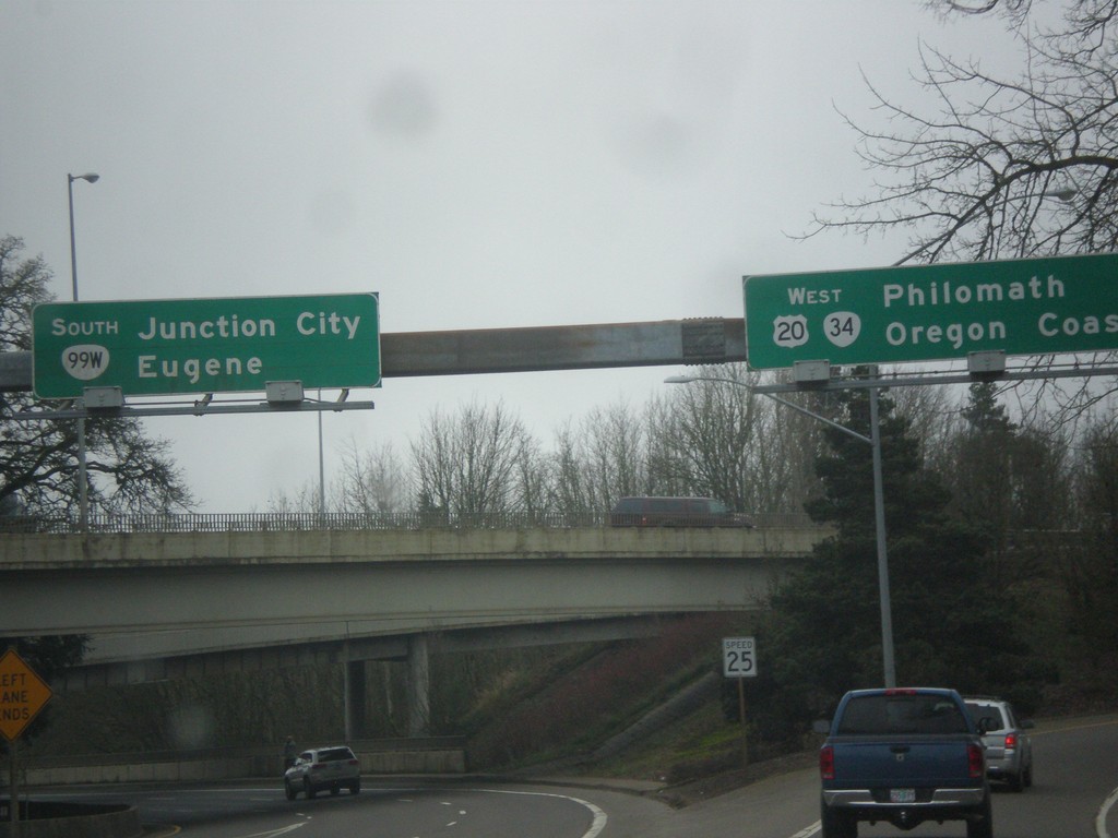
OR-99W South/US-20/OR-34 West at Split
OR-99W South/US-20/OR-34 West at split. Merge right for US-20/OR-34 West to Philomath and Oregon Coast. Continue straight for OR-99W South to Eugene and Junction City. The destination Oregon Coast is common along signs in Oregon, along with Ocean Beaches to denote costal locations.
Taken 02-13-2015
Corvallis
Benton County
Oregon
United States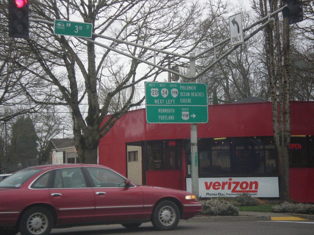
US-20 East (NE Harrison Blvd.) at OR-99W at (NW 3rd St.)
US-20 East (NE Harrison Blvd.) at OR-99W at (NW 3rd St.) in Corvallis. Turn right for OR-99W North to Monmouth and Portland. Continue straight for US-20/OR-34 West/OR-99W South to Philomath, Ocean Beaches, and Eugene. Notice the OR-99W North shield is incorrectly displayed as a US highway shield.
Taken 02-13-2015
Corvallis
Benton County
Oregon
United States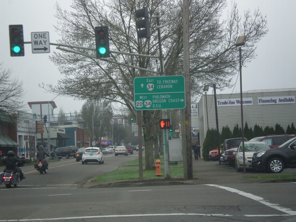
US-20 West at OR-34 - Corvallis
US-20 West (NW 2nd St.) at OR-34 (NW Harrison Blvd). Use US-20/OR-34 West for Philomath/Oregon Coast/O.S.U. (Oregon State University). Continue straight for OR-34 east to Freeway (I-5) and Lebanon.
Taken 02-13-2015
Corvallis
Benton County
Oregon
United States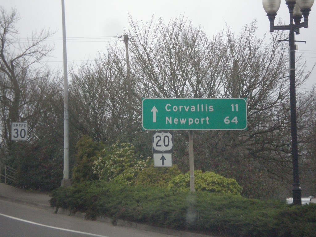
US-20 West - Albany
US-20 West approaching Willamette River bridge in Albany. Continue straight over bridge for US-20 West to Corvallis and Newport.
Taken 02-13-2015
Albany
Linn County
Oregon
United States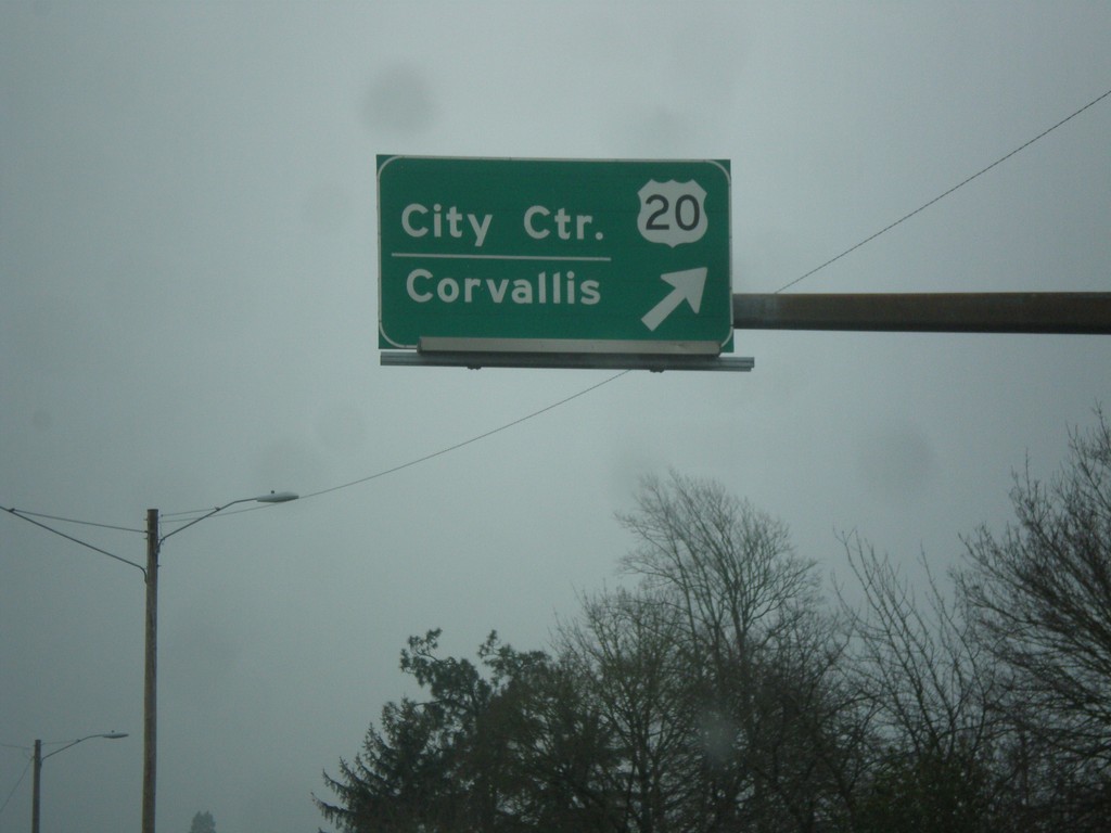
US-20 West/OR-99E (Pacific Blvd. SE) at US-20/OR-99E Split
US-20 West/OR-99E (Pacific Blvd. SE) at US-20/OR-99E split. Merge right for US-20 West/City Center (Albany)/Corvallis.
Taken 02-13-2015
 Albany
Linn County
Oregon
United States
Albany
Linn County
Oregon
United States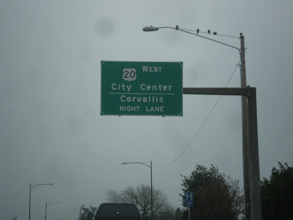
US-20 West/OR-99E South (Pacific Blvd. SE) Approaching Split
US-20 West/OR-99E South (Pacific Blvd. SE) approaching US-20/OR-99E split. Use right lane for US-20 West/City Center (Albany)/Corvallis.
Taken 02-13-2015
Albany
Linn County
Oregon
United States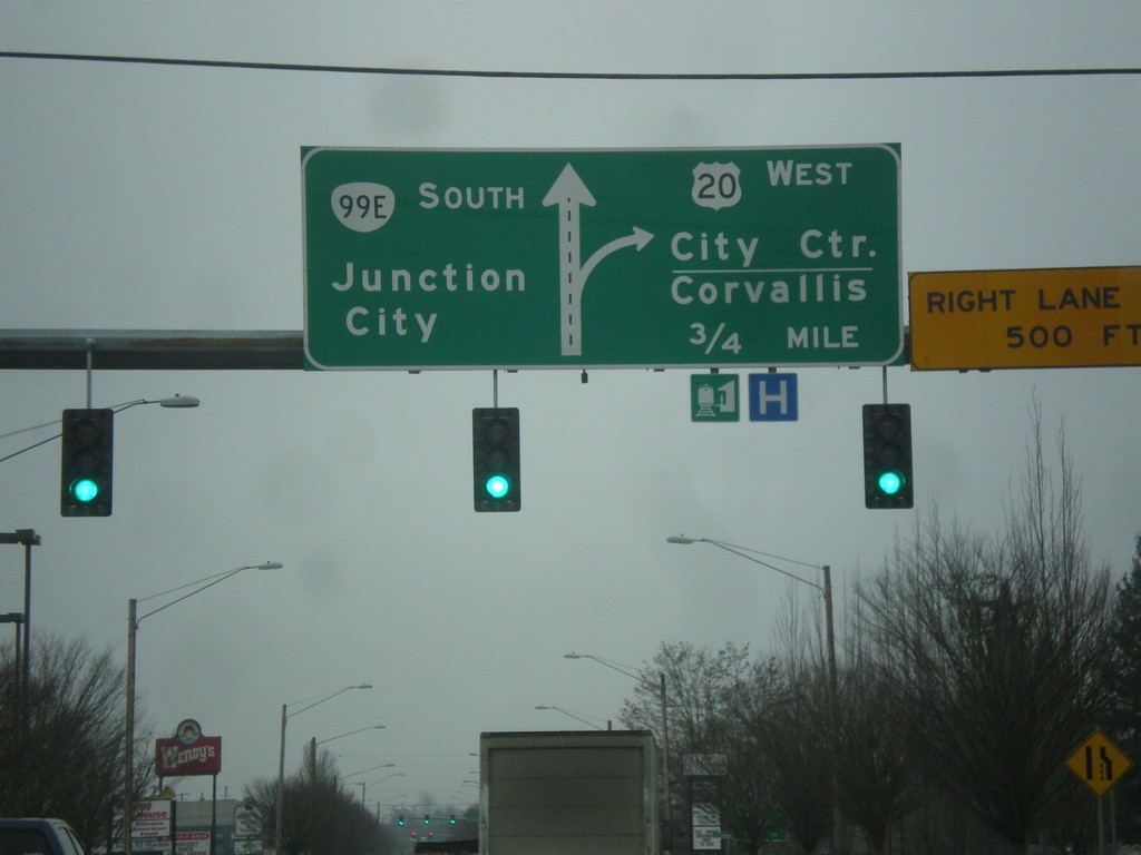
US-20 West/OR-99E South at Geary Blvd.
US-20 West/OR-99E South (Pacific Blvd. SE) at Geary Blvd. Continue south on Pacific Blvd. SE for OR-99E/Junction City. Approaching ramp for US-20 West to City Center (Albany) and Corvallis.
Taken 02-13-2015
Albany
Linn County
Oregon
United States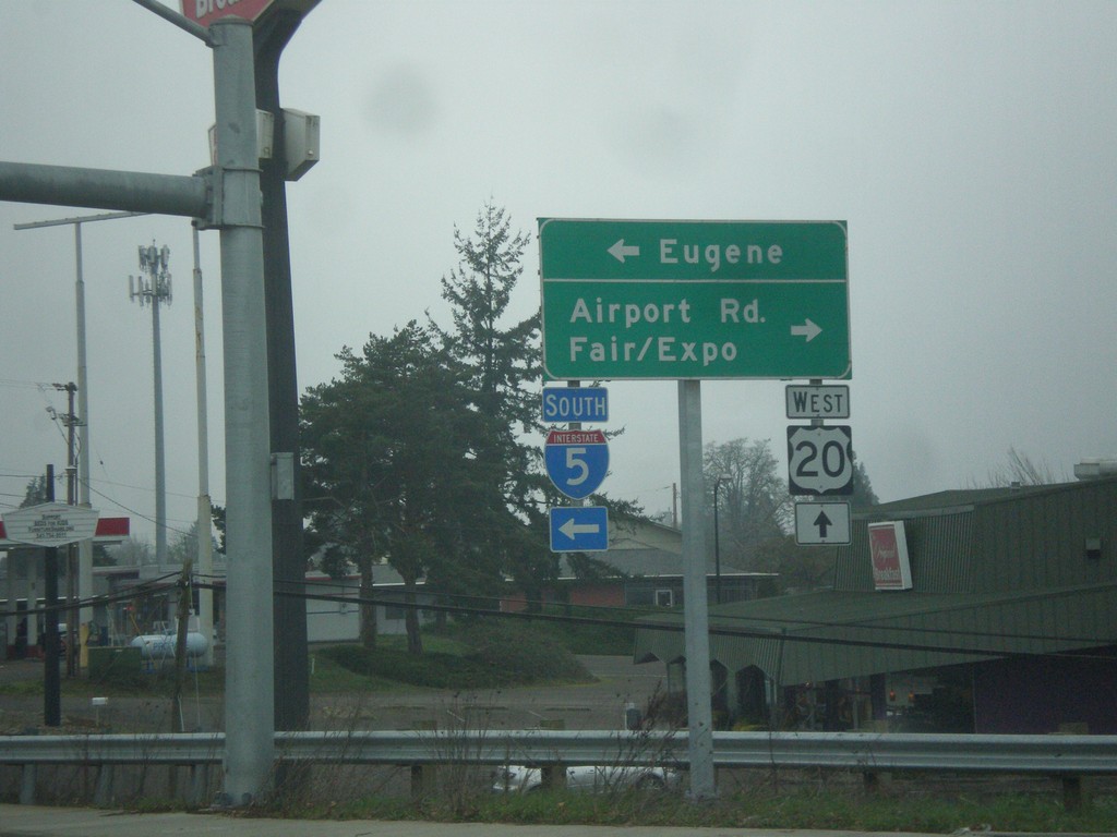
US-20 West at I-5 South
US-20 west at I-5 south. Use I-5 south for Eugene. Turn right for Airport Road and Fair/Expo. Continue straight for US-20 west.
Taken 02-13-2015
 Albany
Linn County
Oregon
United States
Albany
Linn County
Oregon
United States
US-20 West Approaching I-5 South
US-20 west approaching I-5 south to Eugene.
Taken 02-13-2015
Albany
Linn County
Oregon
United States