Signs Tagged With Big Green Sign
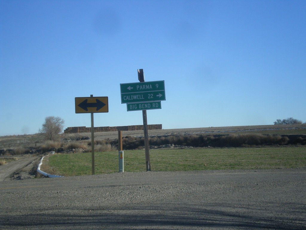
End OR-452 East at OR-454
End OR-452 East (unsigned) at OR-454 (unsigned). Turn right for OR-454 (Big Bend Road) and Caldwell (Idaho). Turn left on Big Bend Road for Parma (Idaho).
Taken 12-14-2014

 Adrian
Malheur County
Oregon
United States
Adrian
Malheur County
Oregon
United States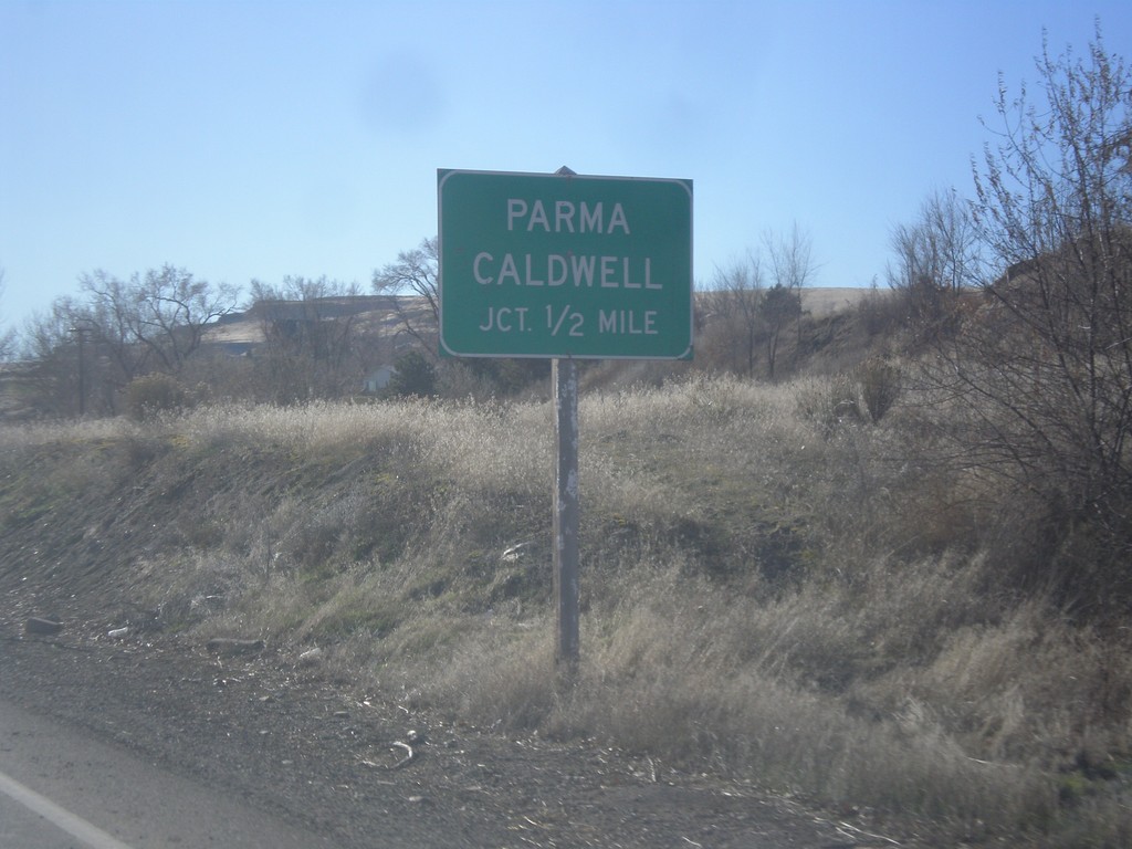
OR-201 South approaching OR-452
OR-201 south approaching OR-452 west to Parma and Caldwell (both in Idaho). OR-452 was an internal Oregon Highway (#451Y) that was recently added as a numbered route. As of late 2014, OR-452 was not signed as a route.
Taken 12-14-2014
 Adrian
Malheur County
Oregon
United States
Adrian
Malheur County
Oregon
United States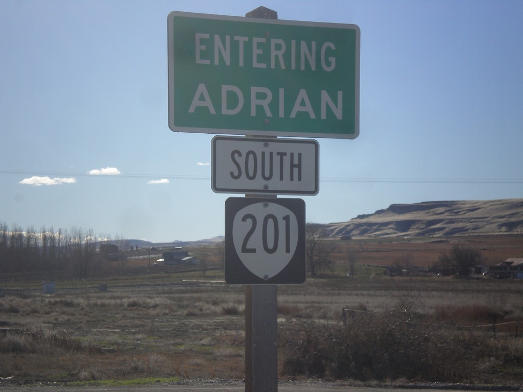
OR-201 South - Adrian
Entering Adrian on OR-201 south.
Taken 12-14-2014
Nyssa
Malheur County
Oregon
United States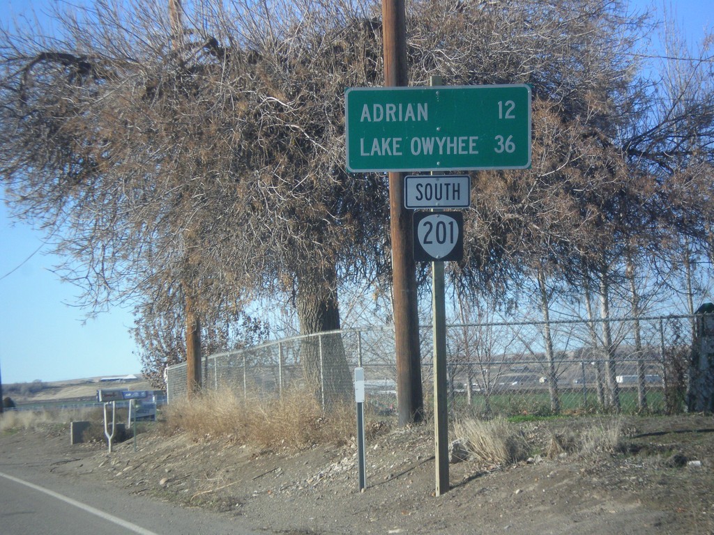
OR-201 South - Distance Marker
Distance marker on OR-201 south. Distance to Adrian and Lake Owyhee.
Taken 12-14-2014
Nyssa
Malheur County
Oregon
United States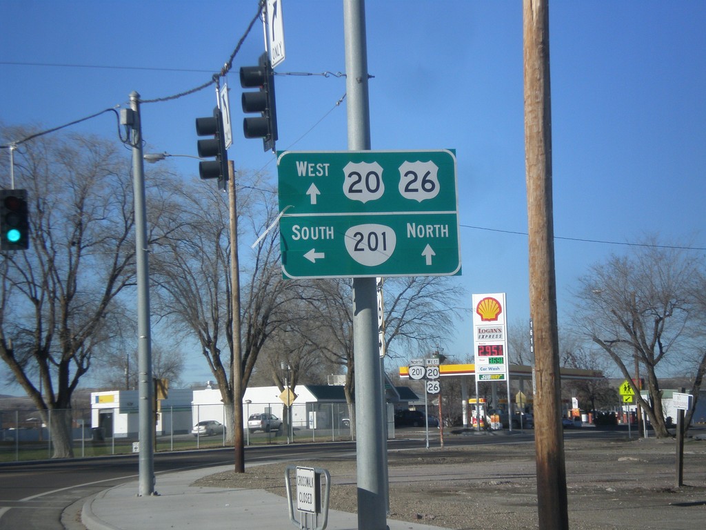
US-20/US-26 West at OR-201
US-20/US-26 west at OR-201 in Nyssa. Turn left for OR-201 south; OR-201 north US-20/US-26 west to Cairo Jct. outside of Ontario.
Taken 12-14-2014

 Nyssa
Malheur County
Oregon
United States
Nyssa
Malheur County
Oregon
United States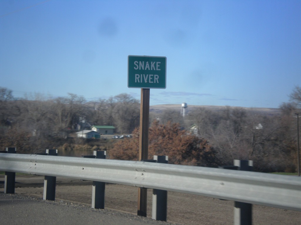
US-20/US-26 West - Snake River
US-20/US-26 West at the Snake River. The Snake River marks the boundary between Oregon and Idaho, starting just south of here.
Taken 12-14-2014
Parma
Canyon County
Idaho
United States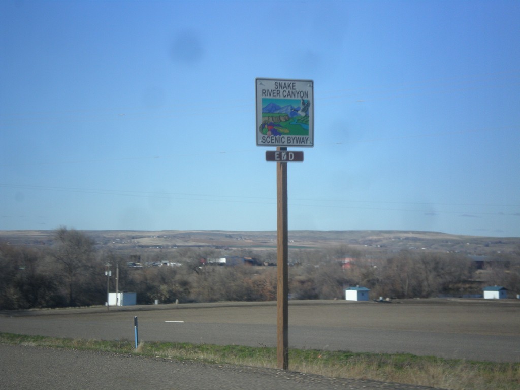
US-20/US-26 West - End Snake River Canyon Scenic Byway
End Snake River Canyon Scenic Byway on US-20/US-26 West, approaching the Oregon state line. This is the only End sign I have seen for a Scenic Byway in Idaho.
Taken 12-14-2014
Parma
Canyon County
Idaho
United States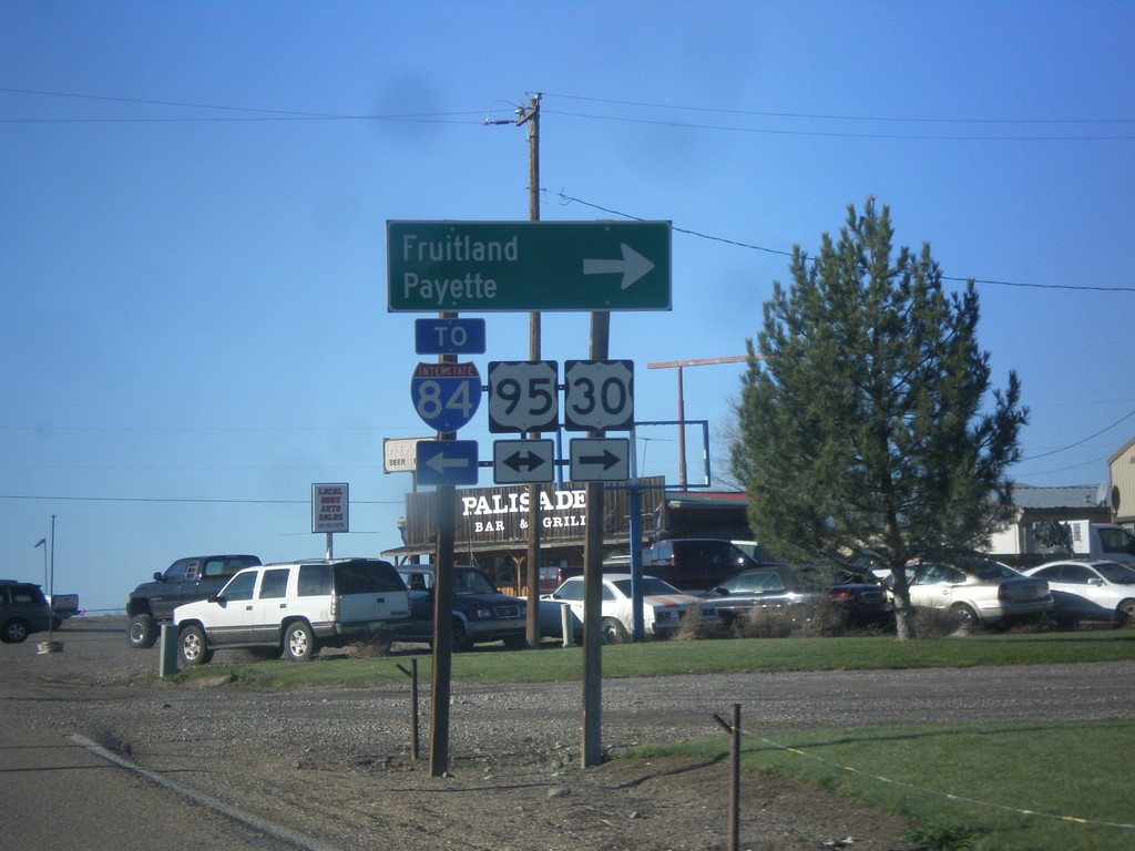
US-30 West at US-95
US-30 west at US-95. Turn right on US-95 north for Fruitland and Payette. Turn left on US-95 south for I-84. US-30 follows US-95 north to Fruitland.
Taken 12-14-2014

 Fruitland
Payette County
Idaho
United States
Fruitland
Payette County
Idaho
United States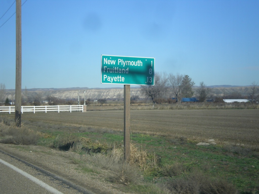
US-30 West - Distance Marker
Distance marker on US-30 west. Distance to New Plymouth, Fruitland, and Payette.
Taken 12-14-2014
New Plymouth
Payette County
Idaho
United States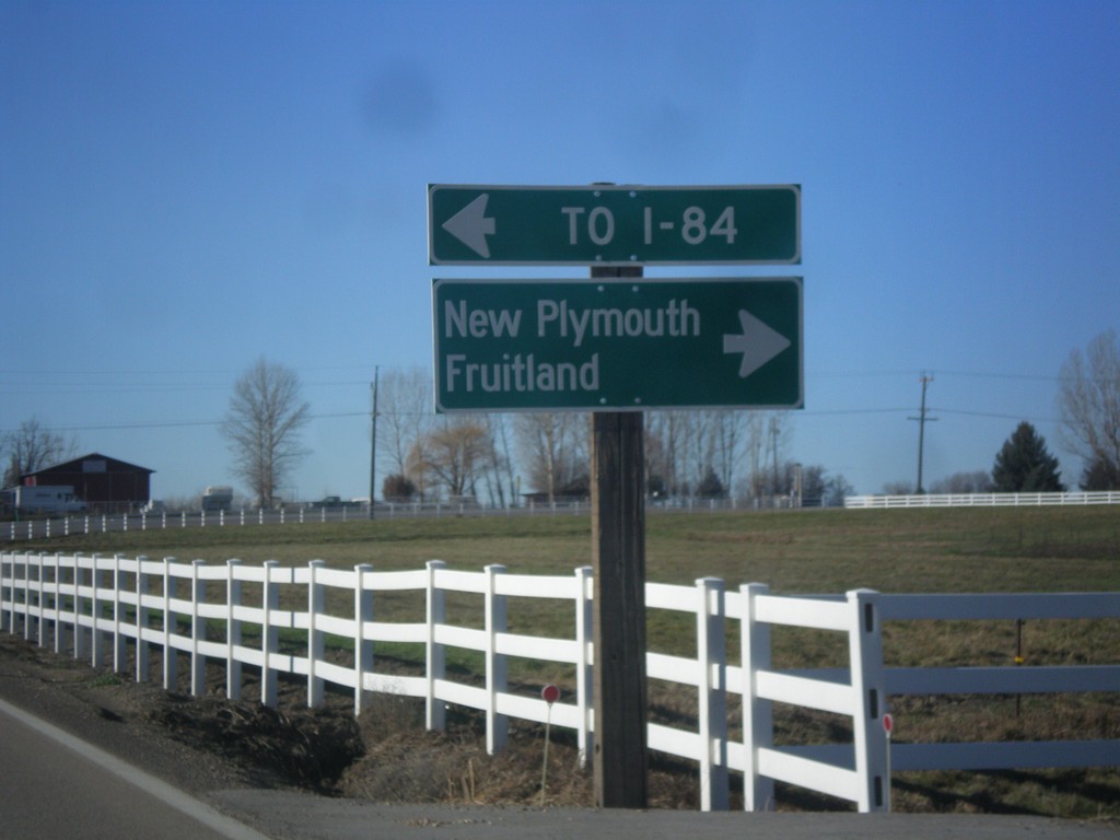
End ID-72 West at US-30
End ID-72 west at US-30. Turn right for US-30 west to New Plymouth and Emmett. Turn left for US-30 east to I-84.
Taken 12-14-2014
 New Plymouth
Payette County
Idaho
United States
New Plymouth
Payette County
Idaho
United States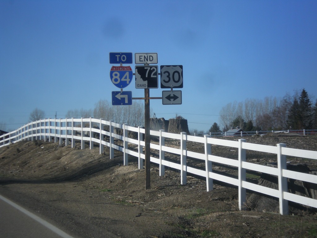
End ID-72 Approaching US-30
End ID-72 approaching US-30 in Payette County.
Taken 12-14-2014
 New Plymouth
Payette County
Idaho
United States
New Plymouth
Payette County
Idaho
United States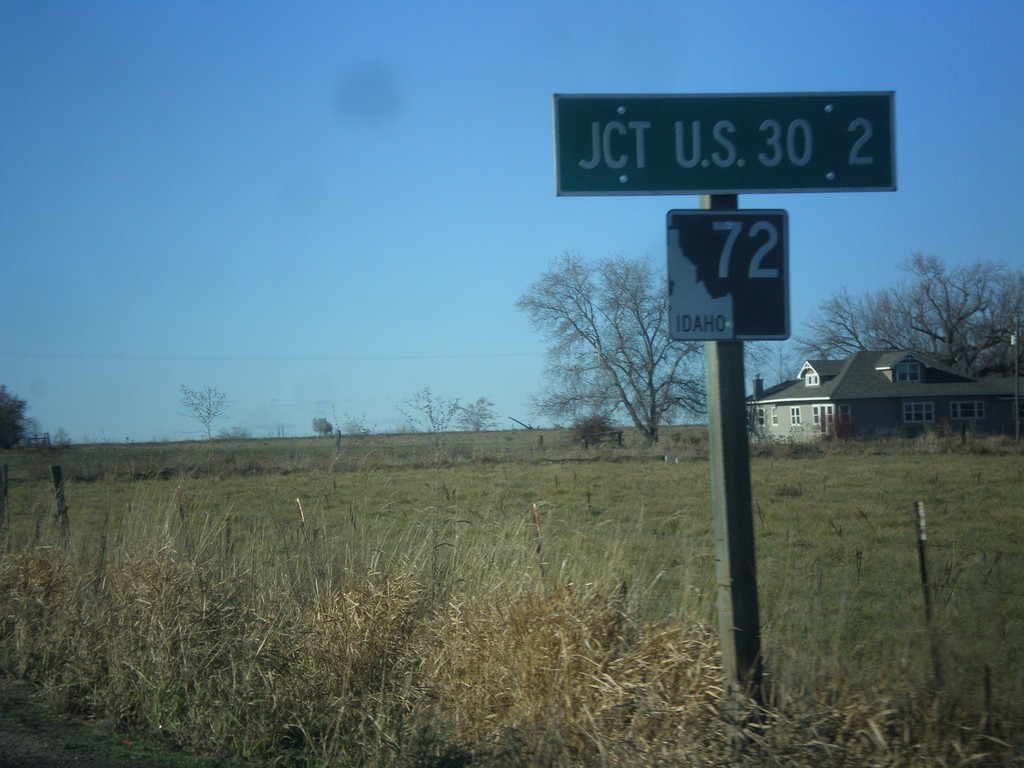
ID-72 West - Distance Marker
Distance marker on ID-72 west. Distance to US-30.
Taken 12-14-2014
New Plymouth
Payette County
Idaho
United States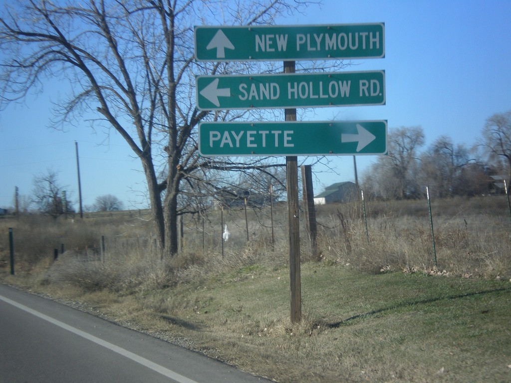
ID-52 West at ID-72
ID-52 west at ID-72 west to New Plymouth. Use ID-52 west for Payette. Turn left for Sand Hollow Road.
Taken 12-14-2014
 New Plymouth
Payette County
Idaho
United States
New Plymouth
Payette County
Idaho
United States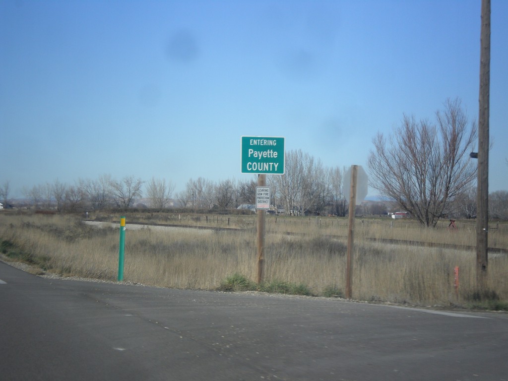
ID-52 West - Payette County
Entering Payette County on ID-52 west.
Taken 12-14-2014
New Plymouth
Payette County
Idaho
United States
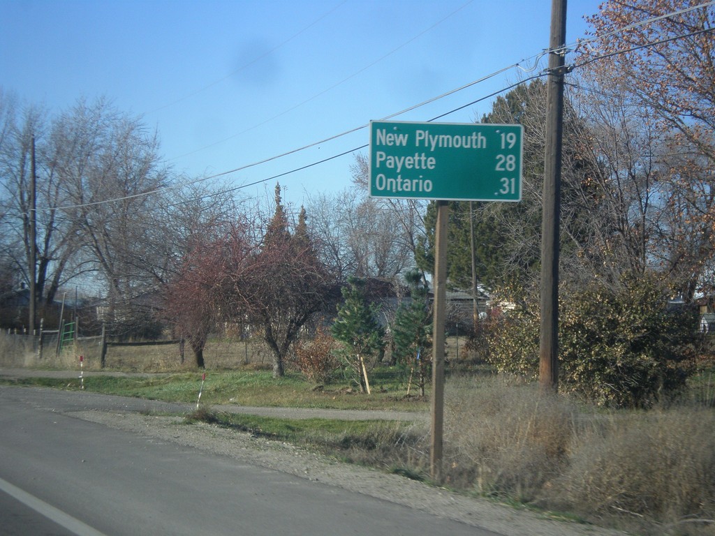
ID-52 West - Distance Marker
Distance marker on ID-52 west for New Plymouth, Payette, and Ontario (Oregon).
Taken 12-14-2014
Emmett
Gem County
Idaho
United States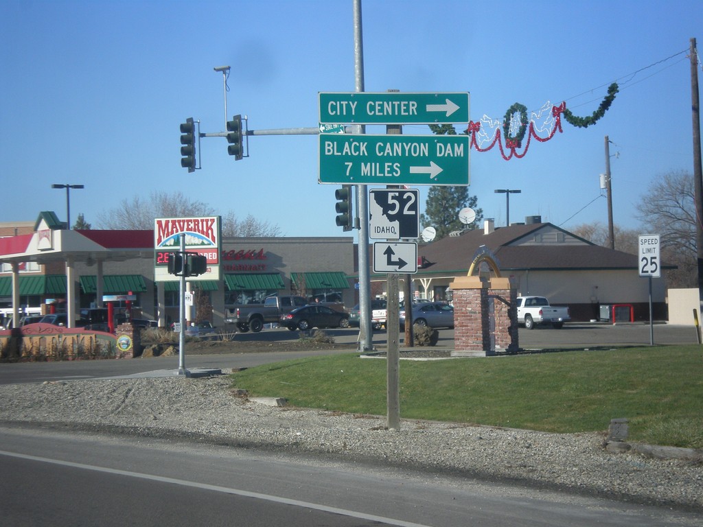
End ID-16 North at ID-52
End ID-16 north at ID-52. Turn right on ID-52 west for (Emmett) City Center and Black Canyon Dam.
Taken 12-14-2014
 Emmett
Gem County
Idaho
United States
Emmett
Gem County
Idaho
United States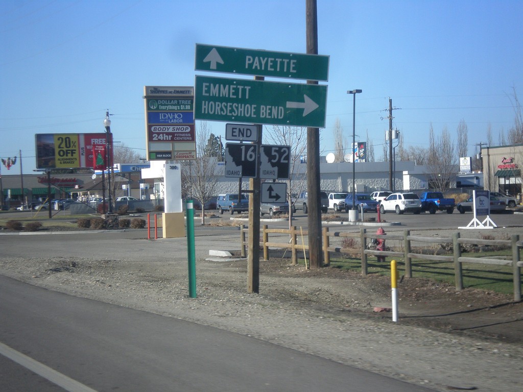
End ID-16 North at ID-52
End ID-16 north at ID-52. Turn right on ID-52 east for Emmett and Horseshoe Bend. Continue straight for ID-52 west to Payette.
Taken 12-14-2014
Emmett
Gem County
Idaho
United States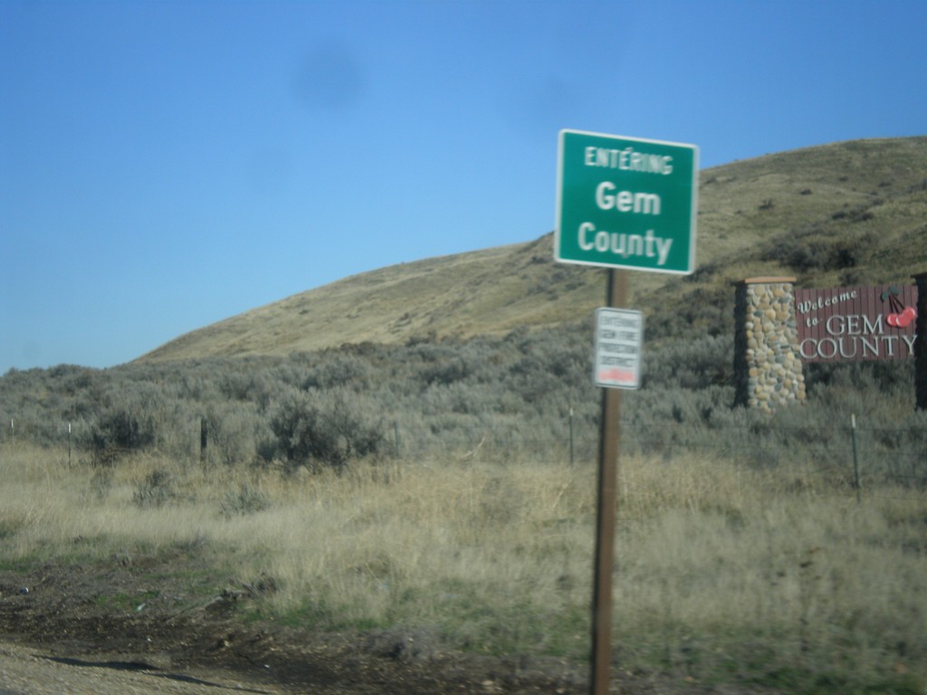
ID-16 North - Gem County
Entering Gem County on ID-16 north.
Taken 12-14-2014
Emmett
Gem County
Idaho
United States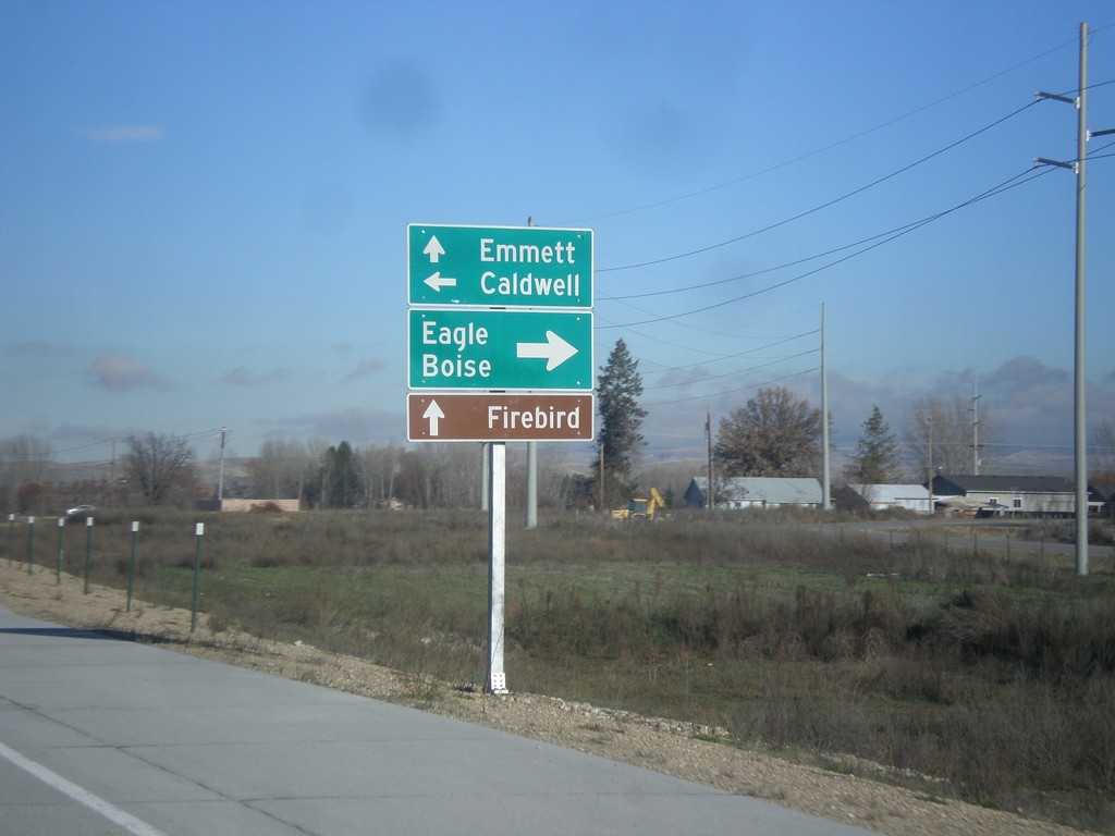
ID-16 North at ID-44
ID-16 north at ID-44. Turn right on ID-44 East for Eagle and Boise. Left on ID-44 West for Caldwell. Continue north on ID-16 for Emmett. Also use ID-16 north for Firebird (Raceway).
Taken 12-14-2014
 Eagle
Ada County
Idaho
United States
Eagle
Ada County
Idaho
United States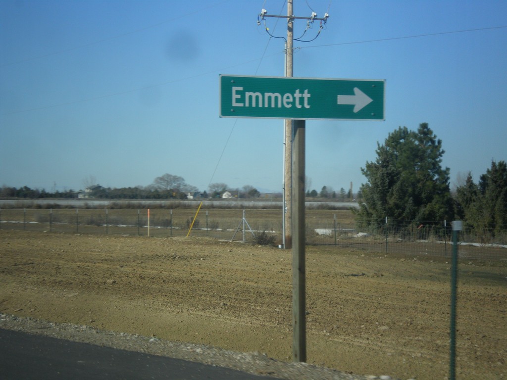
US-20/US-26 West at ID-16 North
US-20/US-26 West at ID-16 North to Emmett.
Taken 12-14-2014
Meridian
Ada County
Idaho
United States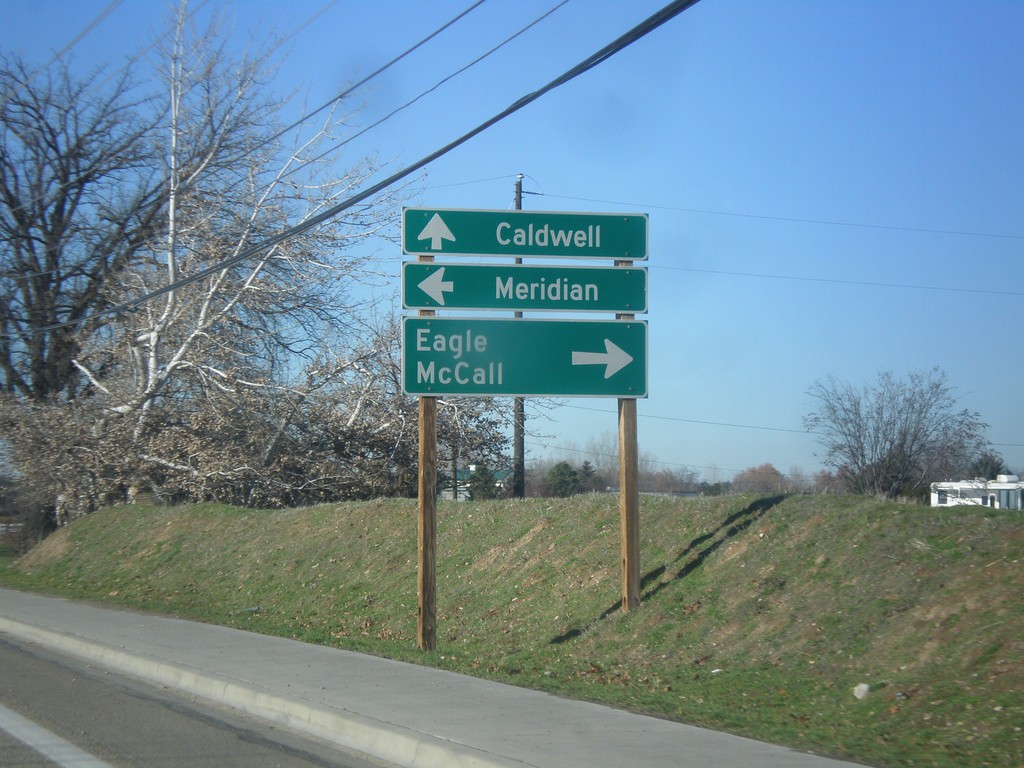
US-20/US-26 West at ID-55
US-20/US-26 West (Chinden Blvd.) at ID-55 (Eagle Road) in Boise. Turn right on ID-55 north for Eagle and McCall. Turn left for ID-55 south to Meridian. Continue west for US-20/US-26 to Caldwell.
Taken 12-14-2014
 Boise
Ada County
Idaho
United States
Boise
Ada County
Idaho
United States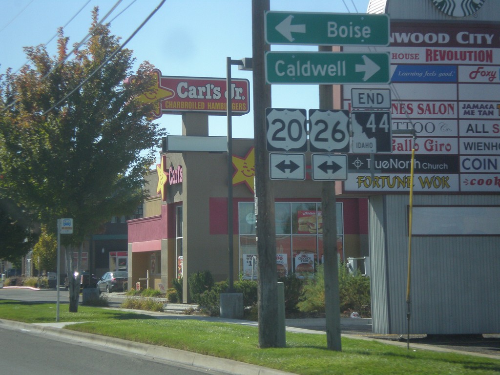
End ID-44 South at US-20/US-26
End ID-44 south (Glenwood St.) at US-20/US-26 (Chinden Blvd.). Turn right for US-20/US-26 west to Caldwell; left to Boise.
Taken 10-05-2014
Garden City
Ada County
Idaho
United States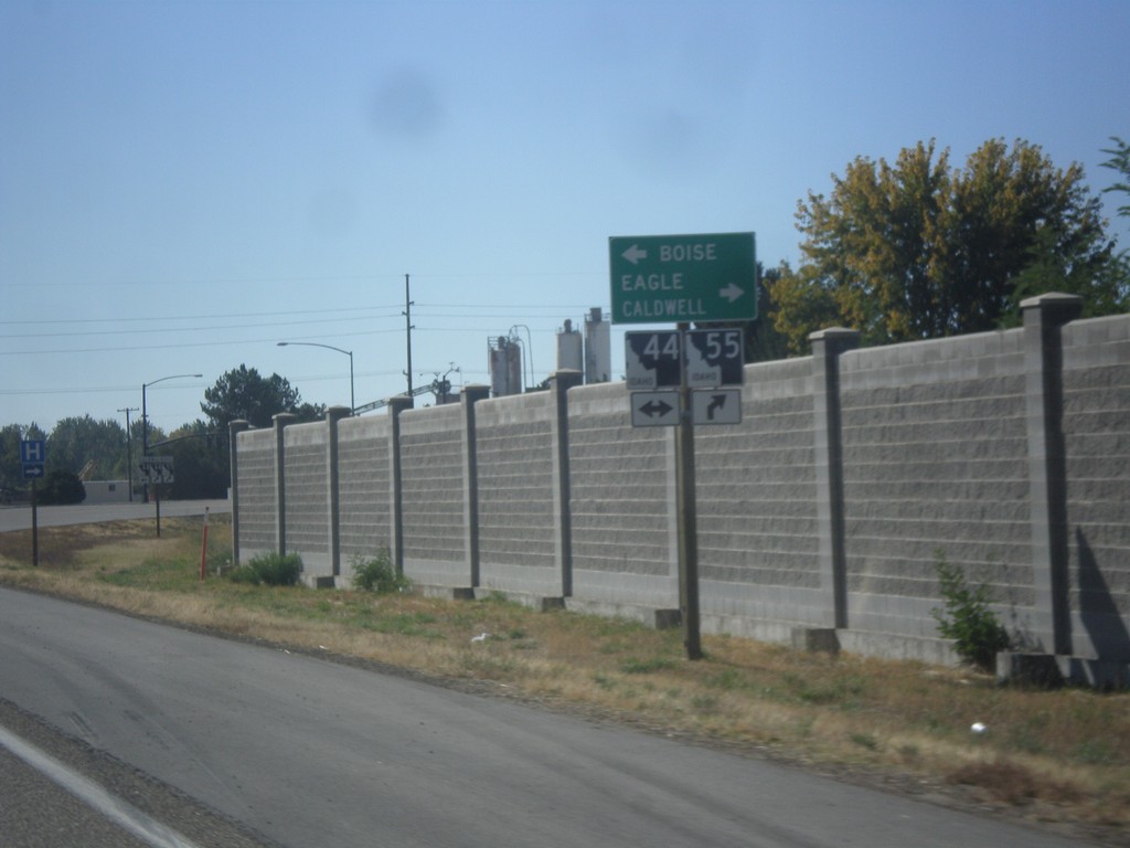
ID-55 South at ID-44
ID-55 south at ID-44. Use ID-44 west for Boise; use ID-44 East/ID-55 South for Eagle and Caldwell.
Taken 10-05-2014
Eagle
Ada County
Idaho
United States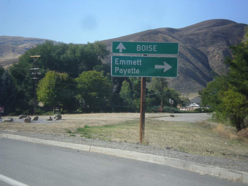
ID-55 South at ID-52
ID-55 south at ID-52 west to Emmett and Payette. Continue south on ID-55 for Boise.
Taken 10-05-2014
Horseshoe Bend
Boise County
Idaho
United States