Signs Tagged With Big Green Sign
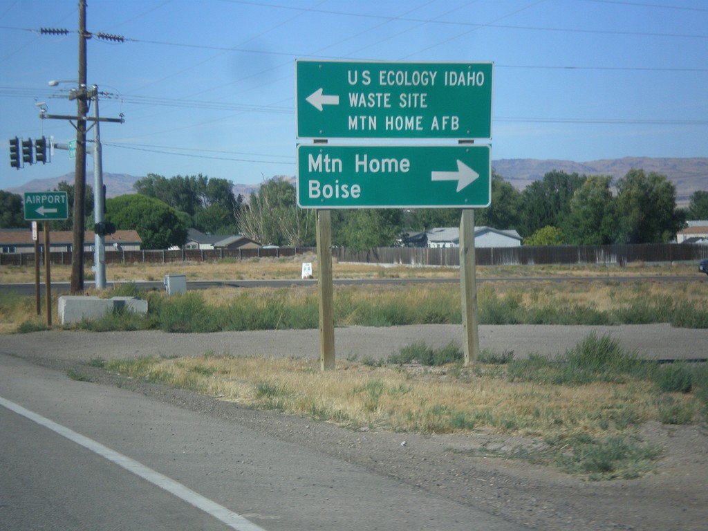
ID-51 North at ID-67
ID-51 north at ID-67. Turn left for ID-67 east to US Ecology Idaho Waste Site and Mountain Home AFB. Turn right on ID-51 north for Mountain Home and Boise.
Taken 08-31-2014

 Mountain Home
Elmore County
Idaho
United States
Mountain Home
Elmore County
Idaho
United States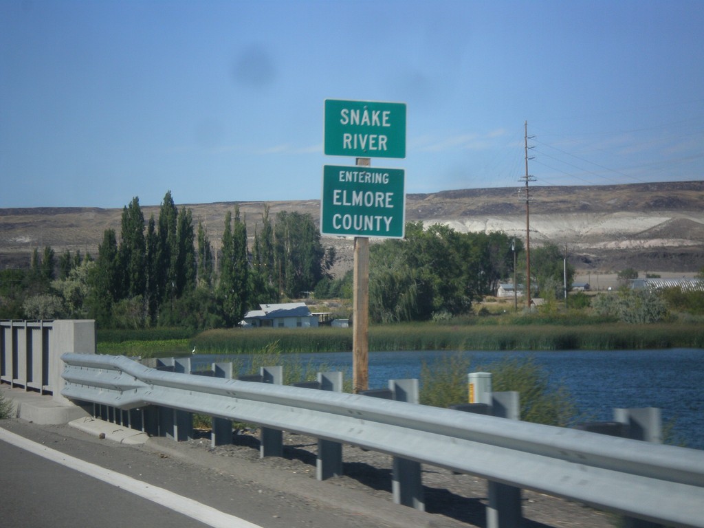
ID-51 North - Entering Elmore County
Entering Elmore County on ID-51 north, on the bridge over the Snake River.
Taken 08-31-2014
Mountain Home
Elmore County
Idaho
United States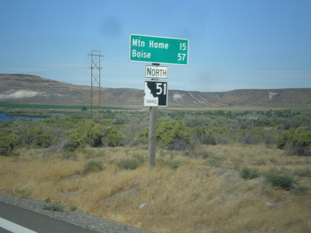
ID-51 North - Distance Marker
Distance marker on ID-51 north. Distance to Mountain Home and Boise.
Taken 08-31-2014
Mountain Home
Owyhee County
Idaho
United States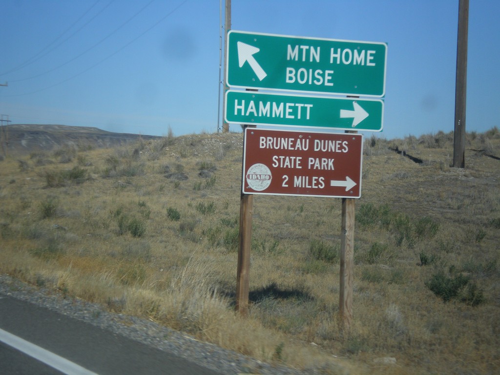
ID-51 North/ID-78 East Jct.
ID-51 North/ID-78 East at ID-51/ID-78 junction. Turn right for ID-78 east to Hammett and Bruneau Dunes State Park. Continue north on ID-51 for Mountain Home and Boise.
Taken 08-31-2014
 Mountain Home
Owyhee County
Idaho
United States
Mountain Home
Owyhee County
Idaho
United States
ID-51 North/ID-78 East - Distance Marker
Distance marker on ID-51 North/ID-78 East. Distance to Mountain Home and Boise.
Taken 08-31-2014
Bruneau
Owyhee County
Idaho
United States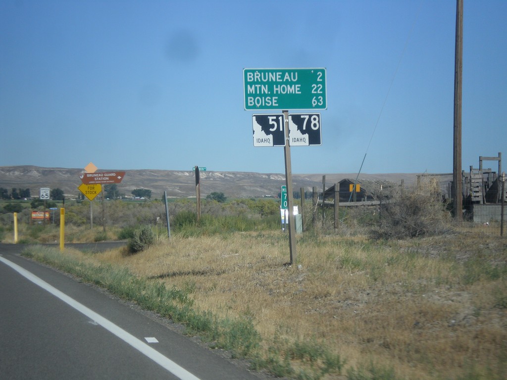
ID-51 North/ID-78 East - Distance Marker
Distance marker on ID-51 North/ID-78 East. Distance to Bruneau, Mountain Home, and Boise.
Taken 08-31-2014
Bruneau
Owyhee County
Idaho
United States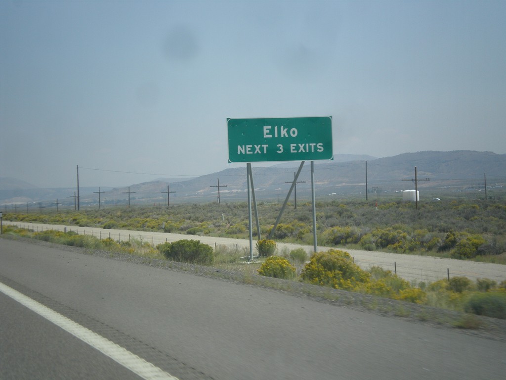
I-80 East - Elko Exits
I-80 East - Elko Next 3 Exits.
Taken 08-31-2014
 Elko
Elko County
Nevada
United States
Elko
Elko County
Nevada
United States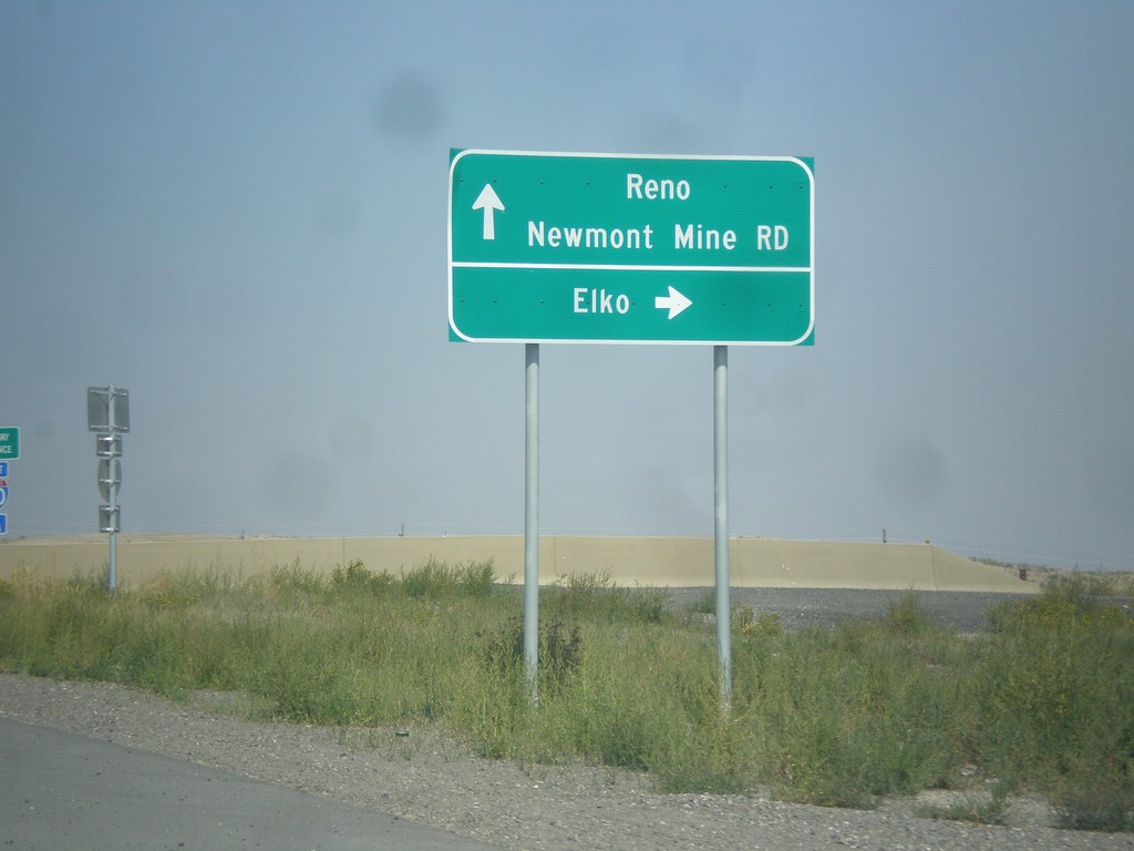
NV-766 North at I-80 (Exit 280)
NV-766 north at I-80 (Exit 280). Use I-80 east for Elko; I-80 west for Reno; NV-766 north for Newmont Mine Road.
Taken 08-31-2014
 Carlin
Elko County
Nevada
United States
Carlin
Elko County
Nevada
United States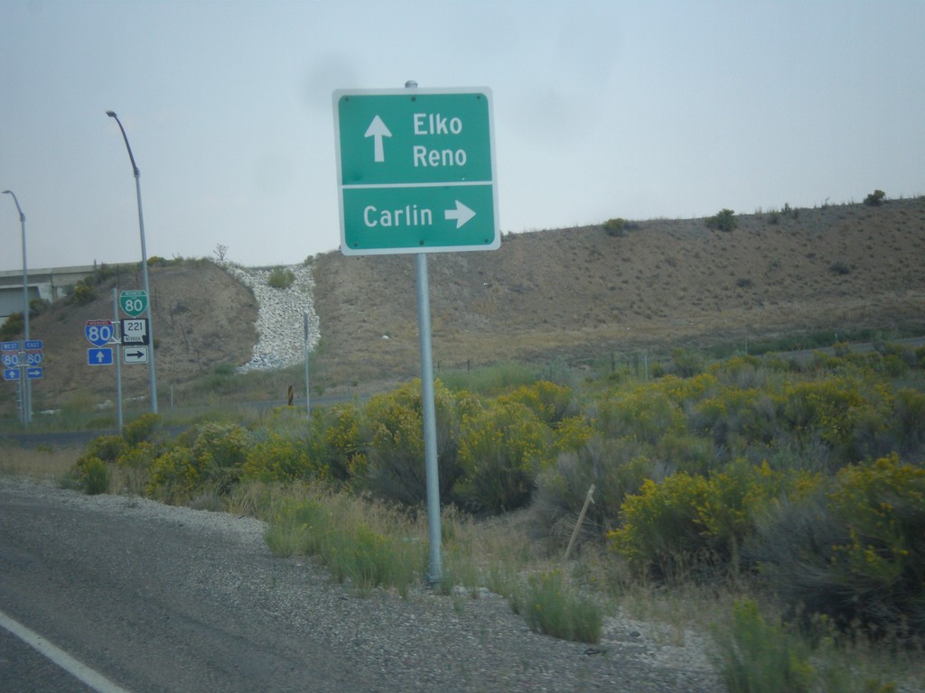
NV-278 North at BL-80/NV-221. Approaching I-80.
NV-278 at BL-80/NV-221 east to Carlin. Immediately after this intersection is the onramp for I-80 to Reno and Elko. This interchange was recently upgraded from a partial diamond to a full diamond that now has an eastbound ramp onto the freeway.
Taken 08-31-2014


 Carlin
Elko County
Nevada
United States
Carlin
Elko County
Nevada
United States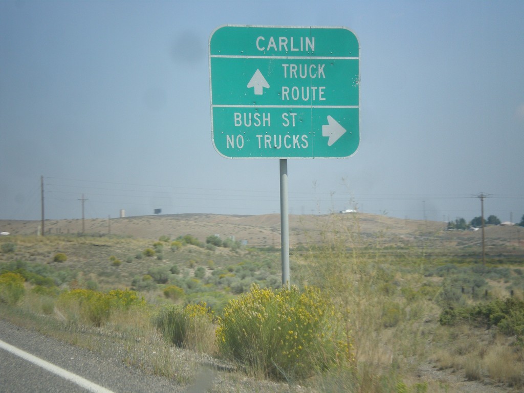
NV-278 North - Bush St. Jct.
NV-278 north at Bush St. Non truck traffic can enter Carlin on Bush Street. Truck traffic needs to continue north on NV-278 to the business loop.
Taken 08-31-2014
Carlin
Elko County
Nevada
United States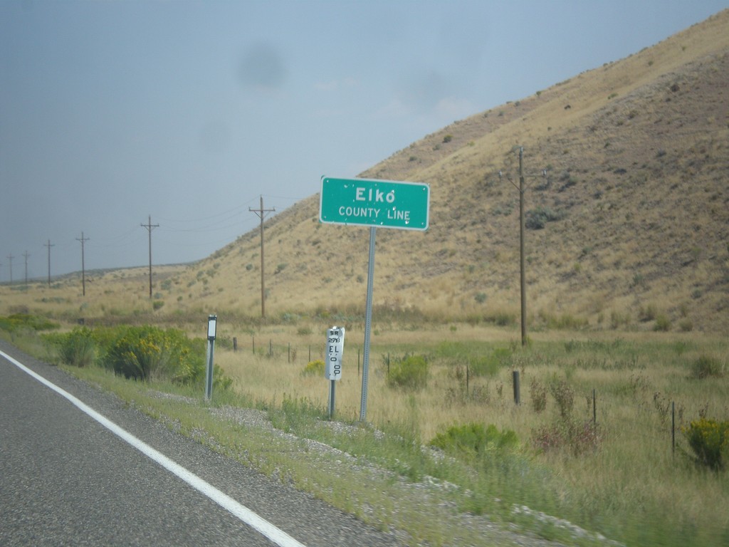
NV-278 North - Elko County Line
Elko County Line on NV-278 north.
Taken 08-31-2014
Carlin
Elko County
Nevada
United States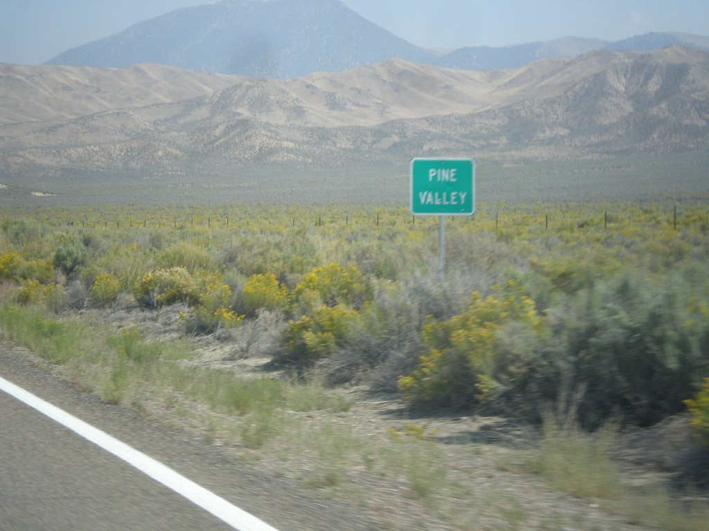
NV-278 North - Pine Valley
Entering Pine Valley along NV-278 north. Pine Valley refers to the physical valley, not an actual community.
Taken 08-31-2014
Carlin
Eureka County
Nevada
United States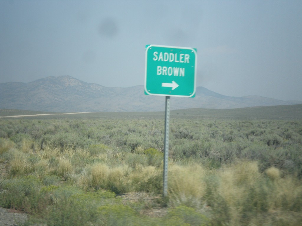
NV-278 North at Saddler Brown Road
NV-278 North at Saddler Brown Road.
Taken 08-31-2014
Eureka
Eureka County
Nevada
United States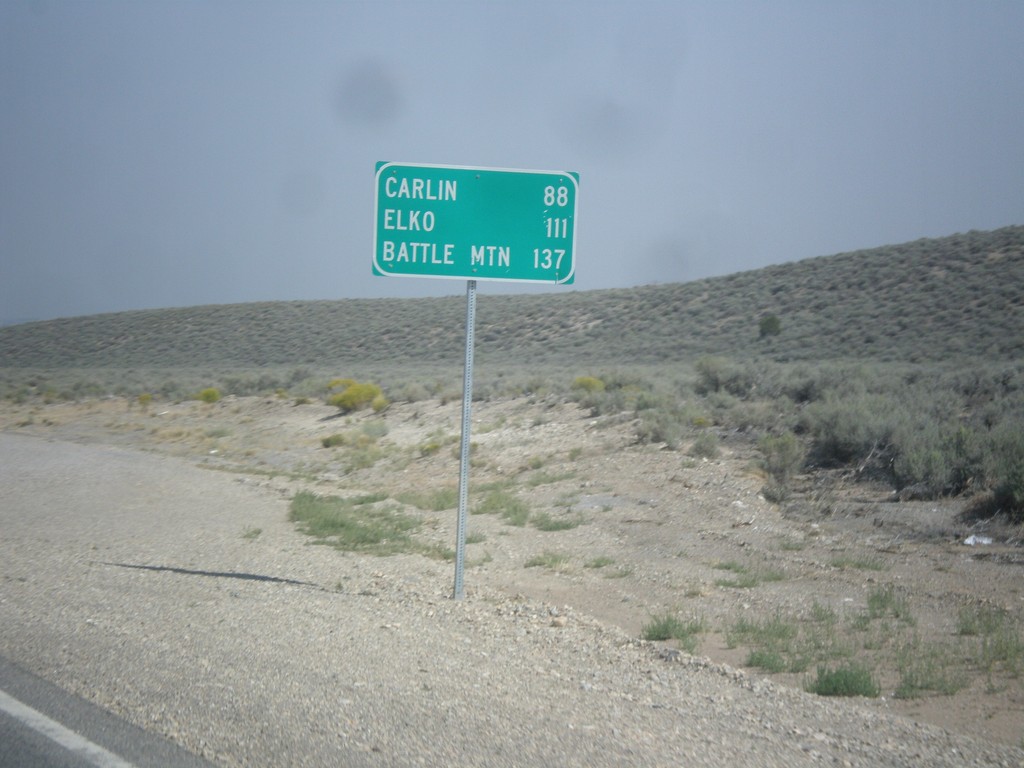
NV-278 North - Distance Marker
Distance marker on NV-278 north. Distance to Carlin, Elko, and Battle Mountain.
Taken 08-31-2014
Eureka
Eureka County
Nevada
United States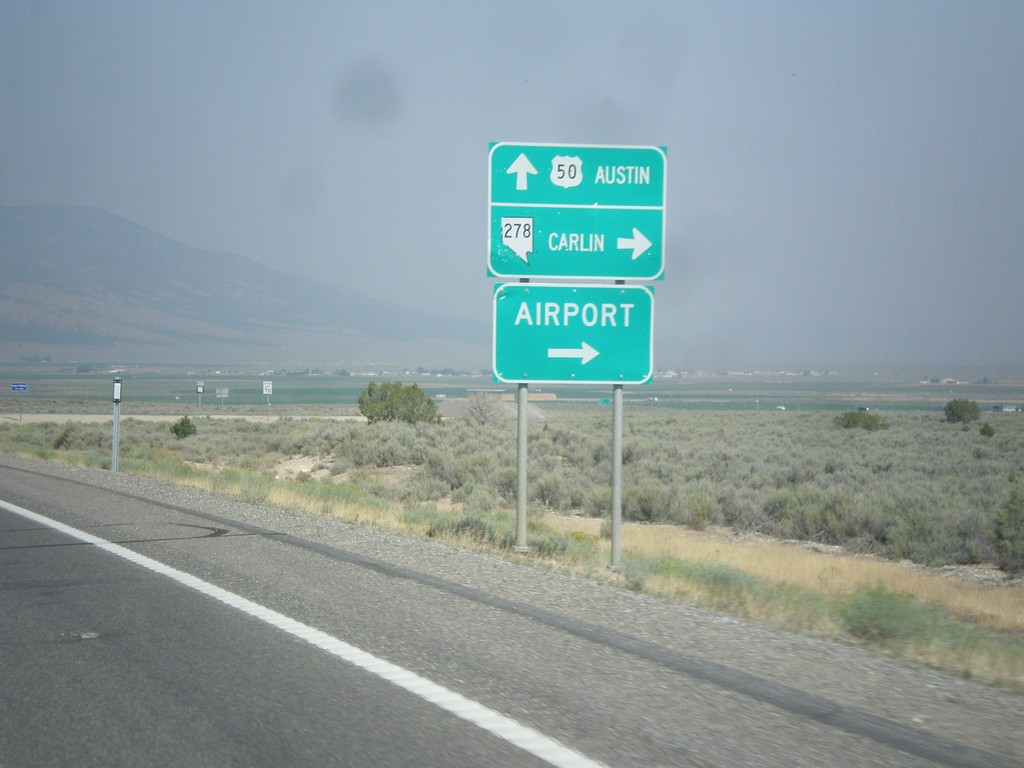
US-50 West at NV-278
US-50 west at NV-278 north to Carlin and (Eureka County) Airport. Continue west on US-50 for Austin.
Taken 08-31-2014
 Eureka
 County
Nevada
United States
Eureka
Eureka County
Nevada
United States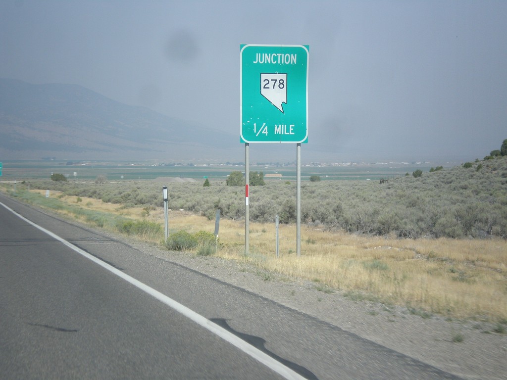
US-50 West Approaching NV-278
US-50 west approaching NV-278 junction.
Taken 08-31-2014
Eureka
Eureka County
Nevada
United States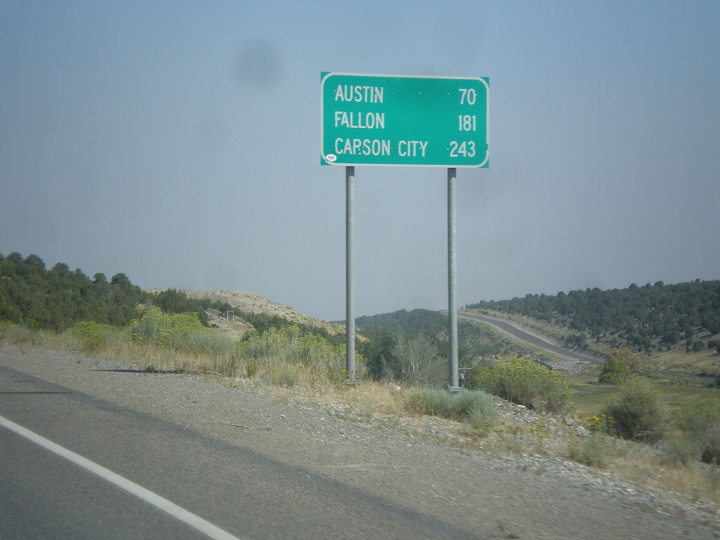
US-50 West - Distance Marker
Distance marker on US-50 west. Distance to Austin, Fallon, and Carson City.
Taken 08-31-2014
Eureka
Eureka County
Nevada
United States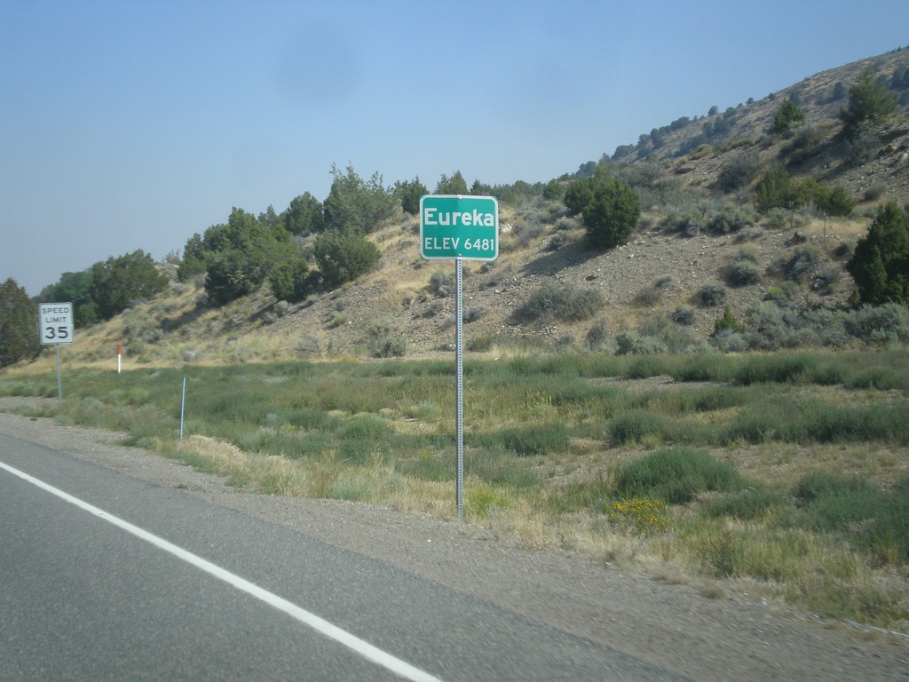
US-50 West - Eureka
Entering Eureka on US-50 west. Eureka is the county seat of Eureka County, Nevada.
Taken 08-31-2014
Eureka
Eureka County
Nevada
United States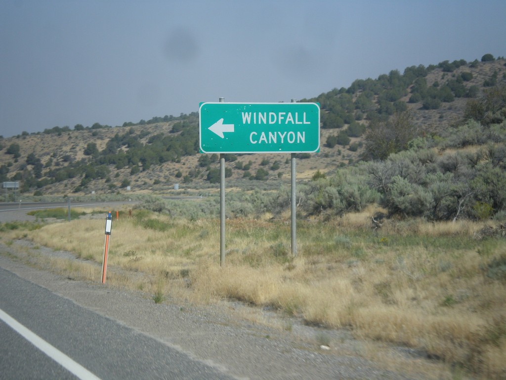
US-50 West - Windfall Canyon Jct.
US-50 west at junction to Windfall Canyon.
Taken 08-31-2014
Eureka
Eureka County
Nevada
United States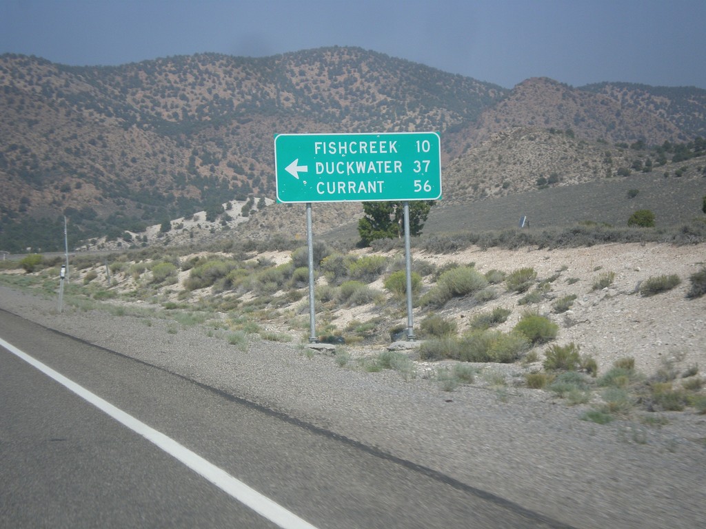
US-50 West - Duckwater Jct.
US-50 west at junction to Fishcreek, Duckwater, and Currant.
Taken 08-31-2014
Eureka
Eureka County
Nevada
United States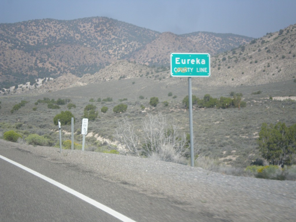
US-50 West - Eureka County Line
Eureka County Line on US-50 west.
Taken 08-31-2014
Eureka
Eureka County
Nevada
United States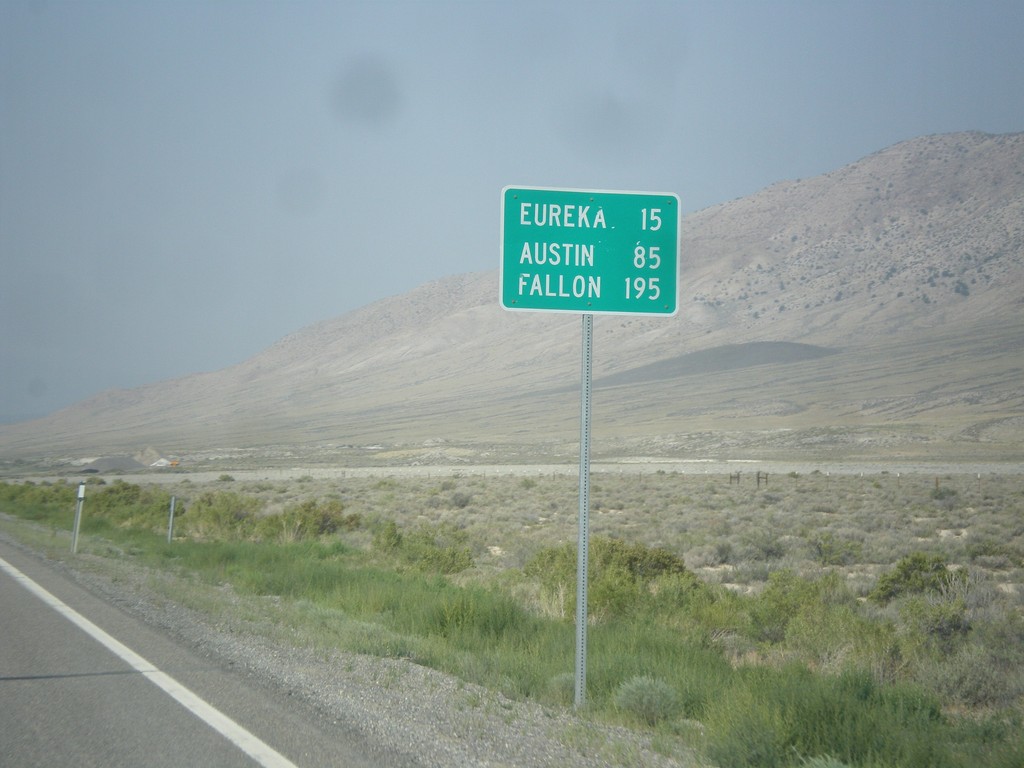
US-50 West - Distance Marker
Distance marker on US-50 west. Distance to Eureka, Austin, and Fallon.
Taken 08-31-2014
Eureka
White Pine County
Nevada
United States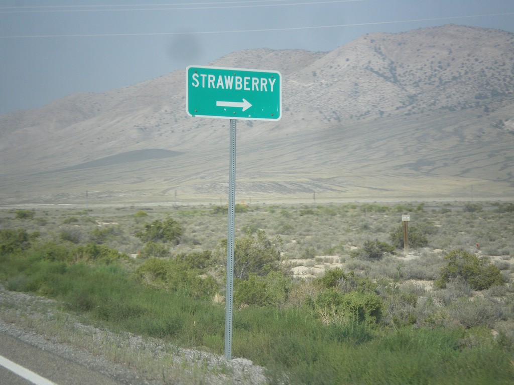
US-50 West Approaching NV-892
US-50 west approaching NV-892 north to Strawberry.
Taken 08-31-2014
 Eureka
White Pine County
Nevada
United States
Eureka
White Pine County
Nevada
United States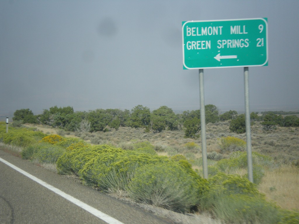
US-50 West - Belmont Mill Jct.
US-50 west at junction to Belmont Mill and Green Springs.
Taken 08-31-2014
White Pine County
Nevada
United States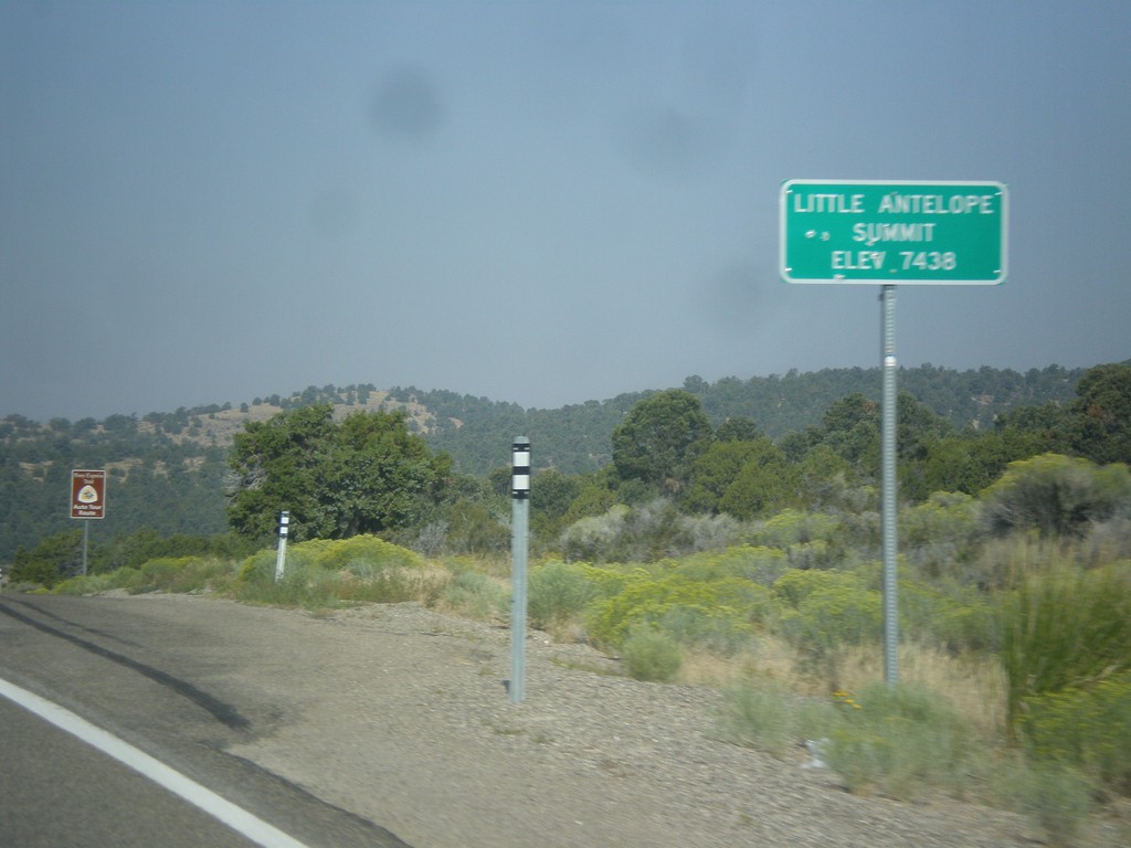
US-50 West - Little Antelope Summit
US-50 west at Little Antelope Summit - Elevation 7,438 Feet. Little Antelope Summit is in the Pine Range.
Taken 08-31-2014
White Pine County
Nevada
United States