Signs Tagged With Big Green Sign
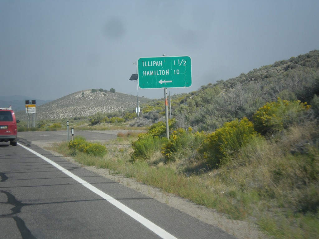
US-50 West - Illipah and Hamilton Jct.
US-50 West at Illipah and Hamilton Jct.
Taken 08-31-2014
 Ely
White Pine County
Nevada
United States
Ely
White Pine County
Nevada
United States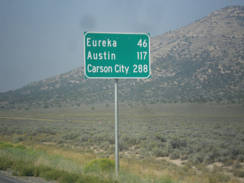
US-50 West - Distance Marker
Distance marker on US-50 west. Distance to Eureka, Austin, and Carson City.
Taken 08-31-2014
Ely
White Pine County
Nevada
United States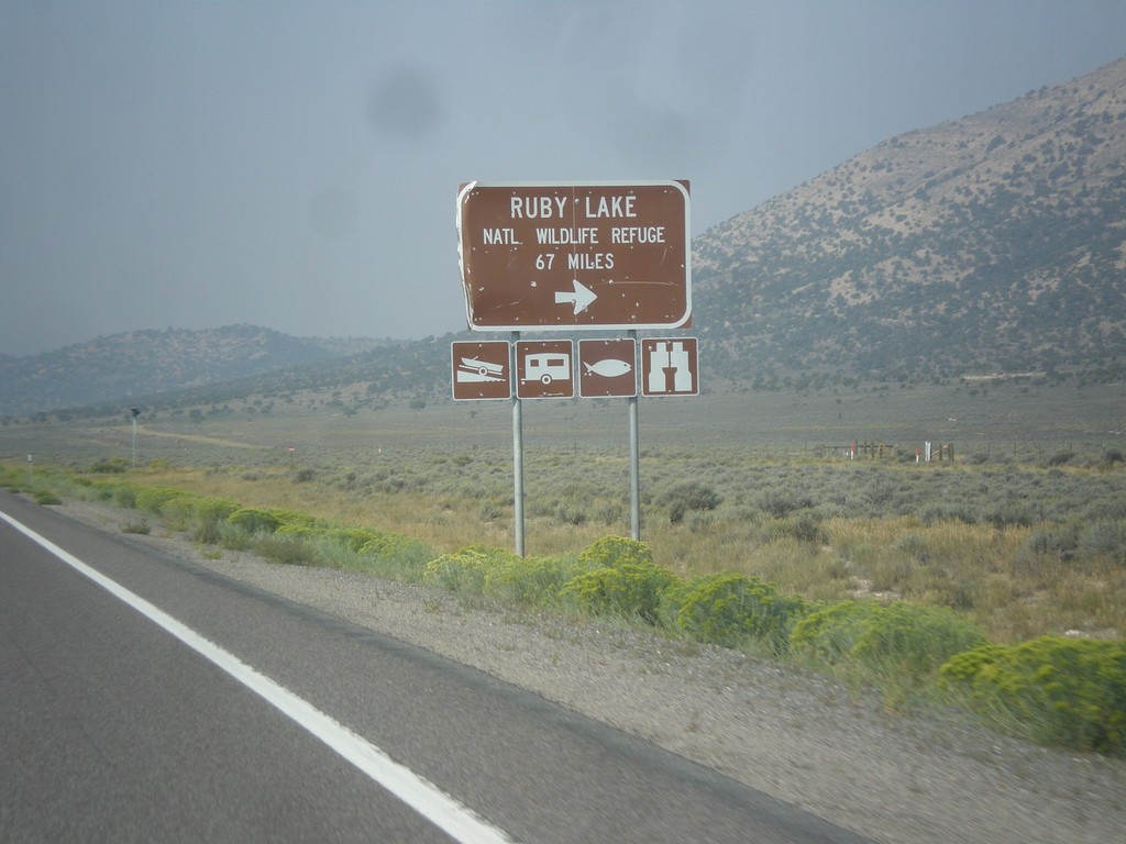
US-50 West - Ruby Lake NWR Jct.
US-50 west at junction to Ruby Lake National Wildlife Refuge in White Pine County.
Taken 08-31-2014
Ely
White Pine County
Nevada
United States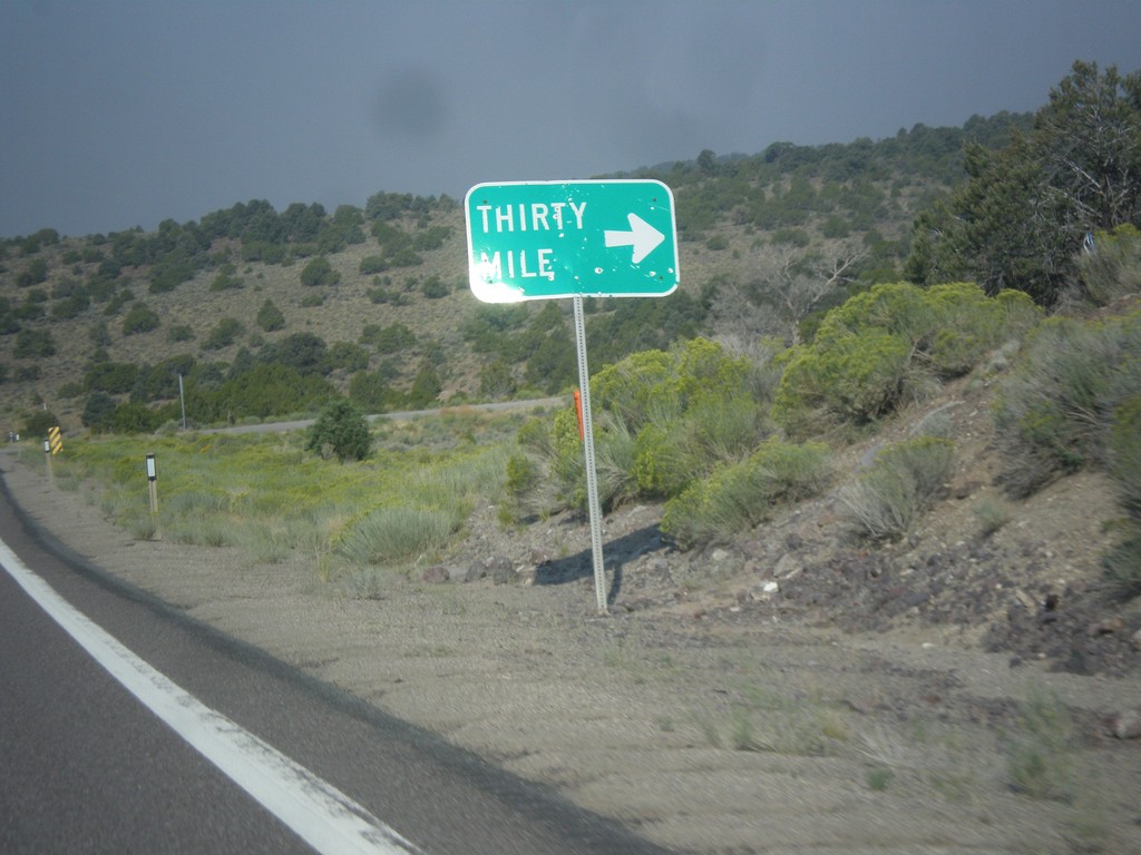
US-50 West - Thirty Mile Jct.
Thirty Mile Jct. on US-50 west in White Pine County.
Taken 08-31-2014
Ely
White Pine County
Nevada
United States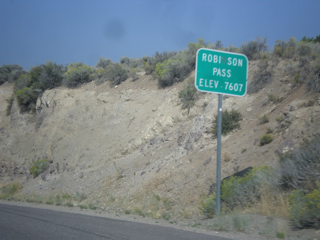
US-50 West - Robinson Summit
US-50 west at Robinson Pass - Elevation 7,607 Feet. Robinson Pass is in the Egan Range.
Taken 08-31-2014
Ely
White Pine County
Nevada
United States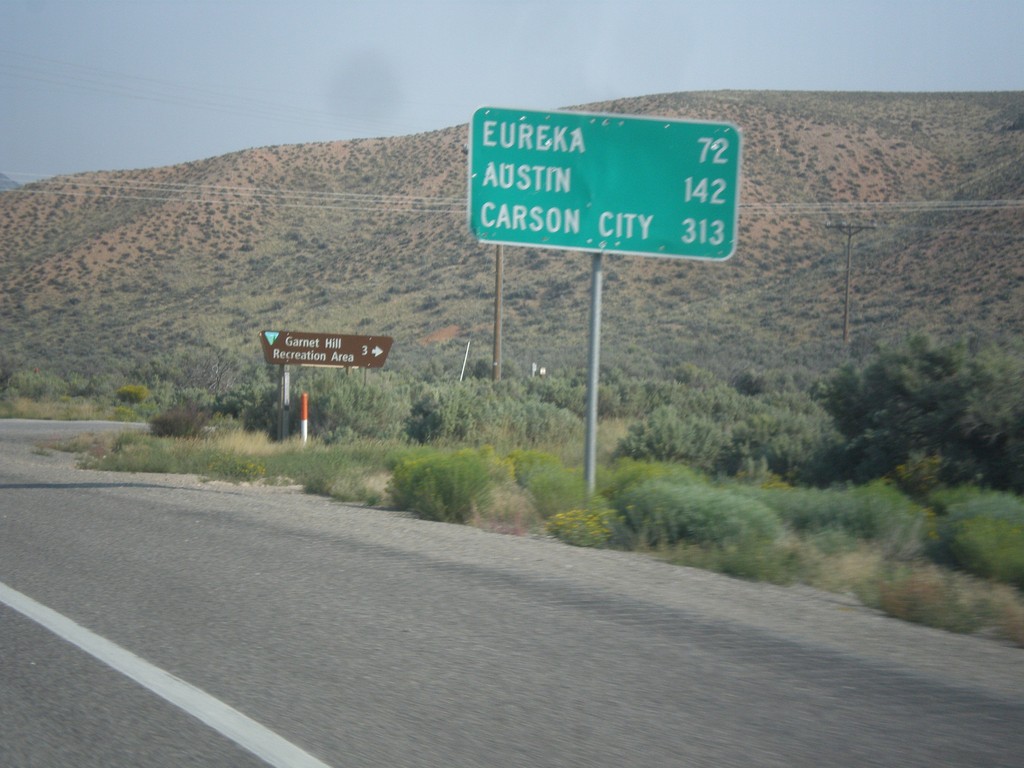
US-50 West - Distance Marker
Distance marker on US-50 west. Distance to Eureka, Austin, and Carson City.
Taken 08-31-2014
Ruth
White Pine County
Nevada
United States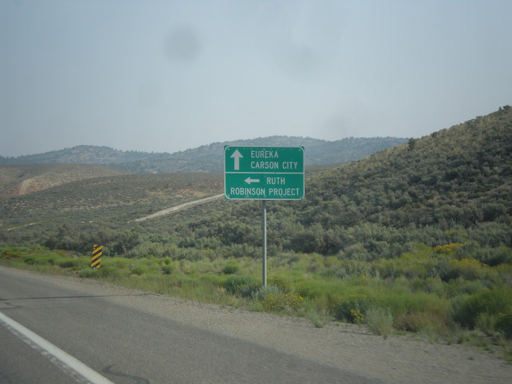
US-50 West - Ruth Jct.
US-50 west at junction to Ruth and Robinson Project. The Robinson Project is a large copper mine.
Taken 08-31-2014
Ruth
White Pine County
Nevada
United States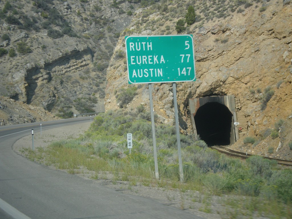
US-50 West - Distance Marker
Distance marker on US-50 west. Distance to Ruth, Eureka, and Austin.
Taken 08-31-2014
Ely
White Pine County
Nevada
United States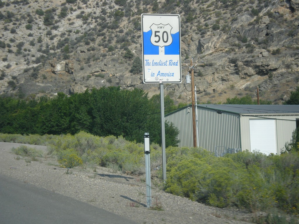
US-50 West - The Loneliest Road In America
The Loneliest Road in America on US-50 west. Taken at the west edge of Ely.
Taken 08-31-2014
Ely
White Pine County
Nevada
United States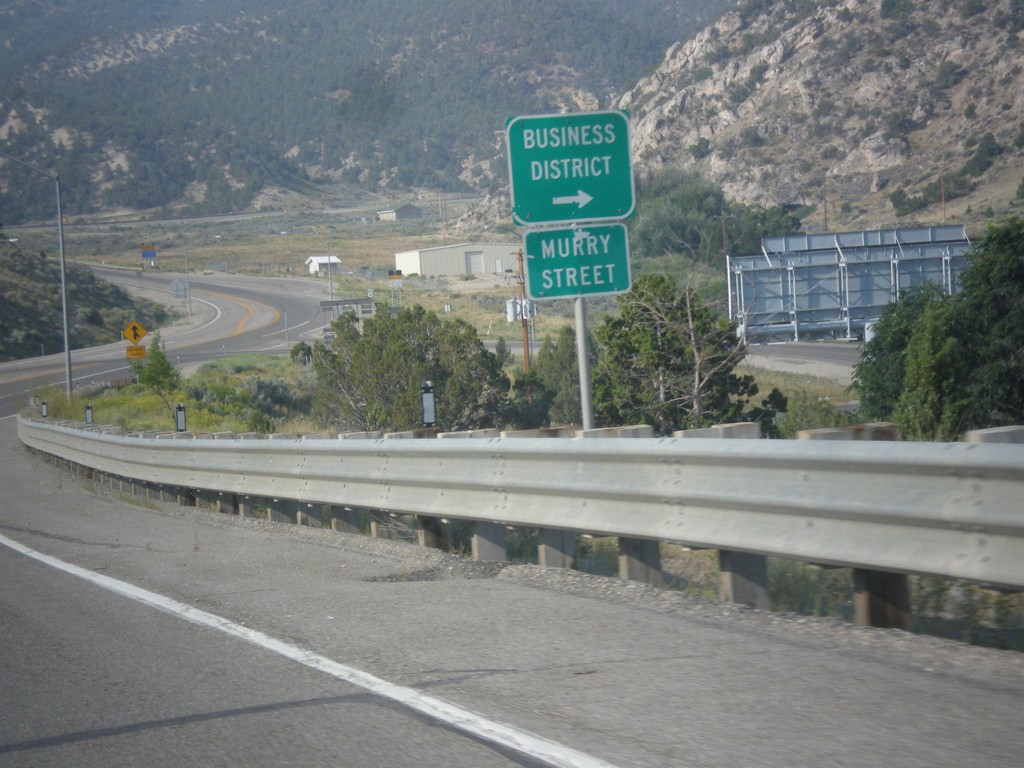
US-6 West - Murry St.
US-6 west approaching Murry St. into the Ely Business District. Murry St. used to be the former route of US-6 into Ely.
Taken 08-31-2014
 Ely
White Pine County
Nevada
United States
Ely
White Pine County
Nevada
United States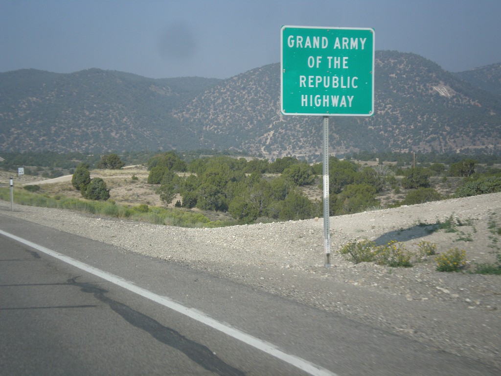
US-6 West - Grand Army of the Republic Highway
US-6 west - Grand Army of the Republic Highway.
Taken 08-31-2014
Ely
White Pine County
Nevada
United States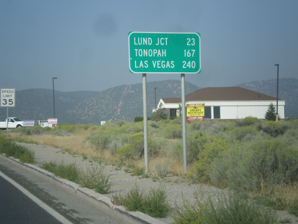
US-6 West - Distance Marker
Distance marker on US-6 west. Distance to Lund Jct., Tonopah, and Las Vegas (via NV-318).
Taken 08-31-2014
Ely
White Pine County
Nevada
United States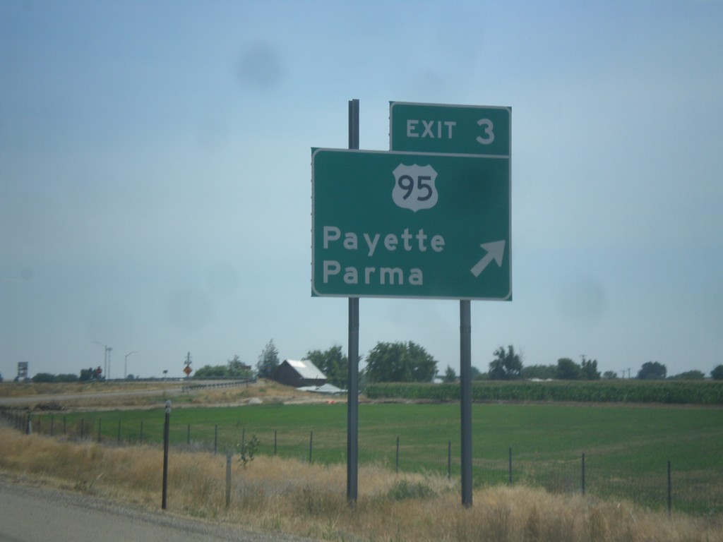
I-84 East - Exit 3
I-84 east at Exit 3 - US-95/Payette/Parma. First Idaho exit.
Taken 07-27-2014

 Fruitland
Payette County
Idaho
United States
Fruitland
Payette County
Idaho
United States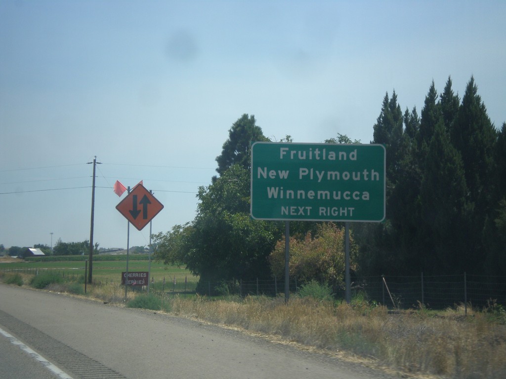
I-84 East Approaching Exit 3
I-84 east approaching Exit 3. Use Exit 3 for Fruitland, New Plymouth, and Winnemucca (Nevada).
Taken 07-27-2014
Fruitland
Payette County
Idaho
United States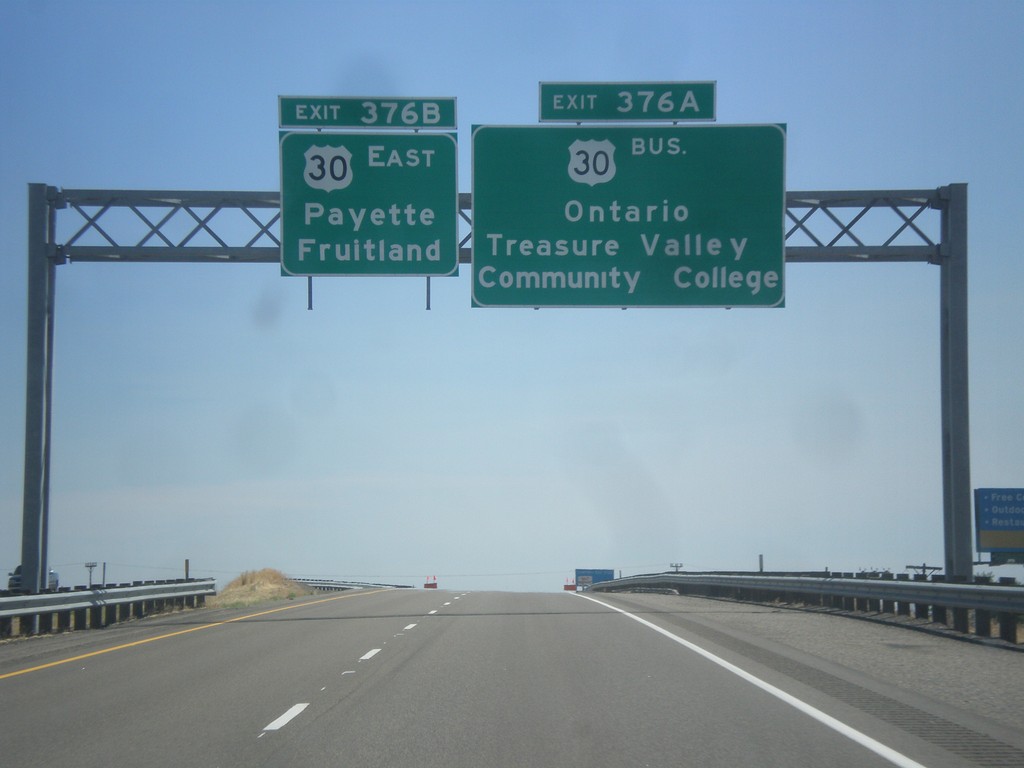
I-84 East - Exits 376A and B
I-84 east approaching Exit 376A - Bus. US-30/Ontario/Treasure Valley Community College. Approaching Exit 376B - US-30 East/Fruitland/Payette. Both Fruitland and Payette are in Idaho.
Taken 07-27-2014

 Ontario
Malheur County
Oregon
United States
Ontario
Malheur County
Oregon
United States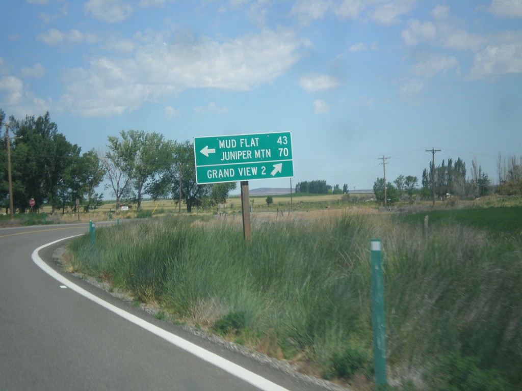
ID-78 West at Mud Flat Road
ID-78 west at Mud Flat Road to Mud Flat and Juniper Mountain. Continue west on ID-78 for Grand View. This is the beginning of the Owyhee Uplands Backcountry Byway, which follows Mud Flat Road along the south side of the Owyhee Mountains and ending in Jordan Valley, Oregon.
Taken 06-21-2014
 Grand View
Owyhee County
Idaho
United States
Grand View
Owyhee County
Idaho
United States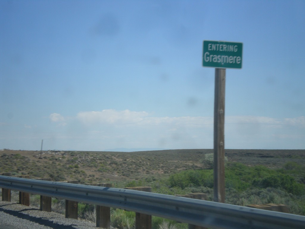
ID-51 North - Entering Grasmere
Entering Grasmere on ID-51 north. Grasmere is basically a ghost town. There are some broken down gas pumps and a few abandoned buildings.
Taken 06-21-2014
 Bruneau
Owyhee County
Idaho
United States
Bruneau
Owyhee County
Idaho
United States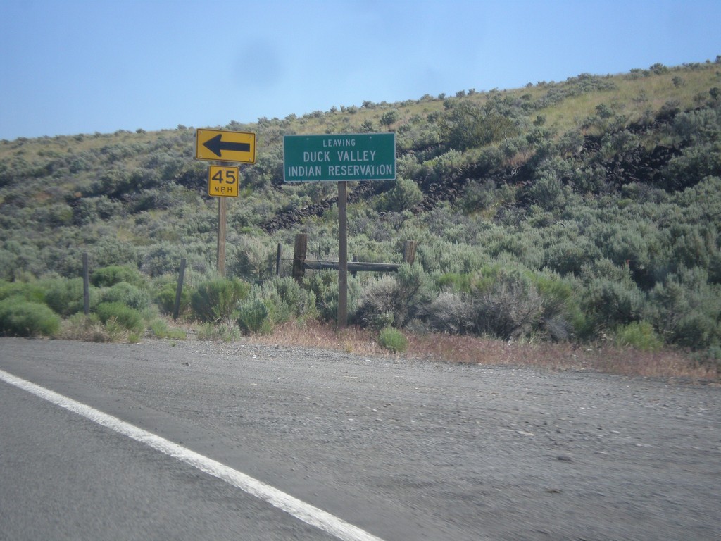
ID-51 North - Leaving Duck Valley Indian Reservation
Leaving the Duck Valley Indian Reservation on ID-51 north.
Taken 06-21-2014
Bruneau
Owyhee County
Idaho
United States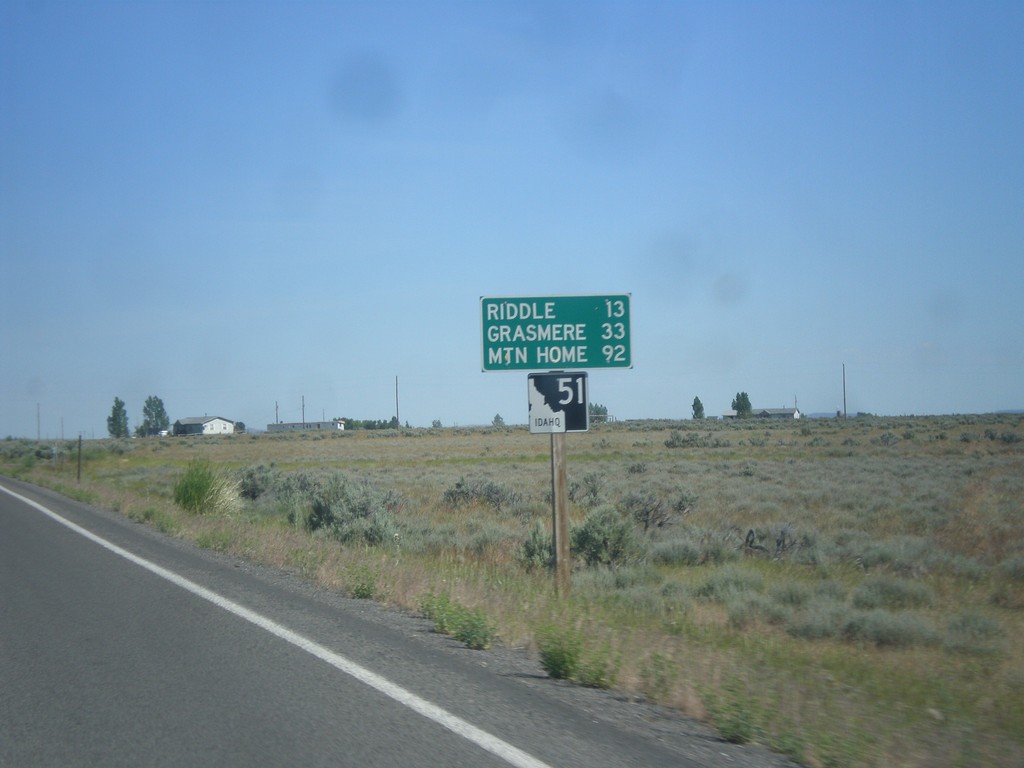
ID-51 North - Distance Marker
Distance marker on ID-51 north. Distance to Riddle, Grasmere, and Mountain Home. This is the first shield and distance marker along ID-51 after the stateline.
Taken 06-21-2014
Owyhee
Owyhee County
Idaho
United States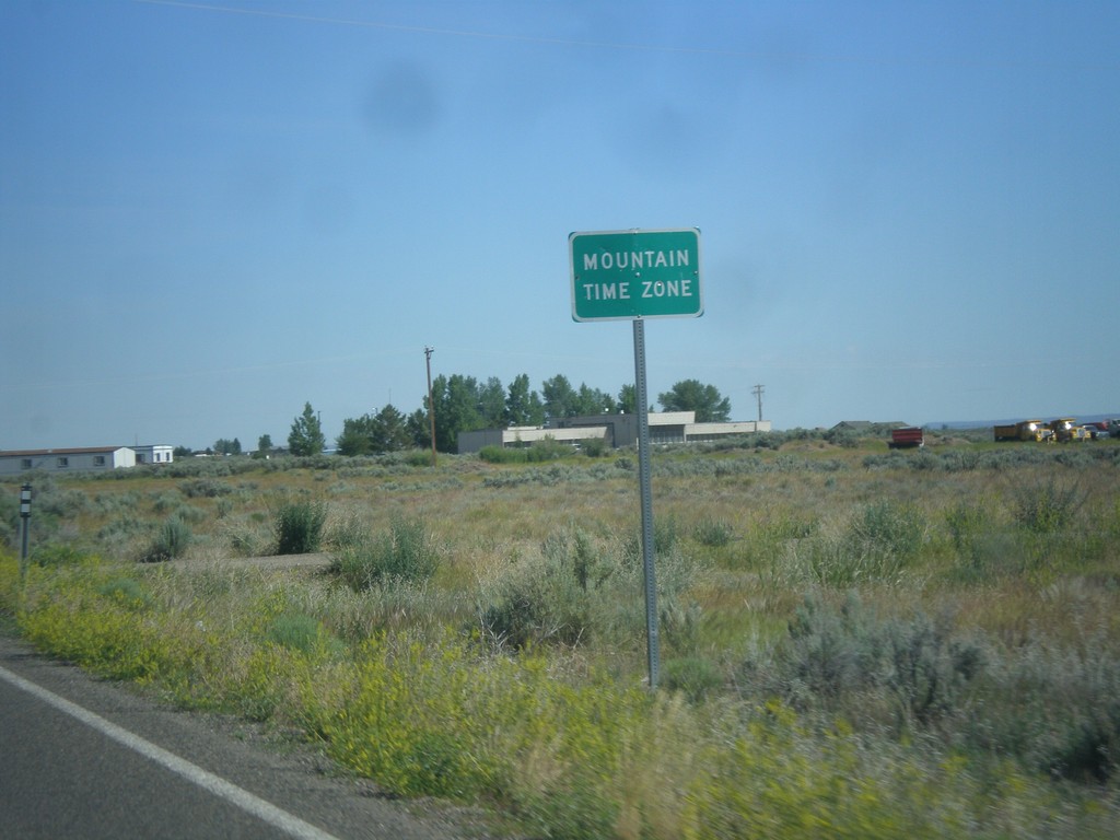
NV-225 North - Mountain Time
Entering Mountain Time Zone on NV-225 north, approaching the Idaho state line. The official time zone boundary is the Nevada-Idaho state line, but the towns of Owyhee and Mountain City, NV both observe Mountain Time.
Taken 06-21-2014
 Owyhee
Elko County
Nevada
United States
Owyhee
Elko County
Nevada
United States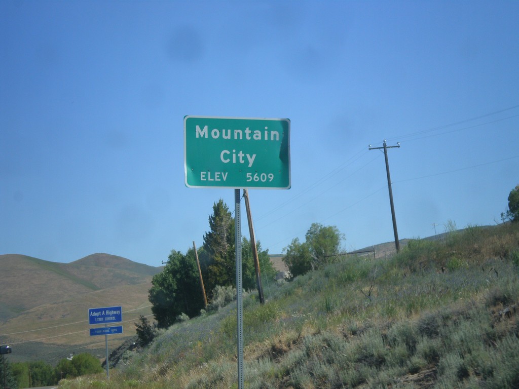
NV-225 North - Mountain City
Entering Mountain City on NV-225 North. Elevation 5,609 Feet.
Taken 06-21-2014
Mountain City
Elko County
Nevada
United States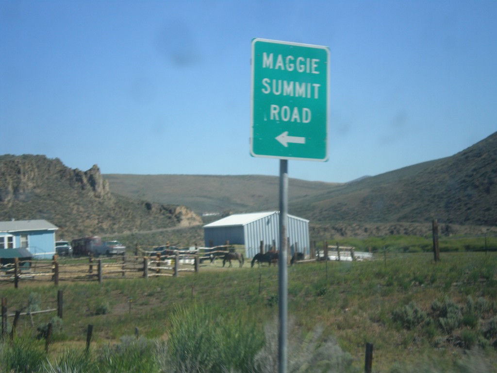
NV-225 North - Maggie Summit Road
NV-225 north at Maggie Summit Road.
Taken 06-21-2014
Mountain City
Elko County
Nevada
United States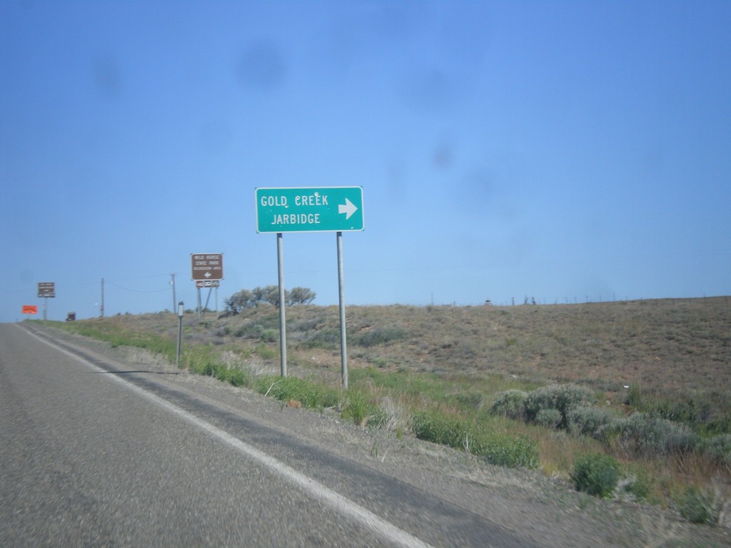
NV-225 North - Gold Creek Road
NV-225 north at Gold Creek Road to Gold Creek and Jarbidge.
Taken 06-21-2014
Elko
Elko County
Nevada
United States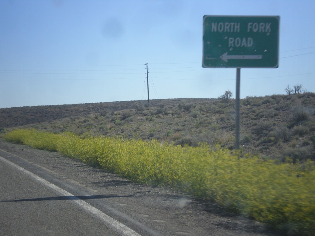
NV-225 North - North Fork Road
NV-225 north at North Fork Road junction. North Fork refers to the North Fork of the Humboldt River.
Taken 06-21-2014
Elko
Elko County
Nevada
United States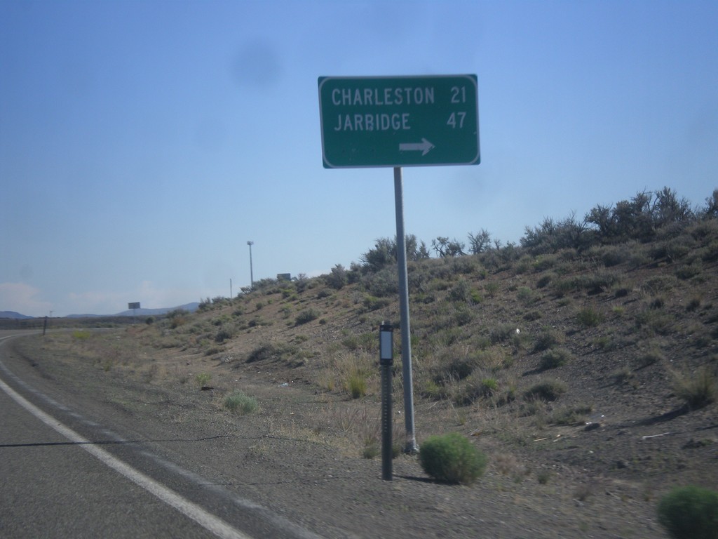
NV-225 North - Charleston/Jarbidge Jct.
NV-225 North at junction with road to Charleston and Jarbidge.
Taken 06-21-2014
Elko
Elko County
Nevada
United States