Signs Tagged With Big Green Sign
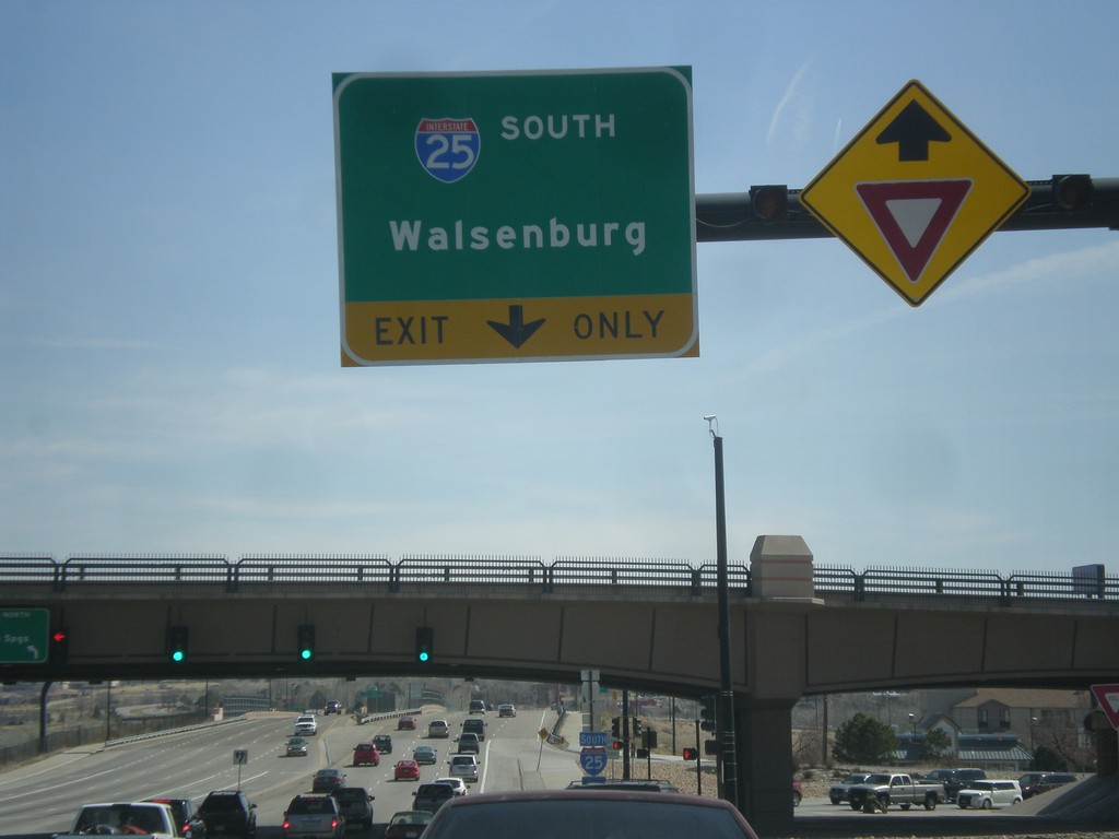
US-50 East at I-25 South
US-50 east at I-25 south to Walsenburg.
Taken 03-29-2014


 Pueblo
 County
Colorado
United States
Pueblo
Pueblo County
Colorado
United States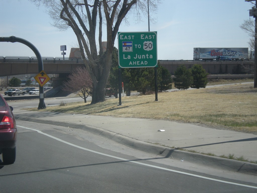
US-50 East at I-25/CO-47
US-50 east at I-25/CO-47. US-50 east continues south briefly on I-25 through Pueblo. An alternate route for US-50 east is to continue straight on CO-47, with loops around to connect with US-50 east.
Taken 03-29-2014
Pueblo
Pueblo County
Colorado
United States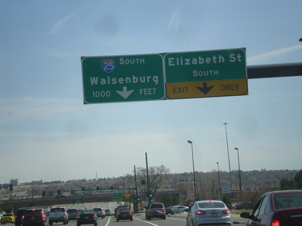
US-50 East Approaching I-25
US-50 east at Elizabeth St. approaching I-25/CO-47 junction in Pueblo. Use I-25 south for Walsenburg.
Taken 03-29-2014
Pueblo
Pueblo County
Colorado
United States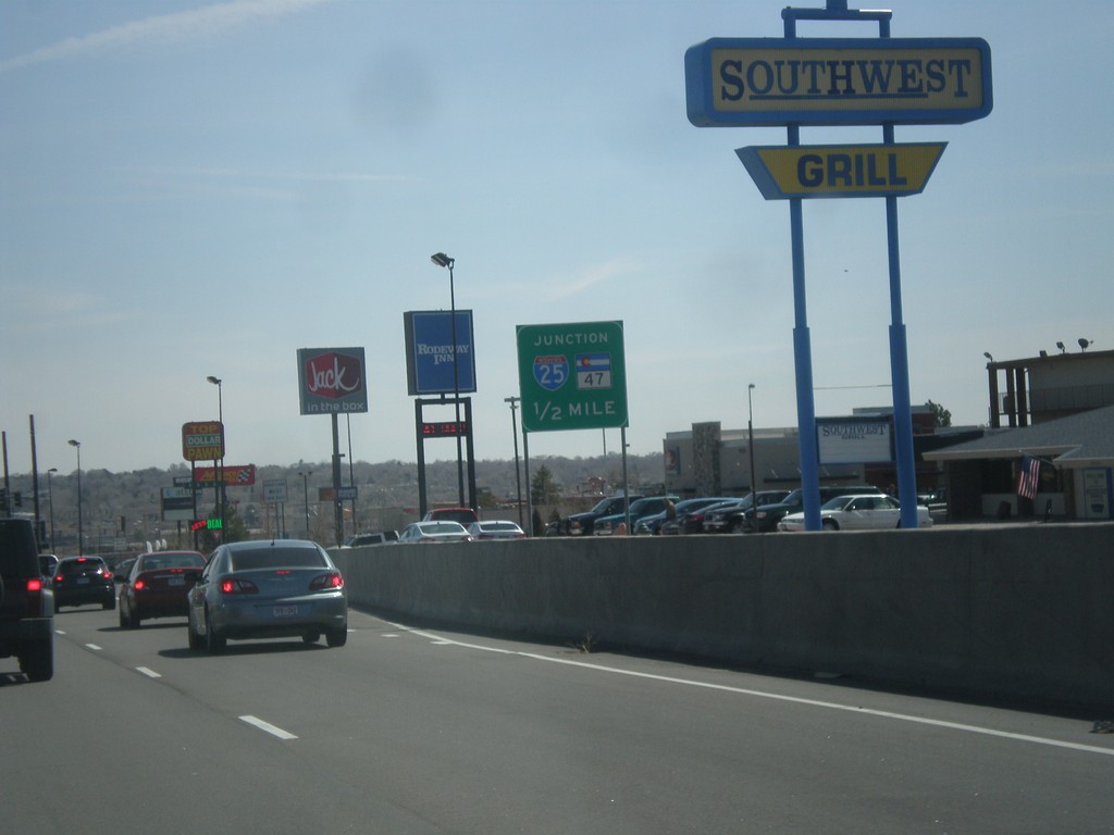
US-50 East Approaching I-25 and CO-47
US-50 East Approaching I-25 and CO-47 in Pueblo. US-50 joins I-25 south briefly through Pueblo.
Taken 03-29-2014
Pueblo
Pueblo County
Colorado
United States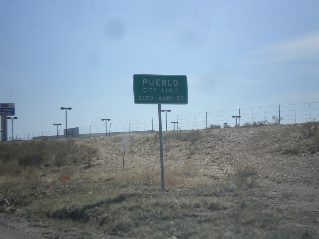
US-50 East - Pueblo City Limits
Pueblo City Limits on US-50 east. Elevation 4,695 feet. Pueblo is the 9th biggest city in Colorado according to the 2012 US Census estimate.
Taken 03-29-2014
Pueblo
Pueblo County
Colorado
United States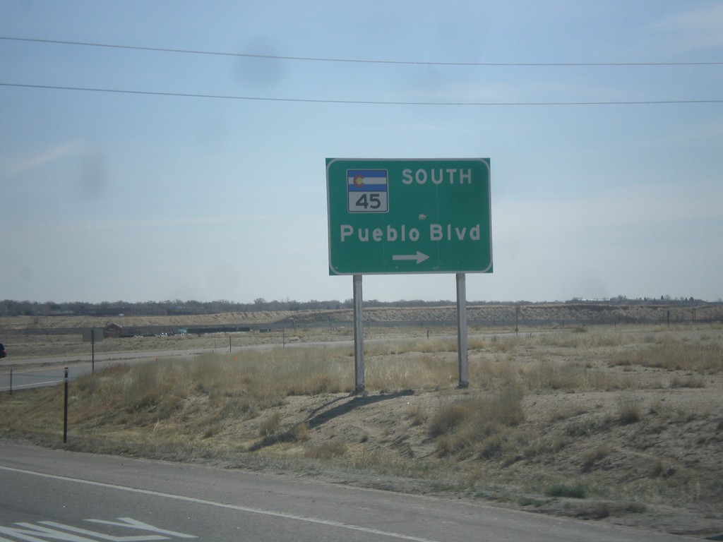
US-50 East at CO-45
US-50 east at CO-45 South/Pueblo Blvd. Pueblo Blvd. is the beltway around the west side of Pueblo.
Taken 03-29-2014
 Pueblo
 County
Colorado
United States
Pueblo
Pueblo County
Colorado
United States
US-50 East - Pueblo West Next 3 Exits
US-50 East - Pueblo West Next 3 Exits.
Taken 03-29-2014
Pueblo West
Pueblo County
Colorado
United States
US-50 East at CO-115 Junction
US-50 east at CO-115/Penrose/Colorado Springs interchange.
Taken 03-29-2014
 Penrose
Fremont County
Colorado
United States
Penrose
Fremont County
Colorado
United States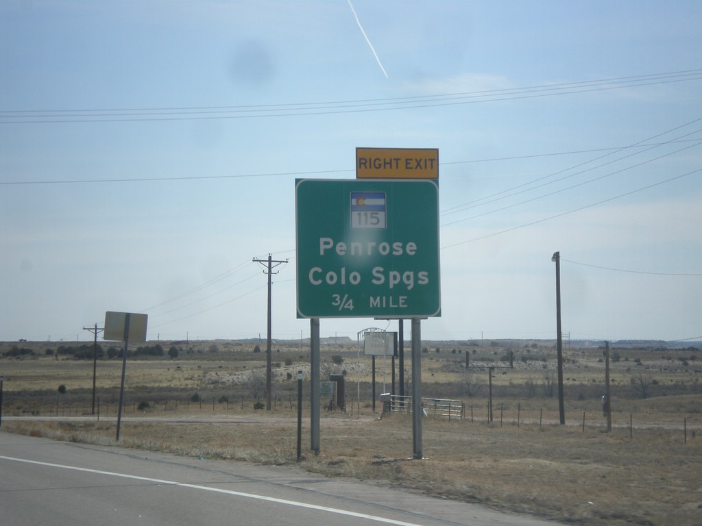
US-50 East Approaching CO-115
US-50 east approaching interchange for CO-115/Penrose/Colorado Springs.
Taken 03-29-2014
Penrose
Fremont County
Colorado
United States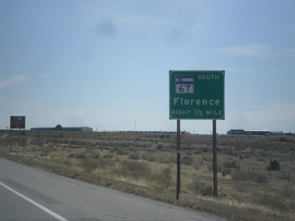
US-50 East Approaching CO-67
US-50 east approaching CO-67 south to Florence.
Taken 03-29-2014
 Penrose
Fremont County
Colorado
United States
Penrose
Fremont County
Colorado
United States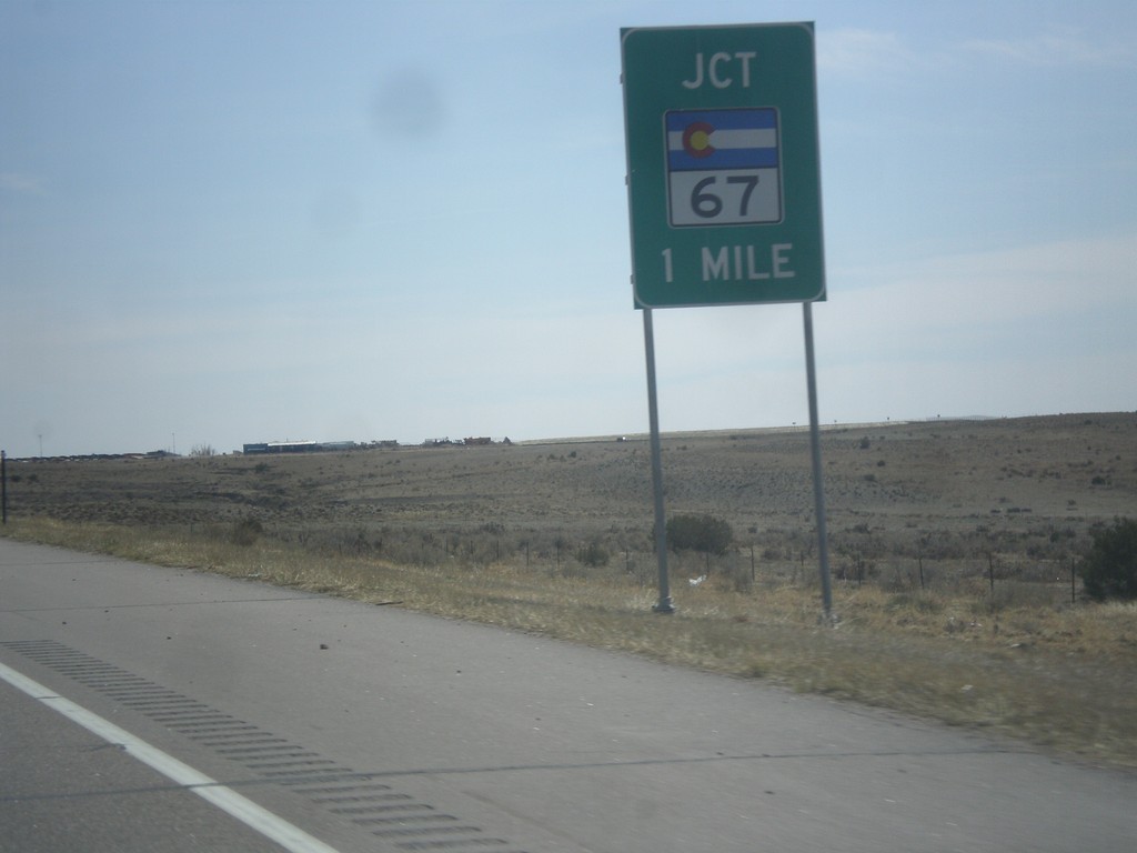
US-50 East Approaching CO-67
US-50 east approaching CO-67 in Fremont County.
Taken 03-29-2014
Penrose
Fremont County
Colorado
United States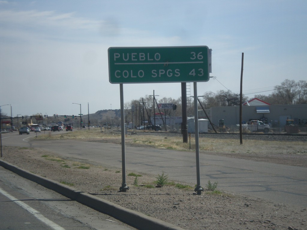
US-50 East - Distance Marker
Distance marker on US-50 east. Distance to Colorado Springs and Pueblo.
Taken 03-29-2014
Cañon City
Fremont County
Colorado
United States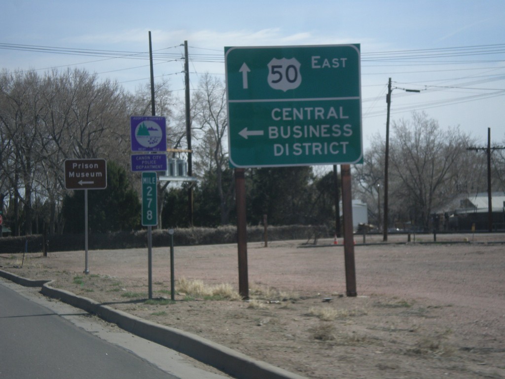
US-50 East - Cañon City Central Business District
US-50 East at 1st St. to (Cañon City) Central Business District.
Taken 03-29-2014
Cañon City
Fremont County
Colorado
United States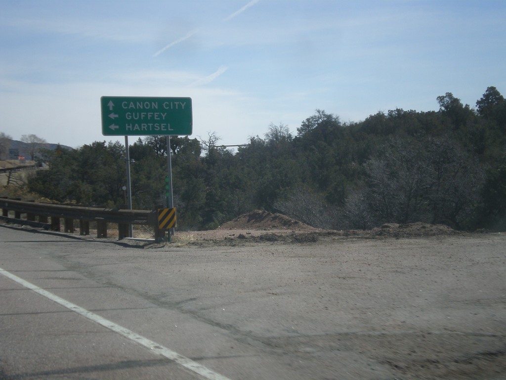
US-50 East At CO-9
US-50 east at CO-9. Turn left on CO-9 north for Guffey and Hartsel. Continue east on US-50 for Canon City.
Taken 03-29-2014
 Cañon City
Fremont County
Colorado
United States
Cañon City
Fremont County
Colorado
United States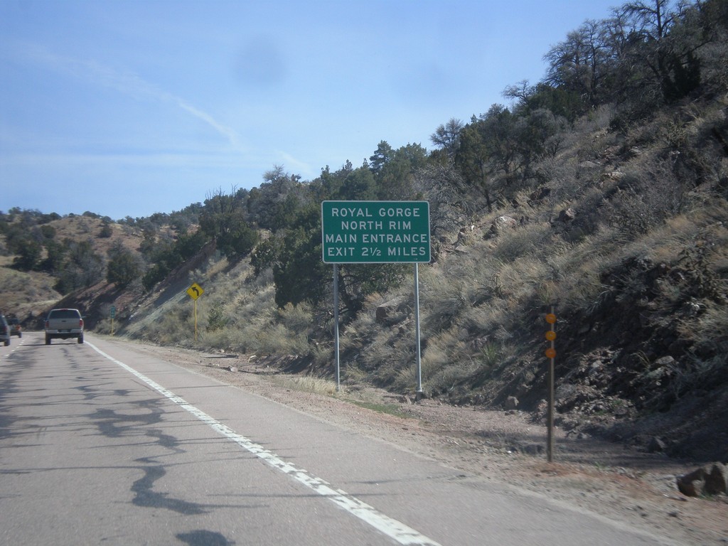
US-50 East - Royal Gorge North Rim
Distance marker on US-50 east for the Royal Gorge North Rim Main Entrance, 2.5 miles. This sign is immediately after the turn off to the South Rim of Royal Gorge.
Taken 03-29-2014
Cañon City
Fremont County
Colorado
United States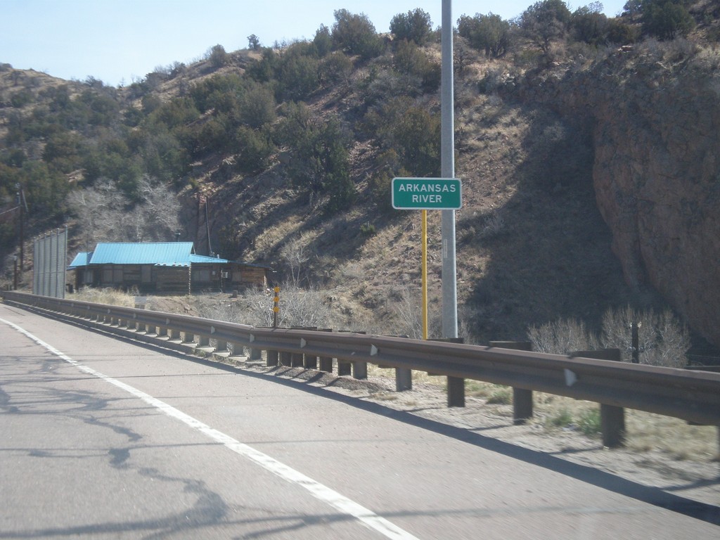
US-50 East - Arkansas River
US-50 east at the Arkansas River bridge. The Arkansas River leaves the highway here and enters Royal Gorge.
Taken 03-29-2014
Cañon City
Fremont County
Colorado
United States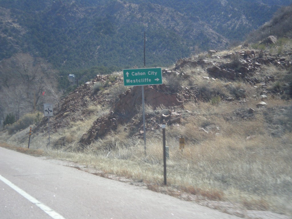
US-50 East Approaching CO-69
US-50 east approaching CO-69. Use CO-69 south for Westcliffe. Continue east on US-50 for Canon City.
Taken 03-29-2014
 Cotopaxi
Fremont County
Colorado
United States
Cotopaxi
Fremont County
Colorado
United States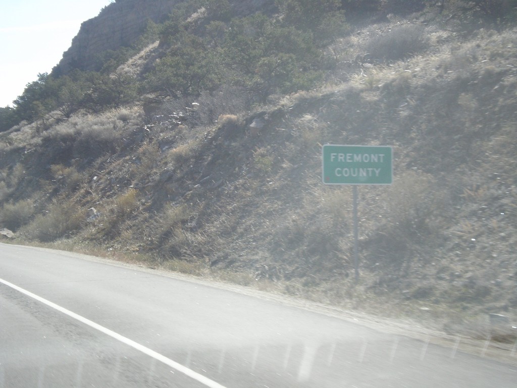
US-50 East - Fremont County
Entering Fremont County on US-50 east.
Taken 03-29-2014
Salida
Fremont County
Colorado
United States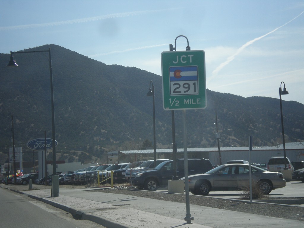
US-50 West Approaching CO-291
US-50 west approaching CO-291 in Salida.
Taken 03-29-2014
 Salida
Chaffee County
Colorado
United States
Salida
Chaffee County
Colorado
United States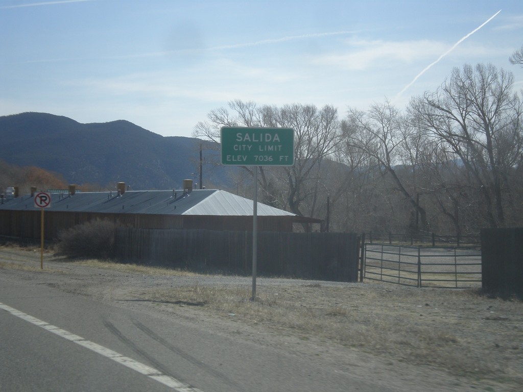
US-50 East - Entering Salida
Salida City Limit on US-50 east. Salida is the county seat of Chaffee County, Colorado.
Taken 03-29-2014
Salida
Chaffee County
Colorado
United States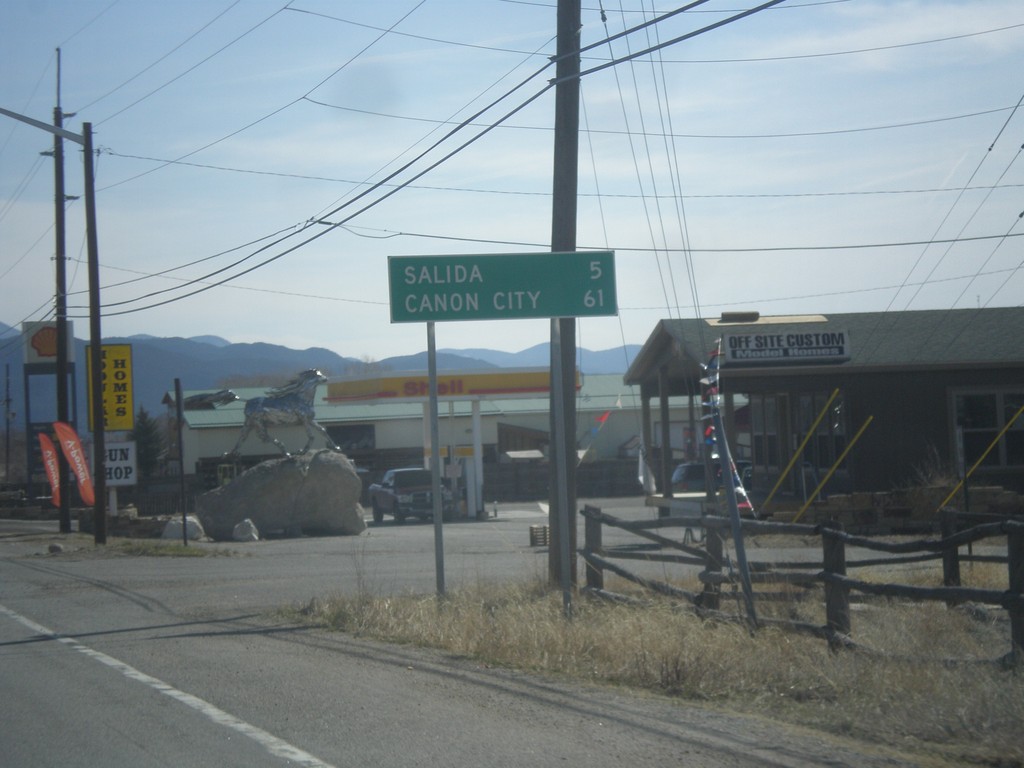
US-50 East - Distance Marker
Distance marker on US-50 east. Distance to Salida and Canon City.
Taken 03-29-2014
Salida
Chaffee County
Colorado
United States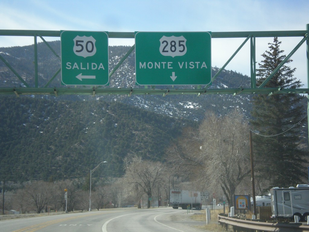
US-50 East/US-285 South at Split
US-50 East/US-285 South at split in Poncha Springs. Merge left for US-50 east to Salida; continue straight for US-285 south to Monte Vista.
Taken 03-29-2014
 Poncha Springs
Chaffee County
Colorado
United States
Poncha Springs
Chaffee County
Colorado
United States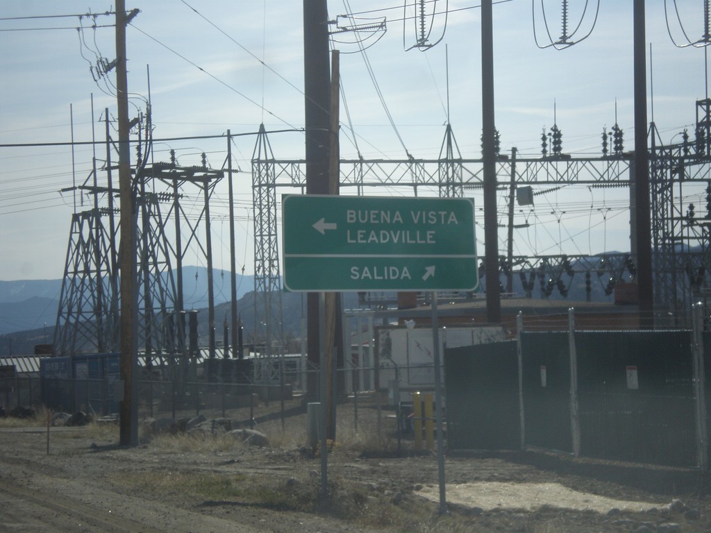
US-50 East at US-285
US-50 east at US-285 in Poncha Springs. Turn left for US-285 north to Buena Vista and Leadville. Continue ahead for US-50/US-285 South to Salida.
Taken 03-29-2014
Poncha Springs
Chaffee County
Colorado
United States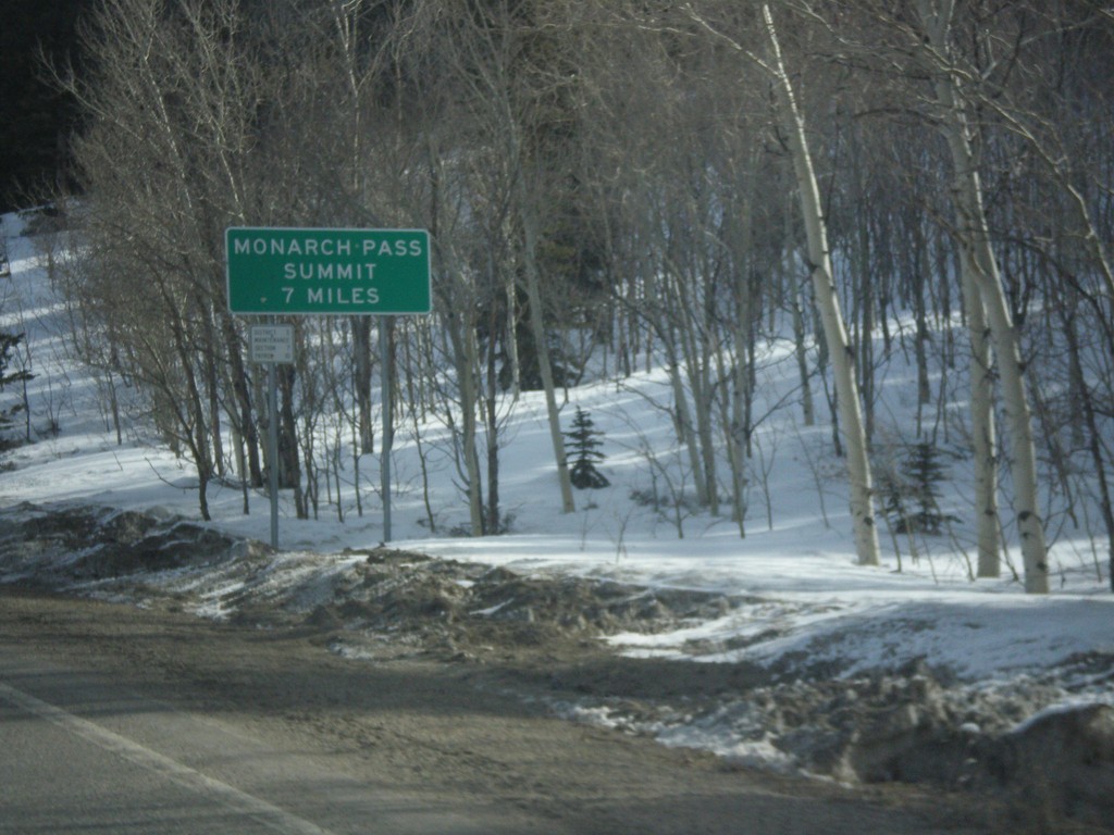
US-50 East - Monarch Pass Summit 7 Miles
Beginning climb up Monarch Pass on US-50 east. Monarch Pass Summit is 7 miles from this point.
Taken 03-29-2014
Sargents
Saguache County
Colorado
United States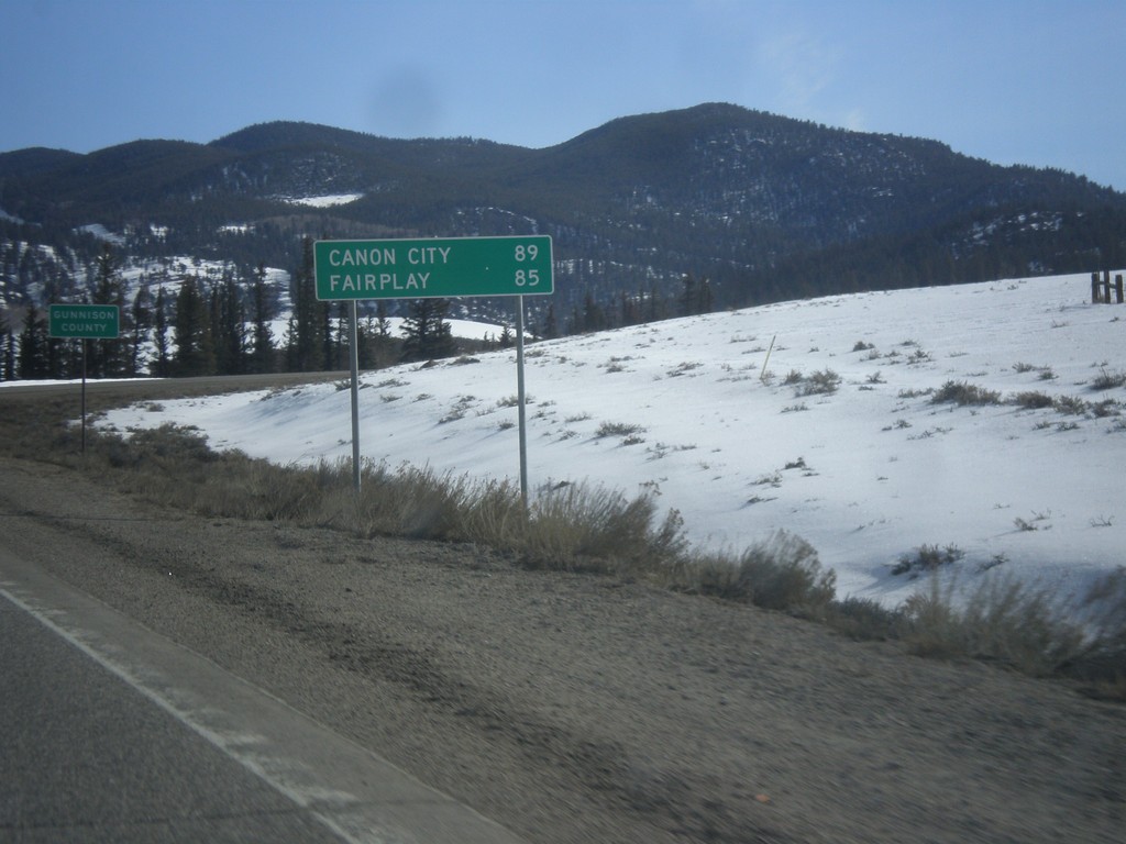
US-50 East - Distance Marker
Distance to Canon City and Fairplay on US-50 east. In the background is the highway enters Gunnison County.
Taken 03-29-2014
Sargents
Saguache County
Colorado
United States