Signs Tagged With Big Green Sign
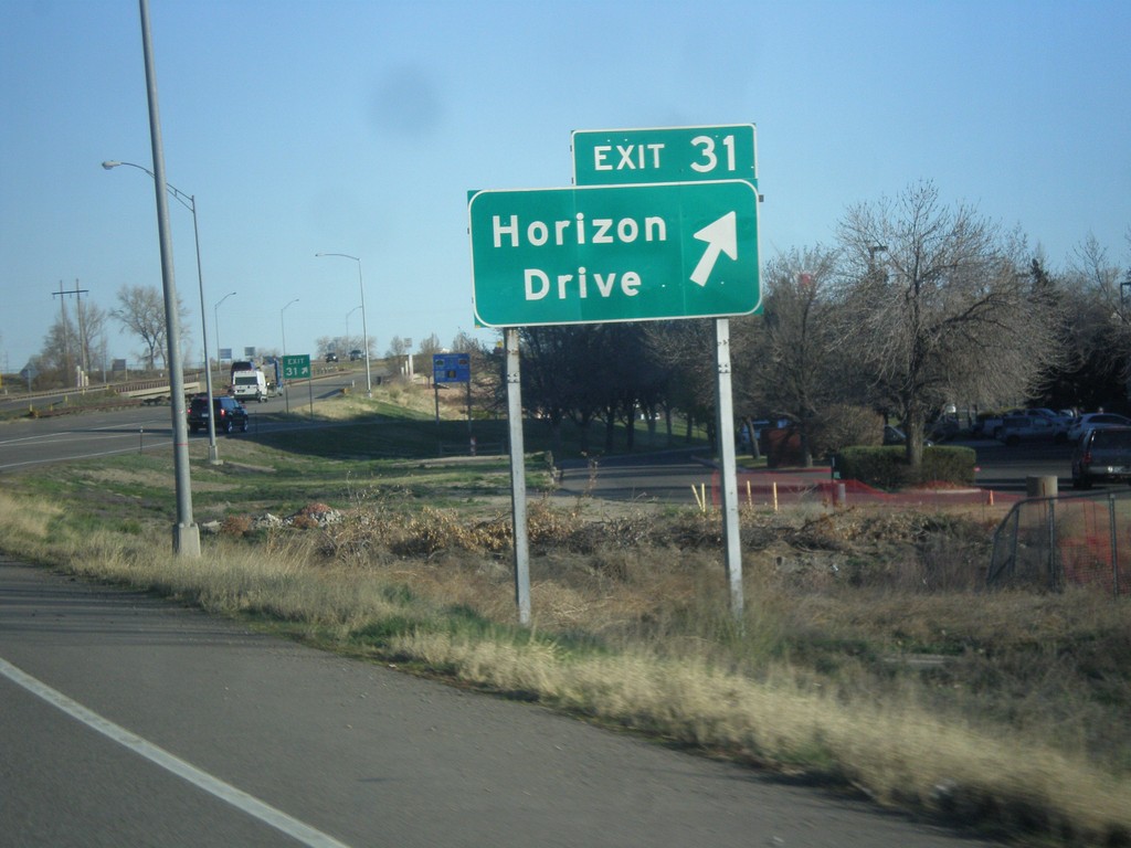
I-70 East - Exit 31
I-70 east at Exit 31 - Horizon Drive.
Taken 03-28-2014
 Grand Junction
Mesa County
Colorado
United States
Grand Junction
Mesa County
Colorado
United States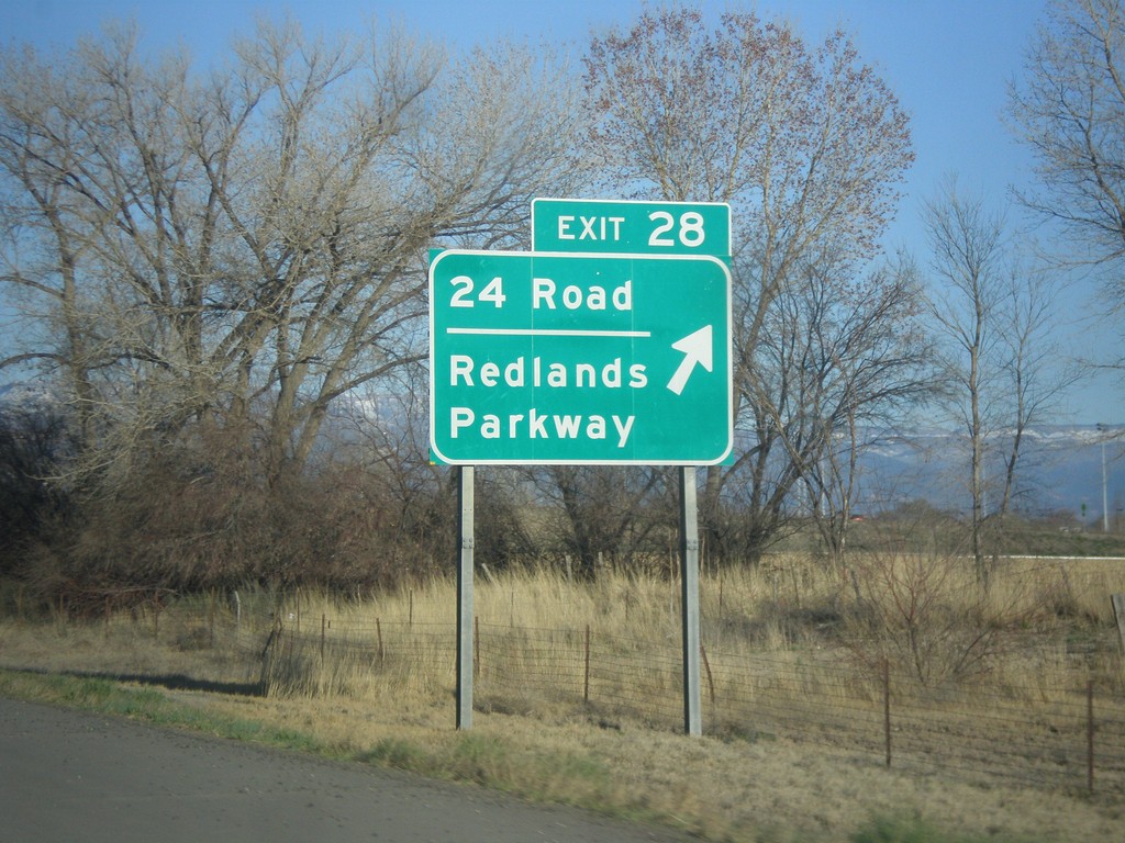
I-70 East - Exit 28
I-70 east at Exit 28 - 24 Road/Redlands Parkway.
Taken 03-28-2014
Grand Junction
Mesa County
Colorado
United States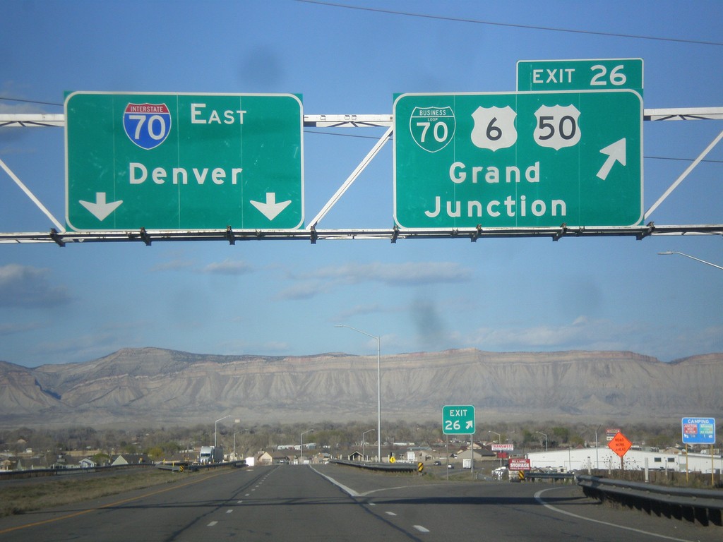
I-70 East - Exit 26
I-70 east at Exit 26 - BL-70/US-6/US-50/Grand Junction. Continue east on I-70 for Denver. This is the eastern end of the Grand Junction business loop. Grand Junction is the largest city in Colorado west of the Rocky Mountains.
Taken 03-28-2014


 Grand Junction
Mesa County
Colorado
United States
Grand Junction
Mesa County
Colorado
United States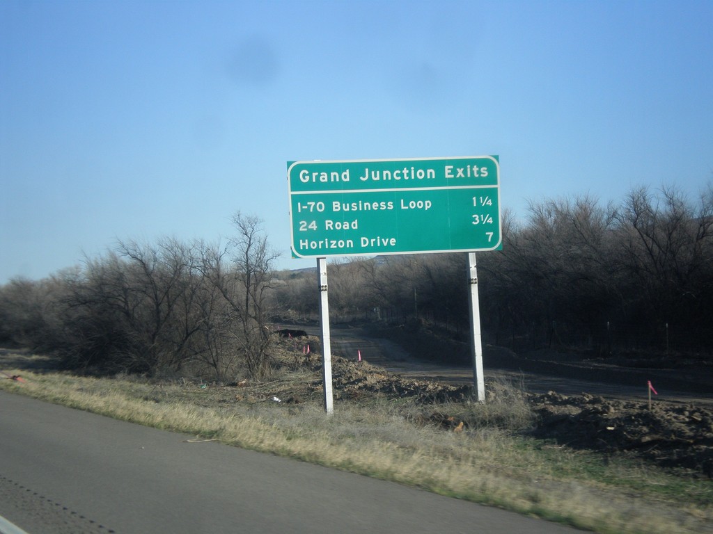
I-70 East - Grand Junction Exits
Grand Junction Exits on I-70 east. Next three exits are I-70 Business Loop, 24 Road, and Horizon Drive.
Taken 03-28-2014
Fruita
Mesa County
Colorado
United States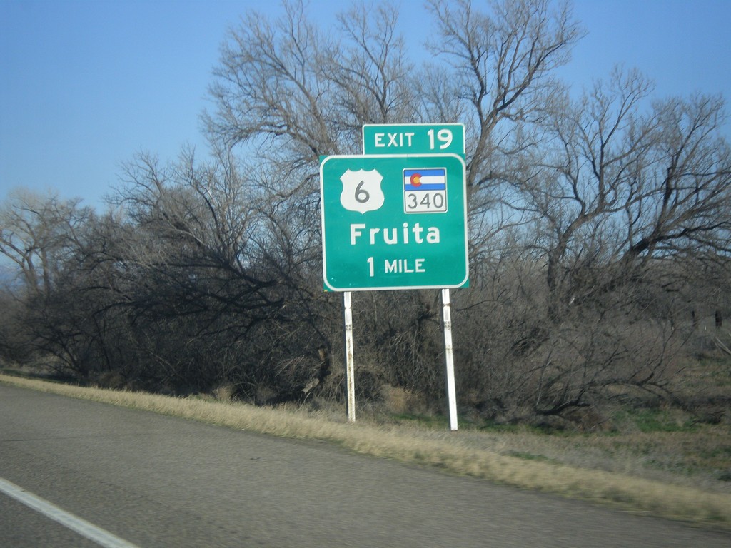
I-70 East Approaching Exit 19
I-70 east approaching Exit 19 - US-6/CO-340/Fruita.
Taken 03-28-2014
 Fruita
Mesa County
Colorado
United States
Fruita
Mesa County
Colorado
United States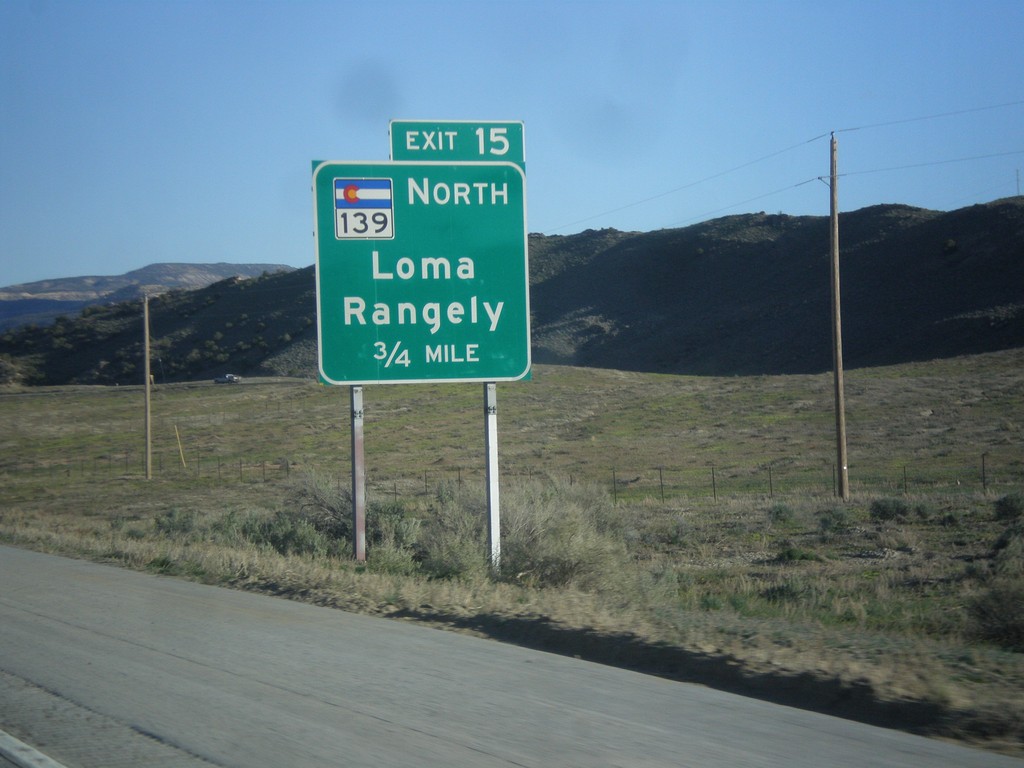
I-70 East - Exit 15
I-70 East at Exit 15 - CO-139 North/Loma/Rangely.
Taken 03-28-2014
 Loma
Mesa County
Colorado
United States
Loma
Mesa County
Colorado
United States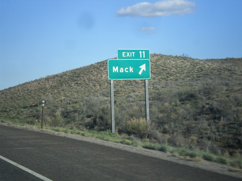
I-70 East - Exit 11
I-70 east at Exit 11 - Mack.
Taken 03-28-2014
Mack
Mesa County
Colorado
United States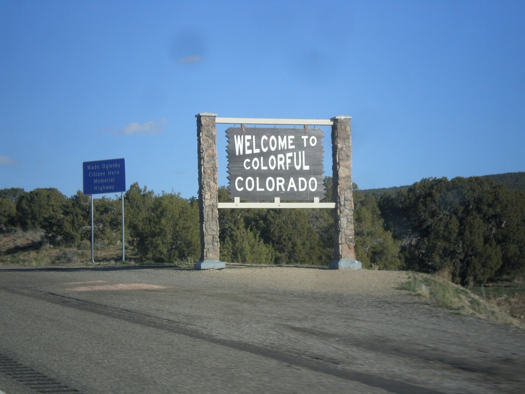
I-70 East - Entering Colorado
Welcome to colorful Colorado on I-70 east. Taken at the Utah-Colorado line.
Taken 03-28-2014
Mack
Mesa County
Colorado
United States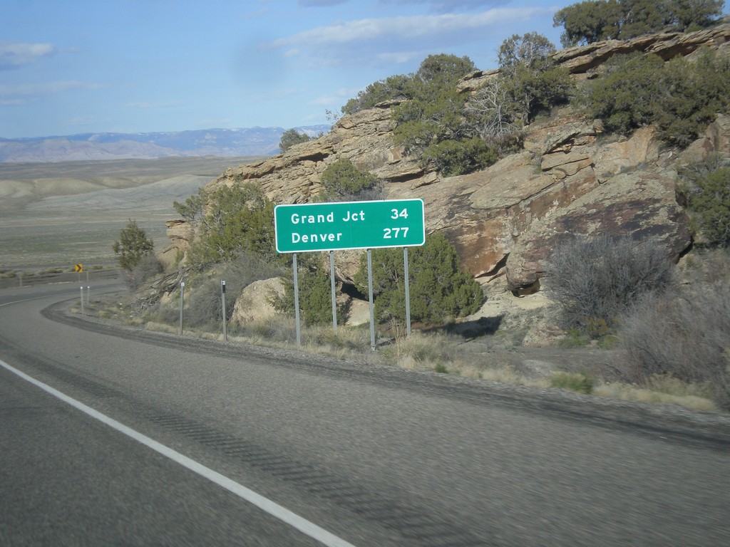
I-70 East - Distance Marker
Distance marker on I-70 west. Distance to Grand Junction and Denver. This is the last distance marker along I-70 in Utah.
Taken 03-28-2014
Cisco
Grand County
Utah
United States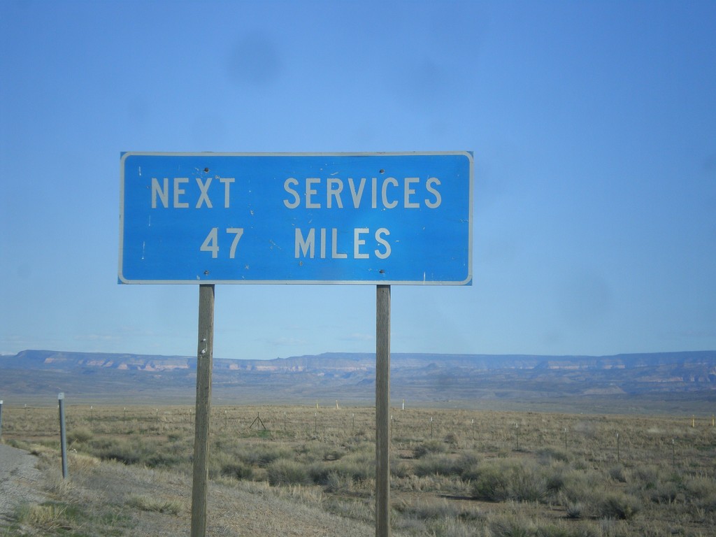
UT-128 - Next Services 47 Miles
Next services 47 miles (in Moab) on UT-128 west.
Taken 03-28-2014
 Thompson Springs
Grand County
Utah
United States
Thompson Springs
Grand County
Utah
United States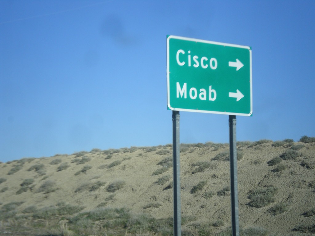
I-70 East - Exit 204 Offramp
I-70 east Exit 204 offramp. Turn right for UT-128 to Cisco and Moab.
Taken 03-28-2014
Cisco
Grand County
Utah
United States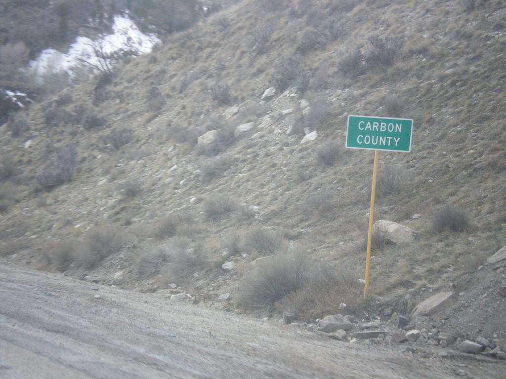
US-6 East - Carbon County
Entering Carbon County on US-6 east.
Taken 03-28-2014
Helper
Carbon County
Utah
United States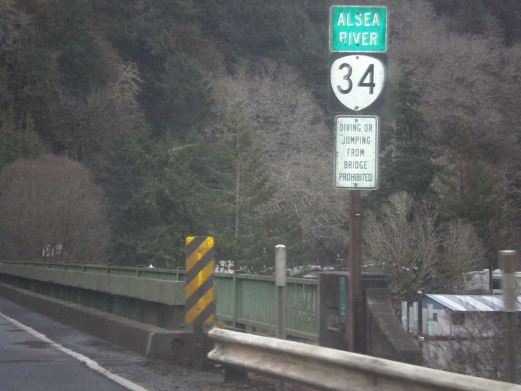
OR-34 East - Alsea River
OR-34 east at the Alsea River bridge.
Taken 02-21-2014
 Waldport
Lincoln County
Oregon
United States
Waldport
Lincoln County
Oregon
United States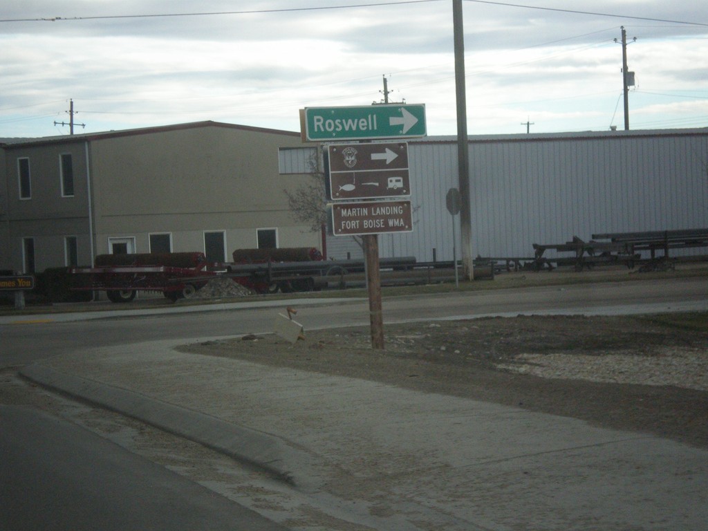
US-20/US-26 East/US-95 South - Roswell Jct.
US-20/US-26 East/US-95 South at Roswell junction (Old Highway 18) in Parma.
Taken 02-17-2014


 Parma
Canyon County
Idaho
United States
Parma
Canyon County
Idaho
United States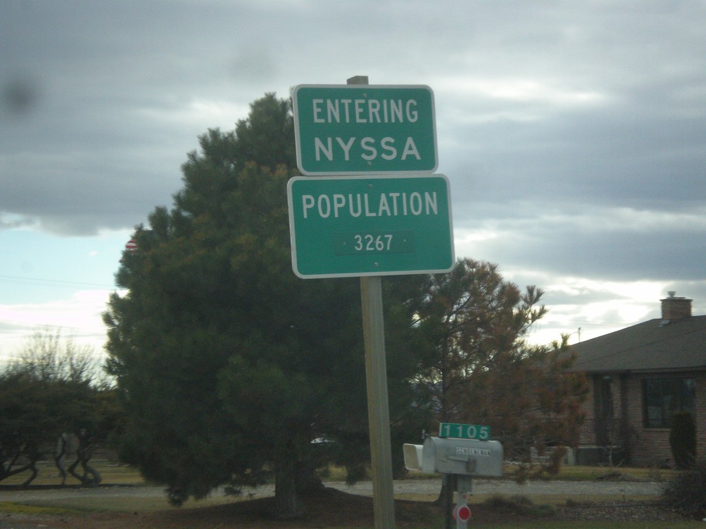
US-20/US-26 East/OR-201 South - Entering Nyssa
Entering Nyssa on US-20/US-26 East/OR-201 South. Nyssa is located on the Oregon-Idaho border along the Snake River.
Taken 02-17-2014
 Nyssa
Malheur County
Oregon
United States
Nyssa
Malheur County
Oregon
United States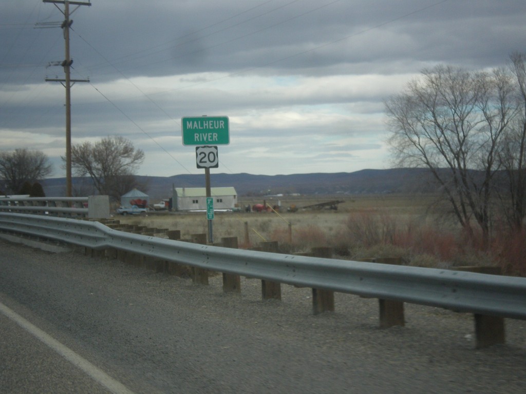
US-20 East - Malheur River
Malheur River bridge on US-20 east in Malheur County.
Taken 02-17-2014
Vale
Malheur County
Oregon
United States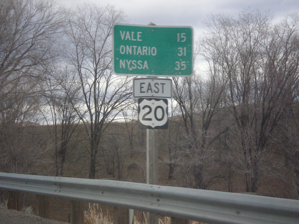
US-20 East - Distance Marker
Distance marker on US-20 east to Vale, Ontario, and Nyssa. Missing US-20 shield on sign.
Taken 02-17-2014
Harper
Malheur County
Oregon
United States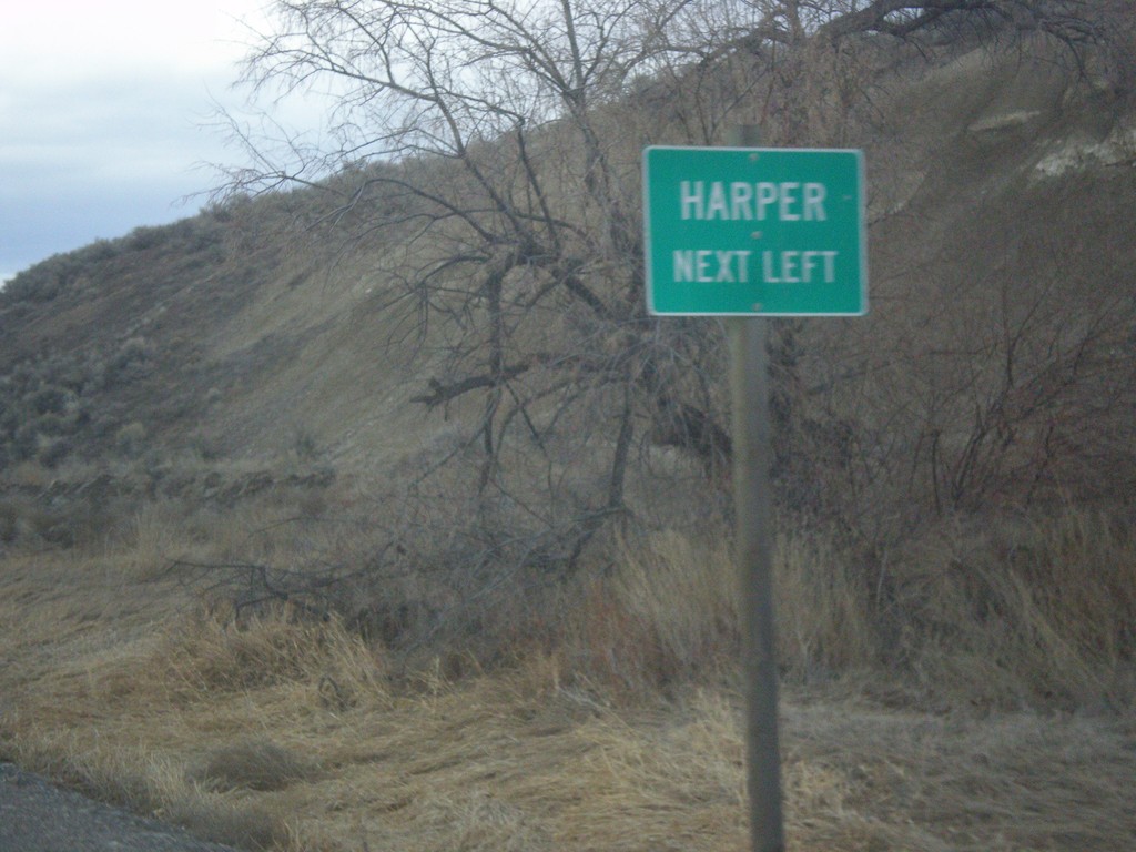
US-20 East - Harper Junction
US-20 east approaching Harper Junction.
Taken 02-17-2014
Harper
Malheur County
Oregon
United States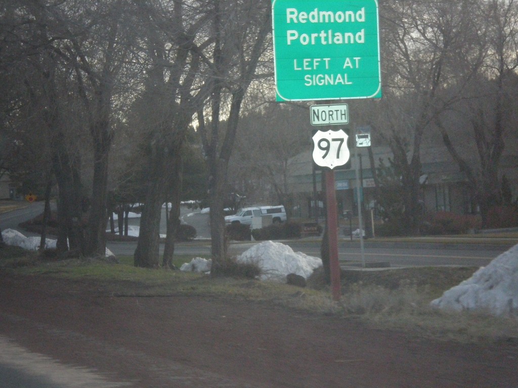
US-20 East Approaching US-97 North
US-20 east approaching Empire Blvd. jct. Use Empire Blvd. for US-97 North access towards Redmond and Portland.
Taken 02-16-2014
 Bend
Deschutes County
Oregon
United States
Bend
Deschutes County
Oregon
United States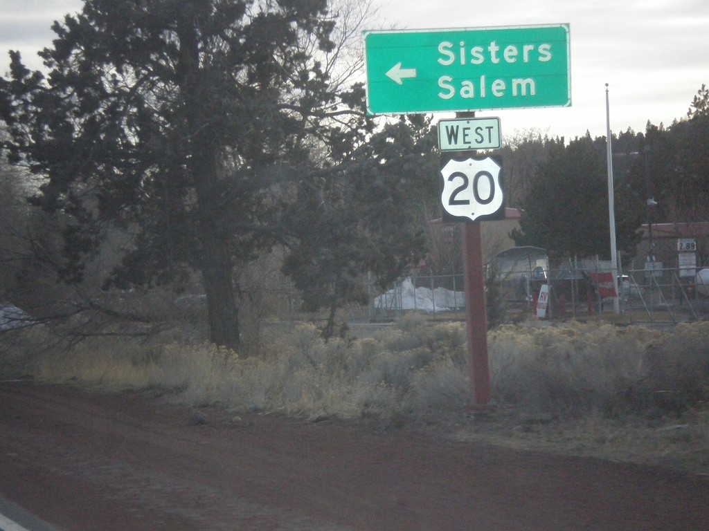
US-20 East at Return To US-20 West
US-20 East at return to US-20 West towards Sisters and Salem.
Taken 02-16-2014
Bend
Deschutes County
Oregon
United States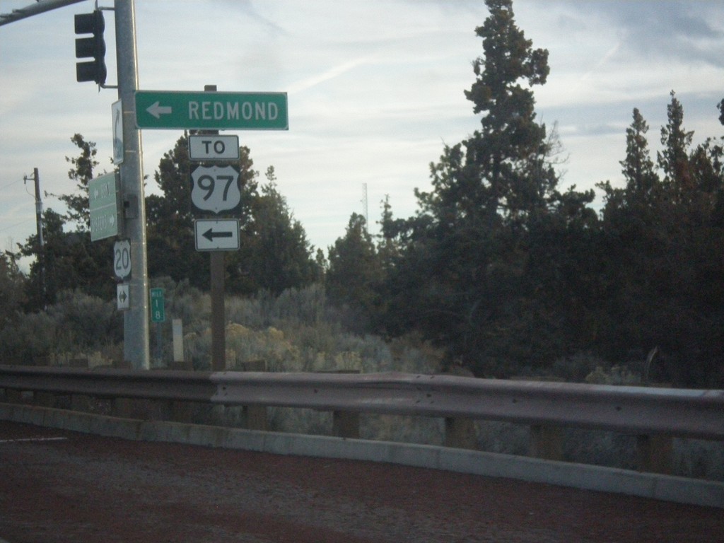
US-20 East at Robal Road
US-20 East at Robal Road. Use Robal Road east for Redmond and US-97 North.
Taken 02-16-2014
Bend
Deschutes County
Oregon
United States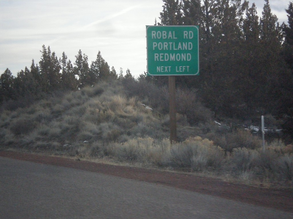
US-20 East - Robal Road Jct.
US-20 east approaching Robal Road. Use Robal Road for Redmond and Portland (via US-97 north).
Taken 02-16-2014
Bend
Deschutes County
Oregon
United States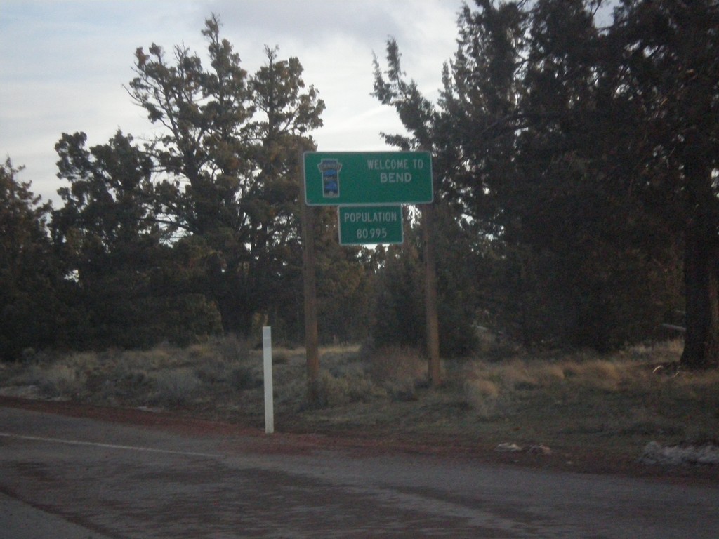
US-20 East - Entering Bend
Entering Bend, Oregon on US-20 east. Bend is the largest city in Oregon east of the Cascades.
Taken 02-16-2014
Bend
Deschutes County
Oregon
United States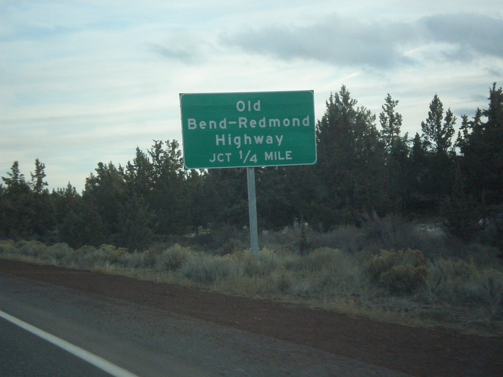
US-20 East Approaching Old Bend - Redmond Highway Jct.
US-20 east approaching Old Bend - Redmond Highway junction in Deschutes County.
Taken 02-16-2014
Bend
Deschutes County
Oregon
United States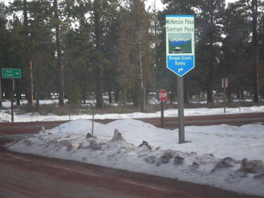
US-20/OR-126 East at OR-242
US-20/OR-126 East at OR-242. OR-242 is part of the McKenzie Pass - Santiam Pass Scenic Byway.
Taken 02-16-2014

 Sisters
Deschutes County
Oregon
United States
Sisters
Deschutes County
Oregon
United States