Signs Tagged With Big Green Sign
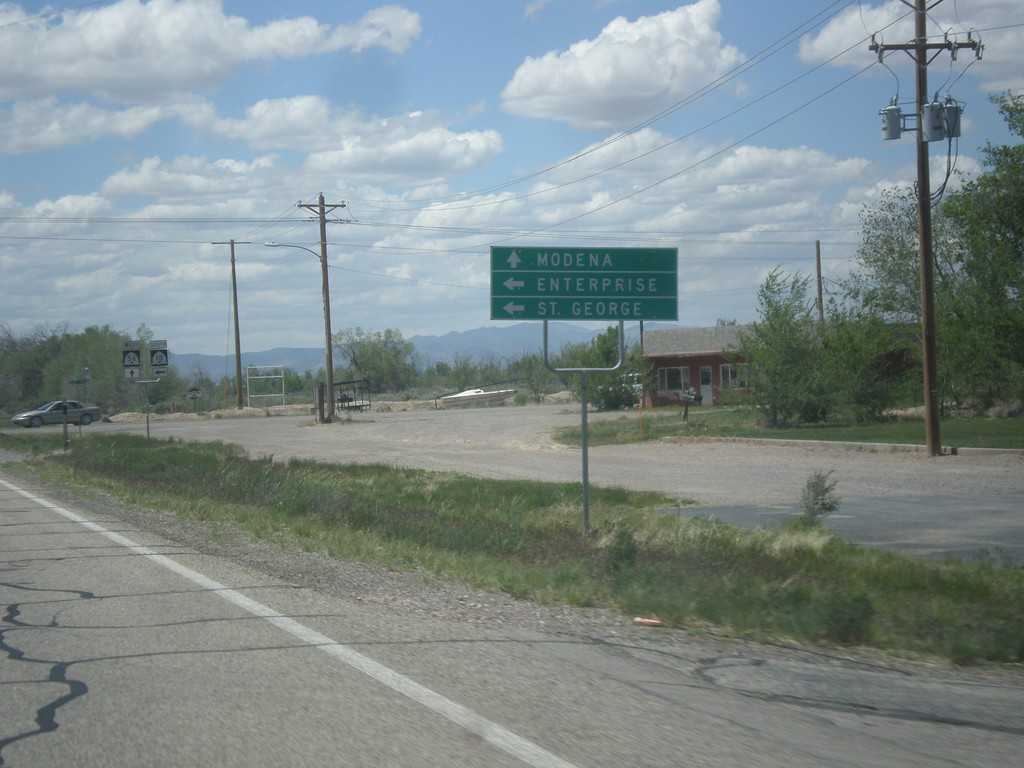
UT-56 West Approaching UT-18
UT-56 West approaching UT-18 south to Enterprise and St. George. Continue west on UT-56 for Modena.
Taken 05-21-2014

 Beryl
Iron County
Utah
United States
Beryl
Iron County
Utah
United States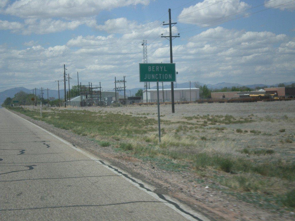
UT-56 West - Beryl Junction
Entering Beryl Junction on UT-56 west.
Taken 05-21-2014
Beryl
Iron County
Utah
United States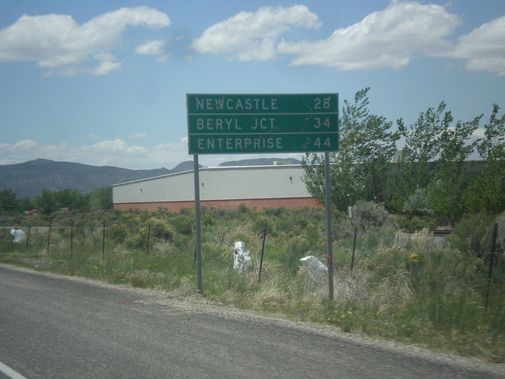
UT-56 West - Distance Marker
Distance marker on UT-56 west. Distance to Newcastle, Beryl Junction, and Enterprise.
Taken 05-21-2014
Cedar City
Iron County
Utah
United States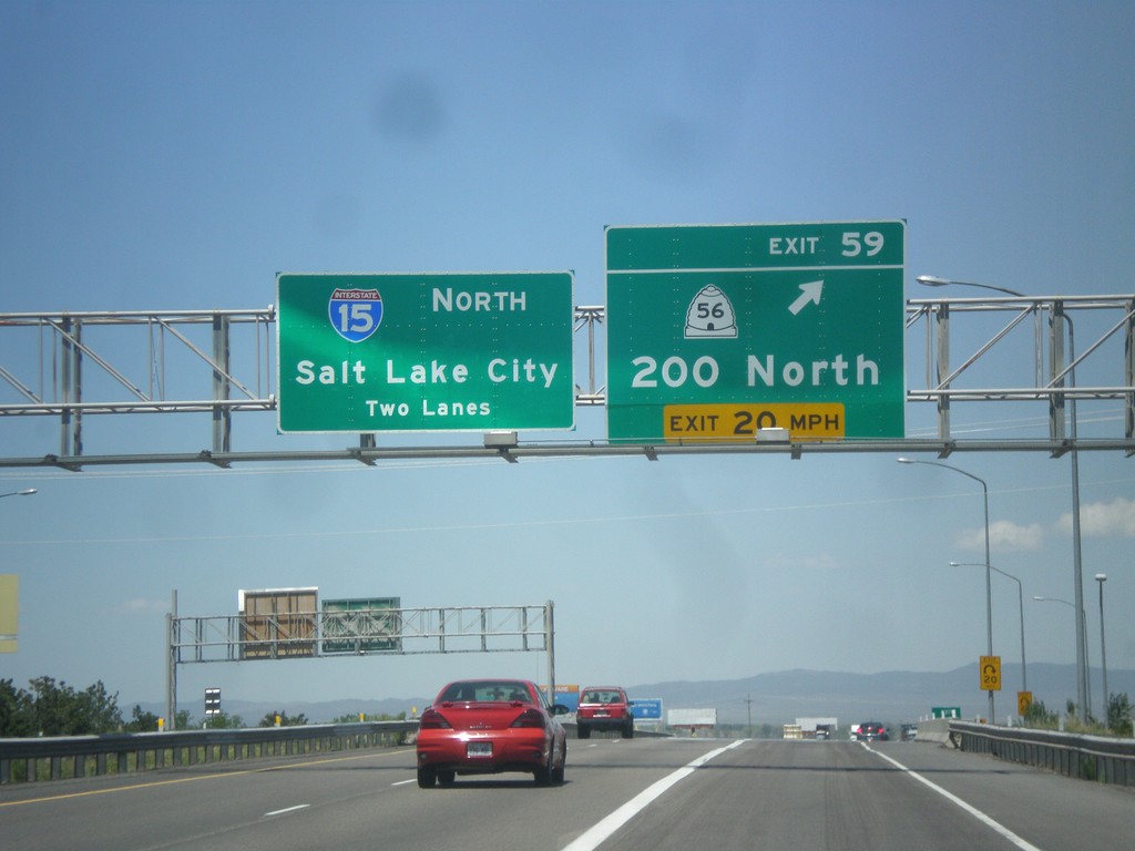
I-15 North - Exit 59
I-15 north at Exit 59 - UT-56/200 North. I-15 continues north towards Salt Lake City.
Taken 05-21-2014
 Cedar City
Iron County
Utah
United States
Cedar City
Iron County
Utah
United States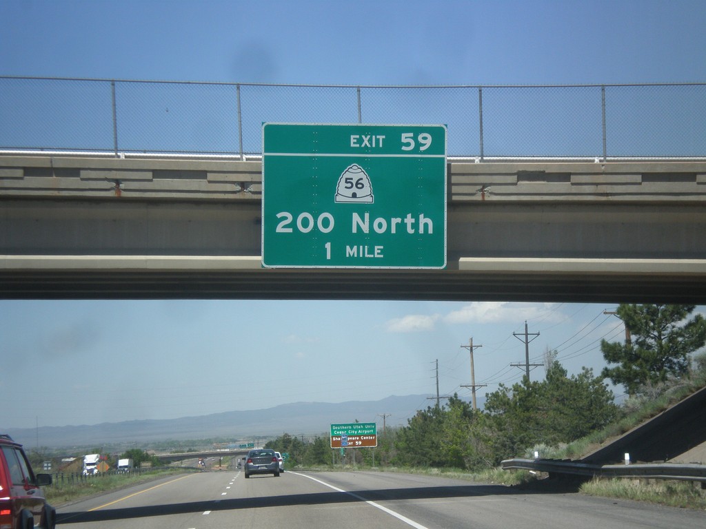
I-15 North - Exit 59
I-15 North approaching Exit 59 - UT-56/200 North.
Taken 05-21-2014
Cedar City
Iron County
Utah
United States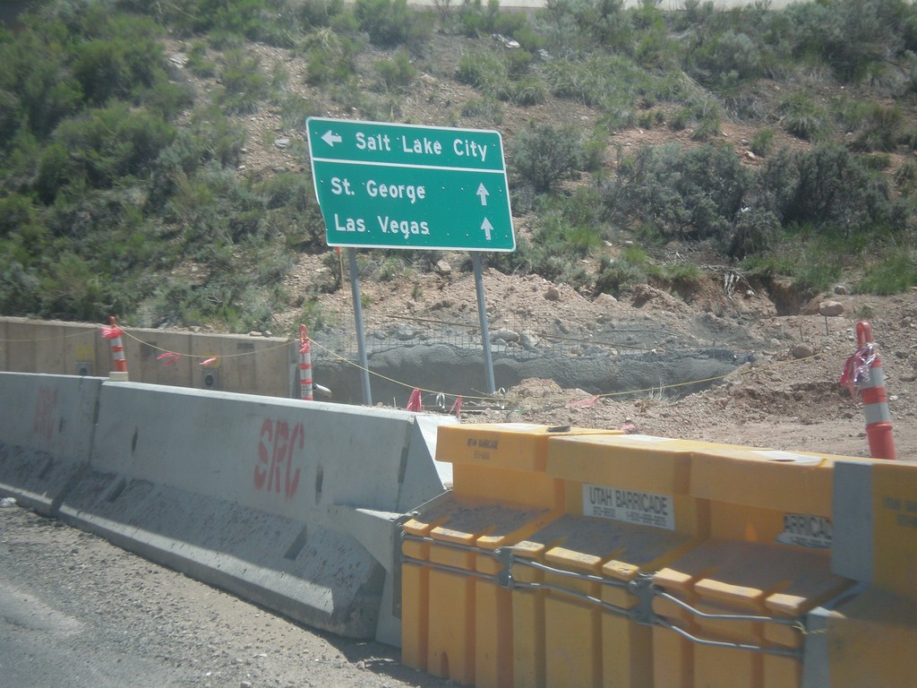
Cross Hollow Road at I-15 South
Cross Hollow Road at I-15 South to Salt Lake City. Continue straight for I-15 north to St. George and Las Vegas.
Taken 05-21-2014
Cedar City
Iron County
Utah
United States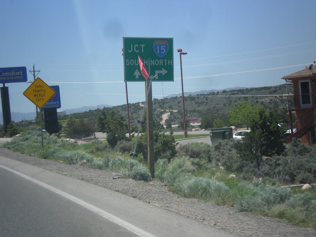
BL-15/UT-130 South at Cross Hollow Road
BL-15/UT-130 South at Cross Hollow Road. Continue straight for I-15 south on ramp. Turn right on Cross Hollow Road for I-15 north on ramp.
Taken 05-21-2014

 Cedar City
Iron County
Utah
United States
Cedar City
Iron County
Utah
United States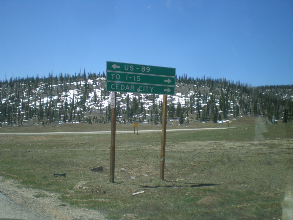
End UT-148 South at UT-14
End UT-148 south at UT-14. Turn right on UT-14 for Cedar City and I-15. Turn left on UT-14 for US-89. UT-14 is part of the Markagunt High Plateau Scenic Byway.
Taken 05-21-2014

 Brian Head
Iron County
Utah
United States
Brian Head
Iron County
Utah
United States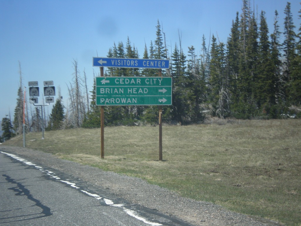
UT-143 West at UT-148
UT-143 west at UT-148. Use UT-148 south to Cedar City. Continue west on UT-143 (right turn) for Brian Head and Parowan. The Utah DOT changed direction on UT-143 between Panguitch Lake and UT-148 junction. At Panguitch UT-143 is a north/south highway. At this junction it is an east/west highway.
Taken 05-21-2014
 Brian Head
Iron County
Utah
United States
Brian Head
Iron County
Utah
United States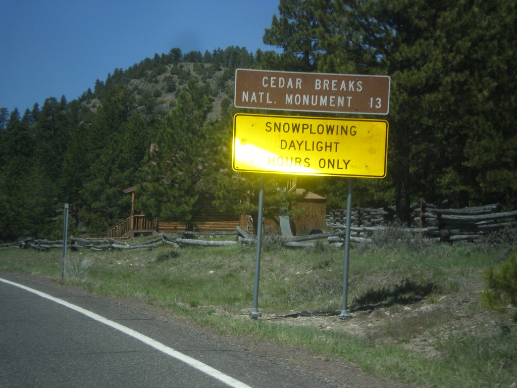
UT-143 - Distance Marker
Distance marker on UT-143 south. Distance to Cedar Breaks National Monument. Below distance marker is another sign reading Snow Plowing Daylight Hours Only.
Taken 05-21-2014
Panguitch
Garfield County
Utah
United States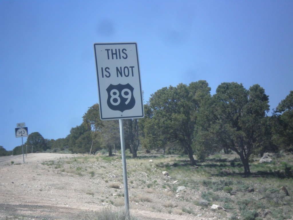
UT-143 South - This is not US-89
This is not US-89 sign on UT-143 south. US-89 southbound traffic in Panguitch who do not turn left at the stoplight in town will end up on UT-143. This sign notifies travelers that they are not on US-89. There are also many oversizes UT-143 signs on the first few miles out of Panguitch as a reminder as well.
Taken 05-21-2014
Panguitch
Garfield County
Utah
United States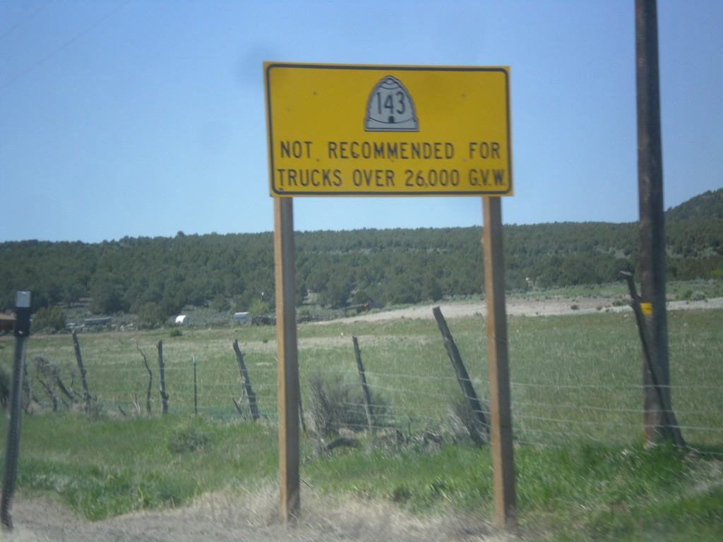
UT-143 - Truck Restrictions
UT-143 not recommended for trucks over 26,000 GVW. UT-143 is a steep, winding mountain road over the Markagunt Plateau.
Taken 05-21-2014
Panguitch
Garfield County
Utah
United States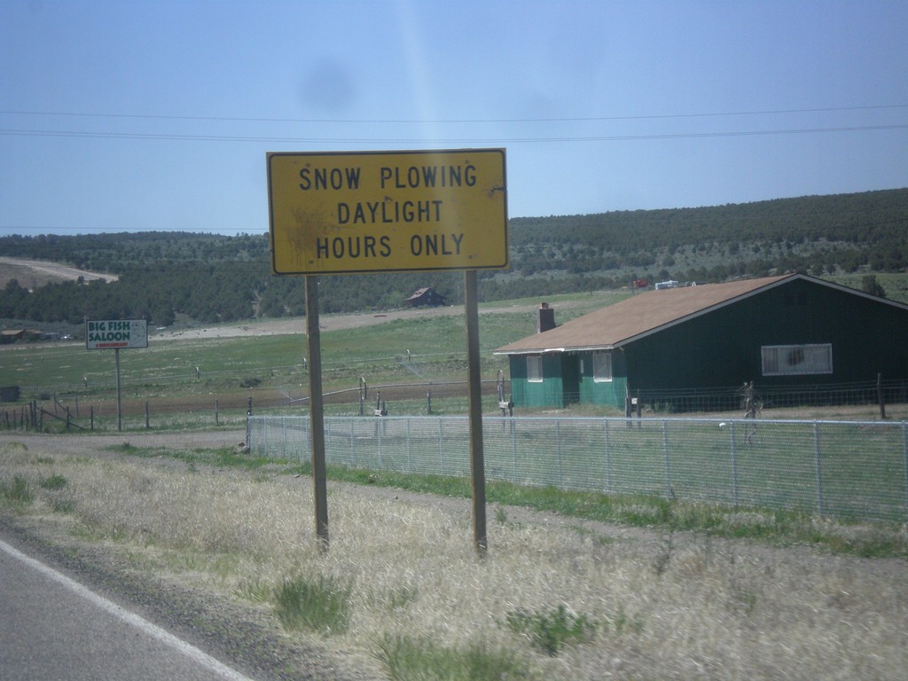
UT-143 South - Snow Plowing Hours
Snow Plowing Daylight Hours Only on UT-143 south. UT-143 south is a very mountainous road that goes over the Markagunt Plateau.
Taken 05-21-2014
Panguitch
Garfield County
Utah
United States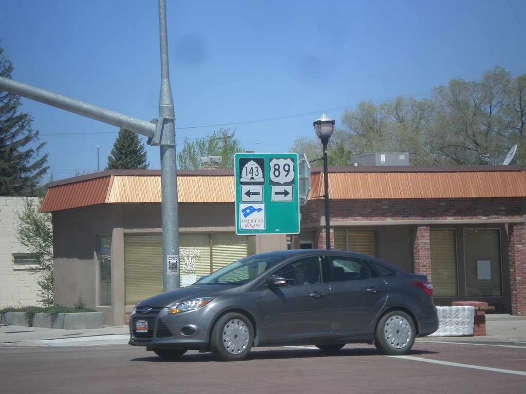
US-89 North at UT-143
US-89 north at UT-143 in Panguitch. Turn left for UT-143 south; right for US-89 north.
Taken 05-21-2014
 Panguitch
Garfield County
Utah
United States
Panguitch
Garfield County
Utah
United States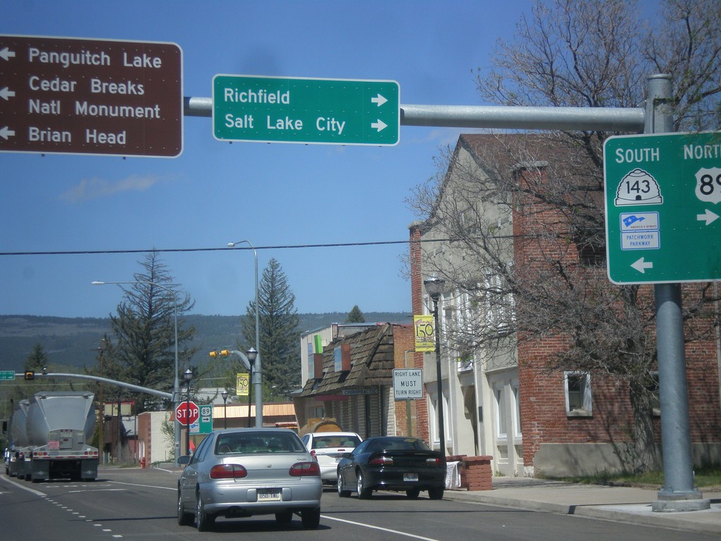
US-89 North at UT-143
US-89 north at UT-143 south. Turn left for UT-143 south to Cedar Breaks National Monument, Brian Head, and Panguitch Lake. Turn right to continue north on US-89 to Richfield and Salt Lake City. UT-143 is part of the Utah’s Patchwork Parkway National Scenic Byway.
Taken 05-21-2014
Panguitch
Garfield County
Utah
United States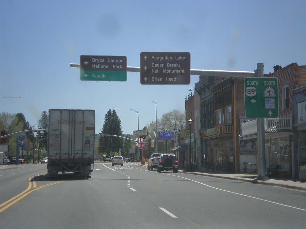
US-89 South at UT-143
US-89 south at UT-143 in Panguitch. Use UT-143 south for Cedar Breaks National Monument, Panguitch Lake, and Brian Head. Turn left to continue south on US-89 towards Bryce Canyon National Park and Kanab. UT-143 is part of Utah’s Patchwork Parkway National Scenic Byway.
Taken 05-19-2014
Panguitch
Garfield County
Utah
United States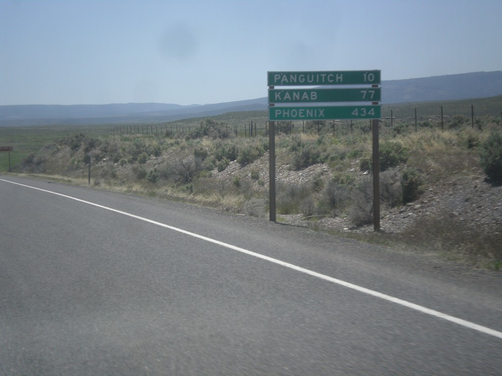
US-89 South - Distance Marker
Distance marker on US-89 south. Distance to Panguitch, Kanab, and Phoenix (Arizona).
Taken 05-19-2014
Spry
Garfield County
Utah
United States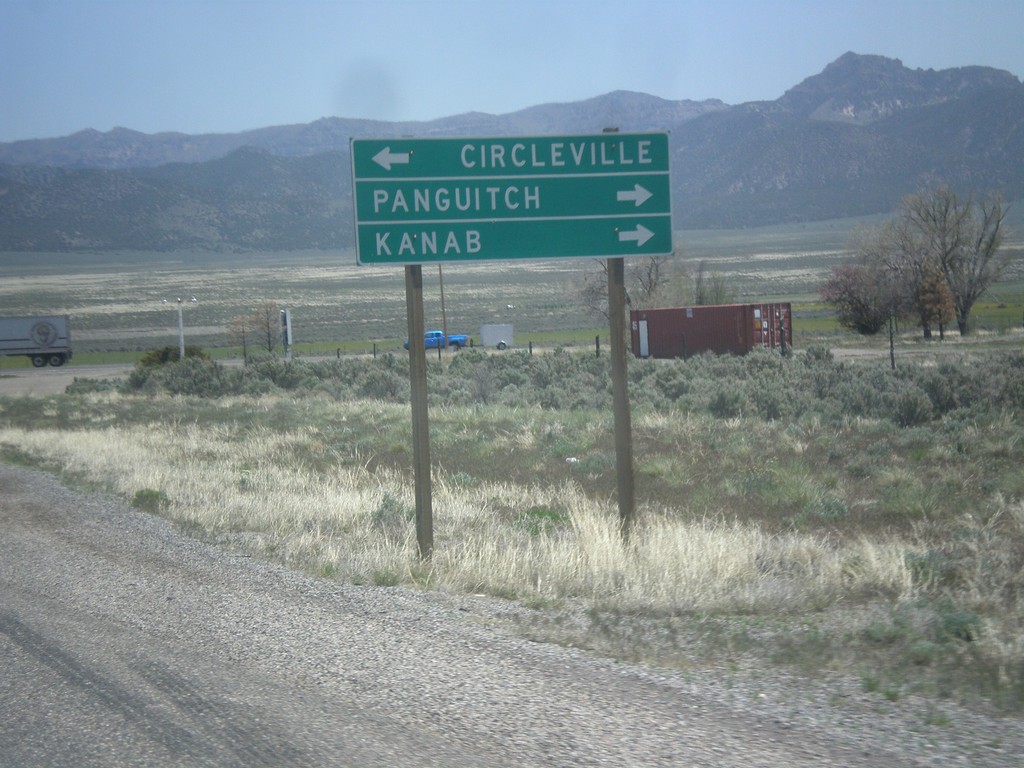
End UT-20 at US-89
End UT-20 East at US-89. Use US-89 north for Circleville; use US-89 south for Panguitch and Kanab.
Taken 05-19-2014
 Spry
Garfield County
Utah
United States
Spry
Garfield County
Utah
United States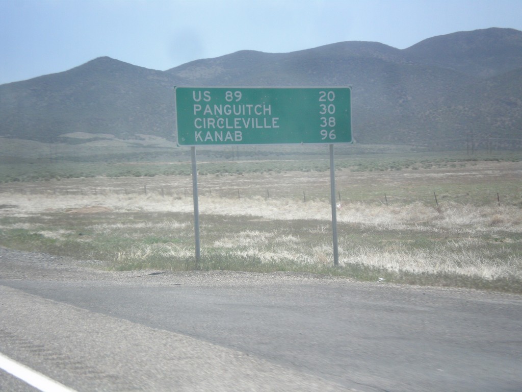
UT-20 East - Distance Marker
Distance marker on UT-20 east. Distance to US-89, Panguitch, Circleville, and Kanab.
Taken 05-19-2014
Paragonah
Iron County
Utah
United States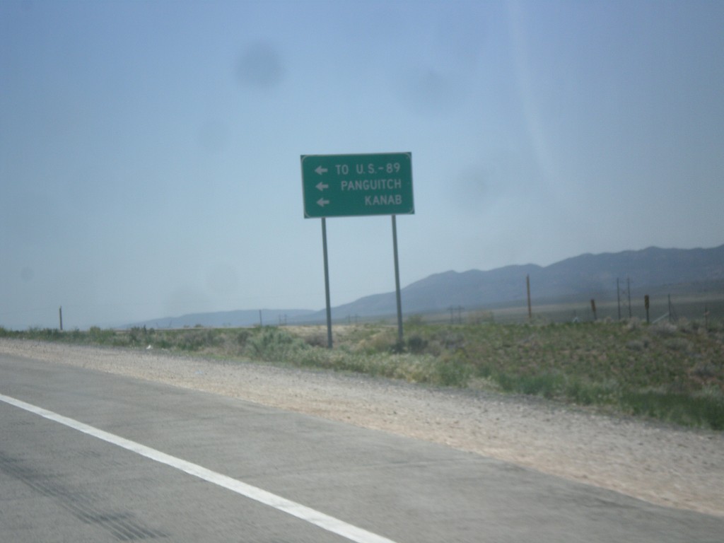
I-15 South at UT-20 Junction
I-15 south offramp at UT-20. Turn left for US-89, Panguitch, and Kanab.
Taken 05-19-2014
Paragonah
Iron County
Utah
United States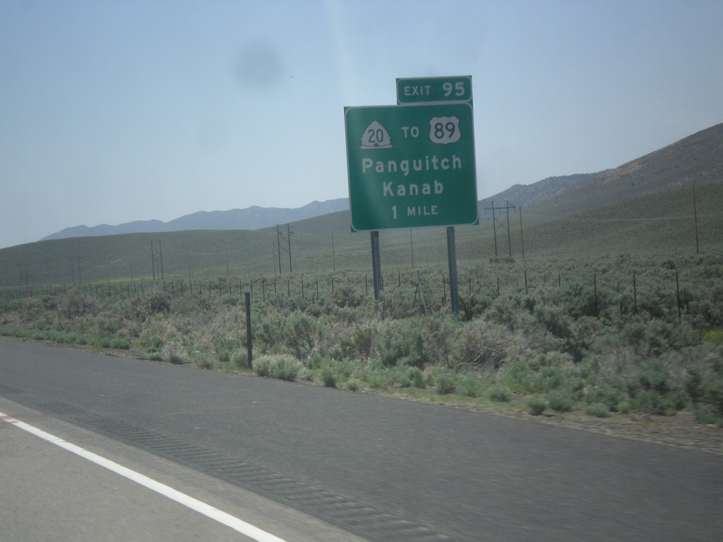
I-15 South - Exit 95
I-15 south at Exit 95 - UT-20/To US-89/Panguitch/Kanab. UT-20 is a short highway that connects I-15 with US-89.
Taken 05-19-2014
Paragonah
Iron County
Utah
United States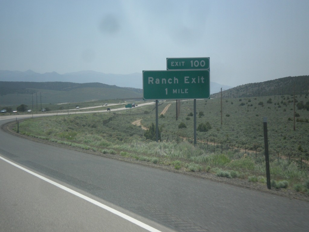
I-15 South - Exit 100
I-15 south approaching Exit 100 - Ranch Exit.
Taken 05-19-2014
Beaver
Beaver County
Utah
United States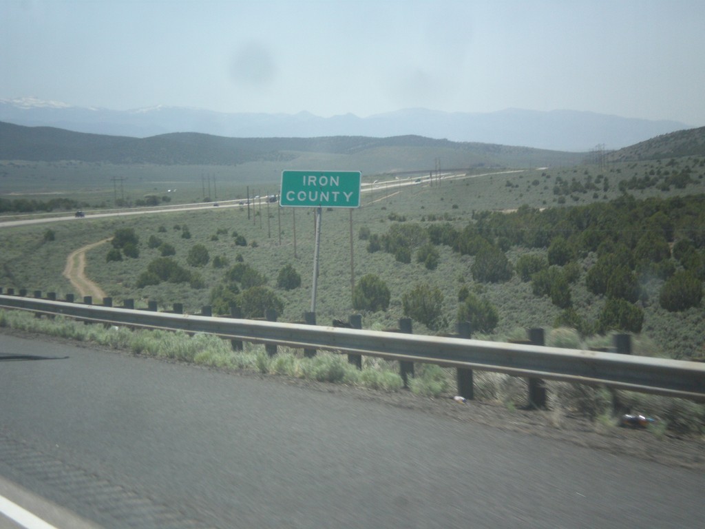
I-15 South - Iron County
Iron County on I-15 south.
Taken 05-19-2014
Beaver
Beaver County
Utah
United States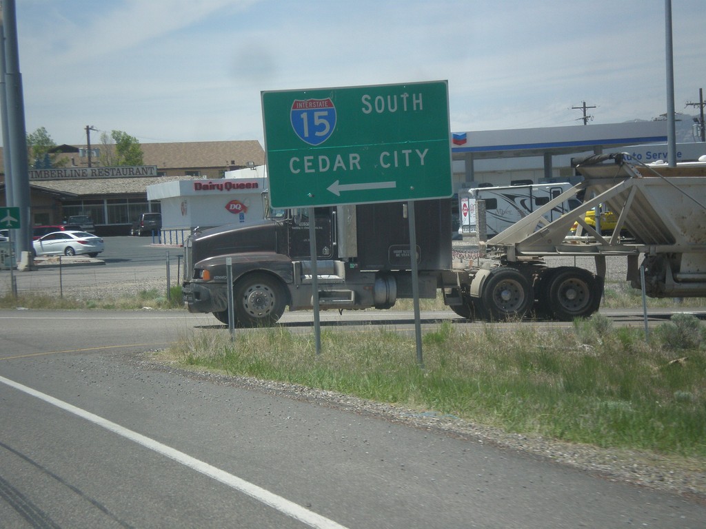
BL-15/UT-160 South at I-15
BL-15/UT-160 South at I-15 to Cedar City. This is the end of the Beaver business loop and UT-160.
Taken 05-19-2014
 Beaver
 County
Utah
United States
Beaver
Beaver County
Utah
United States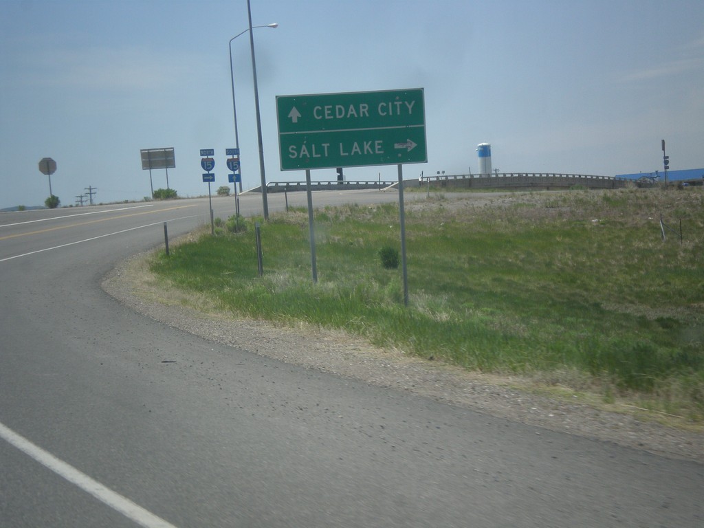
BL-15/UT-160 South Approaching I-15
BL-15/UT-160 South approaching I-15 (Exit 109) in Beaver. Use I-15 north for Salt Lake; I-15 south for Cedar City.
Taken 05-19-2014
Beaver
Beaver County
Utah
United States