Signs Tagged With Big Green Sign
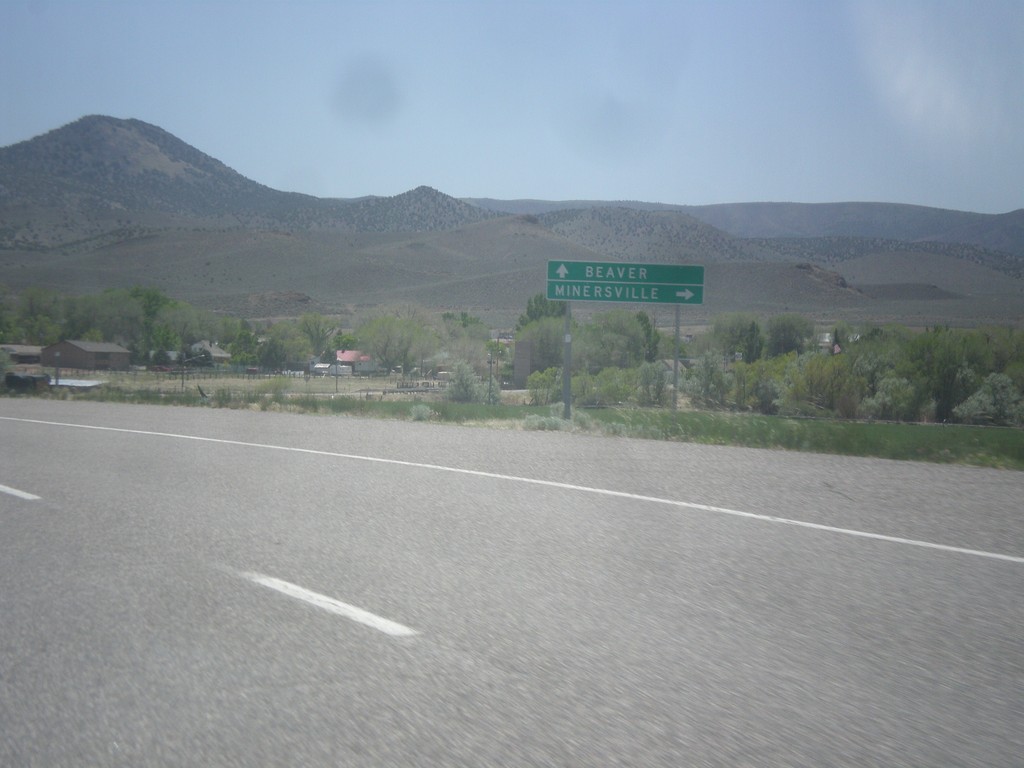
UT-21 East at UT-130
UT-21 east at UT-130 south to Minersville. Continue east on UT-21 for Beaver.
Taken 05-19-2014

 Minersville
Beaver County
Utah
United States
Minersville
Beaver County
Utah
United States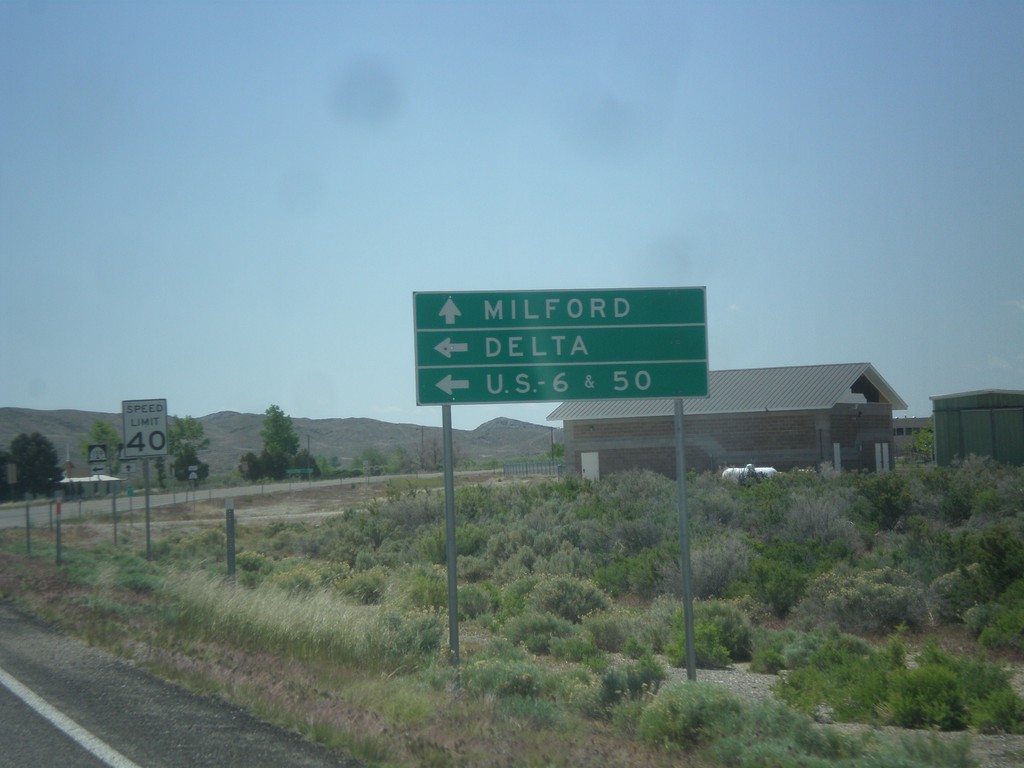
UT-21 East at UT-159
UT-21 east approaching UT-159 north to US-6/US-50 and Delta. Continue east on UT-21 for Milford.
Taken 05-19-2014
 Garrison
Millard County
Utah
United States
Garrison
Millard County
Utah
United States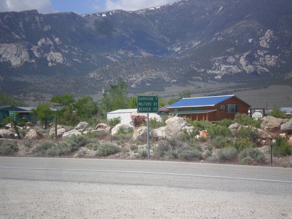
NV-487 South - Distance Marker
Distance marker on NV-487 south. Distance to Gunnison, Milford, and Beaver. All three locations are located in Utah.
Taken 05-19-2014
 Baker
White Pine County
Nevada
United States
Baker
White Pine County
Nevada
United States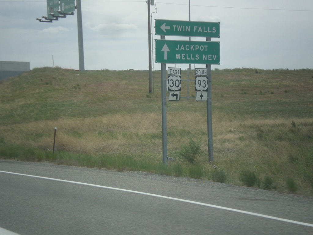
US-93 South at US-30 East
US-93 south at US-30 east to Twin Falls. Continue south on US-93 for Jackpot (NV) and Wells (NV). This sign is not typical in that the font is in all capital letters. Typically this sort of sign is not all upper case.
Taken 05-16-2014

 Filer
Twin Falls County
Idaho
United States
Filer
Twin Falls County
Idaho
United States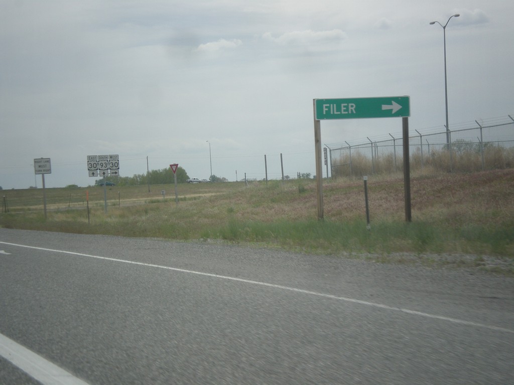
US-93 South Approaching US-30 West
US-93 South approaching US-30 West. Use US-30 west for Filer.
Taken 05-16-2014
Filer
Twin Falls County
Idaho
United States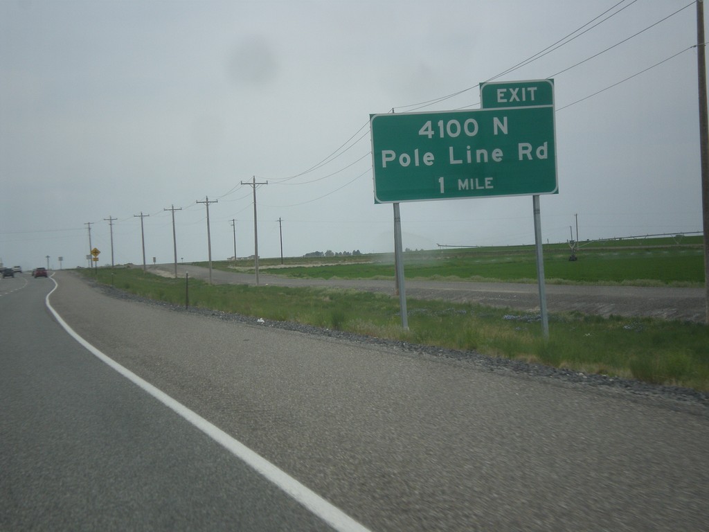
US-93 South - 4100 N Interchange
US-93 south approaching 4100 N/Pole Line Road interchange. US-93 south leaves Pole Line Road at this interchange and swings south.
Taken 05-16-2014
Filer
Twin Falls County
Idaho
United States
US-93 South at Bus. US-93 in Twin Falls
US-93 South (Blue Lakes Blvd.) at Bus. US-93. Turn right on Pole Line Road to continue south on US-93. Continue straight on Blue Lakes Blvd. for Bus. US-93. US-93 was recently re-routed through Twin Falls along a bypass. Bus. US-93 follows the old route through Twin Falls.
Taken 05-16-2014
 Twin Falls
 County
Idaho
United States
Twin Falls
Twin Falls County
Idaho
United States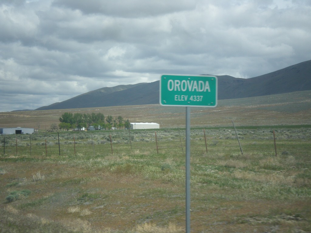
US-95 North - Orovada
Orovada - Elevation 4337 on US-95 north.
Taken 05-06-2014
 Winnemucca
Humboldt County
Nevada
United States
Winnemucca
Humboldt County
Nevada
United States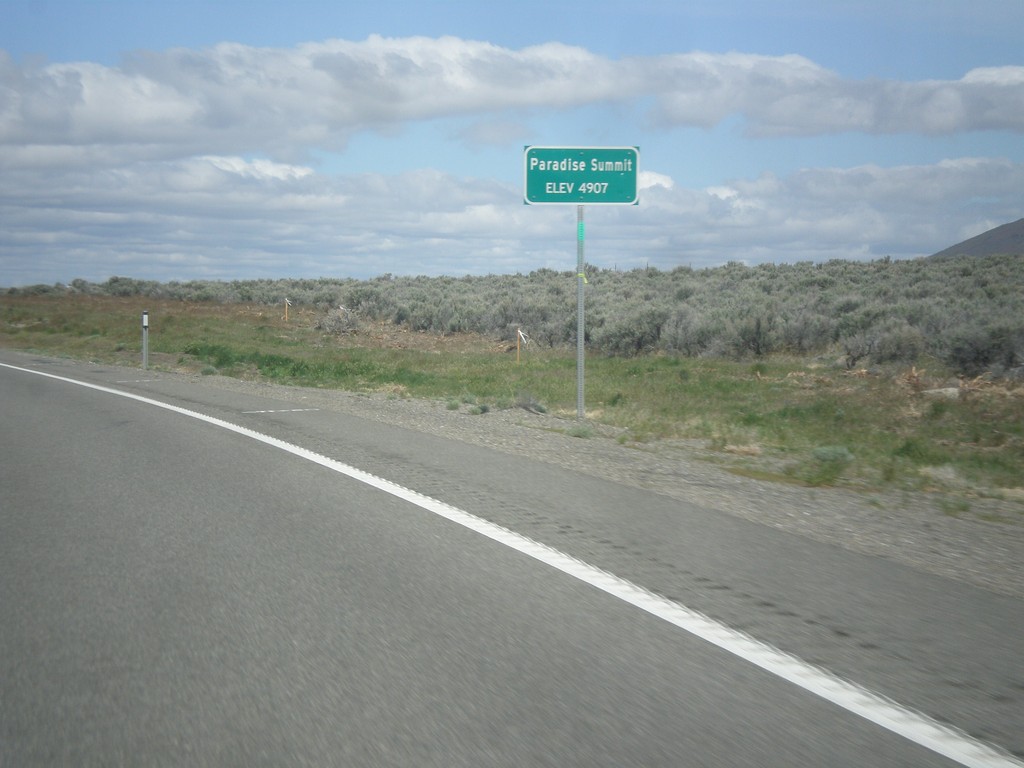
US-95 North - Paradise Summit
Paradise Summit - Elevation 4907 Feet on US-95 North.
Taken 05-06-2014
Winnemucca
Humboldt County
Nevada
United States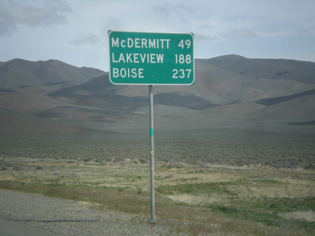
US-95 North - Distance Marker
Distance marker on US-95 north. Distance to McDermit, Lakeview (Oregon - via NV-140), and Boise (Idaho).
Taken 05-06-2014
Winnemucca
Humboldt County
Nevada
United States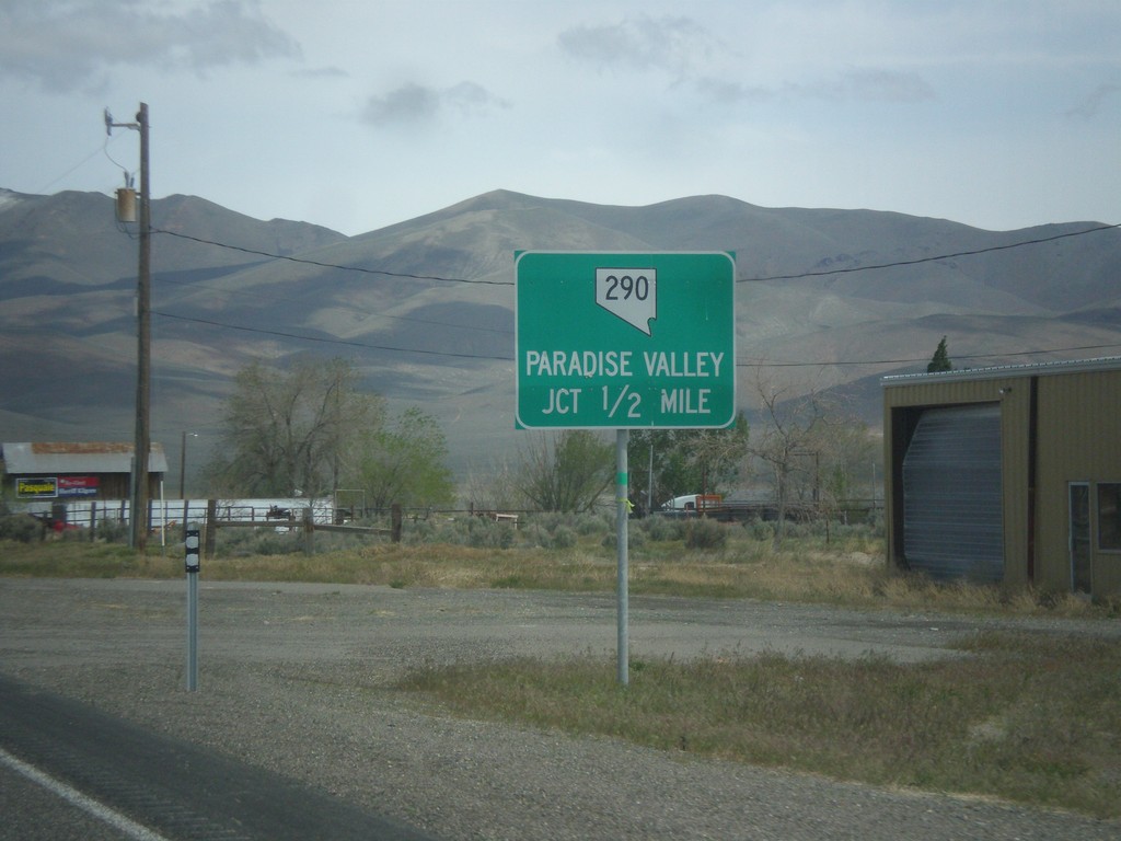
US-95 North Approaching NV-290
US-95 north approaching NV-290 to Paradise Valley.
Taken 05-06-2014
 Winnemucca
Humboldt County
Nevada
United States
Winnemucca
Humboldt County
Nevada
United States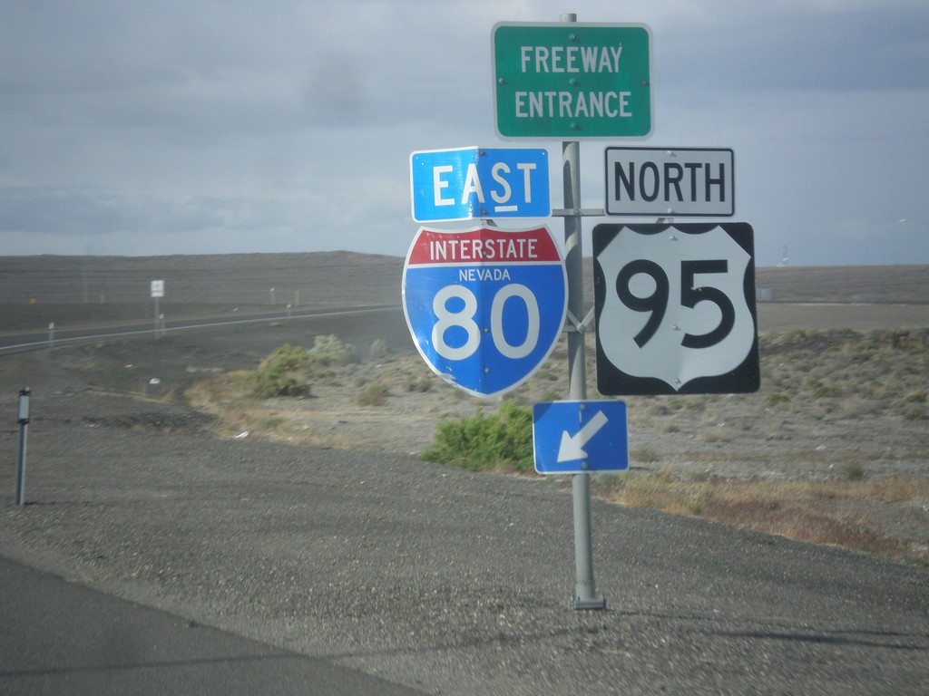
US-95 North at I-80 East (Exit 83)
US-95 north at I-80 (Exit 83) onramp. US-95 north joins I-80 east to Winnemucca.
Taken 05-05-2014

 Churchill County
Nevada
United States
Churchill County
Nevada
United States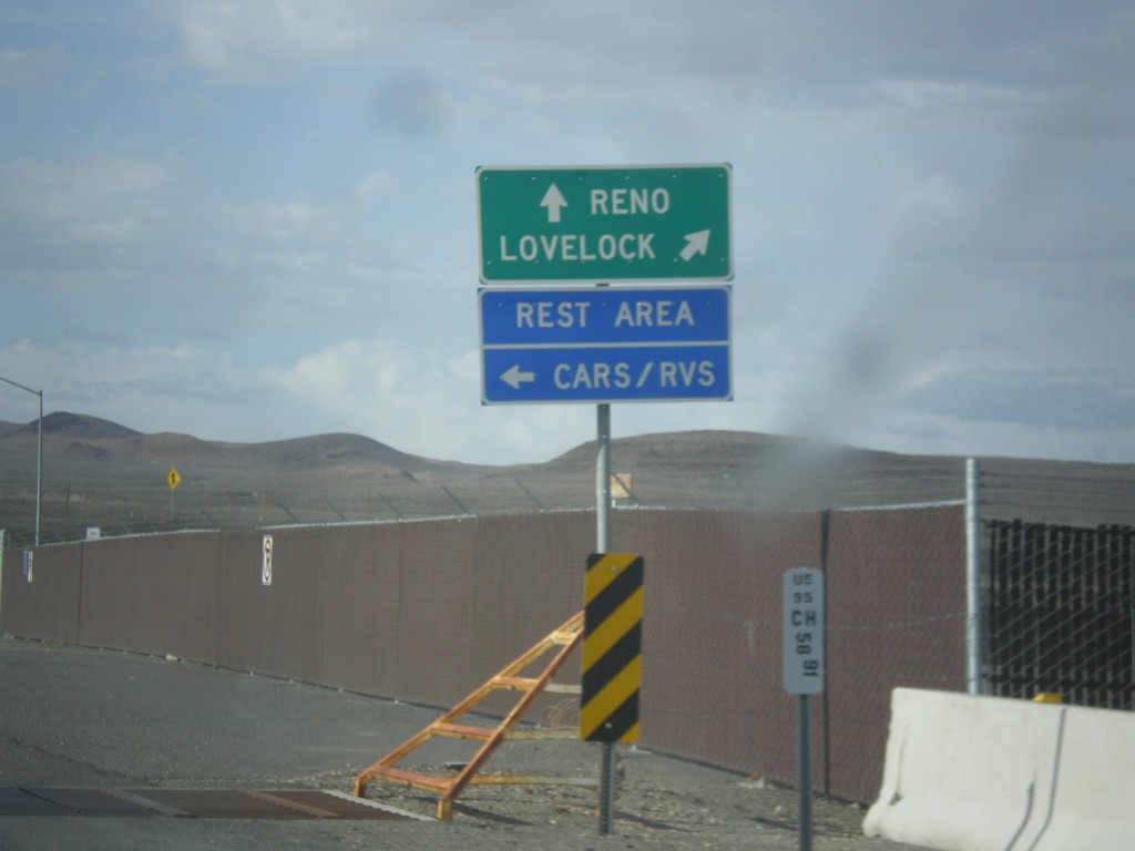
US-95 North Approaching I-80
US-95 north approaching I-80. Use I-80 East/US-95 North to Lovelock; use I-80 West/Alt. US-95 South to Reno. Turn left to enter the Rest Area. Notice the post mile marker at the base of the sign.
Taken 05-05-2014
Churchill County
Nevada
United States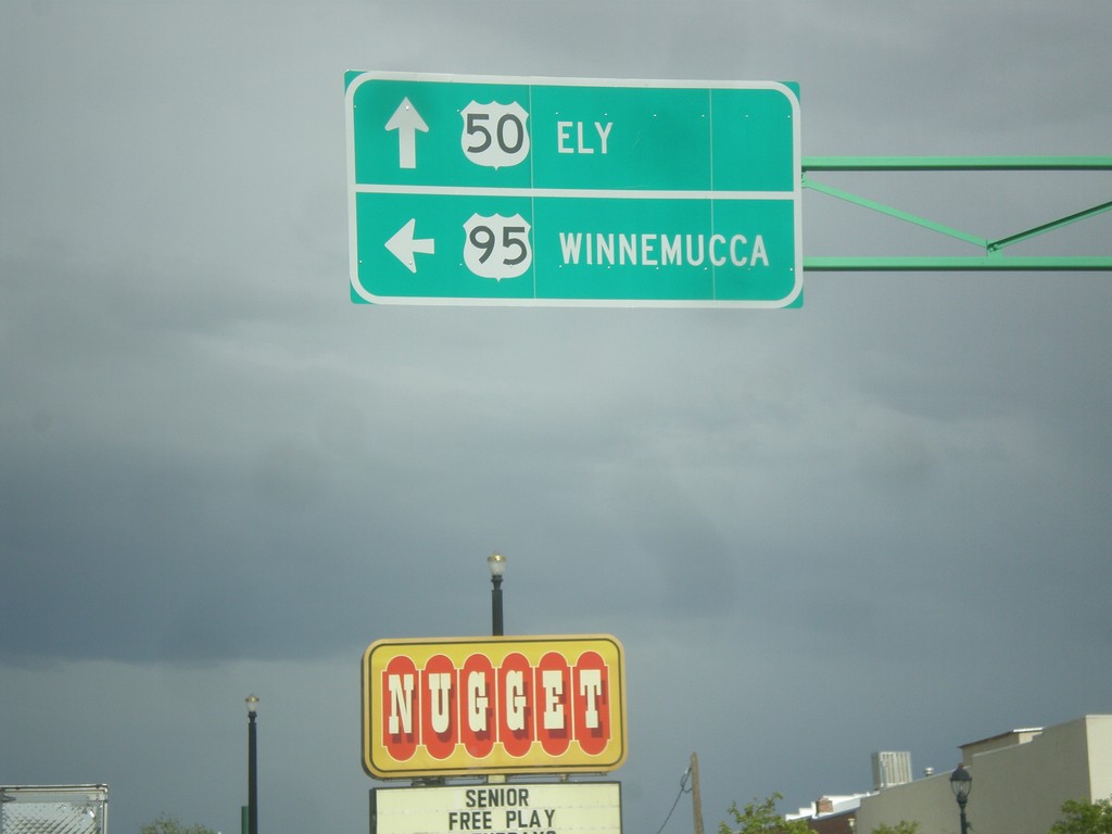
US-50 East/US-95 North - Fallon
US-50 East/US-95 North at US-95 north. Turn left for US-95 north to Winnemucca; continue straight for US-50 east to Ely.
Taken 05-05-2014
 Fallon
Churchill County
Nevada
United States
Fallon
Churchill County
Nevada
United States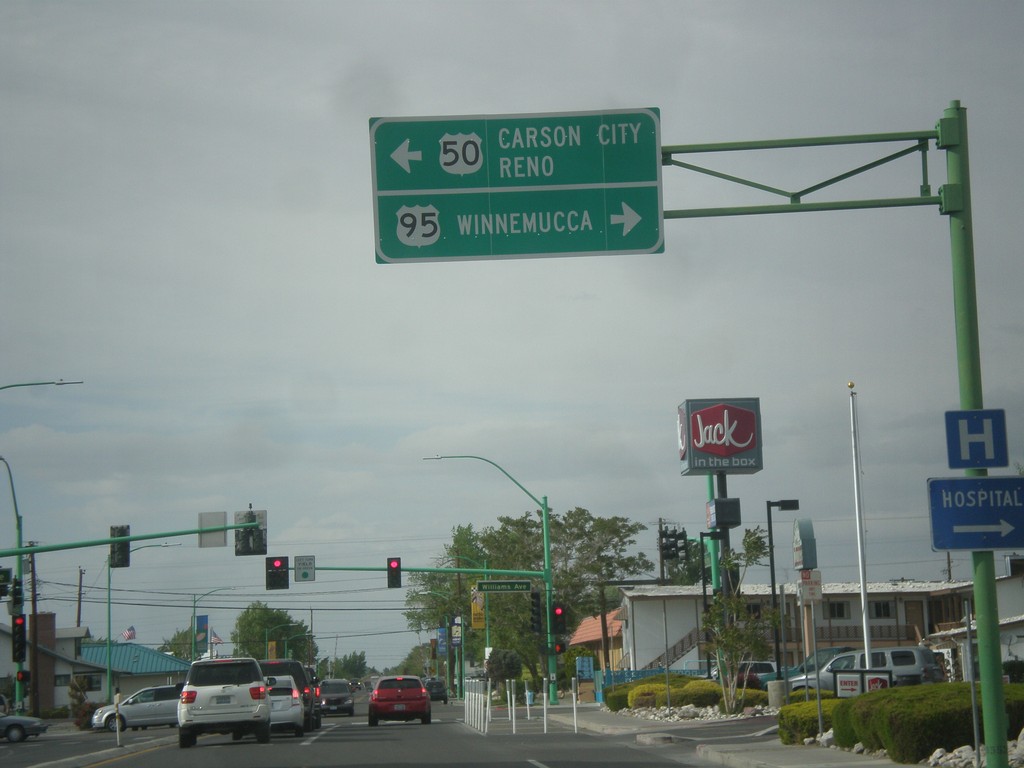
US-95 North at US-50
US-95 north at US-50 in Fallon. Turn left for US-50 west to Carson City and Reno. Turn right for US-50 East (not signed) and US-95 north to Winnemucca. US-95 joins US-50 for a few blocks through Fallon.
Taken 05-05-2014
Fallon
Churchill County
Nevada
United States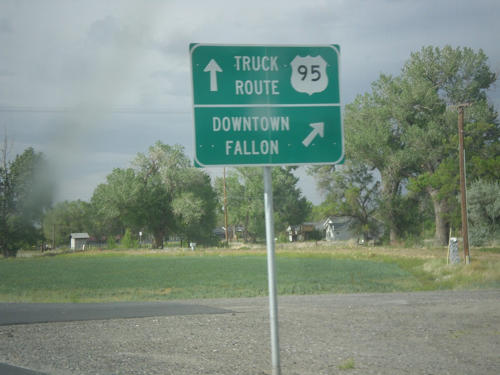
US-95 North - Fallon Truck Route
US-95 north at Maine St. junction. Turn right for Downtown Fallon; continue straight for US-95 North along the Truck Route.
Taken 05-05-2014
Fallon
Churchill County
Nevada
United States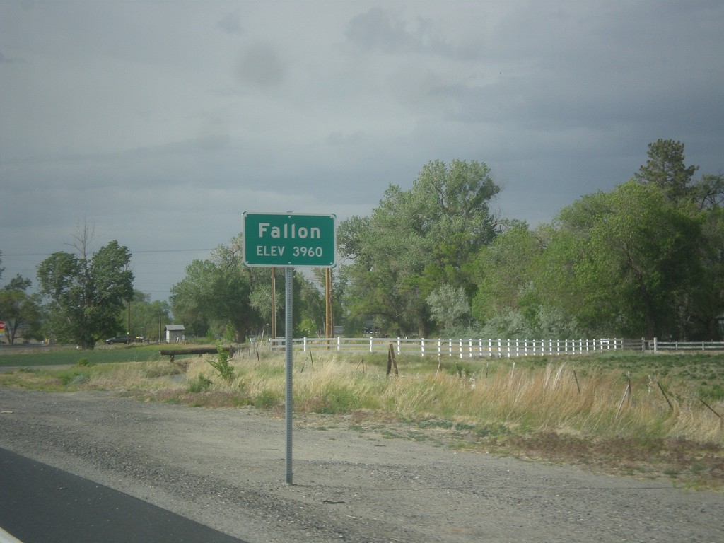
US-95 North - Fallon
Fallon - Elevation 3960 on US-95 north.
Taken 05-05-2014
Fallon
Churchill County
Nevada
United States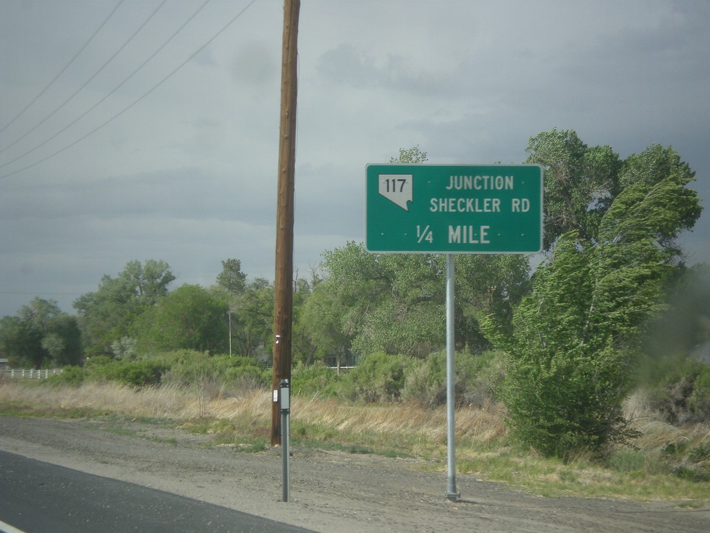
US-95 North Approaching NV-117
US-95 North approaching NV-117 - Sheckler Road.
Taken 05-05-2014
 Fallon
Churchill County
Nevada
United States
Fallon
Churchill County
Nevada
United States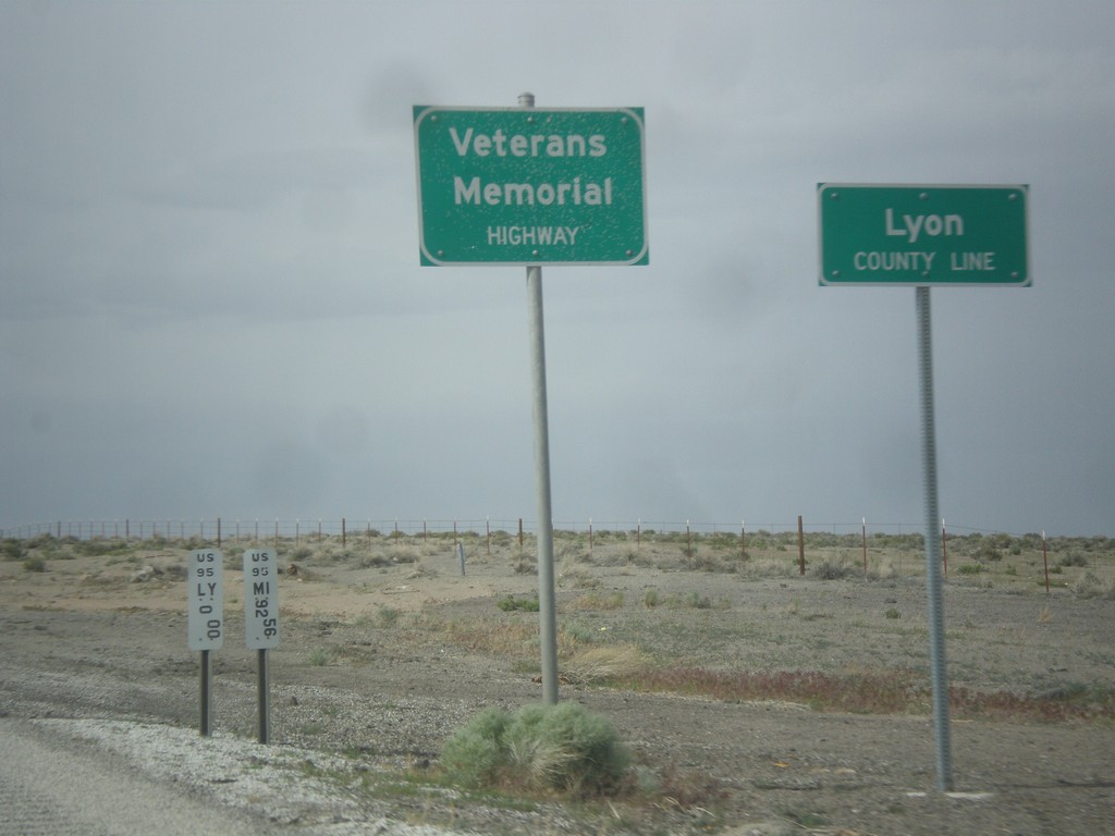
US-95 North - Lyon County Line
Lyon County Line on US-95 north. US-95 is signed as the Veterans Memorial Highway throughout Nevada.
Taken 05-05-2014
Schurz
Lyon County
Nevada
United States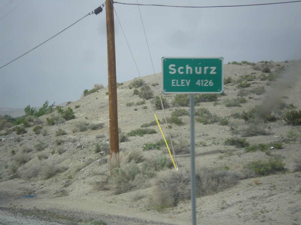
US-95 North - Schurz
Schurz - Elevation 4,126 on US-95 north. Schurz is home to the Walker River Paiute Tribe.
Taken 05-05-2014
Schurz
Mineral County
Nevada
United States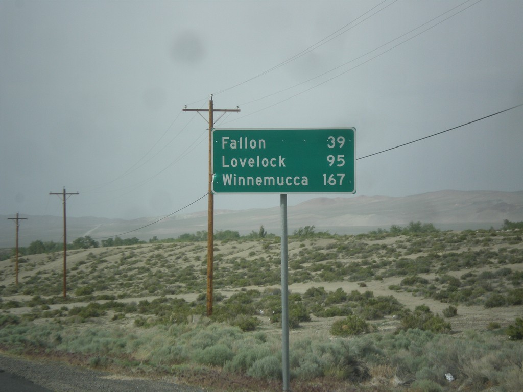
US-95 North - Distance Marker
Distance marker on US-95 north. Distance to Fallon, Lovelock, and Winnemucca. This sign was upgraded to the Clearview font since the last time I photographed it in 2006.
Taken 05-05-2014
Schurz
Mineral County
Nevada
United States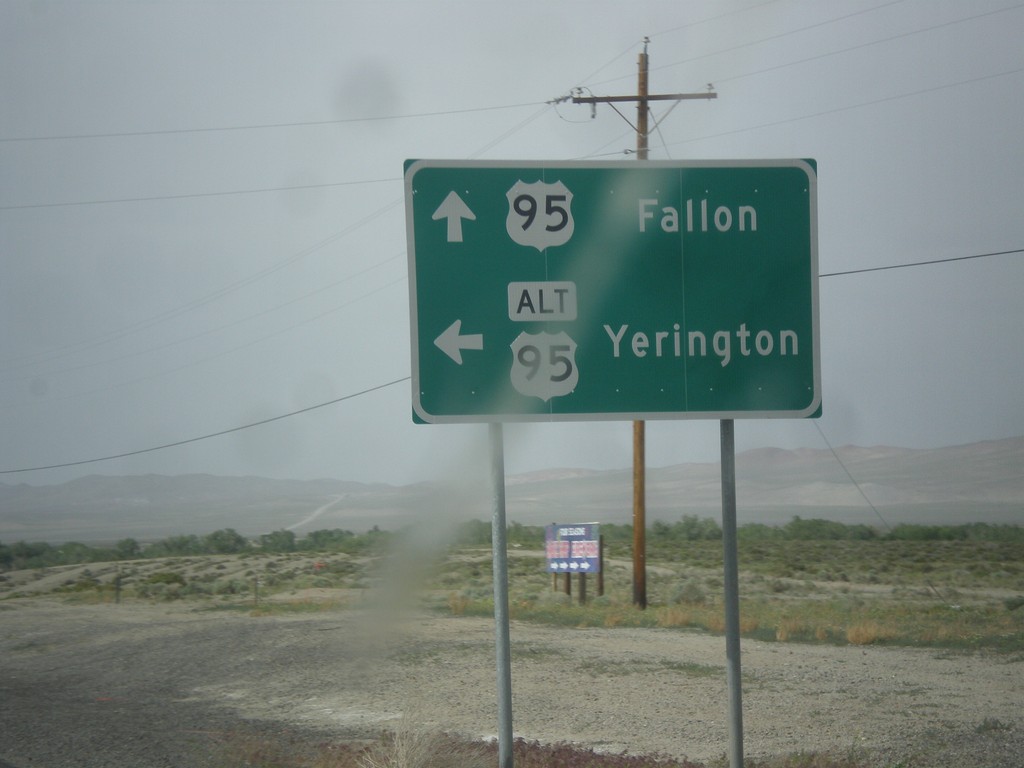
US-95 North at Alt. US-95 North
US-95 North at Alt. US-95 North to Yerington. Continue north on US-95 for Fallon. Alt. US-95 rejoins US-95 north of Fallon at I-80.
Taken 05-05-2014
Schurz
Mineral County
Nevada
United States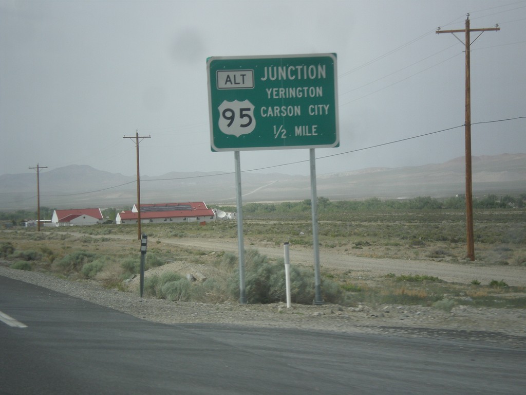
US-95 North Approaching Alt. US-95
US-95 north Approaching Alt. US-95 to Carson City and Yerington.
Taken 05-05-2014
Schurz
Mineral County
Nevada
United States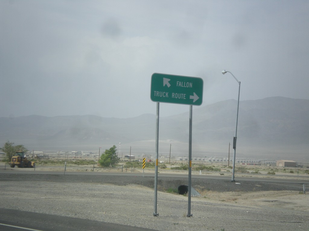
US-95 North at Hawthorne Truck Route
US-95 north at Hawthorne Truck Route. Merge right for the Truck Route, merge left for US-95 north towards Fallon.
Taken 05-05-2014
 Hawthorne
Mineral County
Nevada
United States
Hawthorne
Mineral County
Nevada
United States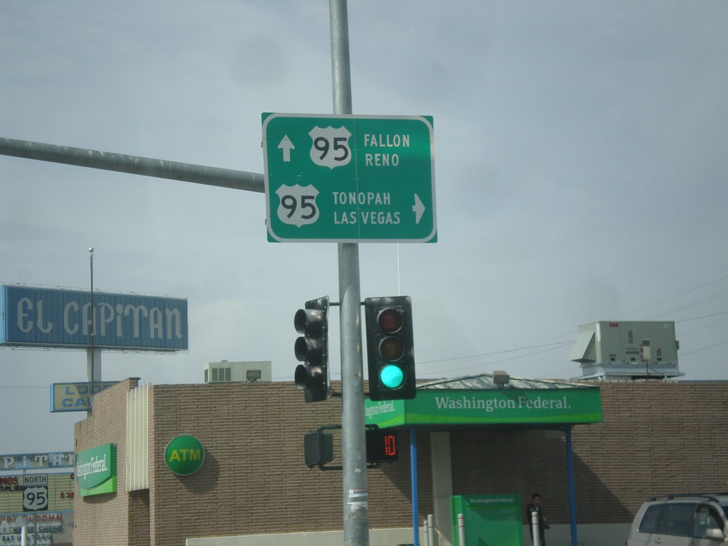
End NV-359 at US-95
End NV-359 at US-95. Turn right for US-95 south to Tonopah and Las Vegas. Continue straight for US-95 north to Fallon and Reno.
Taken 05-05-2014
 Hawthorne
Mineral County
Nevada
United States
Hawthorne
Mineral County
Nevada
United States