Signs Tagged With Big Green Sign

UT-24 West - Piute County
Entering Piute County on UT-24 west.
Taken 10-18-2013
 Koosharem
Piute County
Utah
United States
Koosharem
Piute County
Utah
United States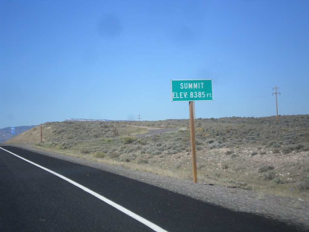
UT-24 West - Summit
Summit 8,385 Feet on UT-24 west. This is the summit of the Awapa Plateau.
Taken 10-18-2013
Koosharem Wayne County Utah United States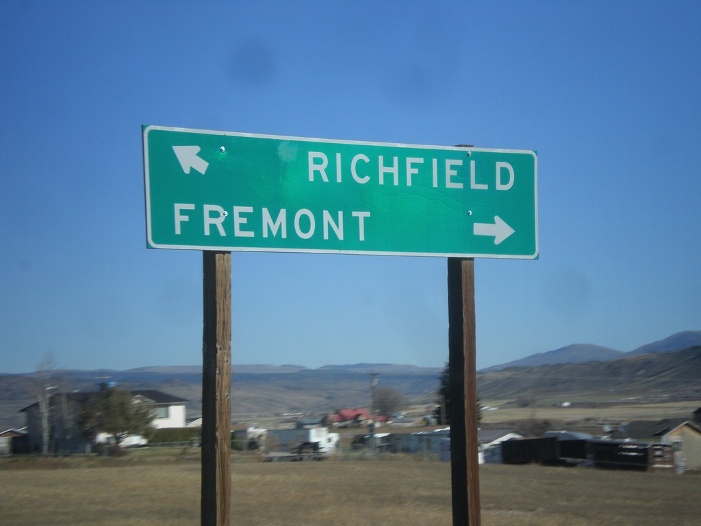
UT-24 West Approaching UT-72
UT-24 west approaching UT-72. Turn right on UT-72 for Fremont. Merge left on UT-24 for Richfield.
Taken 10-18-2013
 Loa
Wayne County
Utah
United States
Loa
Wayne County
Utah
United States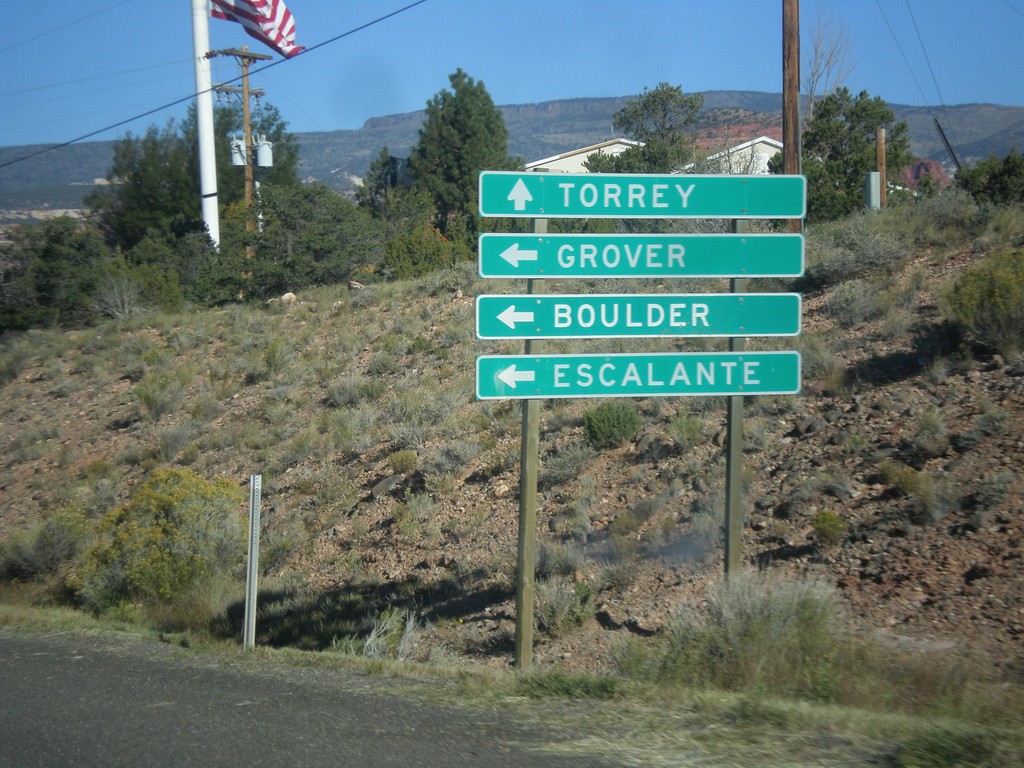
UT-24 West Approaching UT-12
UT-24 west approaching UT-12 west to Grover, Boulder, and Escalante. Continue west on UT-24 for Torrey.
Taken 10-18-2013
 Torrey
Wayne County
Utah
United States
Torrey
Wayne County
Utah
United States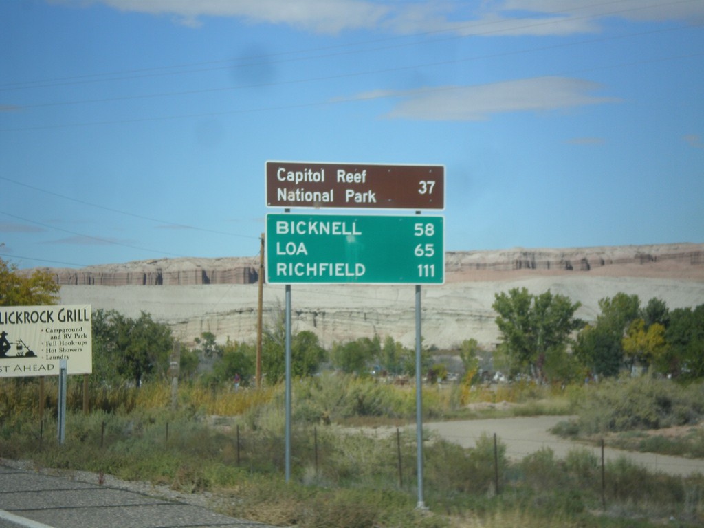
UT-24 West - Distance Marker
Distance marker on UT-24 west, leaving Hanksville. Distance to Capitol Reef National Park, Bicknell, Loa, and Richfield.
Taken 10-14-2013
Hanksville
Wayne County
Utah
United States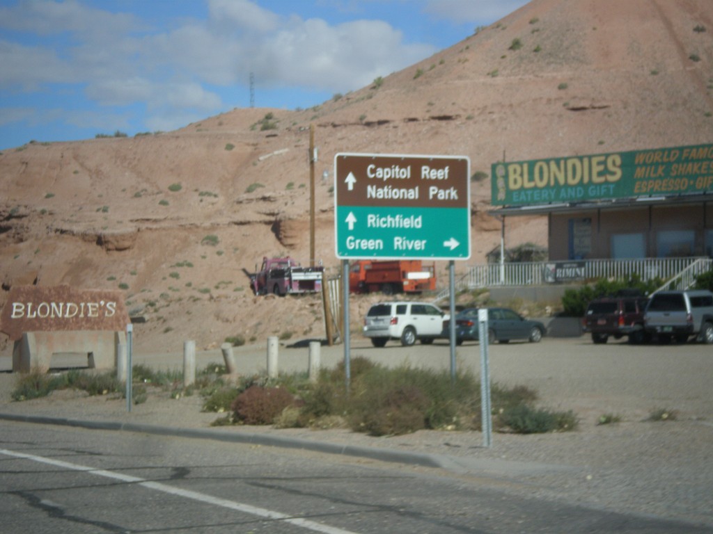
UT-95 West Approaching UT-24
UT-95 west approaching UT-24 in Hanksville. Use UT-24 east for Green River; use UT-24 west for Capitol Reef National Park and Richfield.
Taken 10-14-2013
 Hanksville
Wayne County
Utah
United States
Hanksville
Wayne County
Utah
United States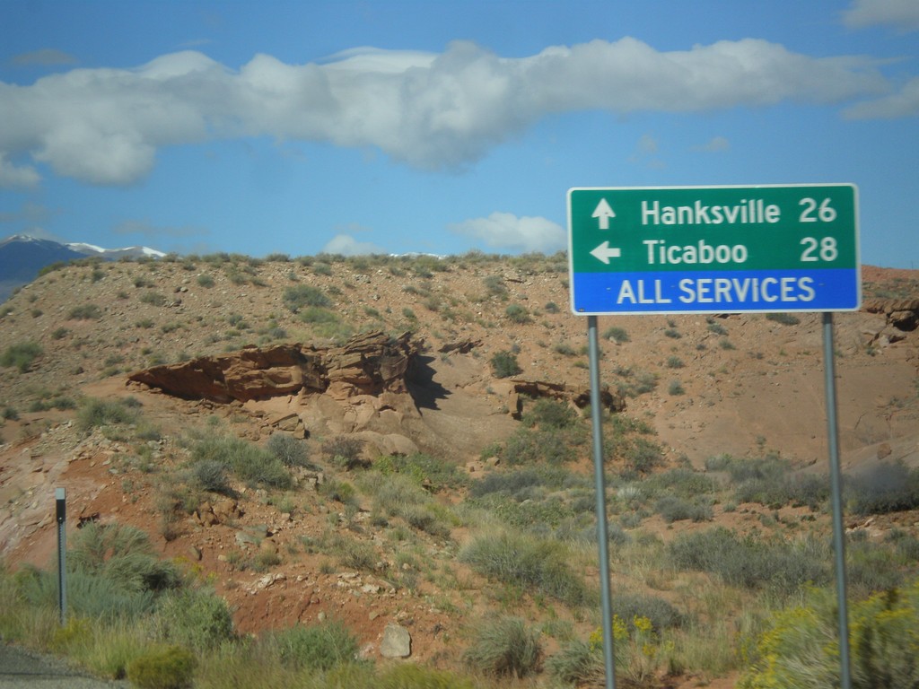
UT-95 West at UT-276
UT-95 west at UT-276 to Ticaboo. Continue west on UT-95 for Blanding.
Taken 10-14-2013
 Lake Powell
Garfield County
Utah
United States
Lake Powell
Garfield County
Utah
United States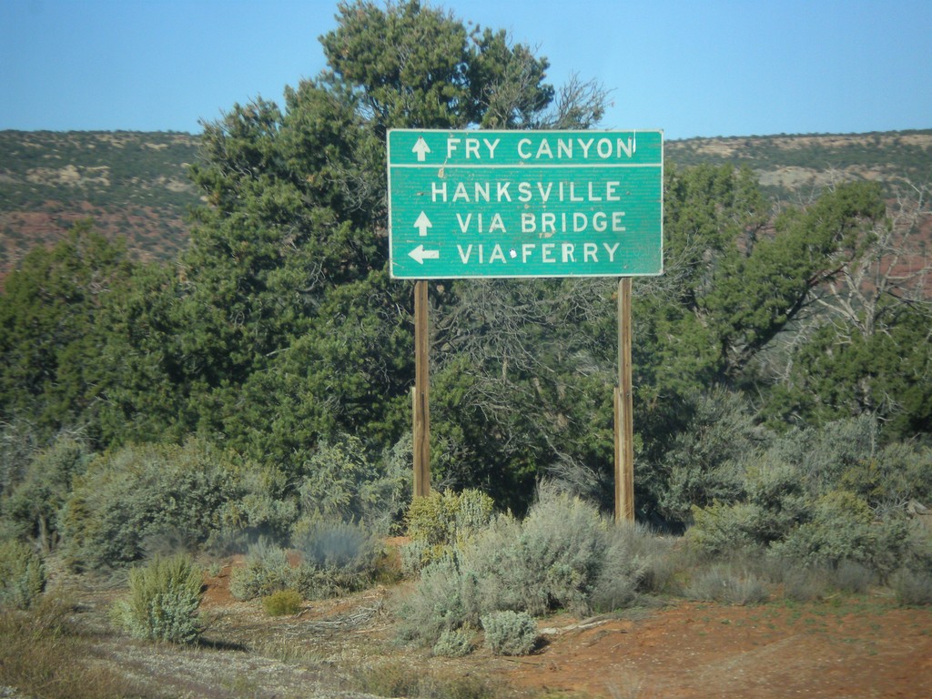
UT-95 West At UT-276 South
UT-95 west at UT-276 south. Use UT-276 for access to Lake Powell, and Hanksville via the ferry. Continue west on UT-95 for Hanksville via the bridge at Hite and Fry Canyon. At the time this picture was taken, the UT-276 ferry was not running.
Taken 10-14-2013
Lake Powell
San Juan County
Utah
United States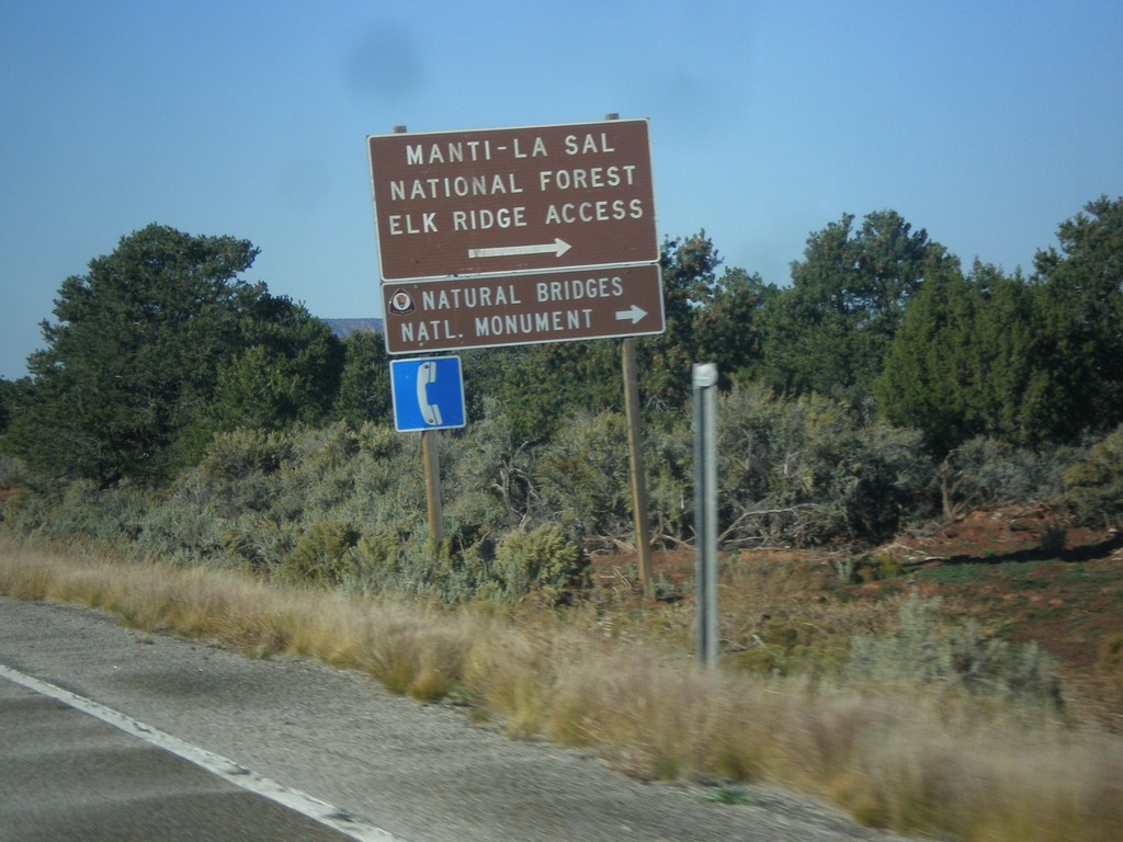
UT-95 West Approaching UT-275
UT-95 west approaching UT-275 north to Natural Bridges National Monument and Manti-La Sal Forest Elk Ridge Access. This is the entrance to Natural Bridges National Monument.
Taken 10-14-2013
 Lake Powell
San Juan County
Utah
United States
Lake Powell
San Juan County
Utah
United States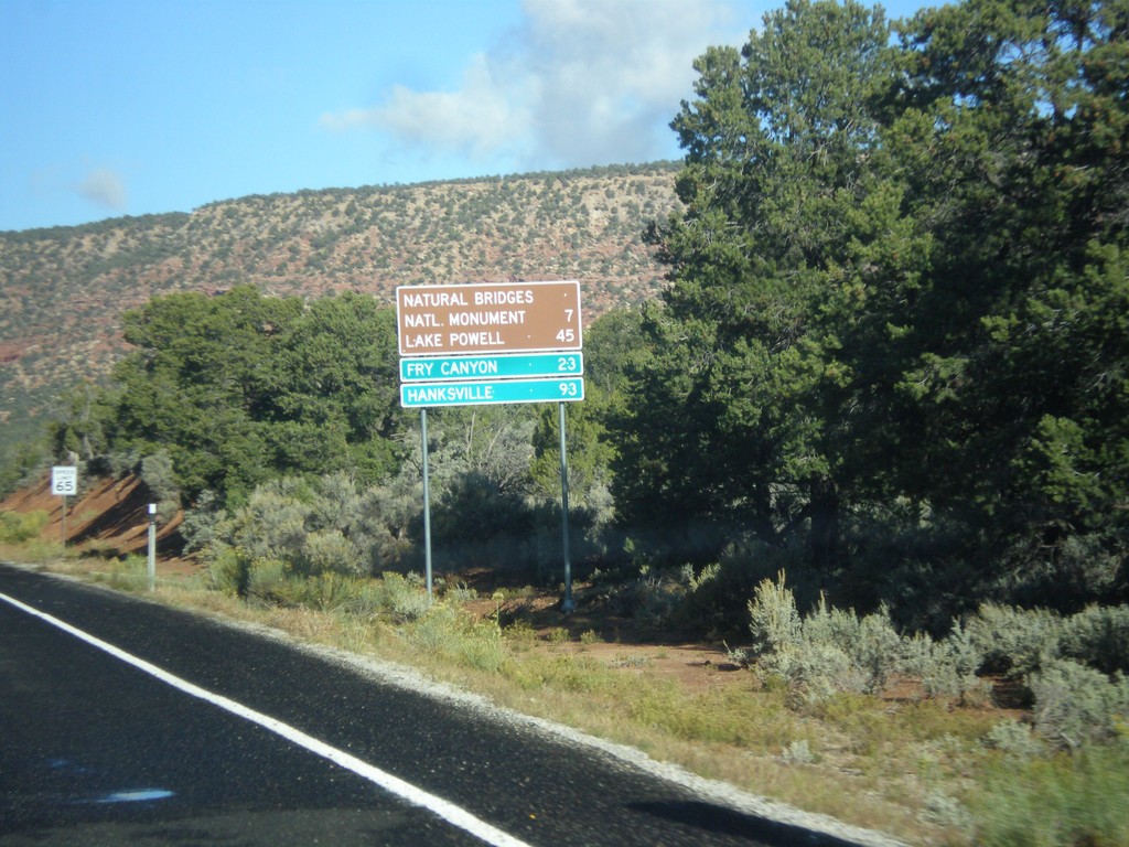
UT-95 West - Distance Marker
Distance marker on UT-95 west to Natural Bridges National Monument, Lake Powell, Fry Canyon, and Hanksville.
Taken 10-14-2013
Lake Powell
San Juan County
Utah
United States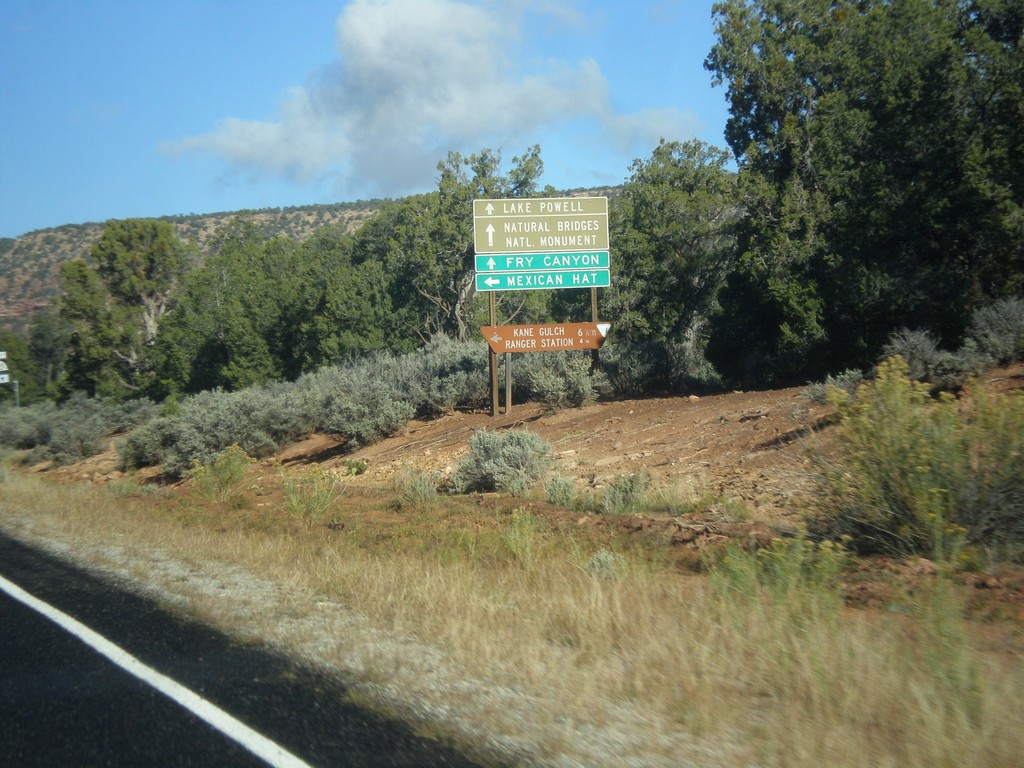
UT-95 West at UT-261
UT-95 west at UT-261 south to Mexican Hat. Continue west on UT-95 for Natural Bridges National Monument, Fry Canyon, Lake Powell, and Hanksville.
Taken 10-14-2013
 Lake Powell
San Juan County
Utah
United States
Lake Powell
San Juan County
Utah
United States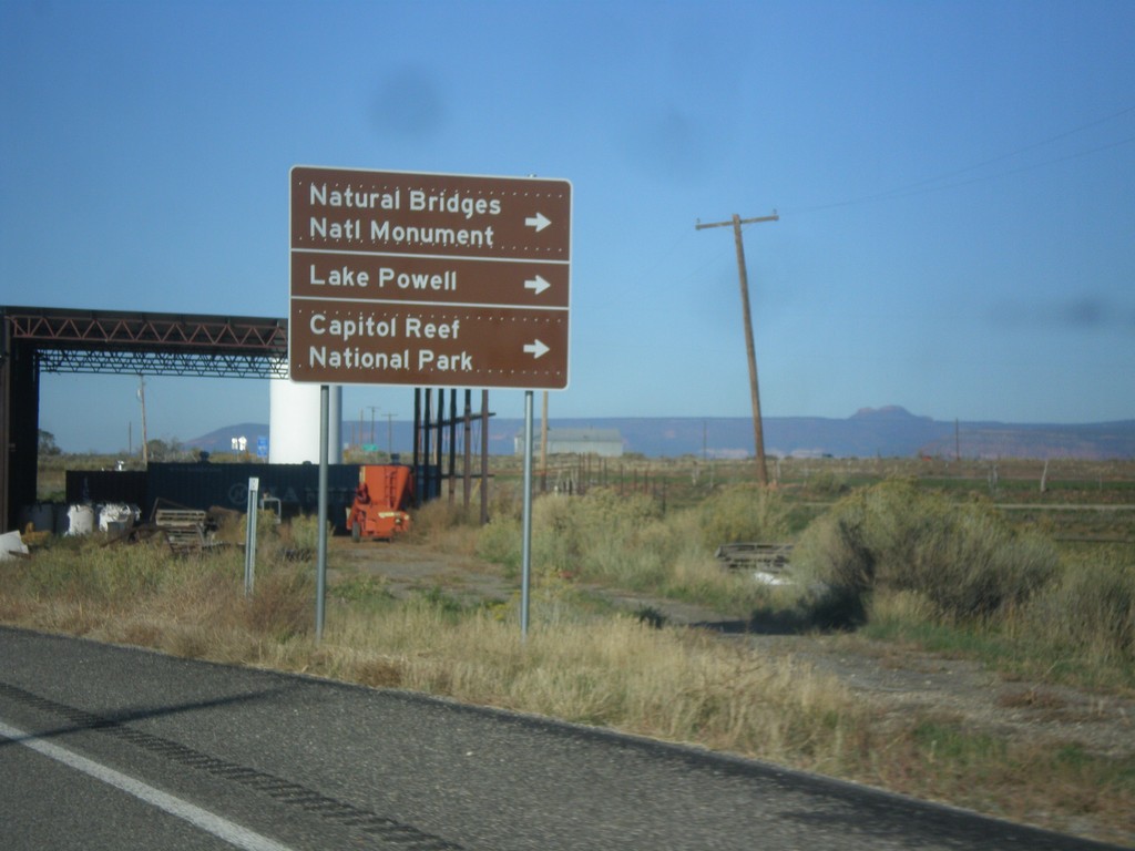
US-191 South Approaching UT-95
US-191 south approaching UT-95 west to Natural Bridges National Monument, Lake Powell, and Capitol Reef National Park.
Taken 10-14-2013
 Blanding
San Juan County
Utah
United States
Blanding
San Juan County
Utah
United States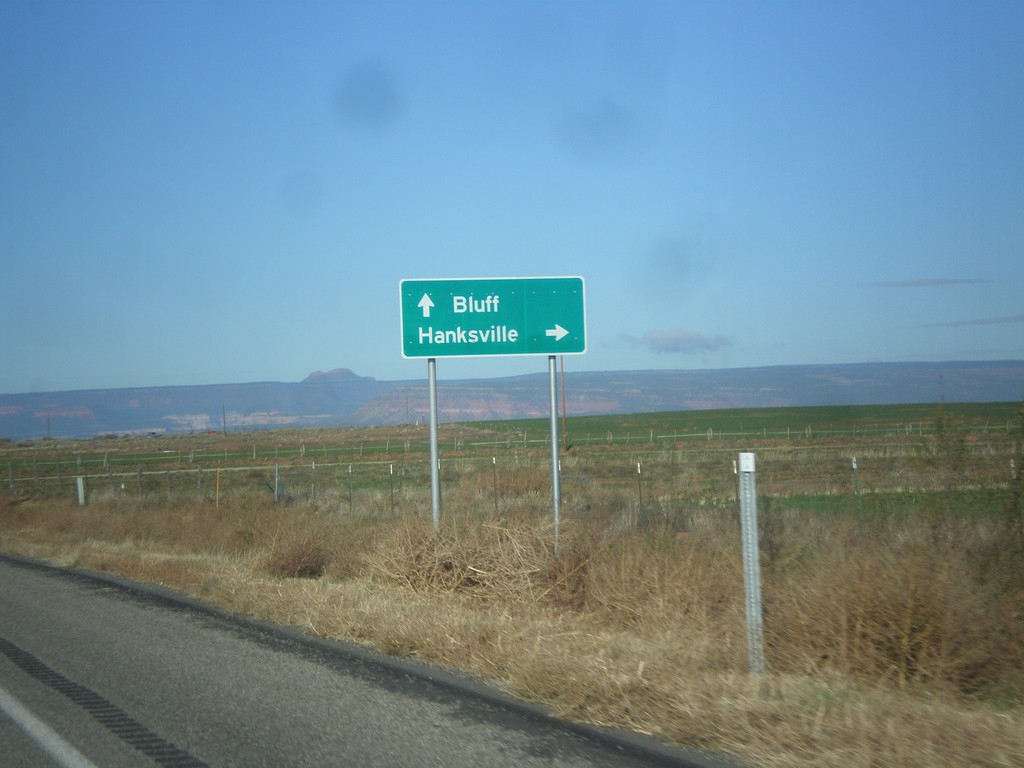
US-191 South Approaching UT-95
US-191 south approaching UT-95 west to Hanksville. Continue south on US-191 to Bluff. This sign is not typical for a junction between two state highways, in that it is not in all capitol letters, and there is not horizontal lines separating the cities.
Taken 10-14-2013
Blanding
San Juan County
Utah
United States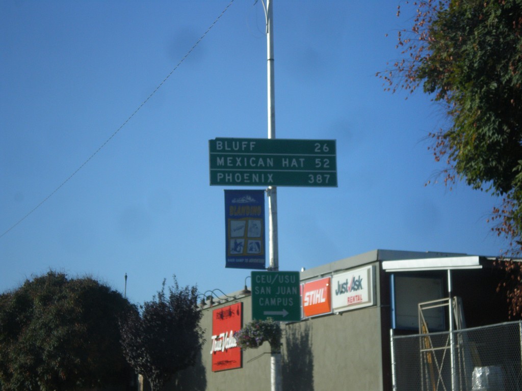
US-191 South - Distance Marker
Distance marker on US-191 south in Blanding. Distance to Bluff, Mexican Hat, and Phoenix. The last city is interesting, because US-191 does not go anywhere near Phoenix. A distance marker between Monticello and Blanding lists Flagstaff as the control city, which is also not on US-191.
Taken 10-14-2013
Blanding
San Juan County
Utah
United States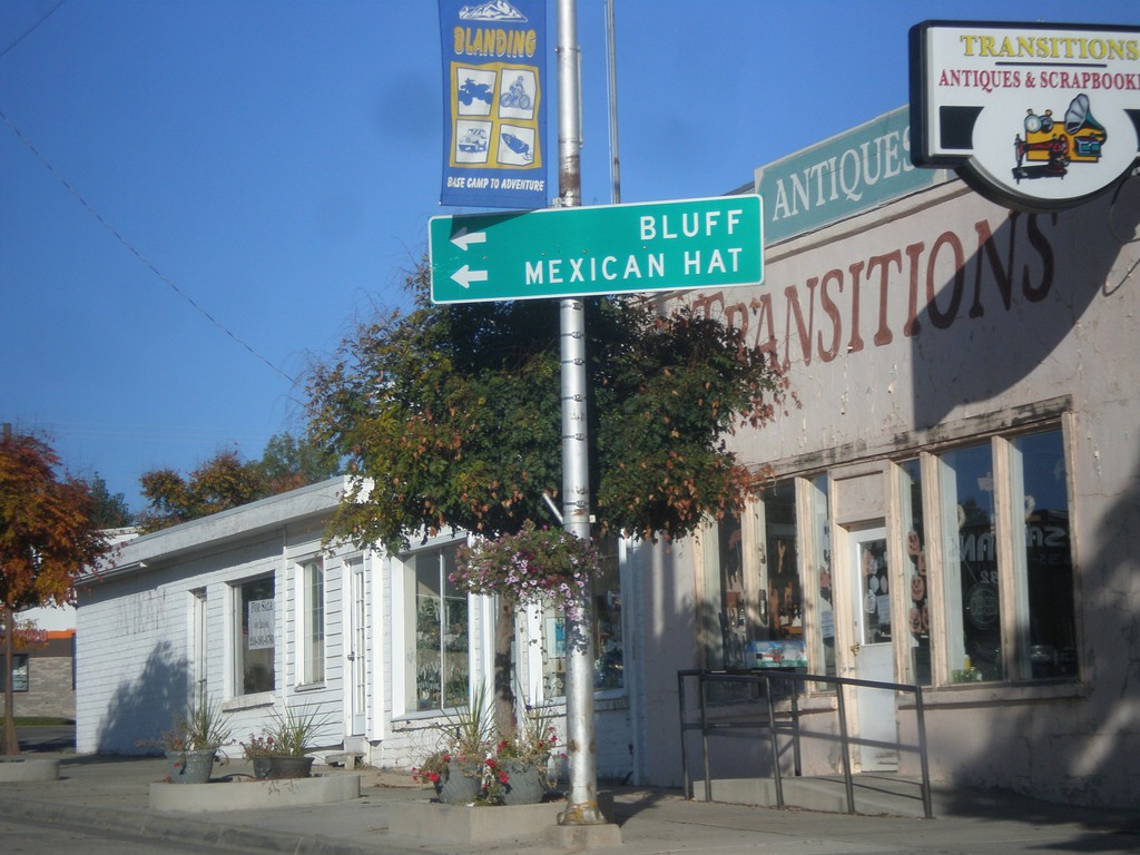
US-191 South - Blanding
US-191 south at Main St. and Center St. in Blanding. US-191 turns south onto Main St. towards Bluff and Mexican Hat.
Taken 10-14-2013
Blanding
San Juan County
Utah
United States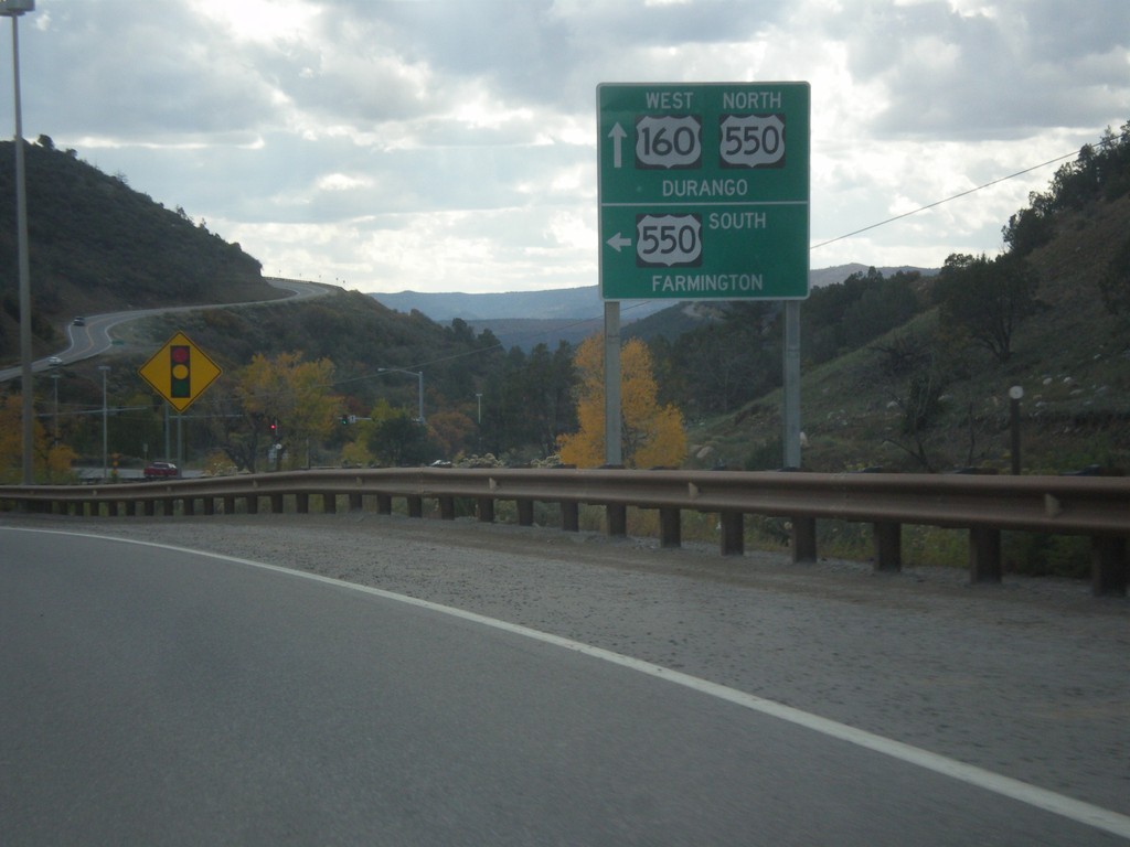
US-160 West at US-550 South
US-160 west at US-550 south. Use US-550 south for Farmington (New Mexico). US-550 north joins US-160 into Durango.
Taken 10-13-2013

 Durango
La Plata County
Colorado
United States
Durango
La Plata County
Colorado
United States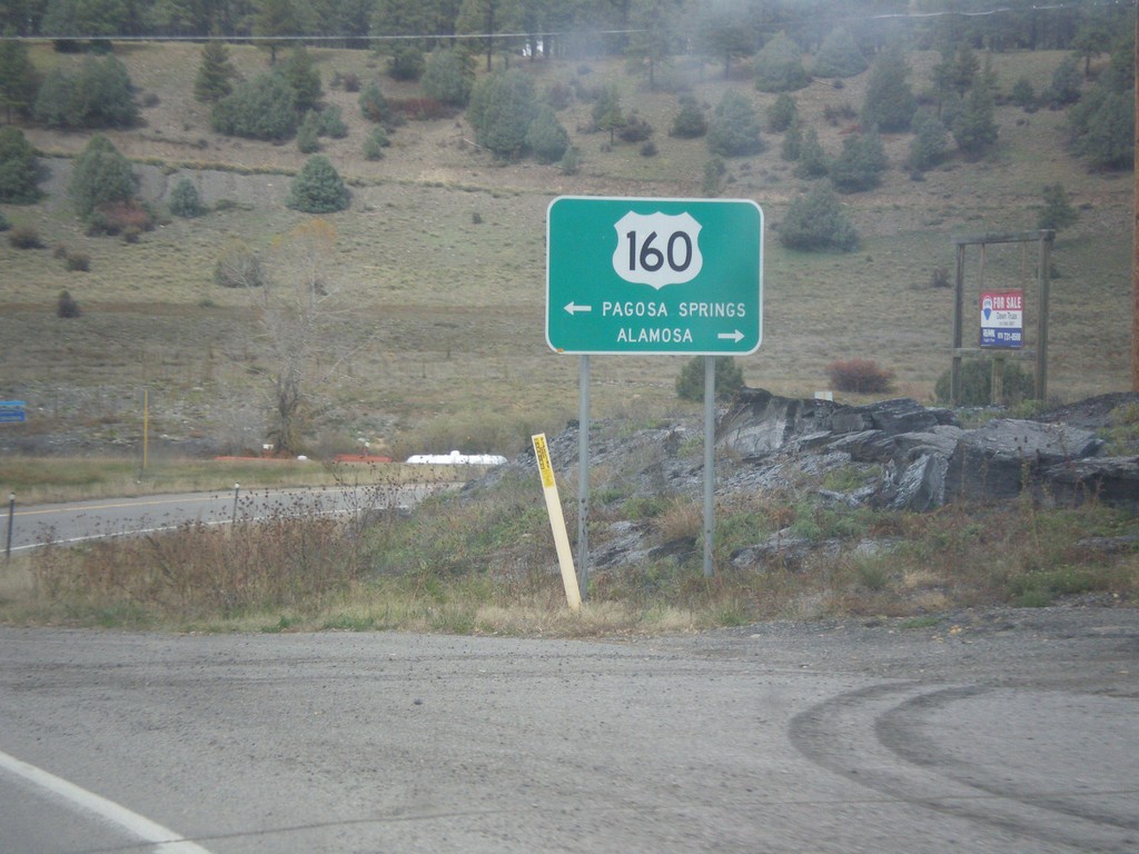
End US-84 at US-160
End US-84 at US-160 in Pagosa Springs. Turn right on US-160 east for Alamosa. Turn left on US-160 west for Pagosa Springs.
Taken 10-13-2013
 Pagosa Springs
Archuleta County
Colorado
United States
Pagosa Springs
Archuleta County
Colorado
United States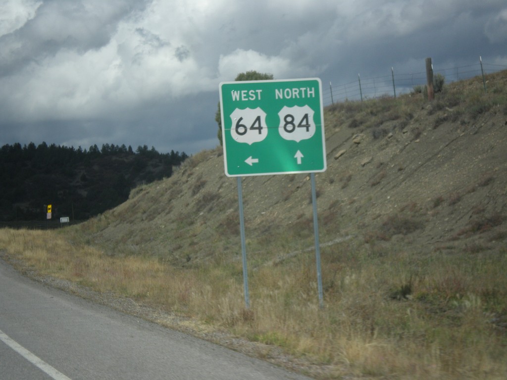
US-64 West/US-84 North at Split
US-64 West/US-84 north at split in Rio Arriba County. US-84 north continues straight; turn left for US-64 west.
Taken 10-13-2013
 Amargo
Rio Arriba County
New Mexico
United States
Amargo
Rio Arriba County
New Mexico
United States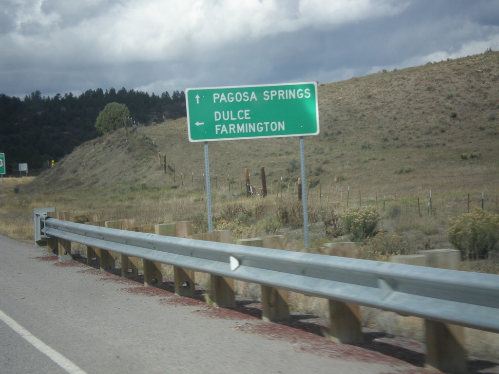
US-64 West/US-84 North Approaching Split
US-64 West/US-84 north approaching US-64/US-84 split. Use US-84 north for Pagosa Springs (Colorado). Turn left for US-64 west to Dulce and Farmington.
Taken 10-13-2013
Amargo
Rio Arriba County
New Mexico
United States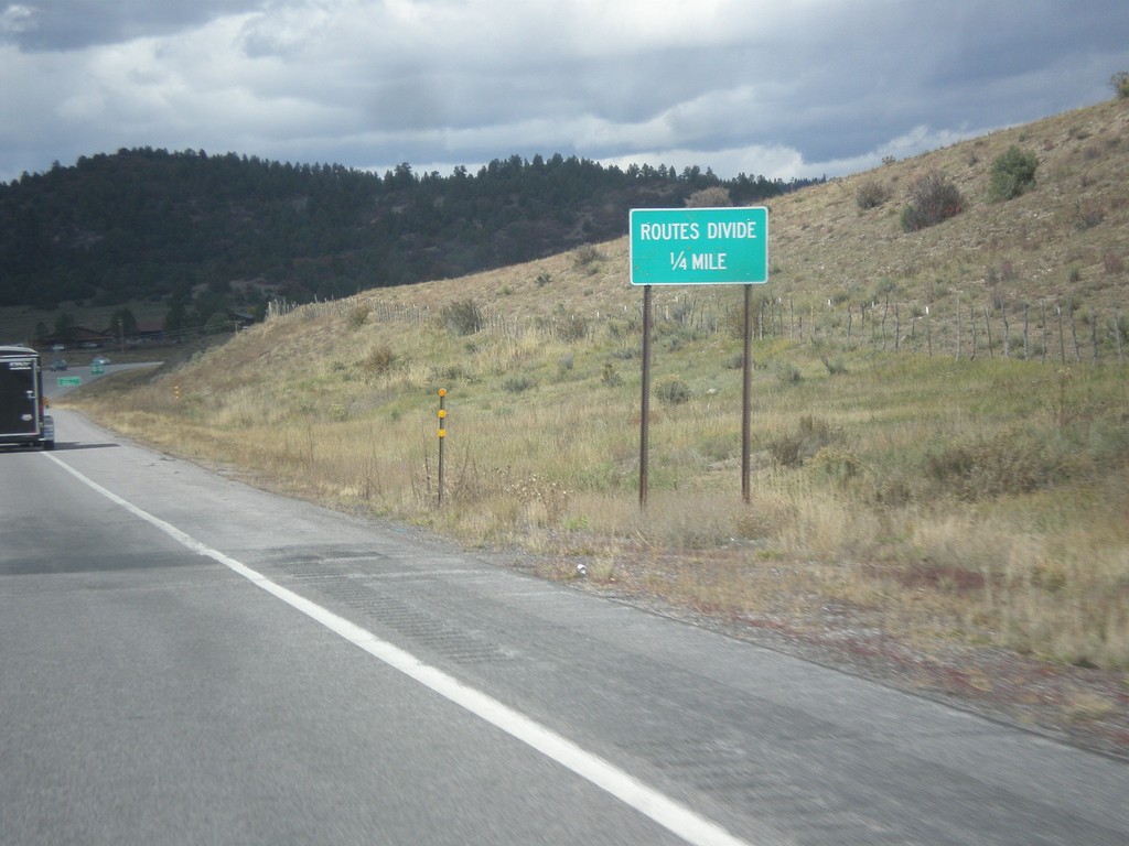
US-64 West/US-84 North - Routes Divide
Approaching US-64 West/US-84 North route divide in Rio Arriba County.
Taken 10-13-2013
Chama
Rio Arriba County
New Mexico
United States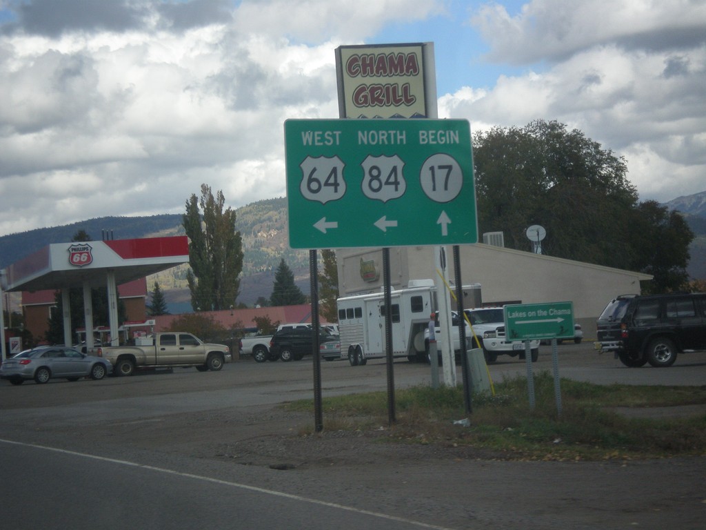
US-64 West/US-84 North at NM-17
US-64 West/US-84 north at NM-17 in Chama. Turn left to continue west on US-64/US-84.
Taken 10-13-2013
 Chama
Rio Arriba County
New Mexico
United States
Chama
Rio Arriba County
New Mexico
United States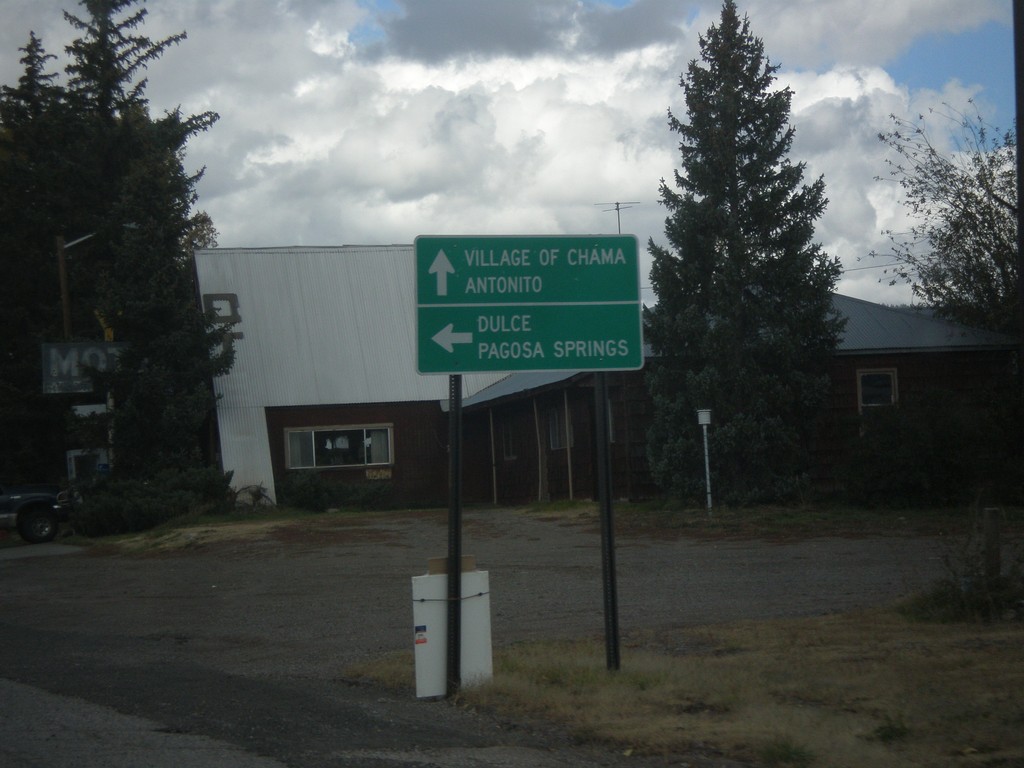
US-64 West/US-84 North Approaching NM-17
US-64 West/US-84 North approaching NM-17. Use NM-17 for the Village of Chama and Antonito (Colorado). Turn left to continue west on US-64/US-84 towards Dulce and Pagosa Springs (Colorado).
Taken 10-13-2013
Chama
Rio Arriba County
New Mexico
United States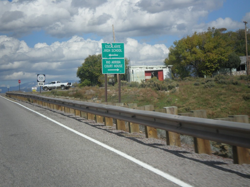
US-64 West/US-84 North Approaching NM-531
US-64 West/US-84 North approaching NM-531. Turn left for Escalante High School; turn right for Rio Arriba Court House (in Tierra Amarilla).
Taken 10-13-2013
 Tierra Amarilla
Rio Arriba County
New Mexico
United States
Tierra Amarilla
Rio Arriba County
New Mexico
United States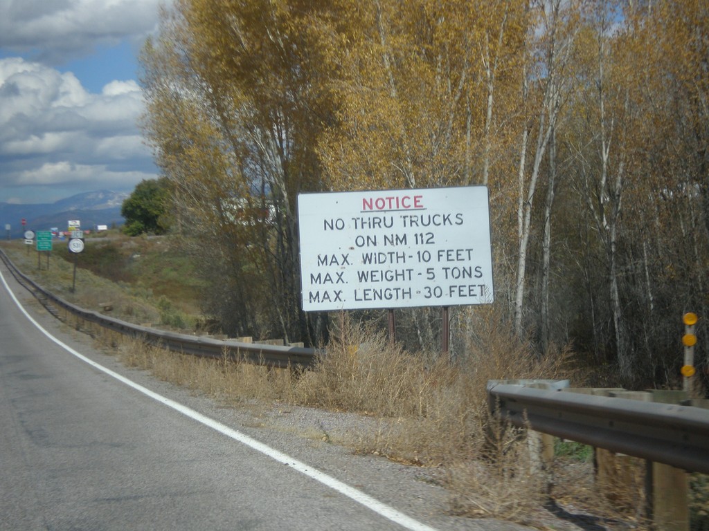
US-64 West/US-84 North - No Thru Trucks on NM-112
US-64 West/US-84 North approaching NM-531 junction. No thru trucks on NM-112.
Taken 10-13-2013
Tierra Amarilla
Rio Arriba County
New Mexico
United States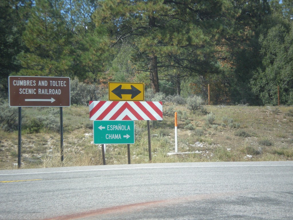
US-64 West at US-84
US-64 west at US-84. Turn right to continue west on US-84. US-64 joins US-84, through Chama, and over the Continental Divide. Turn left on US-64/US-84 for Chama and the Cumbres and Toltec Scenic Railroad; turn right on US-84 for Espanola.
Taken 10-13-2013
Los Ojos
Rio Arriba County
New Mexico
United States