Signs Tagged With Big Green Sign
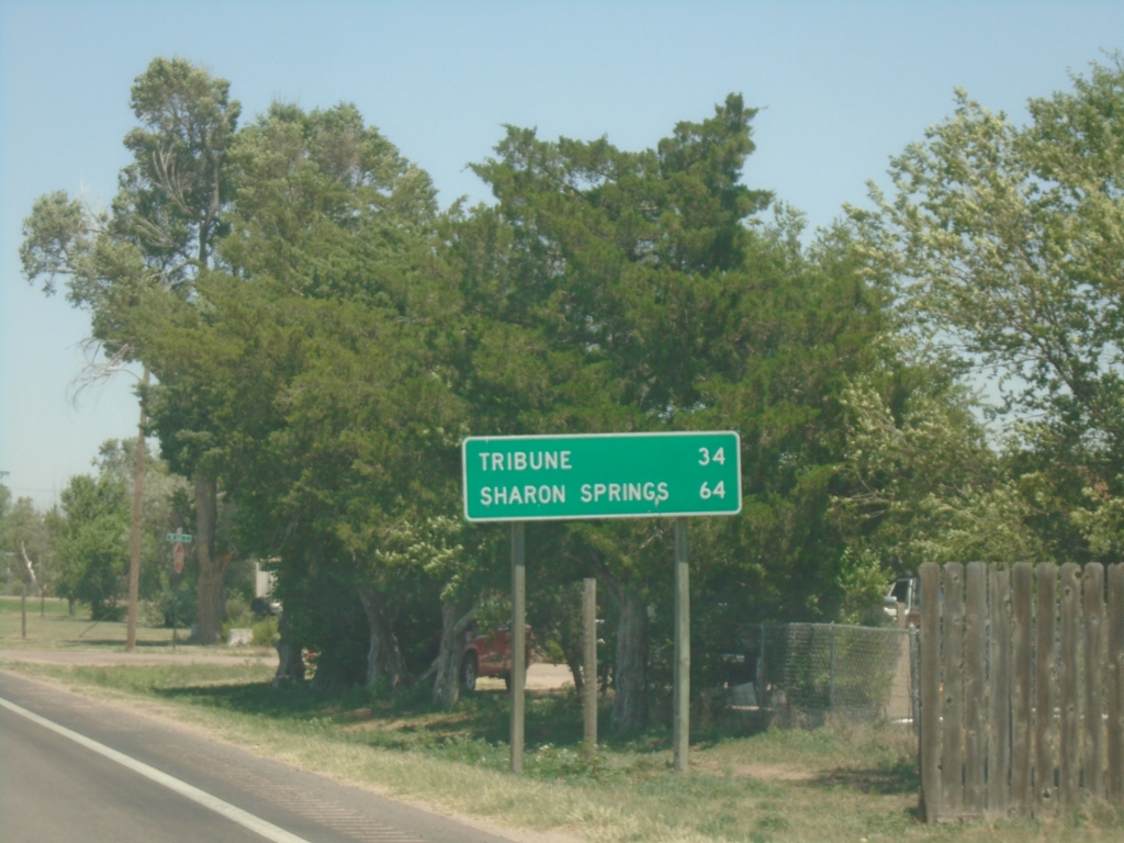
KS-27 North - Distance Marker
Distance marker on KS-27 North. Distance to Tribune and Sharon Springs.
Taken 06-20-2026
 Syracuse
Hamilton County
Kansas
United States
Syracuse
Hamilton County
Kansas
United States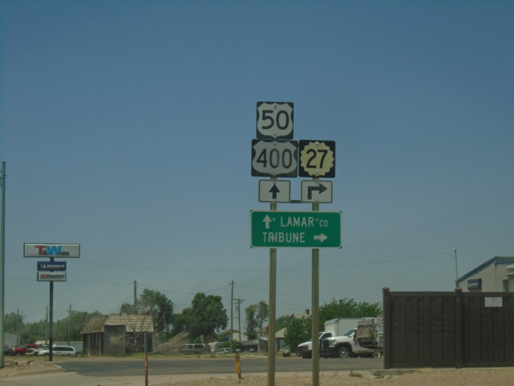
US-50/US-400 West/KS-27 North at KS-27 North
US-50/US-400 West/KS-27 North at KS-27 North in Syracuse. Turn right on KS-27 North to Tribune; continue west on US-50/US-400 for Lamar, Colorado.
Taken 06-20-2026

 Syracuse
Hamilton County
Kansas
United States
Syracuse
Hamilton County
Kansas
United States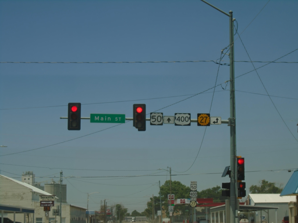
US-50/US-400 West at KS-27
US-50/US-400 West at KS-27 (Main St.) in Syracuse.
Taken 06-20-2026
Syracuse
Hamilton County
Kansas
United States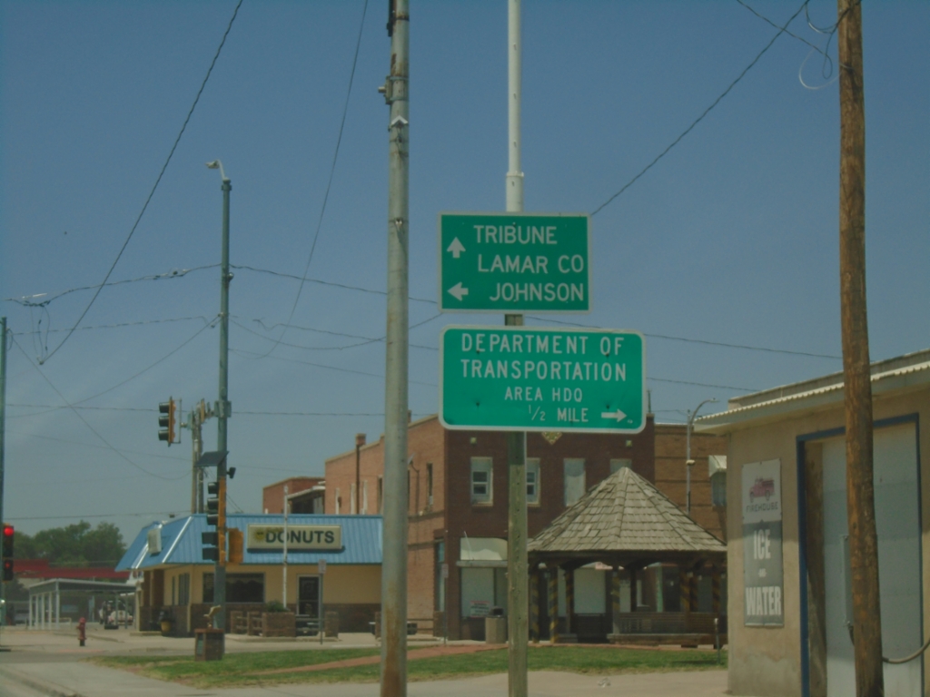
US-50/US-400 West at KS-27
US-50/US-400 West (Ave. A) at KS-27 (Main Street) in Syracuse. Use KS-27 South to Johnson City. Continue west on US-50/US-400/KS-27 North to Lamar, Colorado (via US-50/US-400) and Tribune (via KS-27). Turn right on Main Street for the Department of Transportation area Headquarters.
Taken 06-20-2026
Syracuse
Hamilton County
Kansas
United States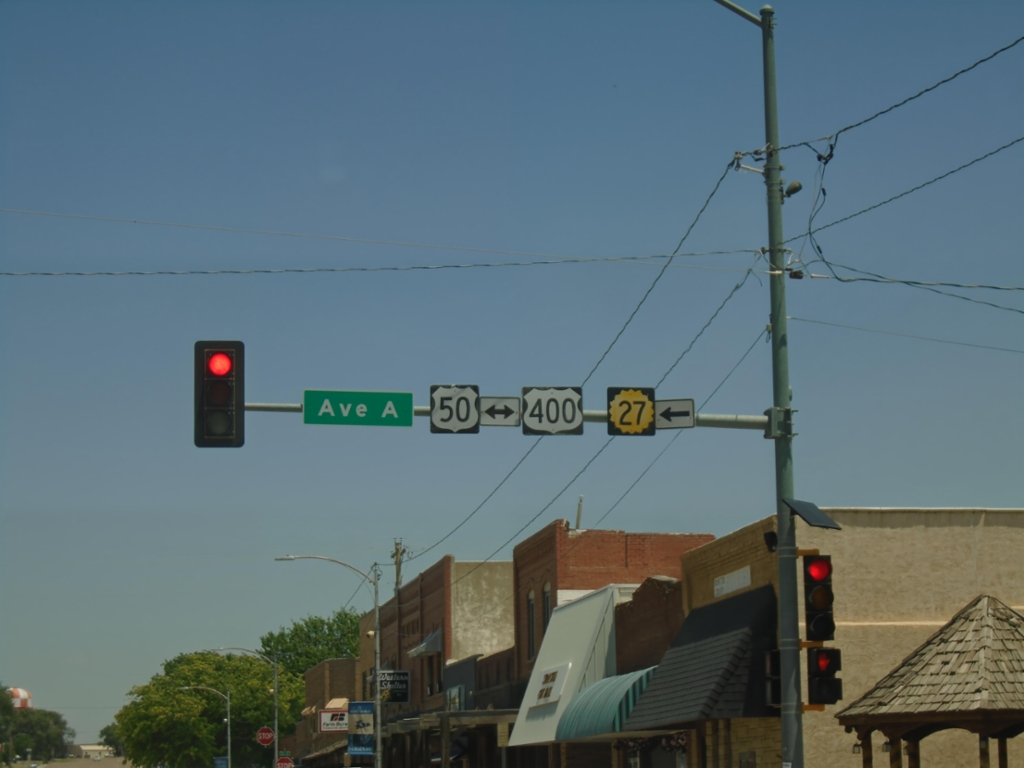
KS-27 North at US-50/US-400
KS-27 North at US-50/US-400 (Ave. A) in Syracuse. Turn left to continue north on KS-27.
Taken 06-20-2026
Syracuse
Hamilton County
Kansas
United States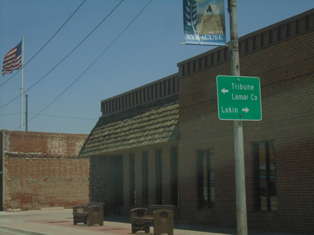
KS-27 North at US-50/US-400
KS-27 North at US-50/US-400 in Syracuse. Use US-50/US-400 East to Lakin. Use US-50/US-400 West to Lamar, Colorado and KS-27 North to Tribune.
Taken 06-20-2026
Syracuse
Hamilton County
Kansas
United States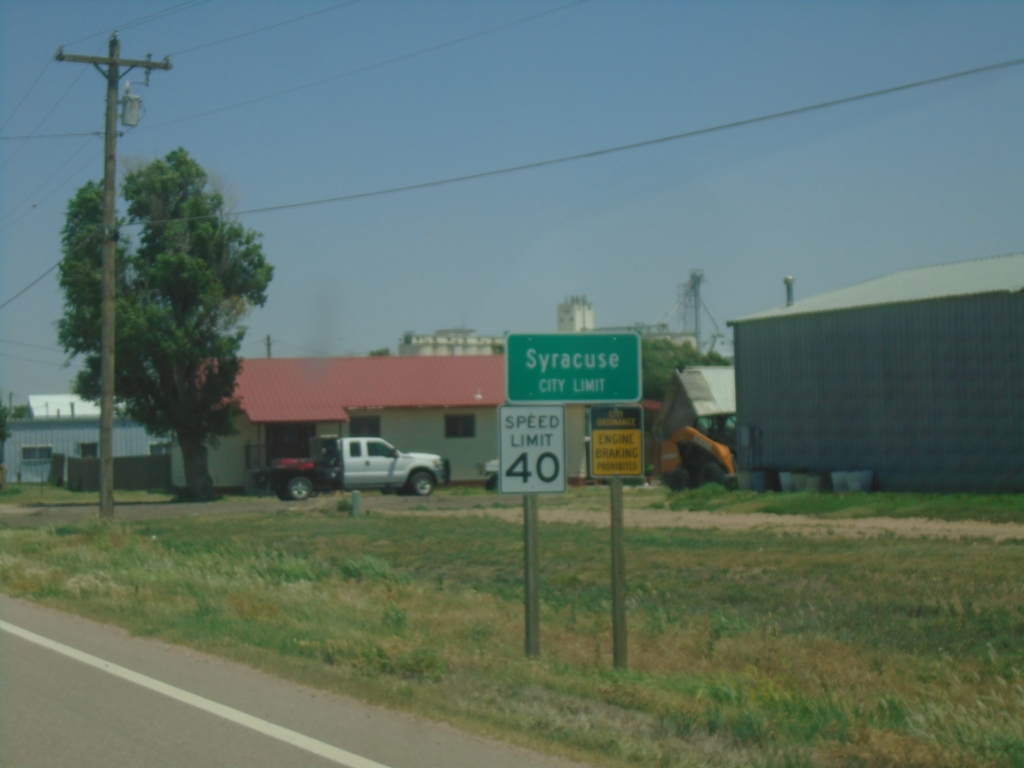
KS-27 North - Syracuse
Syracuse City Limit on KS-27 North. Syracuse is the county seat of Hamilton County.
Taken 06-20-2026
Syracuse
Hamilton County
Kansas
United States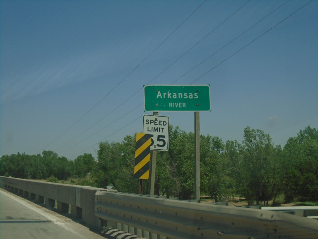
KS-27 North - Arkansas River
Arkansas River bridge on KS-27 North.
Taken 06-20-2026
Syracuse
Hamilton County
Kansas
United States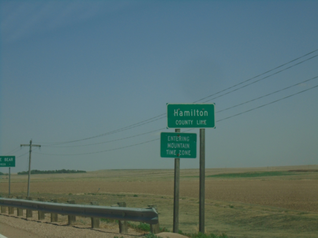
KS-27 North - Hamilton County Line / Mountain Time Zone
Hamilton County Line / Entering Mountain Time Zone on KS-27 North. Four counties in western Kansas are on Mountain Time Zone, the rest of the counties in Kansas are on Central Time Zone.
Taken 06-20-2026
Lamont
Hamilton County
Kansas
United States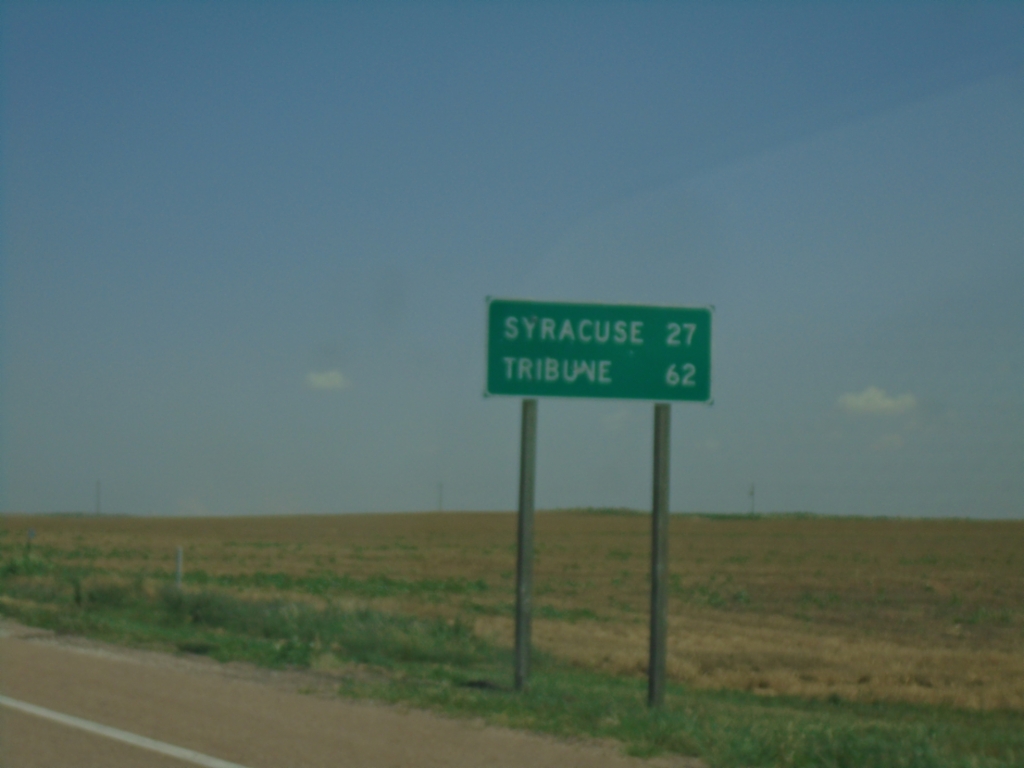
KS-27 North - Distance Marker
Distance marker on KS-27 north. Distance to Syracuse and Tribune.
Taken 06-20-2026
Johnson City
Stanton County
Kansas
United States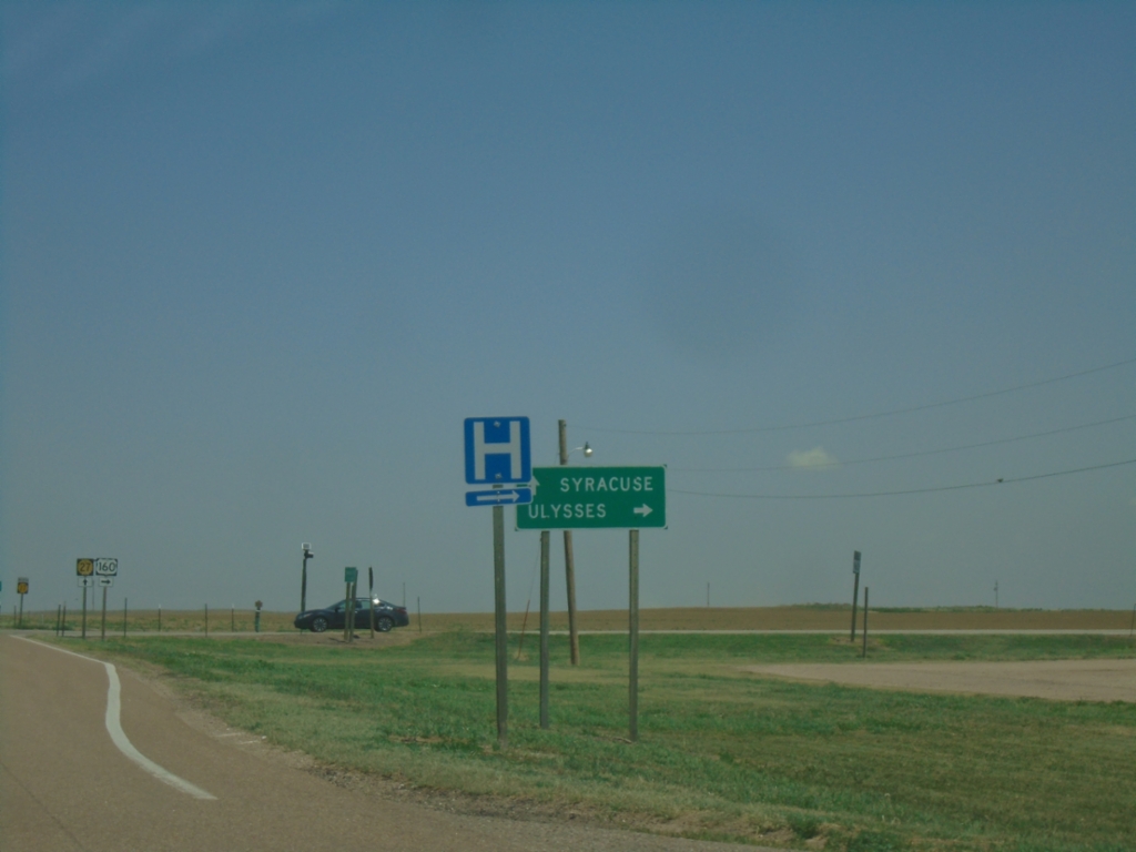
US-160 East/KS-27 North Split in Johnson City
US-160 East/KS-27 North split in Johnson City. Use KS-27 North to Syracuse; use US-160 West to Ulysses.
Taken 06-20-2026
 Johnson City
Stanton County
Kansas
United States
Johnson City
Stanton County
Kansas
United States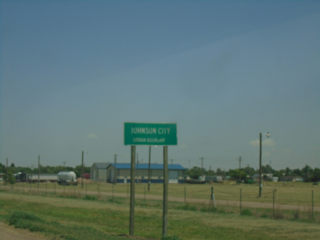
US-160 East/KS-27 North - Johnson City
Johnson City Urban Boundary on US-160 East/KS-27 North.
Taken 06-20-2026
Johnson City
Stanton County
Kansas
United States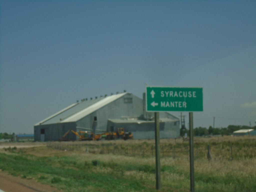
KS-27 North at US-160
KS-27 North at US-160 in Johnson City. Use US-160 West to Manter; continue on KS-27 North/US-160 East to Syracuse.
Taken 06-20-2026
Johnson City
Stanton County
Kansas
United States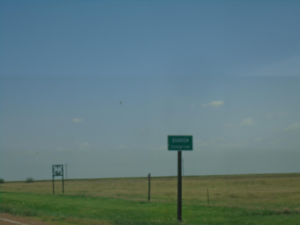
KS-27 North - Stanton County
Stanton County Line on KS-27 North.
Taken 06-20-2026
Stanton
Stanton County
Kansas
United States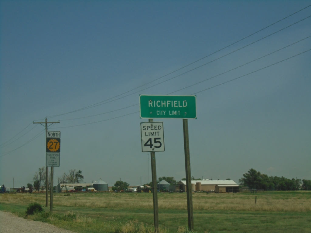
KS-27 North - Richfield
Richfield City Limit on KS-27 North.
Taken 06-20-2026
Richfield
Morton County
Kansas
United States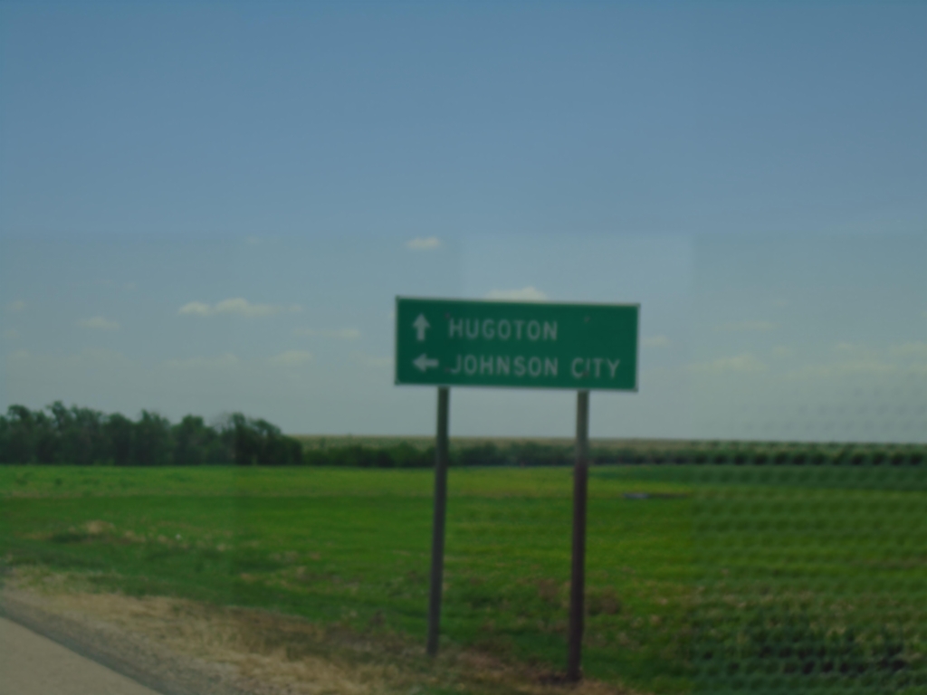
KS-27 North/KS-51 East at KS-27/KS-51 Split
KS-27 North/KS-51 East at KS-27/KS-51 split. Use KS-27 North to Johnson City; KS-51 East to Hugoton.
Taken 06-20-2026
 Richfield
Morton County
Kansas
United States
Richfield
Morton County
Kansas
United States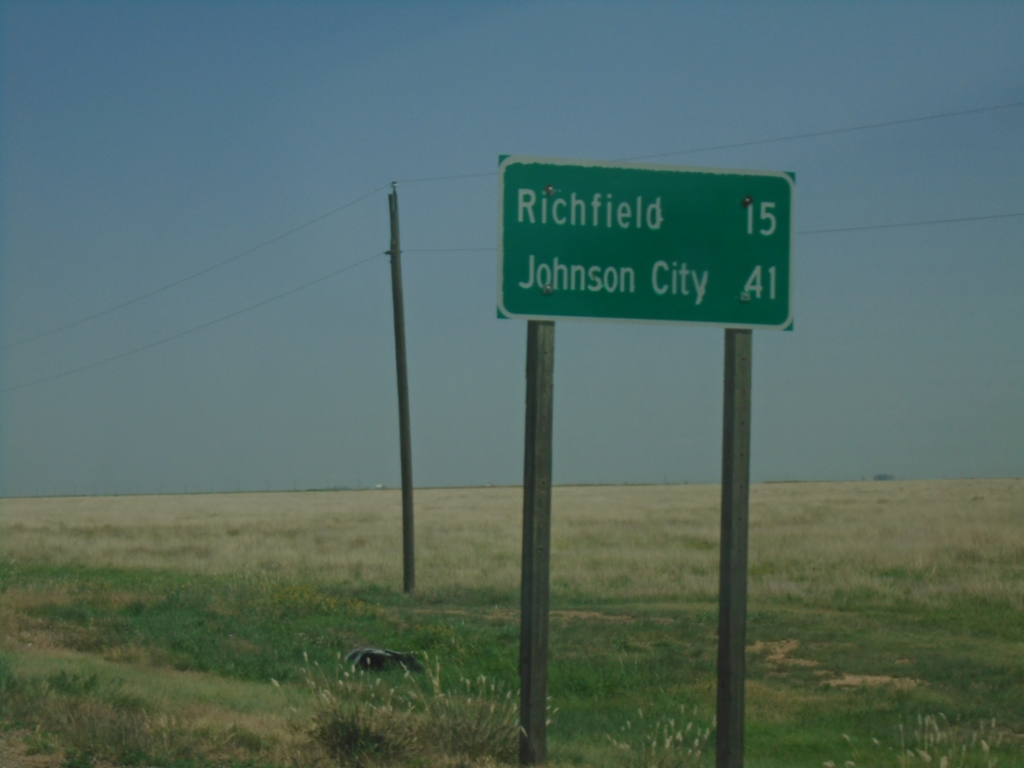
KS-27 North/KS-51 East - Distance Marker
Distance Marker on KS-27 North/KS-51 East. Distance to Richfield and Johnson City.
Taken 06-20-2026
Westola
Morton County
Kansas
United States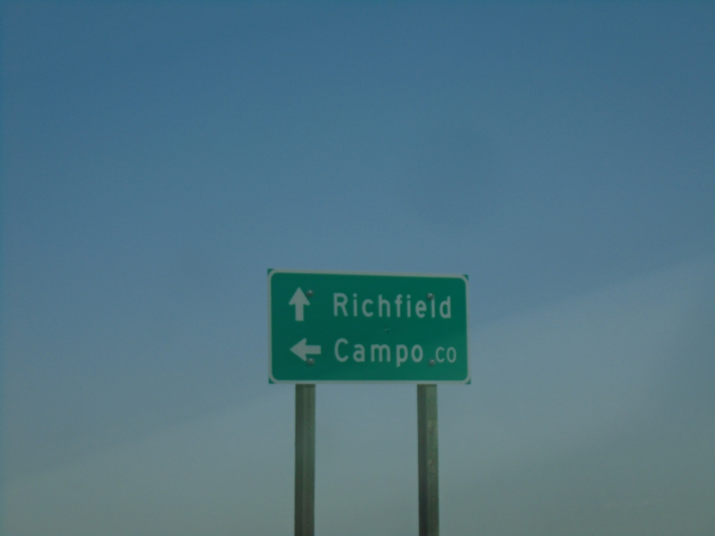
KS-21 North at KS-51
KS-27 North at KS-51 in Morton County. Use KS-51 West to Campo, Colorado. Continue on KS-27 North/KS-51 East to Richfield.
Taken 06-20-2026
Westola
Morton County
Kansas
United States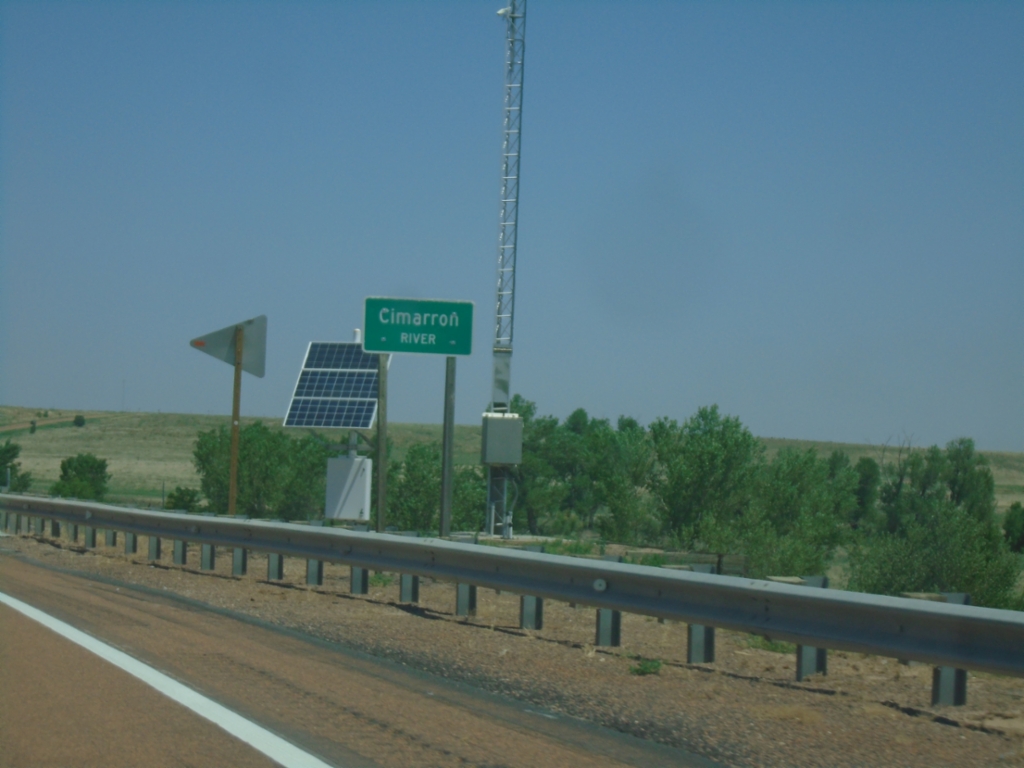
KS-27 North - Cimarron River
Cimarron River bridge on KS-27 North.
Taken 06-20-2026
Taloga
Morton County
Kansas
United States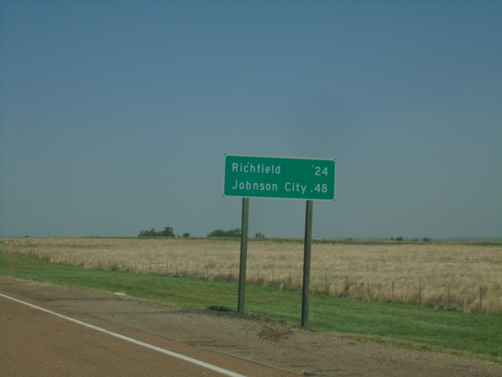
KS-27 North - Distance Marker
Distance marker on KS-27 north. Distance to Richfield and Johnson City.
Taken 06-20-2026
Taloga
Morton County
Kansas
United States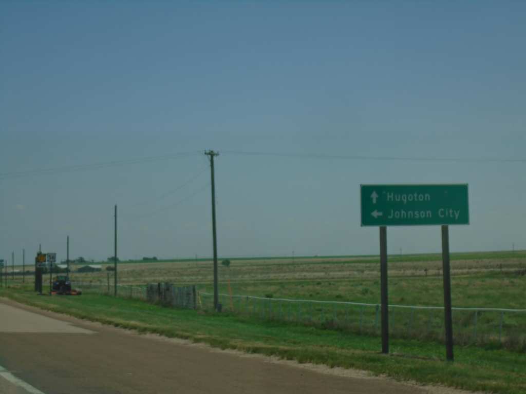
US-56 East at KS-27
US-56 East at KS-27 in Morton County. Turn left for KS-27 North to Johnson City; continue east on US-56 for Hugoton.
Taken 06-20-2026
 Rolla
Morton County
Kansas
United States
Rolla
Morton County
Kansas
United States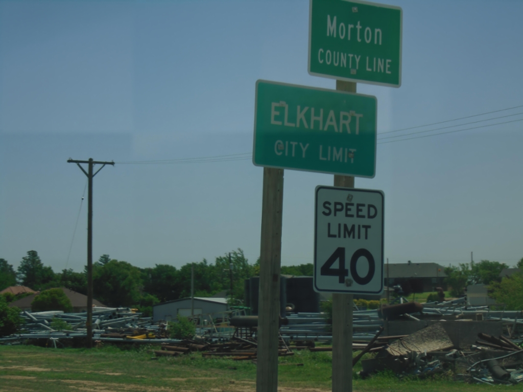
US-56 East - Entering Kansas
US-56 East - Morton County Line / Elkhart City Limit at the Oklahoma/Kansas State Line.
Taken 06-20-2026
Elkhart
Morton County
Kansas
United States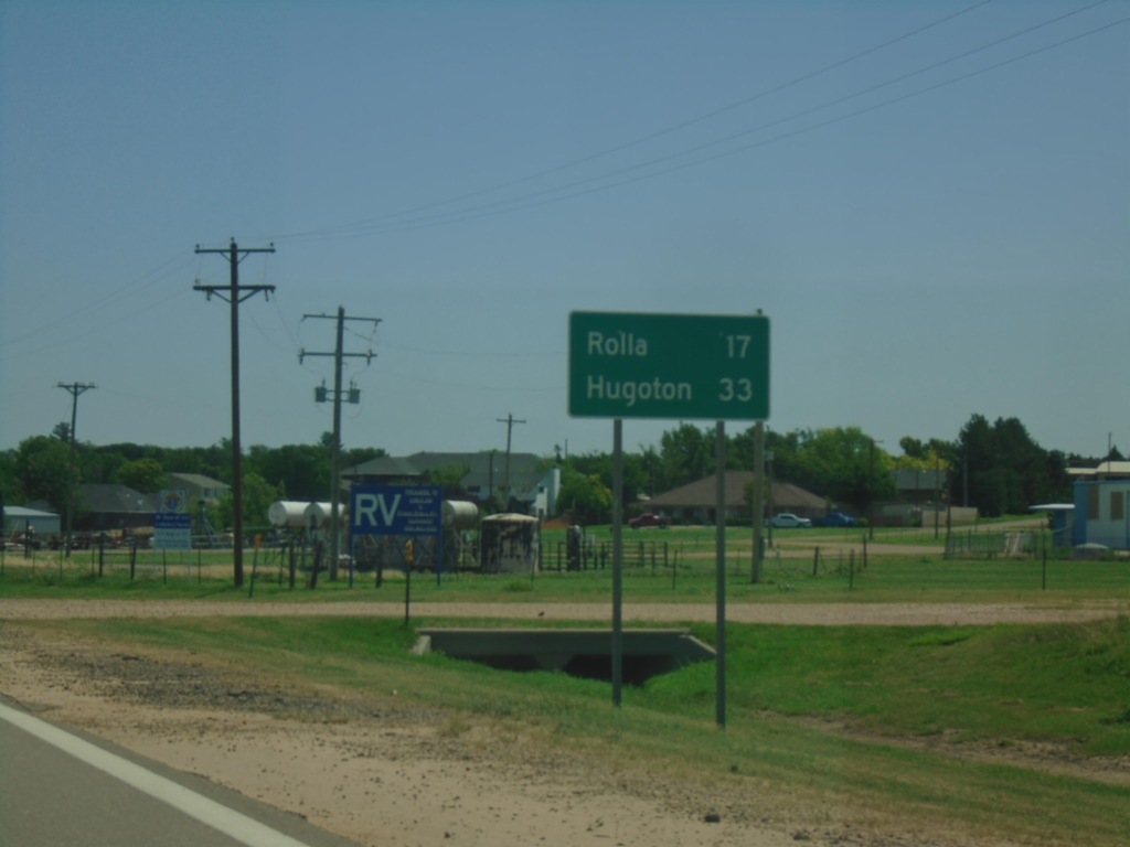
US-56 East - Distance Marker
Distance marker on US-56 east. This is the last distance marker in Oklahoma on US-56. Distance to Rolla and Hugoton (both destinations in Kansas).
Taken 06-20-2026
Elkhart
Texas County
Oklahoma
United States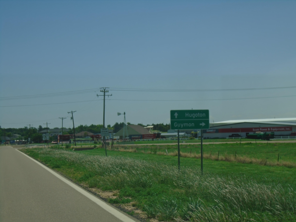
US-56 East Approaching OK-95
US-56 East approaching OK-95. Use OK-95 south to Guymon; continue east on US-56 to Hugoton, KS.
Taken 06-20-2026
 Texas County
Oklahoma
United States
Texas County
Oklahoma
United States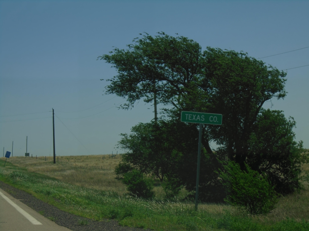
US-56 East - Texas County
Texas County, Oklahoma on US-56 east.
Taken 06-20-2026
Texas County
Oklahoma
United States