Signs Tagged With Big Green Sign
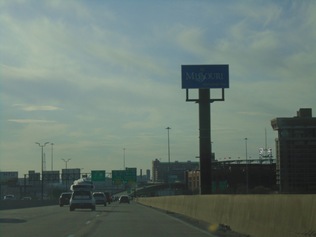
I-64 West/I-55 South - Entering Missouri
Missouri Welcomes You on I-64 West/I-55 South crossing the Mississippi River. The skyline of Saint Louis is in the background.
Taken 03-29-2026


 St. Louis
City of St. Louis
Missouri
United States
St. Louis
City of St. Louis
Missouri
United States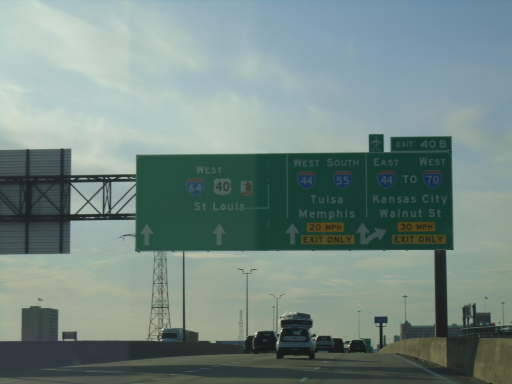
I-64 West/I-55 South Approaching Exit 40B
I-64 West/I-55 South Approaching Exit 40B - I-55 South/I-44 West/Tulsa (OK)/Memphis (TN) and I-44 East/To I-70/Walnut St./Kansas City. I-64/US-40 West continues into Saint Louis. I-55 Southbound leaves I-64 west here.
Taken 03-29-2026

 St. Louis
City of St. Louis
Missouri
United States
St. Louis
City of St. Louis
Missouri
United States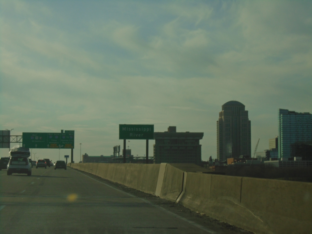
I-64 East/I-55 South - Mississippi River
Mississippi River bridge on I-64 East/I-55 South. The skyline of Saint Louis, Missouri is in the background.
Taken 03-29-2026
East St. Louis
St. Clair County
Illinois
United States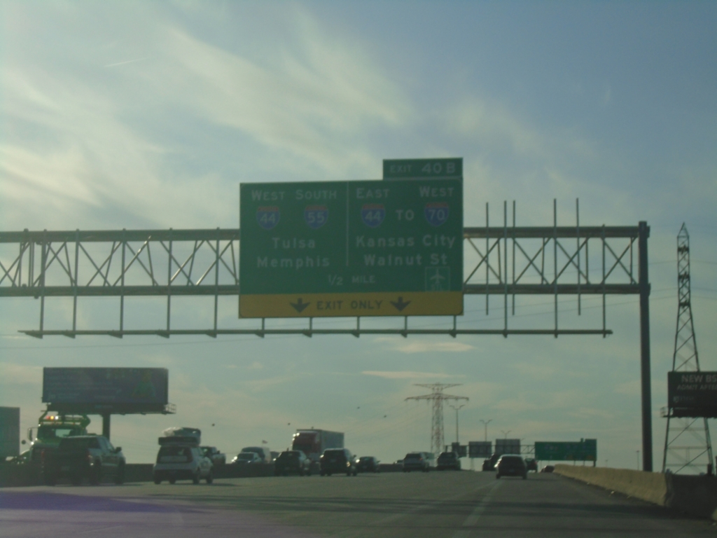
I-64 West/I-55 South Approaching (MO) Exit 40B
I-64 West/I-55 South approaching (MO) Exit 40B - I-44 West/I-55 South/Tulsa (OK)/Memphis (TN) and I-44 East/To I-70 West/Kansas City/Walnut Street. On the approach to the Mississippi River bridge.
Taken 03-29-2026
East St. Louis
St. Clair County
Illinois
United States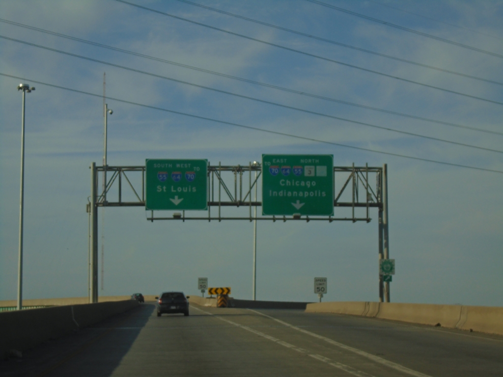
IL-3 North at I-55/I-64/To I-70
IL-3 North at I-55/I-64/To I-70 in East Saint Louis. Use left lanes for I-55 South/I-64 West/To I-70/Saint Louis (MO). Use right lanes for I-55 North/I-64 East/IL-3 North/To I-70/Great River Road/Chicago/Indianapolis (IN).
Taken 03-29-2026
 East St. Louis
St. Clair County
Illinois
United States
East St. Louis
St. Clair County
Illinois
United States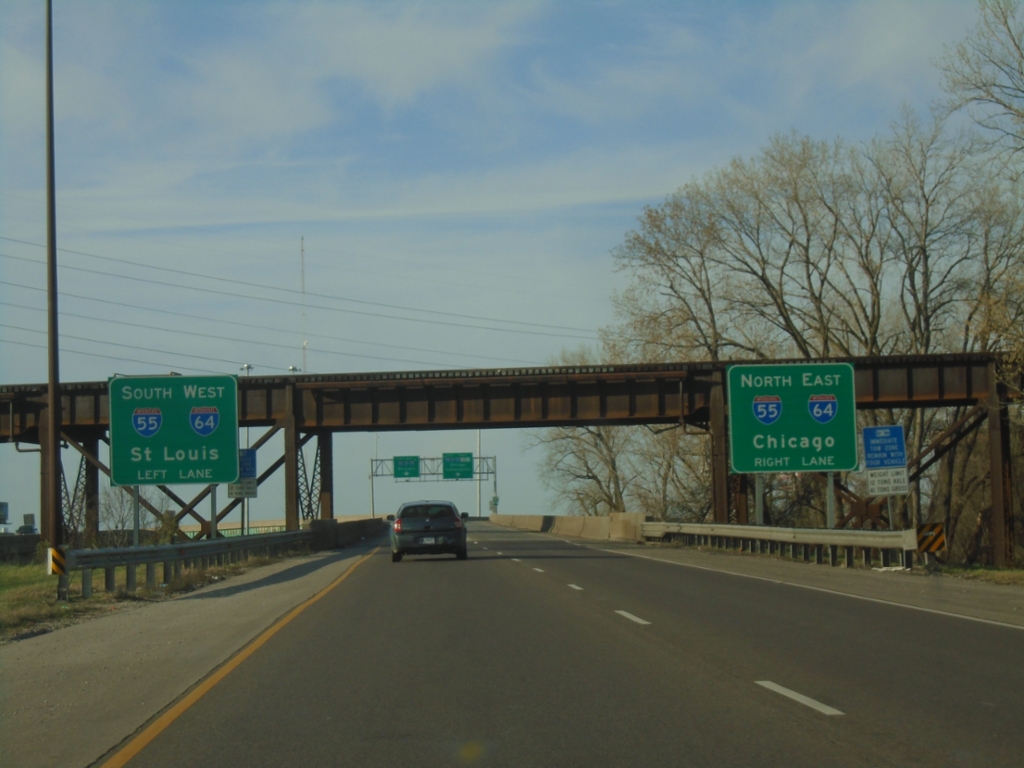
IL-3 North Approaching I-55/I-64
IL-3 North Approaching I-55/I-64 in East Saint Louis. Use I-55 North/I-64 East to Chicago; I-55 South/I-64 West to Saint Louis. Use I-55 North/I-64 East to continue north on IL-3.
Taken 03-29-2026
East St. Louis
St. Clair County
Illinois
United States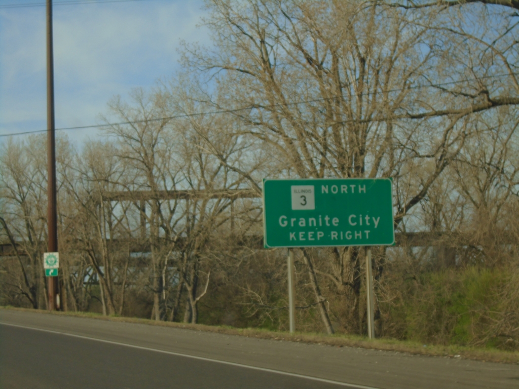
IL-3 North Approaching I-55/I-64
IL-3 North Approaching I-55/I-64 in East Saint Louis. Use right lanes to continue north on IL-3 to Granite City.
Taken 03-29-2026
East St. Louis
St. Clair County
Illinois
United States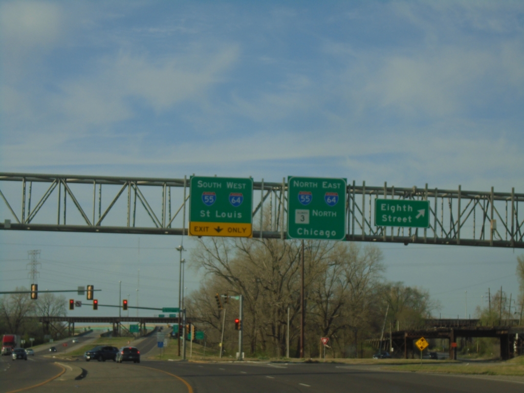
IL-3 North at Eight St - Approaching I-55/I-64
IL-3 North at Eight St - approaching I-55/I-64 junction. Freeway begins here northbound. Use I-55 South/I-64 West to Saint Louis (MO); I-55 North/I-64 East/IL-3 North to Chicago.
Taken 03-29-2026
East St. Louis
St. Clair County
Illinois
United States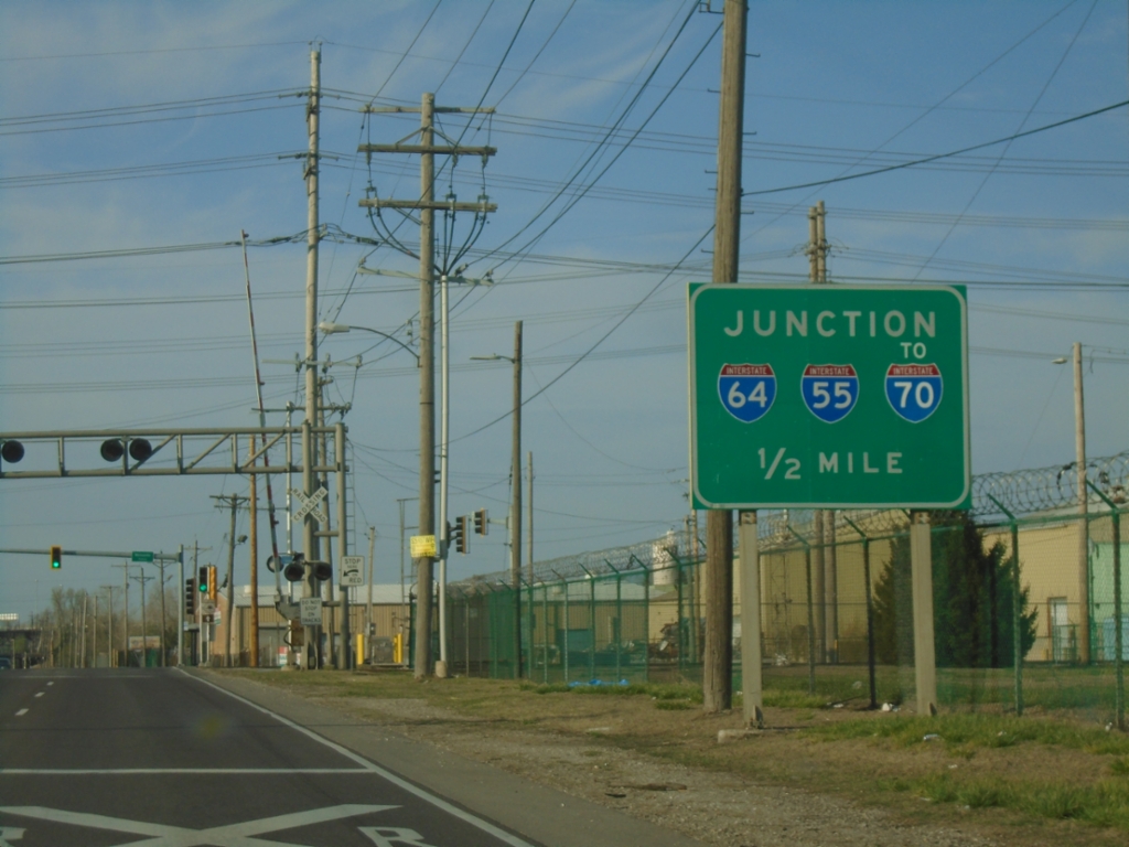
IL-3 North Approaching I-55/I-64/To I-70
IL-3 North approaching I-55/I-64/To I-70 in Sauget.
Taken 03-29-2026
Sauget
Saint Clair County
Illinois
United States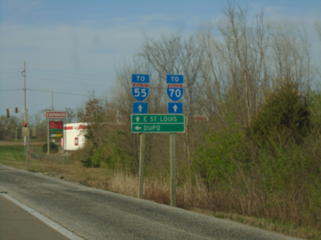
IL-3 North at Main Street
IL-3 North at Main Street in Dupo. Turn left for Dupo; continue north to East Saint Louis and for access to I-55 and I-70.
Taken 03-29-2026
Dupo
St. Clair County
Illinois
United States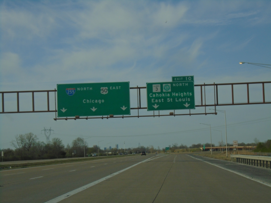
I-255 North - Exit 10
I-255 North/IL-3 North/US-50 East at Exit 10 - IL-3/Great River Road North/Cahokia Heights/East Saint Louis. Continue on I-255 North/US-50 East to Chicago. IL-3 North leaves I-255/US-50 here.
Taken 03-29-2026

 Dupo
St. Clair County
Illinois
United States
Dupo
St. Clair County
Illinois
United States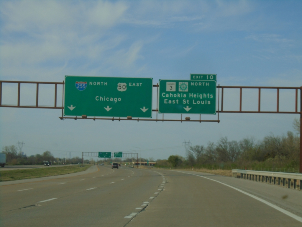
I-255 North - Exit 10
I-255 North/IL-3 North/US-50 East approaching Exit 10 - IL-3/Great River Road North/Cahokia Heights/East Saint Louis. Continue on I-255 North/US-50 East to Chicago.
Taken 03-29-2026
Dupo
St. Clair County
Illinois
United States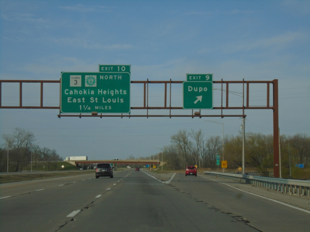
I-255 North - Exits 9 and 10
I-255 North at Exit 9 - Dupo. Approaching Exit 10 - IL-3/Great River Road North/Cahokia Heights/East Saint Louis. IL-3 North leaves I-255 Northbound at Exit 10.
Taken 03-29-2026
Dupo
St. Clair County
Illinois
United States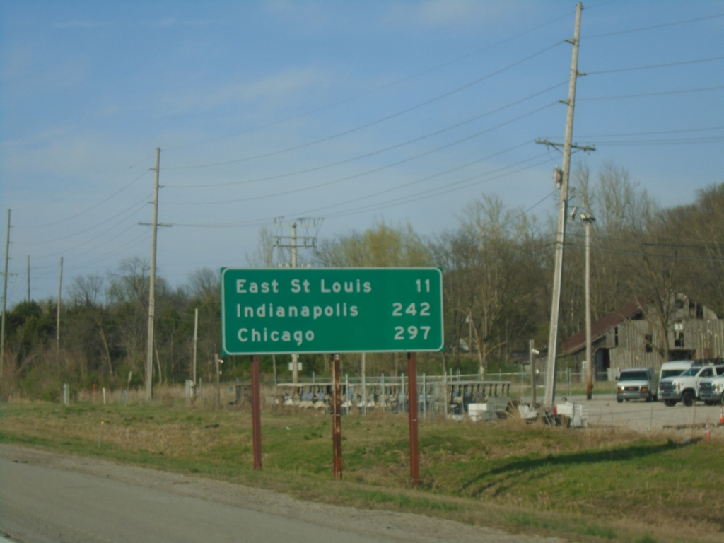
I-255 North - Distance Marker
Distance marker on I-255 North. Distance to East Saint Louis, Chicago (via I-55), and Indianapolis (via I-70).
Taken 03-29-2026
Columbia
St. Clair County
Illinois
United States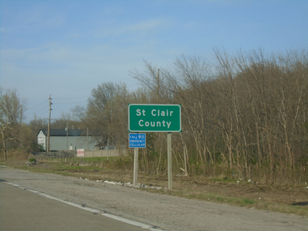
I-255 North - Saint Clair County
Entering Saint Clair County on I-255 North.
Taken 03-29-2026
Columbia
St. Clair County
Illinois
United States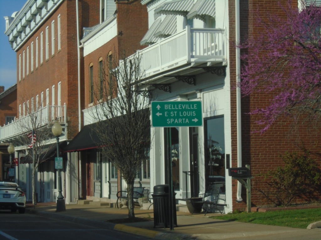
IL-3 North at IL-154 and IL-159
IL-3 North at IL-154 and IL-159 in Red Bud. Use IL-154 to Sparta; IL-159 to Belleville and IL-3 to East Saint Louis. Turn left on Market St. to continue on IL-3 northbound.
Taken 03-29-2026

 Red Bud
Randolph County
Illinois
United States
Red Bud
Randolph County
Illinois
United States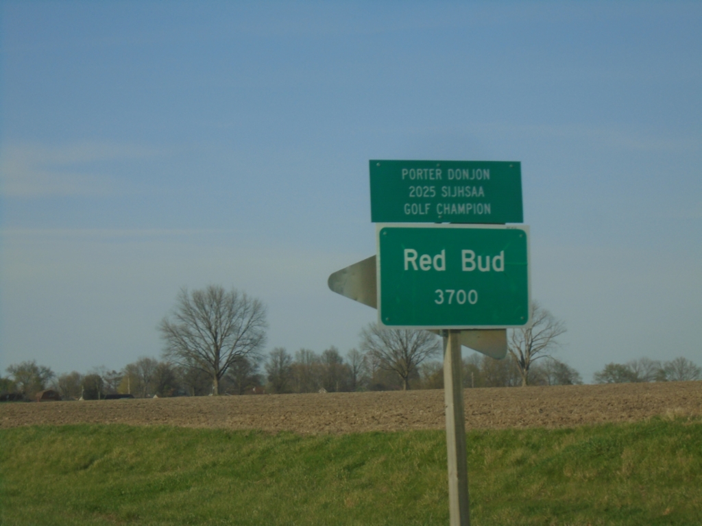
IL-3 North - Red Bud
Entering Red Bud on IL-3 North.
Taken 03-29-2026
Red Bud
Randolph County
Illinois
United States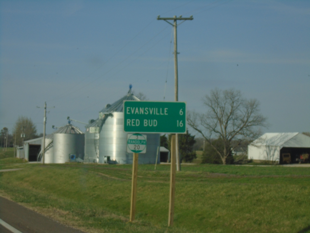
IL-3 North - Distance Marker/Milemarker
Distance marker on IL-3 North. Distance to Evansville and Red Bud. Milemarker 20 (Randolph County).
Taken 03-29-2026
Ellis Grove
Randolph County
Illinois
United States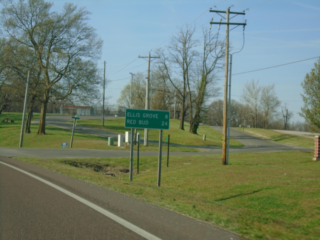
IL-3 North - Distance Marker
Distance maker on IL-3 North. Distance to Ellis Grove and Red Bud.
Taken 03-29-2026
Chester
Randolph County
Illinois
United States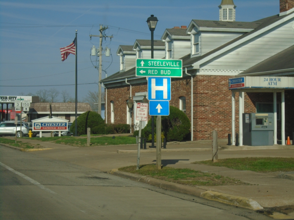
IL-3 North/IL-150 East at IL-3/IL-150 Split
IL-3 North/IL-150 East at IL-3/IL-150 split in Chester. Use IL-150 East to Steeleville; IL-3 North to Red Bud.
Taken 03-29-2026
 Chester
Randolph County
Illinois
United States
Chester
Randolph County
Illinois
United States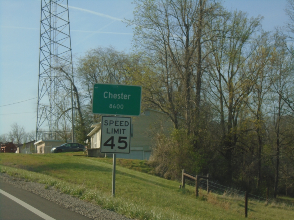
IL-3 North - Chester
Entering Chester on IL-3 North. Chester is the county seat of Randolph County.
Taken 03-29-2026
Chester
Randolph County
Illinois
United States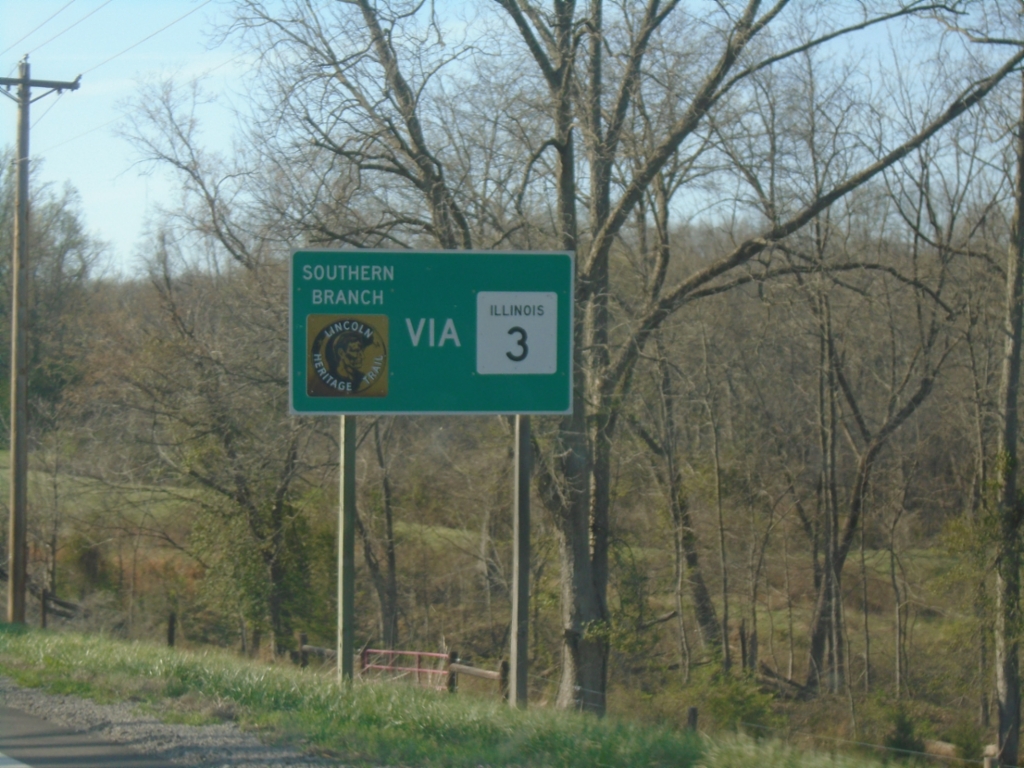
IL-3 North - Lincoln Heritage Trail
Use IL-3 North for Southern Branch of Lincoln Heritage Trail
Taken 03-29-2026
Chester
Randolph County
Illinois
United States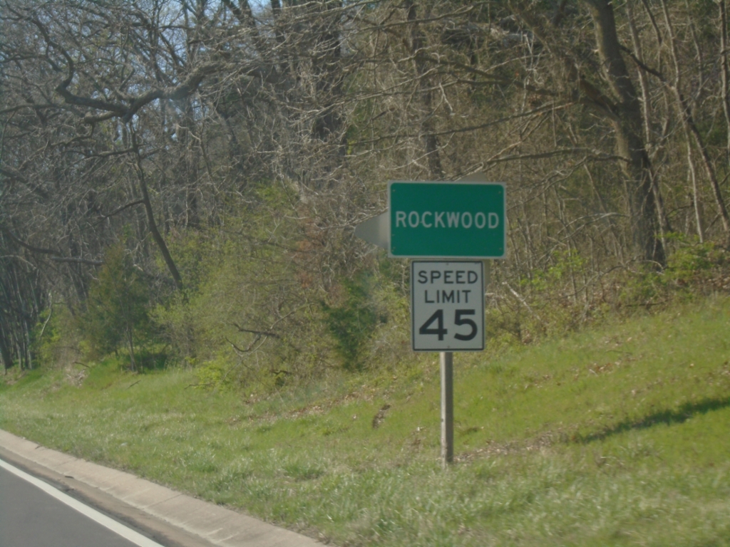
IL-3 North - Rockwood
Entering Rockwood on IL-3 North.
Taken 03-29-2026
Rockwood
Randolph County
Illinois
United States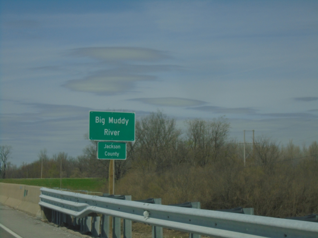
IL-3 North - Jackson County/Big Muddy River
Entering Jackson County on IL-3 North. At the Big Muddy River bridge.
Taken 03-29-2026
Grand Tower
Jackson County
Illinois
United States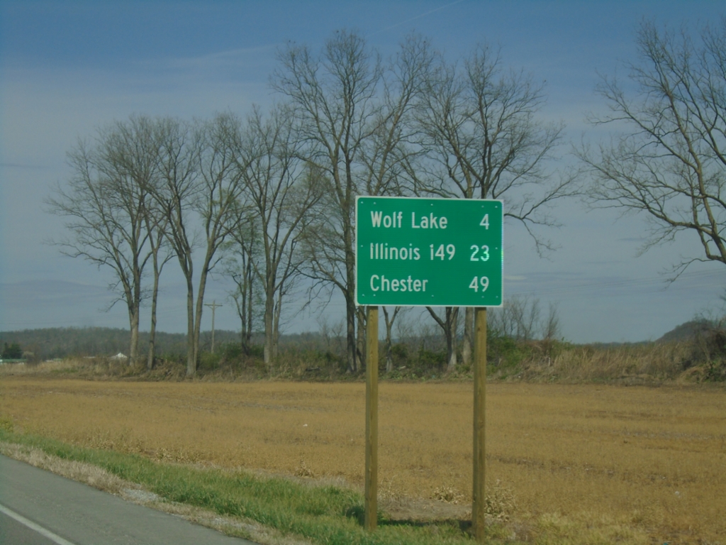
IL-3 North - Distance Marker
Distance marker on IL-3 North. Distance to Wolf Lake, Illinois 149, and Chester.
Taken 03-29-2026
 Ware
Union County
Illinois
United States
Ware
Union County
Illinois
United States