Signs Tagged With Big Green Sign
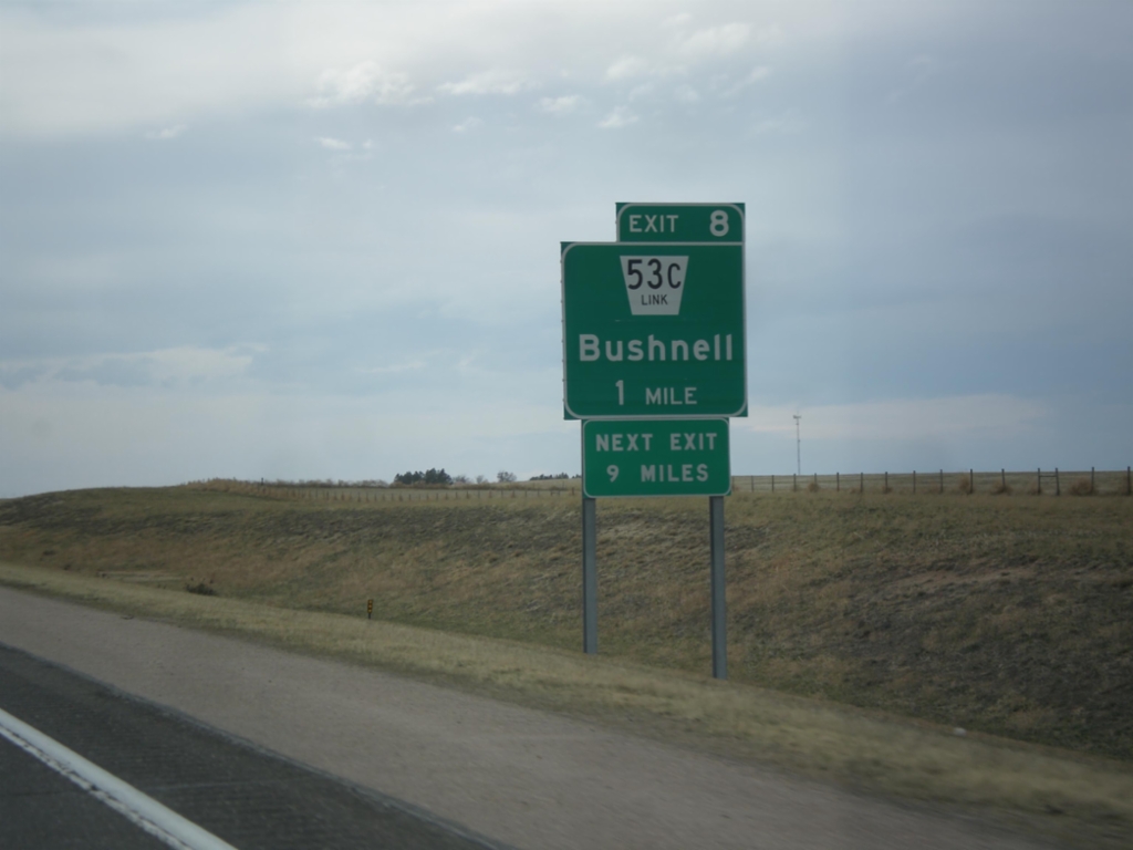
I-80 West - Exit 8
I-80 west approaching Exit 8 - NE-53C Link/Bushnell. Next exit along I-80 west is 9 miles, at Pine Bluffs.
Taken 03-30-2014

 Bushnell
Kimball County
Nebraska
United States
Bushnell
Kimball County
Nebraska
United States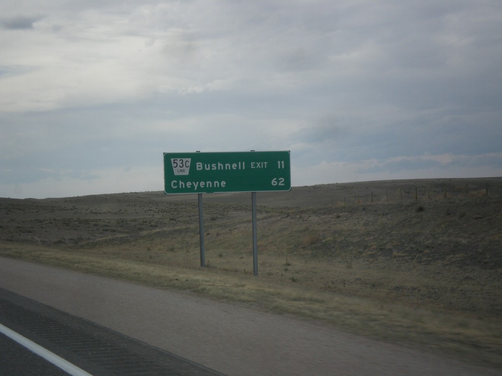
I-80 West - Distance Marker
Distance marker on I-80 west. Distance to NE-53C Link/Bushell Exit and Cheyenne (Wyoming).
Taken 03-30-2014
Kimball
Kimball County
Nebraska
United States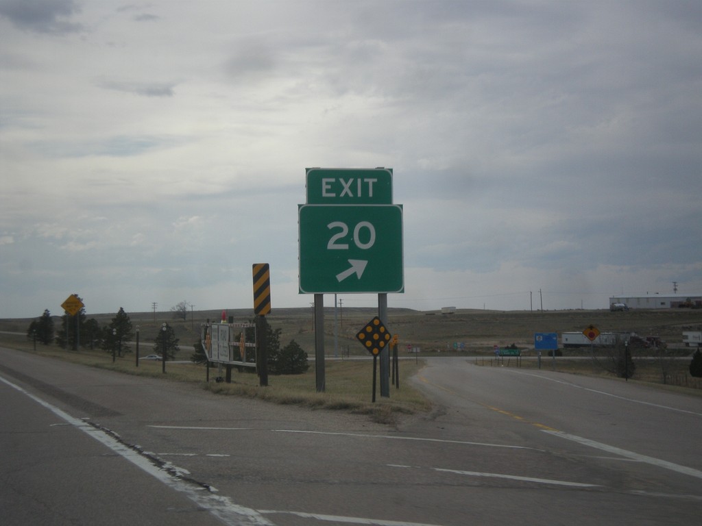
I-80 West - Exit 20 Gore
Exit 20 gore on I-80 west. This is a standard Nebraska exit gore sign.
Taken 03-30-2014
 Kimball
 County
Nebraska
United States
Kimball
Kimball County
Nebraska
United States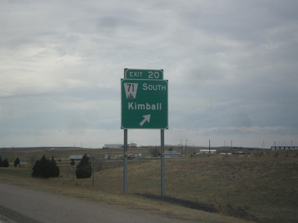
I-80 West - Exit 20
I-80 west at Exit 20 - NE-71 South/Kimball. NE-71 leaves I-80 westbound here.
Taken 03-30-2014
Kimball
Kimball County
Nebraska
United States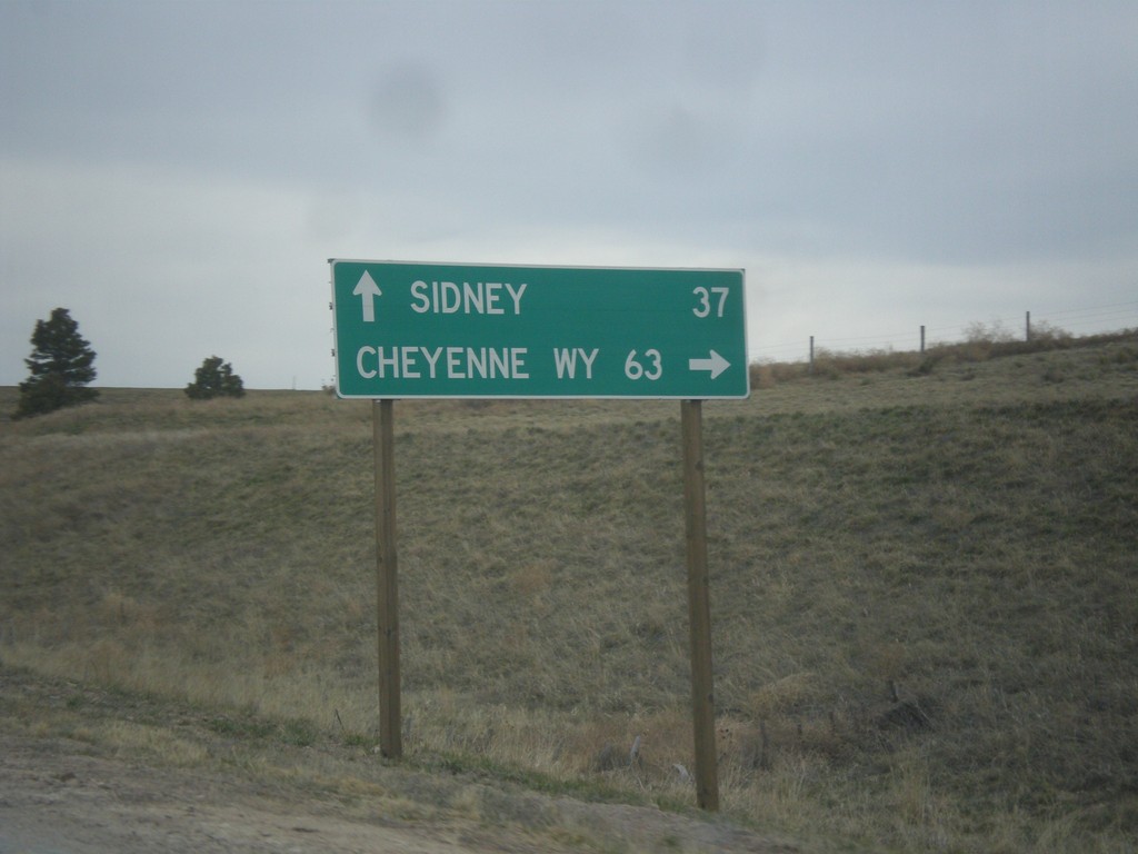
NE-71 South at I-80
NE-71 south at I-80. Use I-80 West/NE-71 South for Cheyenne, WY; I-80 East for Sidney.
Taken 03-30-2014
Kimball
Kimball County
Nebraska
United States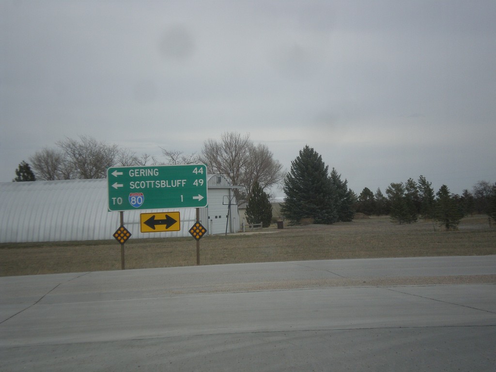
End NE-53E Link at NE-71
End NE-53E Link at NE-71. Use NE-71 north for Gering and Scottsbluff. Use NE-71 south for I-80.
Taken 03-30-2014
 Kimball
 County
Nebraska
United States
Kimball
Kimball County
Nebraska
United States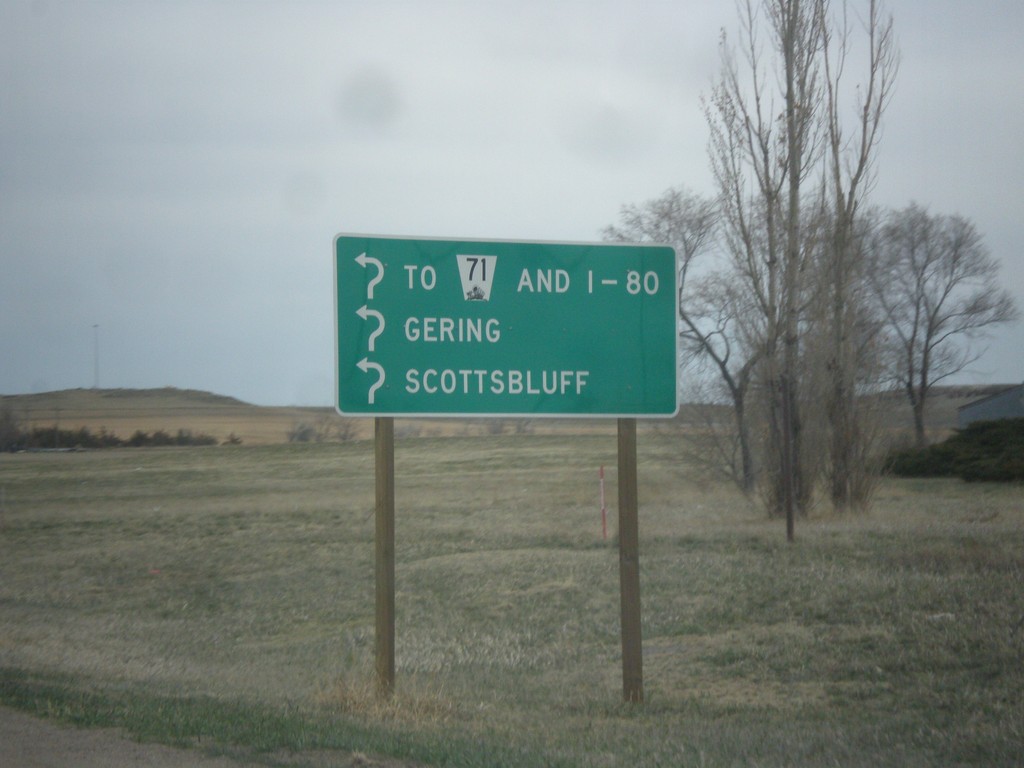
NE-53E Link - Roundabout
Roundabout on NE-53E Link. Enter roundabout for To NE-71 and I-80, Gering, and Scottsbluff. The roundabout only connects two segments of NE-53E Link. Notice the usage of the word I-80 instead of a shield.
Taken 03-30-2014
Kimball
Kimball County
Nebraska
United States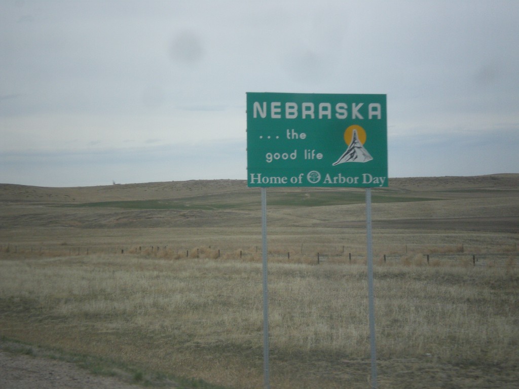
NE-71 North - Nebraska
Nebraska…The Good Life on NE-71 North. Taken at the Colorado-Nebraska stateline.
Taken 03-30-2014
Kimball
Kimball County
Nebraska
United States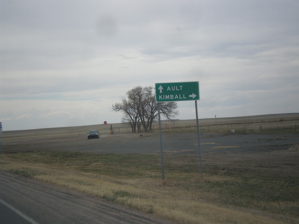
CO-14 West/CO-71 North at CO-71 North
CO-14 West/CO-71 North at CO-71 North. Turn right on CO-71 north for Kimball (Nebraska). Continue west on CO-14 for Ault.
Taken 03-30-2014

 Raymer
Weld County
Colorado
United States
Raymer
Weld County
Colorado
United States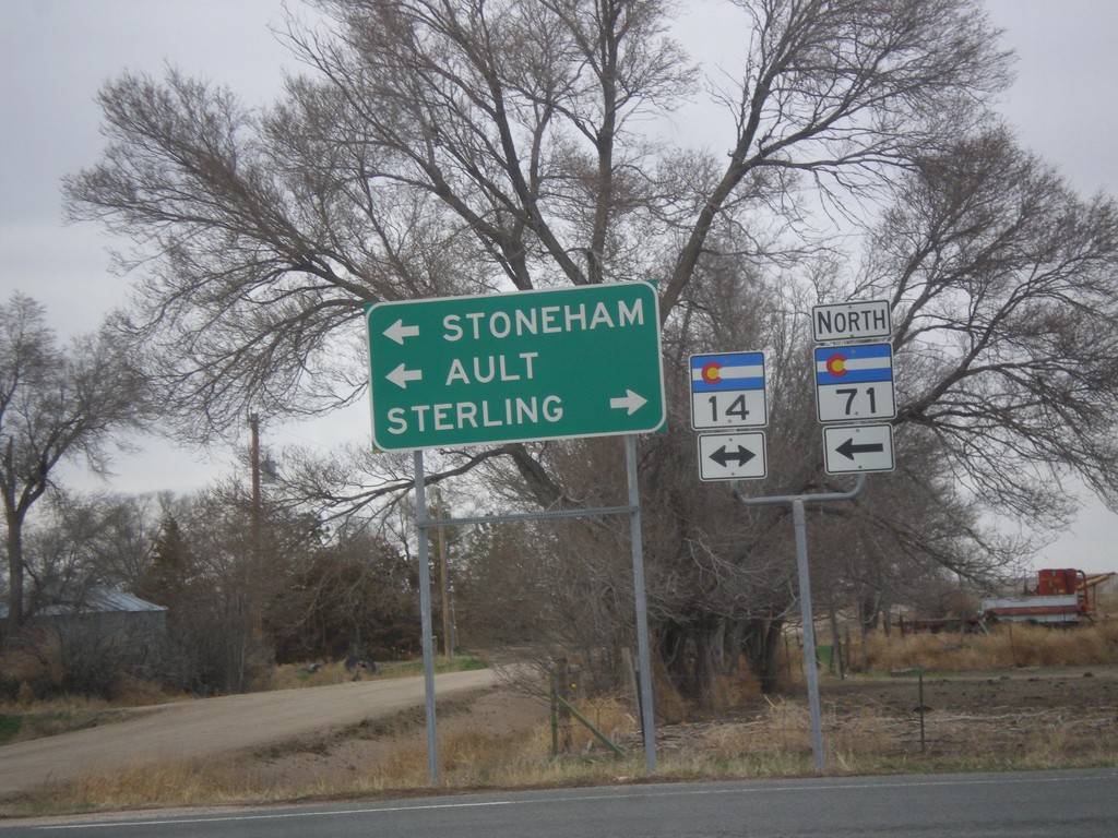
CO-71 North at CO-14
CO-71 north at CO-14. Use CO-14 east for Sterling; CO-14 west/CO-71 north for Stoneham and Ault. CO-71 north joins CO-14 to Stoneham.
Taken 03-30-2014
Stoneham
Weld County
Colorado
United States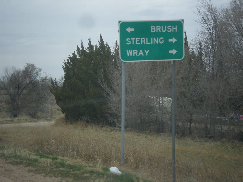
CO-71 North Approaching US-34
CO-71 north approaching US-34. Turn right for US-34 to Sterling and Wray; left for US-34 West/CO-71 North to Brush. CO-71 joins US-34 west through Brush.
Taken 03-30-2014
 Brush
Morgan County
Colorado
United States
Brush
Morgan County
Colorado
United States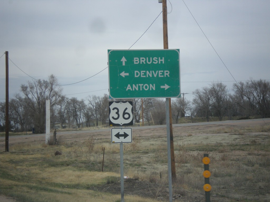
CO-71 North Approaching US-36
CO-71 north approaching US-36. Turn left for US-36 west to Denver; right on US-36 east to Anton. Continue north on CO-71 for Brush.
Taken 03-30-2014
 Woodrow
Washington County
Colorado
United States
Woodrow
Washington County
Colorado
United States
I-70 East - Exit 361
I-70 east at Exit 361 - To CO-71/Limon.
Taken 03-30-2014
 Limon
Lincoln County
Colorado
United States
Limon
Lincoln County
Colorado
United States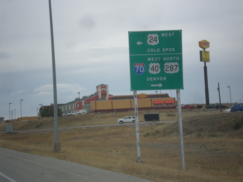
BL-70/US-24/US-40 West/US-287 North at US-24 West
BL-70/US-24/US-40 West/US-287 North at US-24 West in Limon. Turn left to continue west on US-24 to Colorado Springs. Turn right for BL-70/US-40 West/US-287 North to Denver and I-70.
Taken 03-30-2014


 Limon
Lincoln County
Colorado
United States
Limon
Lincoln County
Colorado
United States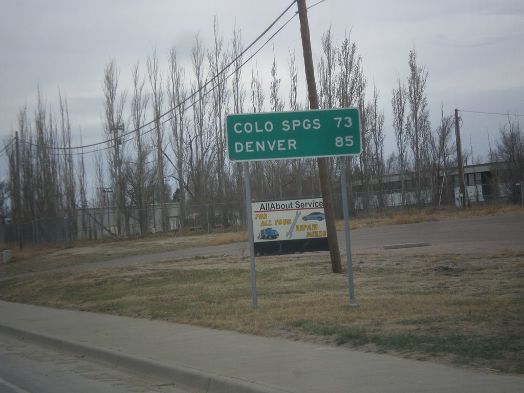
BL-70/US-24/US-40 West/US-287 North - Distance Marker
Distance marker on BL-70/US-24/US-40 West/US-287 North. Distance to Colorado Springs (via US-24) and Denver (via I-70).
Taken 03-30-2014
Limon
Lincoln County
Colorado
United States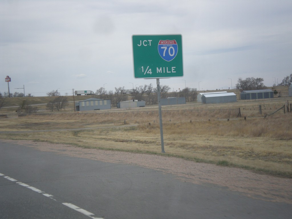
BL-70/US-24/US-40 West/US-287 North Approaching I-70
BL-70/US-24/US-40 West/US-287 North approaching I-70 (Exit 361).
Taken 03-30-2014
Limon
Lincoln County
Colorado
United States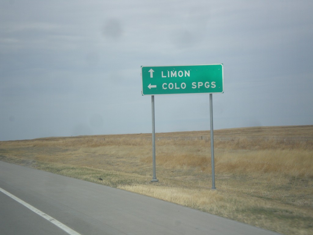
US-40 West/US-287 North at CO-94
US-40 West/US-287 North at CO-94. Turn left on CO-94 west to Colorado Springs; continue on US-40/US-287 for Limon.
Taken 03-30-2014
 Hugo
Cheyenne County
Colorado
United States
Hugo
Cheyenne County
Colorado
United States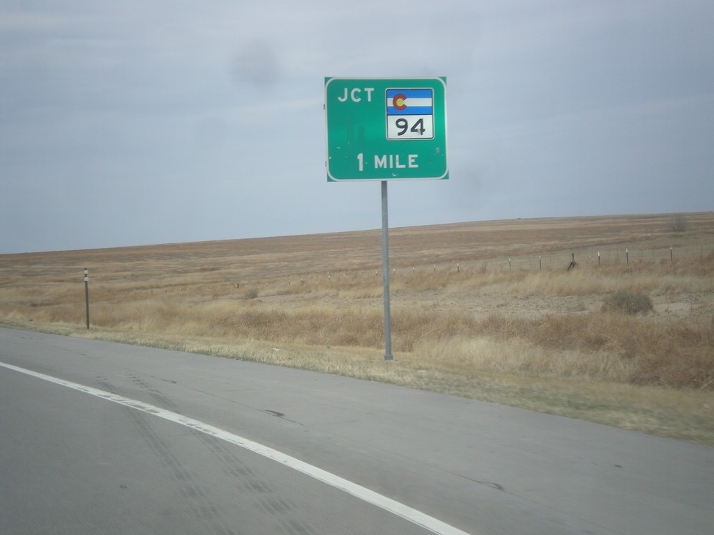
US-40 West/US-287 North Approaching CO-94
US-40 West/US-287 North approaching CO-94 in Cheyenne County.
Taken 03-30-2014
Hugo
Cheyenne County
Colorado
United States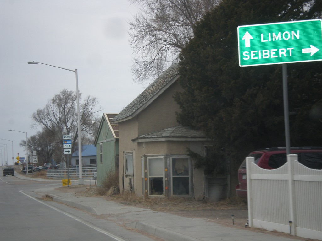
US-40 East/US-287 North - CO-59
US-40 East/US-287 North approaching CO-59. Turn north on CO-59 for Seibert. Continue on US-40 East/US-287 North for Limon.
Taken 03-30-2014
 Kit Carson
Cheyenne County
Colorado
United States
Kit Carson
Cheyenne County
Colorado
United States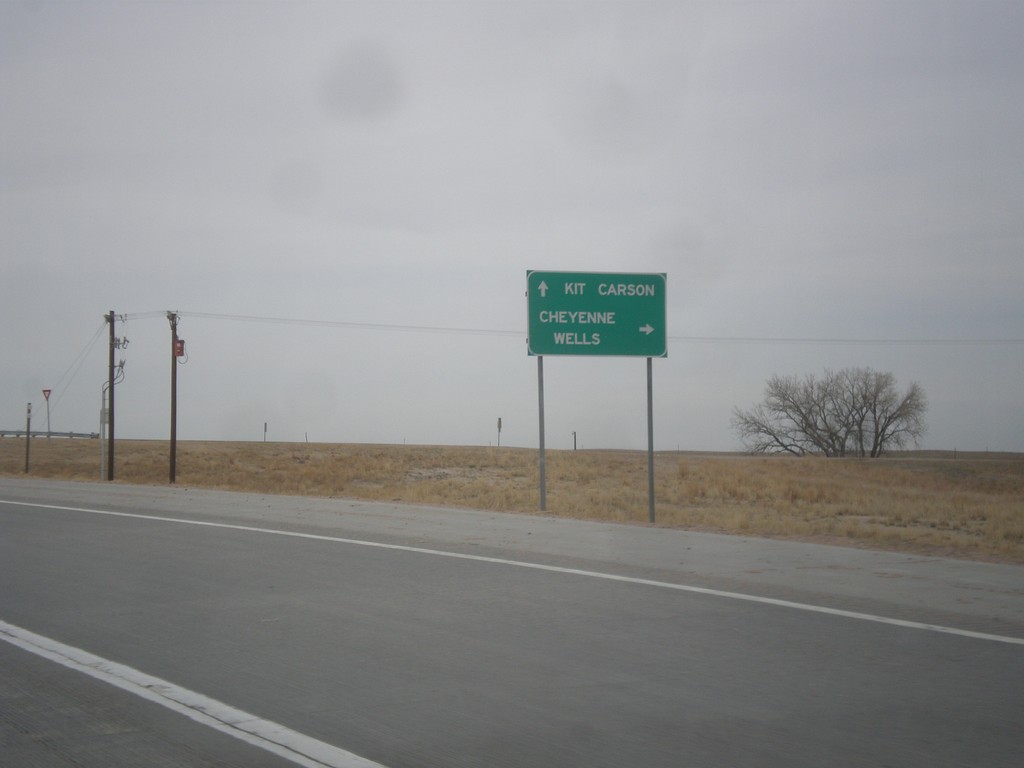
US-287 North Approaching US-40
US-287 north approaching US-40. Use US-40 east for Cheyenne Wells; use US-40 west/US-287 north for Kit Carson.
Taken 03-30-2014
Kit Carson
Cheyenne County
Colorado
United States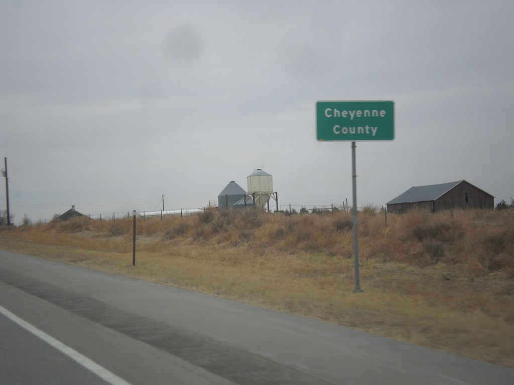
US-287 North - Cheyenne County
Cheyenne County on US-287 north.
Taken 03-30-2014
Kit Carson
Cheyenne County
Colorado
United States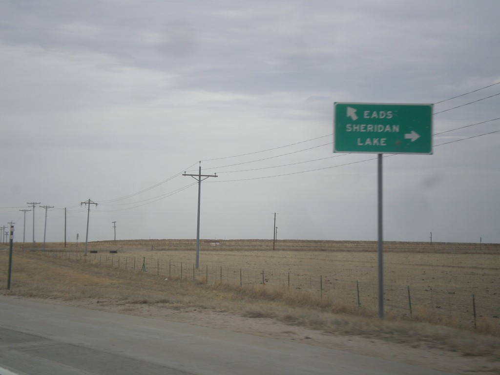
US-287 North at CO-96
US-287 north at CO-96. Use CO-96 east to Sheridan Lake. Use US-287 North/CO-96 West to Eads. CO-96 joins US-287 into Eads.
Taken 03-30-2014
 Eads
Kiowa County
Colorado
United States
Eads
Kiowa County
Colorado
United States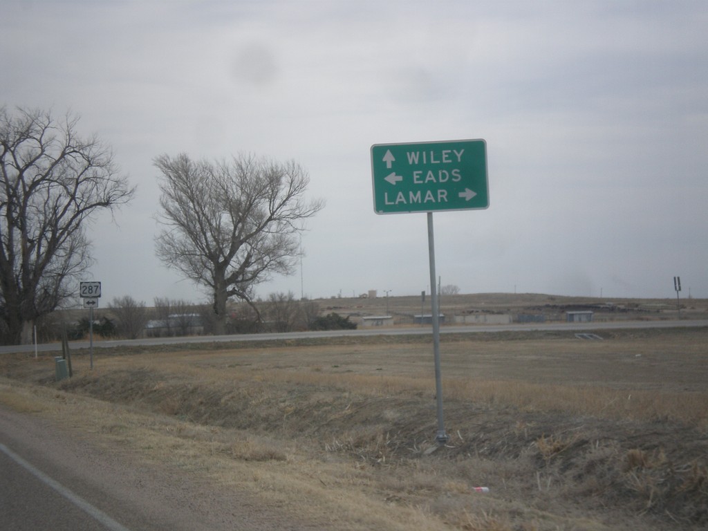
CO-196 East at US-287
CO-196 east at US-287. Turn right for US-287 south to Lamar; left for US-287 north to Eads. Continue on CO-196 east to Wiley.
Taken 03-30-2014
 Wiley
Prowers County
Colorado
United States
Wiley
Prowers County
Colorado
United States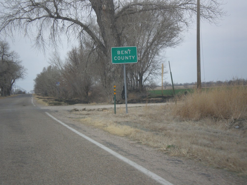
CO-196 West - Bent County
Entering Bent County on CO-196 west.
Taken 03-30-2014
Wiley
Bent County
Colorado
United States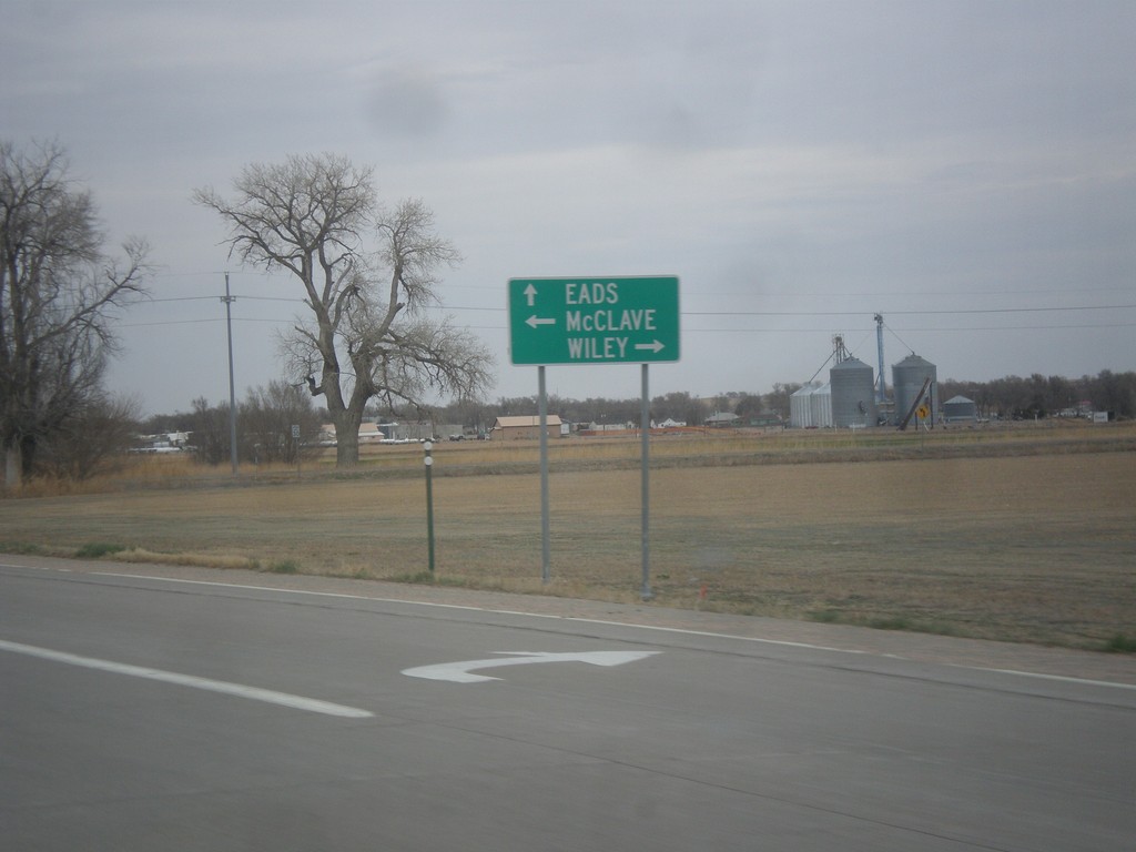
US-287 North at CO-196
US-287 north at CO-196. Turn right on Wiley; turn left for McClave. Continue on US-287 North to Eads.
Taken 03-30-2014
Wiley
Prowers County
Colorado
United States