Signs Tagged With Big Green Sign
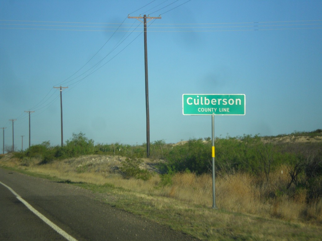
RM-652 West - Culberson County
Culberson County Line on RM-652 west.
Taken 04-15-2013
 Angeles
Reeves County
Texas
United States
Angeles
Reeves County
Texas
United States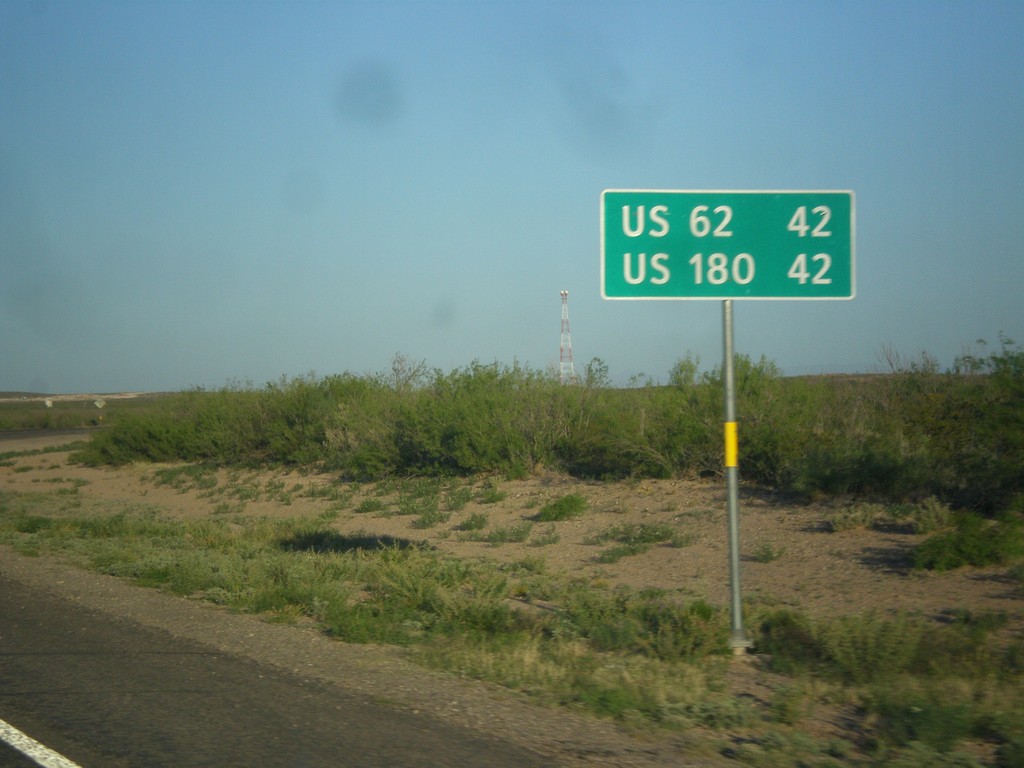
RM-652 West - Distance Marker
Distance marker on RM-652 west to US-62 and US-180.
Taken 04-15-2013
Orla
Reeves County
Texas
United States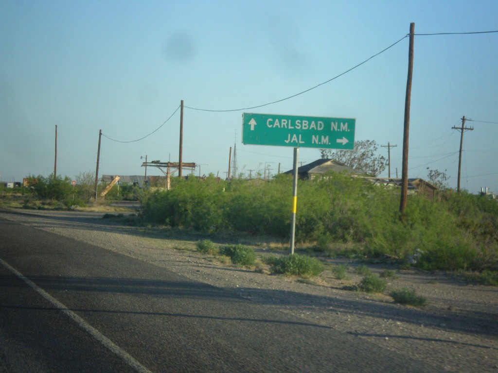
US-285 North at RM-652
US-285 north at RM-652. Turn right for Jal, NM; continue north on US-285 for Carlsbad, NM. Turning left takes you to Guadalupe Mountains National Park.
Taken 04-15-2013
 Orla
Reeves County
Texas
United States
Orla
Reeves County
Texas
United States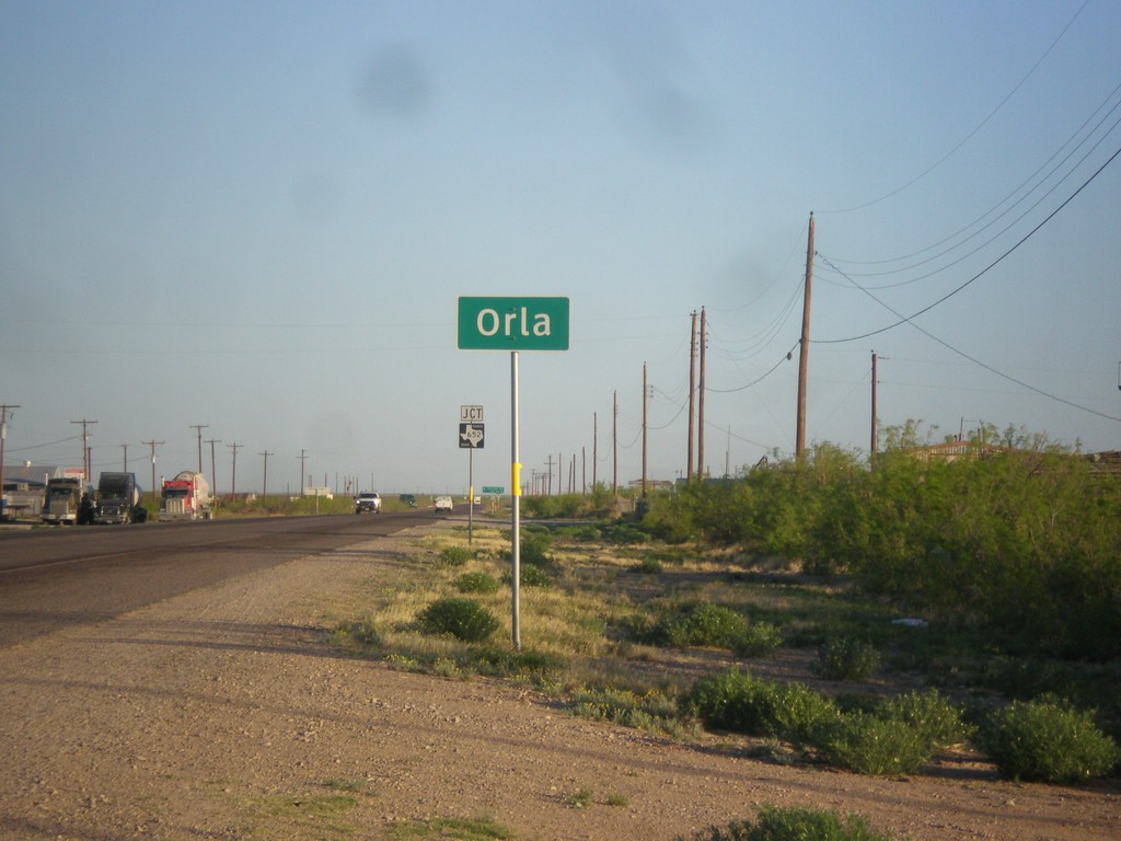
US-285 North - Entering Orla
Entering Orla on US-285 north.
Taken 04-15-2013
Orla
Reeves County
Texas
United States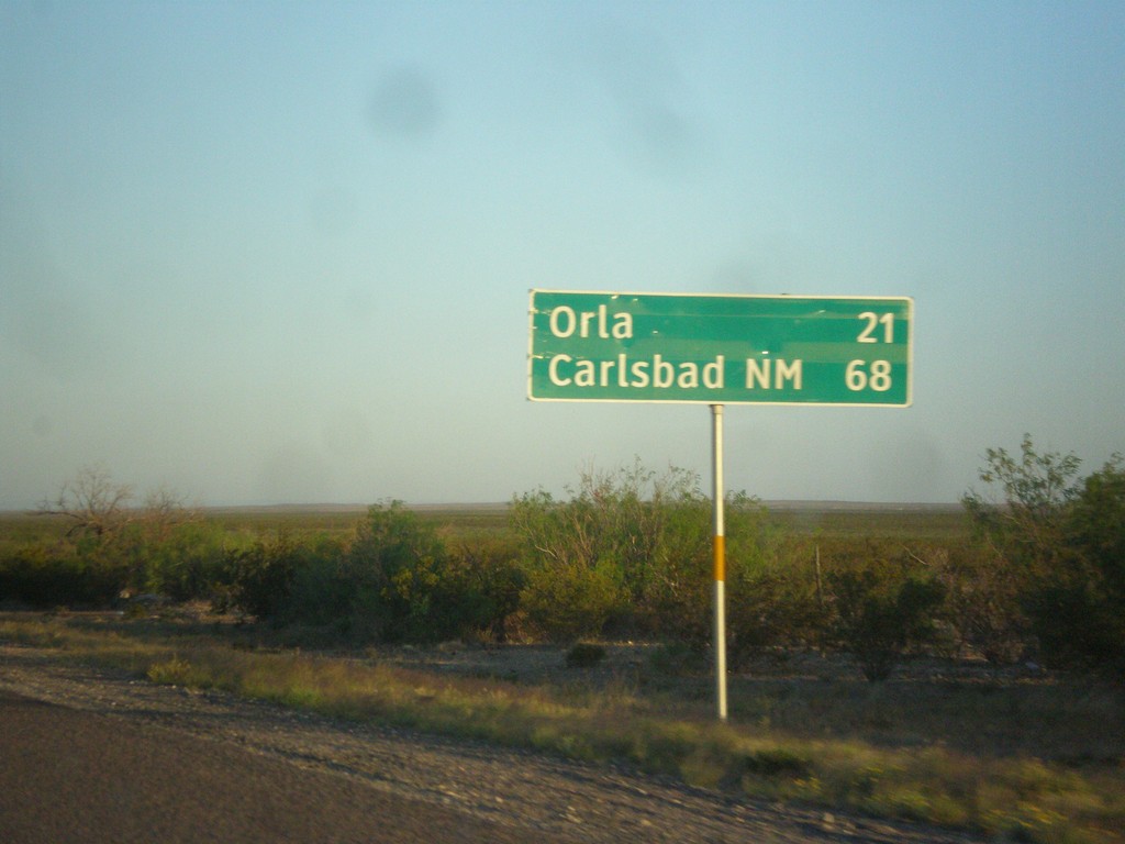
US-285 North - Distance Marker
Distance marker on US-285 north. Distance to Orla, and Carlsbad, NM.
Taken 04-15-2013
Mentone
Loving County
Texas
United States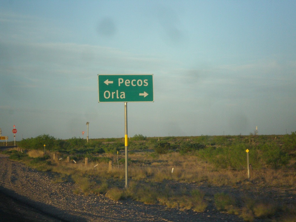
End TX-302 West at US-285
End TX-302 west at US-285. Turn right for US-285 north to Orla; turn left for US-285 south to Pecos.
Taken 04-15-2013
 Pecos
Reeves County
Texas
United States
Pecos
Reeves County
Texas
United States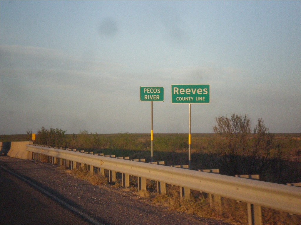
TX-302 West - Reeves County Line
Reeves County Line on TX-302 west, crossing the Pecos River (dry when this photo was taken).
Taken 04-15-2013
Mentone
Loving County
Texas
United States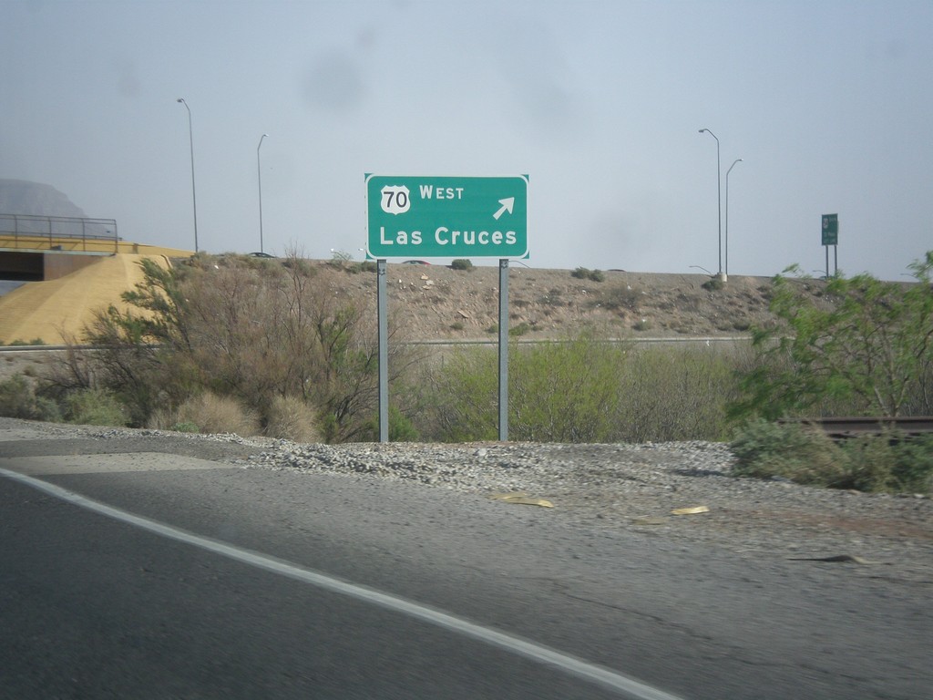
US-70 West/US-54 South at US-70 West
US-54 South/US-70 West (Relief Route) at US-70 West exit to Las Cruces.
Taken 04-15-2013

 Alamogordo
Otero County
New Mexico
United States
Alamogordo
Otero County
New Mexico
United States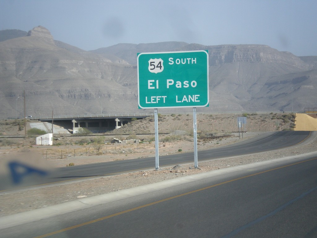
US-54 South/US-70 West - US-70/US-54 Split
US-70/US-54 Split on US-70 West/US-54 South (Alamogordo Relief Route). Use left lanes for US-54 south to El Paso.
Taken 04-15-2013
Alamogordo
Otero County
New Mexico
United States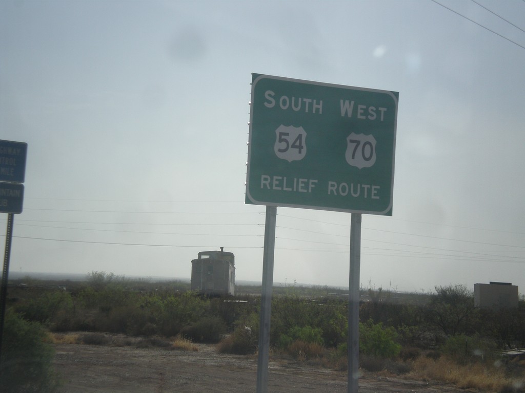
US-70 West/US-54 South - Relief Route
US-70 West/US-54 South - Alamogordo Relief Route.
Taken 04-15-2013
Alamogordo
Otero County
New Mexico
United States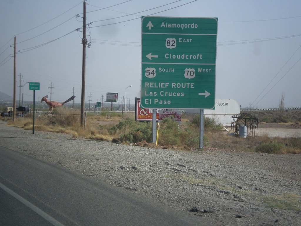
US-54 South/US-70 West at US-82 and Relief Route
US-54 South/US-70 West at US-82 and Alamogordo Relief Route. Turn left for US-82 east to Cloudcroft. Turn right to continue on US-54 South/US-70 West to Las Cruces and El Paso (Alamogordo Relief Route). Continue straight for White Sands Blvd. and downtown Alamogordo. This is the western end of US-82.
Taken 04-15-2013
 Alamogordo
Otero County
New Mexico
United States
Alamogordo
Otero County
New Mexico
United States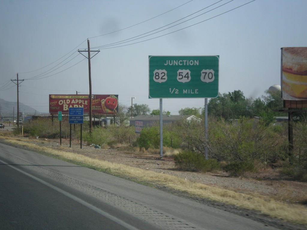
US-54 South/US-70 West Approaching US-82
US-54 South/US-70 West approaching US-82 and Alamogordo Relief Route junction.
Taken 04-15-2013
Alamogordo
Otero County
New Mexico
United States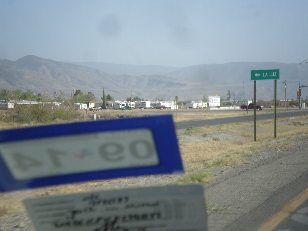
US-54 South/US-70 West - NM-545 Jct.
US-54 South/US-70 West at NM-545 to La Luz.
Taken 04-15-2013
Alamogordo
Otero County
New Mexico
United States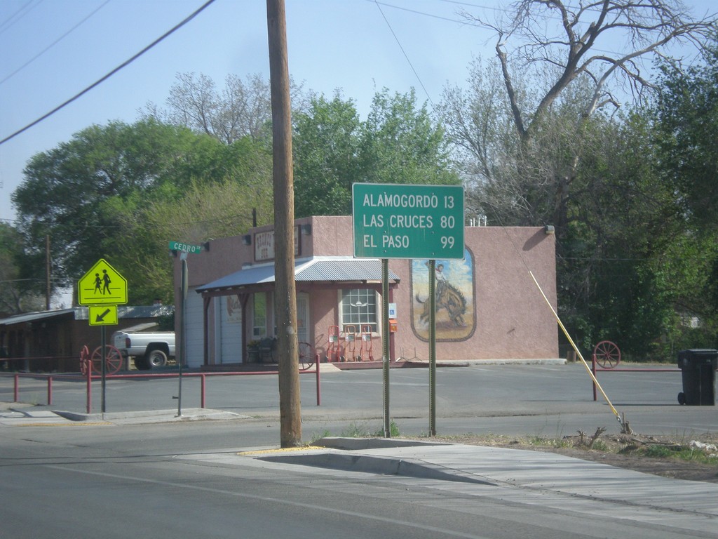
US-70 West/US-54 South - Distance Marker
Distance marker on US-70 West/US-54 South in Tularosa. Distance to Alamogordo, Las Cruces, and El Paso.
Taken 04-15-2013
Tularosa
Otero County
New Mexico
United States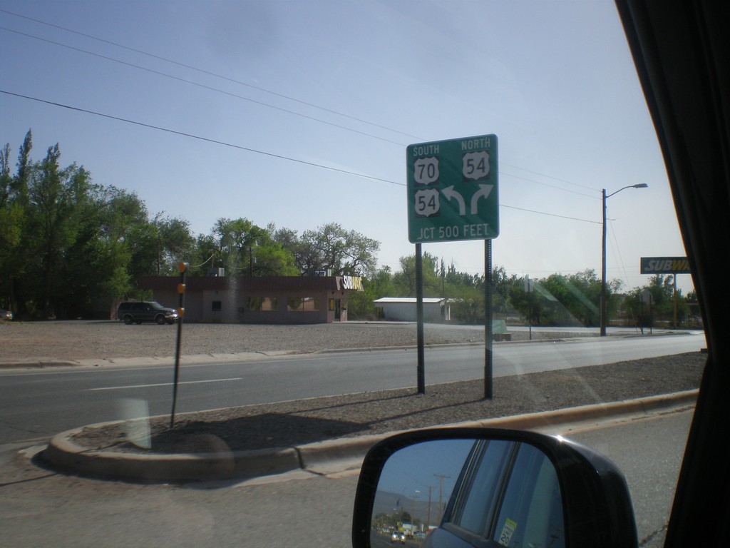
US-70 West Approaching US-54
US-70 west approaching US-54 in Tularosa. US-70 joins US-54 south to Alamogordo.
Taken 04-15-2013
Tularosa
Otero County
New Mexico
United States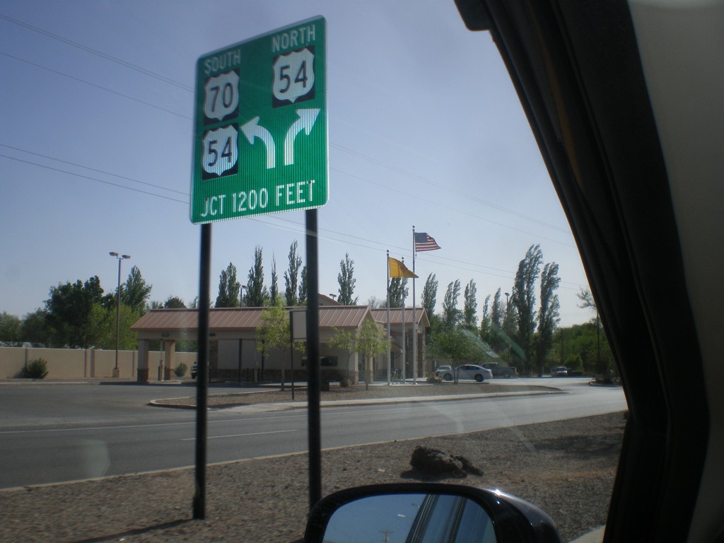
US-70 West Approaching US-54
US-70 west approaching US-54 junction in Tularosa. Merge to continue on US-54/US-70; merge right for US-54 north.
Taken 04-15-2013
Tularosa
Otero County
New Mexico
United States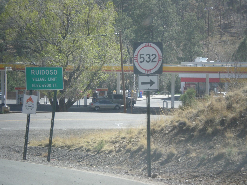
NM-48 South at NM-532
NM-48 south at NM-532. Entering the village of Ruidoso - Elevation 6,900 Feet.
Taken 04-15-2013

 Alto
Lincoln County
New Mexico
United States
Alto
Lincoln County
New Mexico
United States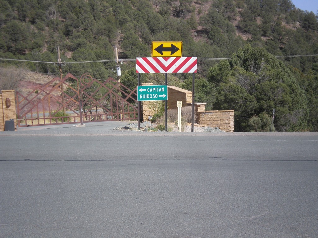
End NM-37 At NM-48
End NM-37 at NM-48. Turn right for NM-48 south to Ruidoso; turn left for NM-48 north to Capitan.
Taken 04-15-2013
 Alto
Lincoln County
New Mexico
United States
Alto
Lincoln County
New Mexico
United States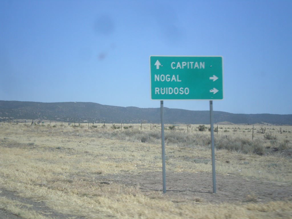
US-380 East at NM-37
US-380 east at NM-37. Use NM-37 south for Nogal and Ruidoso. Continue east on US-380 for Capitan.
Taken 04-15-2013
 Carrizozo
Lincoln County
New Mexico
United States
Carrizozo
Lincoln County
New Mexico
United States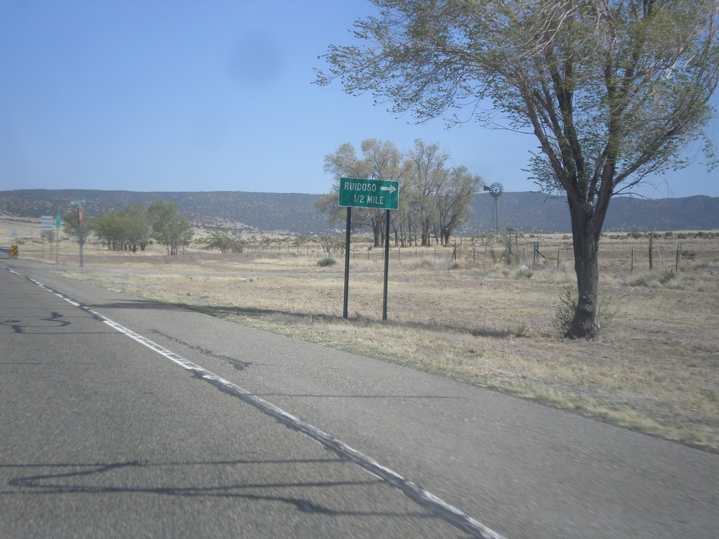
US-380 East Approaching NM-37
US-380 east approaching NM-37 south to Ruidoso.
Taken 04-15-2013
Carrizozo
Lincoln County
New Mexico
United States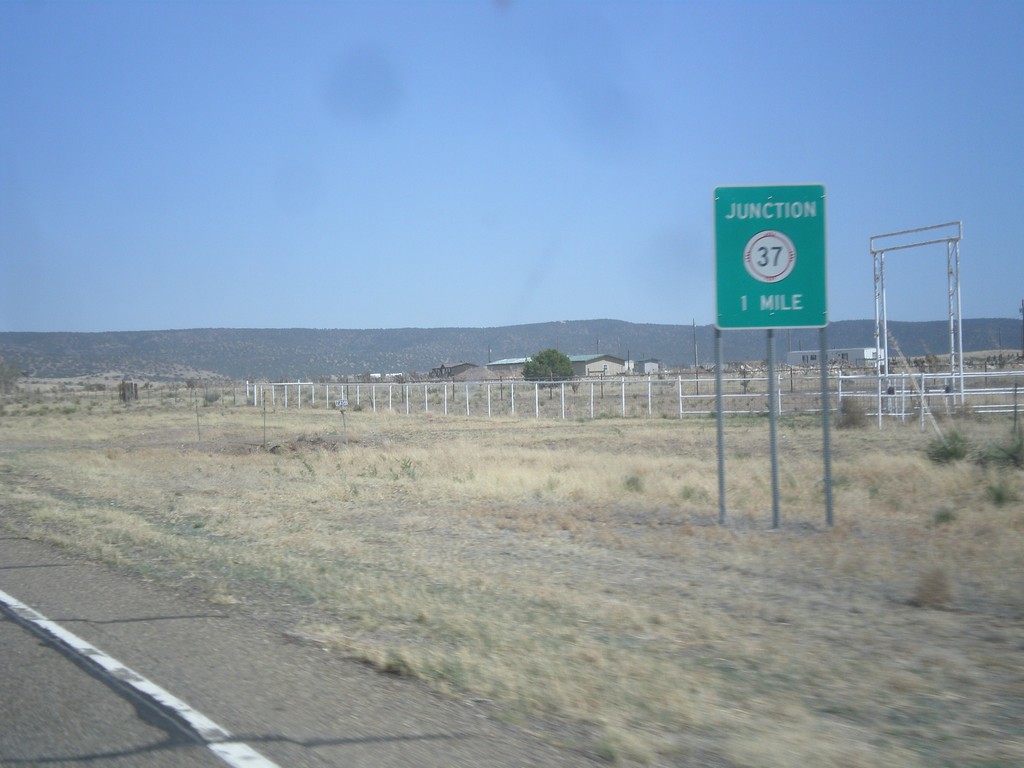
US-380 East Approaching NM-37
US-380 east approaching NM-37.
Taken 04-15-2013
Carrizozo
Lincoln County
New Mexico
United States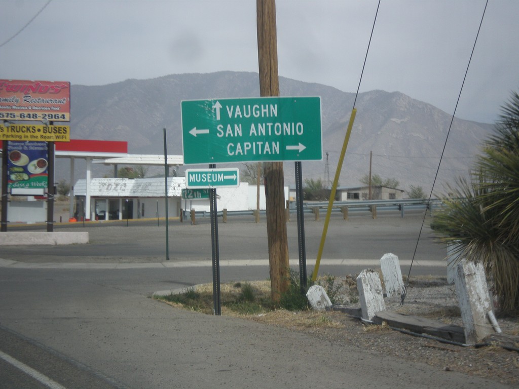
US-54 North at US-380
US-54 north at US-380. Turn right for US-380 east to Capitan; left for US-380 west to San Antonio. Continue north for US-54 to Vaughn.
Taken 04-15-2013
Carrizozo
Lincoln County
New Mexico
United States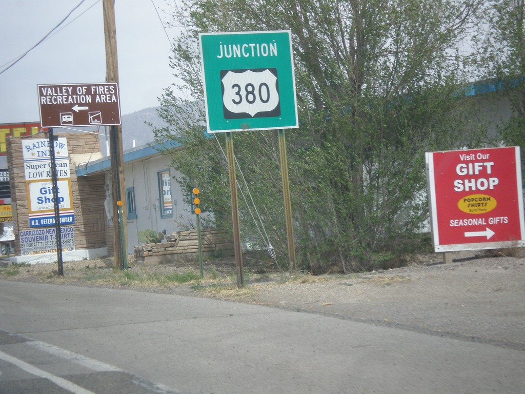
US-54 North Approaching US-380
US-54 north approaching US-380 in Carrizozo. Turn left for Valley of Fires State Recreation Area.
Taken 04-15-2013
Carrizozo
Lincoln County
New Mexico
United States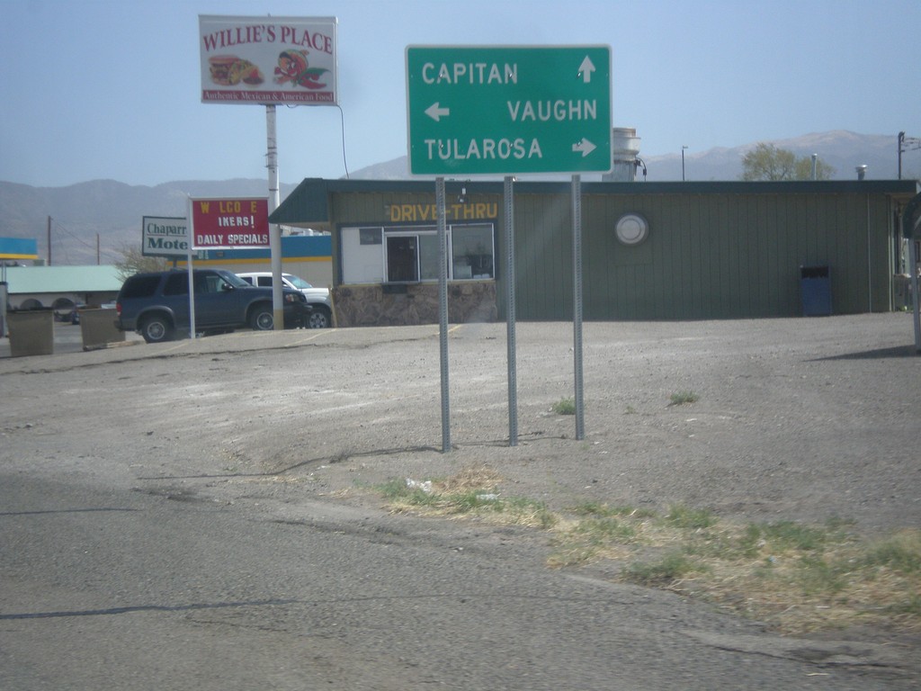
US-380 East at US-54
US-380 east at US-54. Turn right on US-54 south to Tularosa; turn left on US-54 north to Vaughn. Continue straight on US-380 east for Capitan.
Taken 04-15-2013
Carrizozo
Lincoln County
New Mexico
United States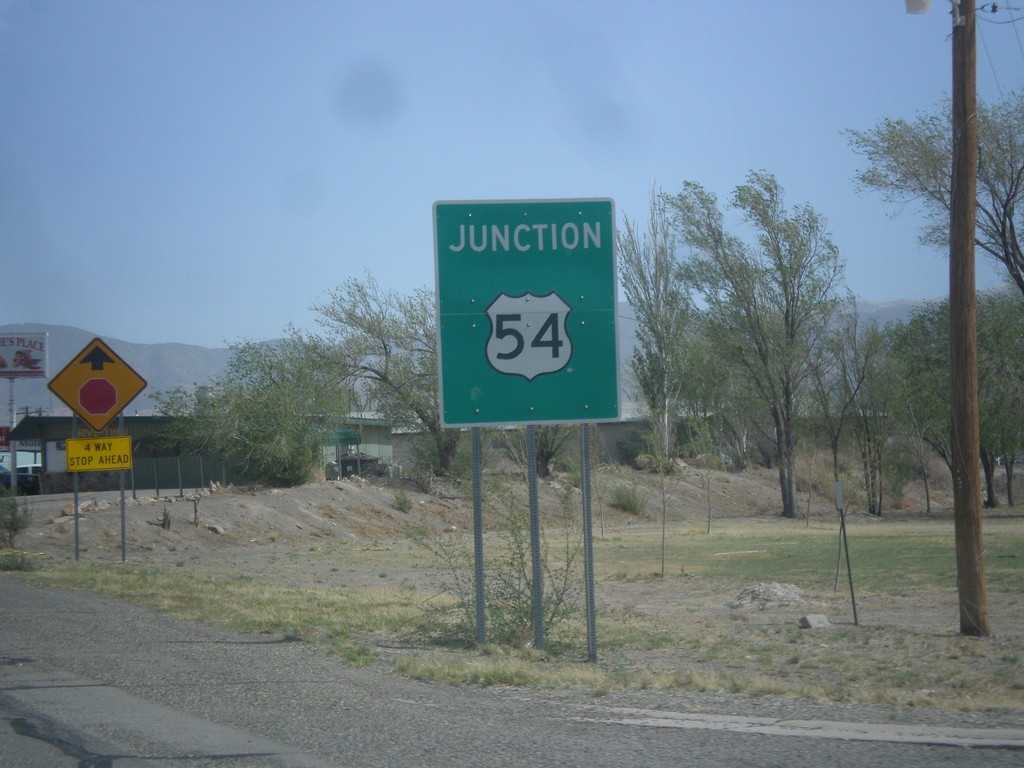
US-380 East Approaching US-54
US-380 east approaching US-54 in Carrizozo.
Taken 04-15-2013
Carrizozo
Lincoln County
New Mexico
United States