Signs Tagged With Big Green Sign
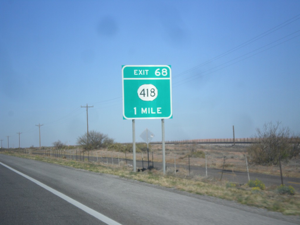
I-10 West - Exit 68
I-10 west approaching Exit 68 - NM-418.
Taken 04-14-2013

 Deming
Luna County
New Mexico
United States
Deming
Luna County
New Mexico
United States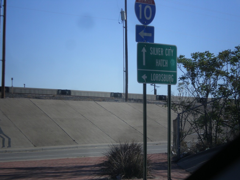
US-180 West/NM-26 East at I-10
US-180 West/NM-26 East at I-10 west. Turn left for I-10 west to Lordsburg. Continue straight for US-180 West/NM-26 East for Silver City and Hatch.
Taken 04-14-2013

 Deming
Luna County
New Mexico
United States
Deming
Luna County
New Mexico
United States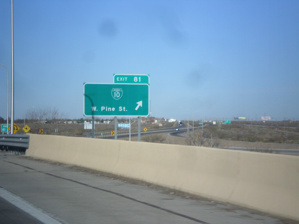
I-10 West - Exit 81
I-10 west at Exit 81 - BL-10/W. Pine St. This is the western end of the Deming business loop.
Taken 04-14-2013
 Deming
Luna County
New Mexico
United States
Deming
Luna County
New Mexico
United States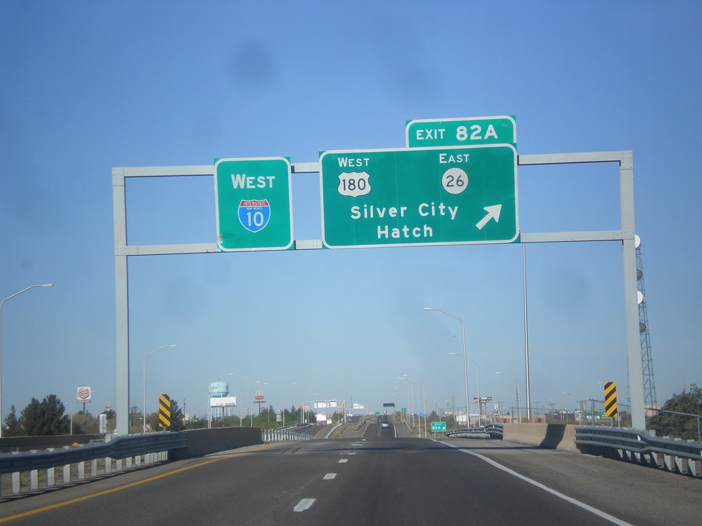
I-10 West - Exit 82A
I-10 west at Exit 82A - US-180 West/NM-26 East/Silver City/Hatch.
Taken 04-14-2013
Deming
Luna County
New Mexico
United States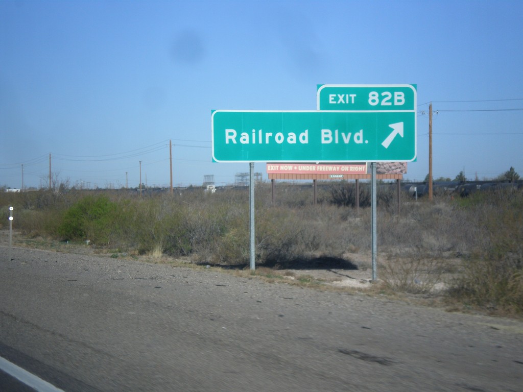
I-10 West - Exit 82B
I-10 west at Exit 82B - Railroad Blvd.
Taken 04-14-2013
Deming
Luna County
New Mexico
United States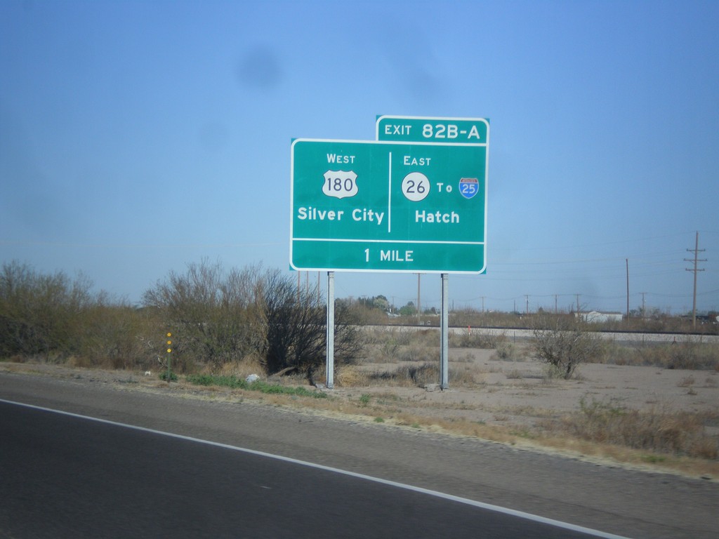
I-10 West Approaching Exits 82A and 82B
I-10 approaching Exits 82A and 82B. Exits 82AB - US-180 West/Silver City/NM-26 East/To I-25/Hatch.
Taken 04-14-2013
 Deming
Luna County
New Mexico
United States
Deming
Luna County
New Mexico
United States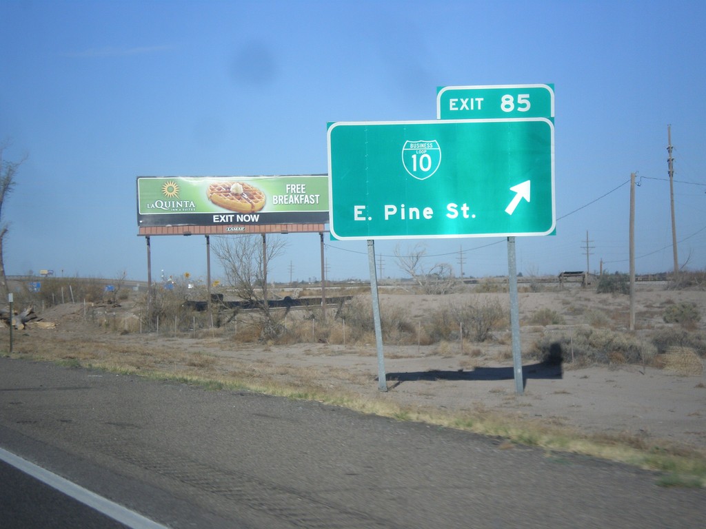
I-10 West - Exit 25
I-10 west at Exit 25 - BL-10/East Pine St. This is the east end of the Deming business loop.
Taken 04-14-2013
Deming
Luna County
New Mexico
United States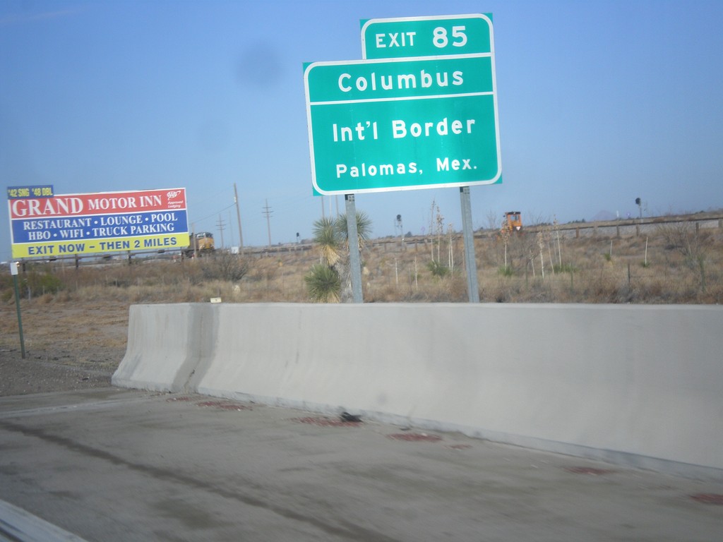
I-10 West Approaching Exit 85
I-10 west approaching Exit 85. Use Exit 85 for Columbus/International Border/Palomas, Mexico.
Taken 04-14-2013
Deming
Luna County
New Mexico
United States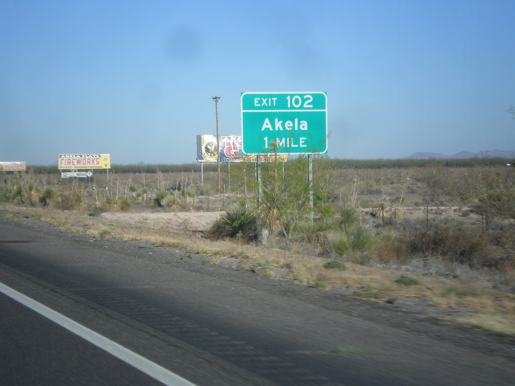
I-10 West - Exit 102
I-10 approaching Exit 102 - Akela.
Taken 04-14-2013
Deming
Luna County
New Mexico
United States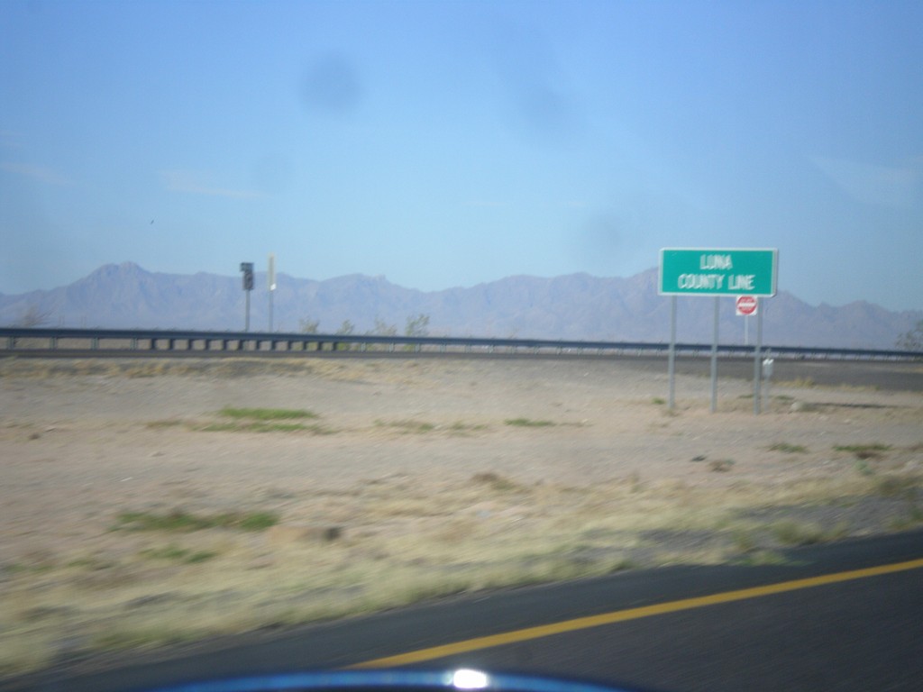
I-10 West - Luna County Line
Luna County Line on I-10 west.
Taken 04-14-2013
Las Cruces
Doña Ana County
New Mexico
United States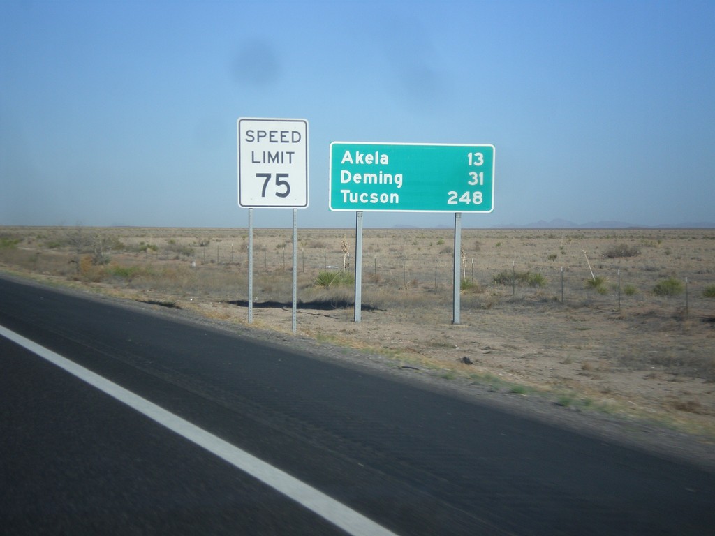
I-10 West - Distance Marker
Distance marker on I-10 west. Distance to Akela, Deming, and Tucson (Arizona).
Taken 04-14-2013
Las Cruces
Doña Ana County
New Mexico
United States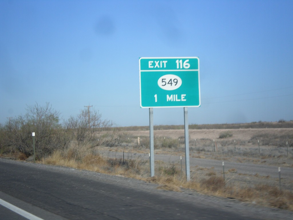
I-10 West - Exit 116
I-10 west approaching Exit 116 - NM-549.
Taken 04-14-2013
 Las Cruces
Doña Ana County
New Mexico
United States
Las Cruces
Doña Ana County
New Mexico
United States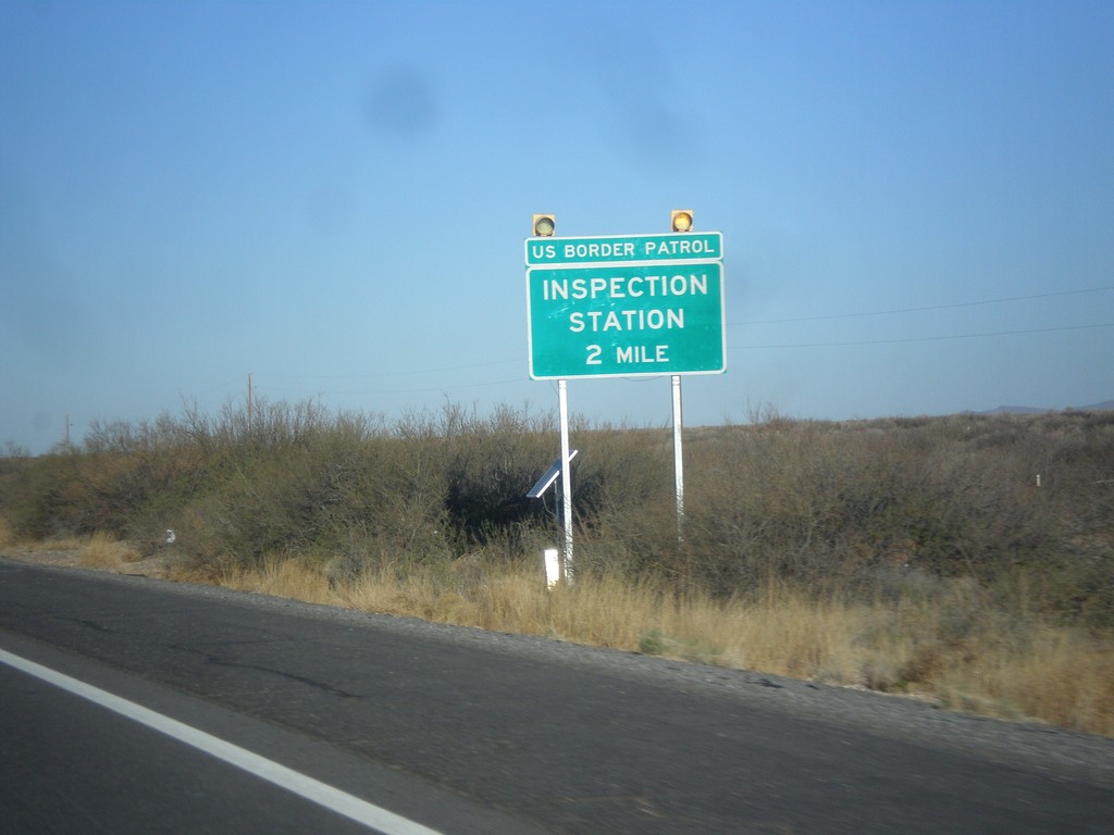
I-10 West - Inspection Station
I-10 west approaching US Border Patrol Inspection Station. I-10 has a US Border Patrol Inspection Station on both sides of the El Paso area.
Taken 04-14-2013
Las Cruces
Doña Ana County
New Mexico
United States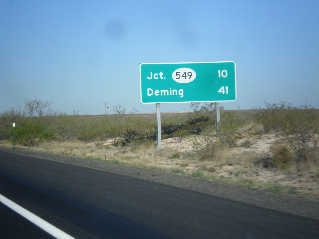
I-10 West - Distance Marker
Distance marker on I-10 west. Distance to NM-549 and Deming.
Taken 04-14-2013
Las Cruces
Doña Ana County
New Mexico
United States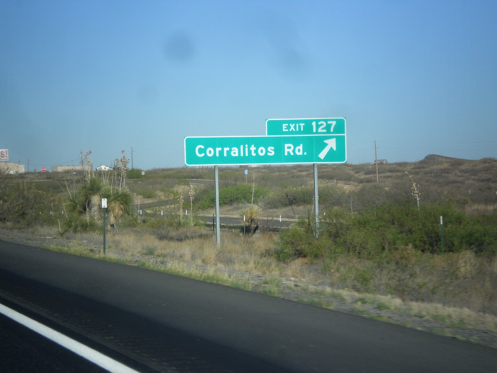
I-10 West - Exit 127
I-10 west at Exit 127 - Corralitos Road.
Taken 04-14-2013
Las Cruces
Doña Ana County
New Mexico
United States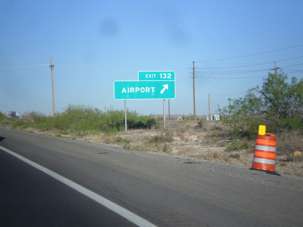
I-10 West - Exit 132
I-10 west at Exit 132 - Airport. Use Exit 132 for the Las Cruces Airport.
Taken 04-14-2013
Las Cruces
Doña Ana County
New Mexico
United States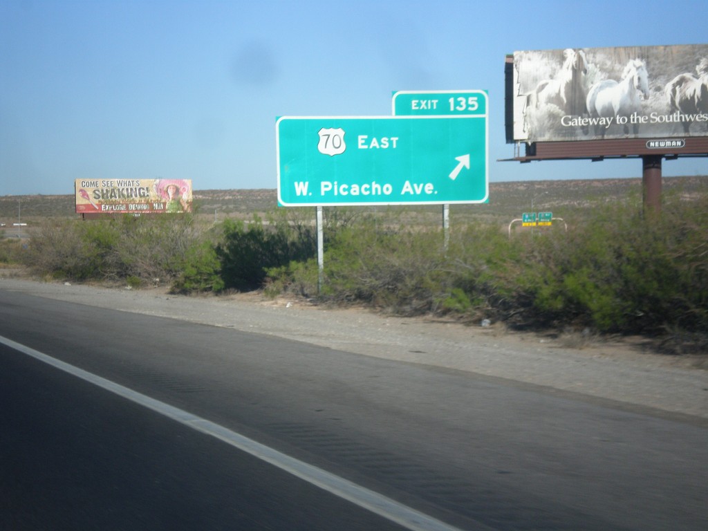
I-10 West - Exit 135
I-10 west at Exit 135 - US-70 East/W. Picacho Ave.
Taken 04-14-2013
 Las Cruces
Doña Ana County
New Mexico
United States
Las Cruces
Doña Ana County
New Mexico
United States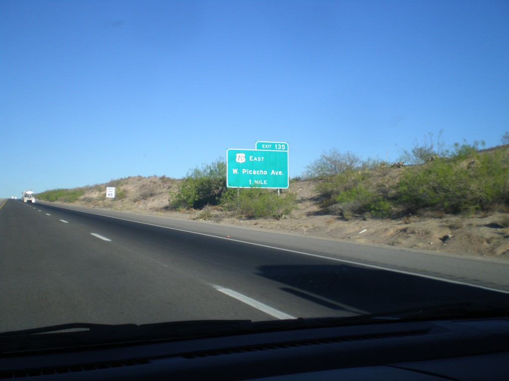
I-10 West Approaching Exit 135
I-10 west approaching Exit 135 - US-70 East/W. Picacho Ave. US-70 joins I-10 westbound to Lordsburg.
Taken 04-14-2013
Las Cruces
Doña Ana County
New Mexico
United States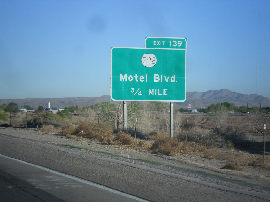
I-10 West - Exit 139
I-10 west approaching Exit 139 - NM-292/Motel Blvd.
Taken 04-14-2013
 Las Cruces
Doña Ana County
New Mexico
United States
Las Cruces
Doña Ana County
New Mexico
United States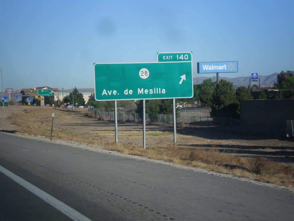
I-10 West - Exit 140
I-10 west at Exit 140 - NM-28/Ave. de Mesilla.
Taken 04-14-2013
 Las Cruces
Doña Ana County
New Mexico
United States
Las Cruces
Doña Ana County
New Mexico
United States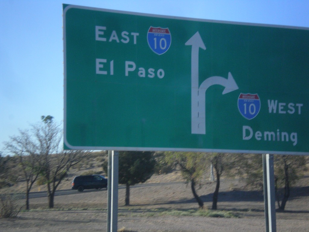
End NM-188 at I-10
End NM-188 at I-10 junction. Use right lanes for I-10 west to Deming; left lanes for I-10 east to El Paso (Texas).
Taken 04-14-2013
 Las Cruces
Doña Ana County
New Mexico
United States
Las Cruces
Doña Ana County
New Mexico
United States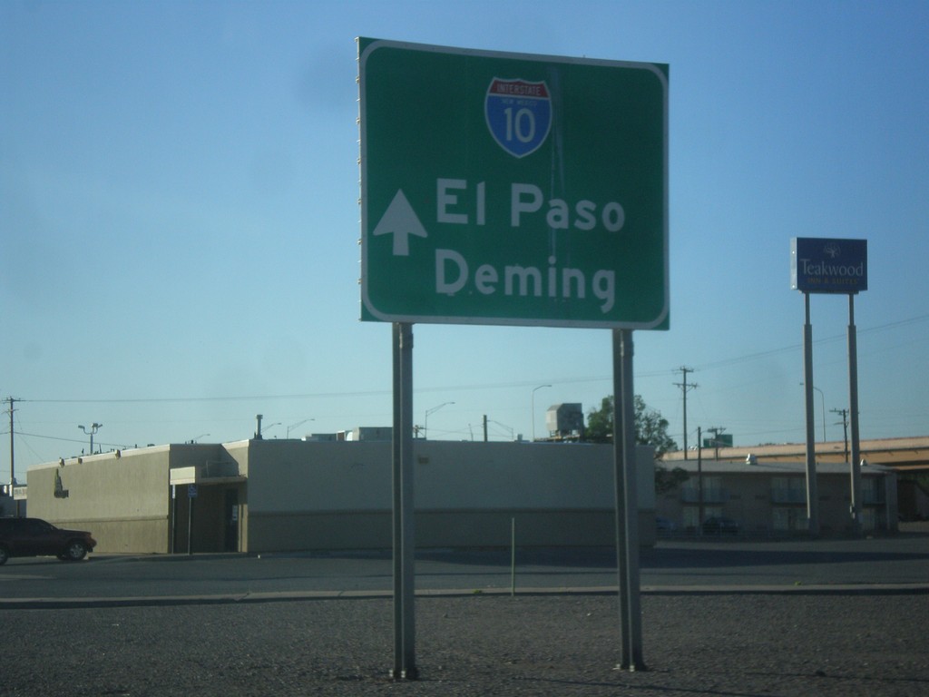
NM-188 East Approaching I-10
NM-188 east approaching I-10. Use I-10 for El Paso (Texas) and Deming.
Taken 04-14-2013
Las Cruces
Doña Ana County
New Mexico
United States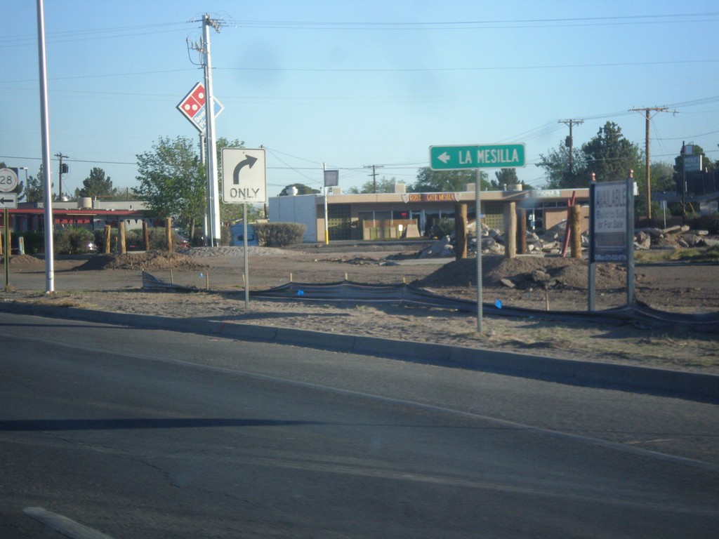
NM-188 West Approaching NM-28
NM-188 west approaching NM-28. Use NM-28 south for La Mesilla.
Taken 04-14-2013
Las Cruces
Doña Ana County
New Mexico
United States
NM-188 West at NM-28
NM-118 west approaching NM-28 junction. This sign is missing the highway shield.
Taken 04-14-2013
Las Cruces
Doña Ana County
New Mexico
United States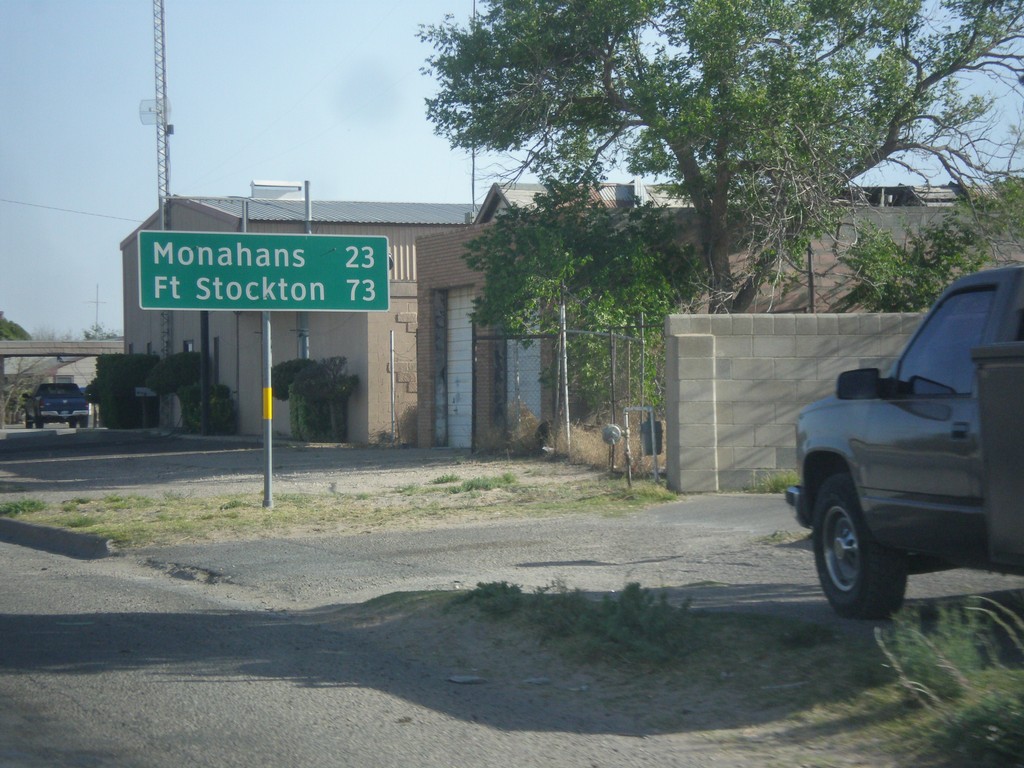
TX-18 South - Distance Marker
Distance marker on TX-18 south. Distance to Monahans and Fort Stockton.
Taken 04-14-2013
 Kermit
Winkler County
Texas
United States
Kermit
Winkler County
Texas
United States