Signs Tagged With Big Green Sign
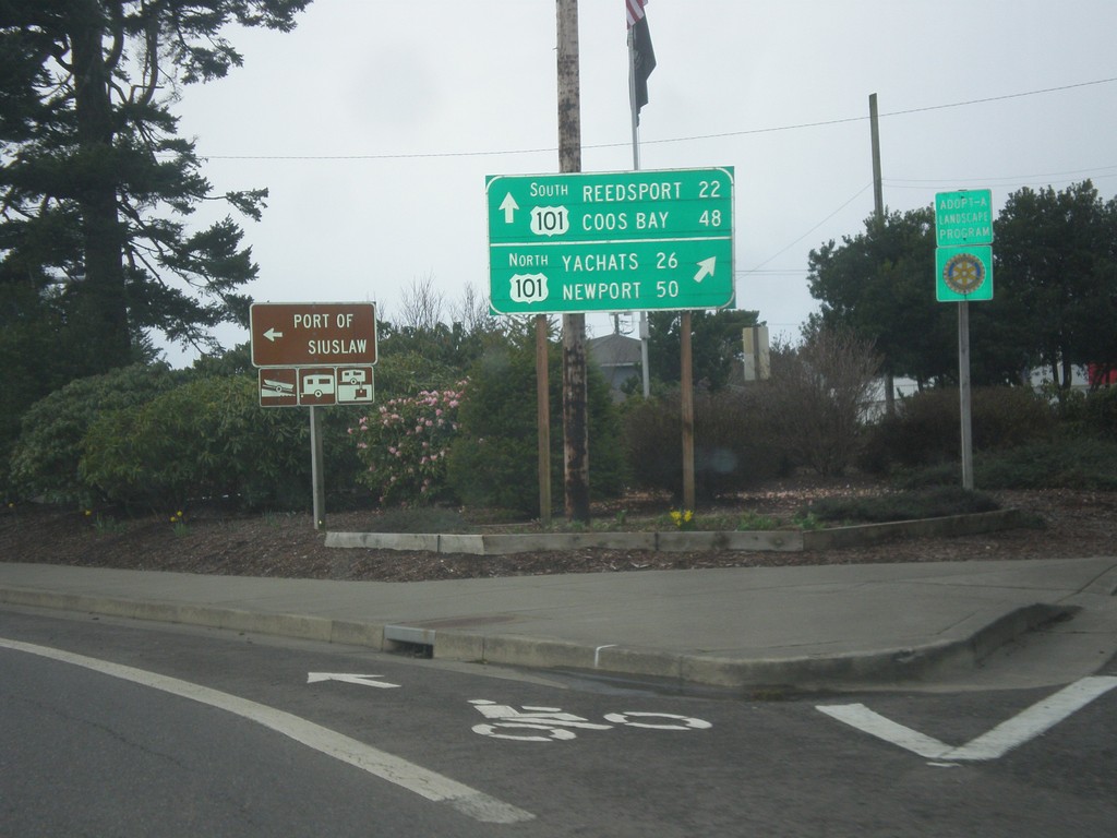
End OR-126 West at US-101
End OR-126 west at US-101. Turn right for US-101 north to Yachats and Newport; turn left for US-101 south to Reedsport and Coos Bay.
Taken 02-13-2014

 Florence
Lane County
Oregon
United States
Florence
Lane County
Oregon
United States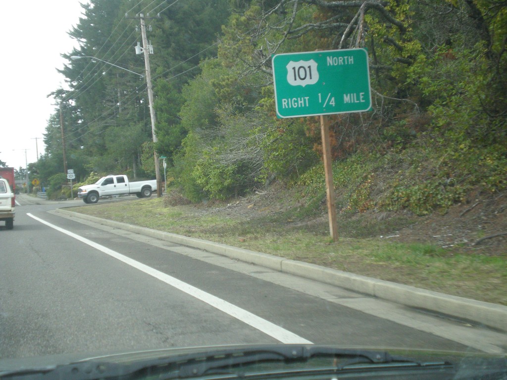
OR-126 West Approaching US-101
OR-126 west approaching US-101. Turn right for US-101 north.
Taken 02-13-2014
Florence
Lane County
Oregon
United States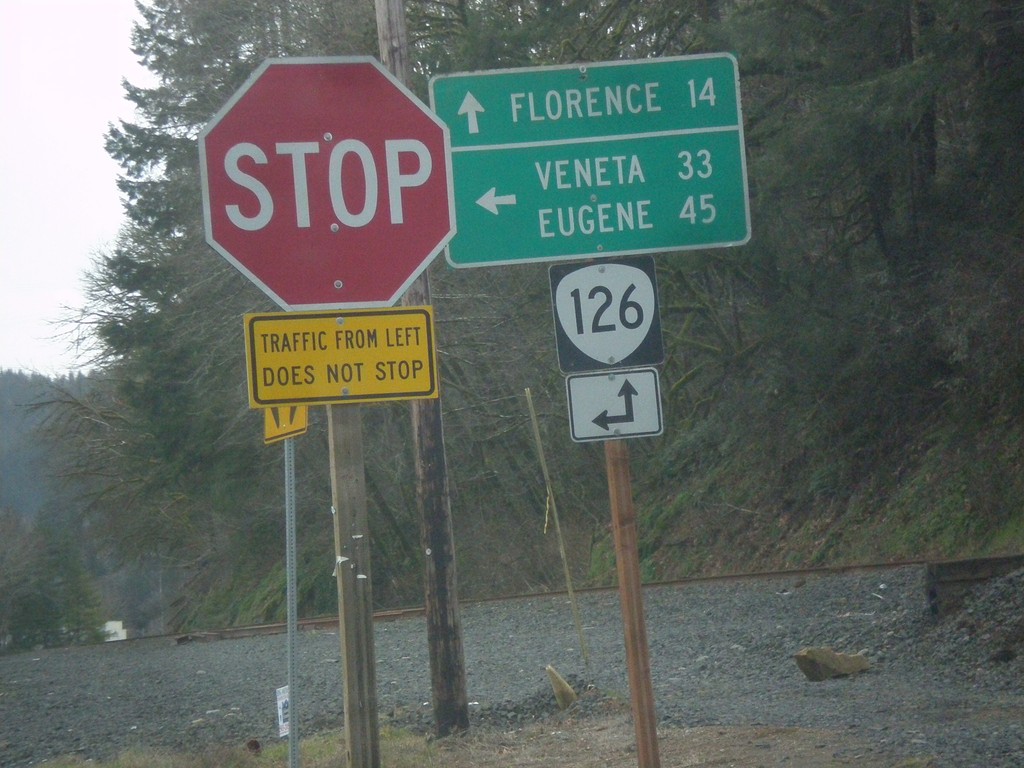
End OR-36 at OR-126
End OR-36 at OR-126. Turn left for OR-126 east to Veneta and Eugene; continue straight for OR-126 west to Florence.
Taken 02-13-2014
 Mapleton
Lane County
Oregon
United States
Mapleton
Lane County
Oregon
United States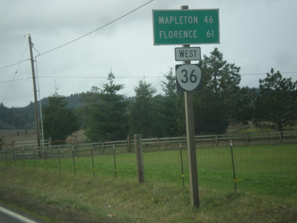
OR-36 West - Distance Marker
Distance marker on OR-36 west to Mapleton and Florence.
Taken 02-13-2014
Cheshire
Lane County
Oregon
United States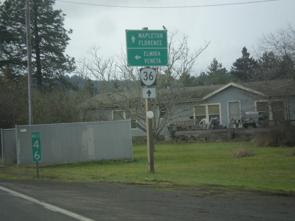
OR-36 West at Territorial Highway
OR-36 west at Territorial Highway south to Veneta and Elmira. Continue west on OR-36 for Mapleton and Florence.
Taken 02-13-2014
Cheshire
Lane County
Oregon
United States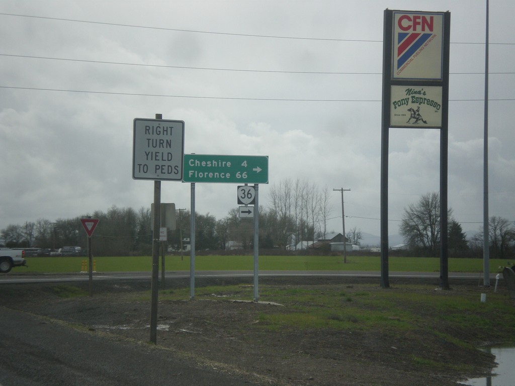
OR-99 South at OR-36
OR-99 south at OR-36 west to Cheshire and Florence.
Taken 02-13-2014
 Junction City
Lane County
Oregon
United States
Junction City
Lane County
Oregon
United States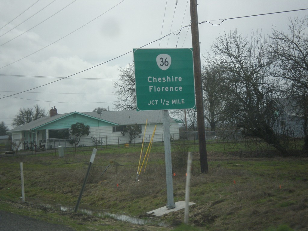
OR-99 South Approaching OR-36
OR-99 south approaching OR-36 west to Cheshire and Florence.
Taken 02-13-2014
Junction City
Lane County
Oregon
United States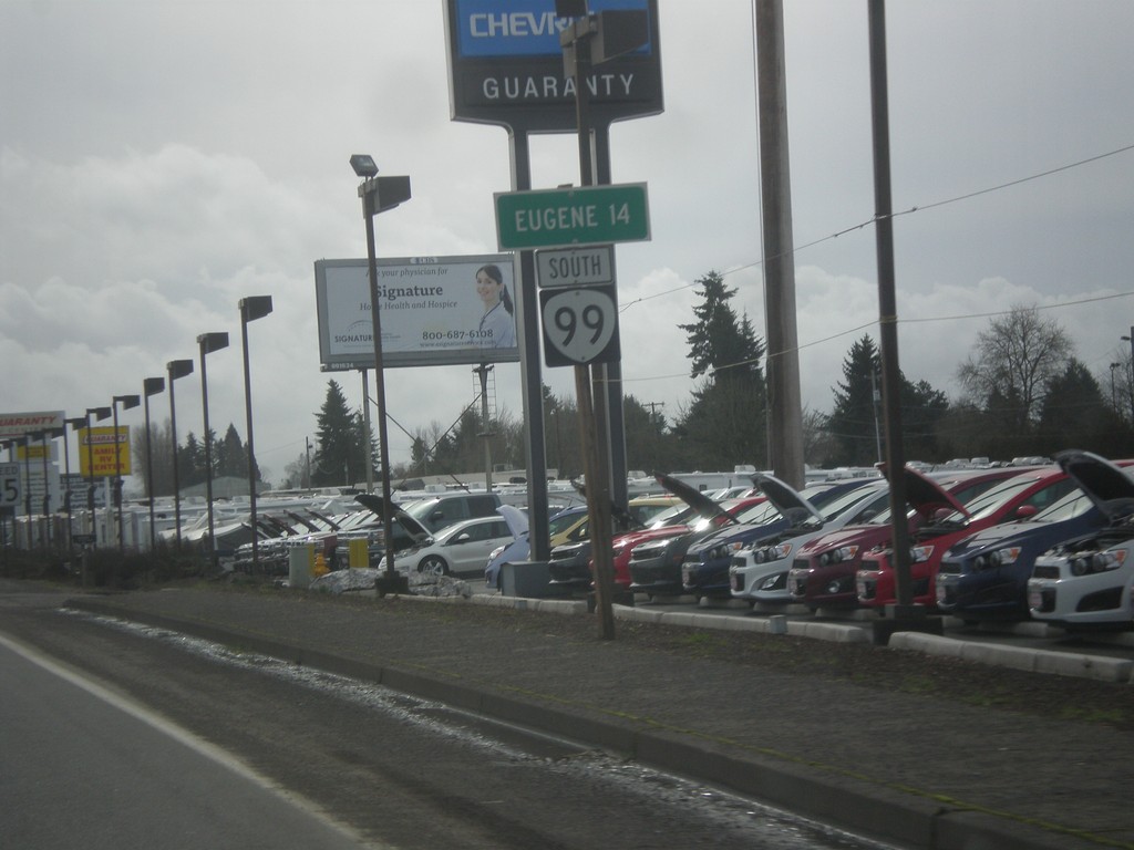
OR-99 South - Distance Marker
Distance to Eugene on OR-99 south in Junction City.
Taken 02-13-2014
Junction City
Lane County
Oregon
United States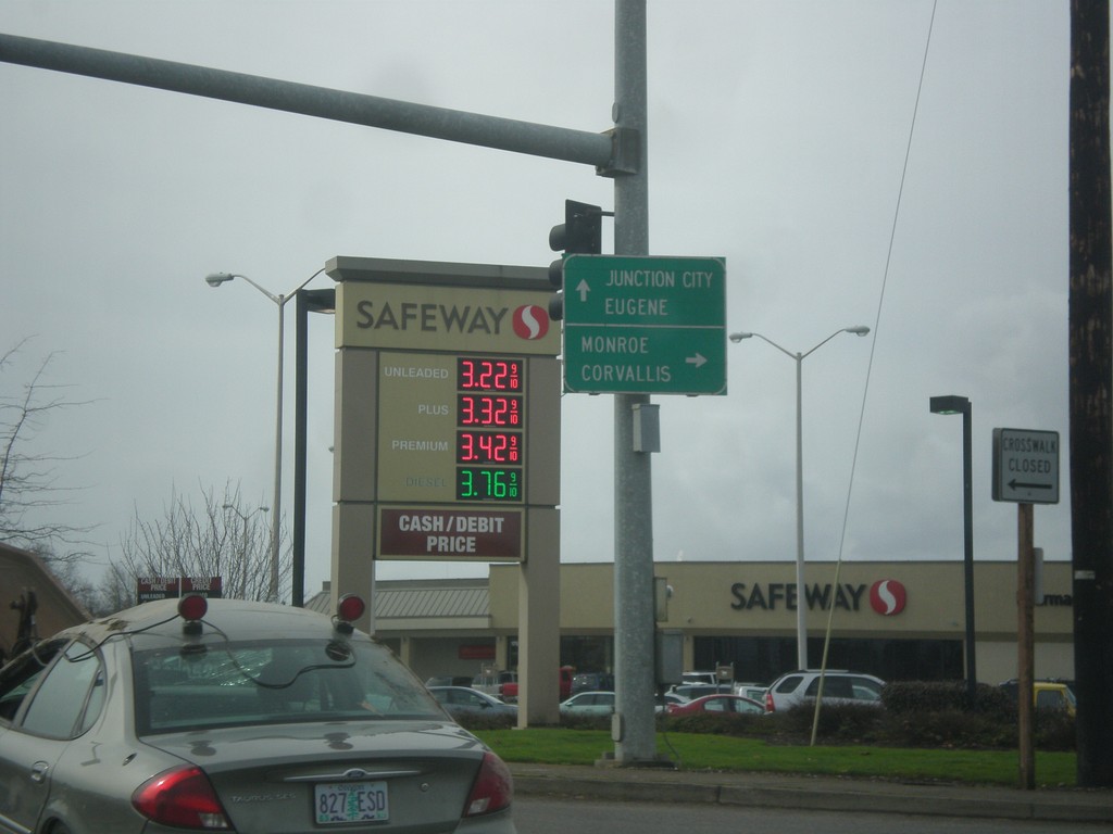
End OR-99E at OR-99W/OR-99
End OR-99E at OR-99W/OR-99. Turn right for OR-99W north to Monroe and Corvallis. Continue straight for OR-99 south to Eugene and Junction City.
Taken 02-13-2014

 Junction City
Lane County
Oregon
United States
Junction City
Lane County
Oregon
United States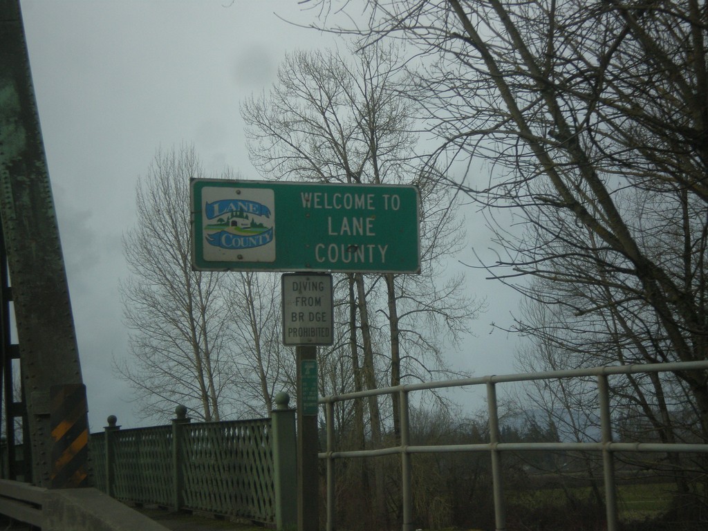
OR-99E South - Entering Lane County
Entering Lane County on OR-99E south on the Willamette River bridge. Many of the counties on western Oregon put logos on their county welcome signs.
Taken 02-13-2014
Harrisburg
Lane County
Oregon
United States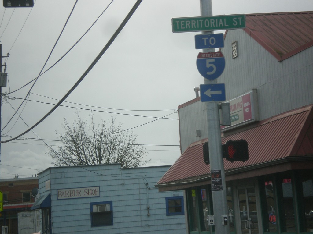
OR-99E South at Territorial St. (To I-5)
OR-99E South at Territorial St. in Harrisburg. Use Territorial St. for I-5.
Taken 02-13-2014
 Harrisburg
Linn County
Oregon
United States
Harrisburg
Linn County
Oregon
United States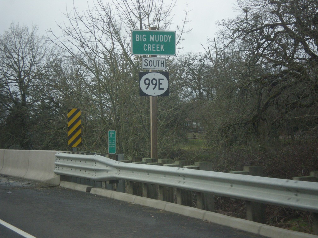
OR-99E - Big Muddy Creek
OR-99E at Big Muddy Creek. The OR-99E shield here is not a typical Oregon state highway style, rather a plain white circle. There were a few shields along or OR-99E in southern Linn County that were not standard.
Taken 02-13-2014
Harrisburg
Linn County
Oregon
United States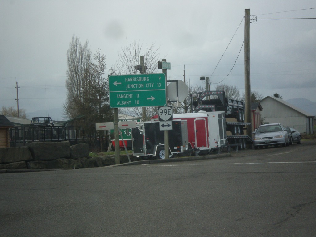
End OR-228 West at OR-99E
End OR-228 west at OR-99E in Halsey. Turn right for Tangent and Albany. Turn left for Harrisburg and Junction City.
Taken 02-13-2014
 Halsey
Linn County
Oregon
United States
Halsey
Linn County
Oregon
United States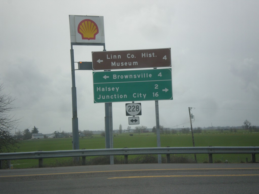
I-5 South at OR-228
I-5 south at OR-228 junction. Turn right on OR-228 for Halsey and Junction City. Turn left on OR-228 for Brownsville and Linn County Historical Museum.
Taken 02-13-2014
Halsey
Linn County
Oregon
United States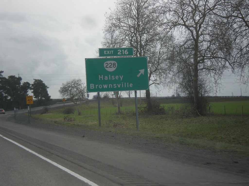
I-5 South - Exit 216
I-5 south at Exit 216 - OR-228/Brownsville/Halsey.
Taken 02-13-2014
Halsey
Linn County
Oregon
United States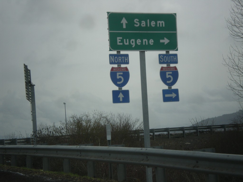
OR-34 East at I-5 Onramp
OR-34 east at I-5 onramp. Turn right for I-5 south to Eugene; continue ahead for I-5 north to Salem.
Taken 02-13-2014
 Albany
Linn County
Oregon
United States
Albany
Linn County
Oregon
United States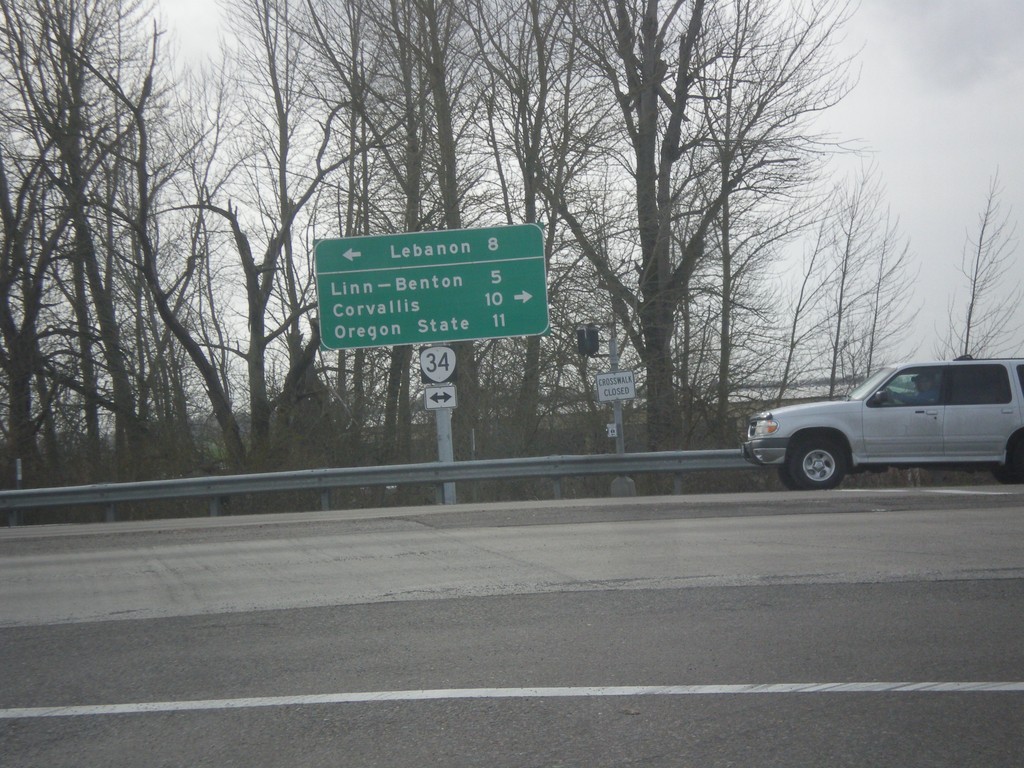
I-5 South at OR-34
I-5 south at OR-34 junction. Turn right for OR-34 west to Linn-Benton (Community College), Corvallis, and Oregon State (University). Turn left for Lebanon.
Taken 02-13-2014
Albany
Linn County
Oregon
United States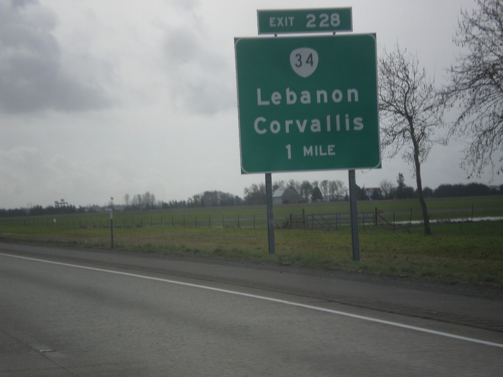
I-5 South Approaching Exit 228
I-5 south approaching Exit 228 - OR-34/Lebanon/Corvallis.
Taken 02-13-2014
Albany
Linn County
Oregon
United States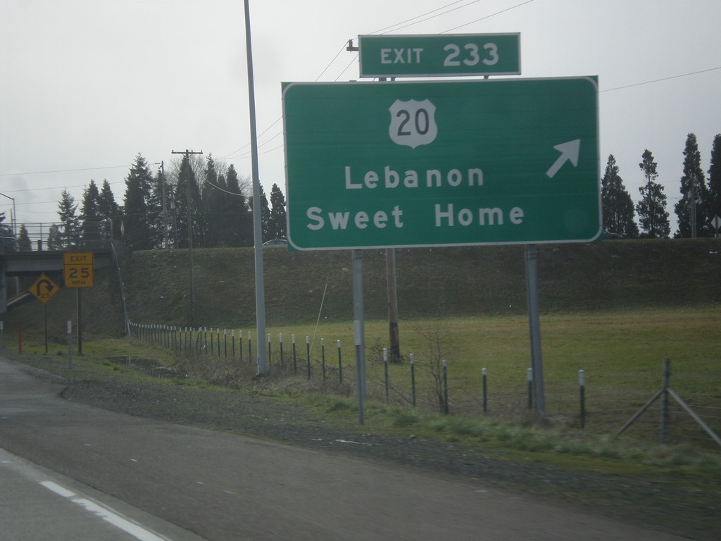
I-5 South - Exit 233
I-5 south at Exit 233 - US-20 East/Lebanon/Sweet Home.
Taken 02-13-2014
 Albany
Linn County
Oregon
United States
Albany
Linn County
Oregon
United States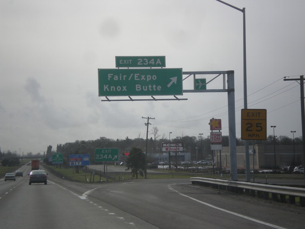
I-5 South - Exit 234A
I-5 south at Exit 234A - Knox Butte/Fair/Expo.
Taken 02-13-2014
Albany
Linn County
Oregon
United States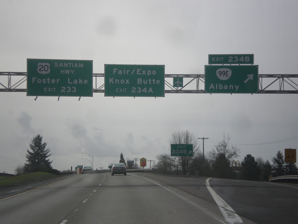
I-5 South - Exits 234BA
I-5 south at Exit 234B - OR-99E/Albany. Approaching Exit 234A - Knox Butte/Fair/Expo. For Foster Lake, use US-20/Santiam Highway, Exit 233.
Taken 02-13-2014
Albany
Linn County
Oregon
United States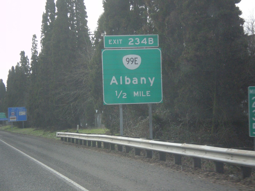
I-5 South Approaching Exit 234B
I-5 south approaching Exit 234B - OR-99E/Albany.
Taken 02-13-2014
Albany
Linn County
Oregon
United States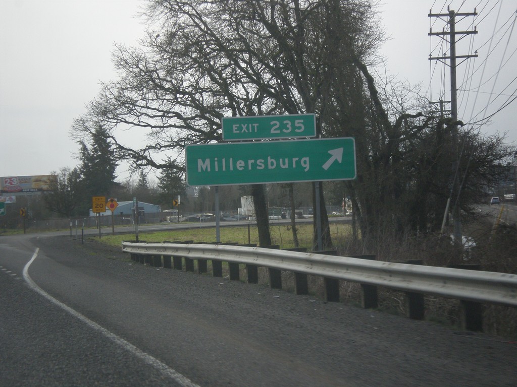
I-5 South - Exit 235
I-5 south at Exit 235 - Millersburg.
Taken 02-13-2014
Millersburg
Linn County
Oregon
United States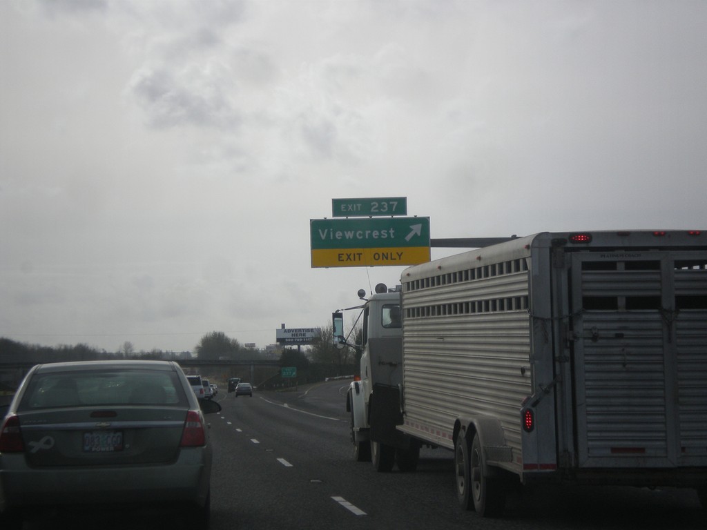
I-5 South - Exit 237
I-5 south at Exit 237 - Viewcrest.
Taken 02-13-2014
Albany
Linn County
Oregon
United States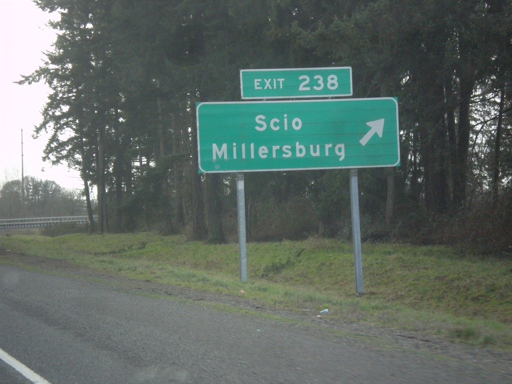
I-5 South - Exit 238
I-5 south at Exit 238 - Scio/Millersburg.
Taken 02-13-2014
Albany
Linn County
Oregon
United States