Signs Tagged With Big Green Sign
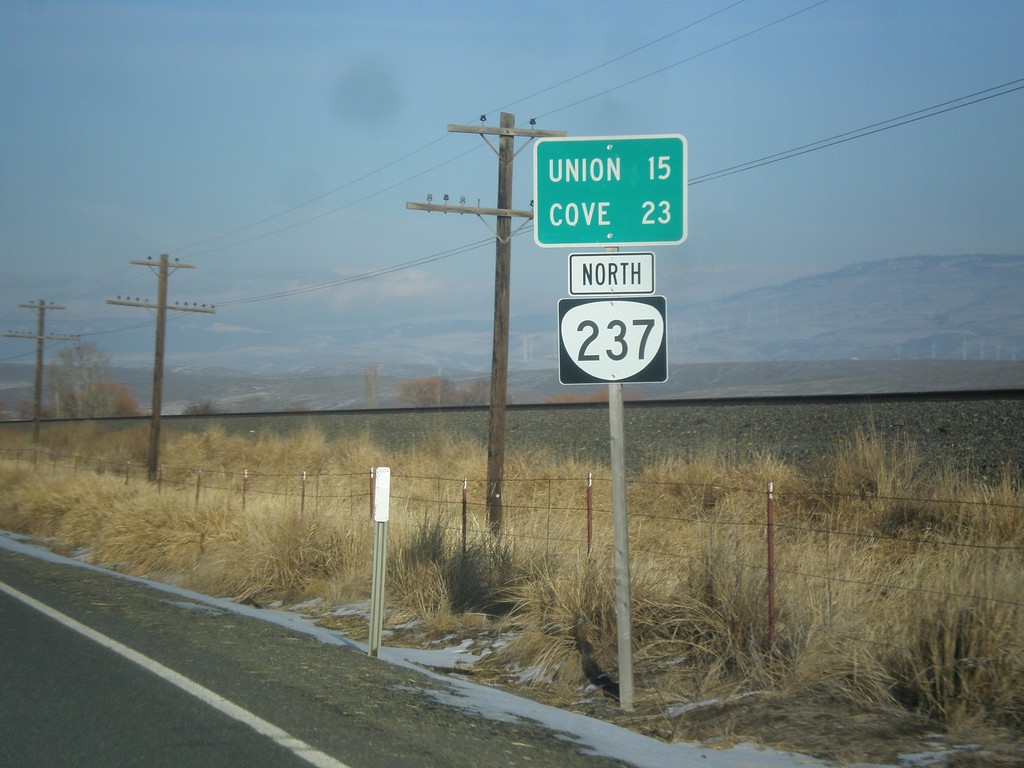
OR-237 North - Distance Marker
Distance marker on OR-237 north. Distance to Union and Cove.
Taken 12-15-2013
 North Powder
Union County
Oregon
United States
North Powder
Union County
Oregon
United States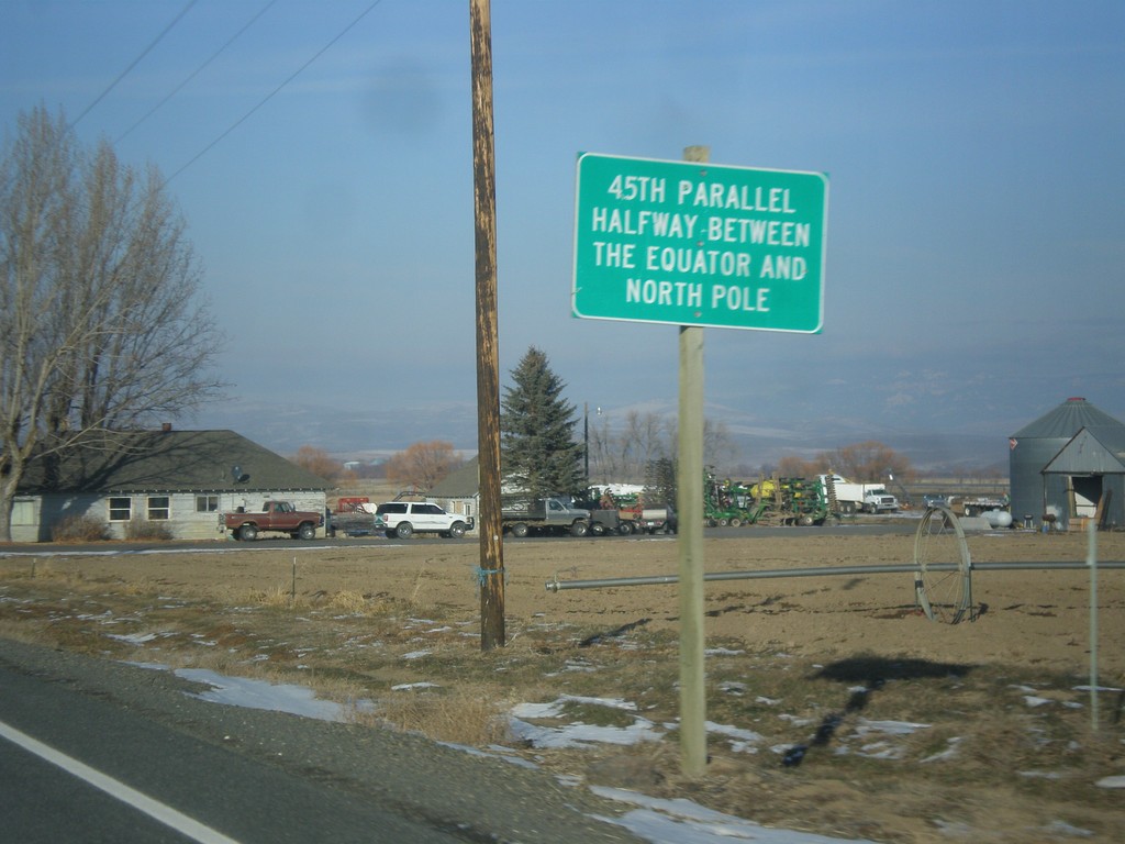
US-30 West - 45th Parallel
45th Parallel - Halfway Between Equator and North Pole. Taken on US-30 west between Haines and North Powder.
Taken 12-15-2013
 North Powder
Baker County
Oregon
United States
North Powder
Baker County
Oregon
United States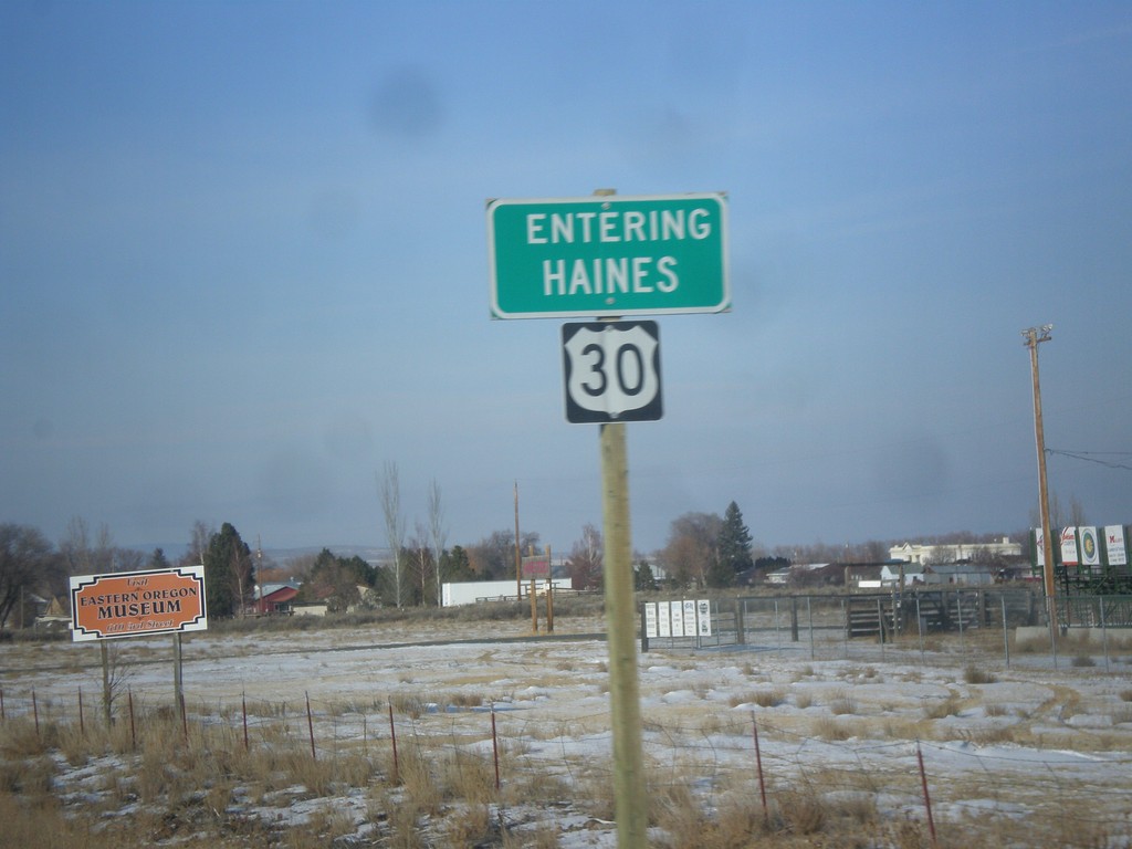
US-30 West - Entering Haines
Entering Haines on US-30 west.
Taken 12-15-2013
Haines
Baker County
Oregon
United States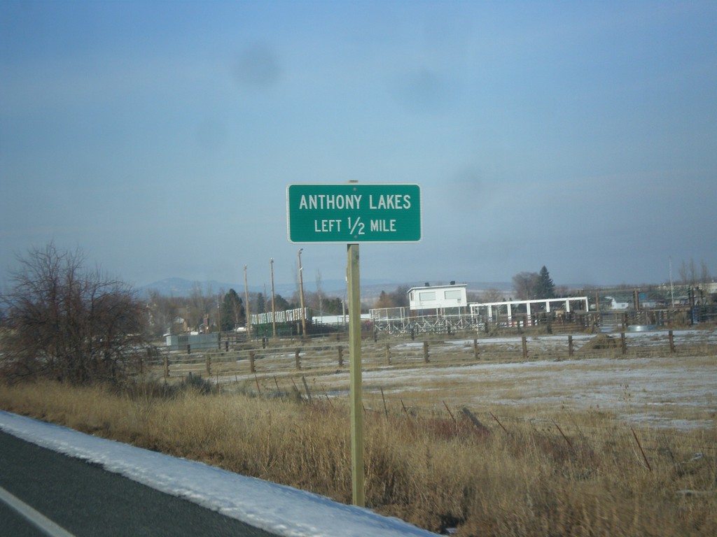
US-30 West - Anthony Lakes Jct.
US-30 west approaching Anthony Lakes Junction in Haines. Anthony Lakes is a ski area.
Taken 12-15-2013
Baker City
Baker County
Oregon
United States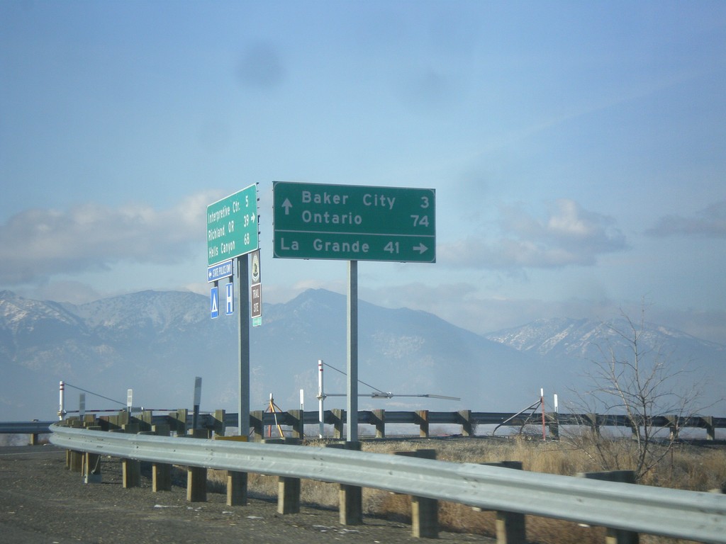
End OR-86 West at I-84
End OR-86 at I-84 (Exit 302). Use I-84 west for La Grande. Use I-84 east for Baker City and Ontario.
Taken 12-15-2013

 Baker City
Baker County
Oregon
United States
Baker City
Baker County
Oregon
United States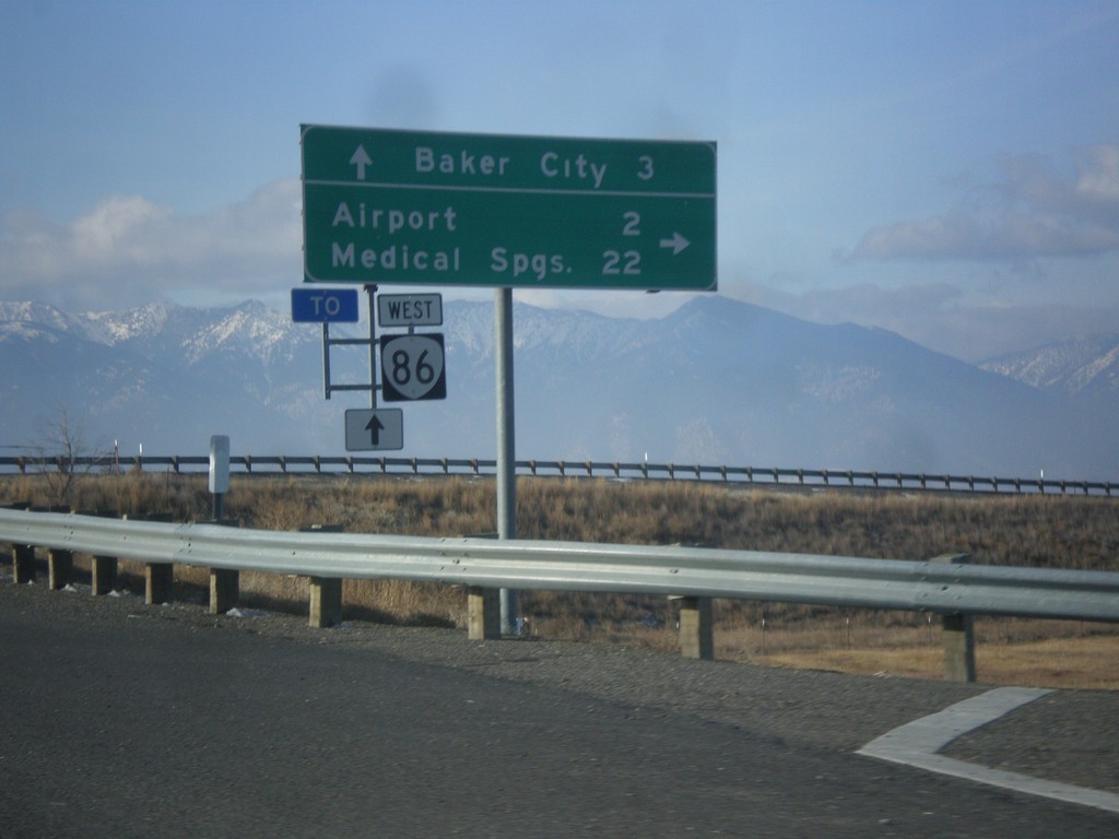
OR-86 West at I-84
OR-86 west at OR-203 (not signed) to Medical Springs and Airport.
Taken 12-15-2013
Baker City
Baker County
Oregon
United States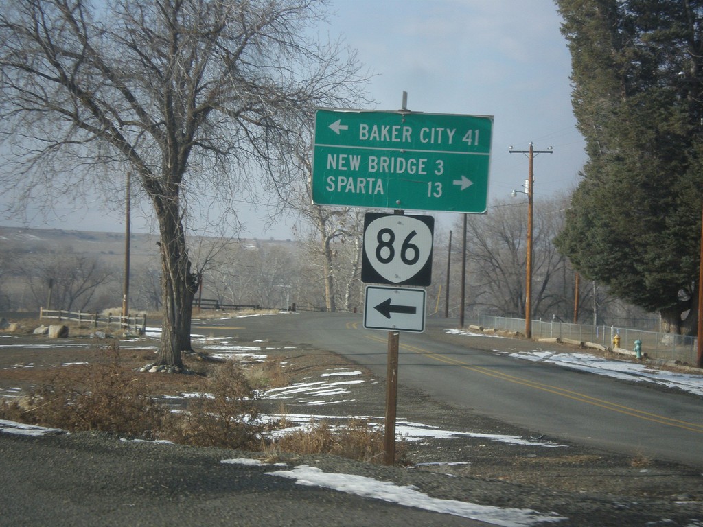
OR-86 West - New Bridge Jct.
OR-86 west at New Bridge Road to New Bridge and Sparta. Continue west on OR-86 for Baker City.
Taken 12-15-2013
Richland
Baker County
Oregon
United States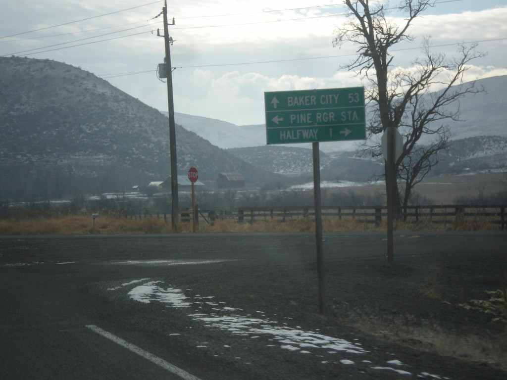
OR-86 West at OR-86 Spur (Unsigned)
OR-86 West at OR-86 Spur (Unsigned) into Halfway, Oregon. Continue west on OR-86 for Baker City.
Taken 12-15-2013
 Halfway
Baker County
Oregon
United States
Halfway
Baker County
Oregon
United States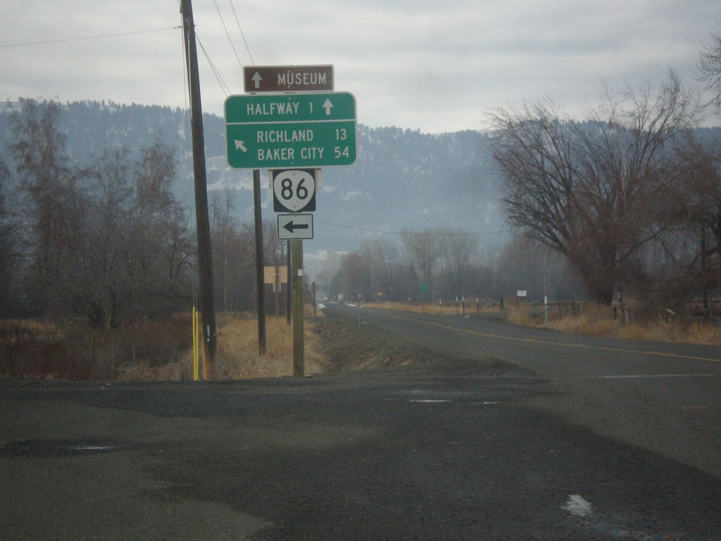
OR-86 West at OR-414
OR-86 west at OR-414 (unsigned). Use OR-414 west for Halfway; continue west on OR-86 for Baker City and Richland.
Taken 12-15-2013
 Halfway
Baker County
Oregon
United States
Halfway
Baker County
Oregon
United States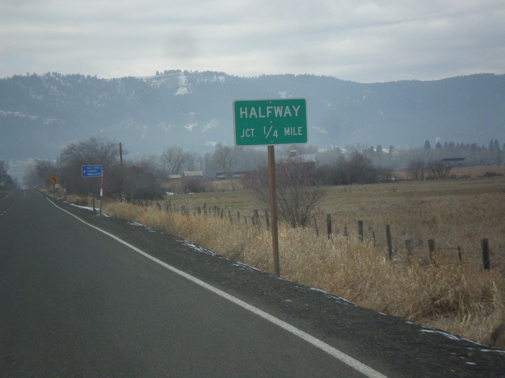
OR-86 West Approaching Halfway Jct.
OR-86 West approaching Halfway Jct (OR-414). OR-414 is unsigned.
Taken 12-15-2013
Halfway
Baker County
Oregon
United States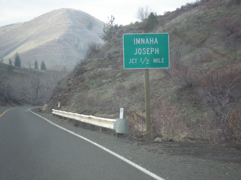
OR-86 West NFH-39 Jct.
OR-86 west approaching NFH-39 north to Imnaha and Joseph.
Taken 12-15-2013
Halfway
Baker County
Oregon
United States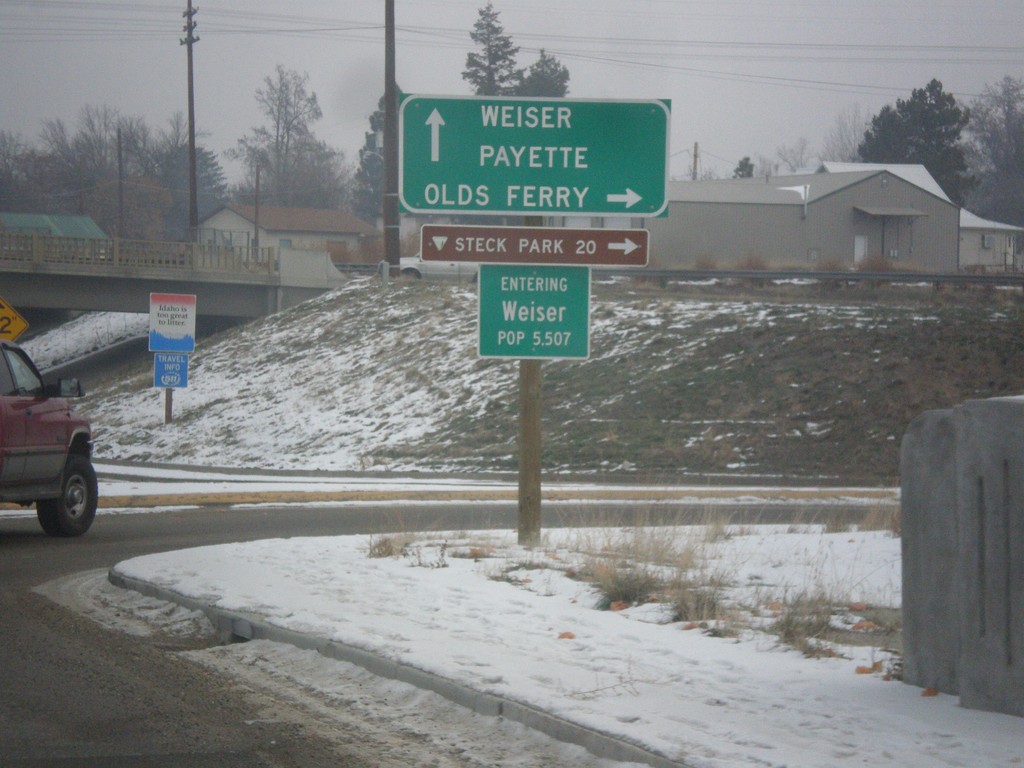
US-95 Spur North at Olds Ferry Jct.
US-95 Spur north at Olds Ferry Jct. Turn right for Olds Ferry; continue north on US-95 Spur for Payette and Weiser. Entering Weiser, Idaho.
Taken 12-15-2013
 Weiser
Washington County
Idaho
United States
Weiser
Washington County
Idaho
United States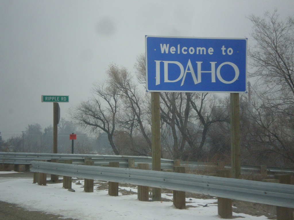
US-95 Spur North - Welcome To Idaho
Welcome To Idaho on US-95 Spur North. The Idaho welcome sign is on the Oregon side of the Snake River. The highway crosses the Snake River here into Weiser, Idaho.
Taken 12-15-2013
Ontario
Malheur County
Oregon
United States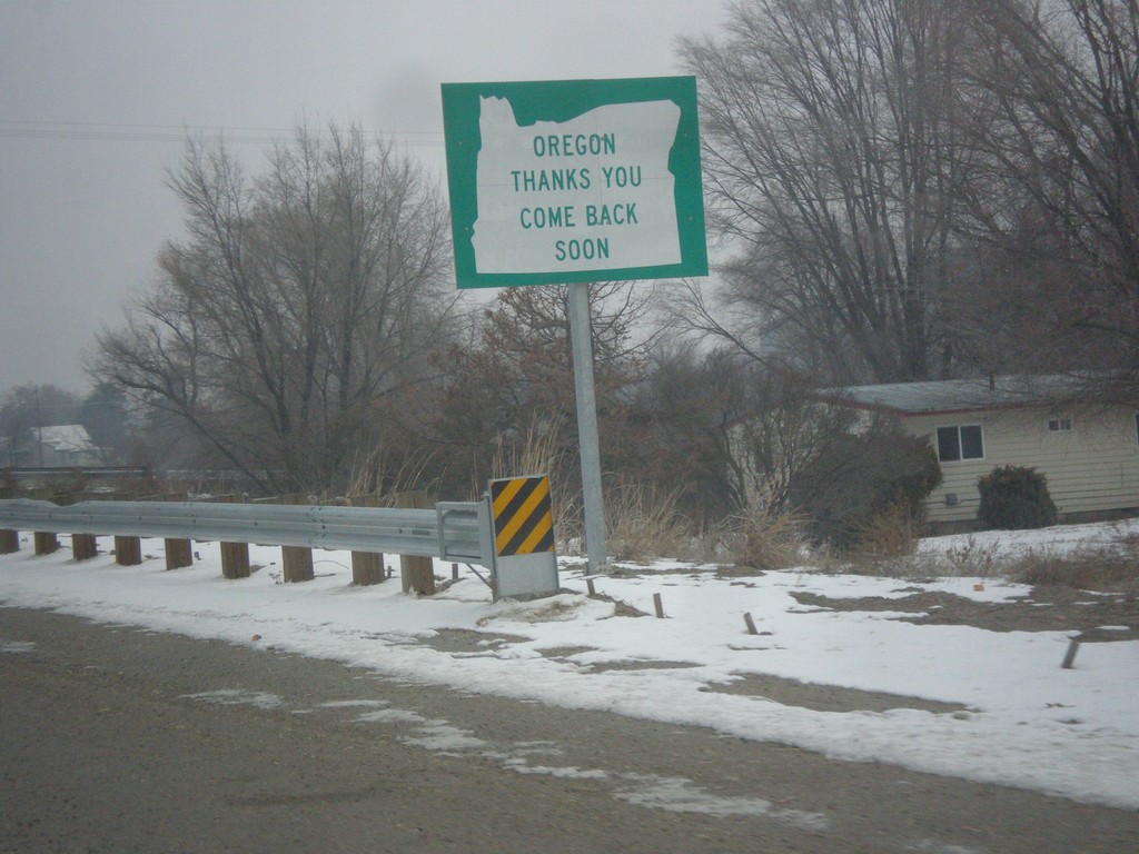
US-95 Spur North - Leaving Oregon
Oregon Thanks You - Come Back Soon on US-95 Spur approaching the Snake River bridge into Idaho.
Taken 12-15-2013
Ontario
Malheur County
Oregon
United States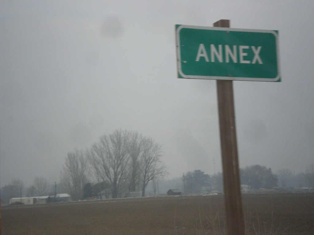
US-95 Spur - Annex
Entering the community of Annex, on US-95 Spur north. Annex is directly across the Snake River from Weiser, Idaho.
Taken 12-15-2013
Ontario
Malheur County
Oregon
United States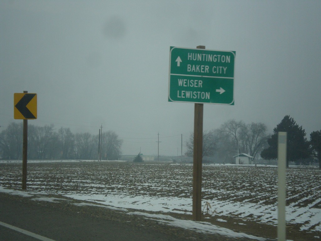
OR-201 North at US-95 Spur
OR-201 north at US-95 Spur. Use US-95 Spur north for Weiser and Lewiston (both in Idaho). Continue north on OR-201 for Baker City and Huntington. US-95 Spur connects OR-201 with US-95 across the Snake River in Idaho.
Taken 12-15-2013
 Ontario
Malheur County
Oregon
United States
Ontario
Malheur County
Oregon
United States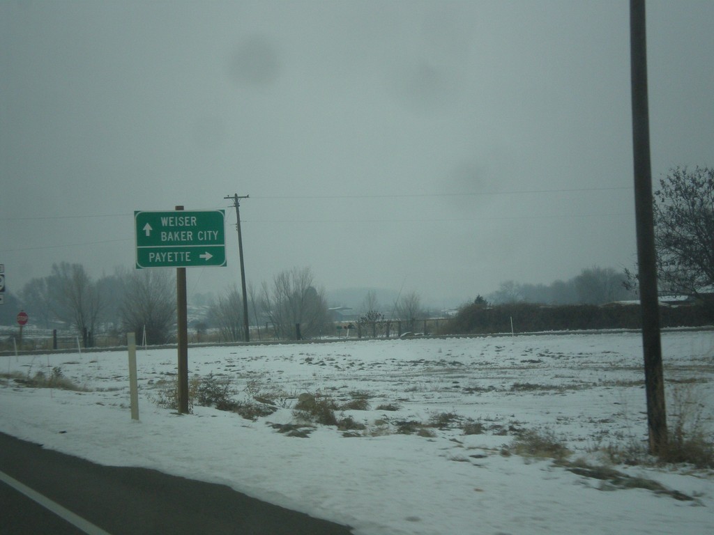
OR-201 North at OR-52
OR-201 north at OR-52 east to Payette (Idaho). Continue north on OR-201 for Weiser (Idaho) and Baker City.
Taken 12-15-2013
 Ontario
Malheur County
Oregon
United States
Ontario
Malheur County
Oregon
United States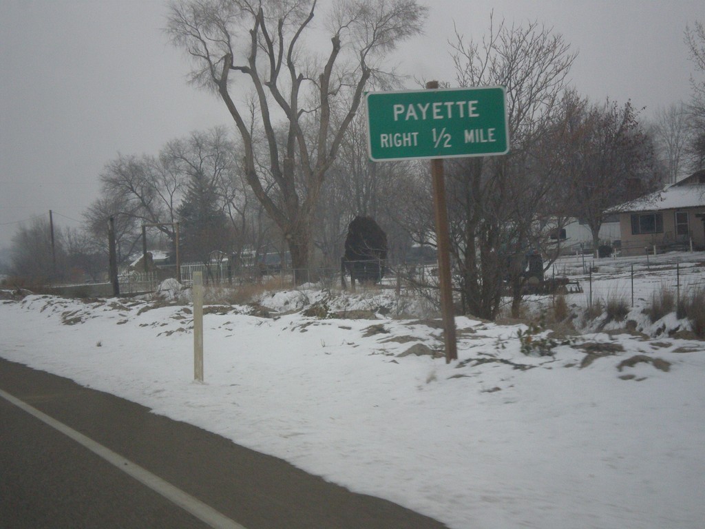
OR-201 North - Payette Jct. (OR-52)
OR-201 north approaching OR-52 east to Payette (Idaho).
Taken 12-15-2013
Ontario
Malheur County
Oregon
United States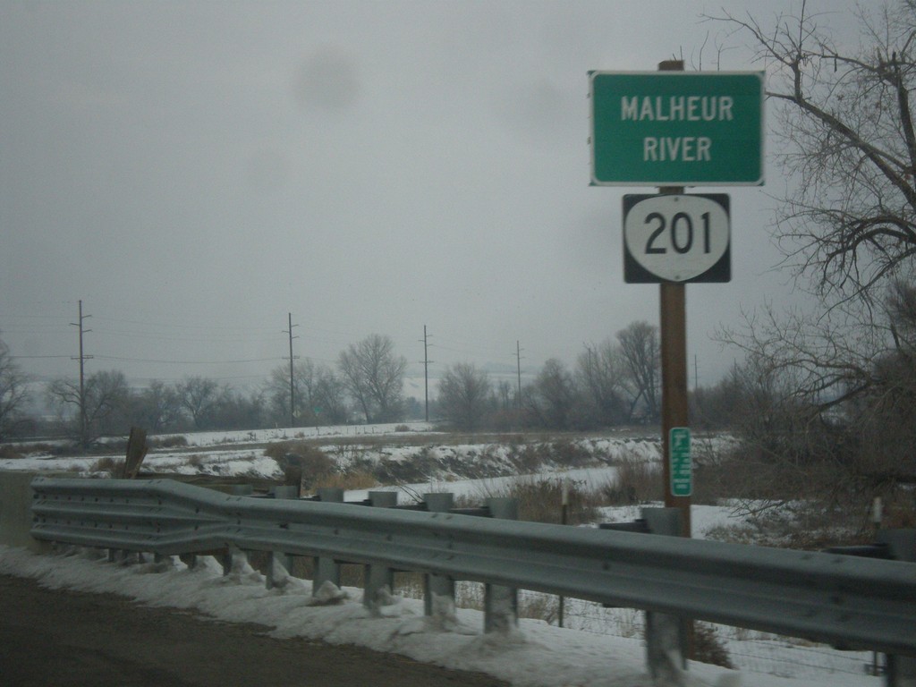
OR-201 North - Malheur River
OR-201 north at the Malheur River bridge. The Malheur River flows into the Snake River just east of here.
Taken 12-15-2013
Ontario
Malheur County
Oregon
United States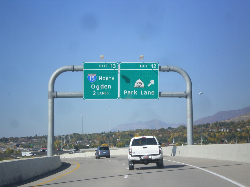
Legacy Parkway - Exits 12 and 13
Legacy Parkway (UT-67) north at Exit 12 - UT-225/Park Lane. Approaching I-15 North/Ogden. Approaching the northern end of Legacy Parkway.
Taken 10-18-2013


 Farmington
Davis County
Utah
United States
Farmington
Davis County
Utah
United States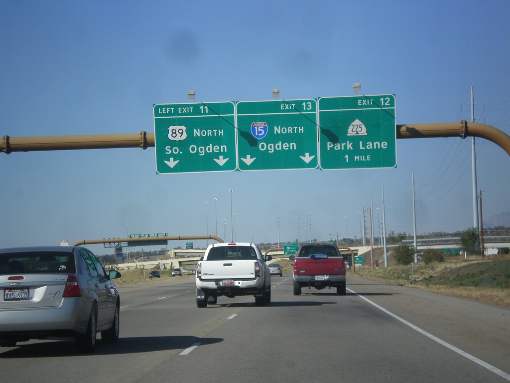
Legacy Parkway (UT-67) North - Exits 11,12,13
Legacy Parkway (UT-67) north at Exit 11- US-89 North/South Ogden. Approaching Exit 12 - UT-225/Park Lane. Also approaching Exit 13 - I-15/Ogden.
Taken 10-18-2013
 Farmington
Davis County
Utah
United States
Farmington
Davis County
Utah
United States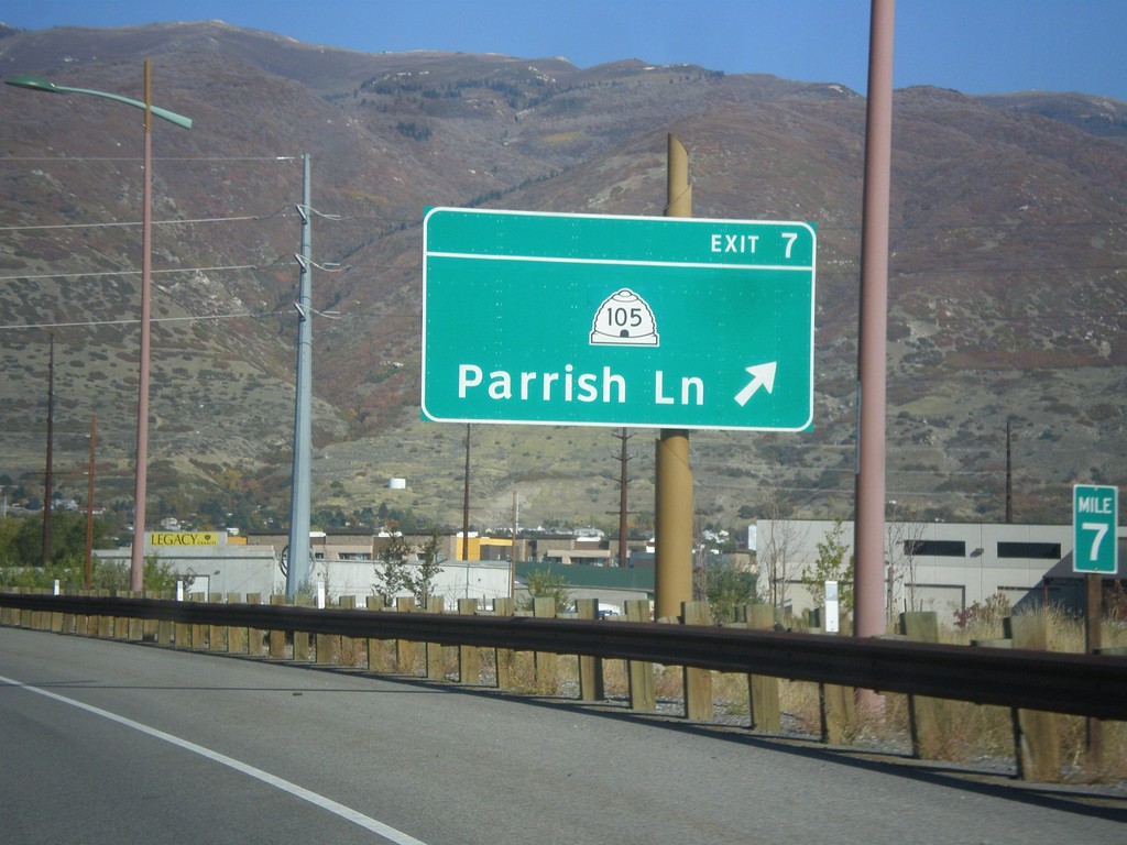
Legacy Parkway (UT-67) North - Exit 7
Legacy Parkway (UT-67) north at Exit 7 - UT-105/Parrish Lane.
Taken 10-18-2013
 Centerville
Davis County
Utah
United States
Centerville
Davis County
Utah
United States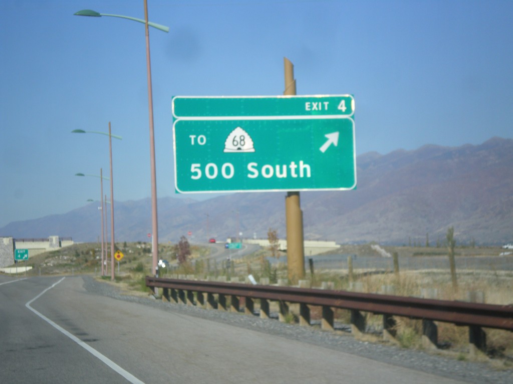
Legacy Parkway (UT-67) North - Exit 4
Legacy Parkway (UT-67) north at Exit 4 - To UT-68/500 South.
Taken 10-18-2013
 Woods Cross
Davis County
Utah
United States
Woods Cross
Davis County
Utah
United States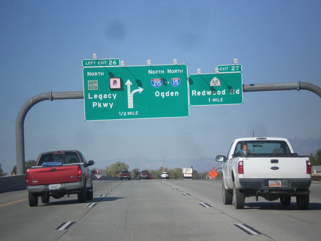
I-215 North - Exits 26 and 27
I-215 north at Exit 26 - UT-67/Legacy Parkway. Approaching Exit 27 - UT-68/Redwood Road. Continue north on I-215 for I-15 and Ogden. Trucks are not allowed to use Legacy Parkway.
Taken 10-18-2013
 Salt Lake City
Salt Lake County
Utah
United States
Salt Lake City
Salt Lake County
Utah
United States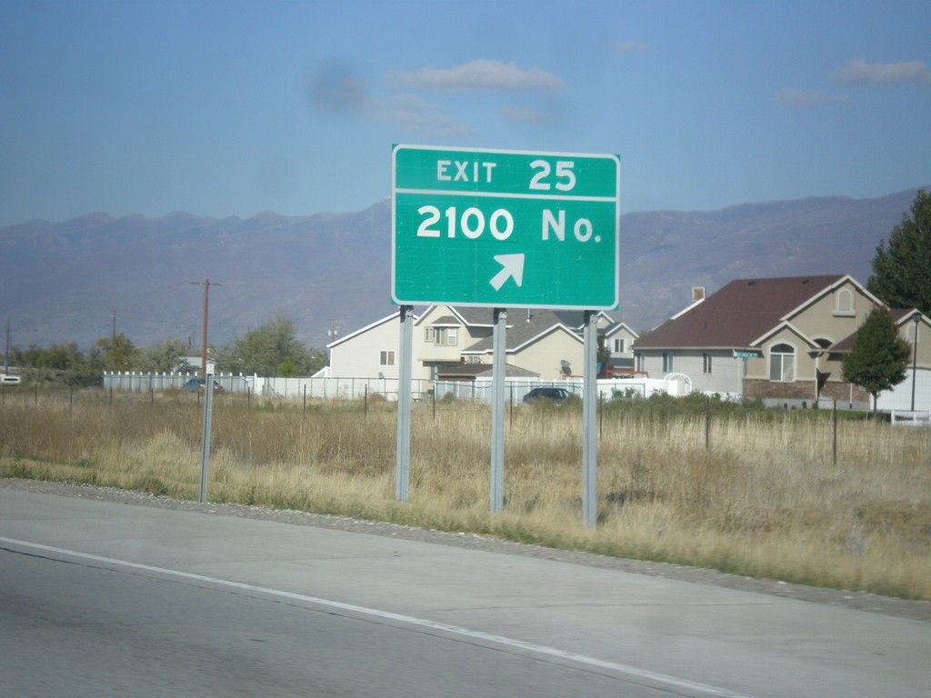
I-215 North - Exit 25
I-215 north at Exit 25 - 2100 North.
Taken 10-18-2013
Salt Lake City
Salt Lake County
Utah
United States