Signs Tagged With Big Green Sign
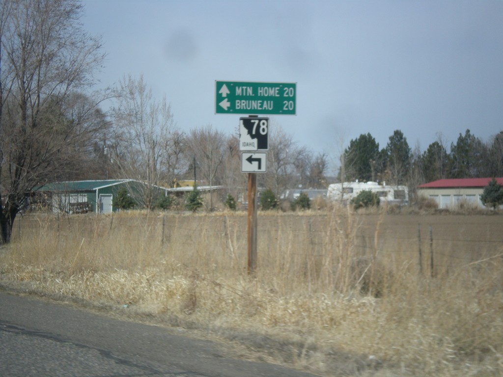
BL-84 West at ID-78
BL-84 west at ID-78 in Hammett. Use ID-78 west for Bruneau; continue west on BL-84 to Mountain Home.
Taken 03-16-2013

 Hammett
Elmore County
Idaho
United States
Hammett
Elmore County
Idaho
United States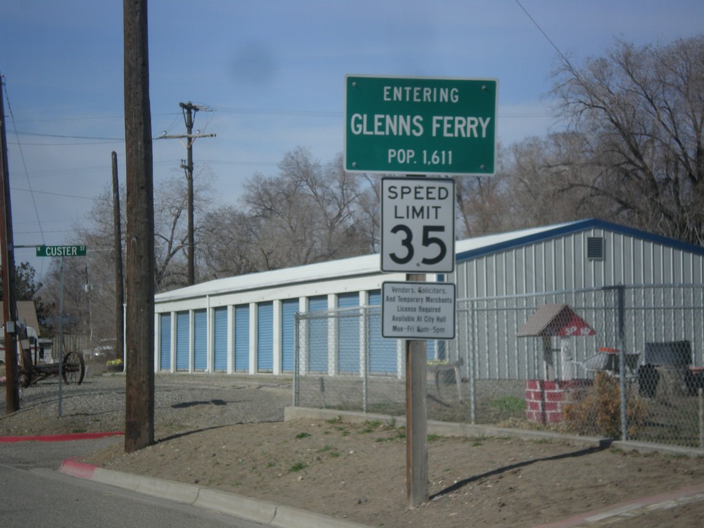
BL-84 West - Entering Glenns Ferry
Entering Glenns Ferry, Idaho on BL-84 west - Population 1,611.
Taken 03-16-2013
Glenns Ferry
Elmore County
Idaho
United States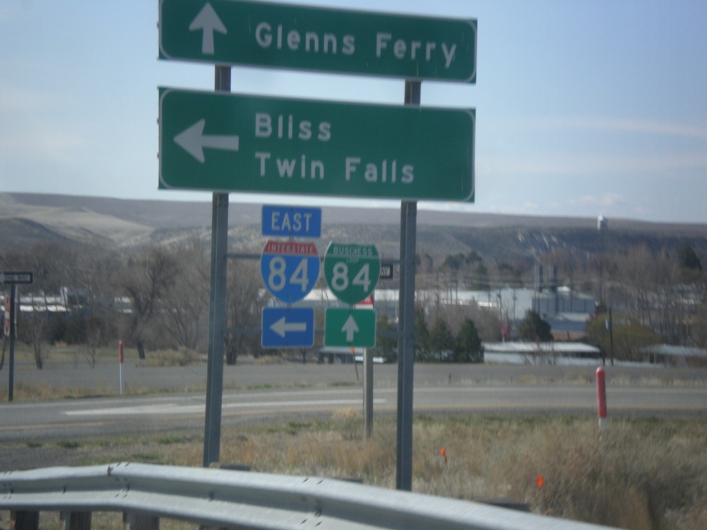
Old US-30 at I-84 East and BL-84
Old US-30 at I-84 East/BL-84 junction. Turn left on I-84 east towards Bliss and Twin Falls. Continue straight for BL-84 into Glenns Ferry.
Taken 03-16-2013


 Glenns Ferry
Elmore County
Idaho
United States
Glenns Ferry
Elmore County
Idaho
United States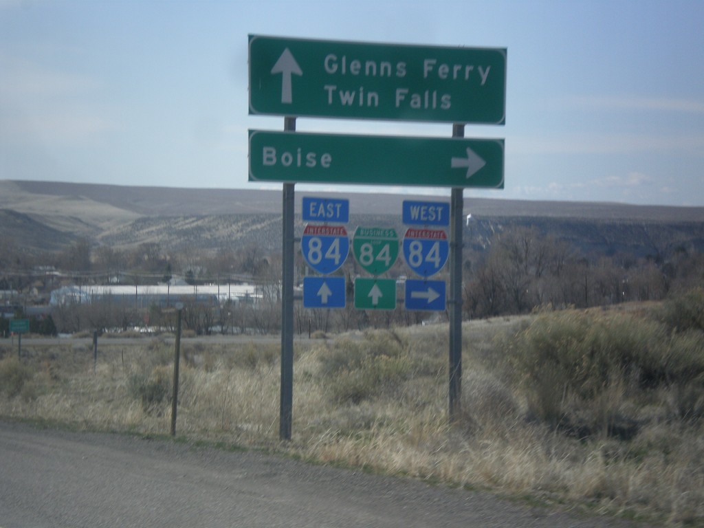
Old US-30 at I-84/BL-84
Old US-30 at I-84/BL-84 junction. Turn right on I-84 west towards Boise. Continue ahead for I-84/BL-84 towards Glenns Ferry and Twin Falls.
Taken 03-16-2013
Glenns Ferry
Elmore County
Idaho
United States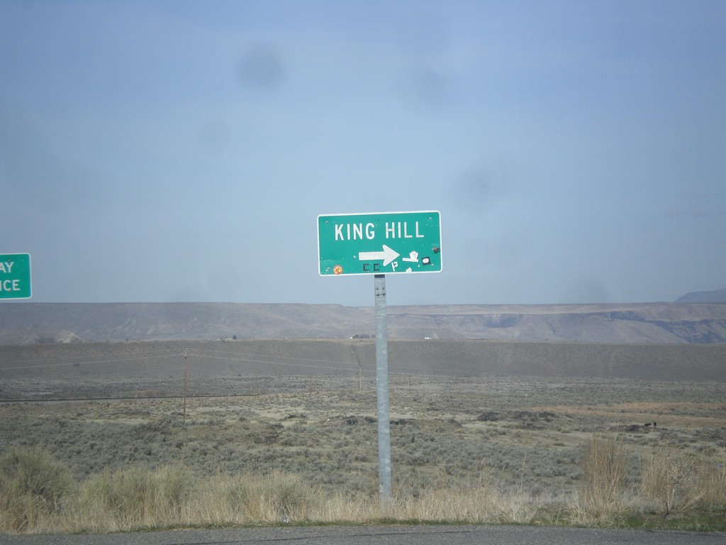
I-84 West - Exit 129 Offramp
I-84 west Exit 129 offramp. Turn right for King Hill.
Taken 03-16-2013
King Hill
Elmore County
Idaho
United States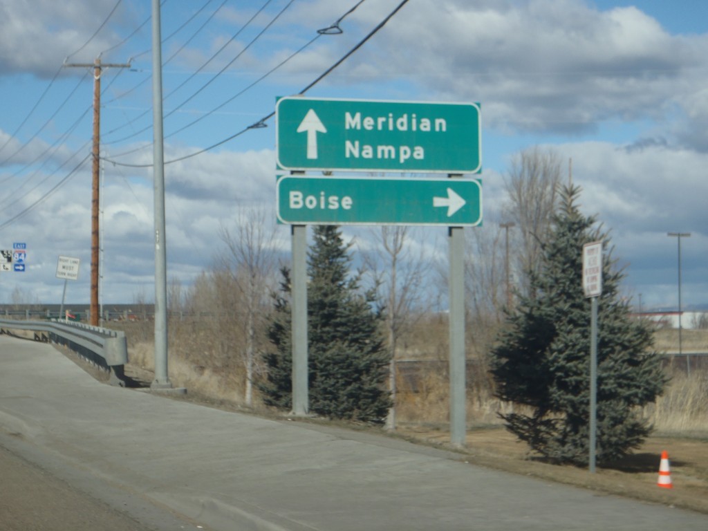
End ID-69 North at I-84/US-30/ID-55
End ID-69 north at I-84/US-30/ID-55 junction. Turn right for I-84/US-30 East/ID-55 north towards Boise; continue over freeway for I-84/US-30 West/ID-55 South towards Nampa. Meridian Road continues north into Meridian.
Taken 02-17-2013

 Meridian
Ada County
Idaho
United States
Meridian
Ada County
Idaho
United States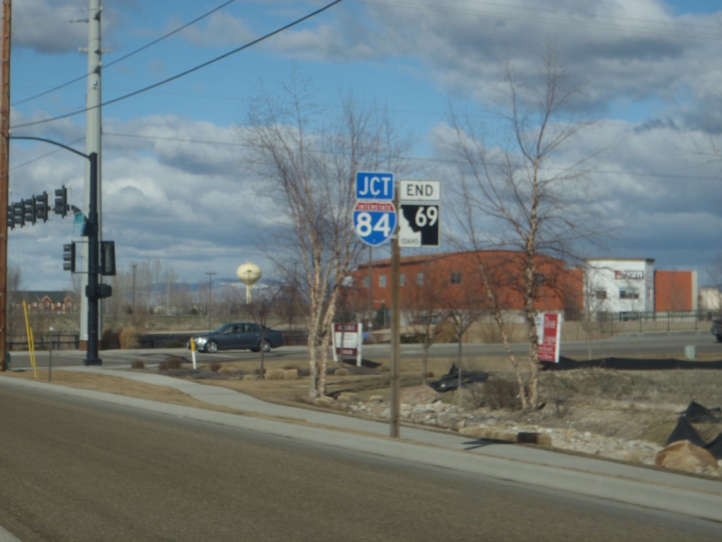
End ID-69 North Approaching I-84
End ID-69 north approaching I-84 in Meridian.
Taken 02-17-2013
Meridian
Ada County
Idaho
United States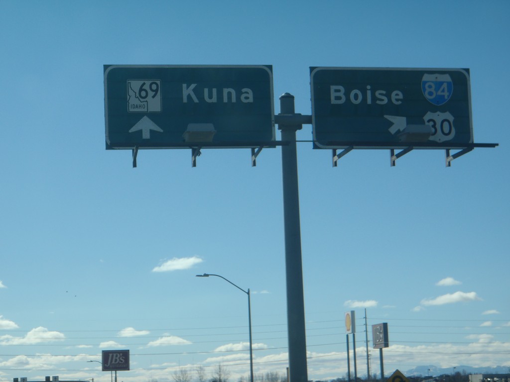
ID-69 South at I-84 East
ID-69 south at I-84 east towards Boise. Continue south on ID-69 for Kuna.
Taken 02-17-2013
Meridian
Ada County
Idaho
United States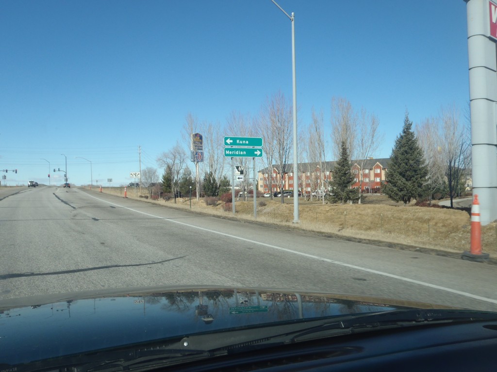
I-84 West - Exit 44 Offramp
I-84 east Exit 44 offramp at ID-69 junction. Turn left for ID-69 south to Kuna; turn right for Meridian Road to Meridian (City Center).
Taken 02-17-2013
Meridian
Ada County
Idaho
United States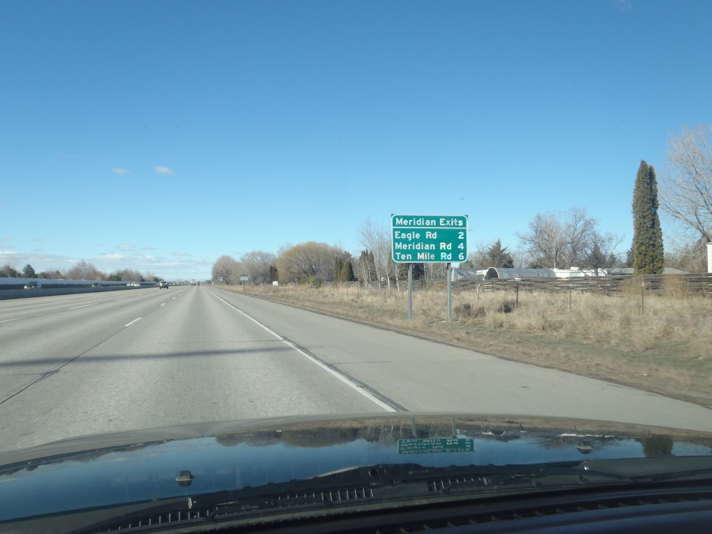
I-84 West - Meridian Exits
Meridian Exits on I-84 west: Eagle Road (ID-55), Meridian Road (ID-69), and Ten Mile Road.
Taken 02-17-2013
Boise
Ada County
Idaho
United States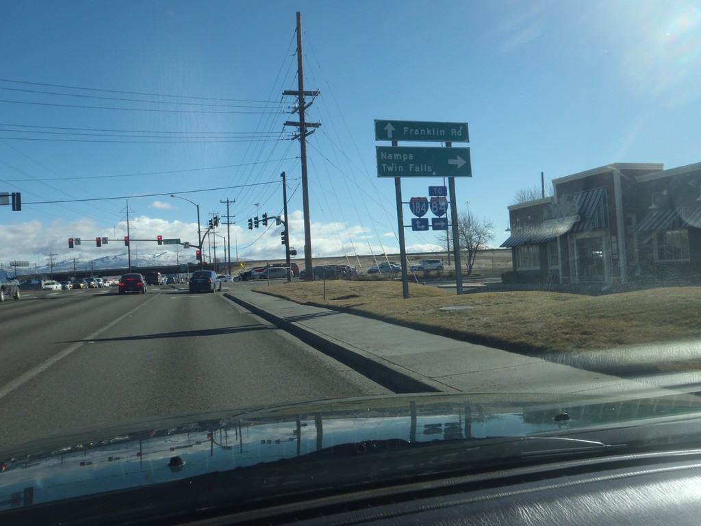
Franklin Road at I-184 West (To I-84)
Franklin Road at I-184 west. Use I-184 west To I-84, Nampa and Twin Falls.
Taken 02-17-2013
 Boise
Ada County
Idaho
United States
Boise
Ada County
Idaho
United States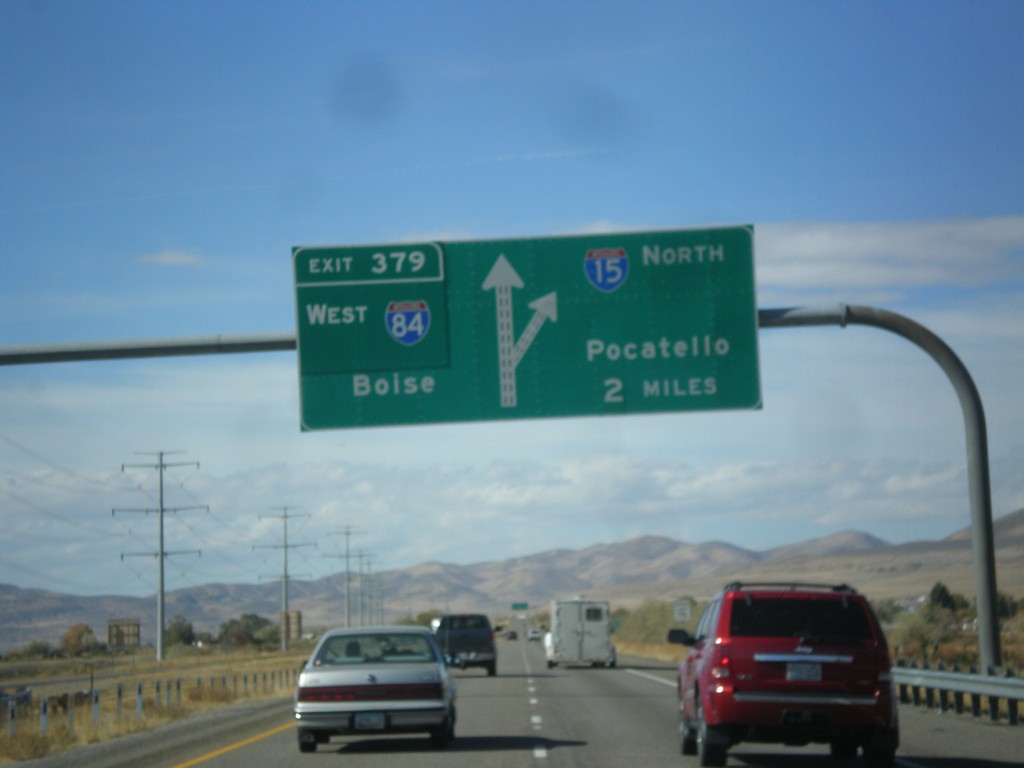
I-15 North - Exit 379
I-15 North/I-84 West approaching Exit 379 - I-84 West/Boise (Idaho). Continue north on I-15 towards Pocatello (Idaho). This is the northern end of the I-84/I-15 multiplex.
Taken 10-20-2012
 Elwood
Box Elder County
Utah
United States
Elwood
Box Elder County
Utah
United States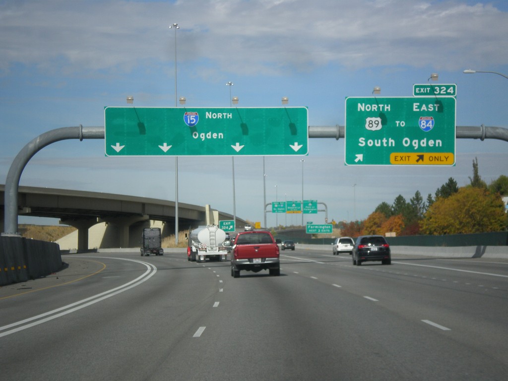
I-15 North - Exit 324
I-15 North at Exit 324 - US-89 North/To I-84/South Ogden. Continue north on I-15 towards Ogden.
Taken 10-20-2012
 Farmington
Davis County
Utah
United States
Farmington
Davis County
Utah
United States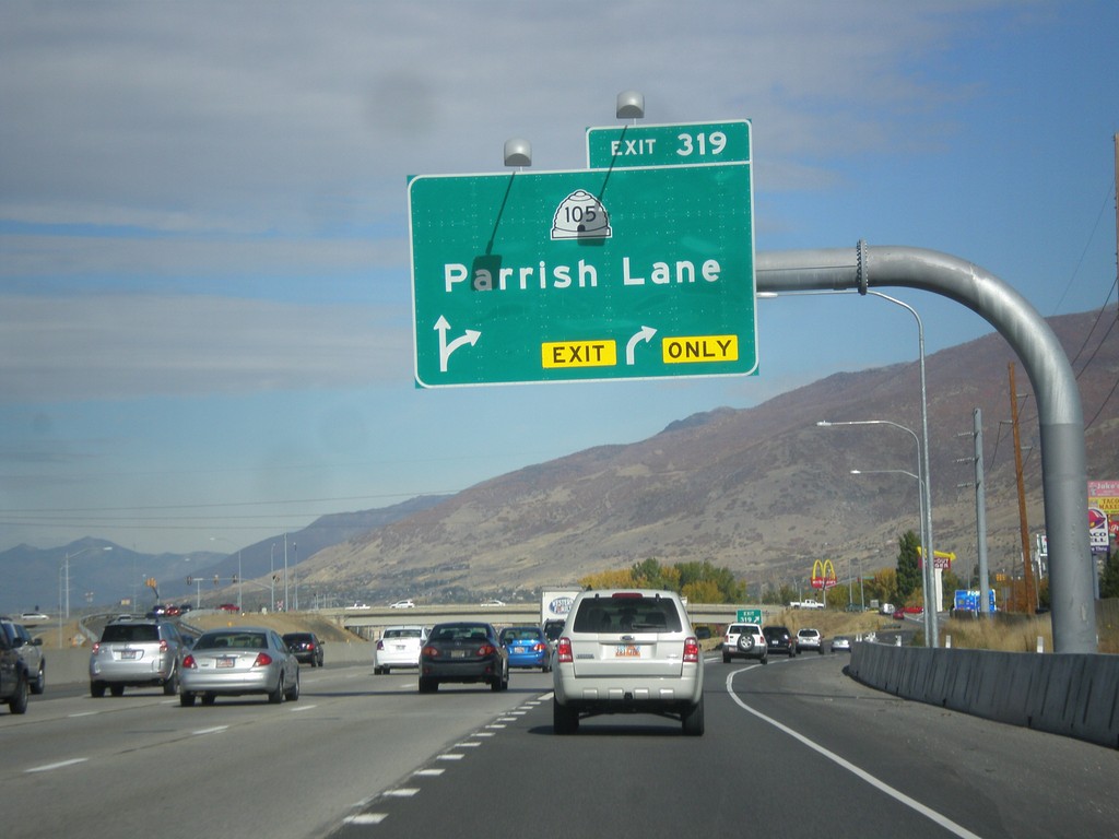
I-15 North - Exit 319
I-15 north at Exit 319 - UT-105/Parrish Lane.
Taken 10-20-2012
 Centerville
Davis County
Utah
United States
Centerville
Davis County
Utah
United States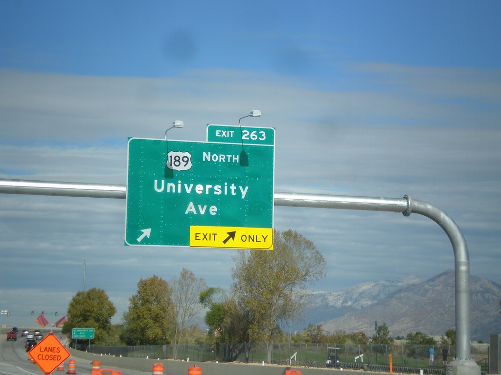
I-15 North - Exit 263
I-15 north at Exit 263 - US-189 North/University Avenue.
Taken 10-20-2012
 Provo
Utah County
Utah
United States
Provo
Utah County
Utah
United States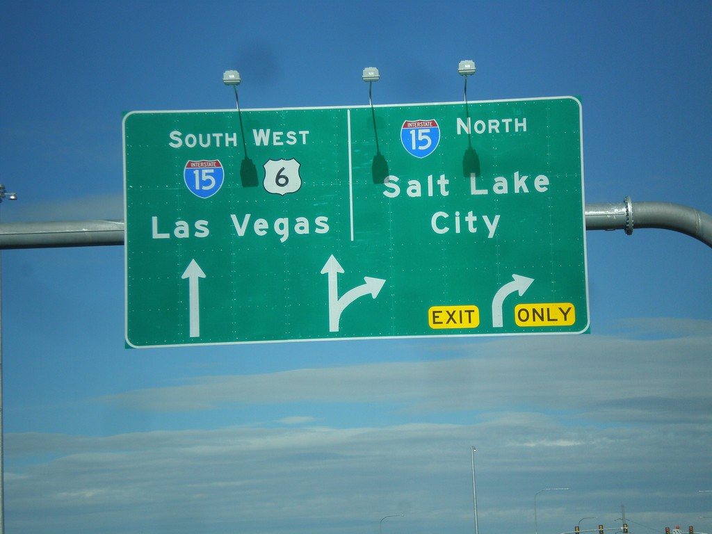
US-6 West Approaching I-15
US-6 west approaching I-15. Merge right for I-15 north towards Salt Lake. Continue ahead for I-15 South/US-6 West for Las Vegas (Nevada). US-6 west joins I-15 south to Santiquin.
Taken 10-20-2012
 Spanish Fork
Utah County
Utah
United States
Spanish Fork
Utah County
Utah
United States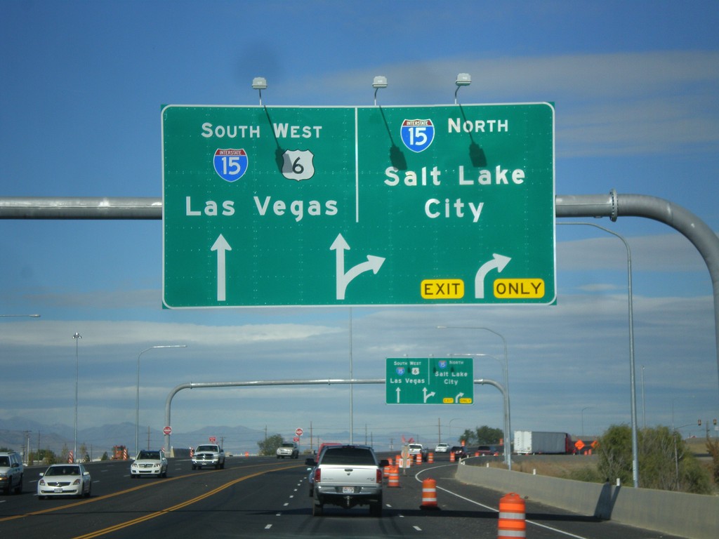
US-6 West at I-15
US-6 west at I-15 in Spanish Fork. Use I-15 north for Salt Lake; use I-15 South/US-6 West for Las Vegas (Nevada). US-6 joins I-15 south to Santiquin.
Taken 10-20-2012
Spanish Fork
Utah County
Utah
United States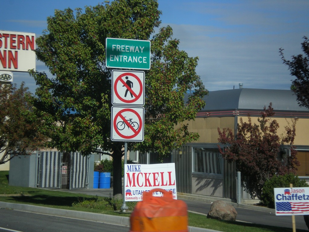
US-6 West - Freeway Entrance
Freeway Entrance on US-6 west approaching I-15.
Taken 10-20-2012
Spanish Fork
Utah County
Utah
United States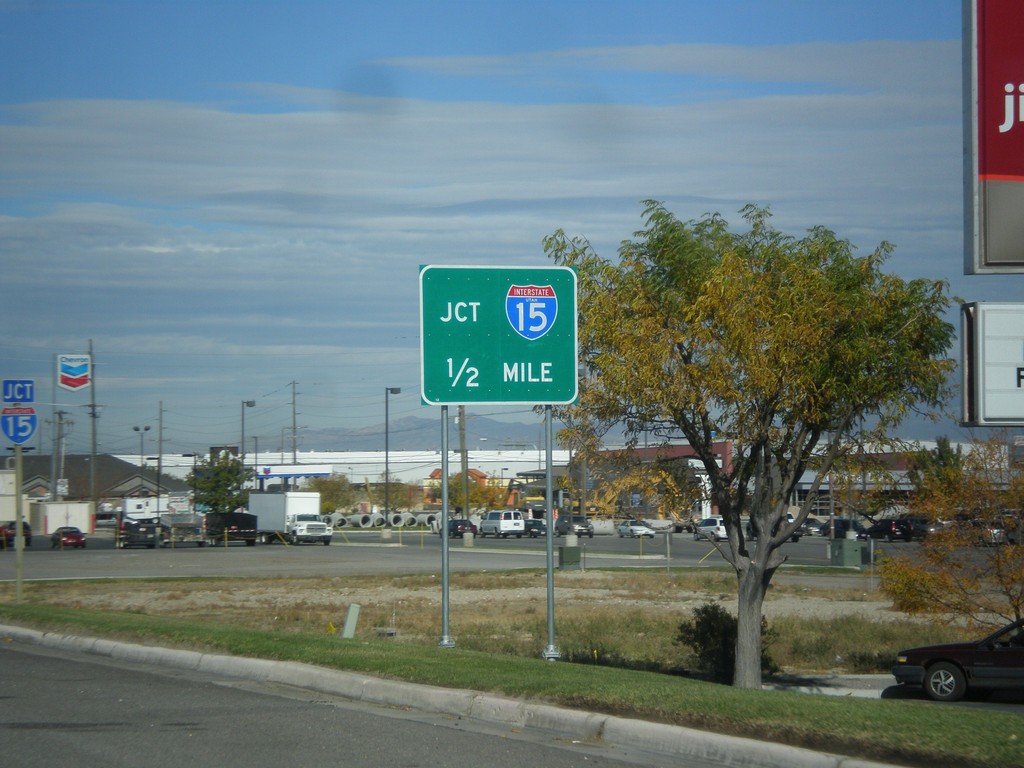
US-6 West Approaching I-15
US-6 west approaching I-15 onramps. Notice the the I-15 shield inside the I-15 Jct. big green sign has the word Utah in it. There are a few of these shields around the Provo area that appear to be newly posted.
Taken 10-20-2012
Spanish Fork
Utah County
Utah
United States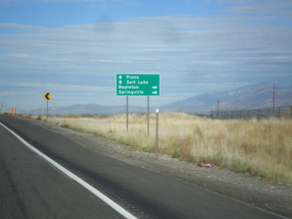
US-6 West/US-89 At US-6/US-89 Split
US-6 West/US-89 at US-6/US-89 split. Turn right for US-89 north to Springville and Mapleton. Continue west on US-6 towards Salt Lake City and Provo.
Taken 10-20-2012
Spanish Fork
Utah County
Utah
United States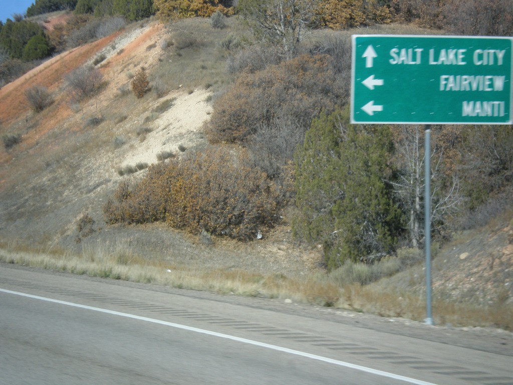
US-6 West at US-89
US-6 west at US-89 junction. Turn left for US-89 south to Manti, and Fairview. Continue west on US-6/US-89 North towards Spanish Fork. US-89 joins US-6 through Spanish Fork Canyon.
Taken 10-20-2012
Spanish Fork
Utah County
Utah
United States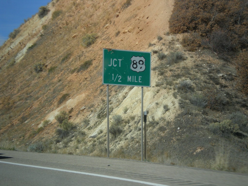
US-6 West Approaching US-89
US-6 west approaching US-89.
Taken 10-20-2012
Spanish Fork
Utah County
Utah
United States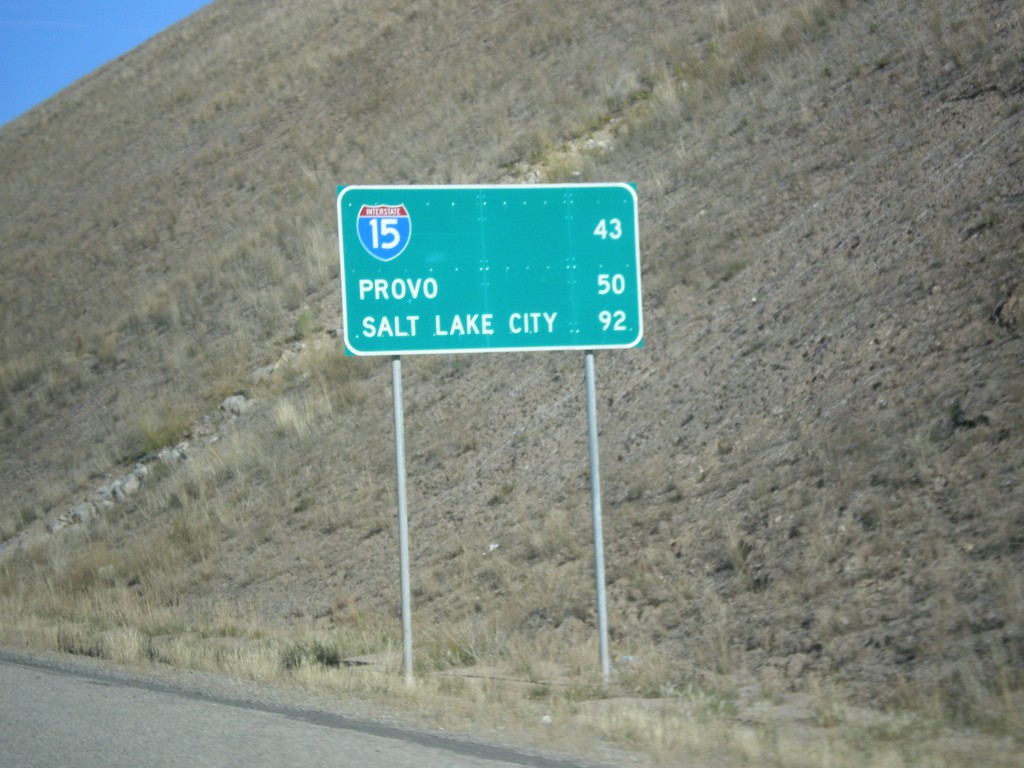
US-6 West - Distance Marker
Distance Marker on US-6 west. Distance to I-15, Provo, and Salt Lake City.
Taken 10-20-2012
Colton
Utah County
Utah
United States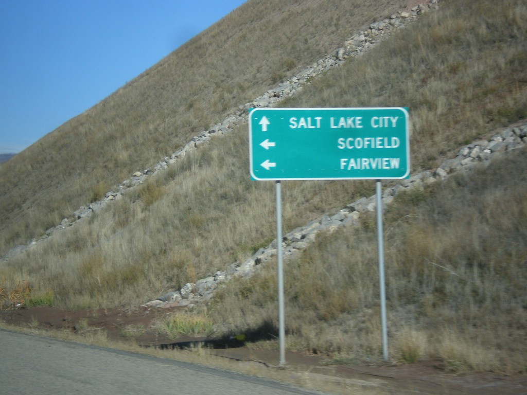
US-6 West Approaching UT-96
US-6 west approaching UT-96 to Scofield and Fairview. Continue west on US-6 for Salt Lake City.
Taken 10-20-2012
 Helper
Utah County
Utah
United States
Helper
Utah County
Utah
United States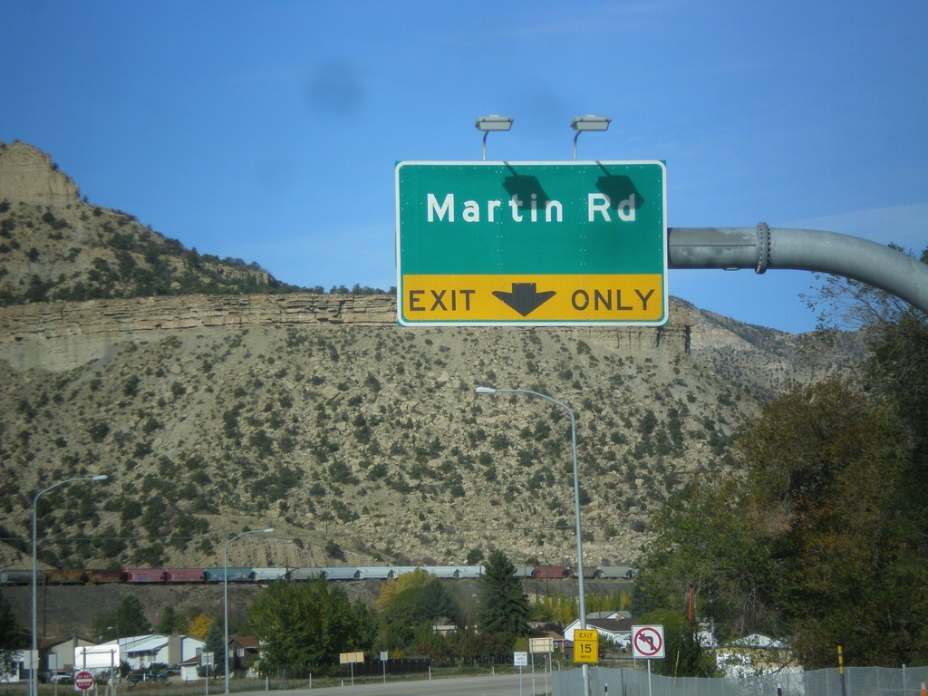
US-6 West/US-191 North at Martin Road
US-6 West/US-191 North at Martin Road interchange.
Taken 10-20-2012
 Helper
Carbon County
Utah
United States
Helper
Carbon County
Utah
United States