Signs Tagged With Big Green Sign
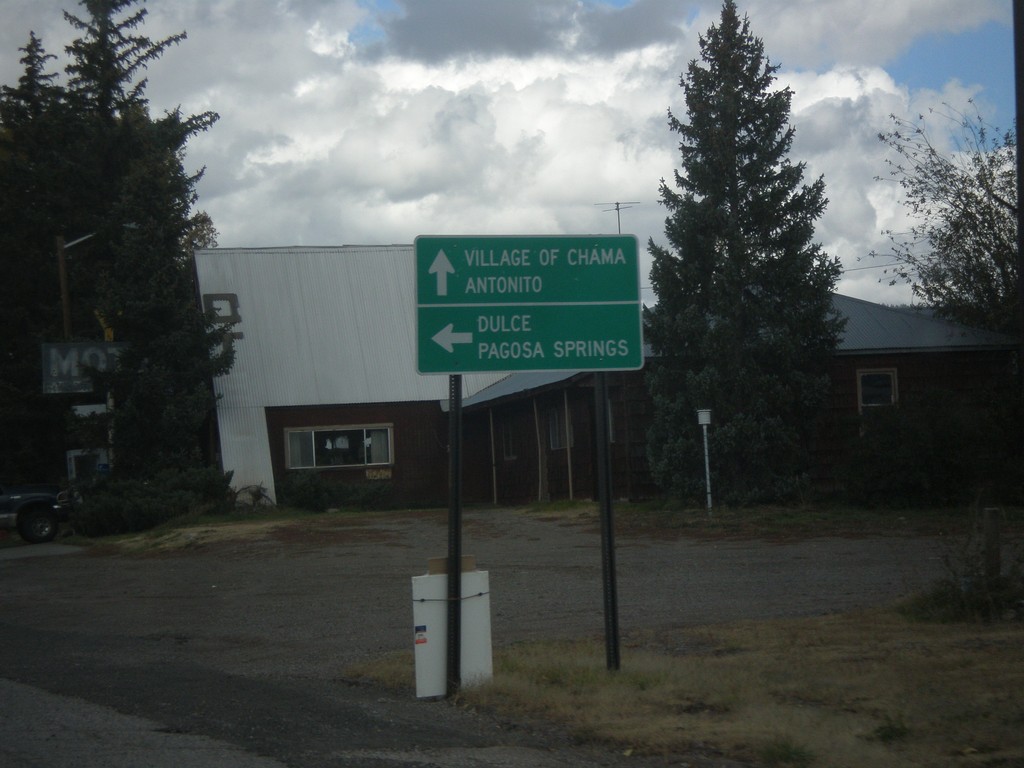
US-64 West/US-84 North Approaching NM-17
US-64 West/US-84 North approaching NM-17. Use NM-17 for the Village of Chama and Antonito (Colorado). Turn left to continue west on US-64/US-84 towards Dulce and Pagosa Springs (Colorado).
Taken 10-13-2013


 Chama
Rio Arriba County
New Mexico
United States
Chama
Rio Arriba County
New Mexico
United States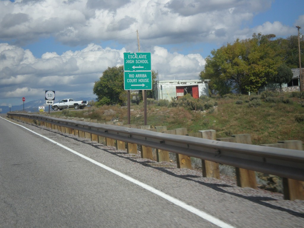
US-64 West/US-84 North Approaching NM-531
US-64 West/US-84 North approaching NM-531. Turn left for Escalante High School; turn right for Rio Arriba Court House (in Tierra Amarilla).
Taken 10-13-2013
 Tierra Amarilla
Rio Arriba County
New Mexico
United States
Tierra Amarilla
Rio Arriba County
New Mexico
United States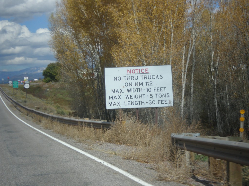
US-64 West/US-84 North - No Thru Trucks on NM-112
US-64 West/US-84 North approaching NM-531 junction. No thru trucks on NM-112.
Taken 10-13-2013
Tierra Amarilla
Rio Arriba County
New Mexico
United States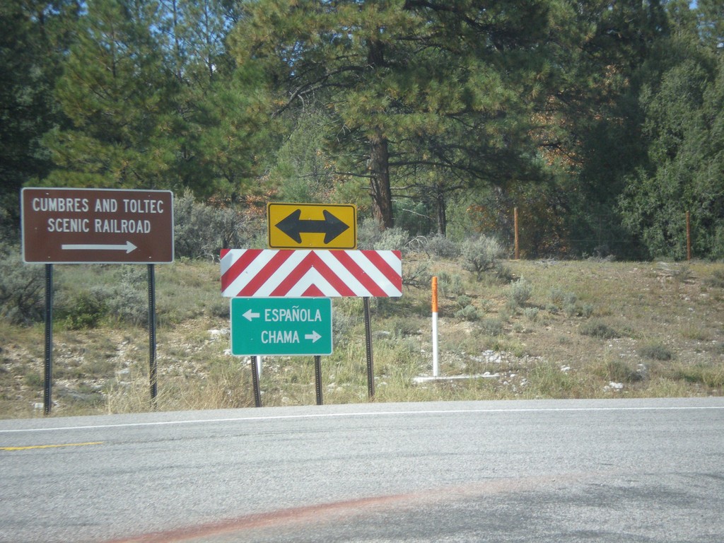
US-64 West at US-84
US-64 west at US-84. Turn right to continue west on US-84. US-64 joins US-84, through Chama, and over the Continental Divide. Turn left on US-64/US-84 for Chama and the Cumbres and Toltec Scenic Railroad; turn right on US-84 for Espanola.
Taken 10-13-2013
Los Ojos
Rio Arriba County
New Mexico
United States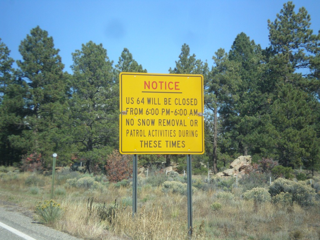
US-64 West Closure Hours
US-64 will be closed from 6:00 PM to 6:00 AM (between Tres Piedras and Tierra Amarilla). No snow removal or patrol activities during these times.
Taken 10-13-2013
Tres Piedras
Taos County
New Mexico
United States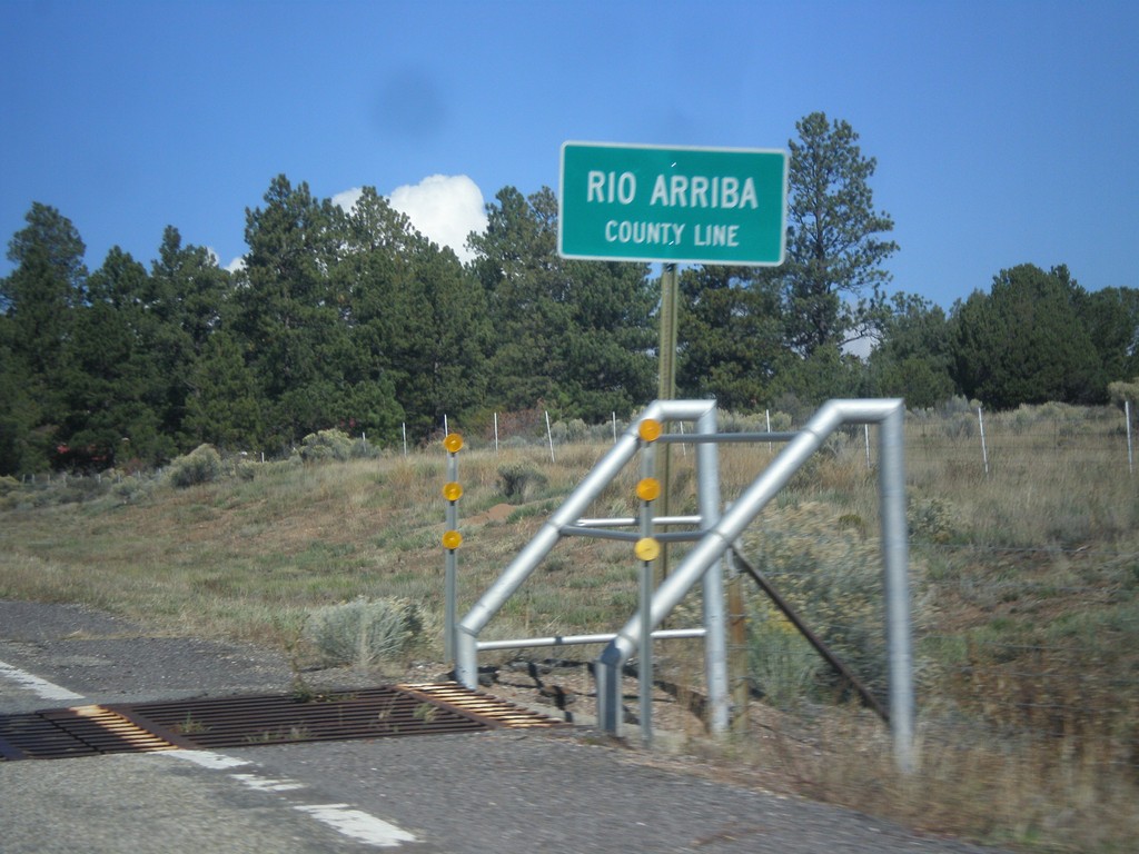
US-64 West - Rio Arriba County Line
Rio Arriba County Line on US-64 west, leaving Tres Piedras.
Taken 10-13-2013
Tres Piedras
Taos County
New Mexico
United States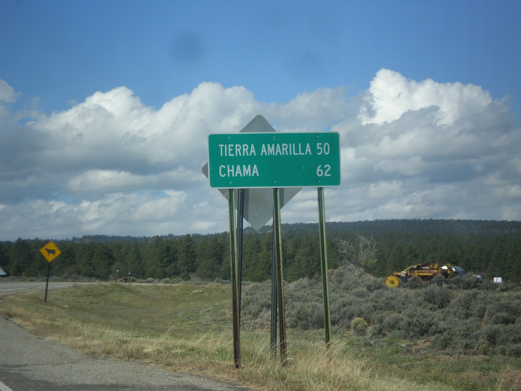
US-64 West - Distance Marker
Distance marker on US-64 west in Tres Piedras. Distance to Tierra Amarilla, and Chama.
Taken 10-13-2013
Tres Piedras
Taos County
New Mexico
United States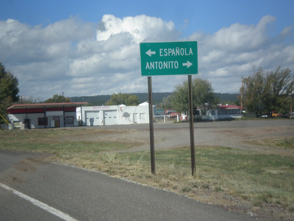
US-64 West at US-285
US-64 west at US-285 in Tres Piedras. Turn right for US-285 north to Antonito (Colorado). Turn left for US-285 south to Espanola.
Taken 10-13-2013
 Tres Piedras
Taos County
New Mexico
United States
Tres Piedras
Taos County
New Mexico
United States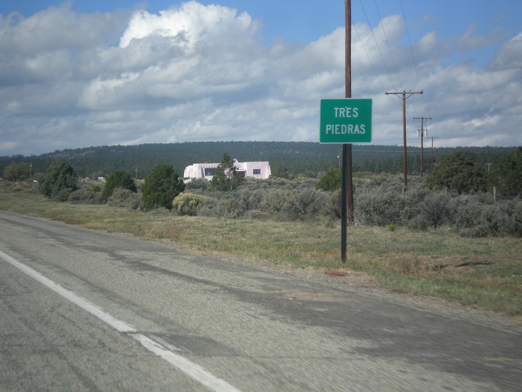
US-64 West - Tres Piedras
Entering Tres Piedras on US-64 west.
Taken 10-13-2013
Tres Piedras
Taos County
New Mexico
United States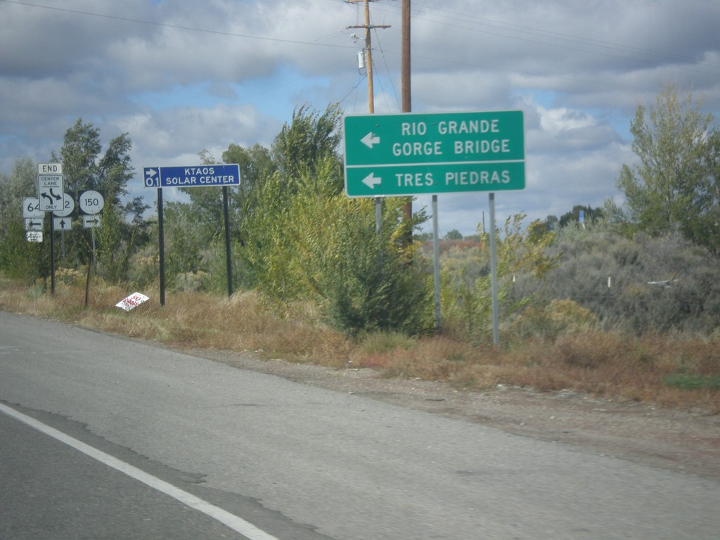
US-64 West at NM-150/NM-522
US-64 west at NM-150/NM-522 junction. Use US-64 for Tres Piedras and Rio Grande Gorge Bridge.
Taken 10-11-2013

 El Prado
Taos County
New Mexico
United States
El Prado
Taos County
New Mexico
United States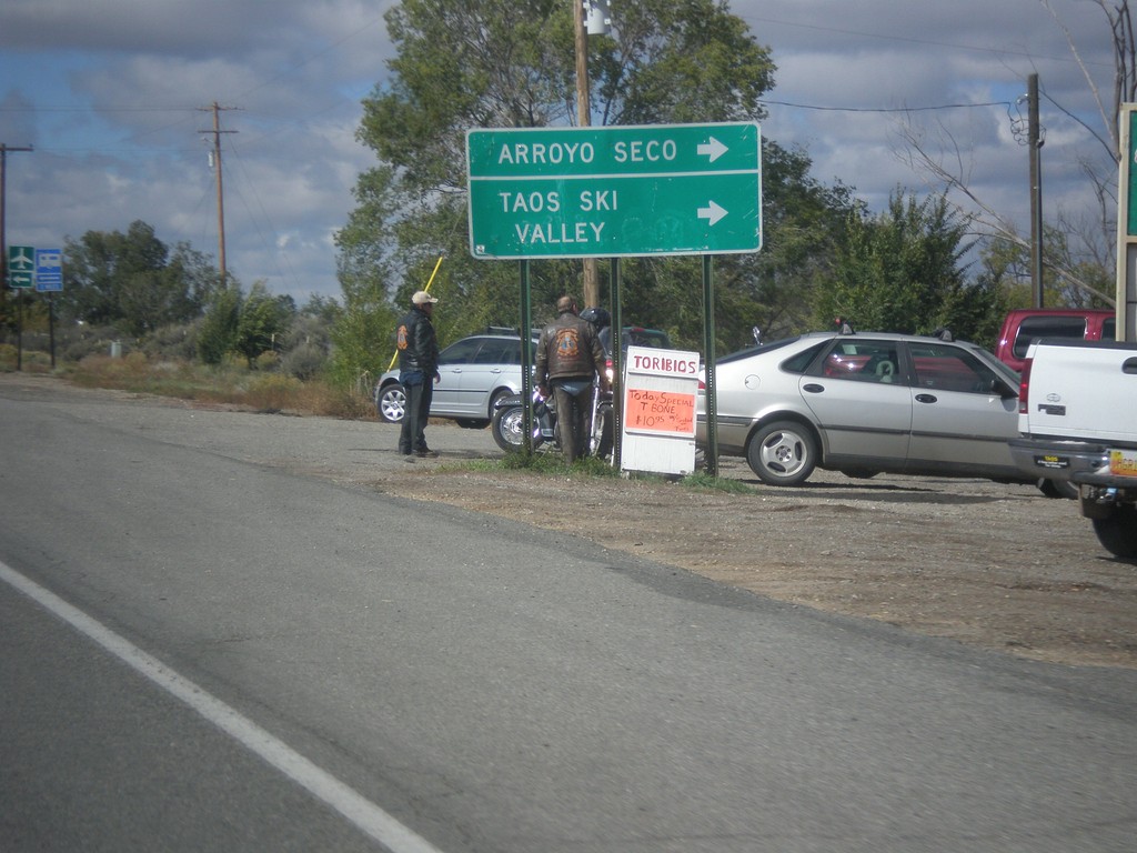
US-64 West at NM-150/NM-522
US-64 west at NM-150/NM-522. Turn right on NM-150 for Taos Ski Valley and Arroyo Seco.
Taken 10-11-2013
El Prado
Taos County
New Mexico
United States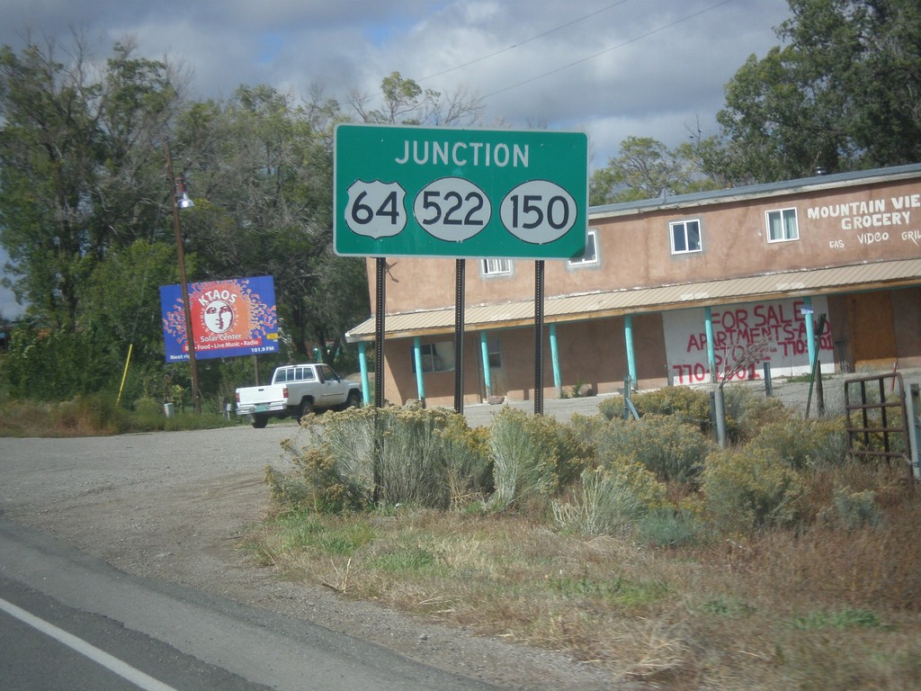
US-64 West Approaching NM-150/NM-522
US-64 West approaching NM-150/NM-522 in El Prado.
Taken 10-11-2013
El Prado
Taos County
New Mexico
United States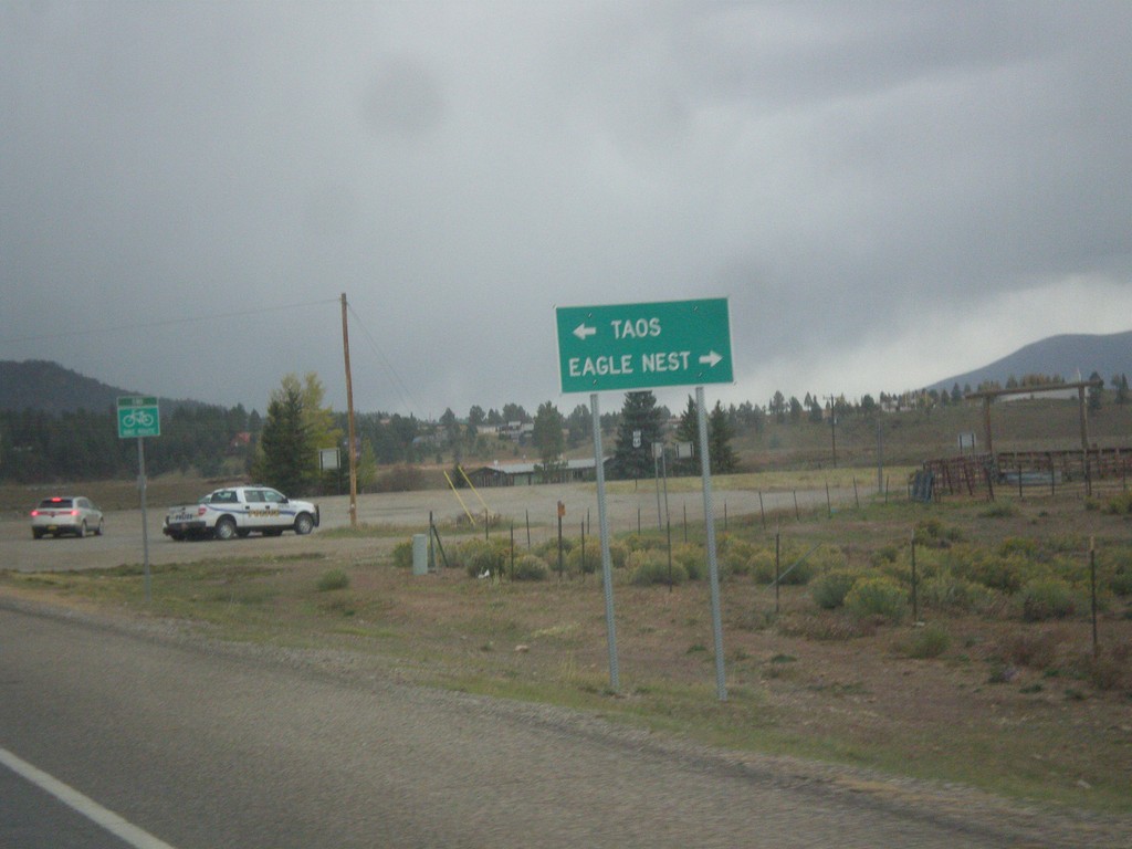
End NM-434 North at US-64
End NM-434 north at US-64. Turn right for US-64 east to Eagle Nest; left for US-64 west to Taos.
Taken 10-10-2013
 Angel Fire
Colfax County
New Mexico
United States
Angel Fire
Colfax County
New Mexico
United States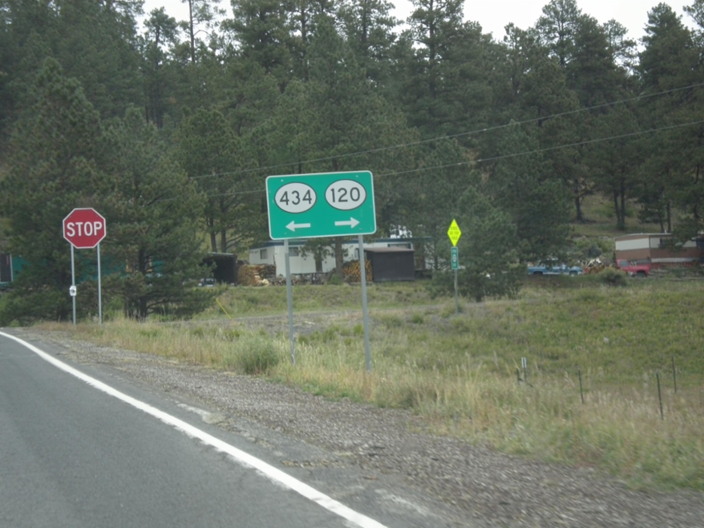
NM-434 North at NM-120
NM-434 north at NM-120 in Colfax County. Turn right for NM-120, turn left to continue north on NM-434.
Taken 10-10-2013
 Guadalupita
Colfax County
New Mexico
United States
Guadalupita
Colfax County
New Mexico
United States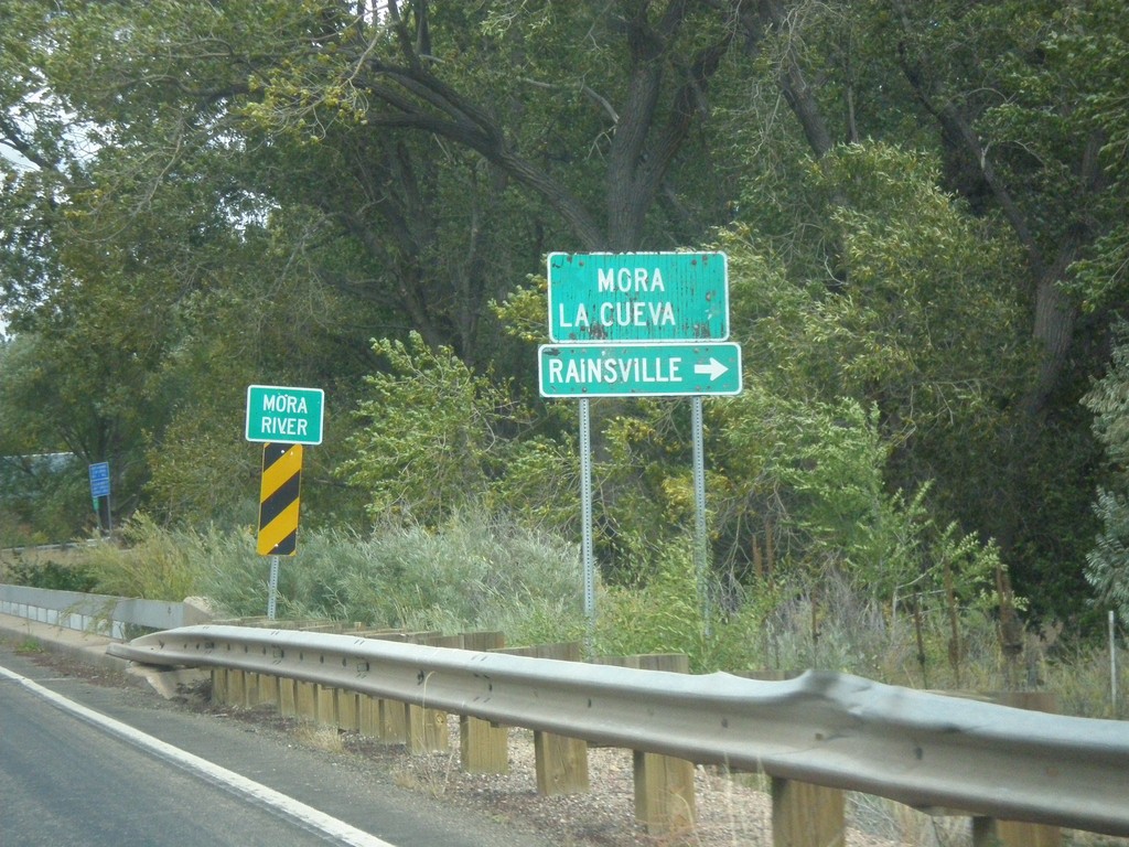
NM-518 North At NM-442
NM-518 north at NM-442. Turn right on NM-442 for Rainsville. Continue north on NM-518 for Mora and La Cueva. Crossing the Mora River.
Taken 10-10-2013

 Mora
Mora County
New Mexico
United States
Mora
Mora County
New Mexico
United States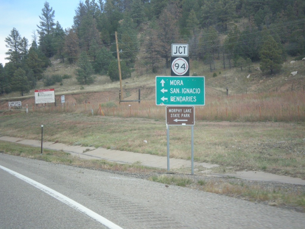
NM-518 North Approaching NM-94
NM-518 north approaching NM-94 west to San Ignacio, Pendaries, and Morphy Lake State Park. Continue north on NM-518 for Mora.
Taken 10-10-2013
 Sapello
San Miguel County
New Mexico
United States
Sapello
San Miguel County
New Mexico
United States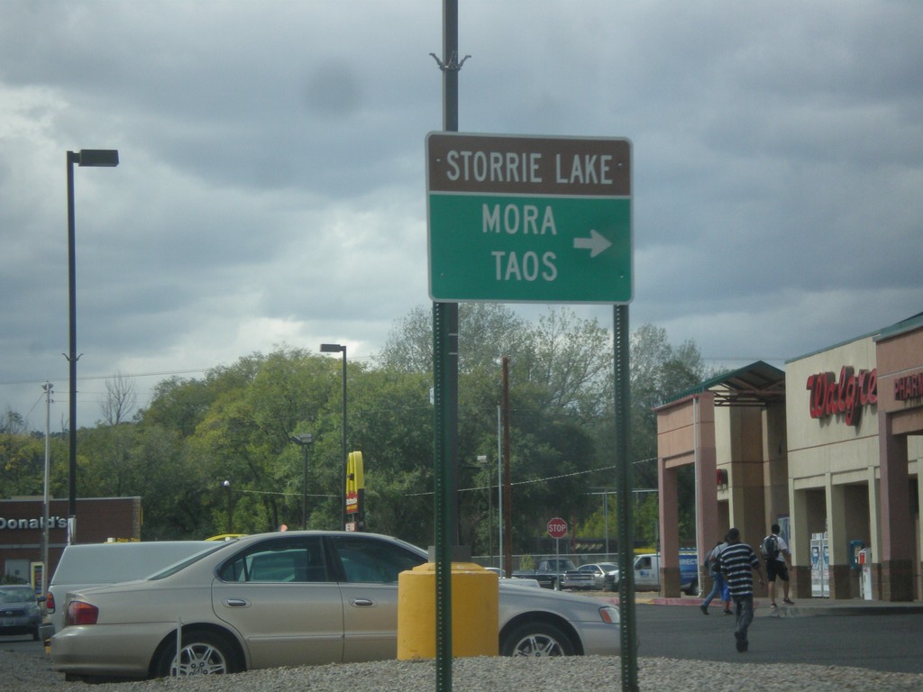
Mills Ave. West at NM-518
Mills Ave. west at NM-518. Use NM-518 north for Storrie Lake (State Park), Mora, and Taos. From the documentation I can find, it appears that Mills Ave. was formerly signed as NM-329. There were no NM-329 shields along Mills Ave. in 2013, when this picture was taken. This is also the southern end of NM-518, which used to extend south through Las Vegas to BL-25.
Taken 10-10-2013
Las Vegas
San Miguel County
New Mexico
United States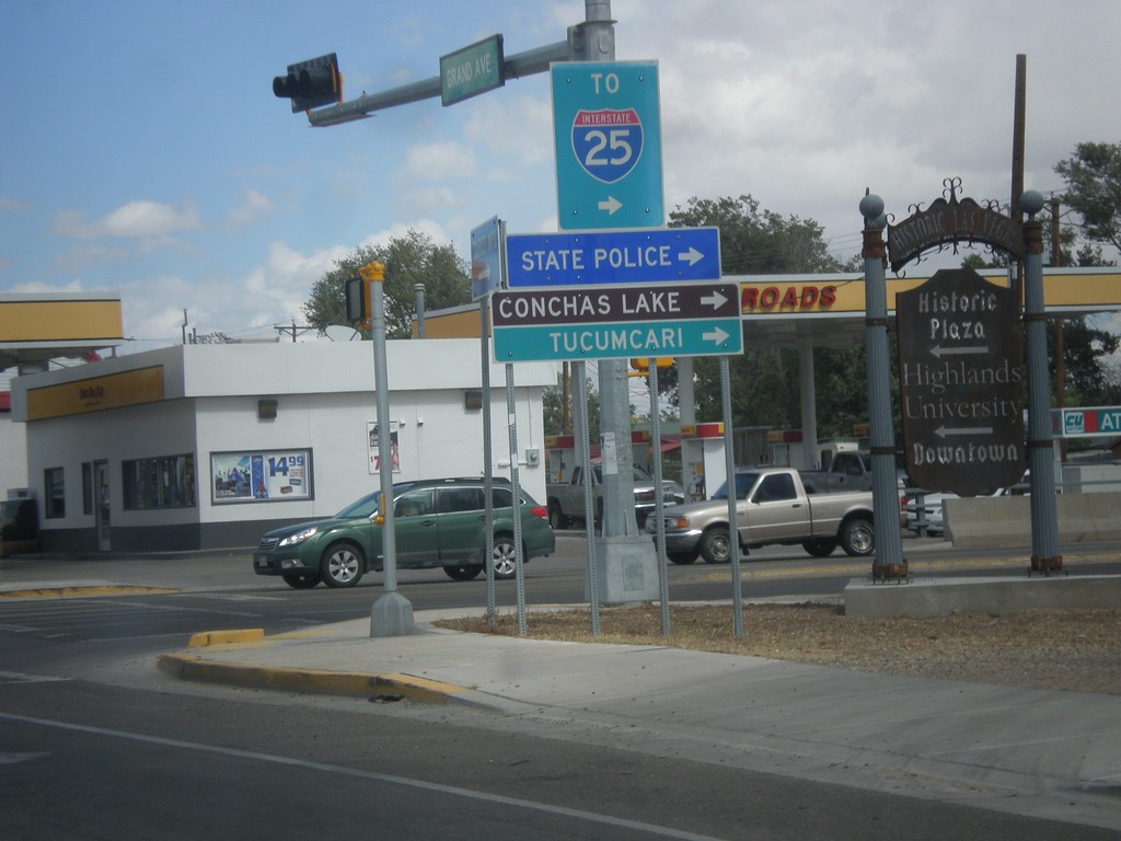
BL-25 North (Grand Ave.) at NM-104
BL-25 North (Grand Ave.) at NM-104 in Las Vegas. Turn right on NM-104 east for I-25, Conchas Lake (State Park), Tucumcari, and State Police.
Taken 10-10-2013

 Las Vegas
San Miguel County
New Mexico
United States
Las Vegas
San Miguel County
New Mexico
United States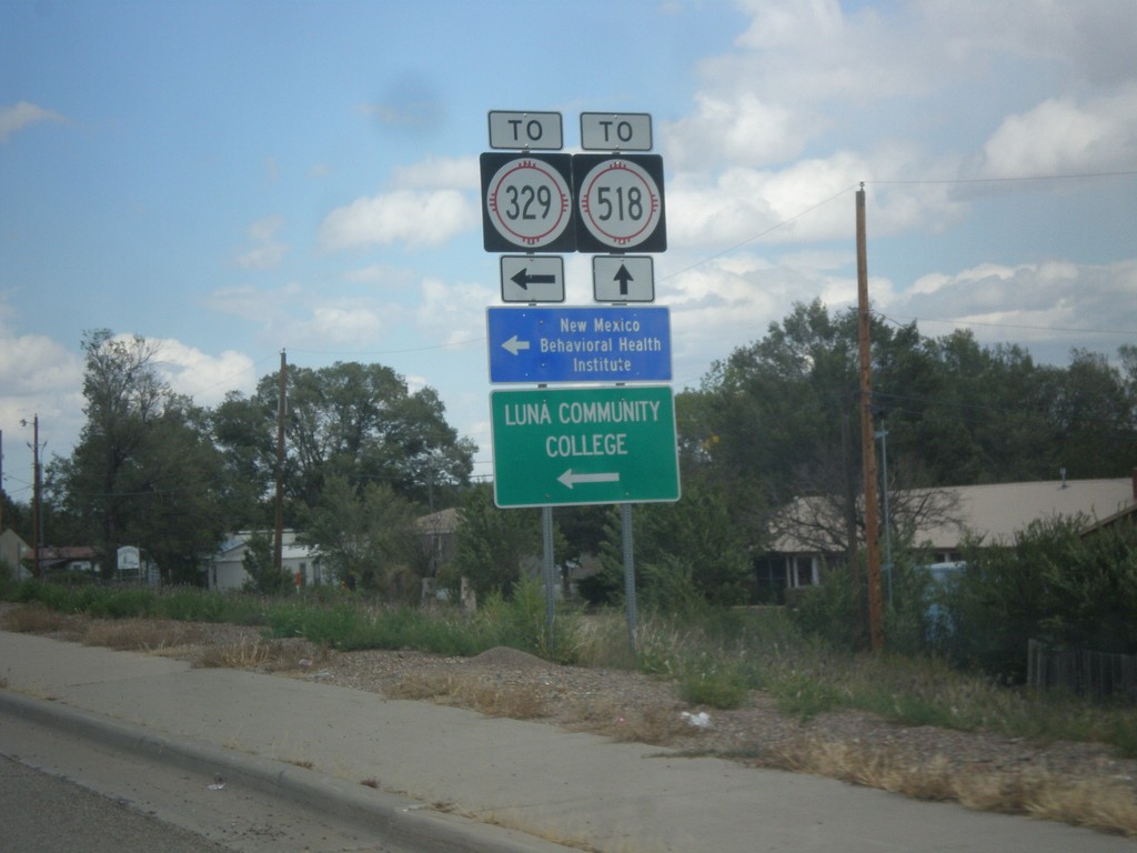
BL-25 North (Grand Ave.) at NM-329 (New Mexico Ave.)
BL-25 North (Grand Ave.) at NM-329 (New Mexico Ave.). This sign assembly says that New Mexico Ave. leads to NM-329. It appears that NM-329 runs down New Mexico Ave. and intersects Grand Ave. here, and the TO text is erroneous. Turn left on NM-329 for New Mexico Behavioral Health Institute and Luna Community College.
Taken 10-10-2013
 Las Vegas
San Miguel County
New Mexico
United States
Las Vegas
San Miguel County
New Mexico
United States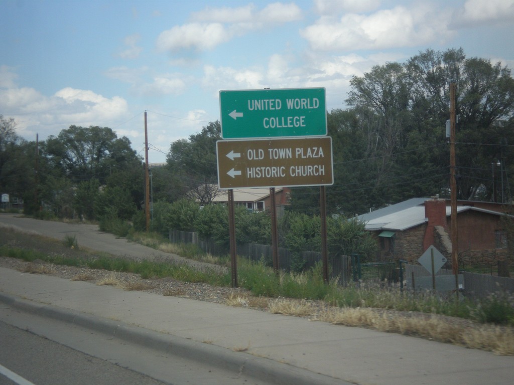
BL-25 North Approaching NM-329
BL-25 north approaching NM-329. Use NM-329 north for United World College, Old Town Plaza, and Historic Church.
Taken 10-10-2013
Las Vegas
San Miguel County
New Mexico
United States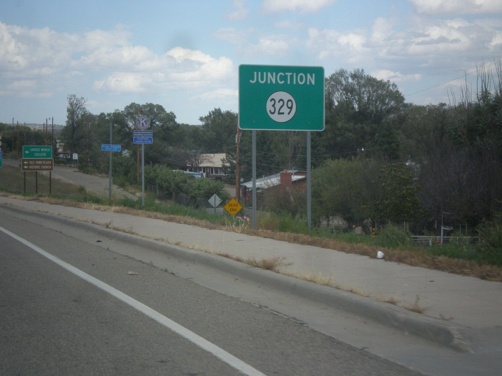
BL-25 North (Grand Ave.) Approaching NM-329
BL-25 north (Grand Ave.) approaching NM-329, in Las Vegas.
Taken 10-10-2013
Las Vegas
San Miguel County
New Mexico
United States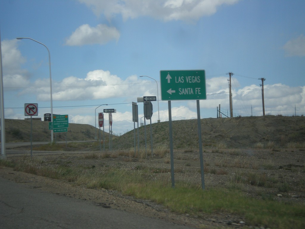
BL-25 North (Grand Ave.) at I-25 South
BL-25 North (Grand Ave.) at I-25 South to Santa Fe. Continue north on BL-25 for Las Vegas.
Taken 10-10-2013
Las Vegas San Miguel County New Mexico United States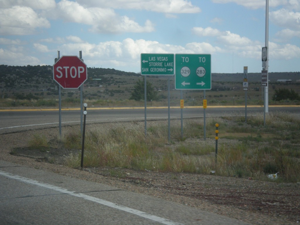
I-25 North at BL-25 - To NM-329/To NM-283
I-25 north, Exit 343 offramp. Turn right for NM-283 to San Geronimo; turn left for BL-25 and NM-329 to Las Vegas and Storrie Lake (State Park).
Taken 10-10-2013

 Las Vegas
San Miguel County
New Mexico
United States
Las Vegas
San Miguel County
New Mexico
United States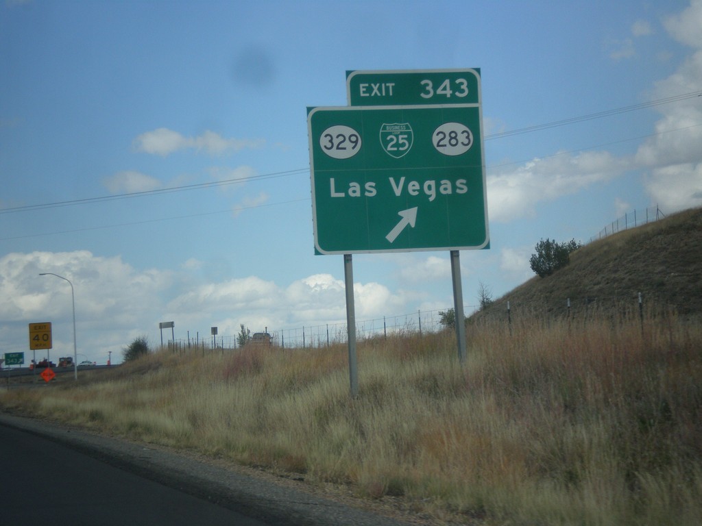
I-25 North - Exit 343
I-25 north at Exit 343 - BL-25/NM-329/NM-283/Las Vegas.
Taken 10-10-2013
Las Vegas
San Miguel County
New Mexico
United States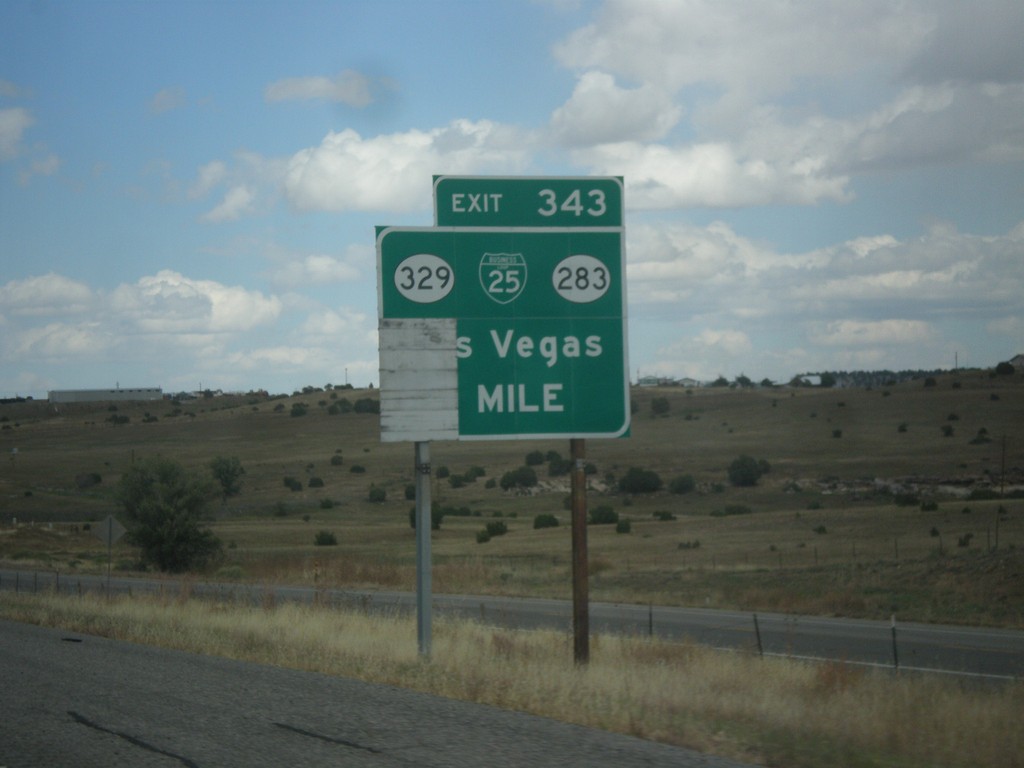
I-25 North - Exit 383
I-25 north at Exit 383 - BL-25/NM-329/NM-283/Las Vegas. This is the southern end of the Las Vegas business loop.
Taken 10-10-2013
Las Vegas
San Miguel County
New Mexico
United States