Signs Tagged With Big Green Sign
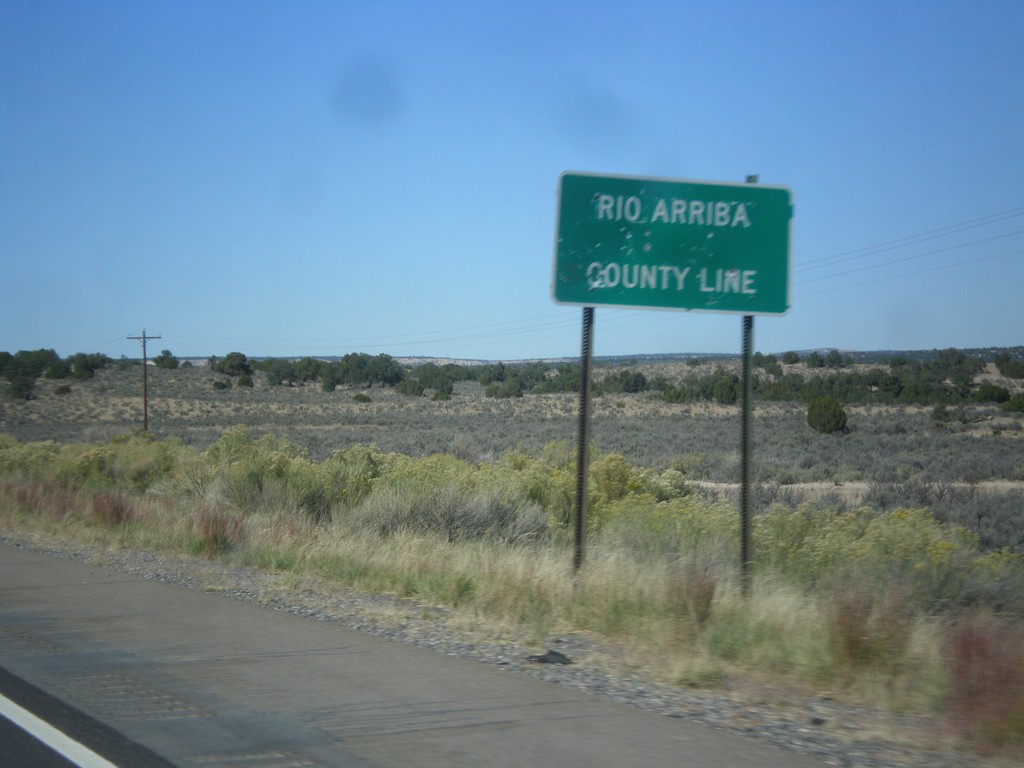
US-550 North - Rio Arriba County Line
Rio Arriba County Line on US-550 north.
Taken 10-15-2012
 Counselor
Rio Arriba County
New Mexico
United States
Counselor
Rio Arriba County
New Mexico
United States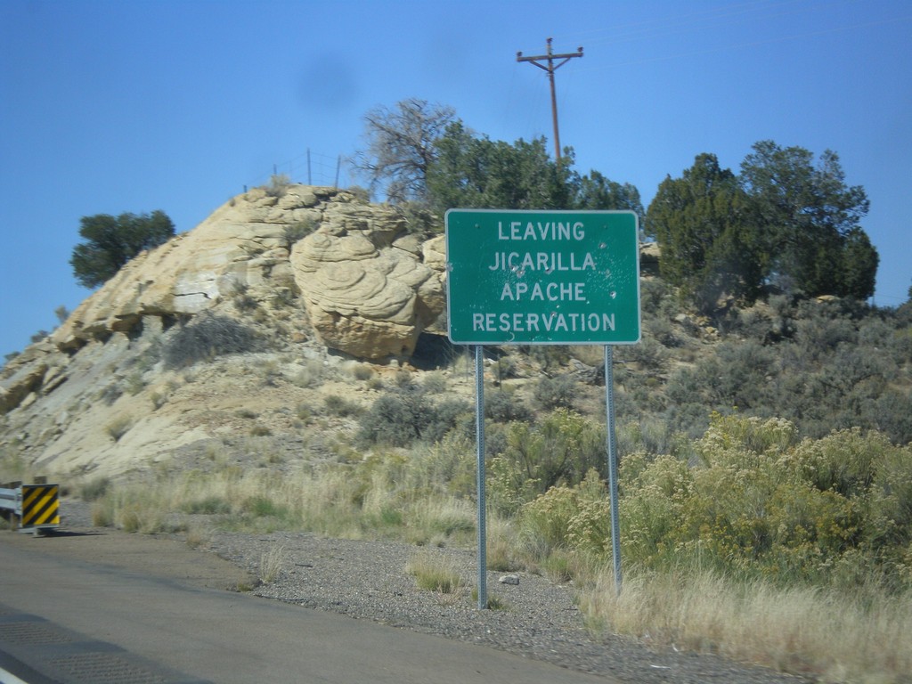
US-550 North - Leaving Jicarilla Apache Reservation
Leaving Jicarilla Apache Reservation on US-550 north.
Taken 10-15-2012
Counselor
Sandoval County
New Mexico
United States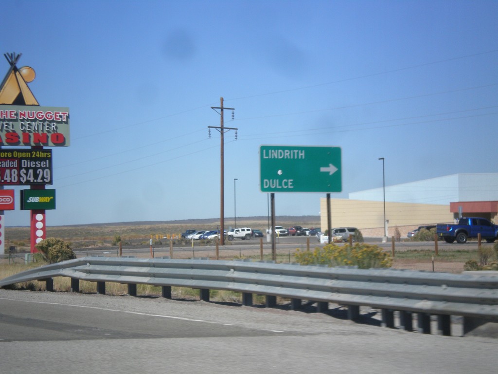
US-550 North at NM-573
US-550 north at NM-573 north to Dulce and Lindrith.
Taken 10-15-2012
 Cuba
Sandoval County
New Mexico
United States
Cuba
Sandoval County
New Mexico
United States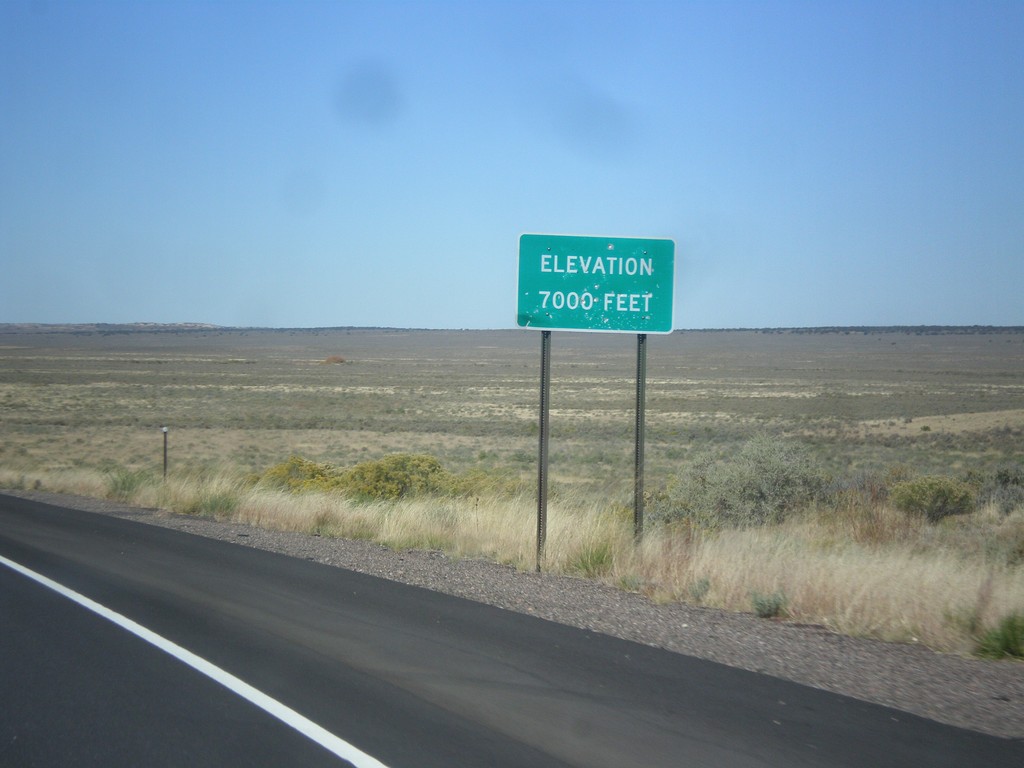
US-550 North - Elevation 7000 Feet
Elevation 7000 Feet, descending from the Continental Divide on US-550 north.
Taken 10-15-2012
Cuba
Sandoval County
New Mexico
United States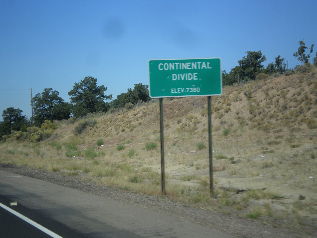
US-550 North - Continental Divide
Continental Divide - Elevation 7380 Feet on US-550 north. This is the divide between the San Juan River drainage and the Rio Grande drainage.
Taken 10-15-2012
Cuba
Sandoval County
New Mexico
United States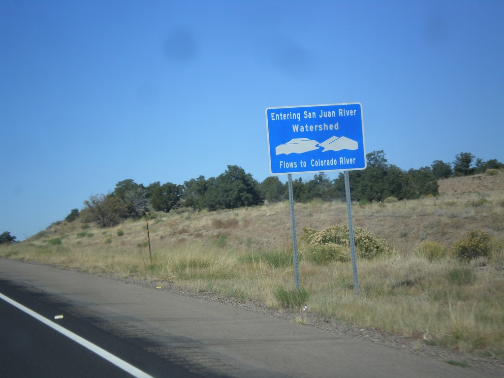
US-550 North - San Juan River Watershed
Entering the San Juan River watershed at the Continental Divide on US-550 north. The San Juan River flows into the Colorado River.
Taken 10-15-2012
Cuba
Sandoval County
New Mexico
United States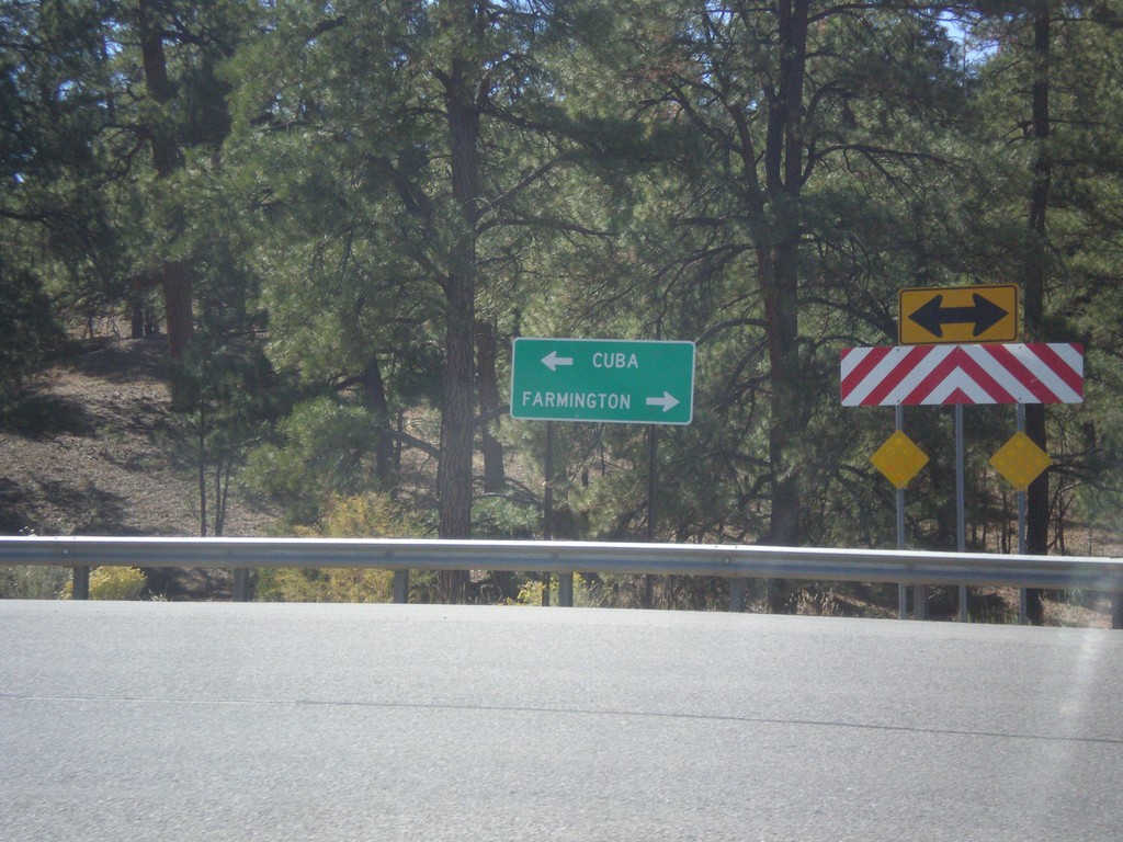
End NM-96 West at US-550
End NM-96 west at US-550. Turn right for Farmington; turn left for Cuba.
Taken 10-15-2012
 Cuba
Sandoval County
New Mexico
United States
Cuba
Sandoval County
New Mexico
United States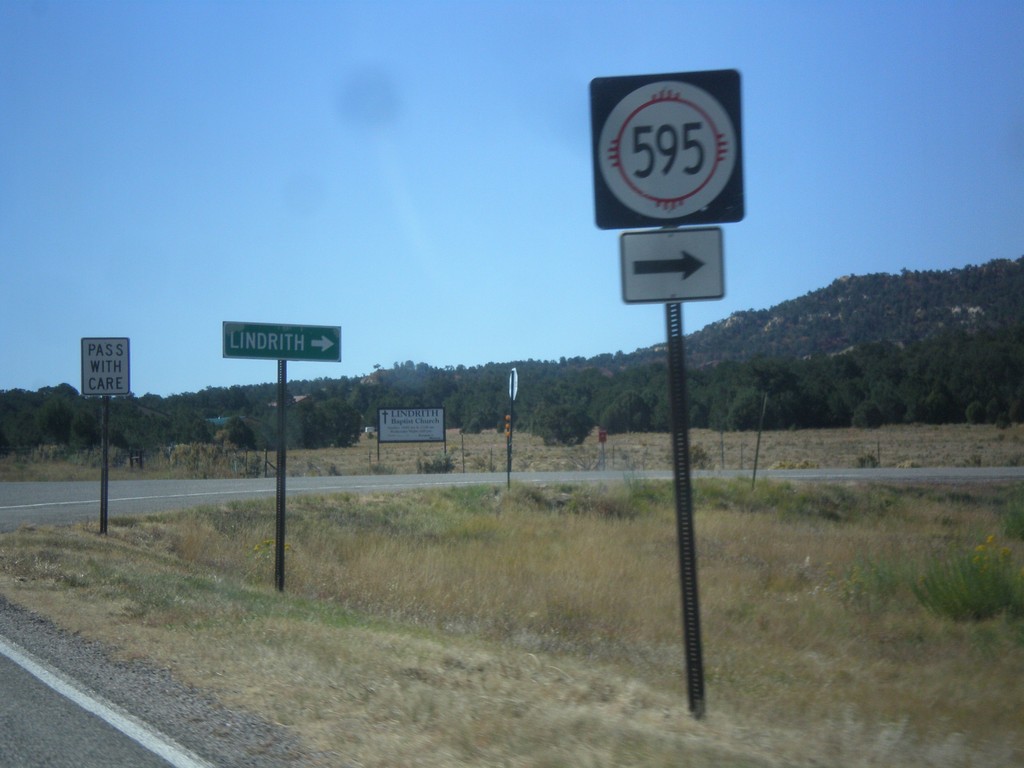
NM-96 West at NM-595
NM-96 west at NM-595 to Lindrith.
Taken 10-15-2012
 Regina
Rio Arriba County
New Mexico
United States
Regina
Rio Arriba County
New Mexico
United States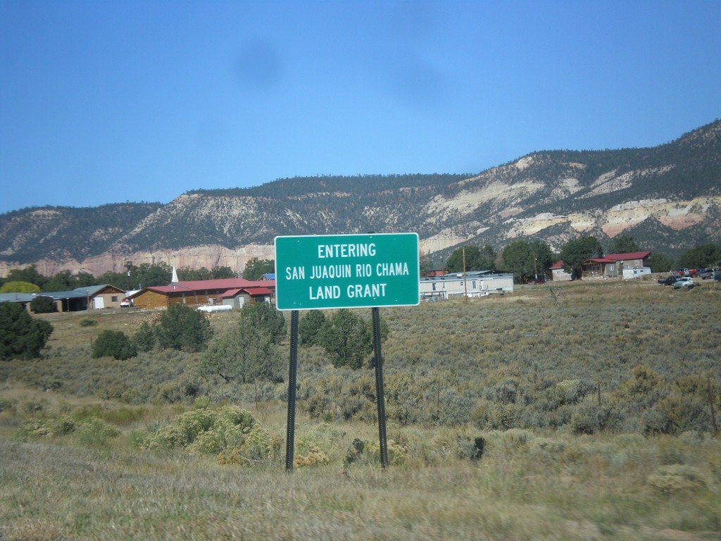
NM-96 West - San Juaquin Rio Chama Land Grant
Entering the San Juaquin Rio Chama Land Grant on NM-96 west.
Taken 10-15-2012
Coyote
Rio Arriba County
New Mexico
United States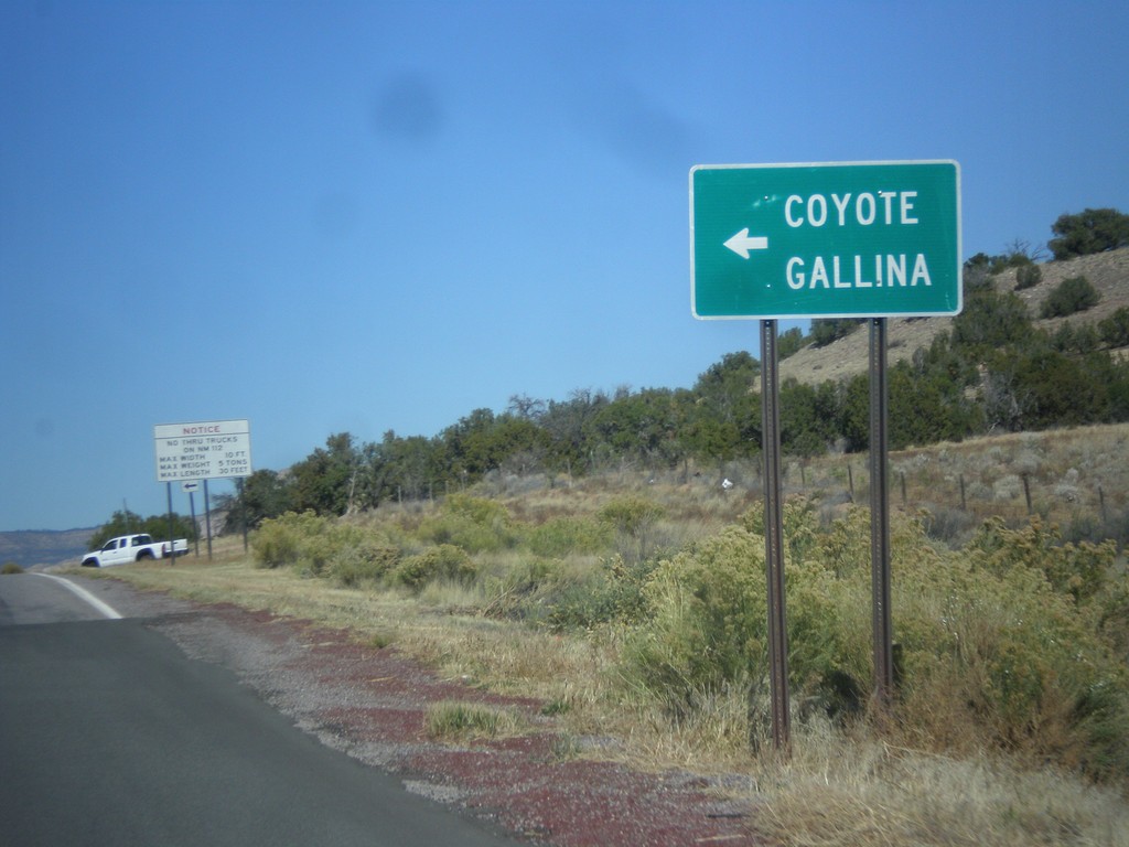
US-84 West Approaching NM-96
US-84 west approaching NM-96. Turn left for NM-96 west to Coyote and Gallina.
Taken 10-15-2012
 Gallina
Rio Arriba County
New Mexico
United States
Gallina
Rio Arriba County
New Mexico
United States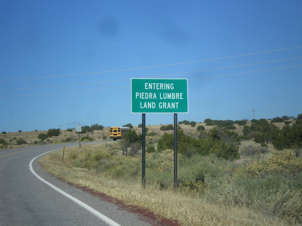
US-84 West - Entering Piedra Lumbre Land Grant
Entering Piedra Lumbre Land Grant on US-84 west.
Taken 10-15-2012
Gallina
Rio Arriba County
New Mexico
United States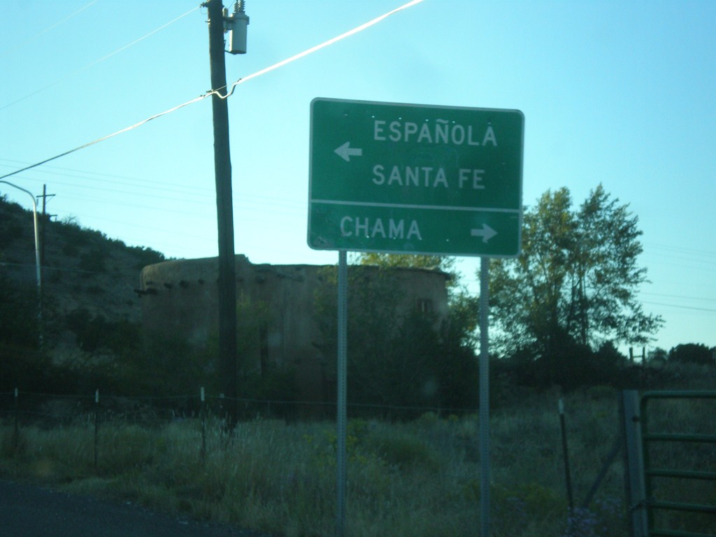
End NM-74 West at US-84/US-285
End NM-74 west at US-84/US-285. Use US-84 West/US-285 North to Chama; use US-84 East/US-285 South to Espanola and Santa Fe.
Taken 10-14-2012

 Hernandez
Rio Arriba County
New Mexico
United States
Hernandez
Rio Arriba County
New Mexico
United States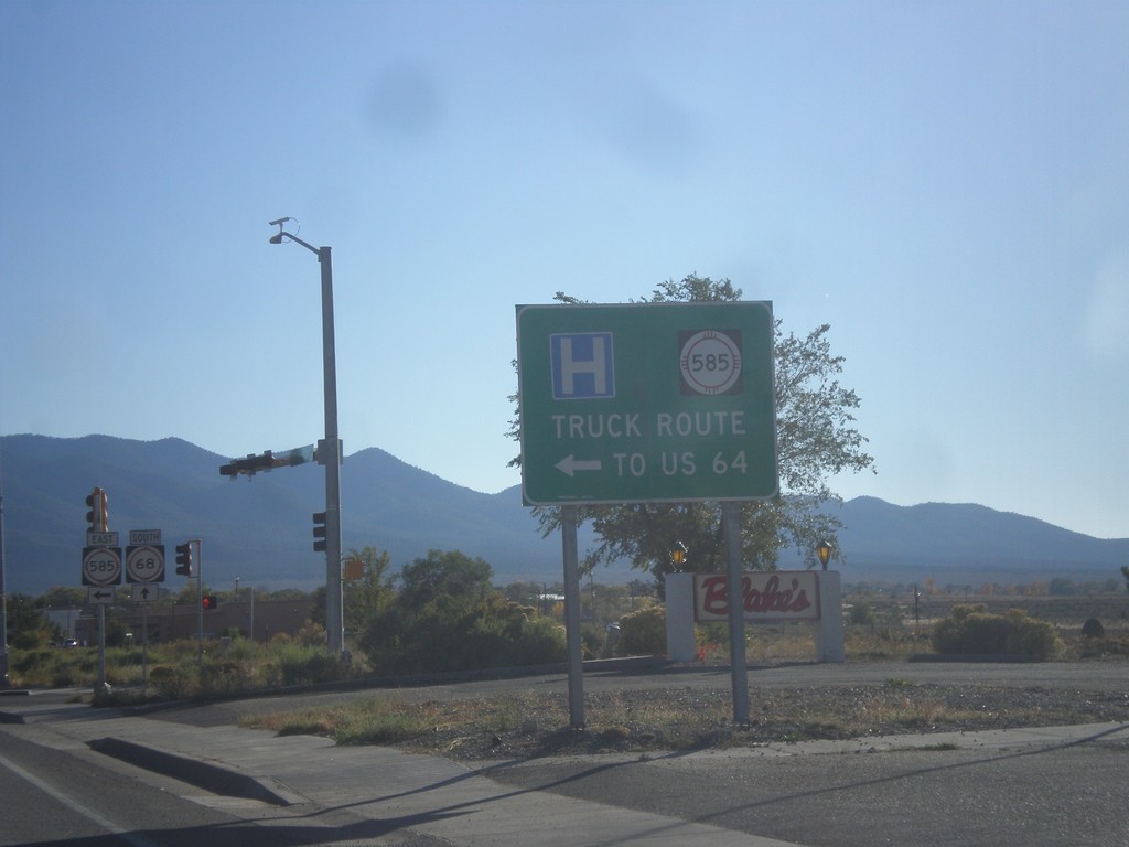
NM-68 South at NM-585 East
NM-68 South at NM-585 East to US-64. NM-585 is the truck route to US-64 east towards Raton.
Taken 10-14-2012


 Taos
Taos County
New Mexico
United States
Taos
Taos County
New Mexico
United States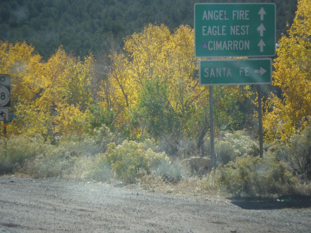
US-64 East at NM-585
US-64 east at NM-585. Use NM-585 west for NM-68 and Santa Fe. Continue east on US-64 for Cimarron, Angel Fire, and Eagle Nest.
Taken 10-14-2012
Taos
Taos County
New Mexico
United States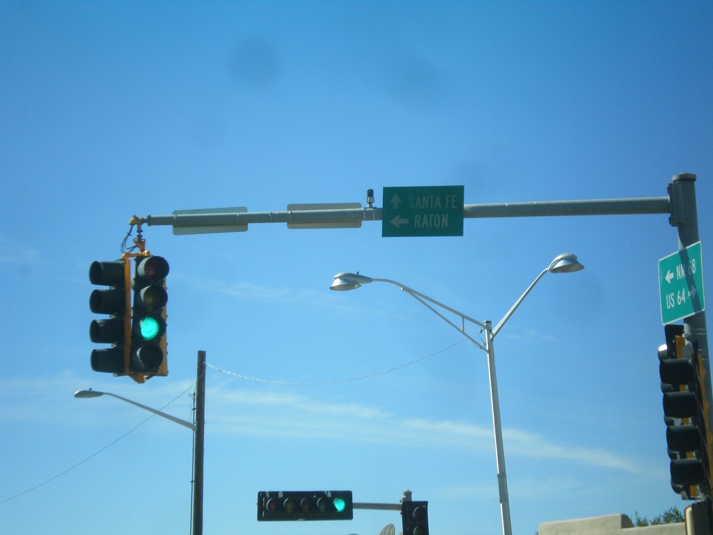
US-64 East at NM-68
US-64 east at NM-68. Turn left to continue on US-64 east to Raton. Continue ahead for NM-68 to Santa Fe.
Taken 10-14-2012
Taos
Taos County
New Mexico
United States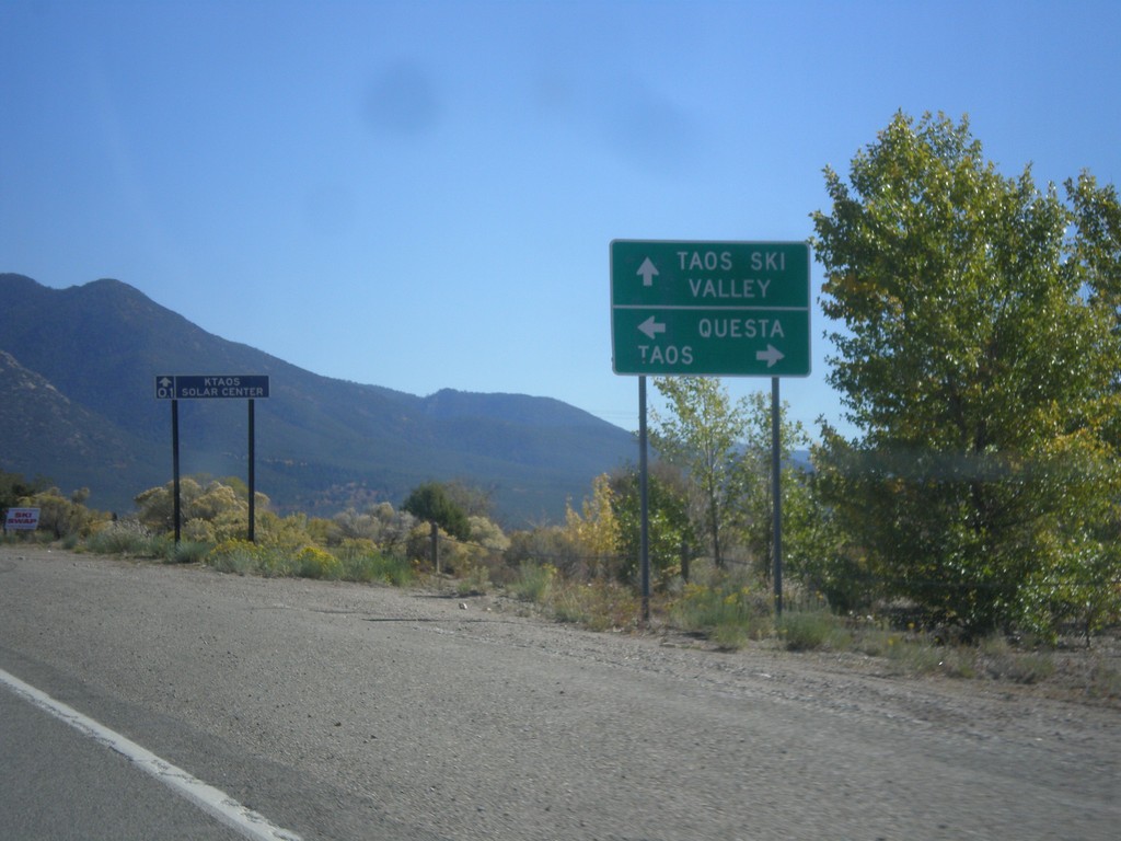
US-64 East Approaching NM-150/NM-522
US-64 East approaching NM-150/NM-522. Turn right for US-64 east to Taos; ahead for NM-150 to Taos Ski Valley; left for NM-522 to Questa.
Taken 10-14-2012

 El Prado
Taos County
New Mexico
United States
El Prado
Taos County
New Mexico
United States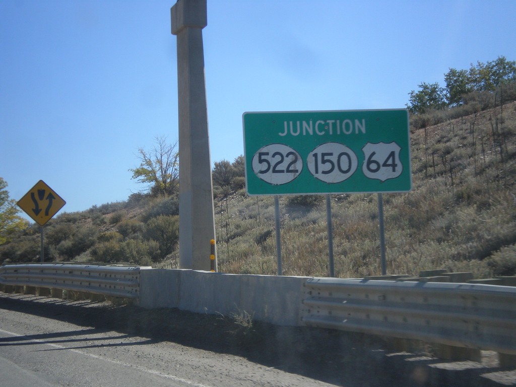
US-64 East Approaching NM-522/NM-150
US-64 East approaching NM-522/NM-150 on the north end of Taos.
Taken 10-14-2012
El Prado
Taos County
New Mexico
United States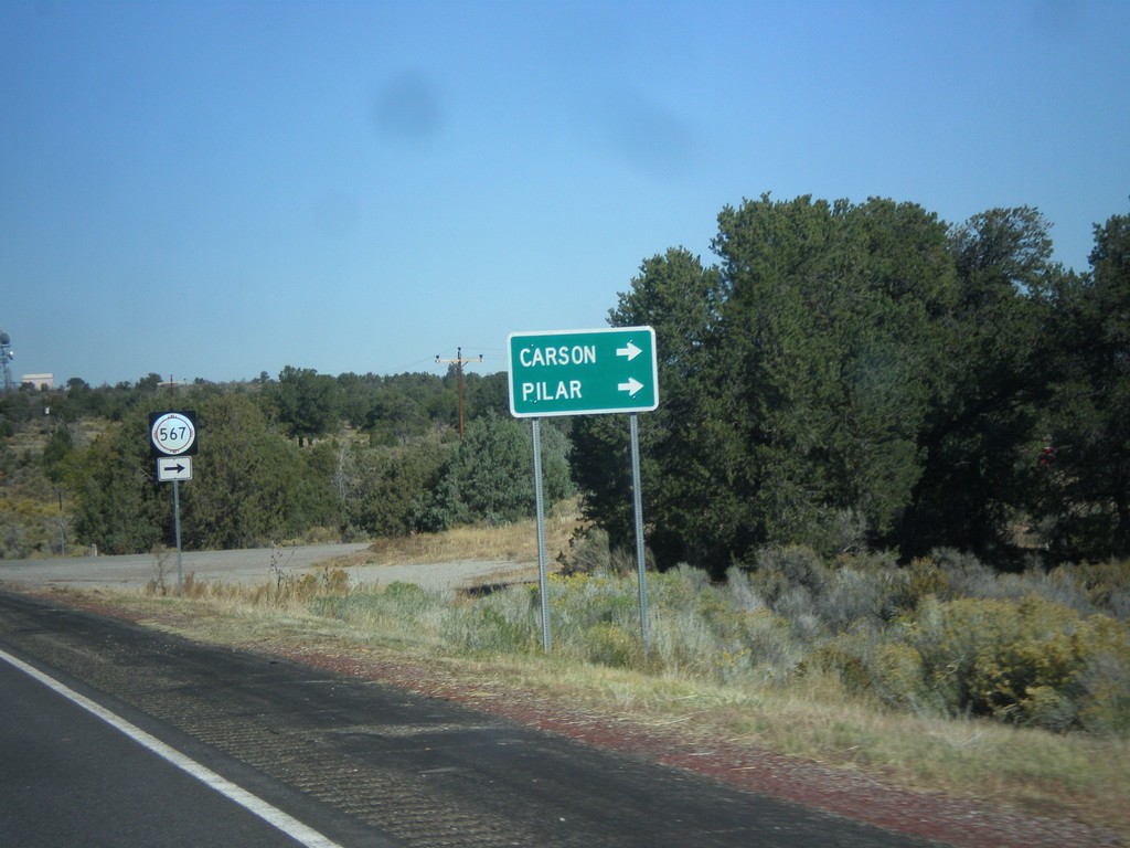
US-285 North at NM-567
US-285 north at NM-567 east to Carson and Pilar.
Taken 10-14-2012
 Carson
Taos County
New Mexico
United States
Carson
Taos County
New Mexico
United States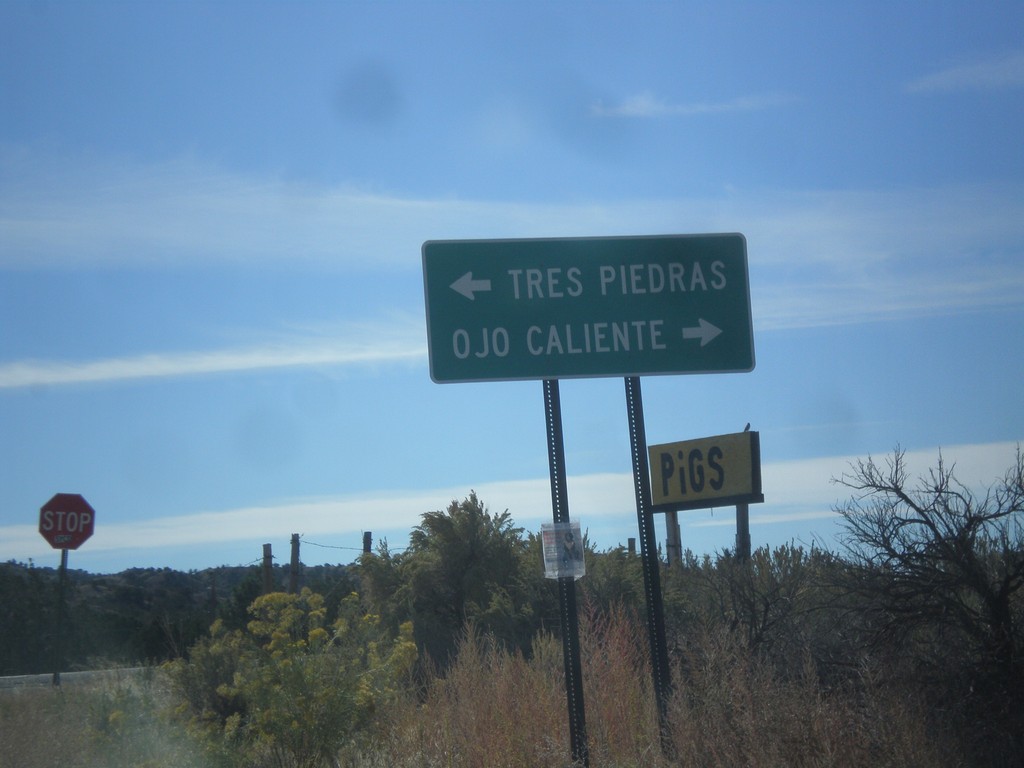
End NM-111 East at US-285
End NM-111 east at US-285. Turn right for US-285 south to Ojo Caliente; left for US-285 north to Tres Piedras.
Taken 10-14-2012
 Ojo Caliente
Taos County
New Mexico
United States
Ojo Caliente
Taos County
New Mexico
United States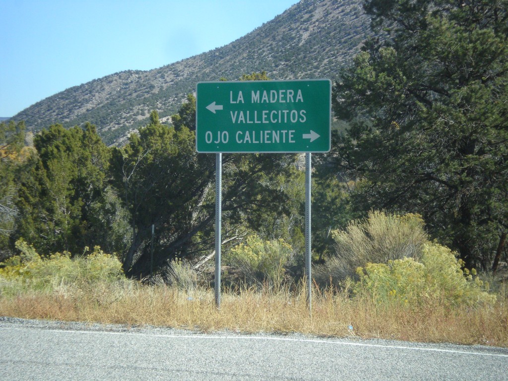
End NM-554 at NM-111
End NM-554 at NM-111. Turn right on NM-111 for Ojo Caliente; left for La Madera and Vallecitos.
Taken 10-14-2012
 La Madera
Rio Arriba County
New Mexico
United States
La Madera
Rio Arriba County
New Mexico
United States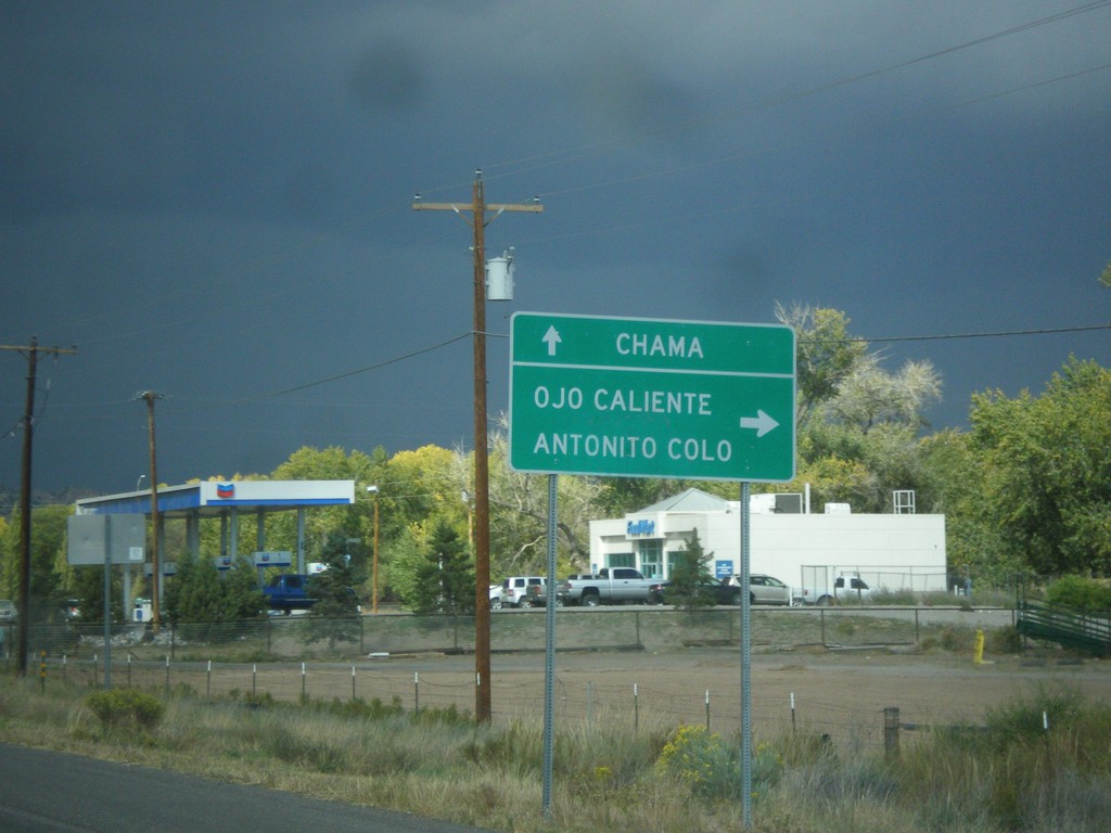
US-84 West/US-285 North Approaching US-84/US-285 Split
US-84 West/US-285 North approaching US-84/US-285 split. Turn right for US-285 north to Ojo Caliente and Antonito, Colorado. Continue west on US-84 for Chama.
Taken 10-12-2012
Hernandez
Rio Arriba County
New Mexico
United States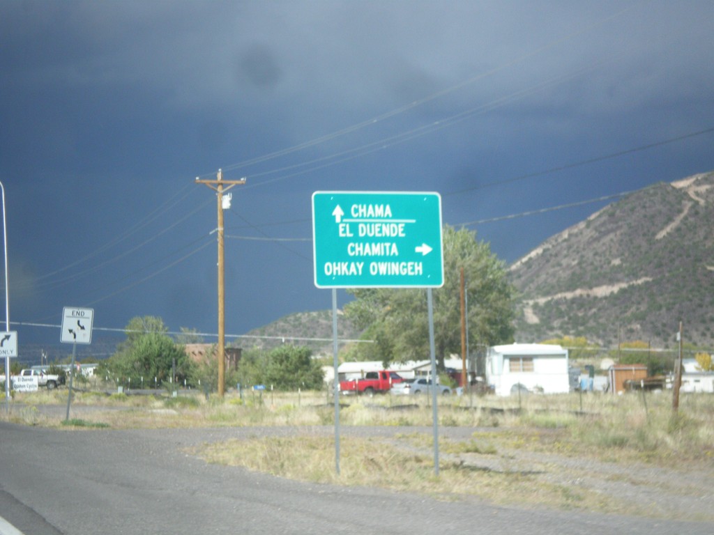
US-84 West/US-285 North Approaching NM-74
US-84 West/US-285 North approaching NM-74. Turn right on NM-74 for El Duende, Chamita and Ohkay Owingeh. Continue north on US-84 West/US-285 North for Chama.
Taken 10-12-2012
Hernandez
Rio Arriba County
New Mexico
United States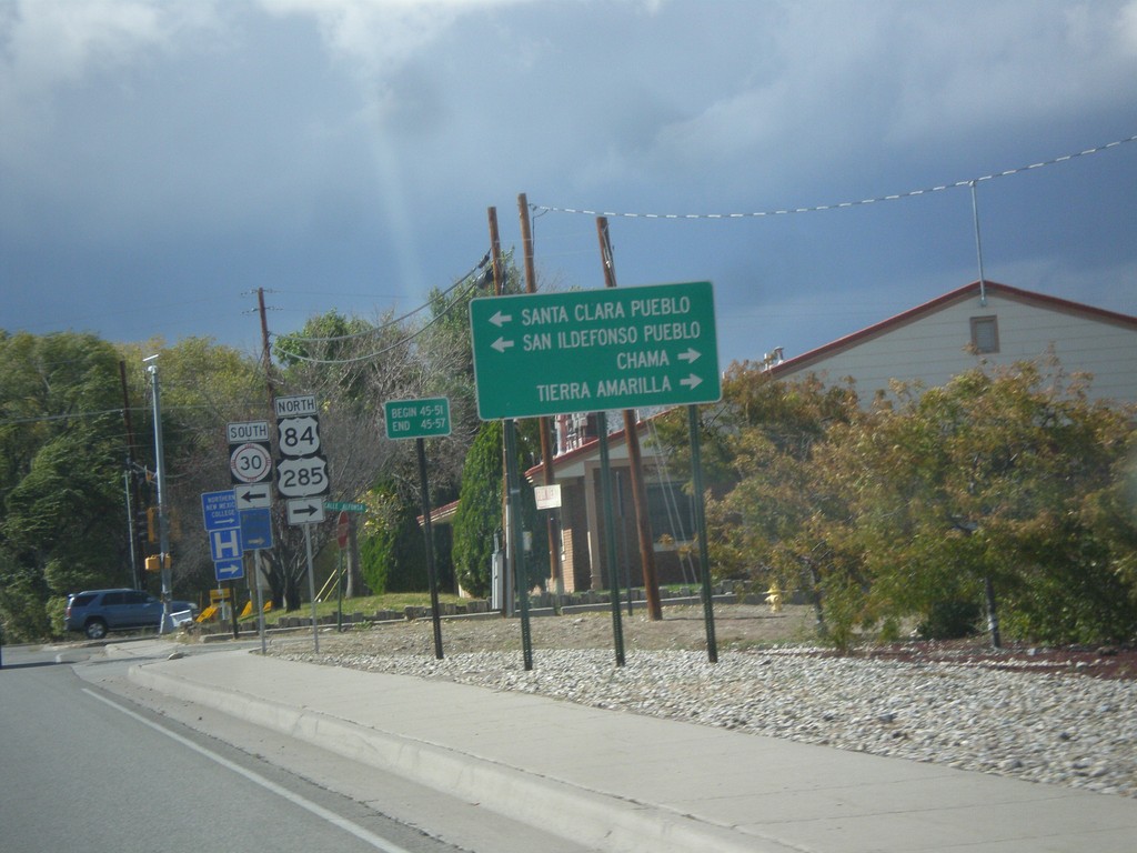
US-84 West/US-285 North Approaching NM-30
US-84 West/US-285 North approaching NM-30. Use NM-30 south for Santa Clara Pueblo, and San Ildefonso Pueblo. Continue on US-84 West/US-285 North for Chama and Tierra Amarilla.
Taken 10-12-2012
 Española
Rio Arriba County
New Mexico
United States
Española
Rio Arriba County
New Mexico
United States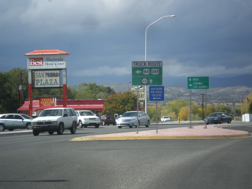
US-84 West/US-285 North at US-84/US-285 Truck Route
US-84 West/US-285 North at US-84/US-285 Truck Route (Santa Clara Bridge Road). Continue north on US-285/US-84 for general route through Espanola and NM-68. Truck traffic turn left for Chama and Los Alamos; continue straight towards Taos (via NM-68).
Taken 10-12-2012
Española
Rio Arriba County
New Mexico
United States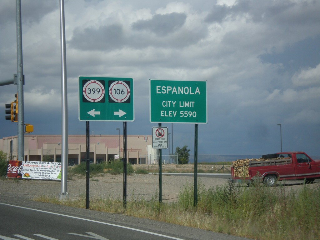
US-84 West/US-285 North - NM-399/NM-106 Jct.
US-84 West/US-285 North at NM-399/NM-106 Jct. Entering Espanola, Elevation 5590.
Taken 10-12-2012

 Santa Cruz
Santa Fe County
New Mexico
United States
Santa Cruz
Santa Fe County
New Mexico
United States