Signs Tagged With Big Green Sign
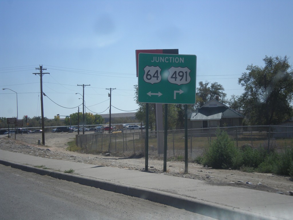
US-491 South Approaching US-64
US-491 south approaching US-64. Turn right for US-64 West/US-491 south; left for US-64 east.
Taken 10-10-2012

 Shiprock
San Juan County
New Mexico
United States
Shiprock
San Juan County
New Mexico
United States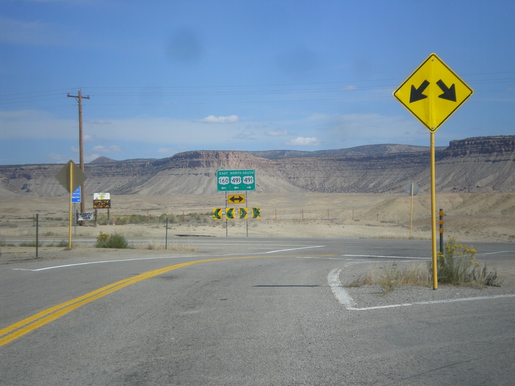
US-160 East at US-491
US-160 east at US-491. Turn left to continue east on US-160. US-160 joins US-491 east to Cortez.
Taken 10-10-2012
 Towaoc
Montezuma County
Colorado
United States
Towaoc
Montezuma County
Colorado
United States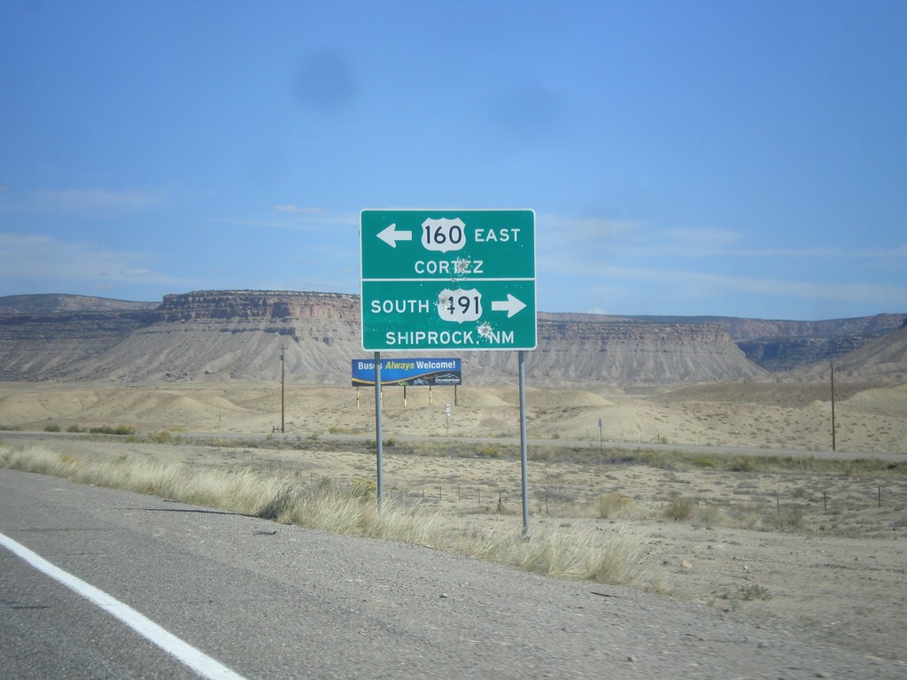
US-160 East at US-491
US-160 east at US-491. Turn right for US-491 south to Shiprock, New Mexico. Turn left for US-491 north and US-160 east to Cortez. US-160 joins US-491 north to Cortez.
Taken 10-10-2012
Towaoc
Montezuma County
Colorado
United States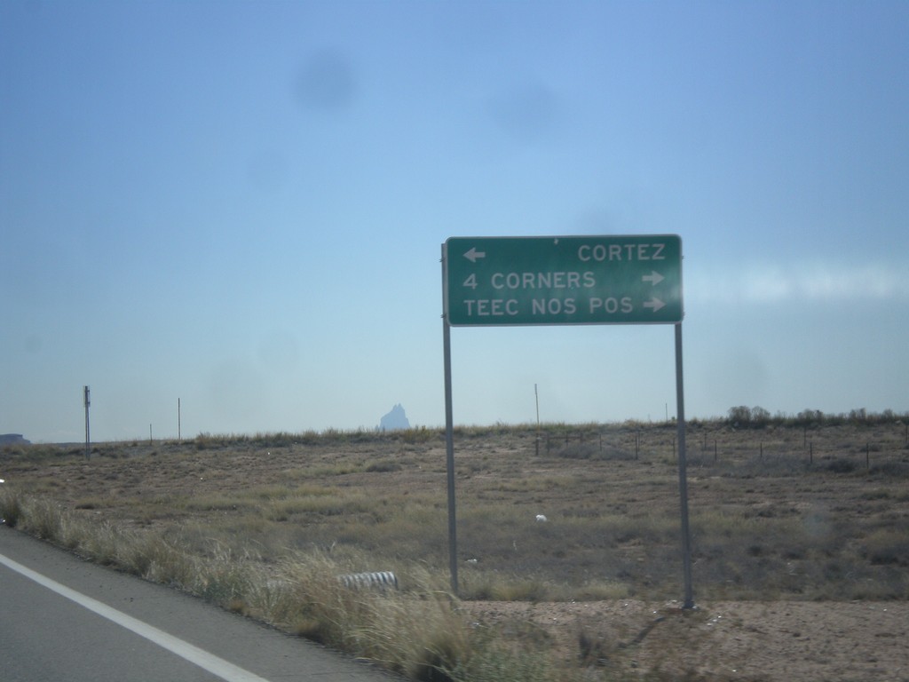
End CO-41 East at US-160
End CO-41 at US-160. Turn right on US-160 west for 4 Corners, and Teec Nos Pos (Arizona). Turn left for Cortez.
Taken 10-10-2012
 Montezuma County
Colorado
United States
Montezuma County
Colorado
United States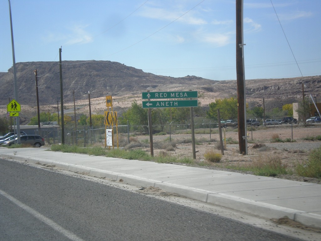
UT-162 East - Montezuma Creek
UT-162 east at Red Mesa Road in Montezuma Creek. Continue straight for Red Mesa; turn left to continue east on UT-162 to Aneth.
Taken 10-10-2012
 Montezuma Creek
San Juan County
Utah
United States
Montezuma Creek
San Juan County
Utah
United States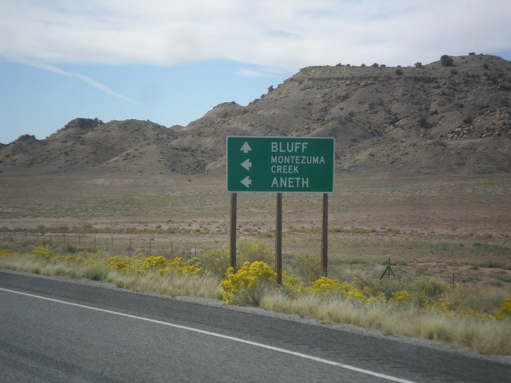
US-191 South Approaching UT-262
US-191 south approaching UT-262 west. Use UT-262 west for Montezuma Creek and Aneth. Continue south on US-191 for Bluff.
Taken 10-10-2012

 Blanding
San Juan County
Utah
United States
Blanding
San Juan County
Utah
United States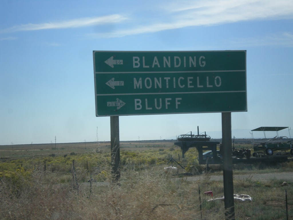
End UT-95 East at US-191
End UT-95 East at US-191. Turn right for Bluff; left for Blanding and Monticello.
Taken 10-10-2012
 Blanding
San Juan County
Utah
United States
Blanding
San Juan County
Utah
United States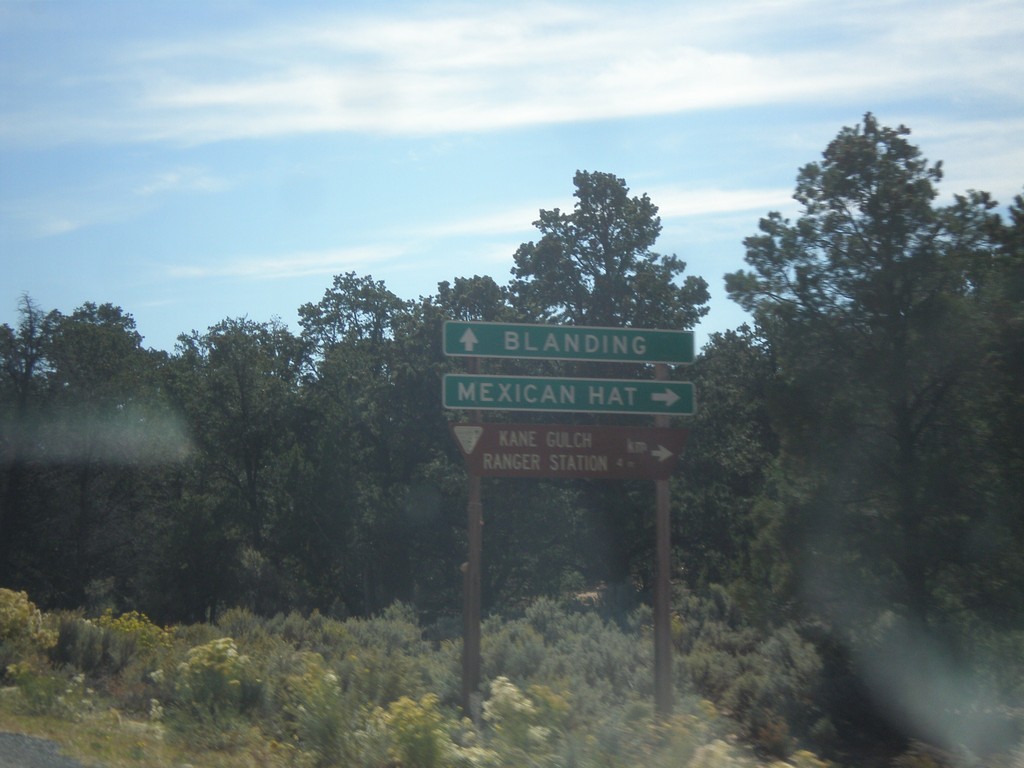
UT-95 West at UT-261
UT-95 east at UT-261. Turn right for Mexican Hat; continue east towards Blanding.
Taken 10-10-2012
 Lake Powell
San Juan County
Utah
United States
Lake Powell
San Juan County
Utah
United States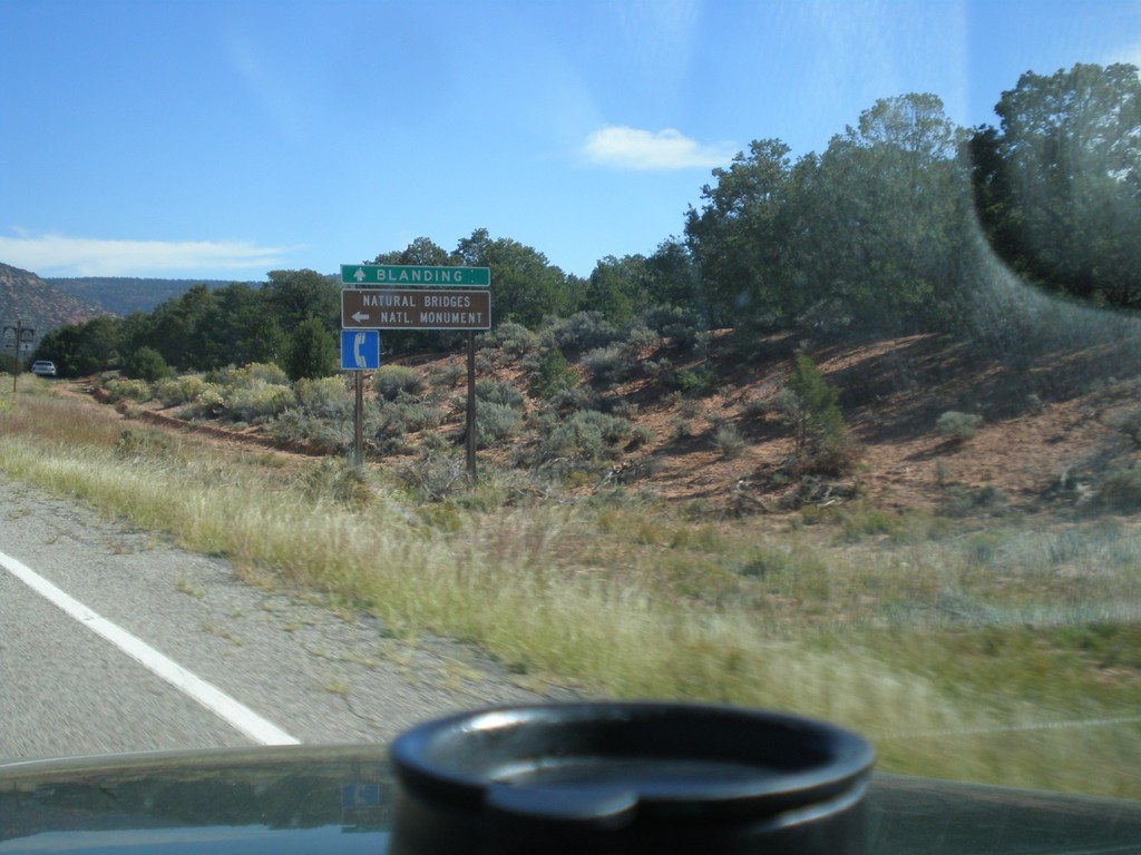
UT-95 East Approaching UT-275
UT-95 East Approaching UT-275 north to Natural Bridges National Monument. Continue east on UT-95 for Blanding.
Taken 10-10-2012
 Lake Powell
San Juan County
Utah
United States
Lake Powell
San Juan County
Utah
United States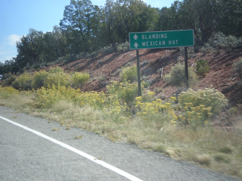
UT-95 East Approaching UT-276
UT-95 East approaching UT-276. Continue east on UT-95 for Mexican Hat and Blanding.
Taken 10-10-2012
 Lake Powell
San Juan County
Utah
United States
Lake Powell
San Juan County
Utah
United States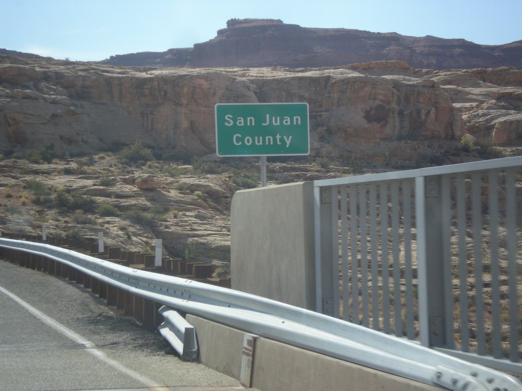
UT-95 East - San Juan County
Entering San Juan County on UT-95 east, crossing the Colorado River. This is the backwaters of Lake Powell, near Hite Marina.
Taken 10-10-2012
Lake Powell
San Juan County
Utah
United States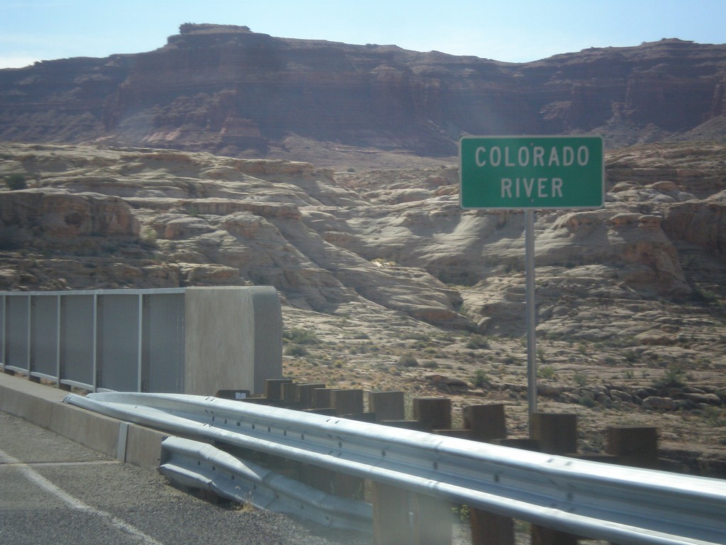
UT-95 East - Colorado River
Colorado River crossing on UT-95 east. This is the backwaters of Lake Powell.
Taken 10-10-2012
Lake Powell
Garfield County
Utah
United States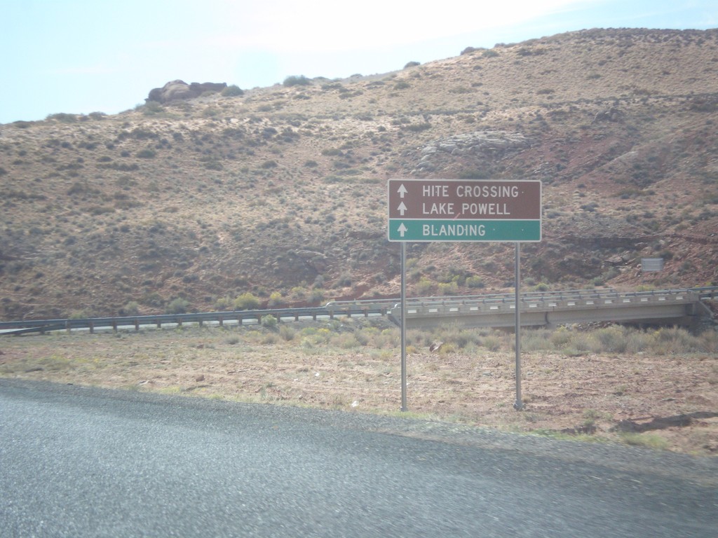
UT-95 East Approaching UT-276
UT-95 east approaching UT-276. Continue east on UT-275 for Hite Crossing, Lake Powell, and Blanding. Lake Powell can also be accessed via UT-276, and can be crossed via ferry.
Taken 10-10-2012
Lake Powell
Garfield County
Utah
United States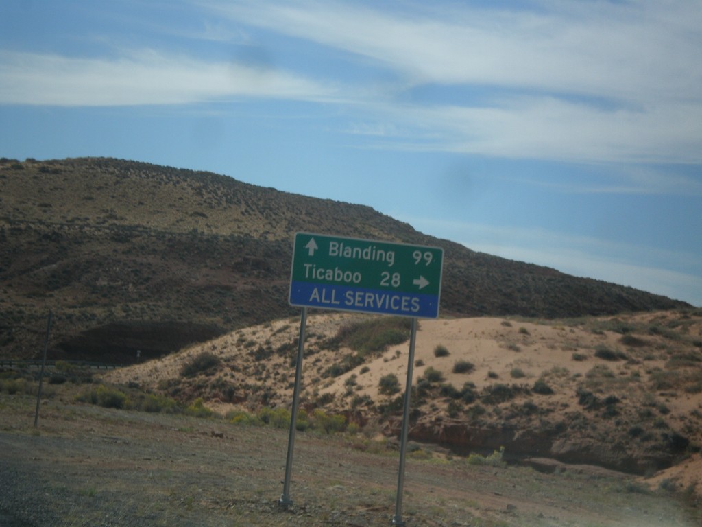
UT-95 East Approaching UT-276
UT-95 east approaching UT-276. Turn right on UT-276 for Ticaboo; continue ahead on UT-95 for Blanding.
Taken 10-10-2012
Lake Powell
Garfield County
Utah
United States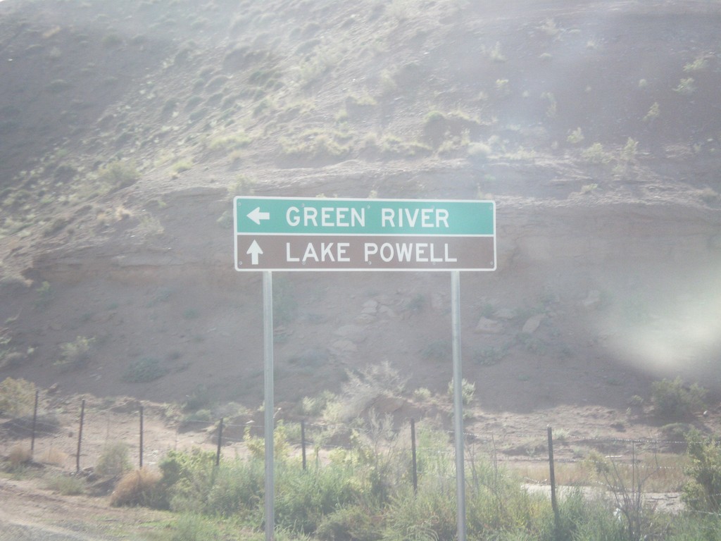
UT-24 East at UT-95
UT-24 east at UT-95. Turn left to continue east on UT-24 towards Green River. Continue ahead for UT-95 east towards Lake Powell.
Taken 10-10-2012
 Hanksville
Wayne County
Utah
United States
Hanksville
Wayne County
Utah
United States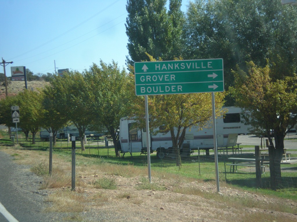
UT-24 East at UT-12
UT-24 east at UT-12 west to Grover and Boulder. Continue east on UT-24 to Hanksville.
Taken 10-07-2012
 Torrey
Wayne County
Utah
United States
Torrey
Wayne County
Utah
United States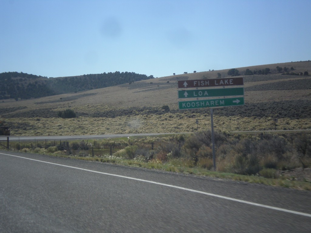
UT-24 East at UT-62 West
UT-24 east at UT-62 west to Koosharem. Continue east on UT-24 for Fish Lake and Loa.
Taken 10-07-2012
 Richfield
Sevier County
Utah
United States
Richfield
Sevier County
Utah
United States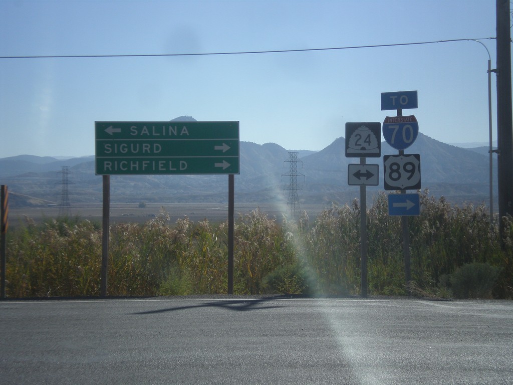
End UT-260 at UT-24
End UT-260 at UT-24. Turn right on UT-24 east for Sigurd and Richfield, and for access to I-70 and US-89. Turn left on UT-24 for Salina.
Taken 10-07-2012


 Aurora
Sevier County
Utah
United States
Aurora
Sevier County
Utah
United States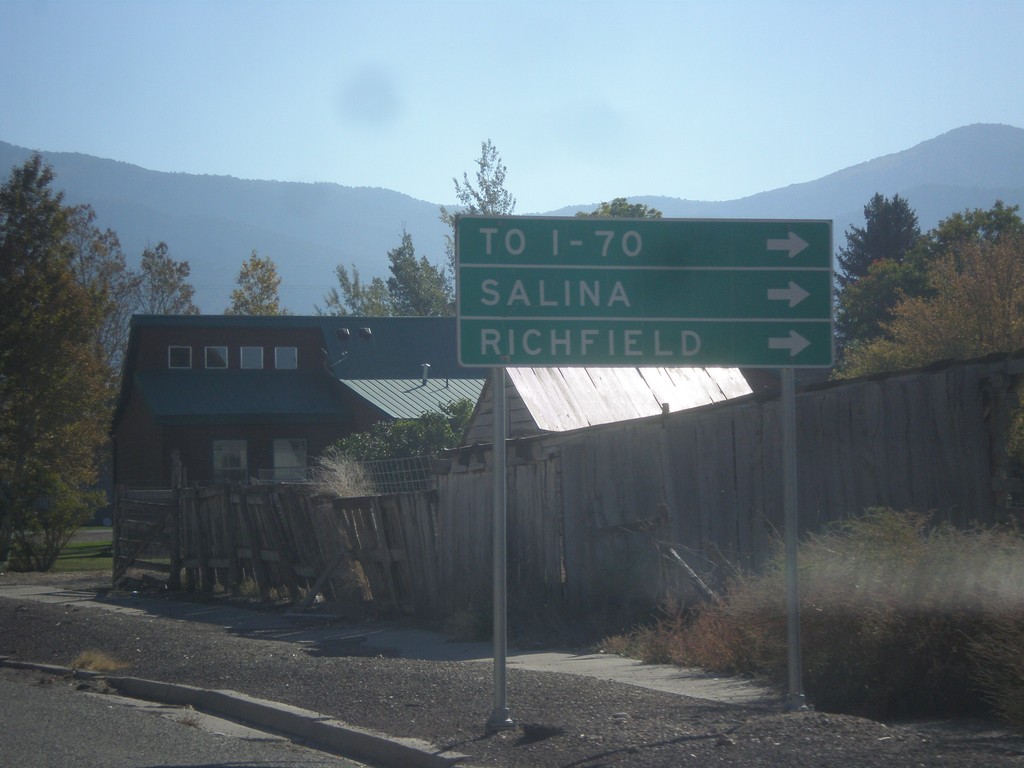
US-50 East in Scipio
US-50 east in Scipio. To continue on US-50 traffic turns right on State St. Turn right for I-70, Salina, and Richfield. US-50 provides shorter access for southbound I-15 traffic to I-70, then continuing on I-15 to I-70 jct.
Taken 10-07-2012
 Scipio
Millard County
Utah
United States
Scipio
Millard County
Utah
United States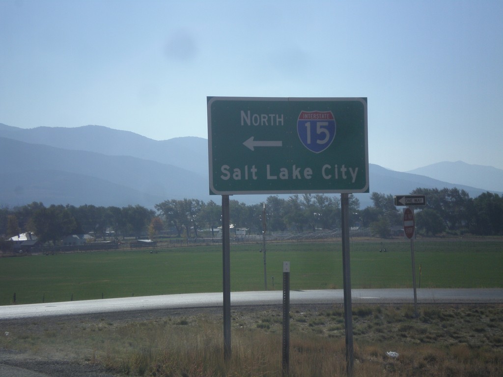
US-50 East at I-15 North
US-50 east at I-15 north to Salt Lake City. US-50 joins I-15 south to Holden.
Taken 10-07-2012
 Scipio
Millard County
Utah
United States
Scipio
Millard County
Utah
United States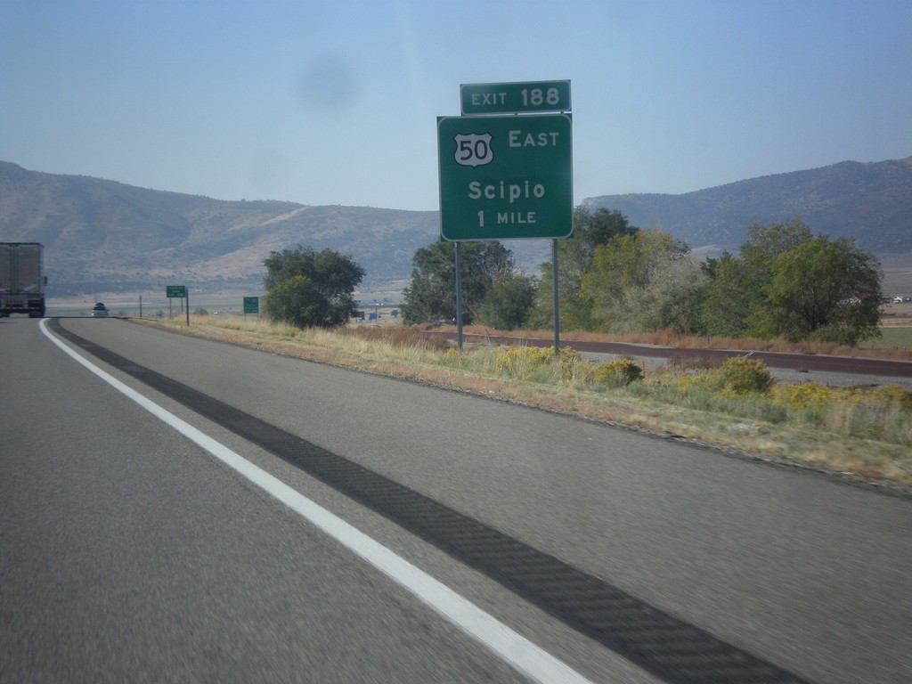
I-15 South Approaching Exit 188
I-15 south approaching Exit 188 - US-50 East/Scipio. US-50 joins I-15 south from Scipio to Holden.
Taken 10-07-2012
Scipio
Millard County
Utah
United States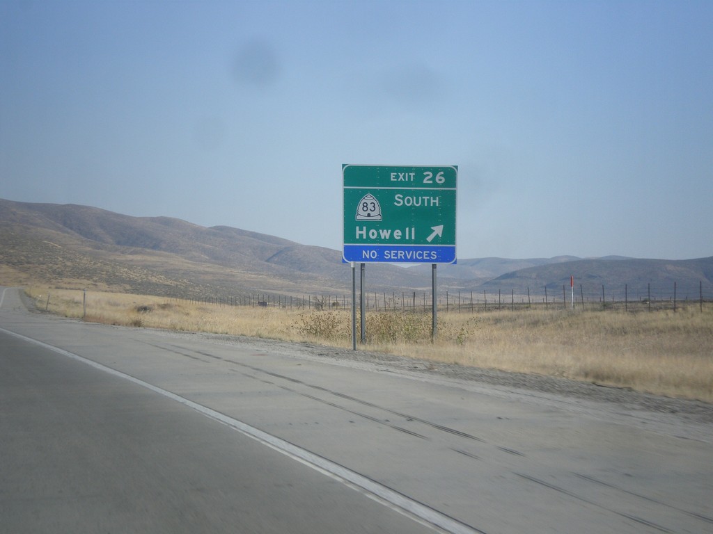
I-84 East - East 26
I-84 east at Exit 26 - UT-83 South/Howell.
Taken 10-06-2012

 Howell
Box Elder County
Utah
United States
Howell
Box Elder County
Utah
United States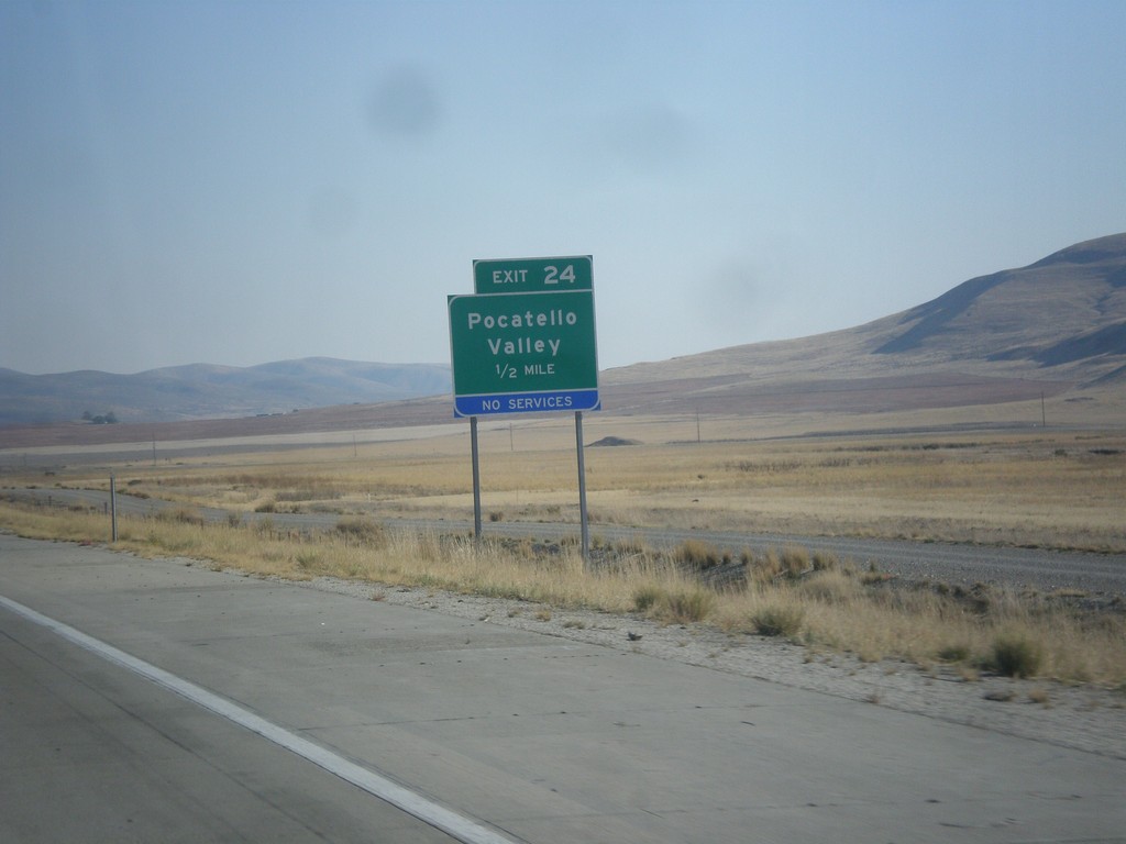
I-84 East - Exit 24
I-84 east approaching Exit 24 - Pocatello Valley. This interchange has recently been renamed from Valley.
Taken 10-06-2012
Howell
Box Elder County
Utah
United States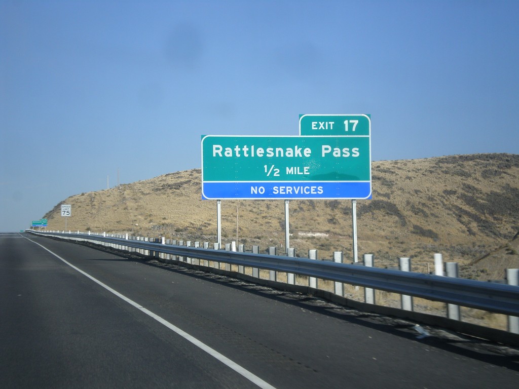
I-84 East - Exit 17
I-84 east approaching Exit 17 - Rattlesnake Pass. This exit was formerly called Ranch Exit.
Taken 10-06-2012
Snowville
Box Elder County
Utah
United States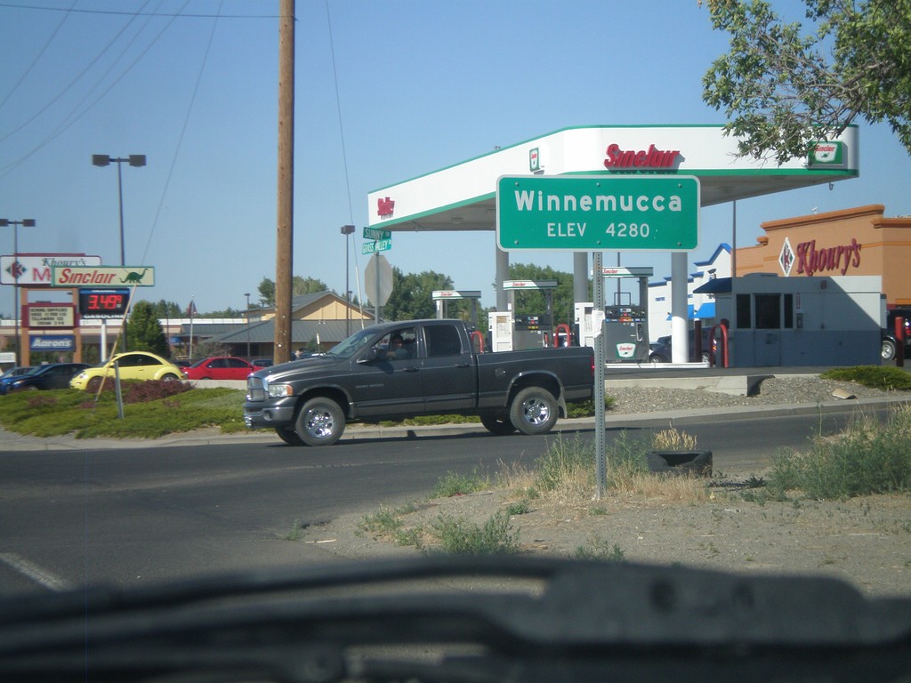
Winnemucca - Elevation 4280
Entering Winnemucca - Elevation 4280 on NV-294 North (Grass Valley Road).
Taken 07-28-2012
 Winnemucca
Humboldt County
Nevada
United States
Winnemucca
Humboldt County
Nevada
United States