Signs Tagged With Big Green Sign
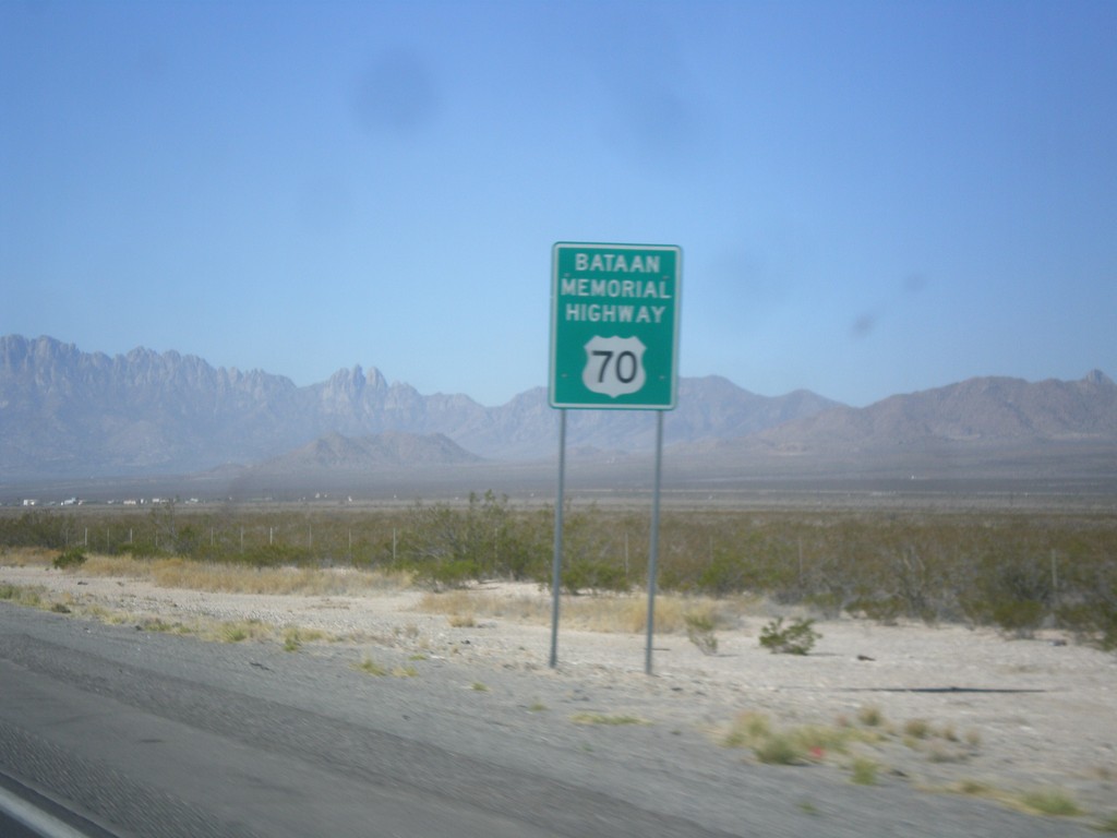
US-70 West - Bataan Memorial Highway
US-70 west - Bataan Memorial Highway. US-70 between Las Cruces and Alamogordo is designated as the Bataan Memorial Highway.
Taken 04-15-2013
 Tularosa
Otero County
New Mexico
United States
Tularosa
Otero County
New Mexico
United States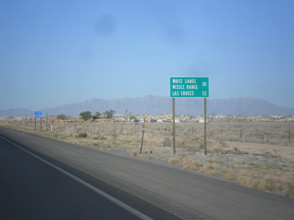
US-70 West - Distance Marker
Distance marker on US-70 west. Distance to White Sands Missile Range and Las Cruces.
Taken 04-15-2013
Tularosa
Otero County
New Mexico
United States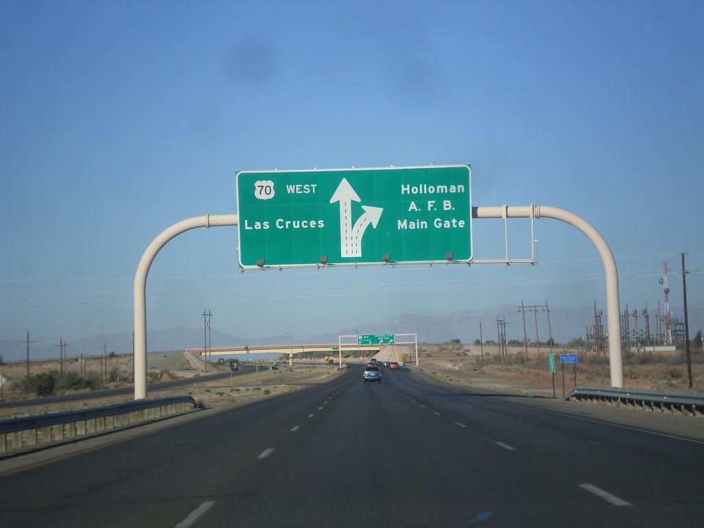
US-70 West - Holloman AFB Main Gate IC
US-70 west approaching Holloman AFB Main Gate interchange. US-70 continues west towards Las Cruces.
Taken 04-15-2013
Holloman Air Force Base
Otero County
New Mexico
United States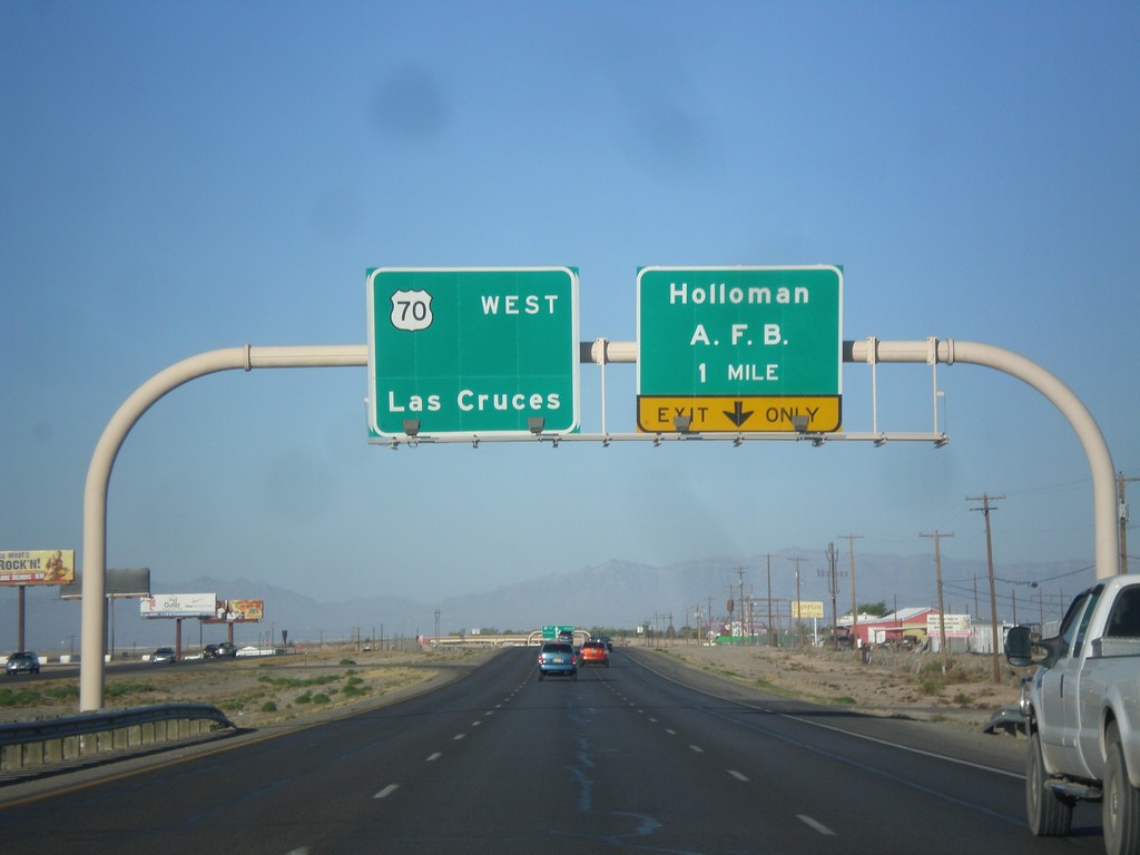
US-70 West - Holloman AFB IC
US-70 west approaching Holloman AFB Main Gate interchange. US-70 continues west towards Las Cruces.
Taken 04-15-2013
Alamogordo
Otero County
New Mexico
United States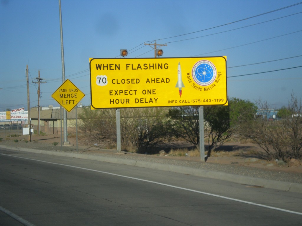
US-70 West - White Sands Missile Range Warning
Warning on US-70 west leaving Alamogordo: When flashing US-70 closed ahead. Expect one hour delay.
Taken 04-15-2013
Alamogordo
Otero County
New Mexico
United States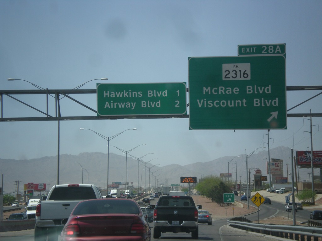
I-10 West - Exit 28A
I-10 west at Exit 28A - FM-2316/McRae Blvd./Viscount Blvd. Approaching Hawkins Blvd. and Airways Blvd.
Taken 04-15-2013

 El Paso
 County
Texas
United States
El Paso
El Paso County
Texas
United States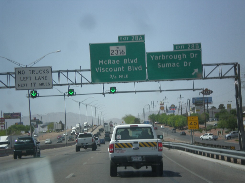
I-10 West - Exits 28B and 28A
I-10 west at Exit 28B - Yarbrough Drive/Sumac Drive. Approaching Exit 28A - FM-2316/McRae Blvd./Viscount Blvd.
Taken 04-15-2013
El Paso
El Paso County
Texas
United States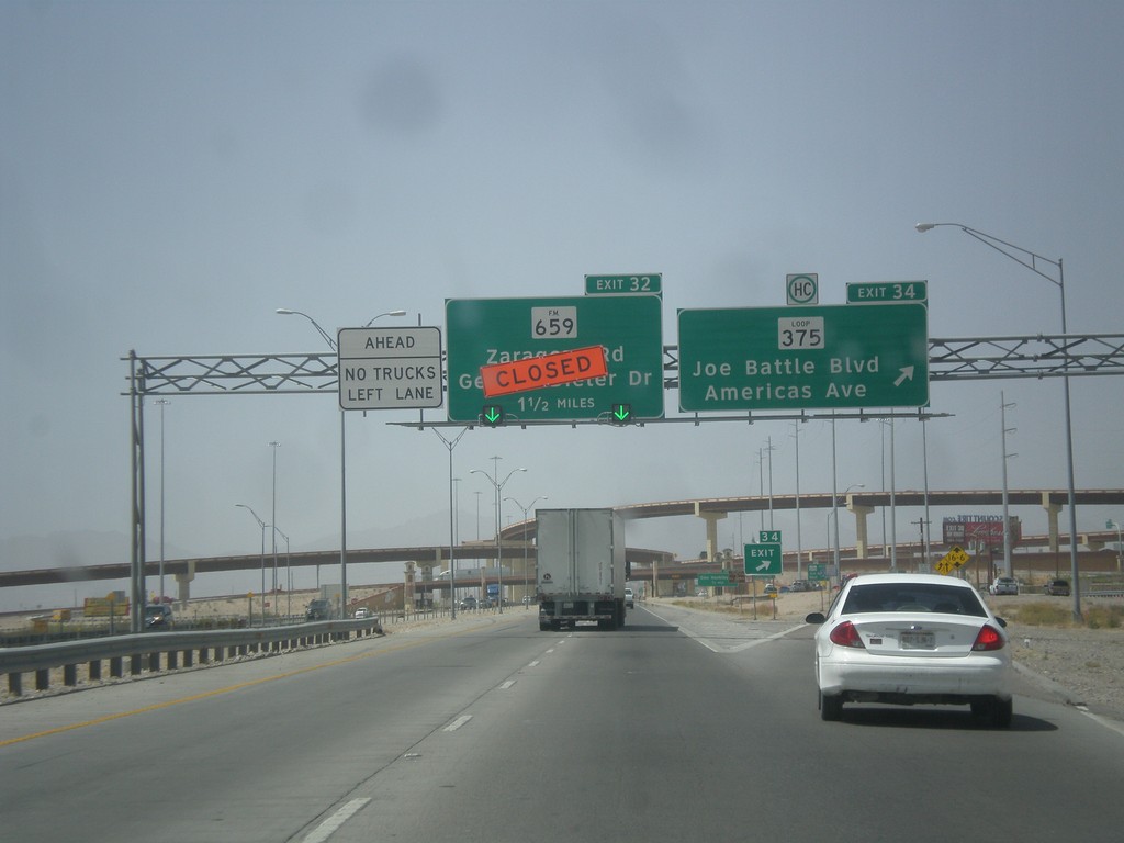
I-10 West - Exits 34 and 32
I-10 west at Exit 34 - Loop 375/Joe Battle Blvd./Americas Ave. Exit 34 is currently closed due to construction.
Taken 04-15-2013

 El Paso
 County
Texas
United States
El Paso
El Paso County
Texas
United States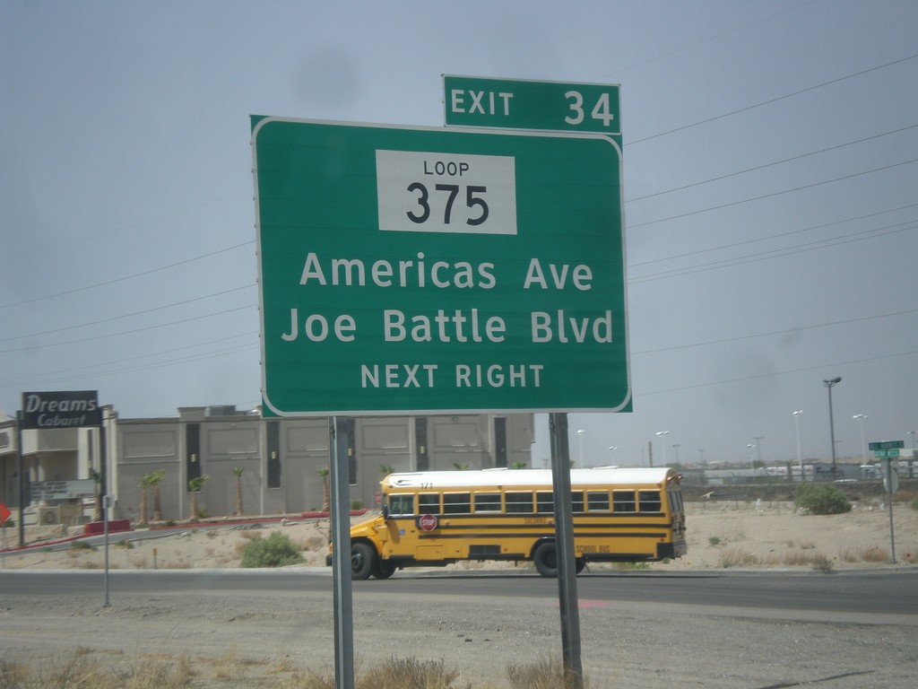
I-10 West - Exit 34
I-10 west approaching Exit 34 - TX-375 Loop/Americas Ave./Joe Battle Blvd. This is the eastern edge of TX-375 Loop which encircles the city of El Paso.
Taken 04-15-2013
El Paso
El Paso County
Texas
United States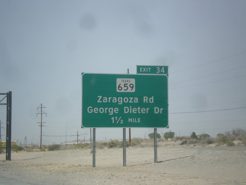
I-10 West Approaching Exit 34
I-10 west approaching Exit 34 - FM-659/Zaragoza road/George Dieter Drive. The FM-659 shield is incorrectly signed as TX-659. Zaragoza Road connects I-10 to the Zaragoza International Bridge into Mexico.
Taken 04-15-2013
El Paso
El Paso County
Texas
United States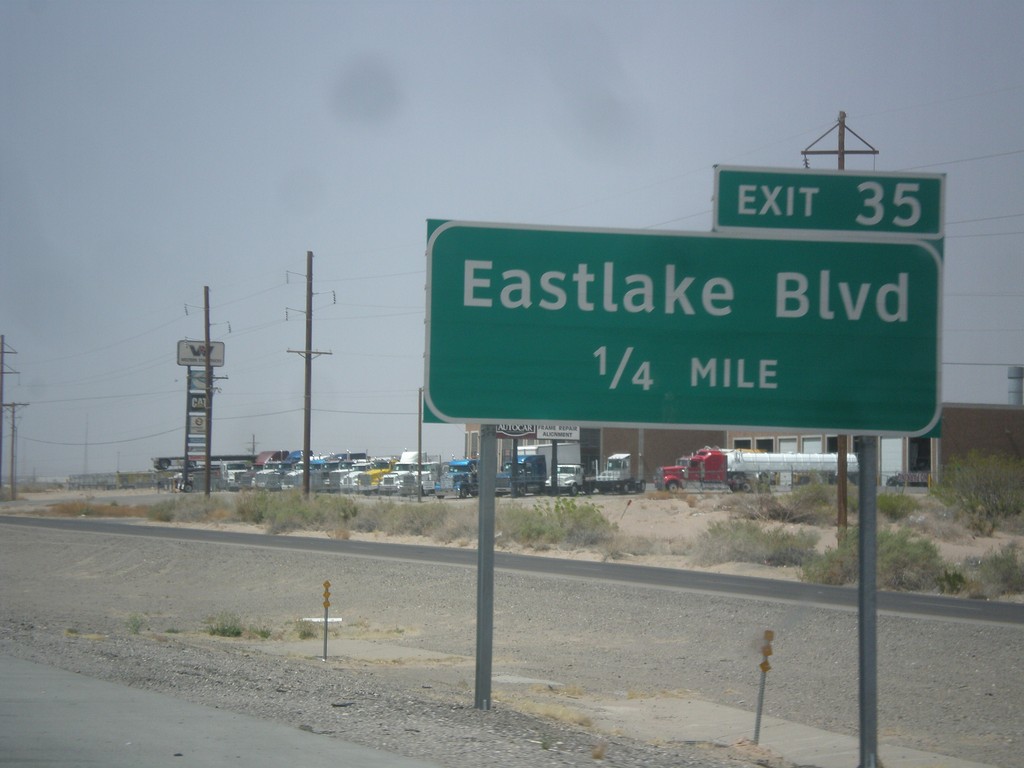
I-10 West - Exit 35
I-10 west at Exit 35 - Eastlake Blvd.
Taken 04-15-2013
El Paso
El Paso County
Texas
United States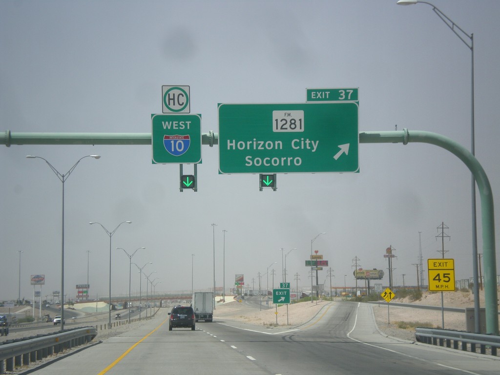
I-10 West - Exit 37
I-10 west approaching Exit 37 - FM-1281/Horizon City/Socorro. I-10 continues west.
Taken 04-15-2013
 El Paso
 County
Texas
United States
El Paso
El Paso County
Texas
United States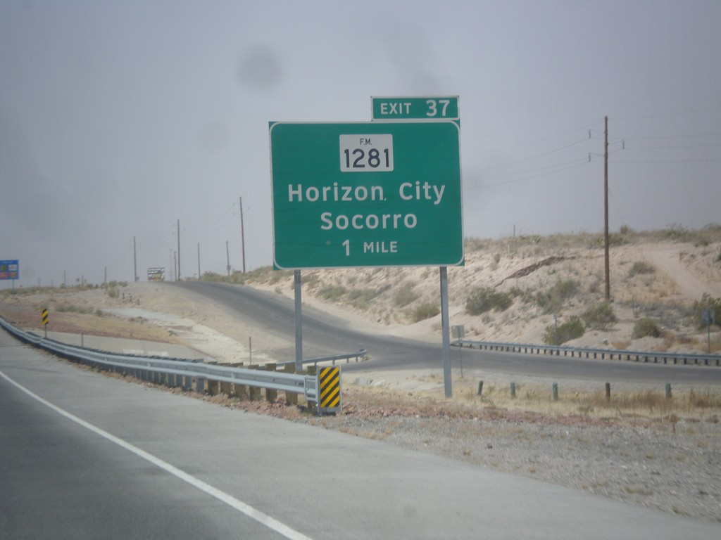
I-10 West - Exit 37
I-10 west approaching Exit 37 - FM-1281/Horizon City/Socorro.
Taken 04-15-2013
El Paso
El Paso County
Texas
United States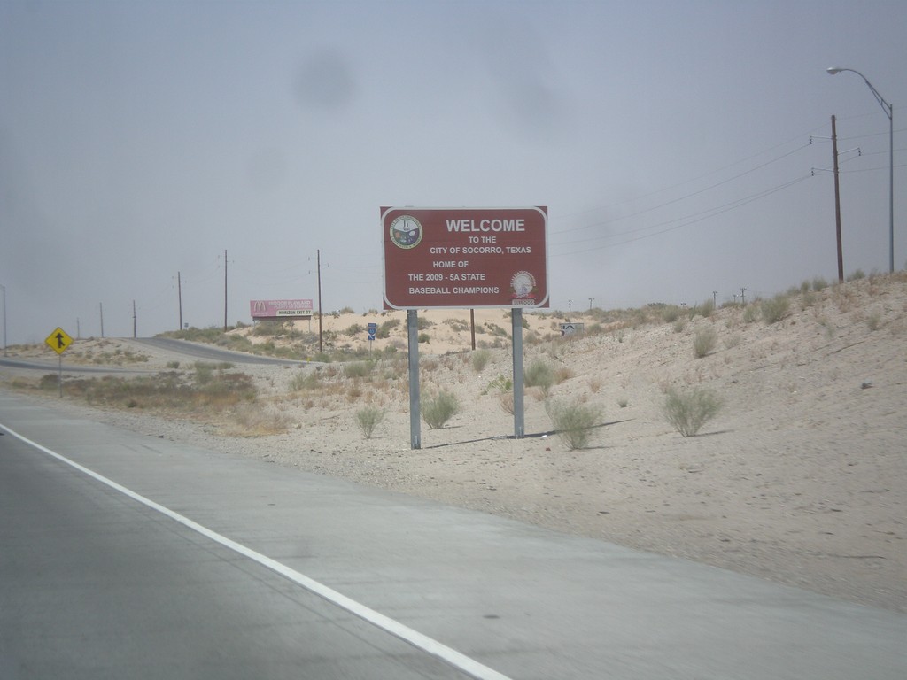
I-10 West - Entering Socorro
Entering Socorro, Texas on I-10 west. This is a non-standard city limit sign, which is brown and contains the city logo. Socorro is an eastern suburb of El Paso.
Taken 04-15-2013
Clint
El Paso County
Texas
United States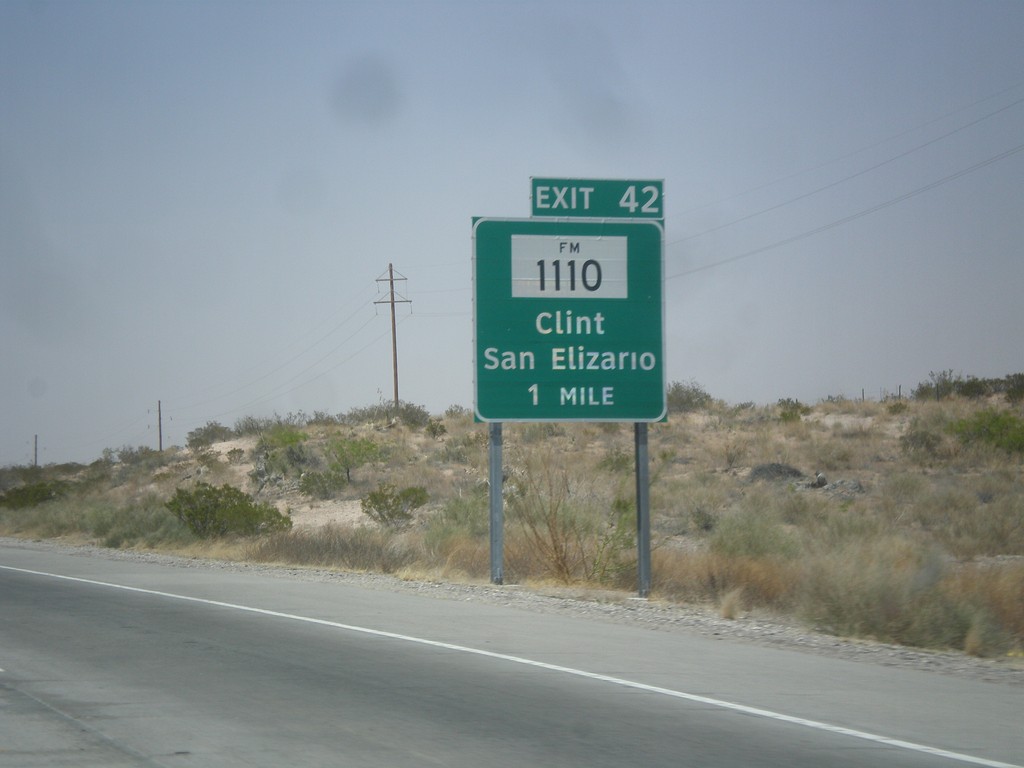
I-10 West - Exit 42
I-10 west at Exit 42 - FM-1110/Clint/San Elizario.
Taken 04-15-2013
 Clint
El Paso County
Texas
United States
Clint
El Paso County
Texas
United States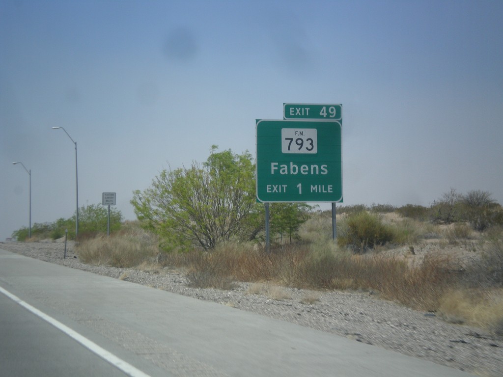
I-10 West - Exit 49
I-10 west at Exit 49 - FM-793/Fabens.
Taken 04-15-2013
 El Paso
 County
Texas
United States
El Paso
El Paso County
Texas
United States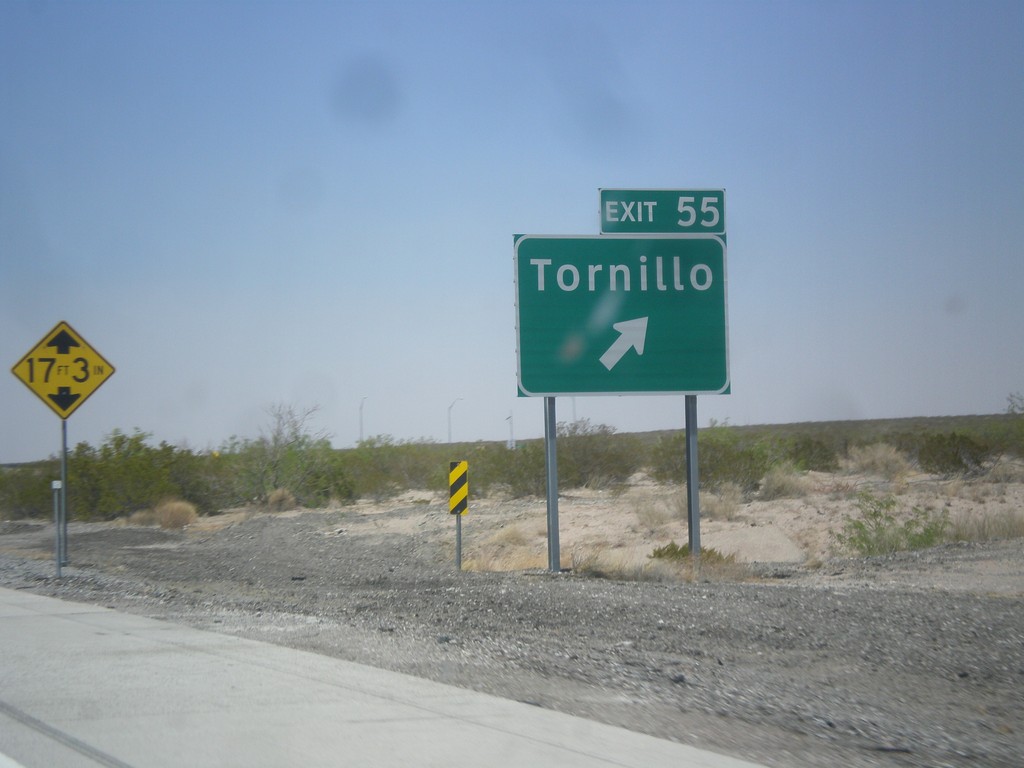
I-10 West - Exit 55
I-10 west at Exit 55 - Tornillo.
Taken 04-15-2013
Tornillo
El Paso County
Texas
United States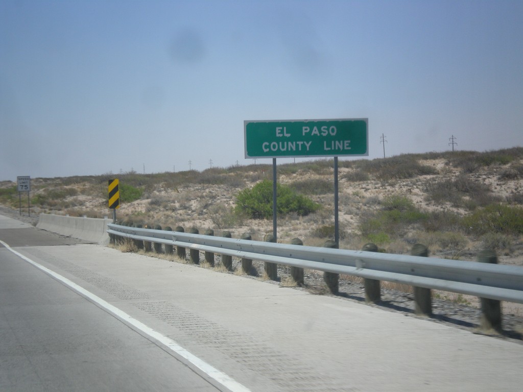
I-10 West - El Paso County Line
El Paso County Line on I-10 west. The speed limit on I-10 drops from 80 MPH, to 75 MPH at the county line. A 75 MPH speed limit sign can be seen in the background.
Taken 04-15-2013
Fort Hancock
El Paso County
Texas
United States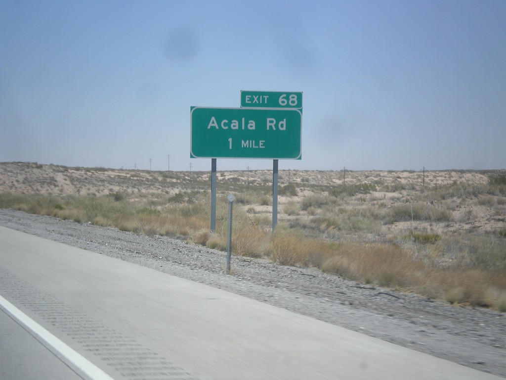
I-10 West - Exit 68
I-10 west approaching Exit 68 - Acala Road.
Taken 04-15-2013
Fort Hancock
Hudspeth County
Texas
United States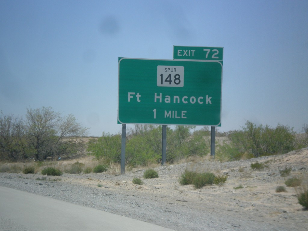
I-10 West - Exit 72
I-10 west approaching Exit 72 - TX-148 Spur/Ft. Hancock.
Taken 04-15-2013
 Fort Hancock
Hudspeth County
Texas
United States
Fort Hancock
Hudspeth County
Texas
United States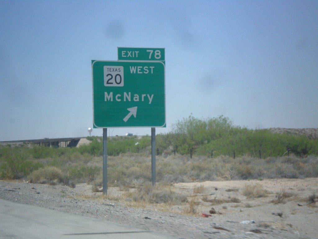
I-10 West - Exit 78
I-10 west at Exit 78 - TX-20/McNary. TX-20 runs between the Rio Grande and I-10 between here and El Paso. Views of the Rio Grande and Mexico can be seen south of the highway through through this area.
Taken 04-15-2013
 Fort Hancock
Hudspeth County
Texas
United States
Fort Hancock
Hudspeth County
Texas
United States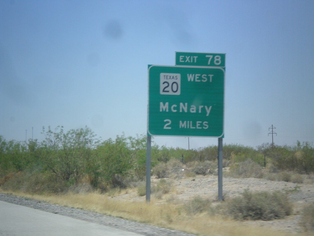
I-10 West Approaching Exit 80
I-10 west approaching Exit 80 - TX-20/McNary.
Taken 04-15-2013
Fort Hancock
Hudspeth County
Texas
United States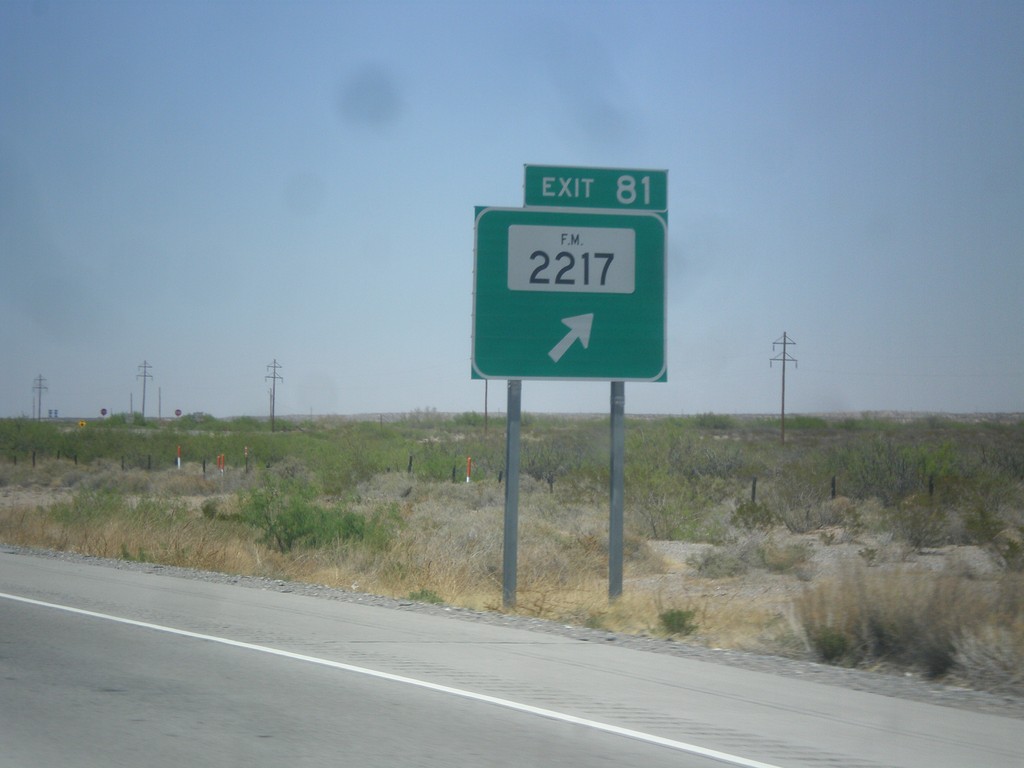
I-10 West - Exit 81
I-10 west at Exit 81 - FM-2217.
Taken 04-15-2013
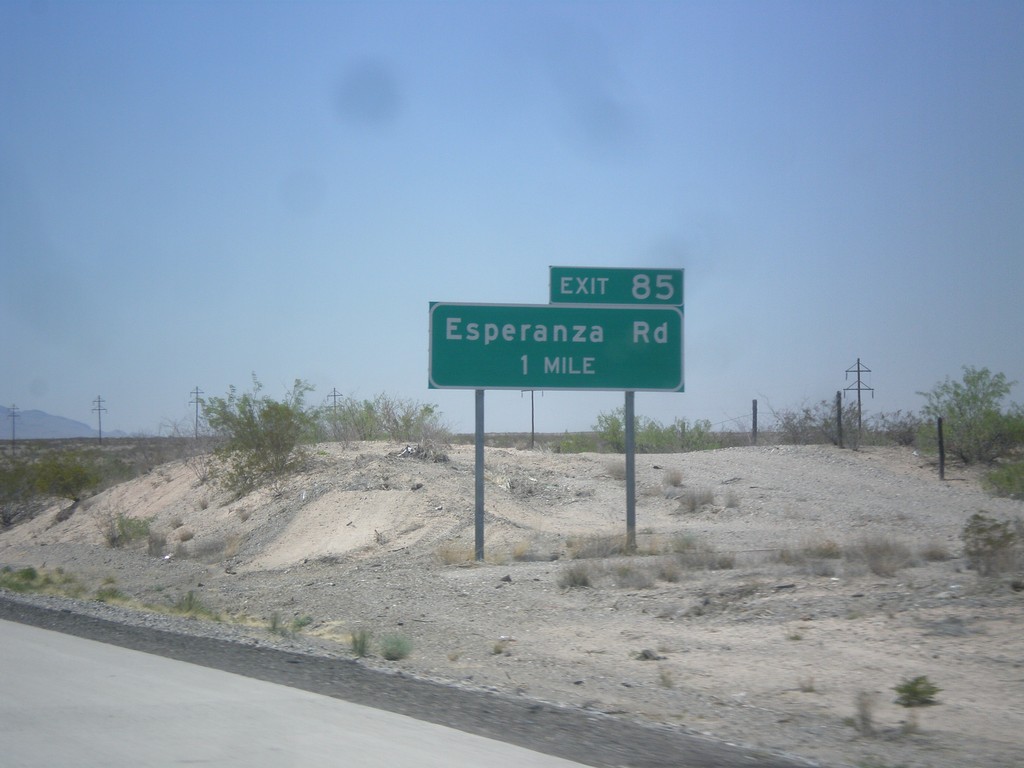
I-10 West - Exit 85
I-10 West at Exit 85 - Esperanza Road. I-10 enters the Rio Grande Valley near here. I-10 parallels the Rio Grande from here to Las Cruces, NM.
Taken 04-15-2013
Fort Hancock
Hudspeth County
Texas
United States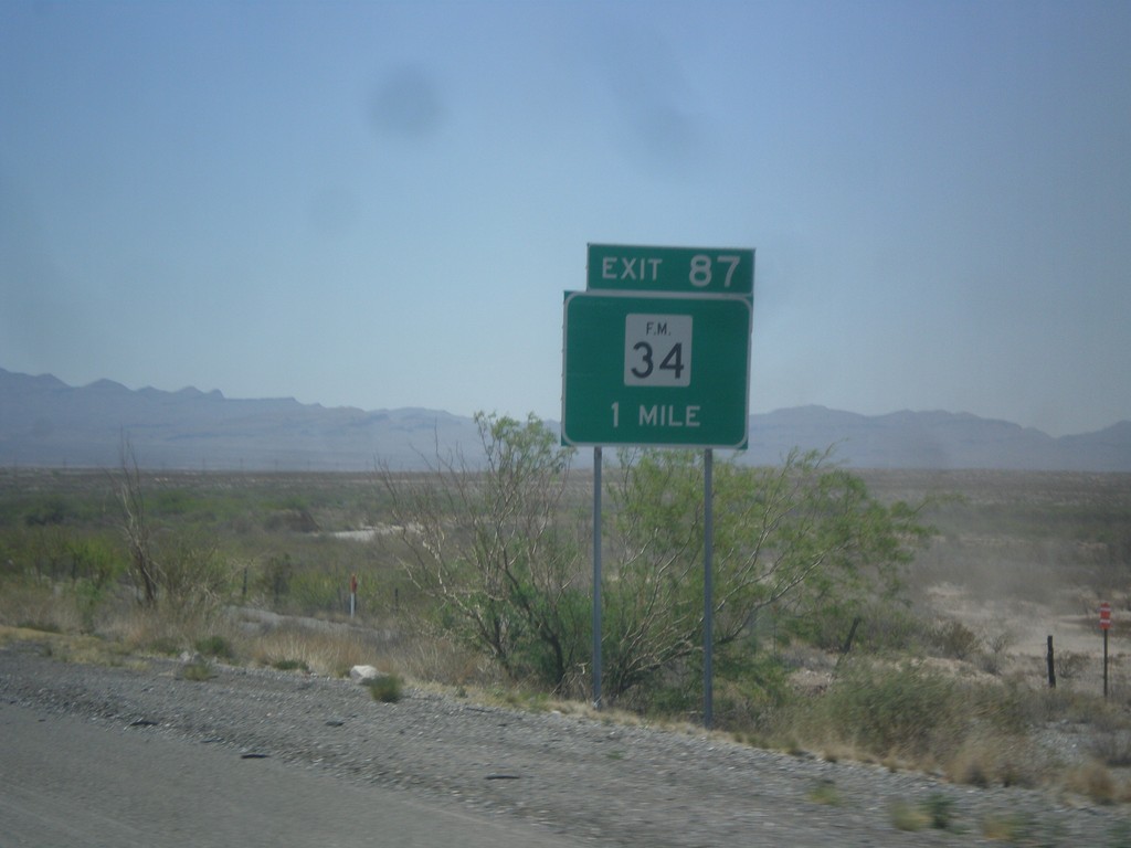
I-10 West - Exit 88
I-10 west at Exit 88 - FM-34.
Taken 04-15-2013
 Esperanza
Hudspeth County
Texas
United States
Esperanza
Hudspeth County
Texas
United States