Signs Tagged With Big Green Sign
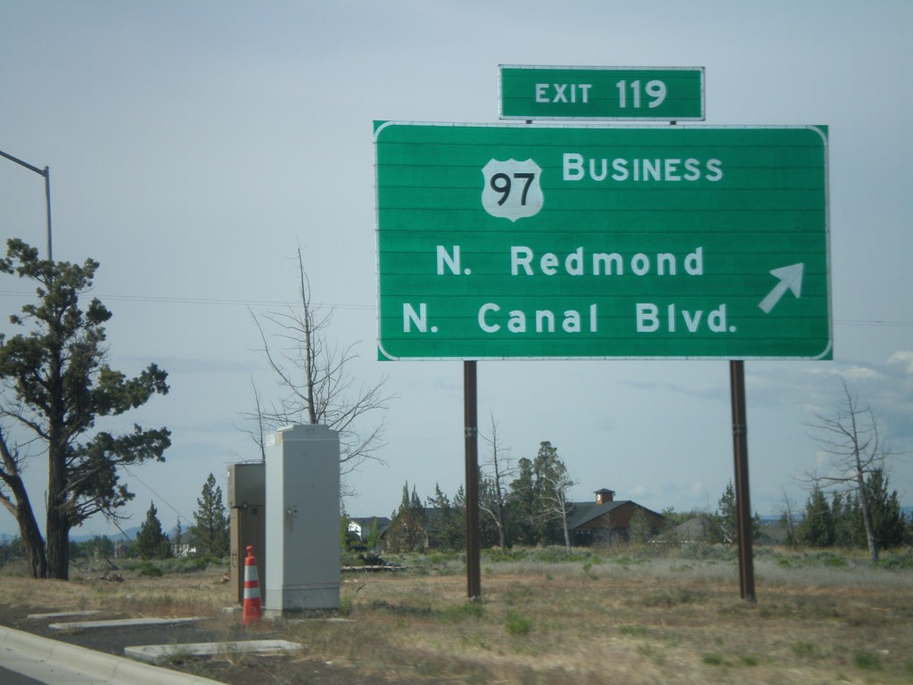
US-97 South - Exit 119
US-97 south at Exit 119 - US-97 Business/N. Redmond/N. Canal Blvd. This is the north end of the Redmond bypass. US-97 formerly followed the route of Business US-97 through downtown Redmond. The new bypass runs to the east of the old highway.
Taken 05-27-2012

 Redmond
Deschutes County
Oregon
United States
Redmond
Deschutes County
Oregon
United States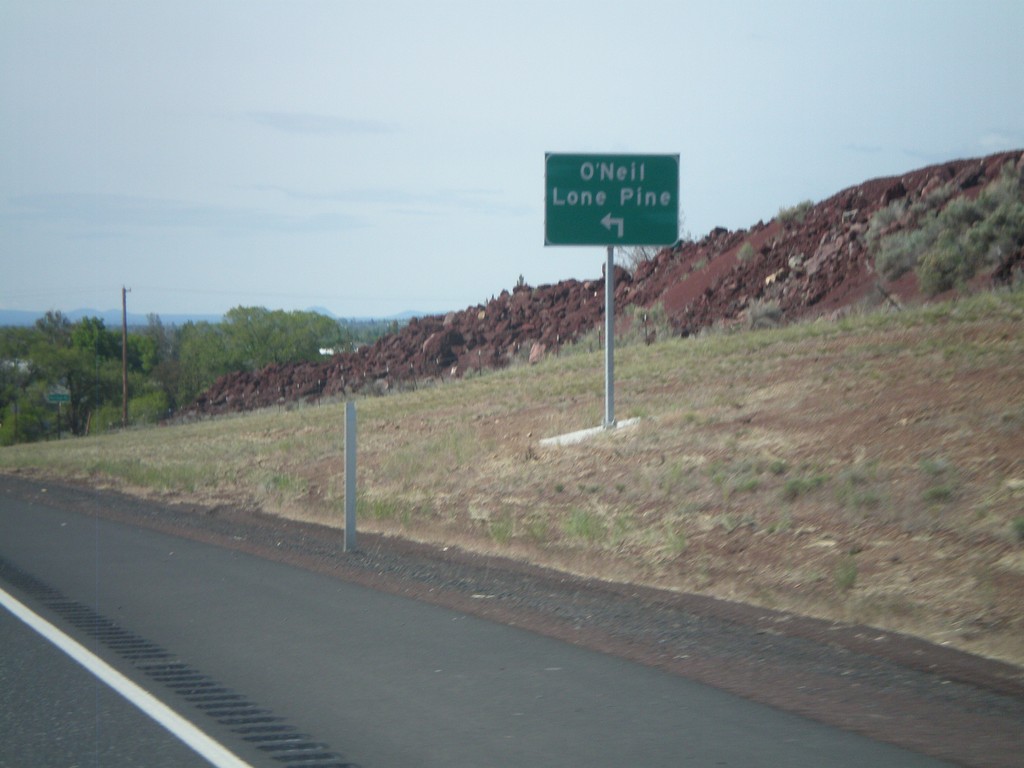
US-97 South at OR-370 (O'Neil Highway)
US-97 south at OR-370 to O’Neill and Lone Pine. OR-370 is not signed as such at this junction, but is part of the O’Neil Highway. This is part of the Oregon State Highway system that did not have a posted route number. In recent years the Oregon Department of Transportation has been assigning numbers to routes that have previously been unsigned.
Taken 05-27-2012
 Redmond
Deschutes County
Oregon
United States
Redmond
Deschutes County
Oregon
United States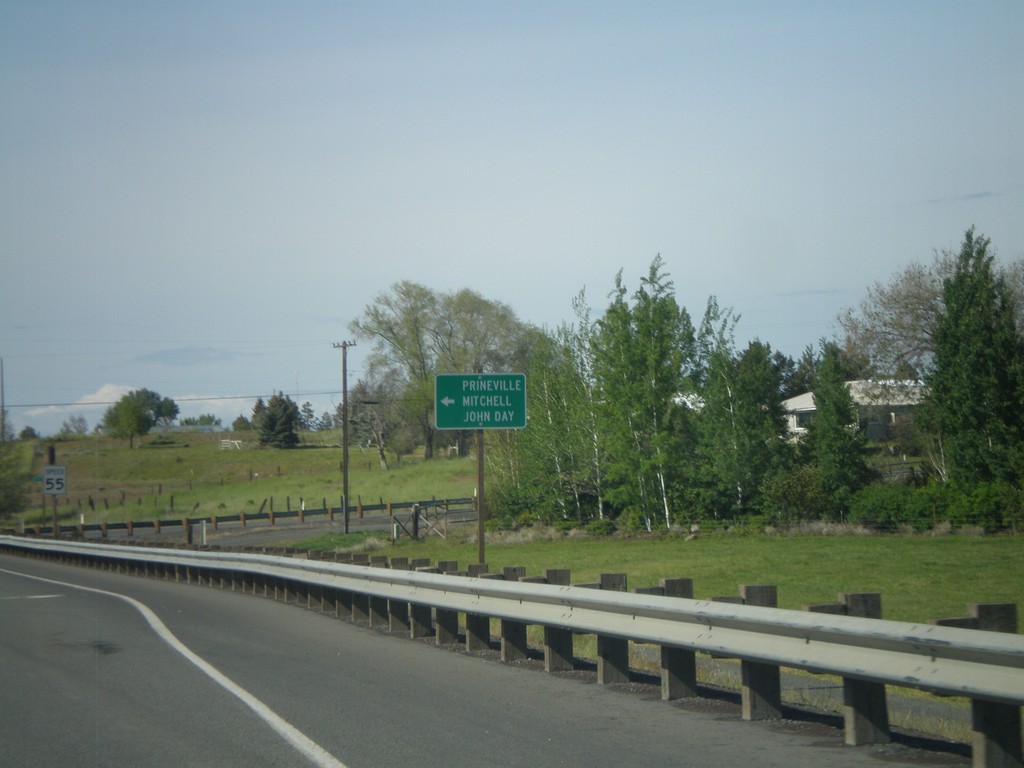
US-97 South/US-26 East at Split
US-97 South/US-26 East at US-97/US-26 split. Turn left for US-26 east to Prineville, Mitchell, and John Day.
Taken 05-27-2012
 Madras
Jefferson County
Oregon
United States
Madras
Jefferson County
Oregon
United States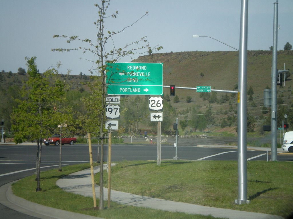
US-97 South at US-26
US-97 south at US-26. Turn right for US-26 west to Portland. Turn left for US-26 east and US-97 south to Redmond, Prineville, and Bend. US-26 joins US-97 south through Madras.
Taken 05-27-2012
Madras
Jefferson County
Oregon
United States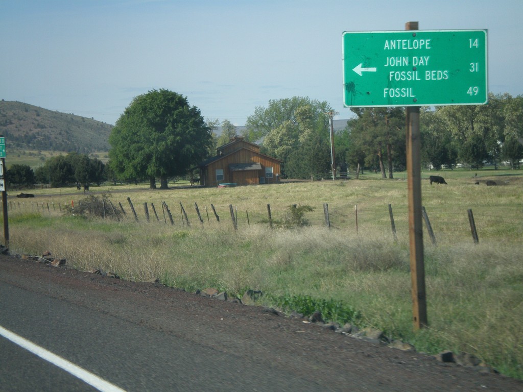
US-97 South at OR-293
US-97 south at OR-293. Use OR-293 east to Antelope, John Day Fossil Beds, and Fossil.
Taken 05-27-2012
 Madras
Jefferson County
Oregon
United States
Madras
Jefferson County
Oregon
United States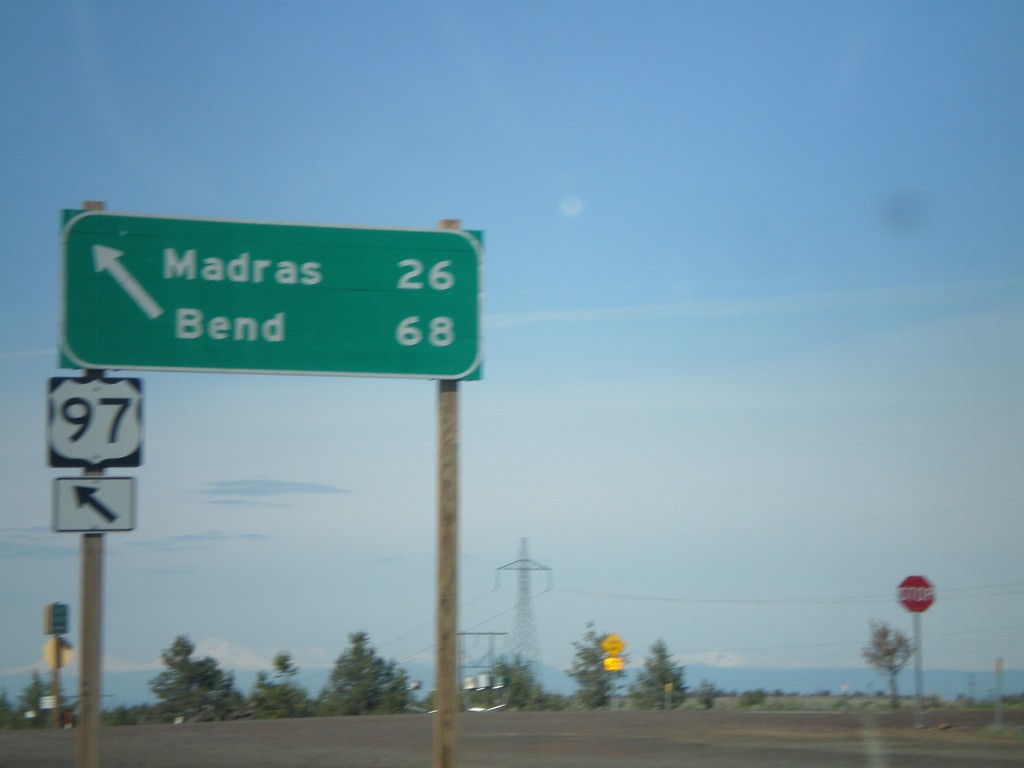
US-97 South at US-197
US-97 south at US-197. Use US-97 south for Madras and Bend. The northbound destination sign for US-197 was knocked over and lying on the ground.
Taken 05-27-2012
 Maupin
Wasco County
Oregon
United States
Maupin
Wasco County
Oregon
United States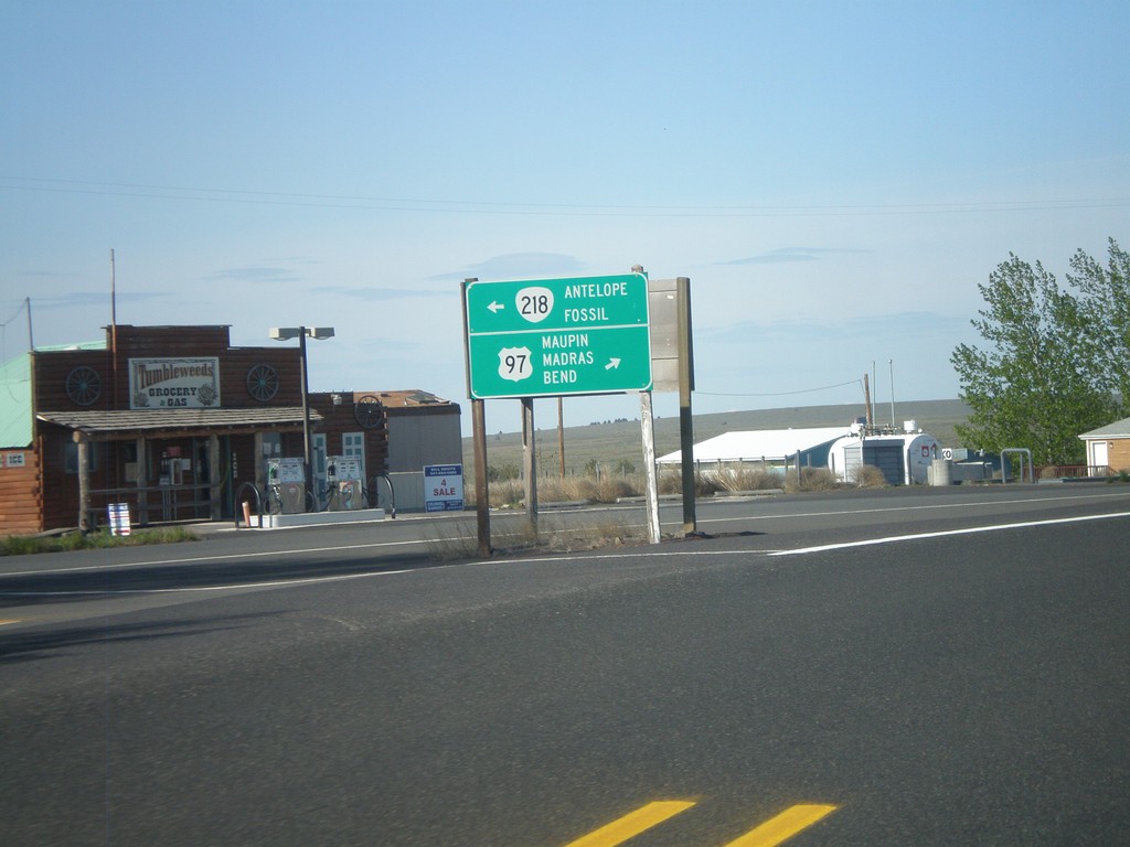
US-97 South at OR-218
US-97 south at OR-218 to Antelope and Fossil. Continue south on US-97 for Maupin, Madras, and Bend.
Taken 05-27-2012
 Shaniko
Wasco County
Oregon
United States
Shaniko
Wasco County
Oregon
United States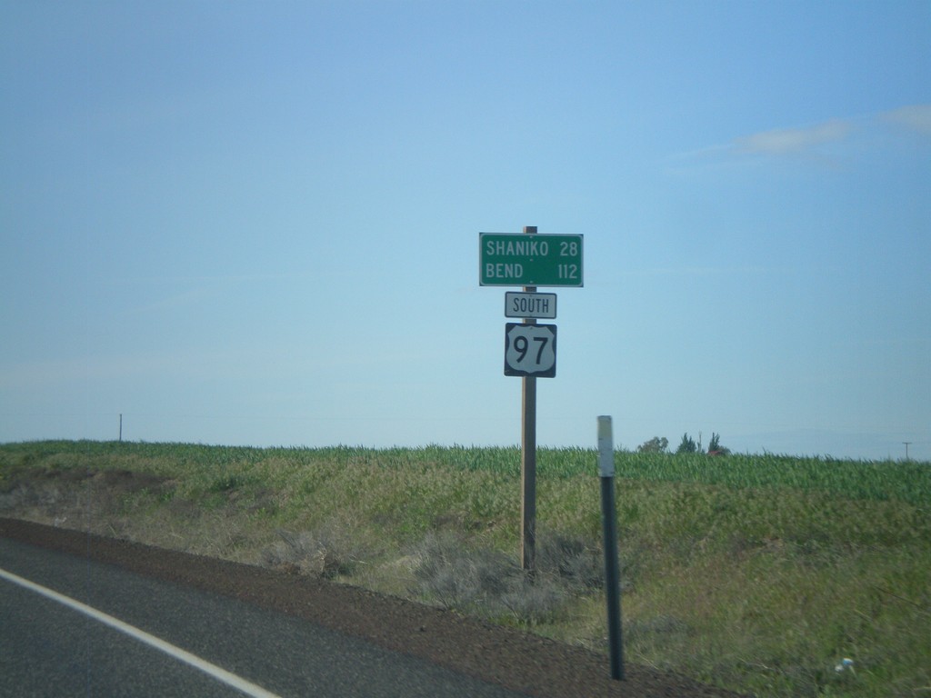
US-97 South - Distance Marker
Distance marker on US-97 south. Distance to Shaniko and Bend.
Taken 05-27-2012
Grass Valley
Sherman County
Oregon
United States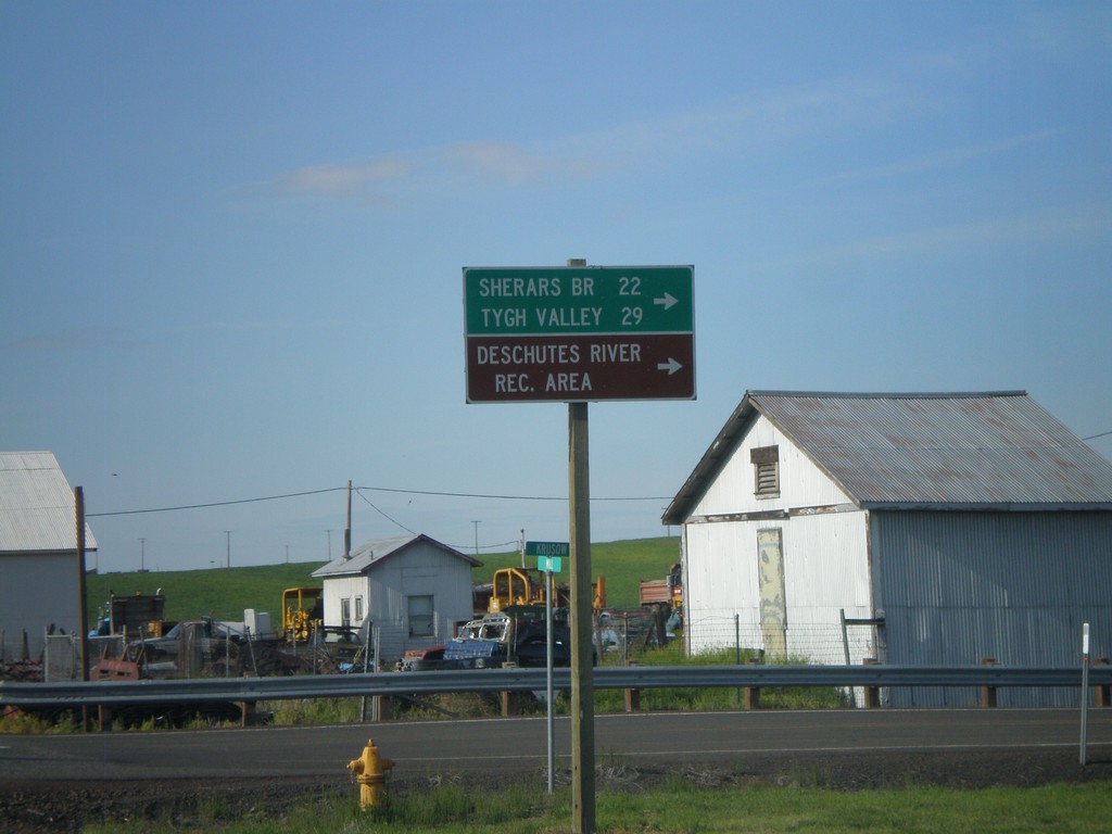
US-97 South at OR-216
US-97 south at OR-216. Use OR-216 west for Sherars Bridge, Tygh Valley, and Deschutes River Recreation Area.
Taken 05-27-2012
 Grass Valley
Sherman County
Oregon
United States
Grass Valley
Sherman County
Oregon
United States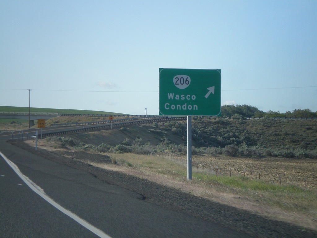
US-97 South at OR-206 Interchange
US-97 South at OR-206 Interchange to Wasco and Condon.
Taken 05-27-2012
 Wasco
Sherman County
Oregon
United States
Wasco
Sherman County
Oregon
United States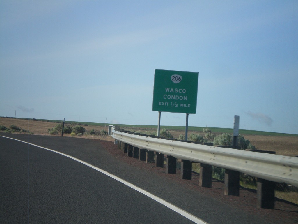
US-97 South Approaching OR-206 IC
US-97 south approaching OR-206 interchange to Wasco and Condon.
Taken 05-27-2012
Wasco
Sherman County
Oregon
United States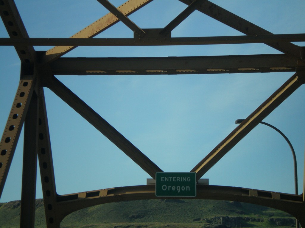
US-97 South - Entering Oregon
Entering Oregon on US-97 south, crossing the Columbia River.
Taken 05-27-2012
Biggs Junction
Sherman County
Oregon
United States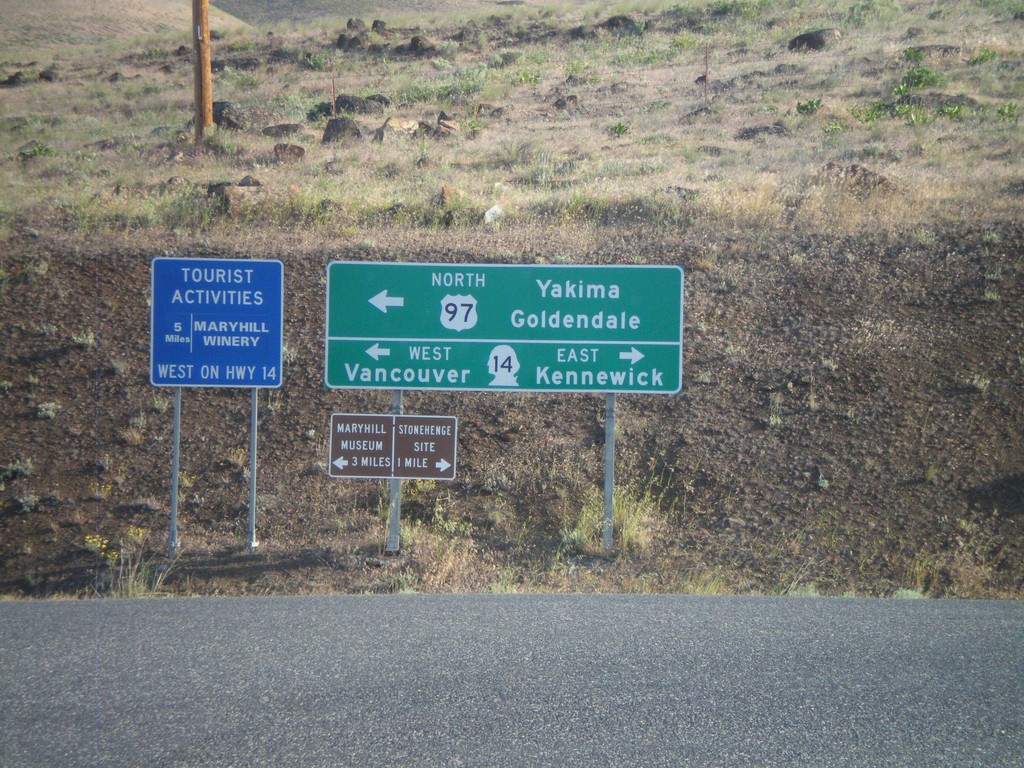
US-97 North at WA-14
US-97 north at WA-14 north. US-97 north joins WA-14 west for about two miles. Turn right on WA-14 east for Kennewick. Turn left on WA-14 west for Vancouver. Also turn left for US-97 north to Yakima and Goldendale.
Taken 05-27-2012
 Maryhill
Klickitat County
Washington
United States
Maryhill
Klickitat County
Washington
United States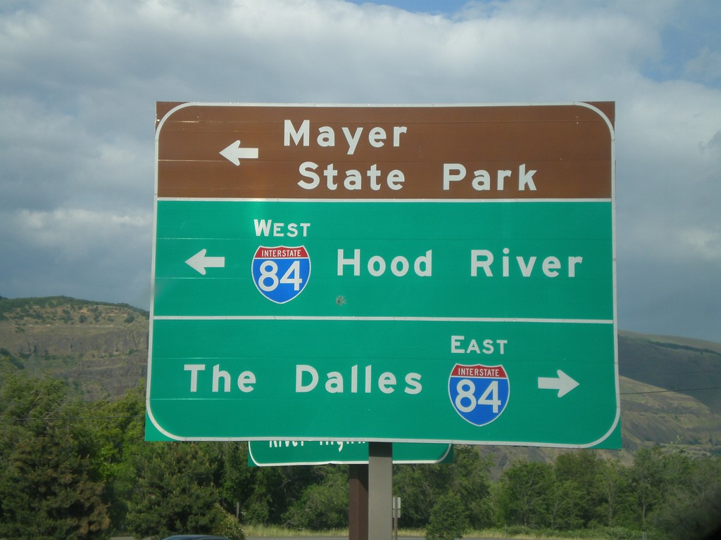
Rowena Access Road at I-84
Rowena Access Road at I-84 (Exit 76) onramp. Turn right for I-84 east to The Dalles. Turn left for I-84 west to Hood River, and to continue under freeway towards Mayer State Park.
Taken 05-26-2012

 The Dalles
Wasco County
Oregon
United States
The Dalles
Wasco County
Oregon
United States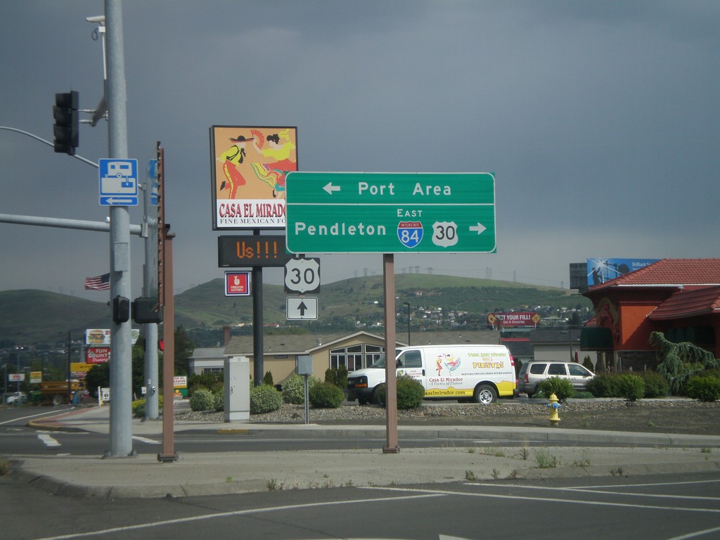
W 2nd St. at US-30 and I-84
W 2nd St. in The Dalles at US-30 and I-84 east junction. Turn right for I-84 east, to Pendleton, and US-30 west. Continue ahead on 2nd St. for US-30 east. Turn left for the Port Area along the Columbia River.
Taken 05-26-2012
The Dalles
Wasco County
Oregon
United States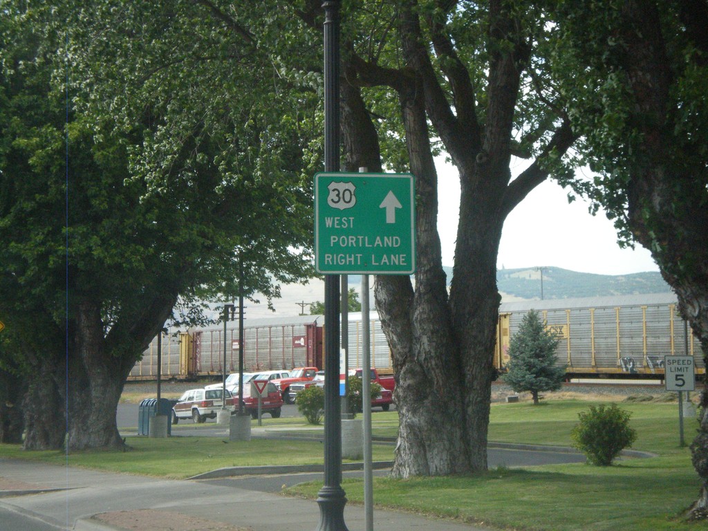
US-30 West - Downtown The Dalles
E 2nd St. west in downtown The Dalles. Use right lanes to continue west on US-30 toward Portland.
Taken 05-26-2012
The Dalles
Wasco County
Oregon
United States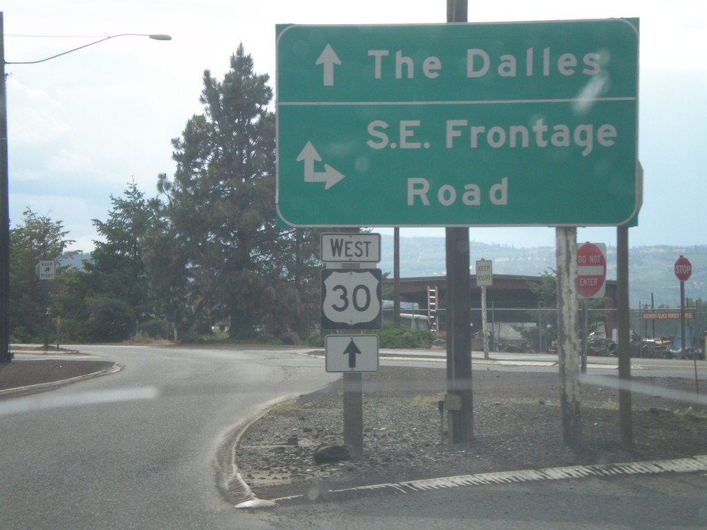
US-30 West at SE Frontage Road
US-30 west at SE Frontage Road.
Taken 05-26-2012
The Dalles
Wasco County
Oregon
United States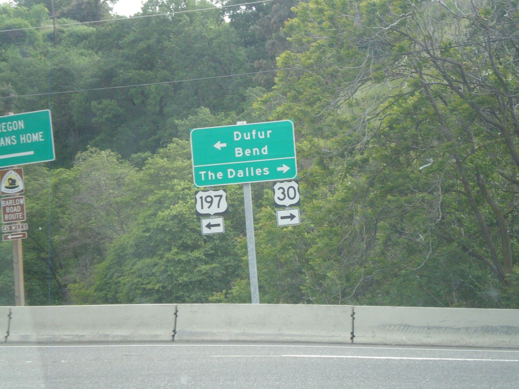
US-197 South/US-30 West at Split
US-197 South/US-30 West at US-197/US-30 split. Turn right for US-30 west to The Dalles. Turn left for US-197 south to Dufur and Bend.
Taken 05-26-2012
The Dalles
Wasco County
Oregon
United States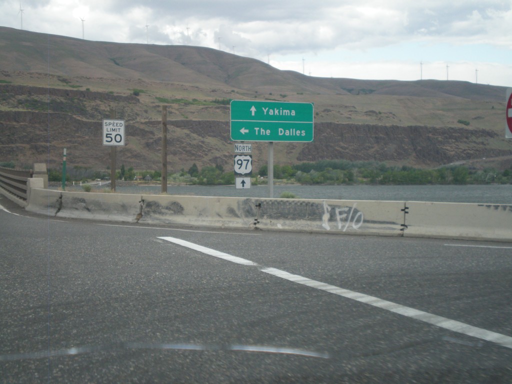
US-97 North at I-84/US-30 West
US-97 north at I-84/US-30 West (Exit 104). Turn left for I-84/US-30 west to The Dalles. Continue north on US-97 towards Yakima (Washington). US-97 crosses over the Columbia River into Washington immediately north of this junction. The Columbia River and the hills of Washington state are in the background of this photograph.
Taken 05-26-2012
Biggs Junction
Sherman County
Oregon
United States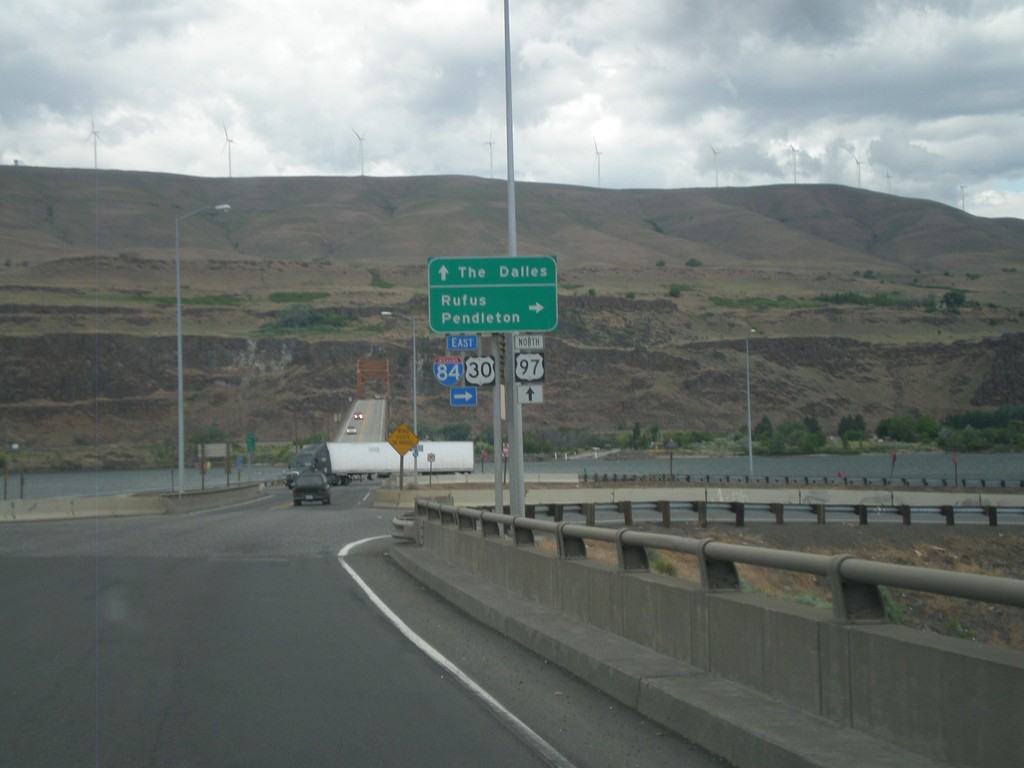
US-97 North at I-84/US-30 (Exit 104)
US-97 north at I-84/US-30 (Exit 104) junction. Turn right on I-84/US-30 east for Rufus and Pendleton. Continue over freeway for I-84/US-30 west to The Dalles. The Columbia River, and bridge over the Columbia River into Washington is in the background of the photograph.
Taken 05-26-2012
Wasco
Sherman County
Oregon
United States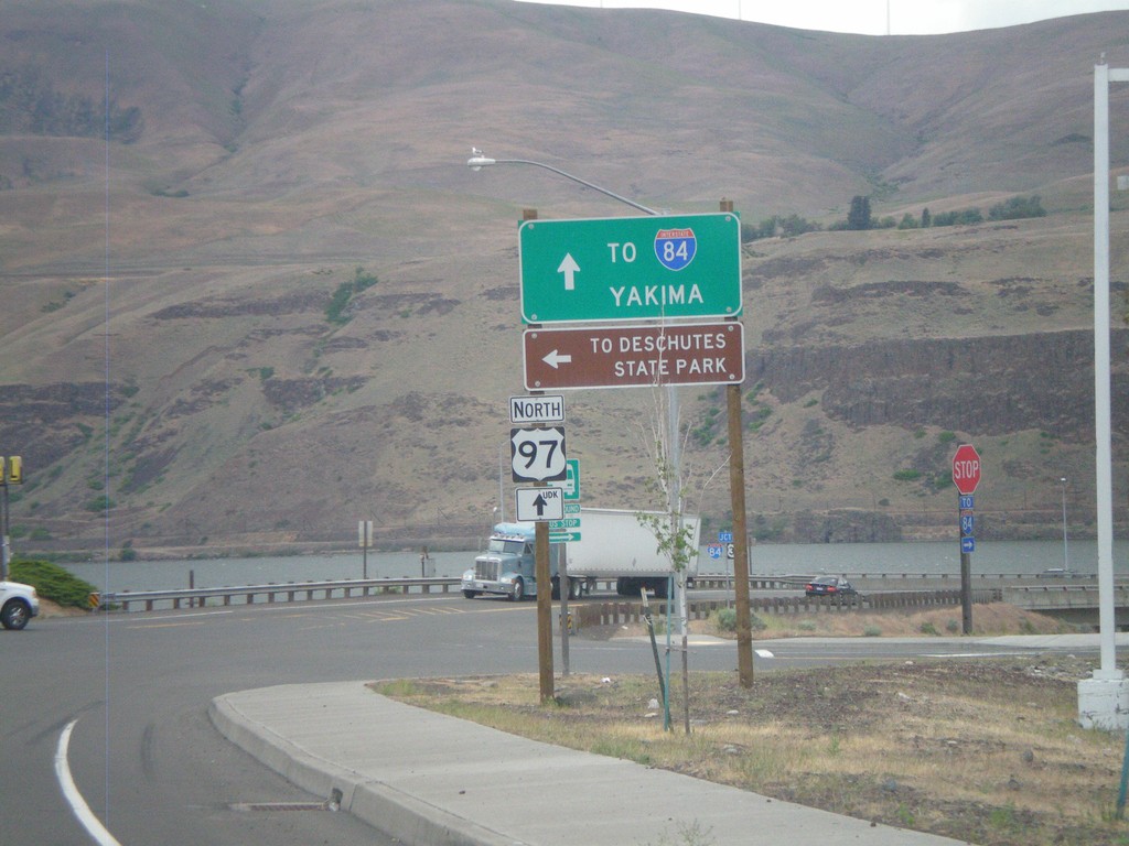
US-97 North at I-84 Frontage Road
I-84 north at I-84 Frontage Road, and approaching I-84/US-30 junction. Turn left on the Frontage Road for Deschutes State Park. Continue north on US-97 for I-84 junction, and Yakima (Washington). The Columbia River and Washington state are in the background of the photograph.
Taken 05-26-2012
Wasco
Sherman County
Oregon
United States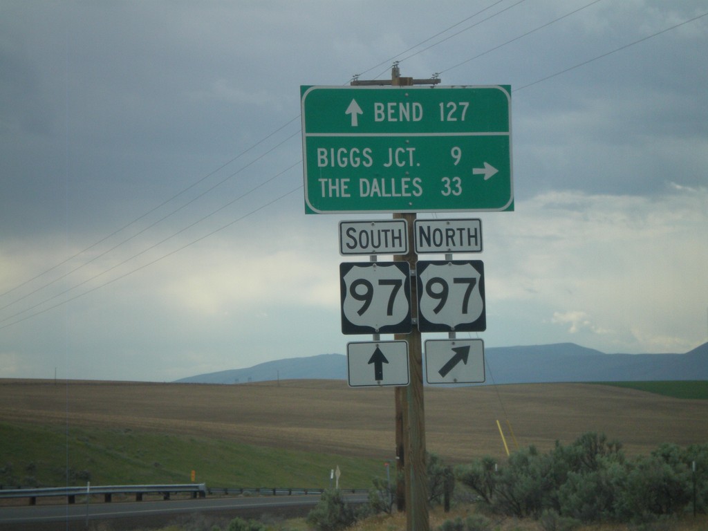
OR-206 West at US-97
OR-206 west at US-97 onramp. Turn right for US-97 north to Biggs Junction and The Dalles. Continue over the highway for US-97 southbound ramp to Bend.
Taken 05-26-2012
Wasco
Sherman County
Oregon
United States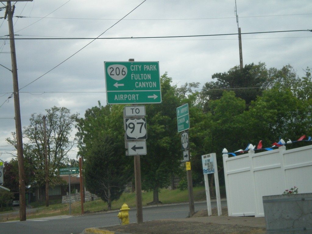
OR-206 West In Wasco
OR-206 west on Clark St. at Armsworthy St. in Wasco. Turn left on Armsworthy St. to continue on OR-206 for Fulton Canyon, (Wasco) City Park and US-97. Turn right for the Wasco Airport.
Taken 05-26-2012
Wasco
Sherman County
Oregon
United States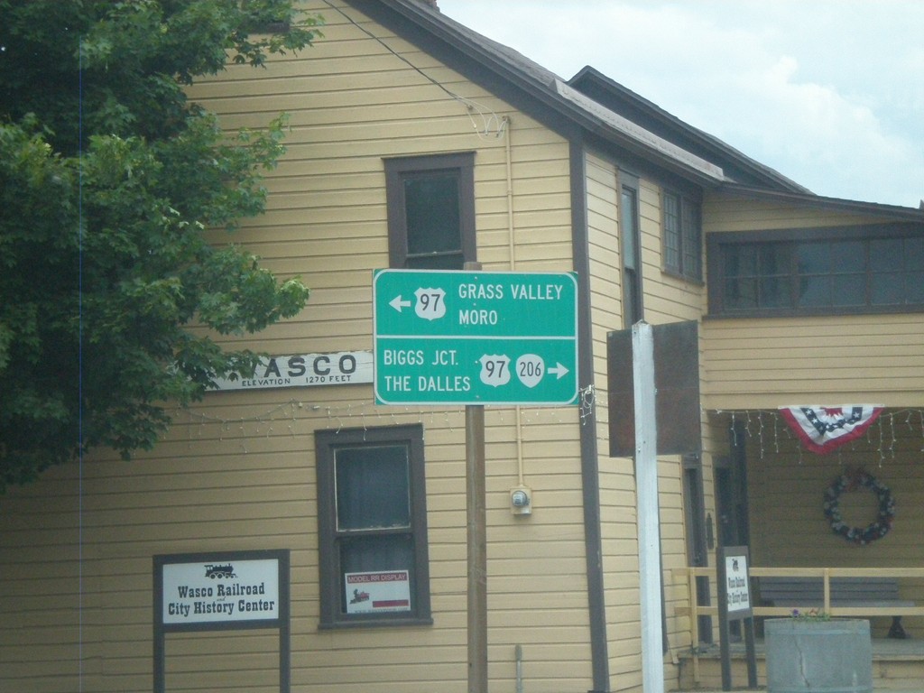
OR-206 West at Clark St. - Wasco
OR-206 west at Clark St. in Wasco. Turn left on Clark St. south to US-97 South towards Moro and Grass Valley. Turn right on Clark St. for US-97 north, OR-206 west to Biggs Jct. and The Dalles.
Taken 05-26-2012
Wasco
Sherman County
Oregon
United States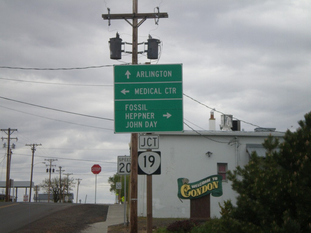
OR-206 East at OR-19
OR-206 east at OR-19 in Condon. Continue ahead for OR-19 north to Arlington. Turn right for OR-206 East/OR-19 South for Fossil, Heppner, and John Day. Turn left on Main St. for the Medical Center.
Taken 05-26-2012
 Condon
Gilliam County
Oregon
United States
Condon
Gilliam County
Oregon
United States