Signs Tagged With Big Green Sign
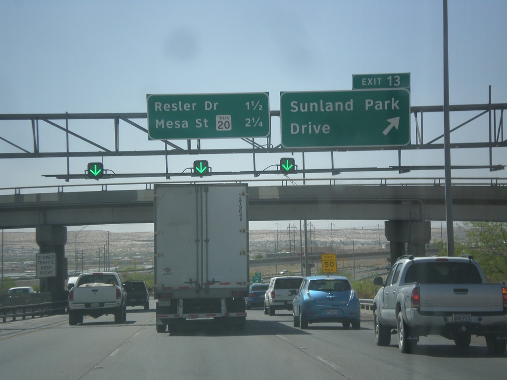
I-10 West - Exit 13
I-10 west at Exit 13 - Sunland Park Drive. Approaching Resler Drive, and TX-20/Mesa St. interchanges.
Taken 04-14-2013

 El Paso
 County
Texas
United States
El Paso
El Paso County
Texas
United States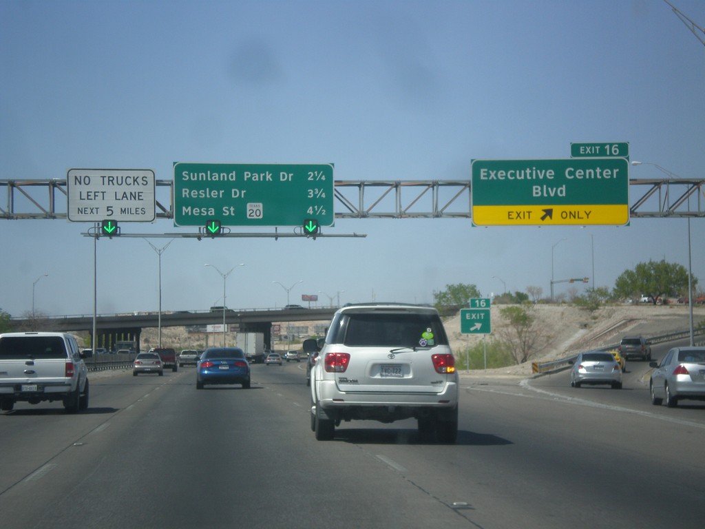
I-10 West - Exit 16
I-10 west at Exit 16 - Executive Center Blvd. Approaching Sunland Park Drive, Resler Drive, and TX-20/Mesa St. interchanges.
Taken 04-14-2013
El Paso
El Paso County
Texas
United States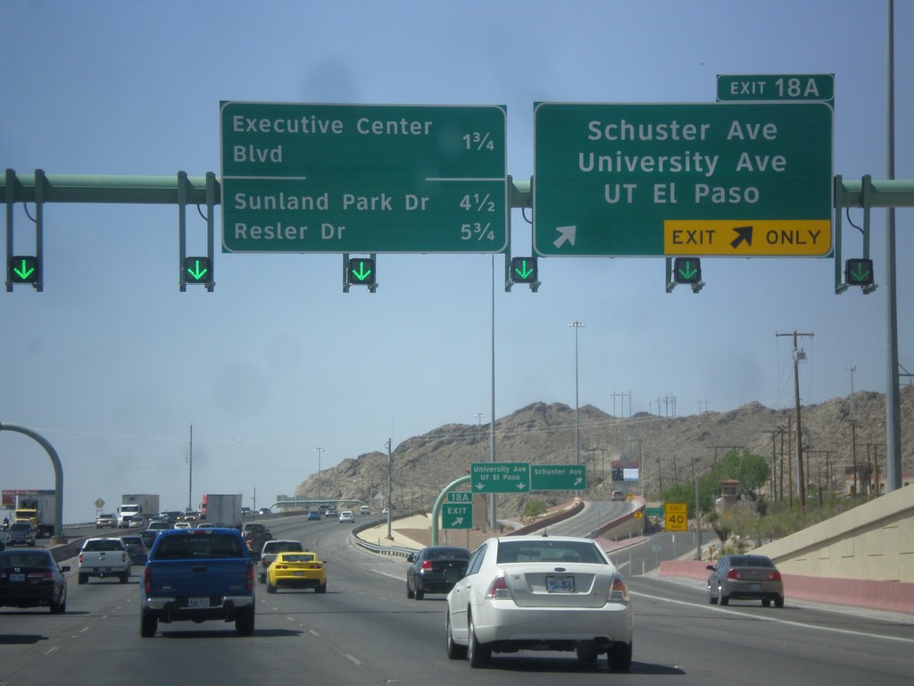
I-10 West - Exit 18A
I-10 west at Exit 18A - Schuster Ave./University Ave./UT El Paso. Approaching Executive Center Blvd., Sunland Park Drive, and Resler Drive interchanges.
Taken 04-14-2013
El Paso
El Paso County
Texas
United States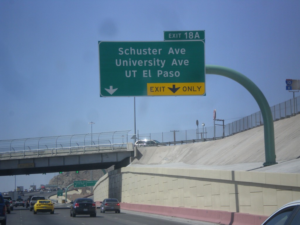
I-10 West - Exit 18A
I-10 west at Exit 18A - Schuster Ave./University Ave./UT El Paso.
Taken 04-14-2013
El Paso
El Paso County
Texas
United States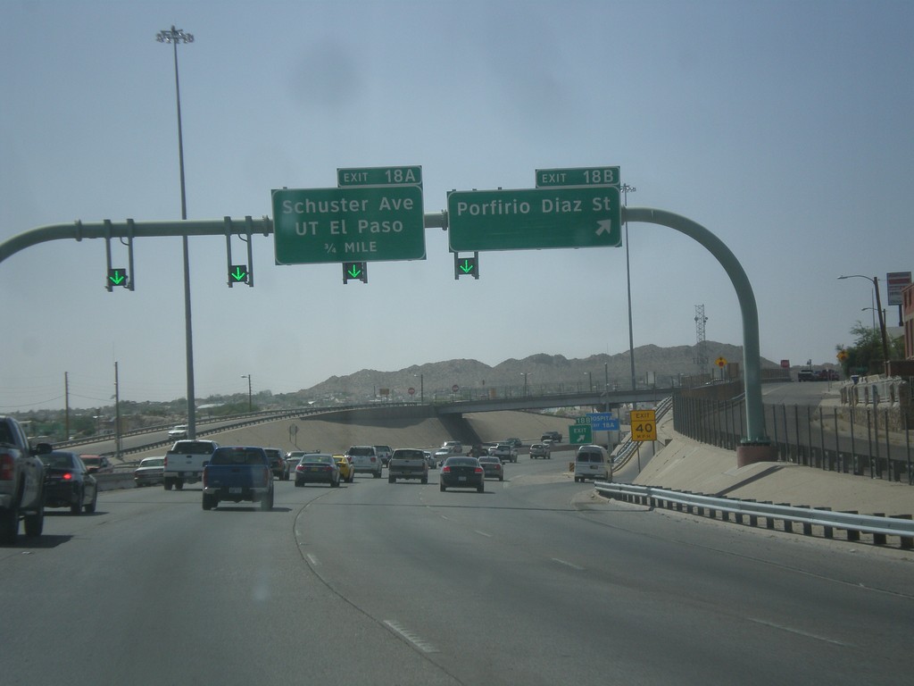
I-10 West - Exits 18B and 18A
I-10 west at Exit 18B - Porfirio Diaz St. Approaching Exit 18A - Schuster Ave/UT El Paso.
Taken 04-14-2013
El Paso
El Paso County
Texas
United States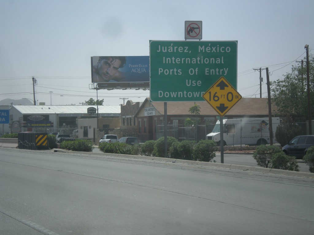
I-10 West - Exit 19B
I-10 west approaching Exit 19B - Juarez, Mexico/International Ports of Entry - Use Downtown Exit.
Taken 04-14-2013
El Paso
El Paso County
Texas
United States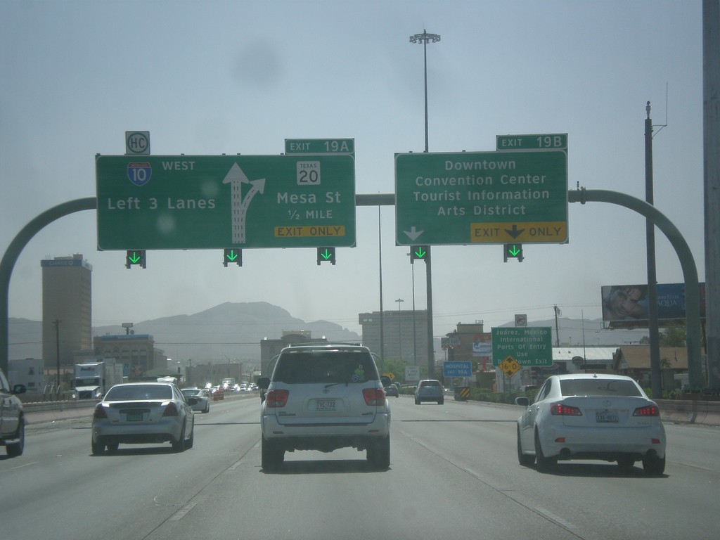
I-10 West - Exits 19B and 19A
I-10 west at Exit 19B - Downtown/Convention Center/Tourist Information/Arts District. Approaching Exit 19A - TX-20/Mesa St. Use left 3 lanes for I-10 west.
Taken 04-14-2013
El Paso
El Paso County
Texas
United States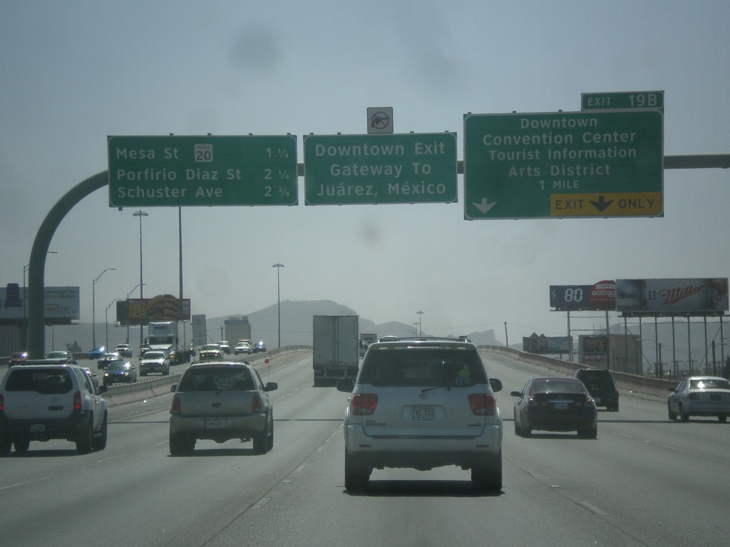
I-10 West - Exit 19B
I-10 west approaching Exit 19B - Downtown/Convention Center/Tourist Information/Arts District. Use Exit 19B for Juarez, Mexico. Approaching TX-20/Mesa St., Porfirio Diaz St., and Schuster Ave.
Taken 04-14-2013
El Paso
El Paso County
Texas
United States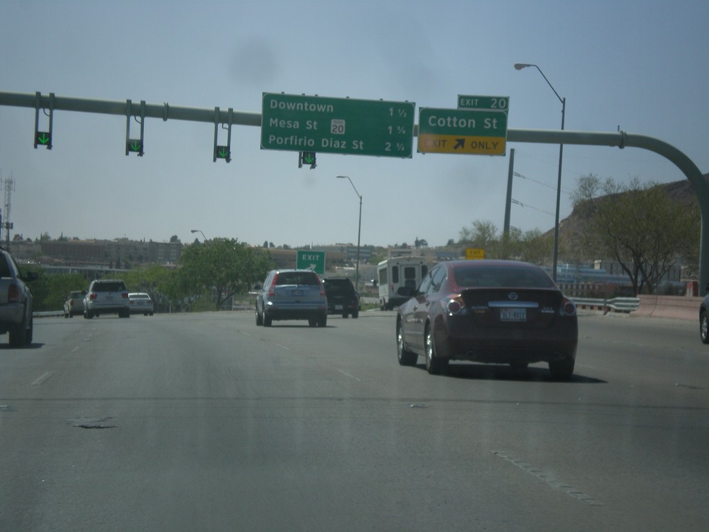
I-10 West - Exit 20
I-10 west at Exit 20 - Cotton St. Approaching Downtown, TX-20/Mesa St., and Porfirio Diaz St. interchanges.
Taken 04-14-2013
El Paso
El Paso County
Texas
United States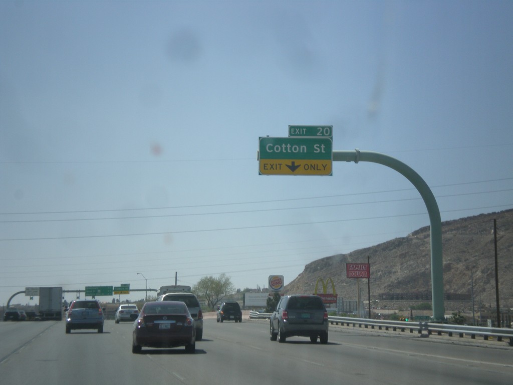
I-10 West Approaching Exit 20
I-10 west approaching Exit 20 - Cotton St.
Taken 04-14-2013
El Paso
El Paso County
Texas
United States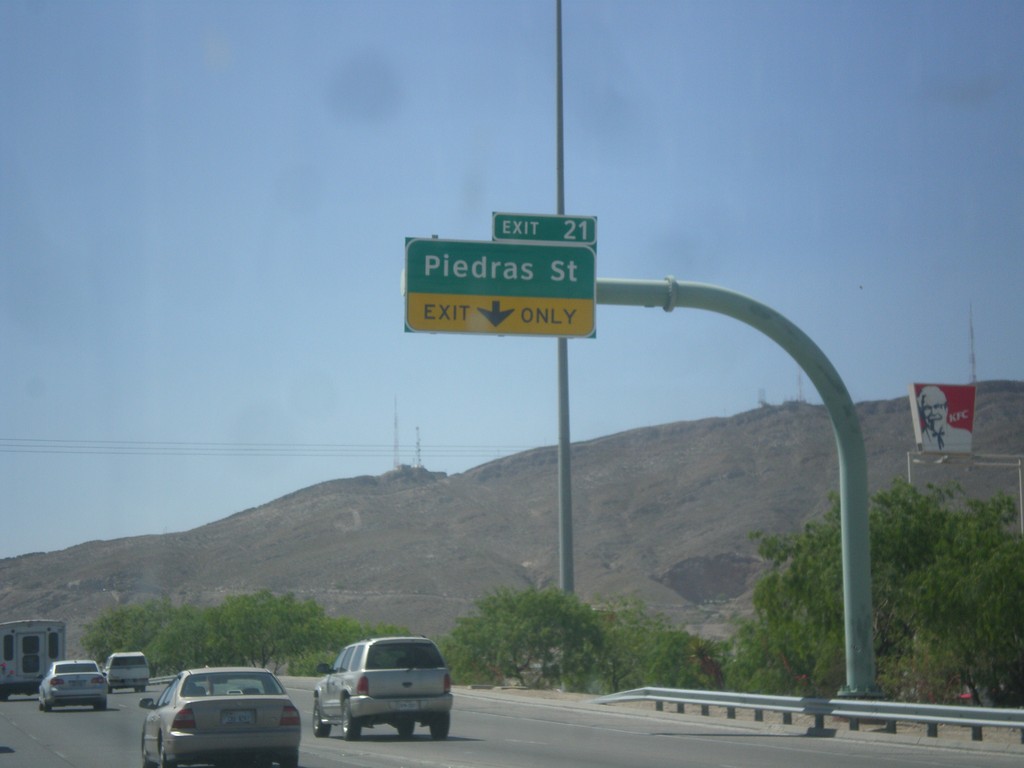
I-10 West - Exit 21
I-10 west at Exit 21 - Piedras St.
Taken 04-14-2013
El Paso
El Paso County
Texas
United States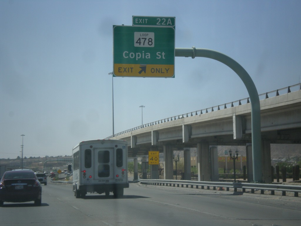
I-10 West - Exit 22A
I-10 west at Exit 22A - TX-478 Loop/Copia St.
Taken 04-14-2013
 El Paso
 County
Texas
United States
El Paso
El Paso County
Texas
United States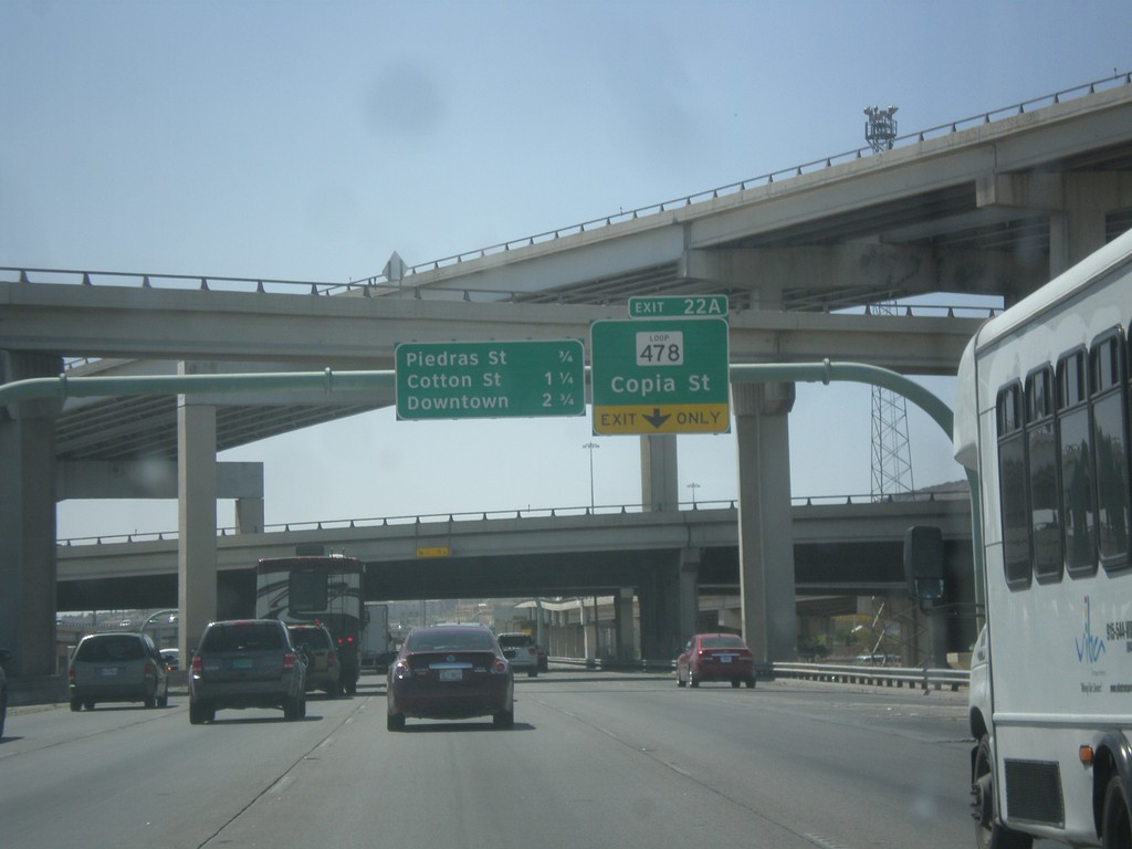
I-10 West Approaching Exit 22A
I-10 west approaching Exit 22A - TX-478 Loop/Copia St. Approaching Piedras St., Cotton St., and Downtown interchanges.
Taken 04-14-2013
El Paso
El Paso County
Texas
United States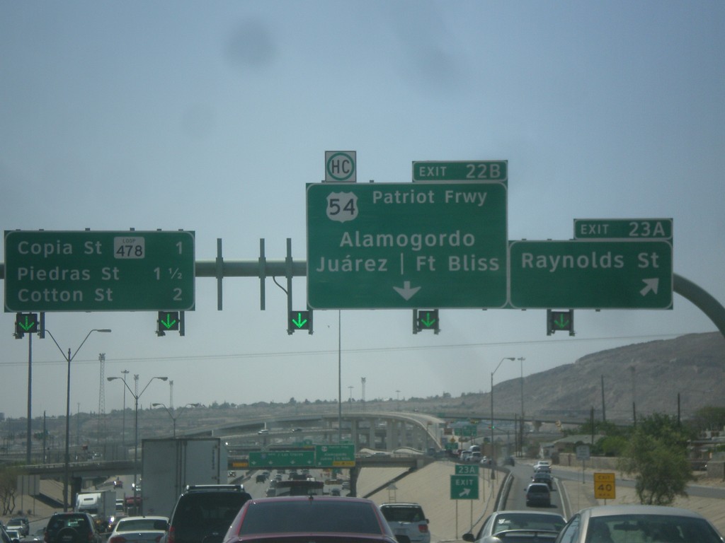
I-10 West - Exits 23A and 22B
I-10 west at Exit 23A - Raynolds St. Approaching Exit 22B - US-54/Patriot Freeway/Alamogordo (NM)/Fort Bliss/Juarez (Mexico). Continue west on I-10 for Copia St./TX 478 Loop/Piedras St./Cotton St.
Taken 04-14-2013
 El Paso
 County
Texas
United States
El Paso
El Paso County
Texas
United States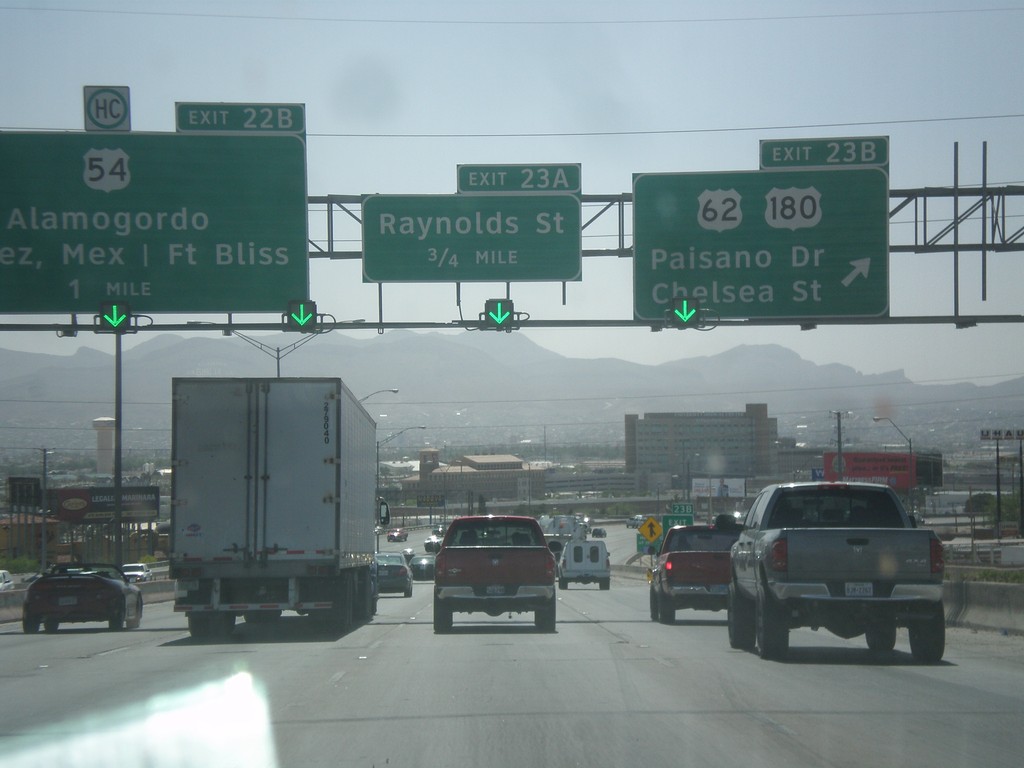
I-10 West - Exits 23B, 23A, and 22B
I-10 west at Exit 23B - US-62/US-180/Paisano Drive/Chelsea St. Approaching Exit 23A - Raynolds St. Also approaching Exit 22B - US-54/Alamogordo/Fort Bliss/Juarez, Mexico.
Taken 04-14-2013

 El Paso
 County
Texas
United States
El Paso
El Paso County
Texas
United States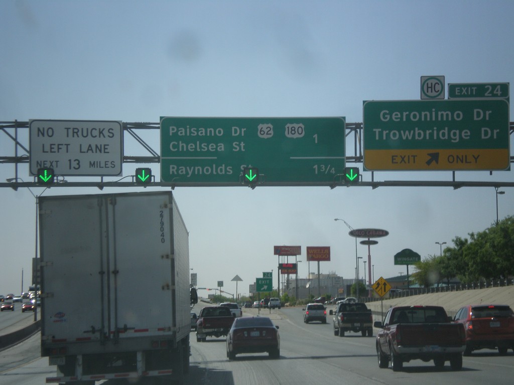
I-10 West - Exit 24
I-10 west at Exit 24 - Geronimo Drive/Trowbridge Drive. Approaching US-62/US-180 Jct. and Raynolds St. Jct.
Taken 04-14-2013
El Paso
El Paso County
Texas
United States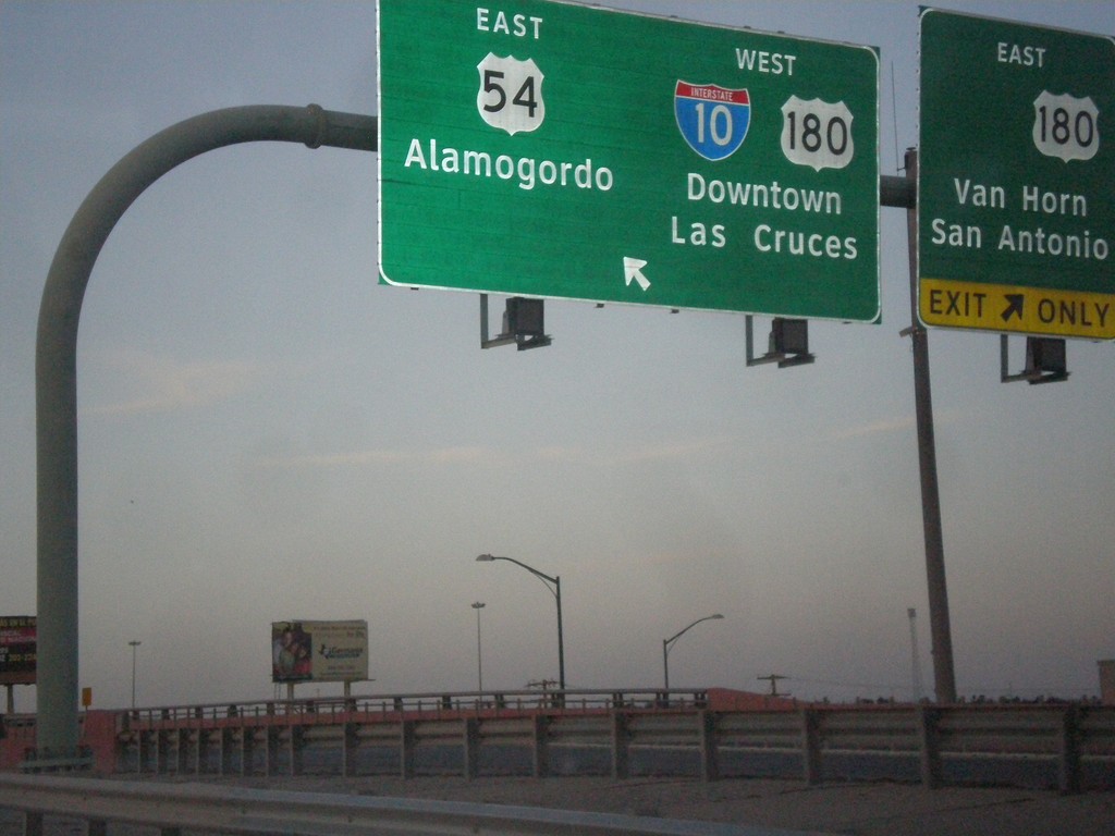
I-110/US-54 North at I-10
I-110/US-54 North at I-10/US-180 jct. Merge left for US-54 North/Alamogordo (NM), and I-10/US-180 West/Downtown/Las Cruces (NM). Merge right for I-10(not-signed)/US-180 East/Van Horn/San Antonio. This is the northern end of I-110.
Taken 04-13-2013
 El Paso
 County
Texas
United States
El Paso
El Paso County
Texas
United States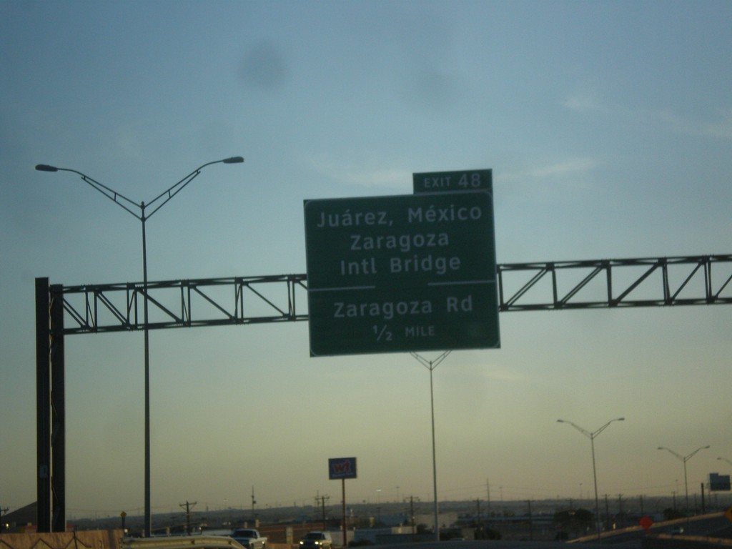
TX-375 Loop - Exit 48
TX-375 Loop southwest approaching Exit 48 - Juarez, Mexico/Zaragoza International Bridge/Zaragoza Road.
Taken 04-13-2013
 El Paso
 County
Texas
United States
El Paso
El Paso County
Texas
United States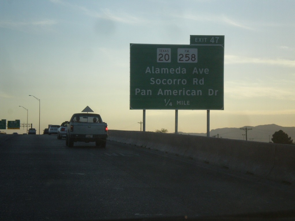
TX-375 Loop South - Exit 47
TX-375 Loop South approaching Exit 47 - TX-20/FM-258/Alameda Ave./Socorro Road/Pan American Drive.
Taken 04-13-2013
 El Paso
 County
Texas
United States
El Paso
El Paso County
Texas
United States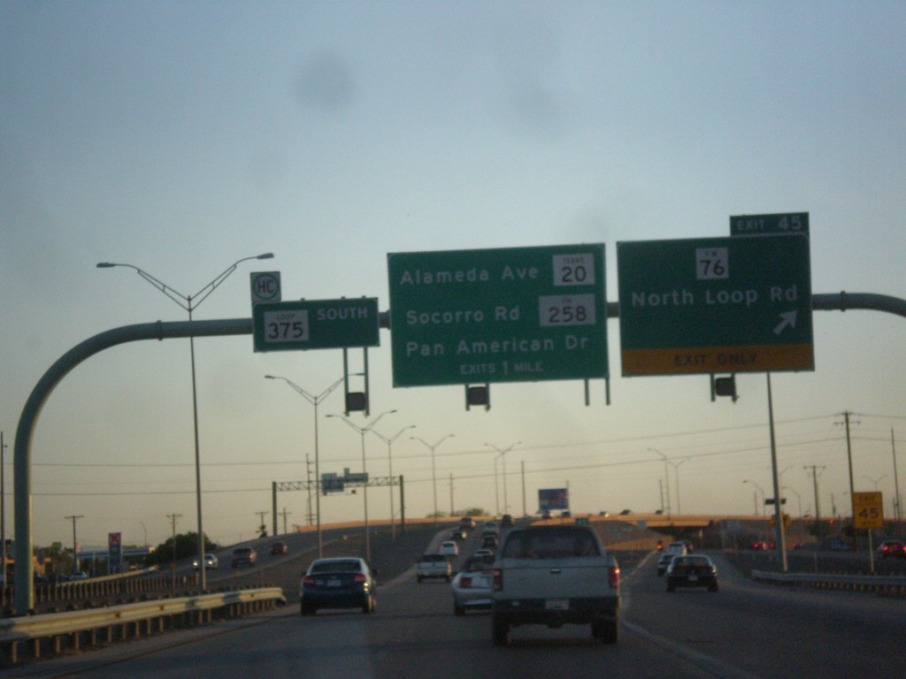
TX-375 Loop South - Exit 45
TX-375 Loop South at Exit 45 - FM-76/North Loop Road. Approaching TX-20/Alameda Ave. and FM-258/Soccoro Road/Pan American Drive.
Taken 04-13-2013
 El Paso
 County
Texas
United States
El Paso
El Paso County
Texas
United States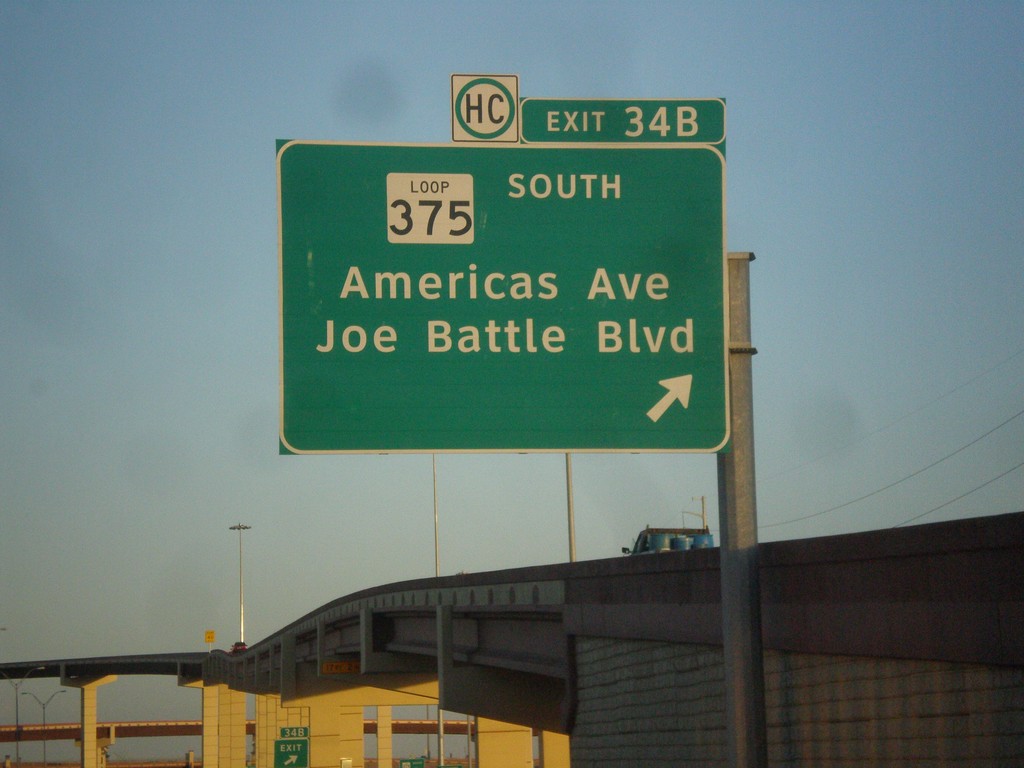
I-10 East - Exit 34B
I-10 east at Exit 34B - TX-375 Loop South/Americas Ave./Joe Battle Blvd.
Taken 04-13-2013
El Paso
El Paso County
Texas
United States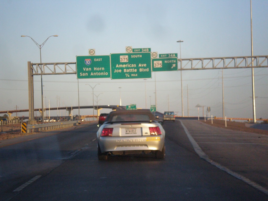
I-10 East - Exits 34A and B
I-10 east at Exit 34A - TX-375 Loop North. Approaching Exit 34B - TX-375 Loop South/Americas Ave./Joe Battle Blvd. I-10 continues east towards Van Horn and San Antonio. This is the eastern end of TX-375 Loop.
Taken 04-13-2013
El Paso
El Paso County
Texas
United States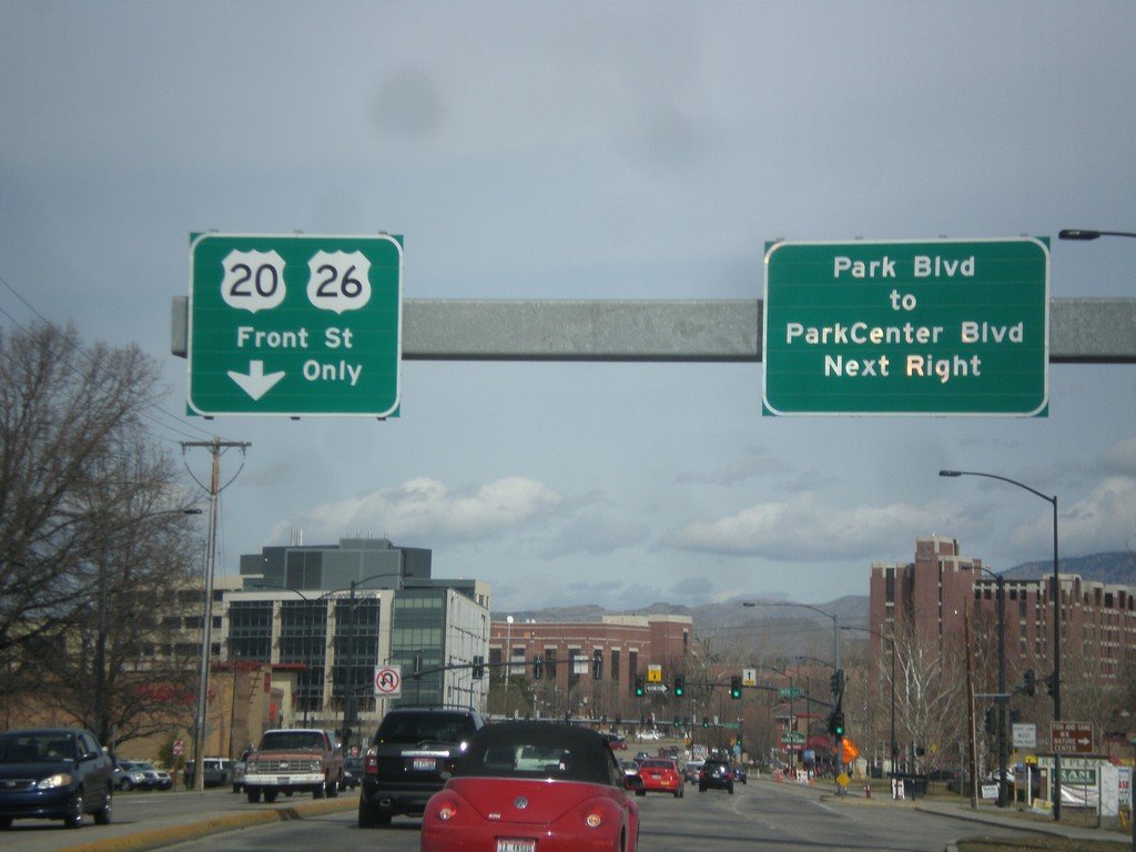
US-20/US-26 West - Broadway Ave at Front St
US-20/US-26 west (Broadway Ave.) approaching Front St. US-20/US-26 traffic turns left on Front St. Turn right at the next light for Park Blvd. to Park Center Blvd.
Taken 03-16-2013

 Boise
Ada County
Idaho
United States
Boise
Ada County
Idaho
United States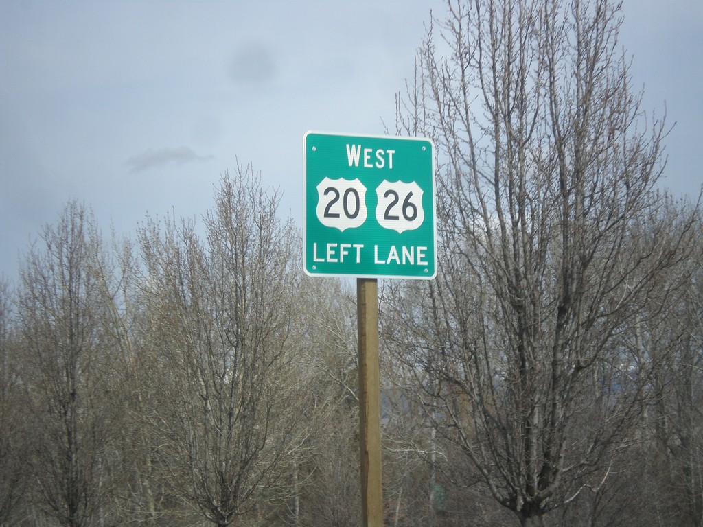
US-20/US-26 West - Broadway Ave Approaching Front St
US-20/US-26 West (Broadway Ave.) approaching Front St. US-20/US-26 traffic need to get in the left lanes to turn onto Front St.
Taken 03-16-2013
Boise
Ada County
Idaho
United States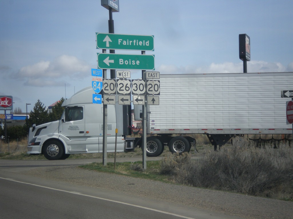
BL-84 East at I-84/US-20/US-26/US-30
BL-84 east at I-84 west interchange (Exit 95) in Mountain Home. Turn left for I-84/US-20/US-26/US-30 west towards Boise. Continue straight ahead for US-20 east to Fairfield. This is the eastern end of the Mountain Home business loop.
Taken 03-16-2013


 Mountain Home
Elmore County
Idaho
United States
Mountain Home
Elmore County
Idaho
United States