Signs Tagged With Big Green Sign
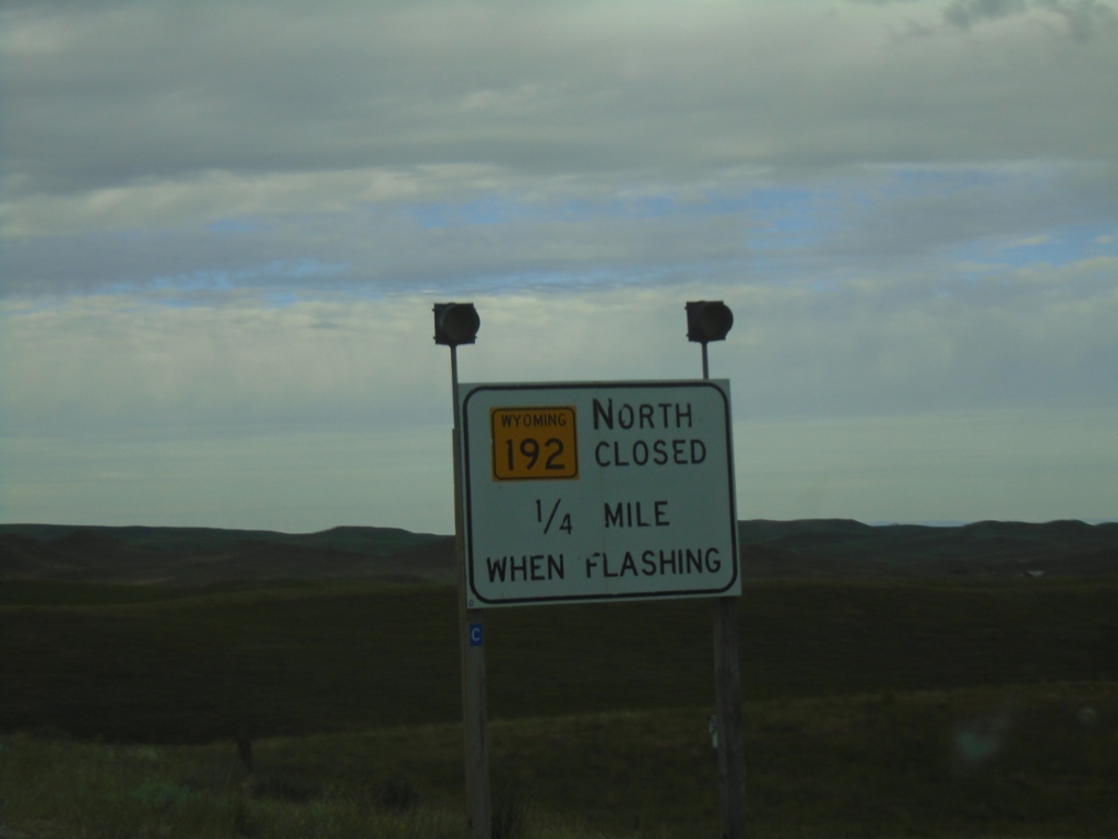
WY-387 West Approaching WY-192
WY-387 West approaching WY-192 in Johnson County. WY-192 Closed When Lights Flashing.
Taken 07-04-2025

 Kaycee
Johnson County
Wyoming
United States
Kaycee
Johnson County
Wyoming
United States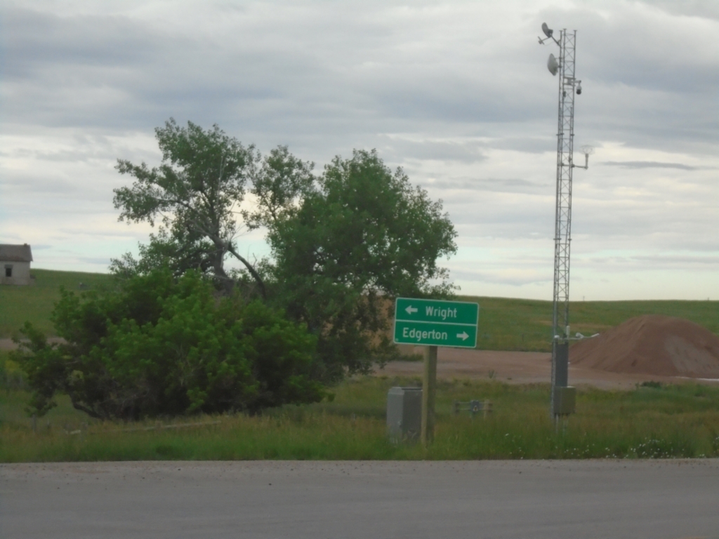
End WY-50 South at WY-387
End WY-50 South at WY-387 in Campbell County. Use WY-387 West to Edgerton; WY-387 East to Wright.
Taken 07-04-2025
 Gillette
Campbell County
Wyoming
United States
Gillette
Campbell County
Wyoming
United States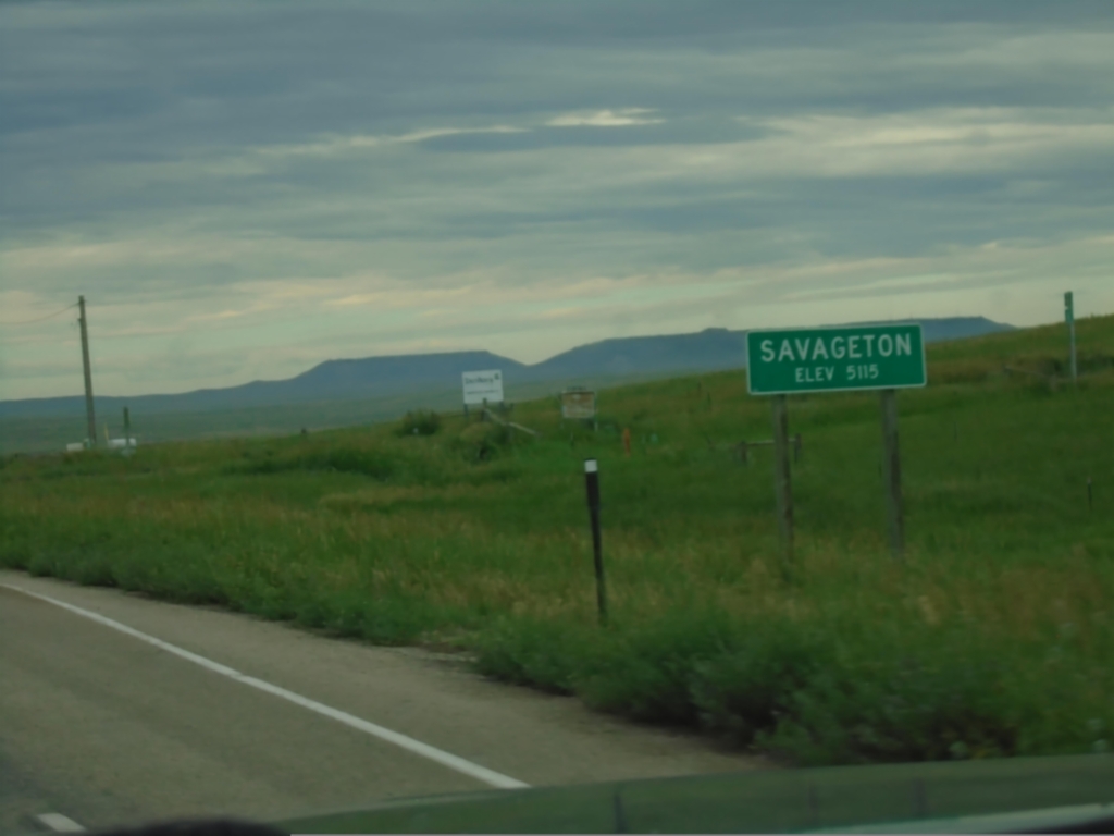
WY-50 South - Savageton
Entering Savageton - Elevation 5115 on WY-50 south.
Taken 07-04-2025
Gillette
Campbell County
Wyoming
United States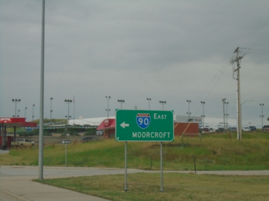
BL-90 West/WY-50 South at I-90 West
BL-90 West/WY-50 South at I-90 West to Moorcroft.
Taken 07-04-2025

 Gillette
Campbell County
Wyoming
United States
Gillette
Campbell County
Wyoming
United States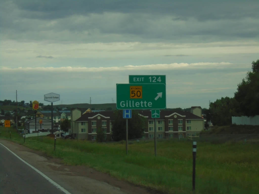
I-90 West - Exit 124
I-90 west at Exit 124 - WY-50/Gillette.
Taken 07-04-2025
Gillette
Campbell County
Wyoming
United States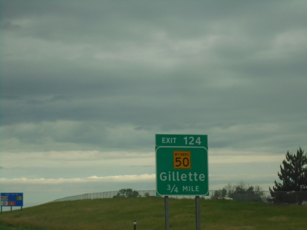
I-90 West - Exit 124
I-90 west approaching Exit 124 - WY-50/Gillette.
Taken 07-04-2025
Gillette
Campbell County
Wyoming
United States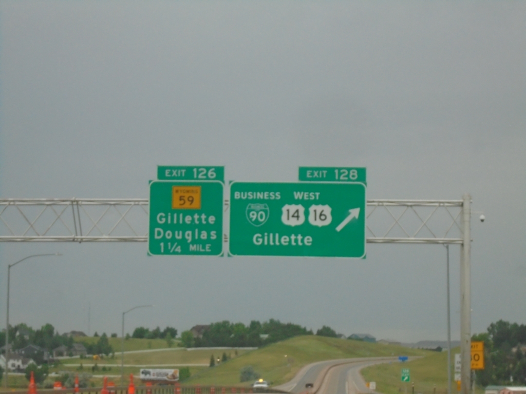
I-90 West - Exits 128 and 126
I-90 West at Exit 128 - BL-90/US-14/US-16 West/Gillette. Approaching Exit 126 - WY-59/Gillette/Douglas.
Taken 07-04-2025


 Gillette
Campbell County
Wyoming
United States
Gillette
Campbell County
Wyoming
United States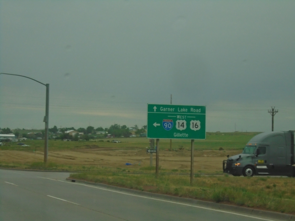
Garner Lake Road at I-90 West
Garner Lake Road at I-90/US-14/US-16 West. Turn left for I-90/US-14/US-16 West to Gillette.
Taken 07-04-2025
Gillette
Campbell County
Wyoming
United States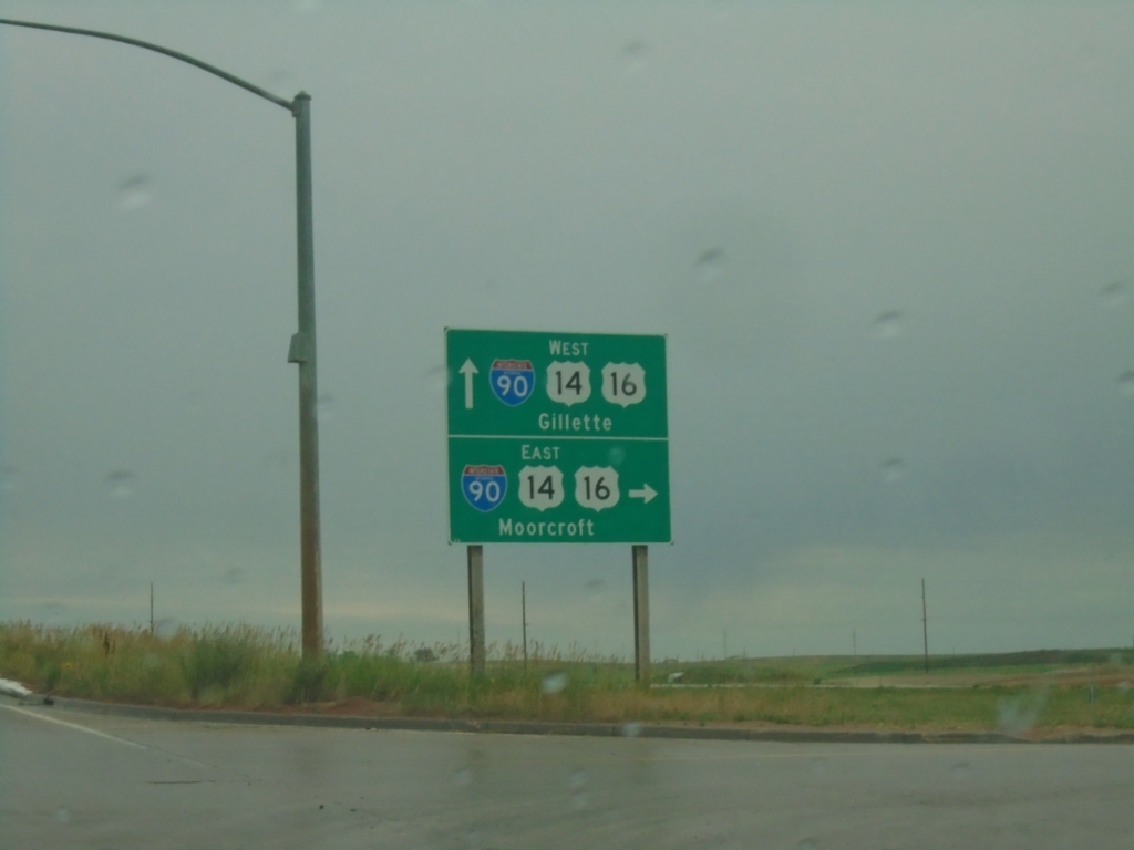
Garner Lake Road North at I-90
Garner Lake Road North at I-90/US-14/US-16 (Exit 129) in Gillette. Use I-90/US-14/US-16 East to Moorcroft; I-90/US-14/US-16 West to Gillette.
Taken 07-04-2025
Gillette
Campbell County
Wyoming
United States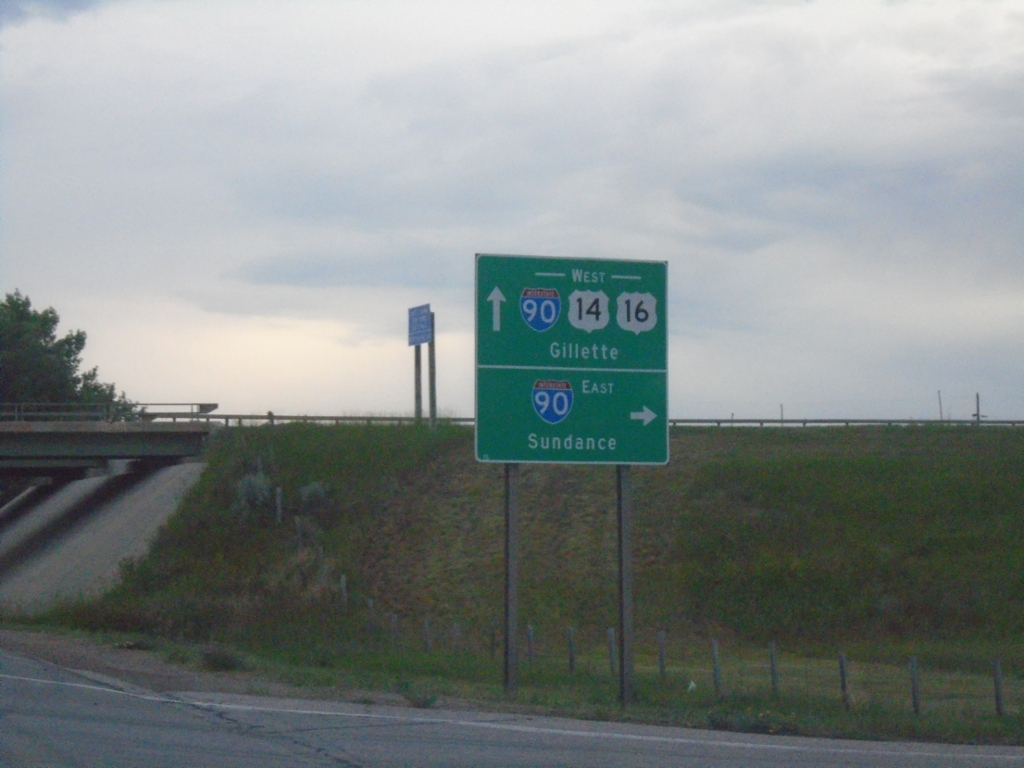
BL-90/US-14/US-16 at I-90 Junction
BL-90/US-14/US-16 at I-90 in Moorcroft. Use I-90 East to Sundance; I-90/US-14/US-16 West to Gillette.
Taken 07-04-2025
Moorcroft
Crook County
Wyoming
United States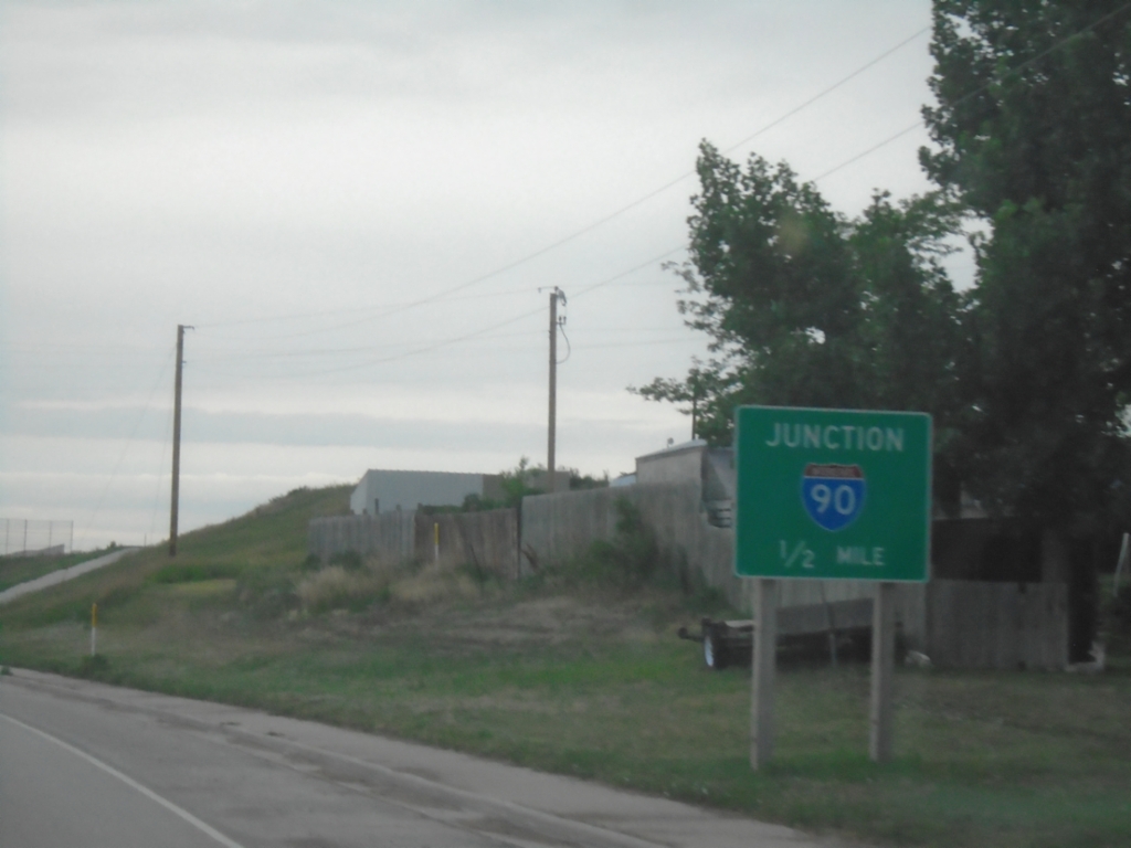
BL-90/US-14/US-16 West Approaching I-90
BL-90/US-14/US-16 West approaching I-90 in Moorcroft.
Taken 07-04-2025
Moorcroft
Crook County
Wyoming
United States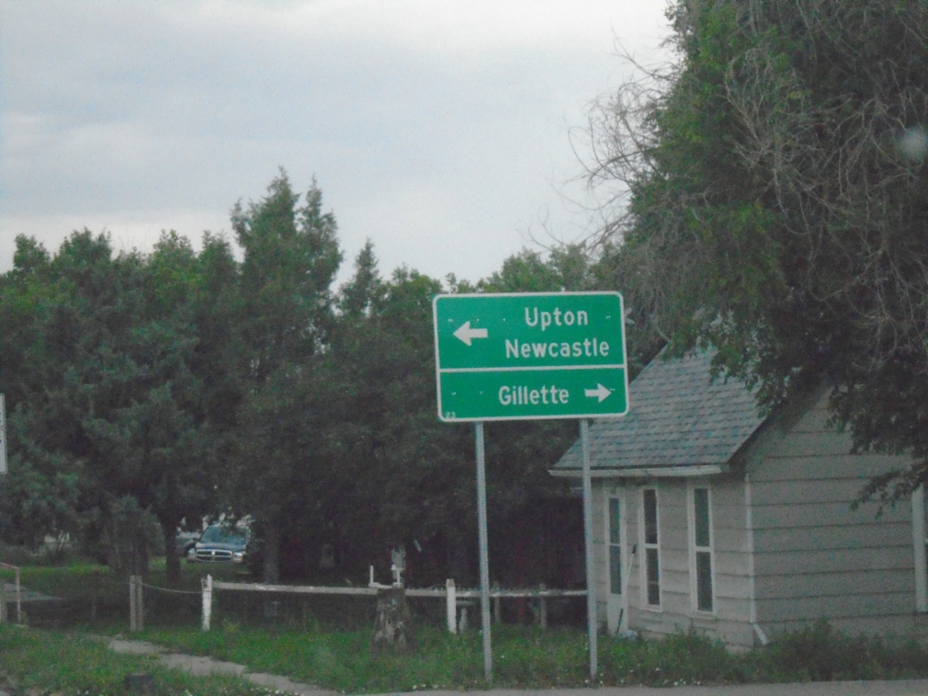
US-14 West Approaching US-16/BL-90
US-14 West approaching US-16/BL-90 in Moorcroft. Turn right for BL-90/US-14/US-16 West to Gillette; turn left for BL-90/US-16 East to Upton and Newcastle.
Taken 07-04-2025
Moorcroft
Crook County
Wyoming
United States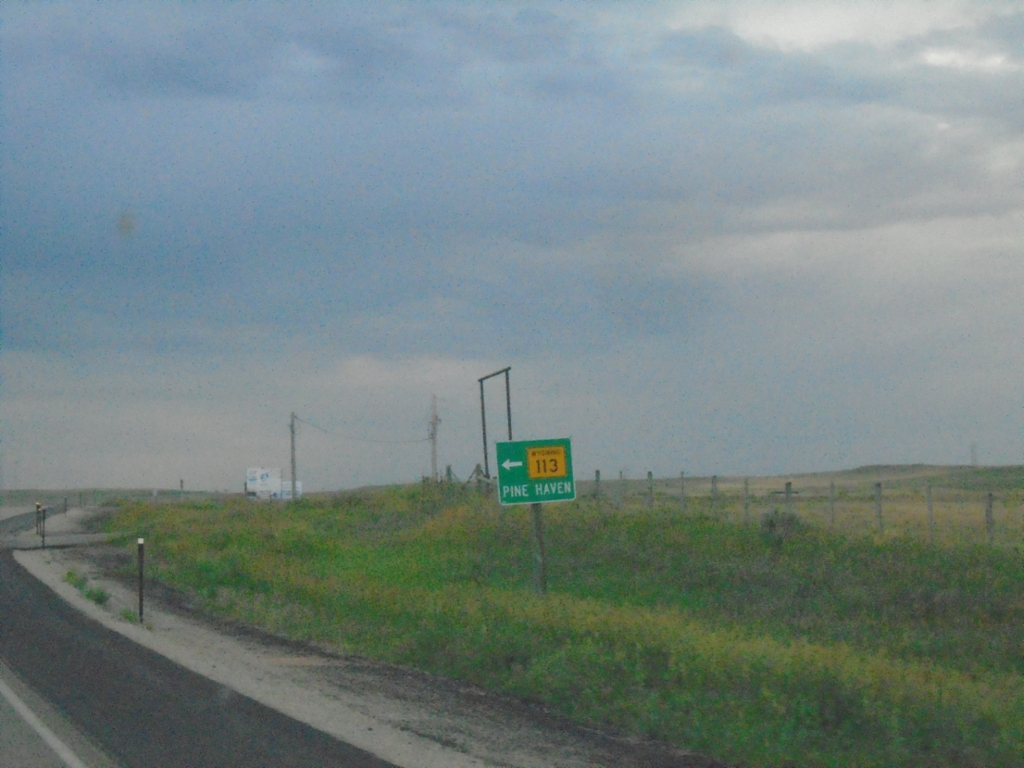
US-14 West at WY-113
US-14 West at WY-113 to Pine Haven.
Taken 07-04-2025
 Oshoto
Crook County
Wyoming
United States
Oshoto
Crook County
Wyoming
United States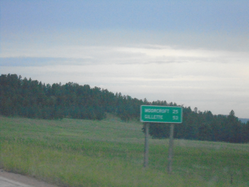
US-14 West - Distance Marker
Distance marker on US-14 west. Distance to Moorcroft and Gillette.
Taken 07-04-2025
Sundance
Crook County
Wyoming
United States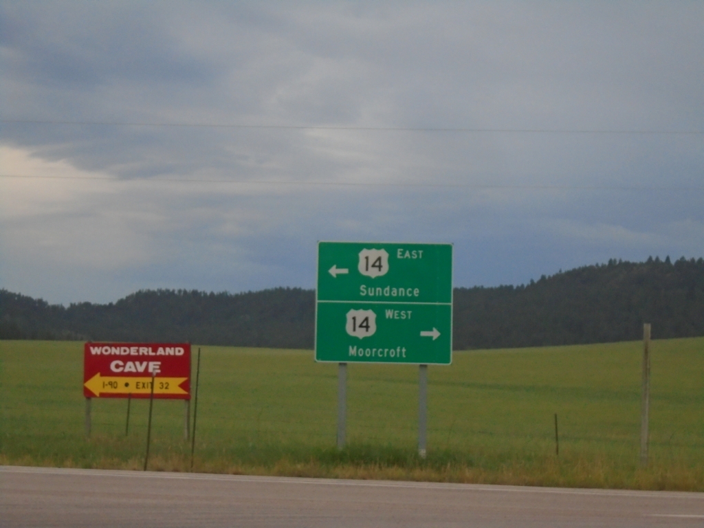
End WY-24 West at US-14
End WY-24 West at US-14 at Devils Tower Junction. Use US-14 west to Moorcroft; US-14 east to Sundance.
Taken 07-04-2025
 Sundance
Crook County
Wyoming
United States
Sundance
Crook County
Wyoming
United States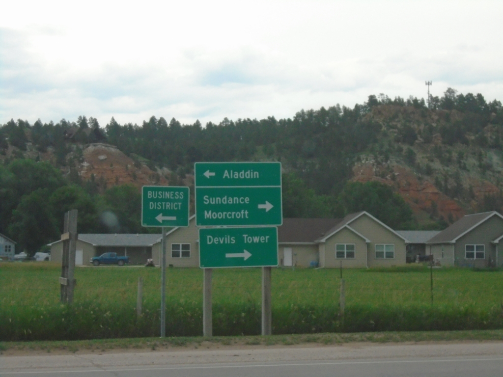
End WY-112 South at WY-24
End WY-112 South at WY-24 in Hulett. Use WY-24 East to Aladdin; use WY-24 West to Sundance, Moorcroft, and Devils Tower.
Taken 07-03-2025
 Hulett
Crook County
Wyoming
United States
Hulett
Crook County
Wyoming
United States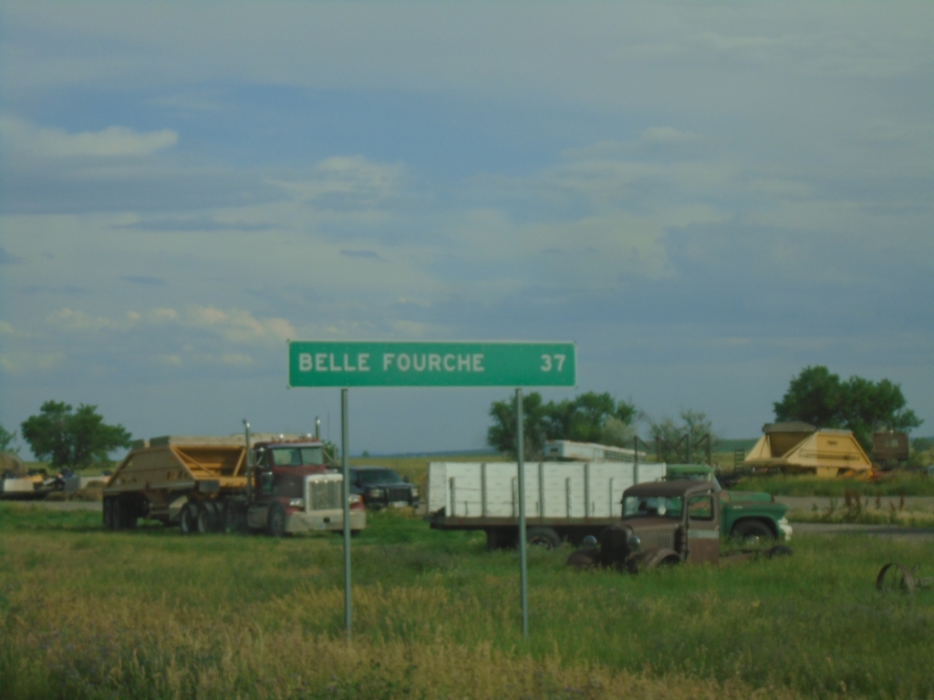
US-212 East - Distance Marker
Distance marker on US-212 east. Distance to Belle Fourche (SD).
Taken 07-03-2025
 Alzada
Carter County
Montana
United States
Alzada
Carter County
Montana
United States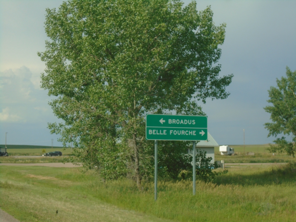
MTS-326 Approaching US-212
MTS-326 Approaching US-212 in Alzada. Use US-212 West to Broadus; US-212 East to Belle Fourche (SD).
Taken 07-03-2025
 Alzada
Carter County
Montana
United States
Alzada
Carter County
Montana
United States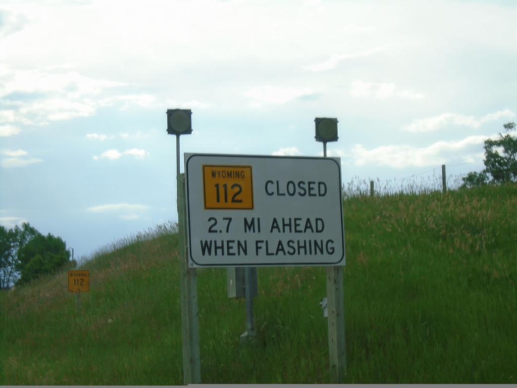
WY-112 North - Winter Closure
WY-112 North Closed 1.2 Miles Ahead When Flashing.
Taken 07-03-2025
Hulett
Crook County
Wyoming
United States
FS-849 West - Distance Marker
Distance Marker on FS-849 West. Distance to St. Hwy 24 and Hulett.
Taken 07-02-2025
Crook County Wyoming United States
Farall Road at FS-841
Farall Road at FS-841. Use Farall Road for Hulett and Sundance.
Taken 07-02-2025
Crook County Wyoming United States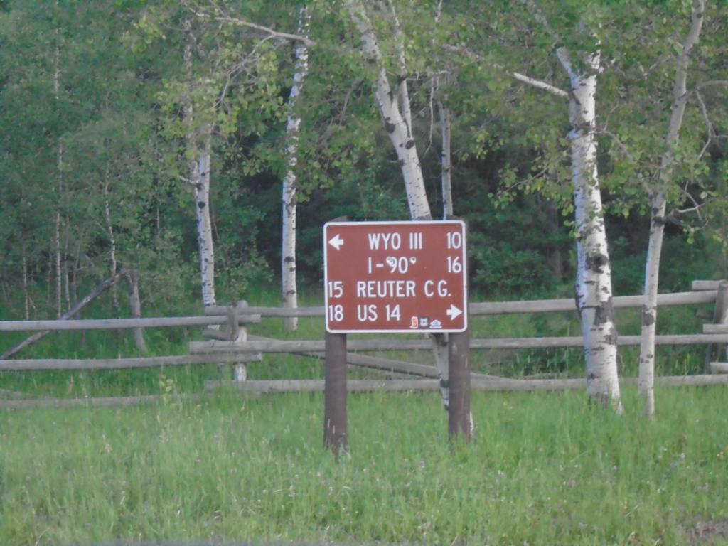
Bear Lodge Road at Farrall Road
Bear Lodge Road at Farrall Road. Use Farrall Road west to Reuter Campground and US-14; Farrall Road east to WYO-111 and I-90.
Taken 07-02-2025
Farrall Crook County Wyoming United States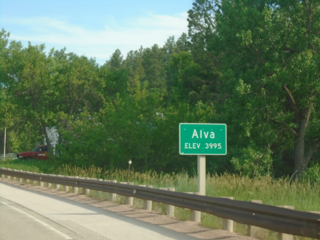
WY-24 East - Alva
Entering Alva on WY-24 East. Elevation 3995.
Taken 07-02-2025
Aladdin
Crook County
Wyoming
United States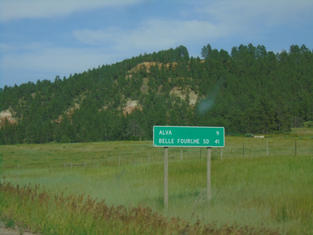
WY-24 - Distance Marker
Distance marker on WY-24 east. Distance to Alva and Belle Fourche, SD.
Taken 07-02-2025
Hulett
Crook County
Wyoming
United States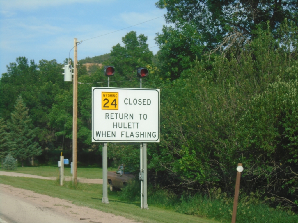
WY-24 East - Return To Hulett When Flashing
WY-24 Closed - Return To Hulett When Flashing on WY-24 East.
Taken 07-02-2025
Hulett
Crook County
Wyoming
United States