Signs Tagged With Big Green Sign
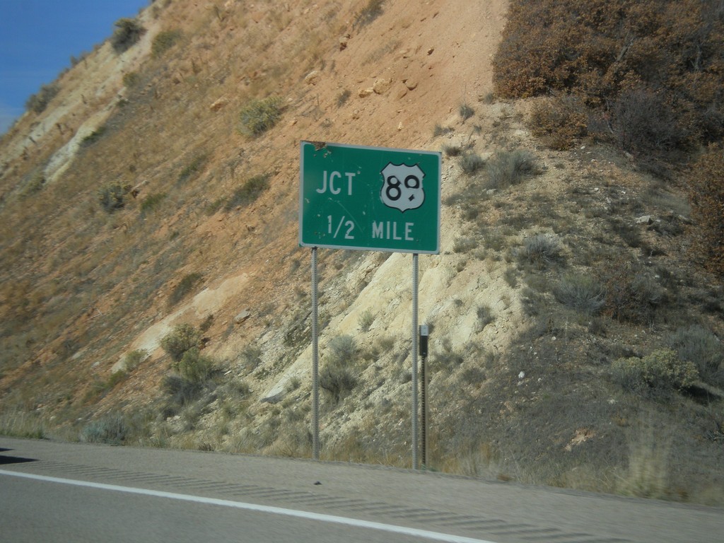
US-6 West Approaching US-89
US-6 west approaching US-89.
Taken 10-20-2012

 Spanish Fork
Utah County
Utah
United States
Spanish Fork
Utah County
Utah
United States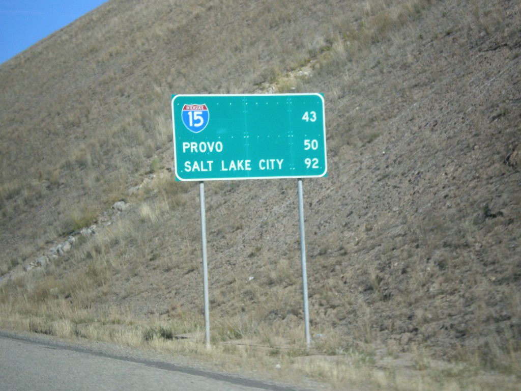
US-6 West - Distance Marker
Distance Marker on US-6 west. Distance to I-15, Provo, and Salt Lake City.
Taken 10-20-2012
Colton
Utah County
Utah
United States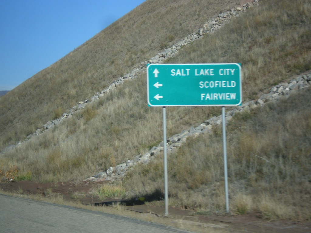
US-6 West Approaching UT-96
US-6 west approaching UT-96 to Scofield and Fairview. Continue west on US-6 for Salt Lake City.
Taken 10-20-2012
 Helper
Utah County
Utah
United States
Helper
Utah County
Utah
United States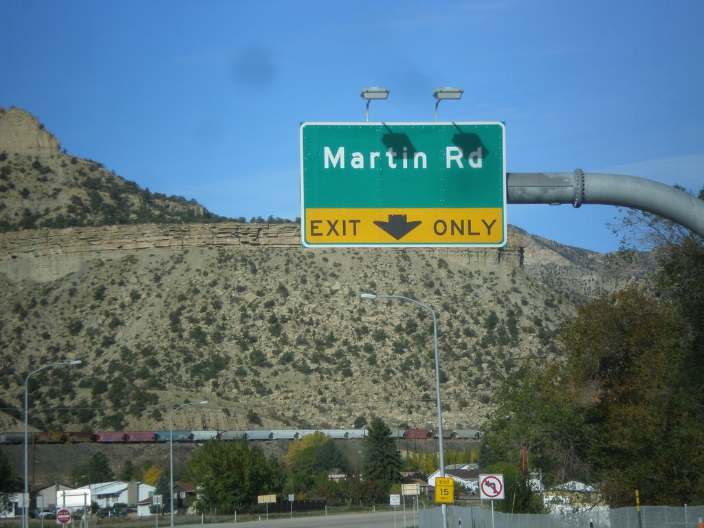
US-6 West/US-191 North at Martin Road
US-6 West/US-191 North at Martin Road interchange.
Taken 10-20-2012
 Helper
Carbon County
Utah
United States
Helper
Carbon County
Utah
United States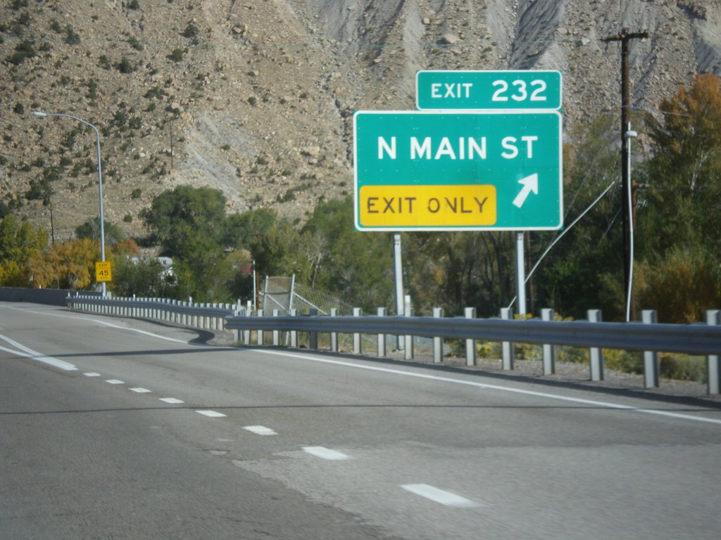
US-6 West/US-191 North - Exit 232
US-6 West/US-191 North at Exit 232 - N. Main St.
Taken 10-20-2012

 Helper
Carbon County
Utah
United States
Helper
Carbon County
Utah
United States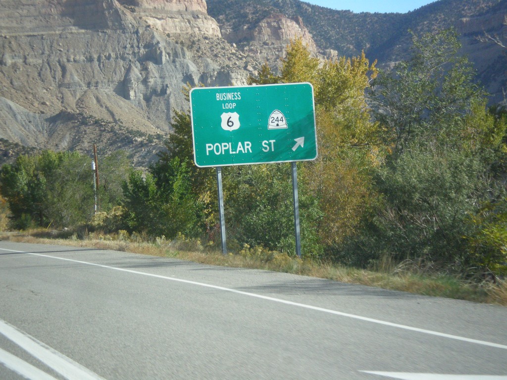
US-6 West/US-191 North at UT-244
US-6 West/US-191 north at UT-244. Exit here for UT-244/Business US-6/Poplar St.
Taken 10-20-2012
Helper
Carbon County
Utah
United States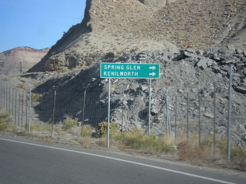
US-6 West/US-191 North - UT-157/US-139 Jct.
US-6 West/US-191 North approaching UT-157/UT-139 junction. Turn right on UT-157/US-139 for Spring Glen and Kneilworth.
Taken 10-20-2012

 Helper
Carbon County
Utah
United States
Helper
Carbon County
Utah
United States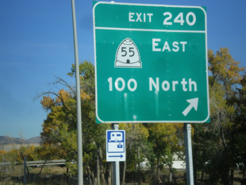
US-6 West/US-191 North at Exit 240
US-6 West/US-191 North at Exit 240 - UT-55 East/100 North.
Taken 10-20-2012
 Price
Carbon County
Utah
United States
Price
Carbon County
Utah
United States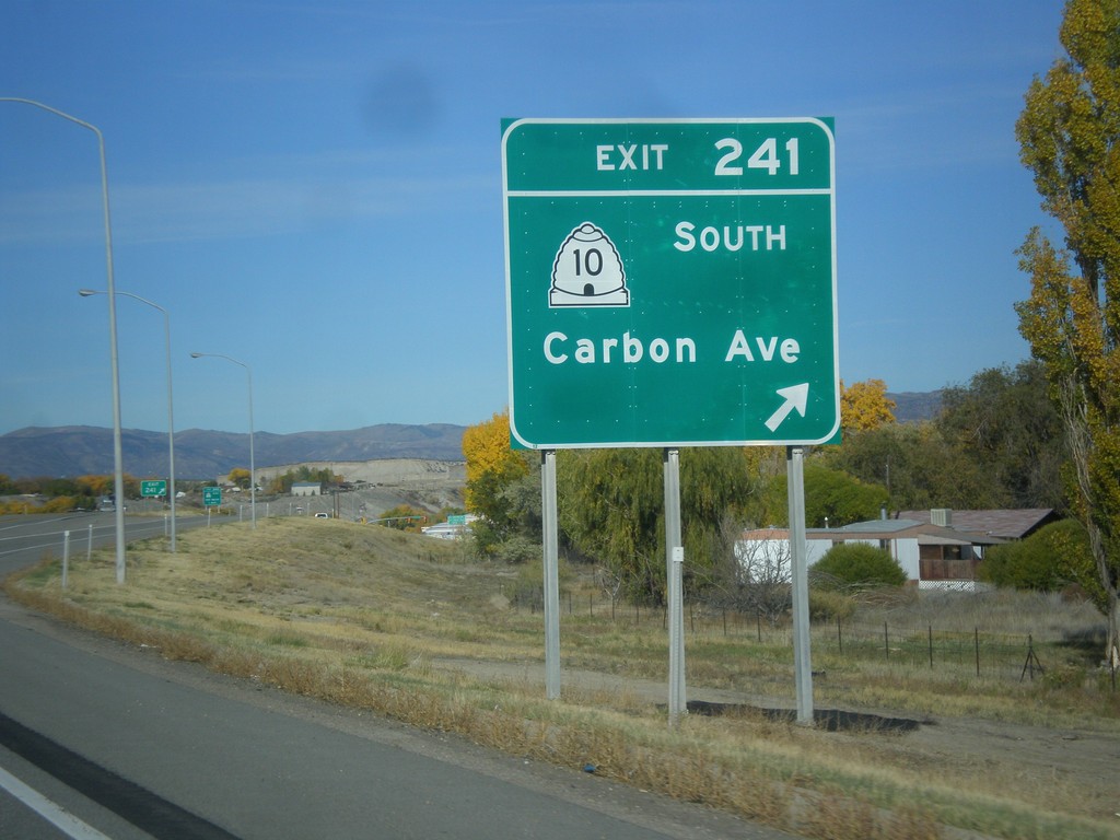
US-6 West/US-191 North - Exit 241
US-6 West/US-191 North at Exit 241 - UT-10 South/Carbon Ave.
Taken 10-20-2012
 Price
Carbon County
Utah
United States
Price
Carbon County
Utah
United States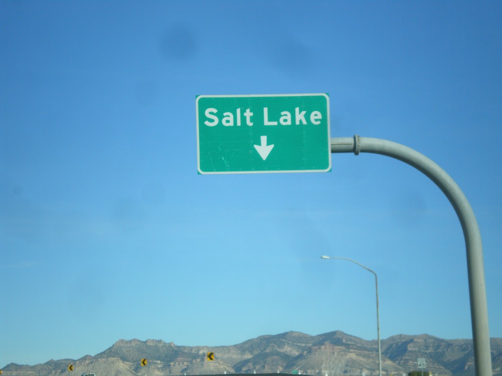
US-6 West/US-191 North - Exit 243
US-6 West/US-191 North - Exit 243. Use left lanes for Salt Lake. Right lanes are for Exit 243.
Taken 10-20-2012
Price
Carbon County
Utah
United States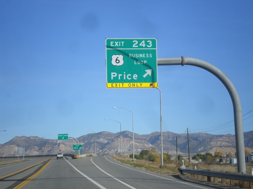
US-6 West/US-191 North - Exit 243
US-6 West/US-191 North at Exit 243 - Business Loop 6/Price.
Taken 10-20-2012
Price
Carbon County
Utah
United States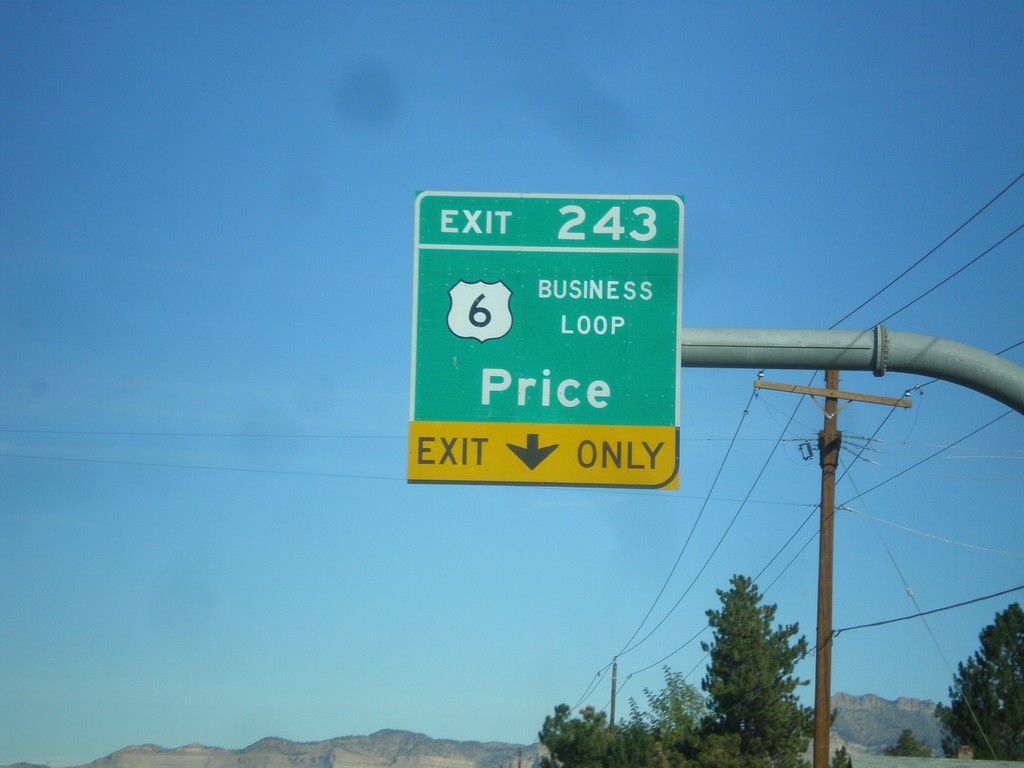
US-6 West/US-191 North Approaching Exit 243
US-6 West/US-191 North approaching Exit 243 - Business Loop US-6/Price. The is the eastern end of the Price business loop.
Taken 10-20-2012
Price
Carbon County
Utah
United States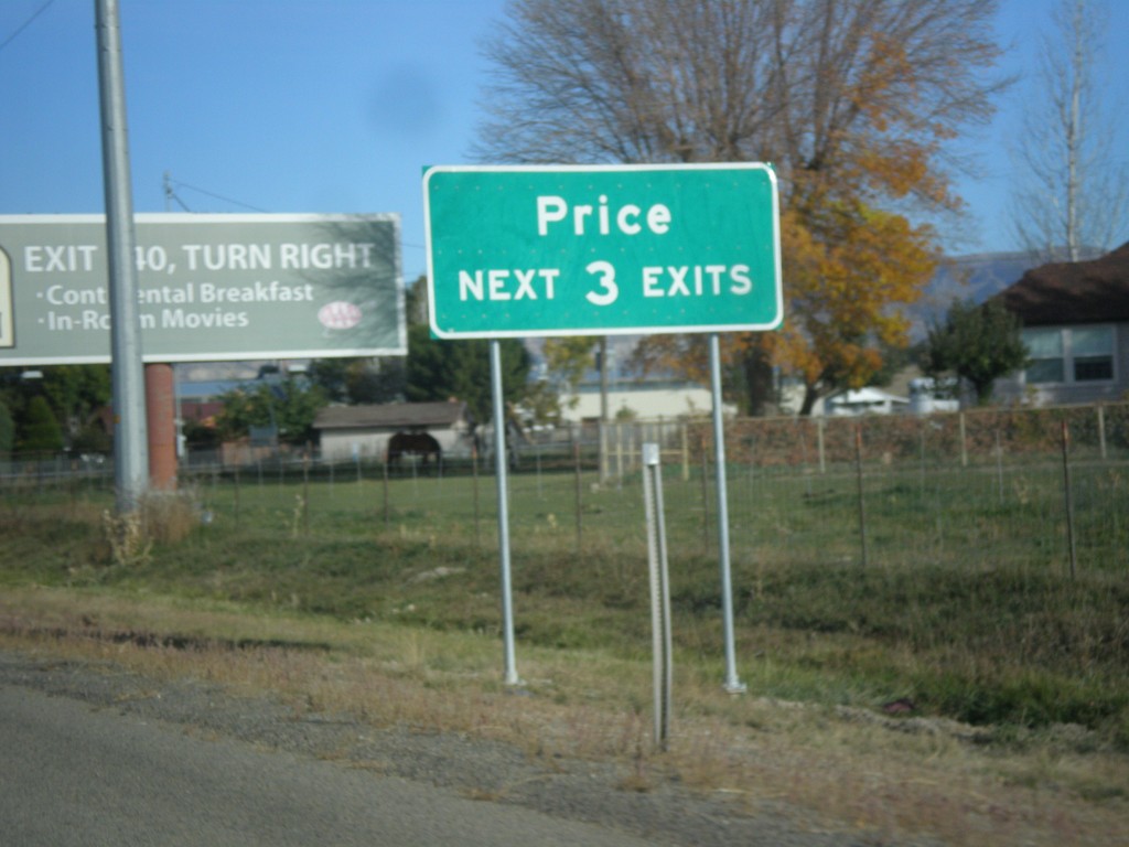
US-6 West/US-191 North - Price Next 3 Exits
US-6 West/US-191 North - Price Next 3 Exits. A freeway beings here that bypasses Price. Some of the freeway is only one lane in each direction.
Taken 10-20-2012
Price
Carbon County
Utah
United States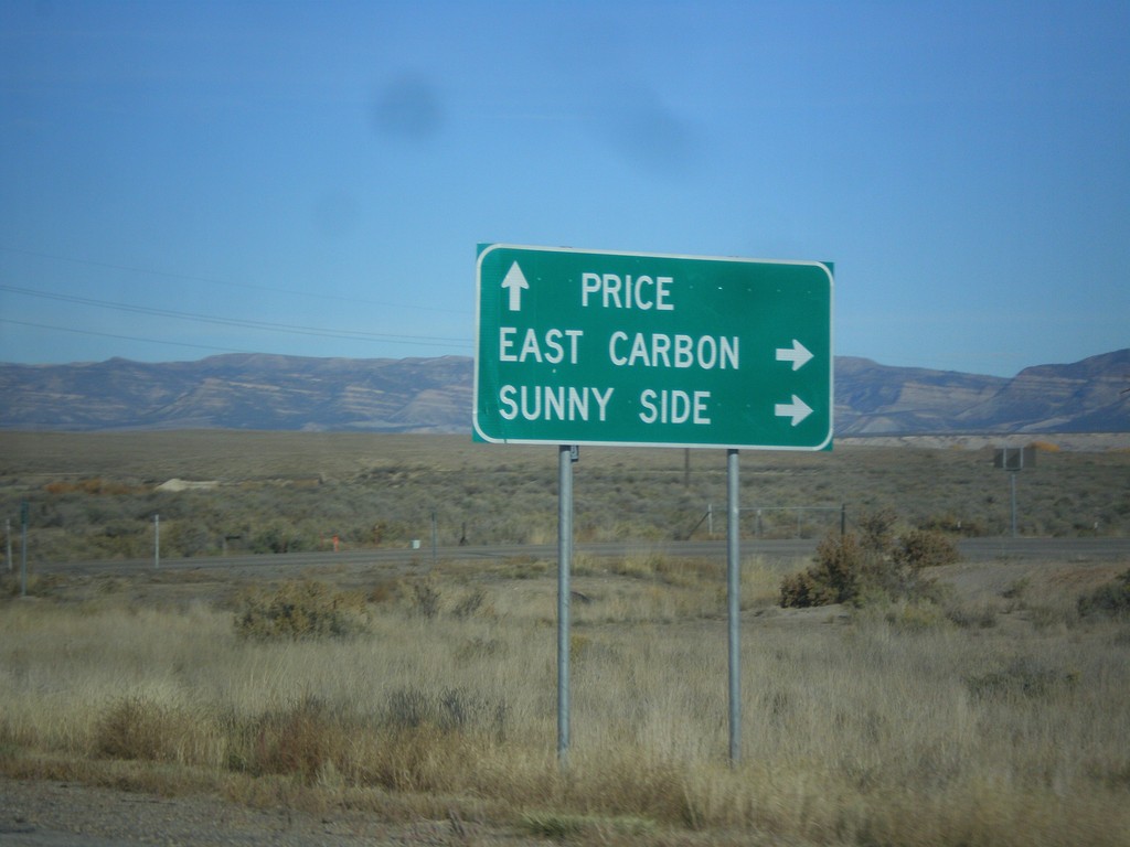
US-6 West/US-191 North Approaching UT-123
US-6 West/US-191 North approaching UT-123. Use UT-123 for East Carbon and Sunnyside. Continue on US-6 West/US-191 North for Price.
Taken 10-20-2012
 Price
Carbon County
Utah
United States
Price
Carbon County
Utah
United States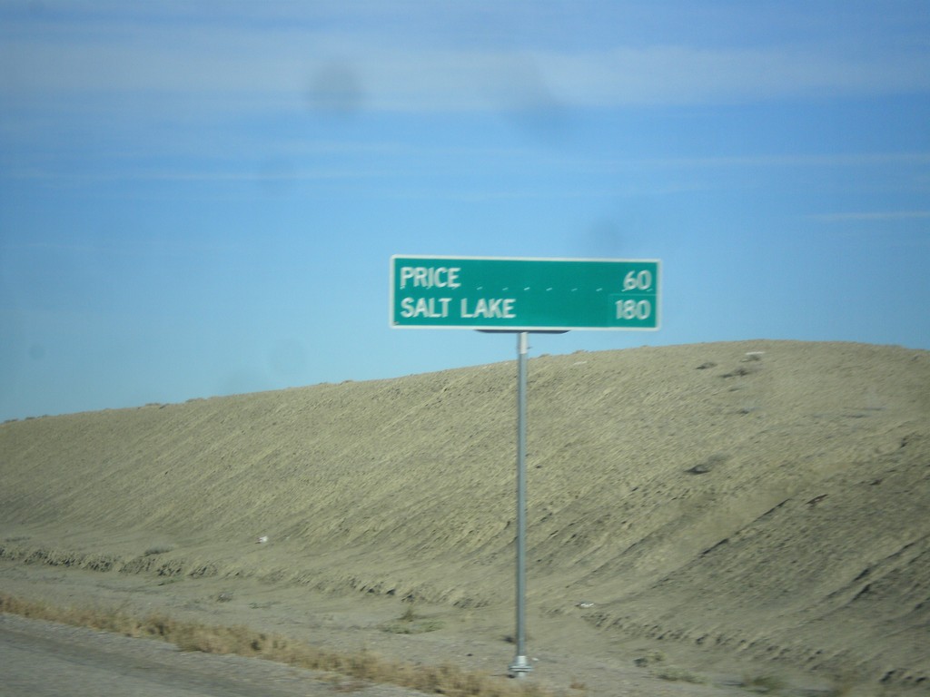
US-6 West/US-191 North - Distance Marker
Distance marker on US-6 West/US-191 North. Distance to Price and Salt Lake. Taken just north of I-70.
Taken 10-20-2012
Green River
Emery County
Utah
United States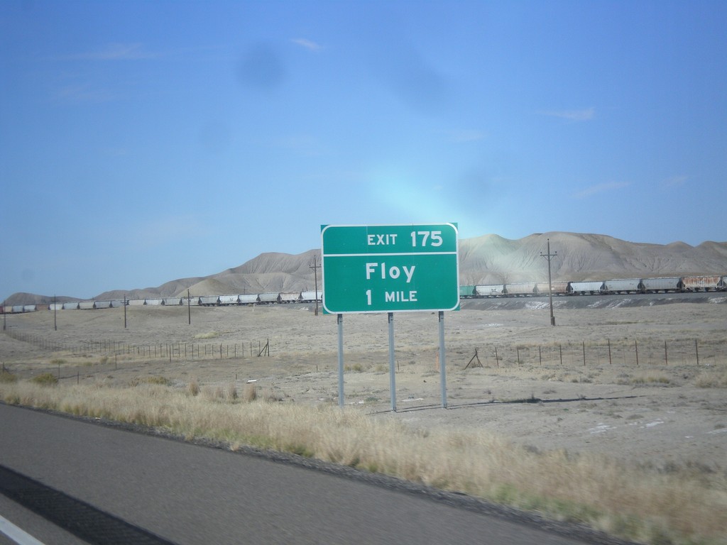
I-70 East Approaching Exit 175
I-70 east approaching Exit 175 - Floy. This exit previously was called Ranch Exit.
Taken 10-19-2012

 Green River
Grand County
Utah
United States
Green River
Grand County
Utah
United States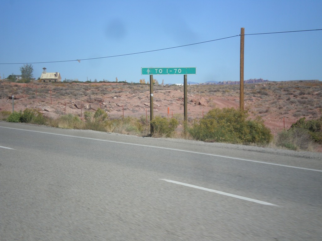
US-191 North Approaching UT-313
US-191 north approaching UT-313. Continue north on US-191 north for I-70.
Taken 10-17-2012
 Moab
Grand County
Utah
United States
Moab
Grand County
Utah
United States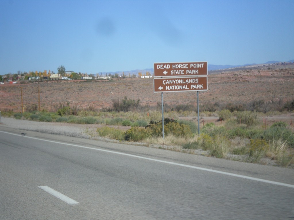
US-191 North Approaching UT-313
US-191 north approaching UT-313. Use UT-313 west for Dead Horse Point State Park, and Canyonlands National Park (Island In The Sky Unit).
Taken 10-17-2012
Moab
Grand County
Utah
United States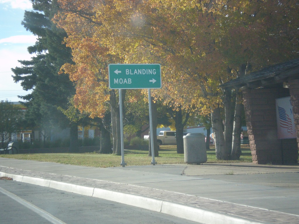
End US-491 at US-191
End US-491 at US-191. Use US-191 north for Moab; US-191 south for Blanding.
Taken 10-15-2012
 Monticello
San Juan County
Utah
United States
Monticello
San Juan County
Utah
United States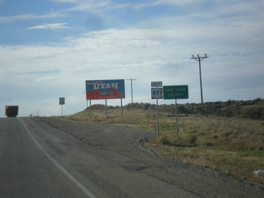
US-491 North - Welcome To Utah
Welcome to Utah on US-491 north at the Colorado-Utah Border. Also entering San Juan County.
Taken 10-15-2012
Ucolo
San Juan County
Utah
United States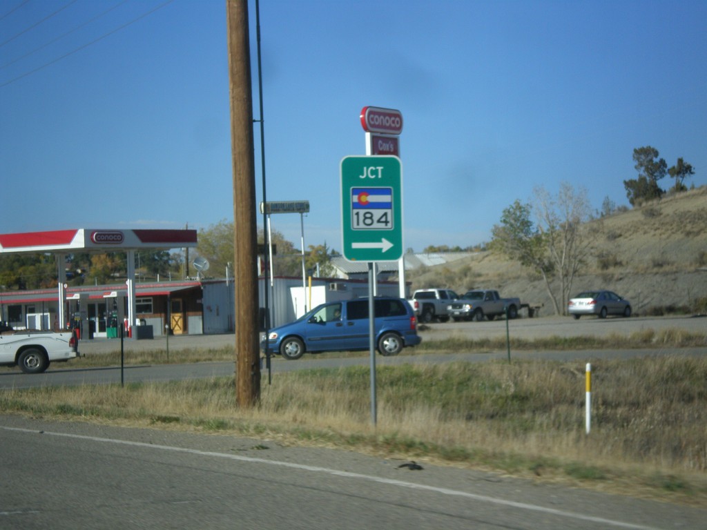
US-491 North at CO-184
US-491 North at CO-184 in Montezuma County.
Taken 10-15-2012
 Cortez
Montezuma County
Colorado
United States
Cortez
Montezuma County
Colorado
United States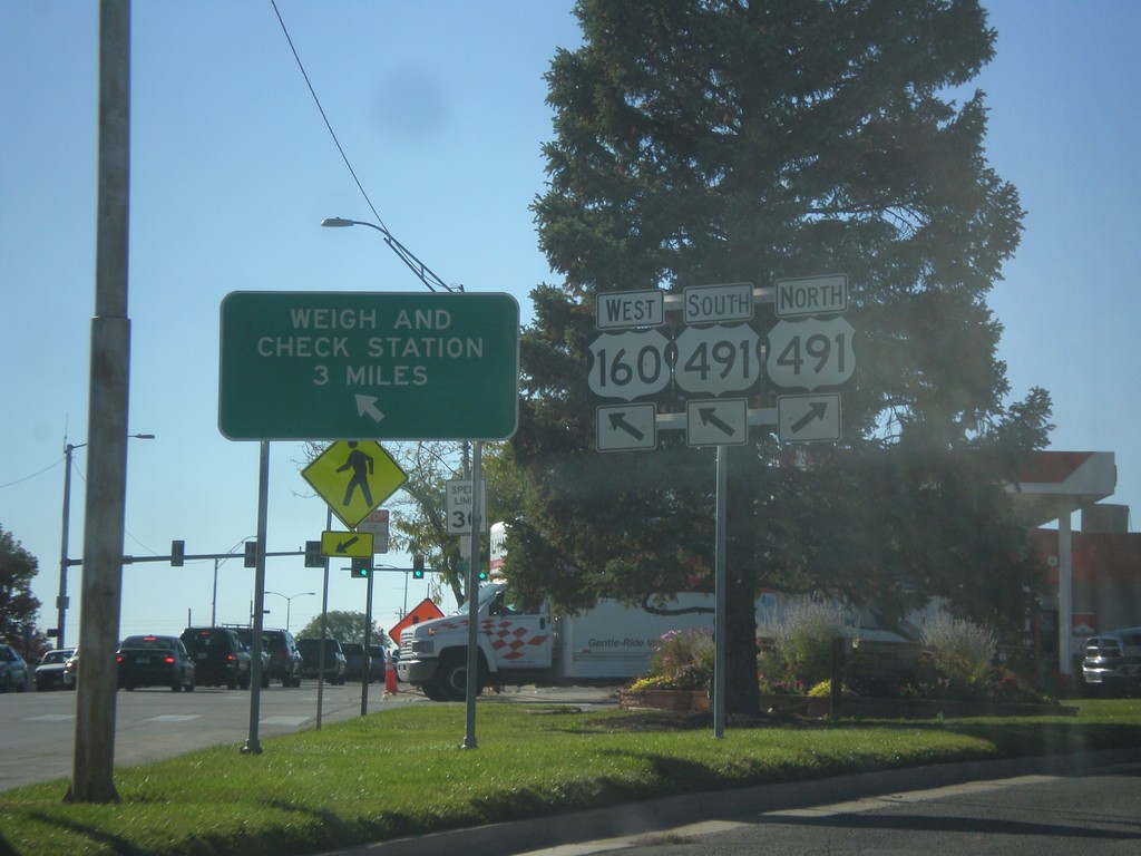
US-160 West at US-491
US-160 west at US-491. Merge right for US-491 north. Continue straight for US-491 South/US-160 West. US-491 South joins US-160 West. Use US-160 West/US-491 North for Weigh and Check Station.
Taken 10-15-2012
 Cortez
Montezuma County
Colorado
United States
Cortez
Montezuma County
Colorado
United States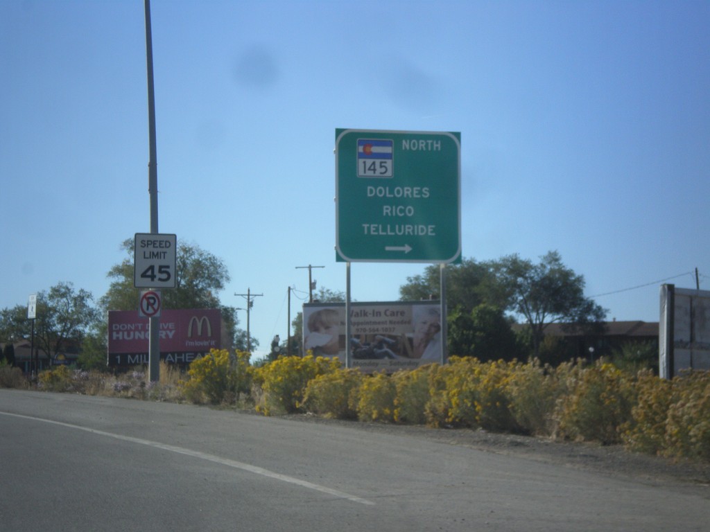
US-160 West at CO-145
US-160 west at CO-145 North to Dolores, Rico, and Telluride.
Taken 10-15-2012
 Cortez
Montezuma County
Colorado
United States
Cortez
Montezuma County
Colorado
United States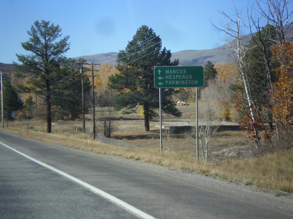
US-160 West Approaching CO-140
US-160 west approaching CO-140 south to Hesperus and Farmington (New Mexico). Continue west on US-160 for Mancos.
Taken 10-15-2012
 Durango
La Plata County
Colorado
United States
Durango
La Plata County
Colorado
United States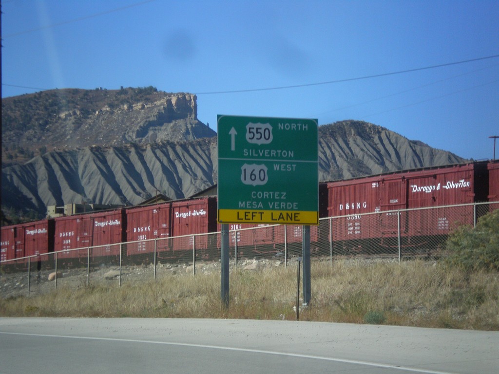
US-550 North/US-160 West at Split
US-550 North/US-160 West at US-550/US-160 split in Durango. Continue straight for US-550 north to Silverton. Turn left for US-160 west to Cortez and Mesa Verde (National Park).
Taken 10-15-2012
 Durango
La Plata County
Colorado
United States
Durango
La Plata County
Colorado
United States