Signs Tagged With Big Green Sign
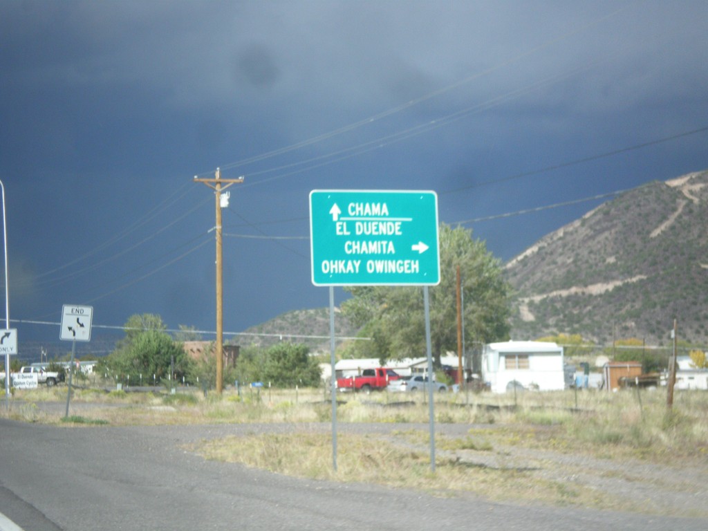
US-84 West/US-285 North Approaching NM-74
US-84 West/US-285 North approaching NM-74. Turn right on NM-74 for El Duende, Chamita and Ohkay Owingeh. Continue north on US-84 West/US-285 North for Chama.
Taken 10-12-2012


 Hernandez
Rio Arriba County
New Mexico
United States
Hernandez
Rio Arriba County
New Mexico
United States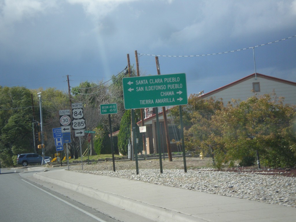
US-84 West/US-285 North Approaching NM-30
US-84 West/US-285 North approaching NM-30. Use NM-30 south for Santa Clara Pueblo, and San Ildefonso Pueblo. Continue on US-84 West/US-285 North for Chama and Tierra Amarilla.
Taken 10-12-2012
 Española
Rio Arriba County
New Mexico
United States
Española
Rio Arriba County
New Mexico
United States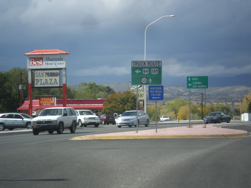
US-84 West/US-285 North at US-84/US-285 Truck Route
US-84 West/US-285 North at US-84/US-285 Truck Route (Santa Clara Bridge Road). Continue north on US-285/US-84 for general route through Espanola and NM-68. Truck traffic turn left for Chama and Los Alamos; continue straight towards Taos (via NM-68).
Taken 10-12-2012
 Española
Rio Arriba County
New Mexico
United States
Española
Rio Arriba County
New Mexico
United States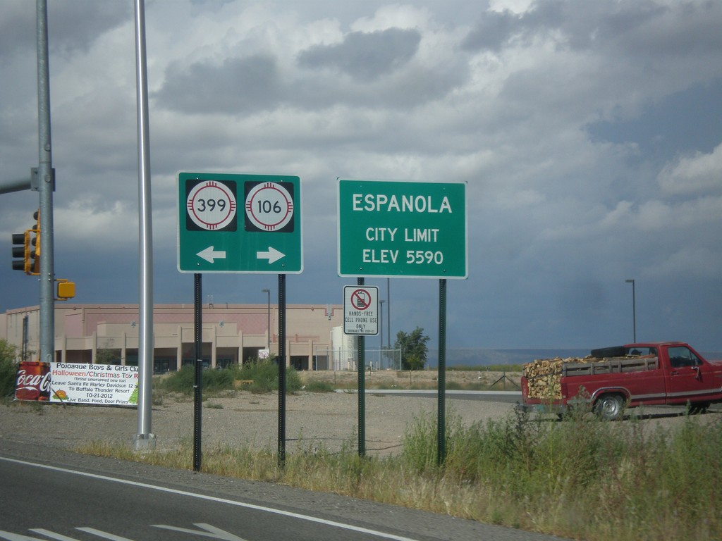
US-84 West/US-285 North - NM-399/NM-106 Jct.
US-84 West/US-285 North at NM-399/NM-106 Jct. Entering Espanola, Elevation 5590.
Taken 10-12-2012

 Santa Cruz
Santa Fe County
New Mexico
United States
Santa Cruz
Santa Fe County
New Mexico
United States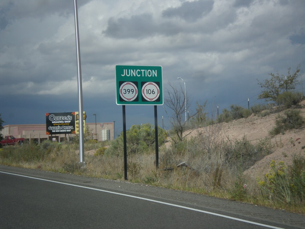
US-84 West/US-285 North Approaching NM-399/NM-106
US-84 West/US-285 North approaching NM-399/NM-106.
Taken 10-12-2012
Santa Cruz
Santa Fe County
New Mexico
United States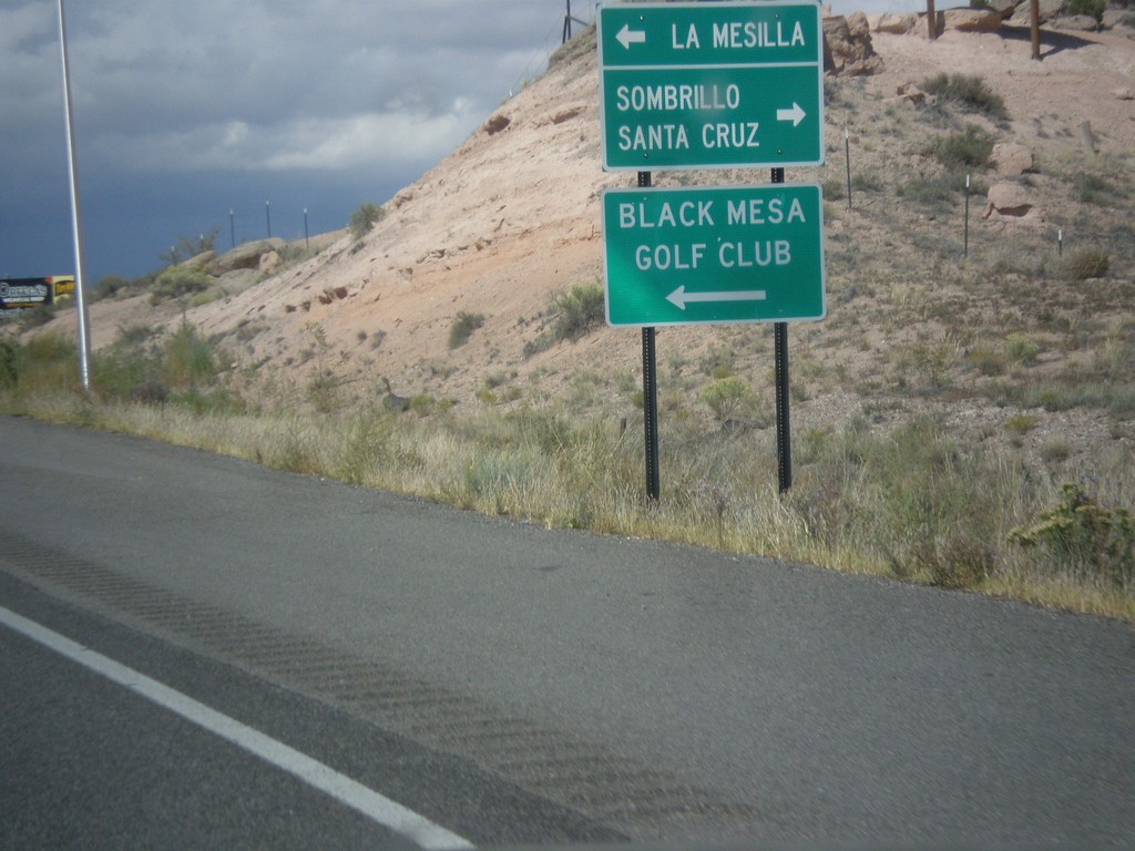
US-84 West/US-285 North Approaching NM-106/NM-399
US-84 West/US-285 North approaching NM-106/NM-399. Turn left on NM-399 for La Mesilla and Black Mesa Golf Club; right on NM-106 for Santa Cruz and Sombrillo.
Taken 10-12-2012
Santa Cruz
Santa Fe County
New Mexico
United States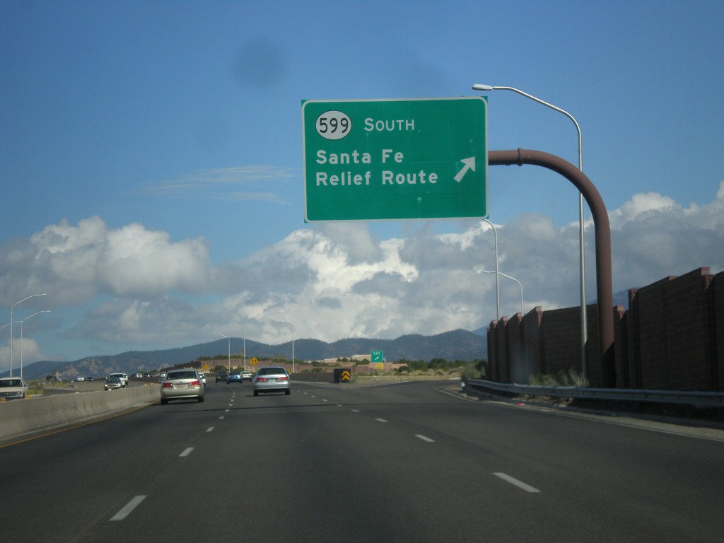
US-84 West/US-285 North at NM-599 Interchange
US-84 West/US-285 North at NM-599 interchange. Use NM-599 South for the Santa Fe Relief Route. The Sante Fe Relief Route connects the north side of Santa Fe to I-25 south without having to go through downtown Santa Fe.
Taken 10-12-2012
 Santa Fe
 County
New Mexico
United States
Santa Fe
Santa Fe County
New Mexico
United States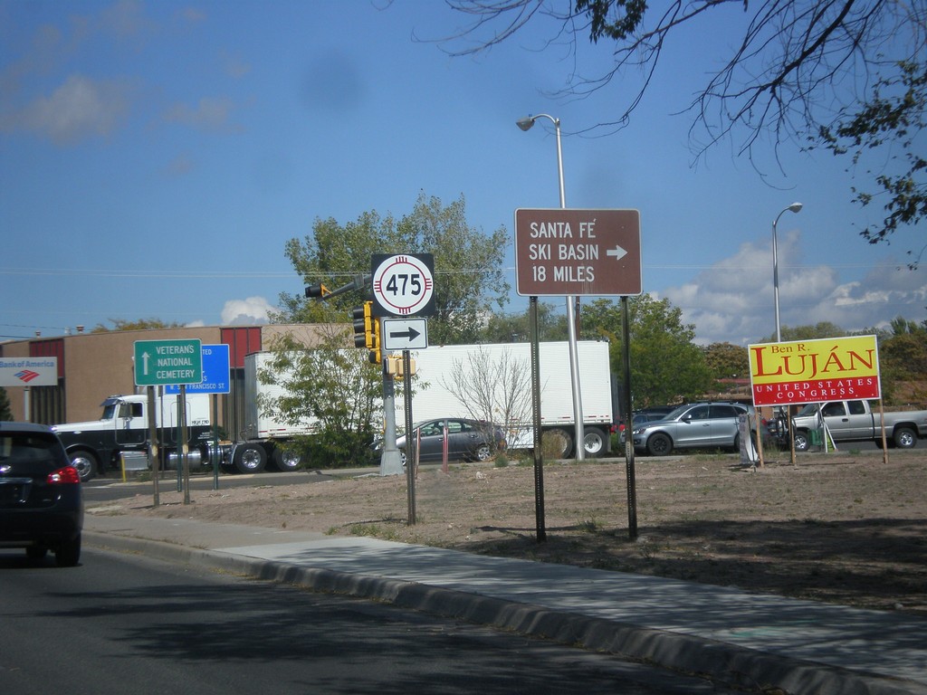
US-84 West/US-285 North at NM-475
US-84 West/US-285 North at NM-475 (Paseo de Peralta). Turn right on NM-475 for Santa Fe Ski Basin.
Taken 10-12-2012
 Santa Fe
 County
New Mexico
United States
Santa Fe
Santa Fe County
New Mexico
United States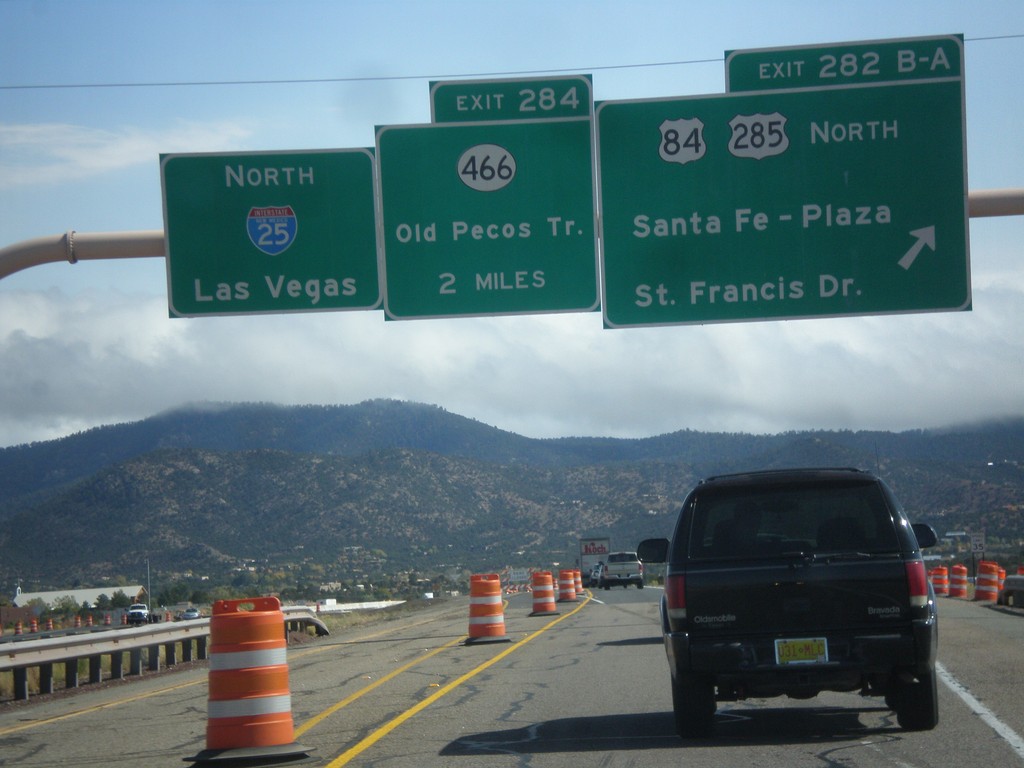
I-25 North - Exits 282B-A and 284
I-25 north at Exit 282B-A - US-84/US-285 North/Santa Fe - Plaza/St. Francis Drive. Approaching Exit 284 - NM-466/Old Pecos Trail. Continue north on I-25 for Las Vegas. US-84 joins I-25 north towards Las Vegas; US-285 joins I-25 north for 8 miles.
Taken 10-12-2012

 Santa Fe
 County
New Mexico
United States
Santa Fe
Santa Fe County
New Mexico
United States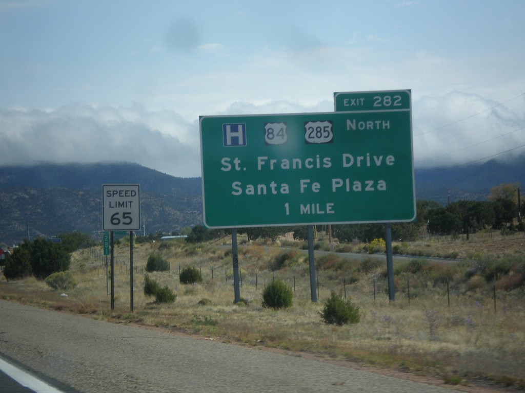
I-25 North Approaching Exit 282
I-25 North approaching Exit 282 - US-84/US-285 North/Santa Fe Plaza/St. Francis Drive.
Taken 10-12-2012
Santa Fe
Santa Fe County
New Mexico
United States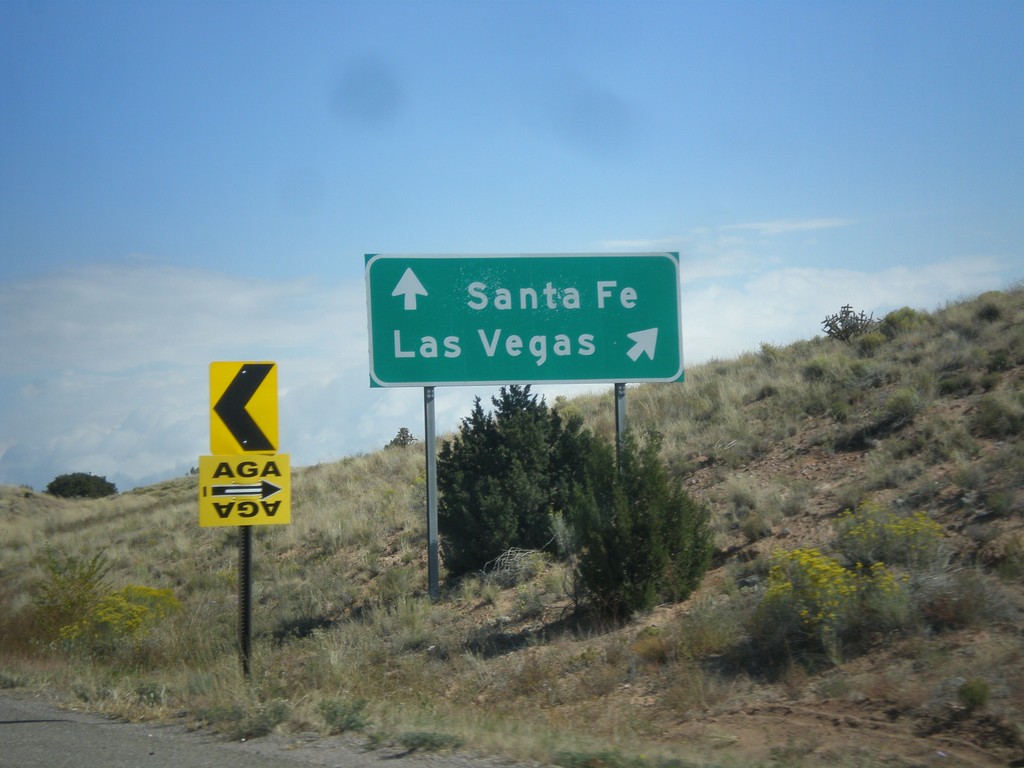
NM-14 North at I-25
NM-14 north at I-25. Merge right for I-25 north to Las Vegas. Continue north on NM-14 for Santa Fe.
Taken 10-12-2012
 Santa Fe
 County
New Mexico
United States
Santa Fe
Santa Fe County
New Mexico
United States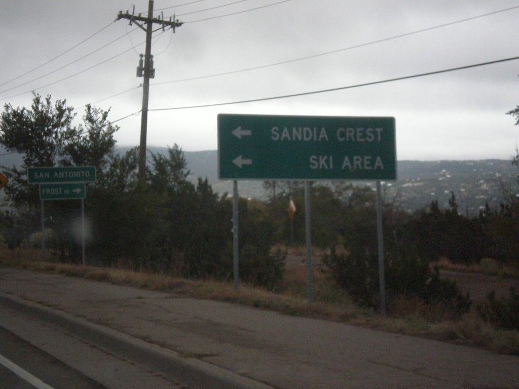
NM-14 North at NM-306/NM-536
NM-14 north at NM-536 west to Sandia Crest Ski Area. Turn right for NM-306, Frost Road. Entering the community of San Antonito.
Taken 10-12-2012

 Sandia Park
Bernalillo County
New Mexico
United States
Sandia Park
Bernalillo County
New Mexico
United States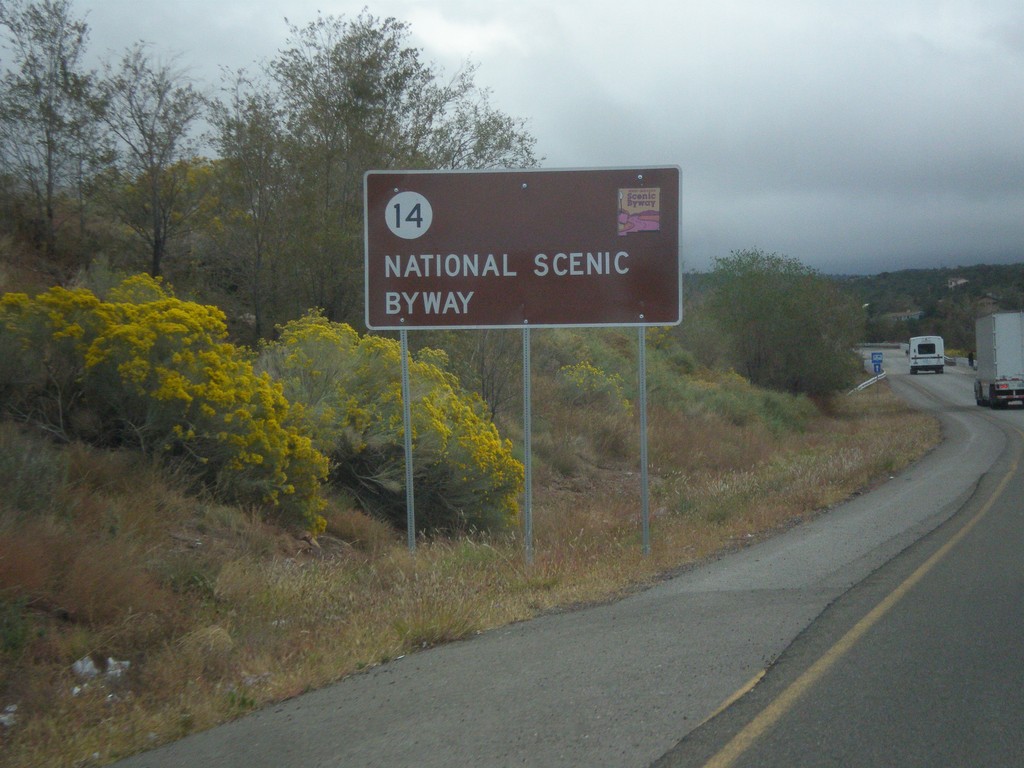
NM-14 North - National Scenic Byway
NM-14 north National Scenic Byway and New Mexico Scenic Byway sign. This is the start of the Turquoise Trail.
Taken 10-12-2012
Tijeras
Bernalillo County
New Mexico
United States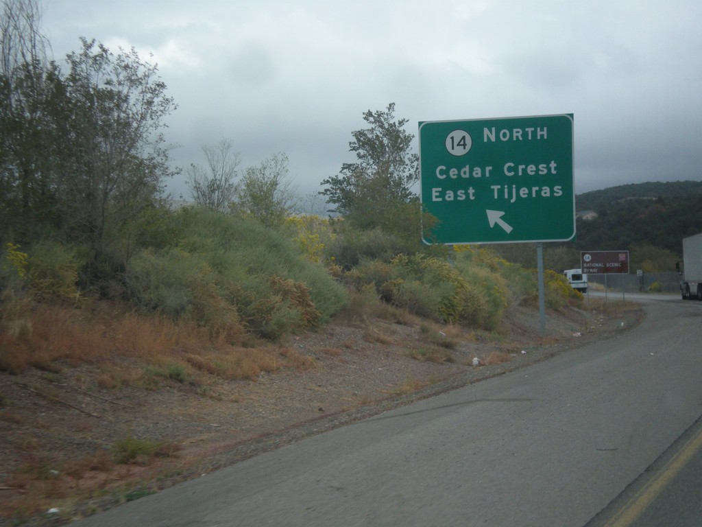
NM-14 at NM-333/NM-337
NM-14/NM-333/NM-337 junction. Use left lane for NM-14 North/Cedar Crest/East Tijeras.
Taken 10-12-2012

 Tijeras
Bernalillo County
New Mexico
United States
Tijeras
Bernalillo County
New Mexico
United States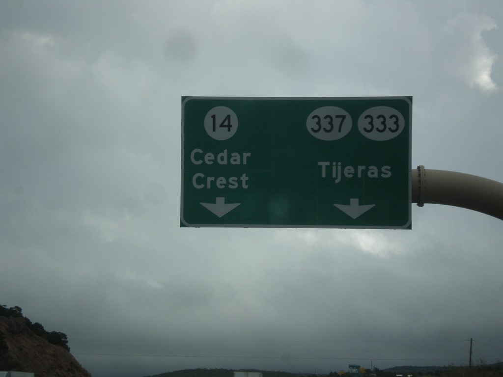
I-40 East Exit 175 Offramp
I-40 East Exit 175 offramp. Use left lane for NM-14 north to Cedar Crest. Use right lane for NM-337/NM-333 to Tijeras.
Taken 10-12-2012
 Tijeras
Bernalillo County
New Mexico
United States
Tijeras
Bernalillo County
New Mexico
United States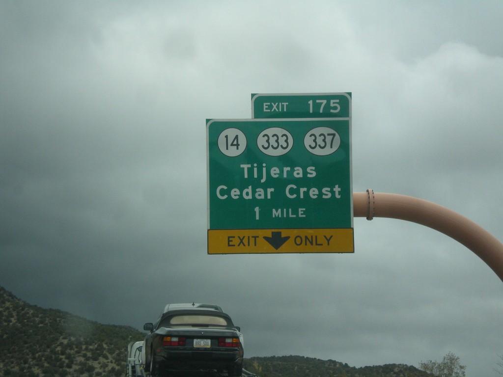
I-40 East - Exit 175
I-40 east at Exit 175 - NM-14/NM-333/NM-337/Tijeras/Cedar Crest. Use NM-14 for the Turquoise Trail National Scenic Byway and the Sandia Crest Ski Area.
Taken 10-12-2012
Cedar Crest
Bernalillo County
New Mexico
United States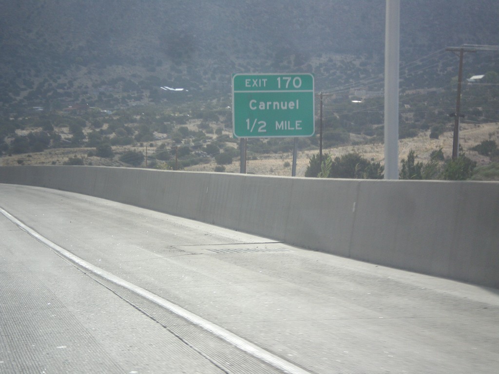
I-40 East - Exit 170
I-40 east approaching Exit 170 - Carnuel.
Taken 10-12-2012
 Carnuel
Bernalillo County
New Mexico
United States
Carnuel
Bernalillo County
New Mexico
United States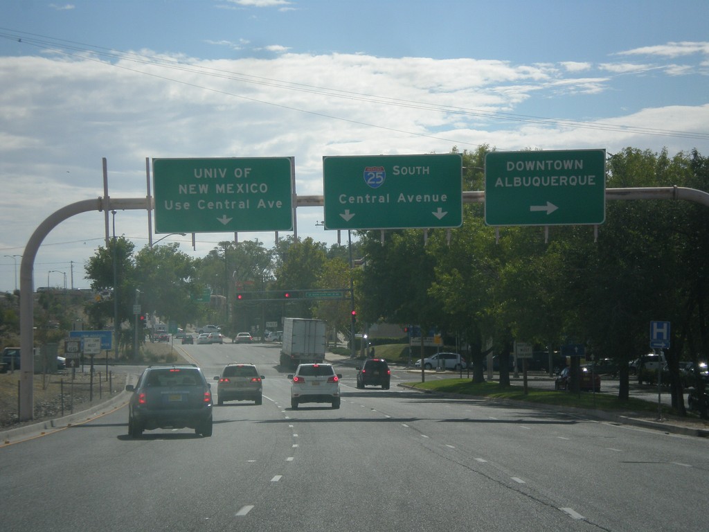
I-25 South - Exit 224B Frontage Road
I-25 South on Exit 224B Frontage Road (Locust St). Turn right for Downtown Albuquerque (Dr. Martin Luther King Jr Blvd.). Continue straight for I-25 South and the University of New Mexico (via Central Ave.).
Taken 10-11-2012
Albuquerque
Bernalillo County
New Mexico
United States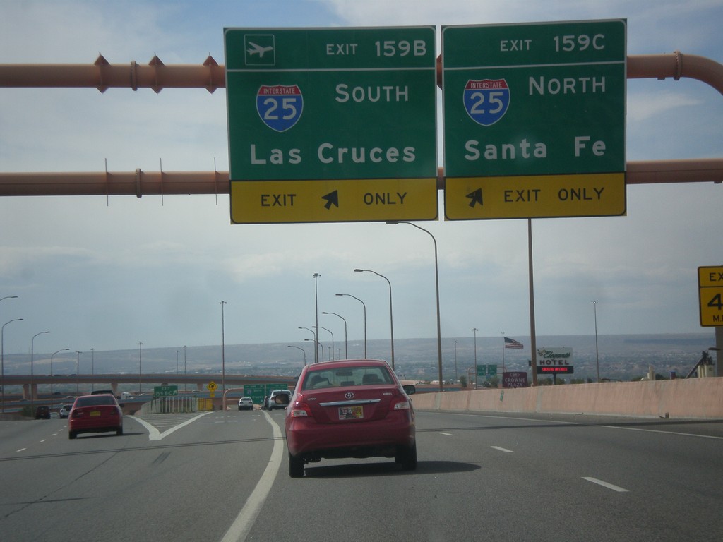
I-40 West - Exits 159B and 159C
I-40 west at Exits 159B and 159C. Use Exit 159B for I-25 South to Las Cruces; Exit 159C for I-25 north to Santa Fe.
Taken 10-11-2012
Albuquerque
Bernalillo County
New Mexico
United States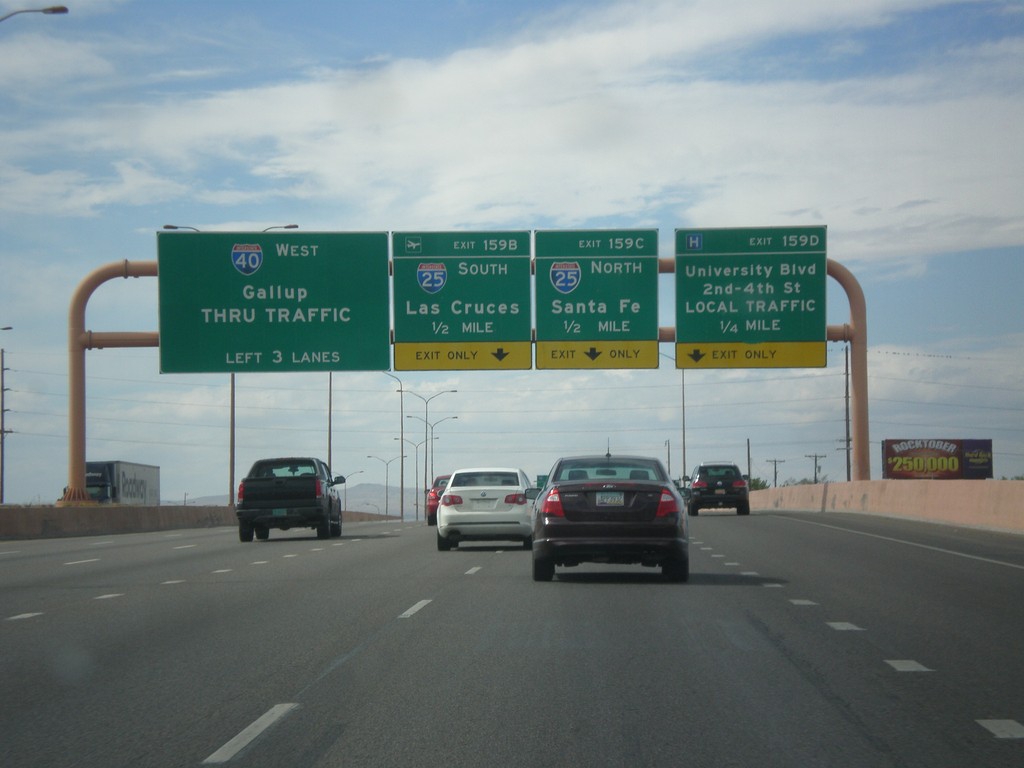
I-40 West - Exits 159B-D
I-40 west approaching Exit 159D - University Blvd./2nd-4th St./LOCAL TRAFFIC. Exit 159C - I-25 North/Santa Fe. Exit 159B - I-25 South/Las Cruces. Continue west on I-40 for Gallup.
Taken 10-11-2012
Albuquerque
Bernalillo County
New Mexico
United States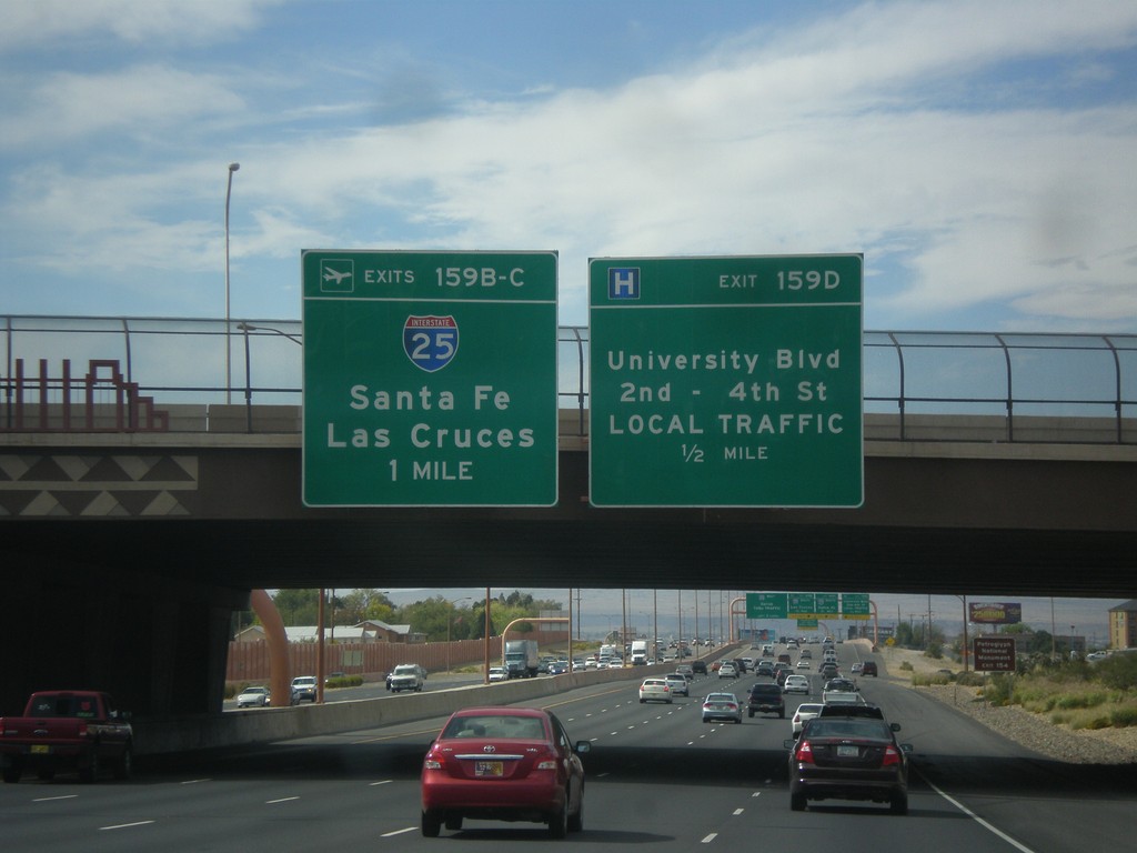
I-40 West Approaching Exits 159B-D
I-40 west approaching Exit 159D - University Blvd./2nd-4th St./LOCAL TRAFFIC; Exit 159BC - I-25/Santa Fe/Las Cruces.
Taken 10-11-2012
Albuquerque
Bernalillo County
New Mexico
United States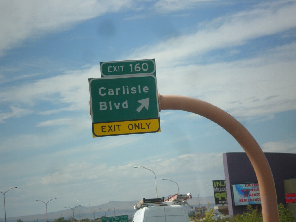
I-40 West - Exit 160
I-40 west at Exit 160 - Carlisle Blvd.
Taken 10-11-2012
Albuquerque
Bernalillo County
New Mexico
United States
Eubank Blvd. South Approaching I-40
Eubank Blvd. South approaching I-40 (Exit 165). Use right lane for I-40 west; left lanes for I-40 east.
Taken 10-11-2012
Albuquerque
Bernalillo County
New Mexico
United States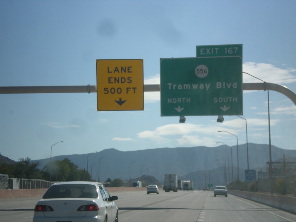
I-40 East - Exit 167
I-40 east at Exit 167 - NM-556/Tramway Blvd.
Taken 10-11-2012
 Albuquerque
Bernalillo County
New Mexico
United States
Albuquerque
Bernalillo County
New Mexico
United States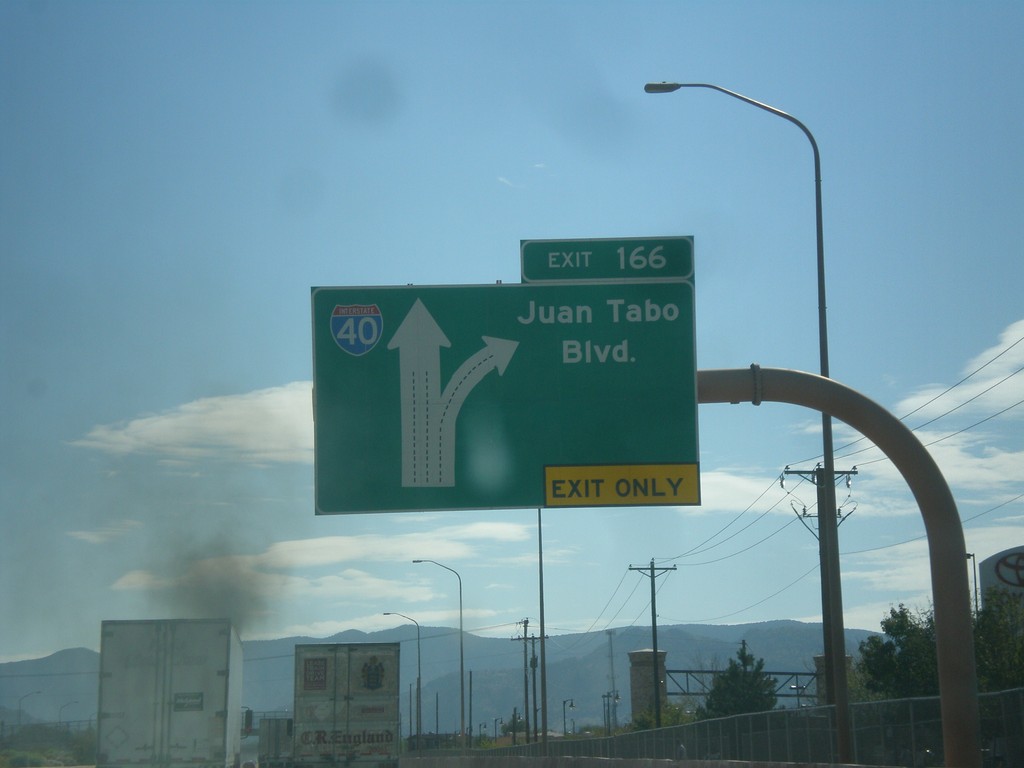
I-40 East - Exit 160
I-40 east at Exit 160 - Juan Tabo Blvd.
Taken 10-11-2012
Albuquerque
Bernalillo County
New Mexico
United States