Signs Tagged With Big Green Sign
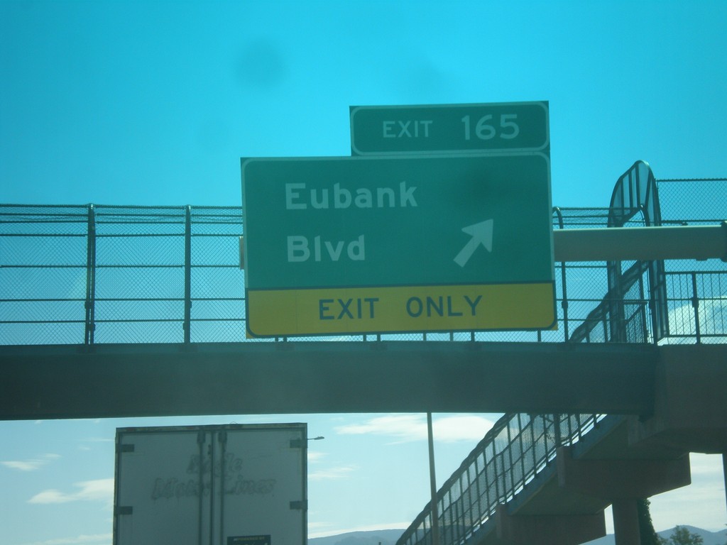
I-40 East - Exit 165
I-40 east at Exit 165 - Eubank Blvd.
Taken 10-11-2012
 Albuquerque
Bernalillo County
New Mexico
United States
Albuquerque
Bernalillo County
New Mexico
United States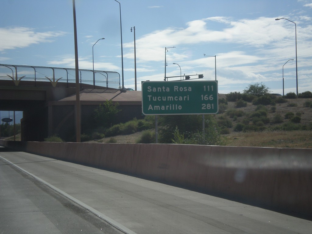
I-40 East - Distance Marker
Distance marker on I-40 east in Albuquerque. Distance to: Santa Rosa, Tucumcari, Amarillo (Texas).
Taken 10-11-2012
Albuquerque
Bernalillo County
New Mexico
United States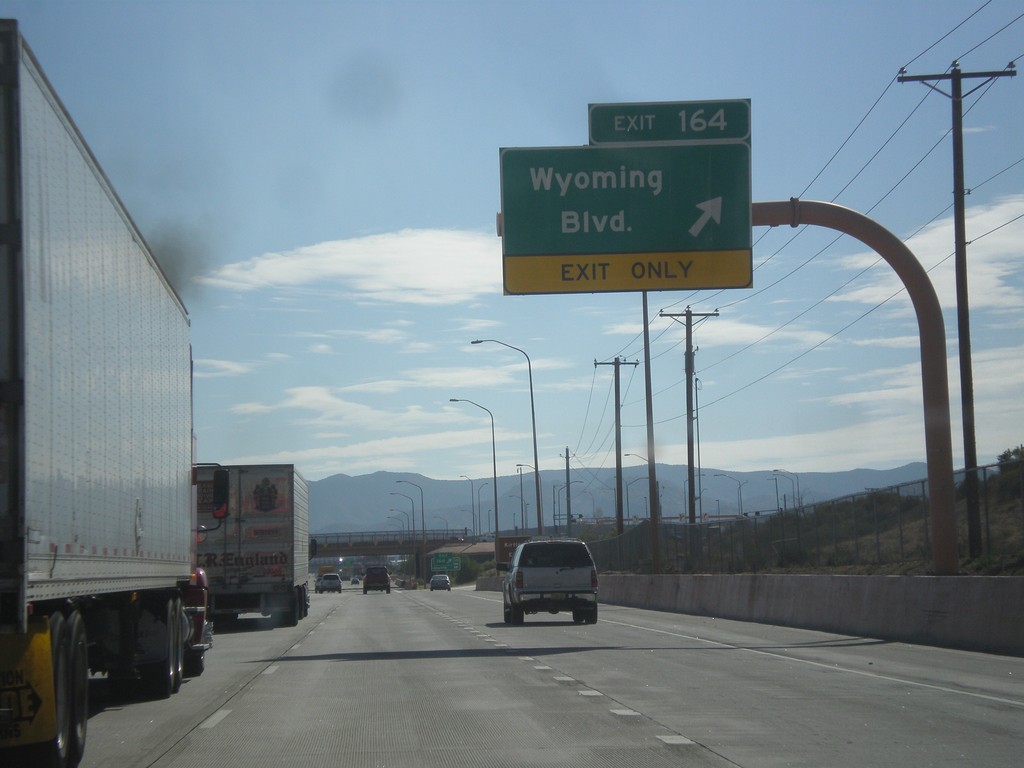
I-40 East - Exit 164
I-40 east at Exit 164 - Wyoming Blvd.
Taken 10-11-2012
Albuquerque
Bernalillo County
New Mexico
United States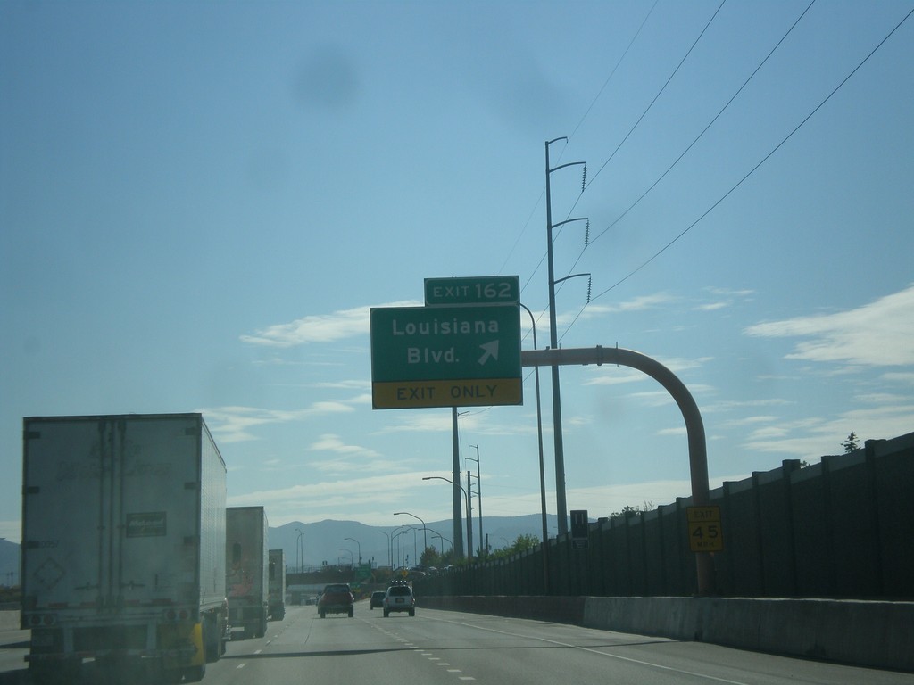
I-40 East - Exit 162
I-40 east at Exit 162 - Louisiana Blvd.
Taken 10-11-2012
Albuquerque
Bernalillo County
New Mexico
United States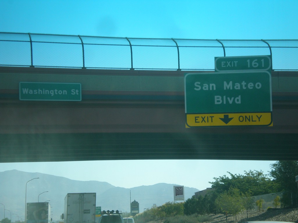
I-40 East - Exit 161
I-40 east approaching Exit 161 - San Mateo Blvd.
Taken 10-11-2012
Albuquerque
Bernalillo County
New Mexico
United States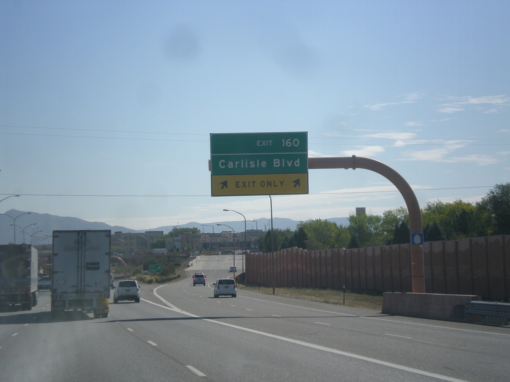
I-40 East - Exit 160
I-40 east at Exit 160 - Carlisle Blvd.
Taken 10-11-2012
Albuquerque
Bernalillo County
New Mexico
United States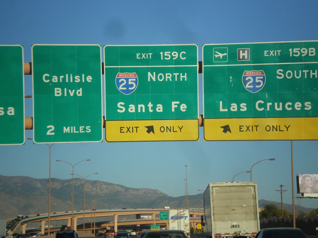
I-40 East - Exits 159CB. Approaching Exit 160.
I-40 east at Exit 159B - I-25 South/Las Cruces and Exit 159C - I-25 North/Santa Fe. Approaching Exit 160 - Carlisle Blvd.
Taken 10-10-2012
 Albuquerque
Bernalillo County
New Mexico
United States
Albuquerque
Bernalillo County
New Mexico
United States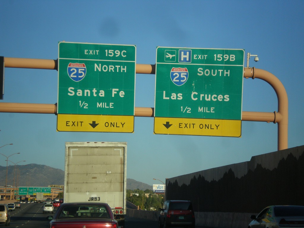
I-40 East Approaching Exits 159C-B
I-40 east approaching Exit 159B - I-25 South/Las Cruces and Exit 159C - I-25 North/Santa Fe.
Taken 10-10-2012
Albuquerque
Bernalillo County
New Mexico
United States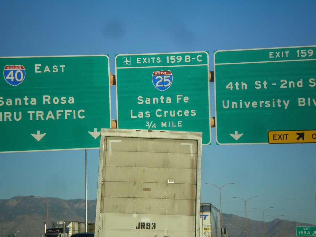
I-40 East - Exits 159 A-C
I-40 east at Exit 159A - 4th-2nd St./University Blvd. Approaching Exit 159BC - I-25/Las Cruces/Santa Fe. Continue east on I-40 east to Santa Rosa.
Taken 10-10-2012
Albuquerque
Bernalillo County
New Mexico
United States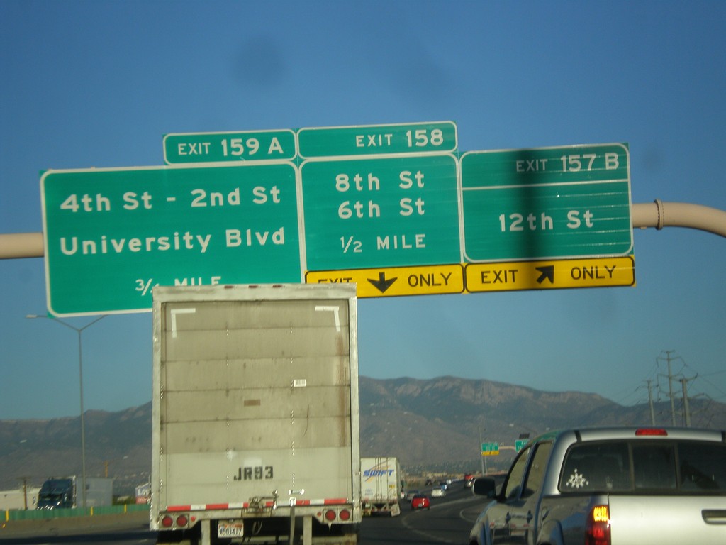
I-40 East - Exits 157B, 158, 159A
I-40 east at Exit 157B - 12th St. Approaching Exit 158 - 8th St./6th St. Also approaching Exit 159A - 4th St. - 2nd St./University Blvd.
Taken 10-10-2012
Albuquerque
Bernalillo County
New Mexico
United States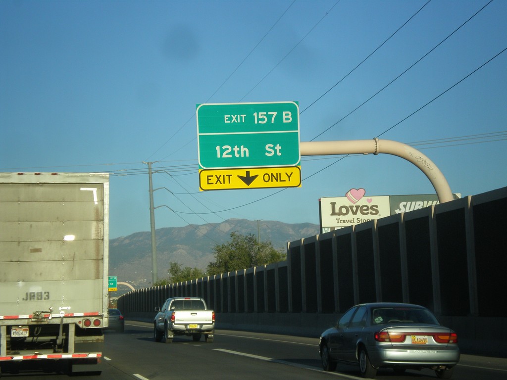
I-40 East Approaching Exit 157B
I-40 east approaching Exit 157B - 12th St.
Taken 10-10-2012
Albuquerque
Bernalillo County
New Mexico
United States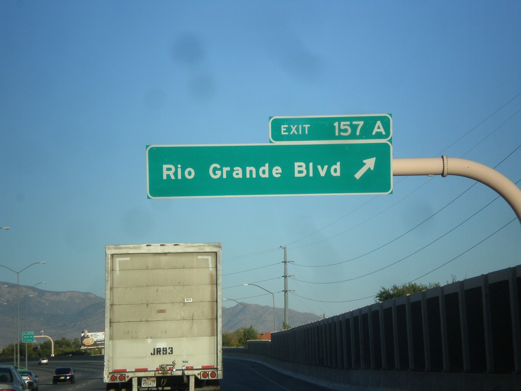
I-40 East - Exit 157A
I-40 east at Exit 157A - Rio Grande Blvd.
Taken 10-10-2012
Albuquerque
Bernalillo County
New Mexico
United States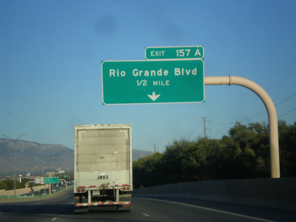
I-40 East Approaching Exit 157A
I-40 east approaching Exit 157A - Rio Grande Blvd.
Taken 10-10-2012
Albuquerque
Bernalillo County
New Mexico
United States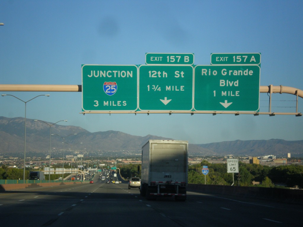
I-40 East Approaching Exits 157A-B
I-40 east approaching Exit 157A - Rio Grande Blvd. and Exit 157B - 12th St. Also approaching I-25 junction in 3 miles.
Taken 10-10-2012
Albuquerque
Bernalillo County
New Mexico
United States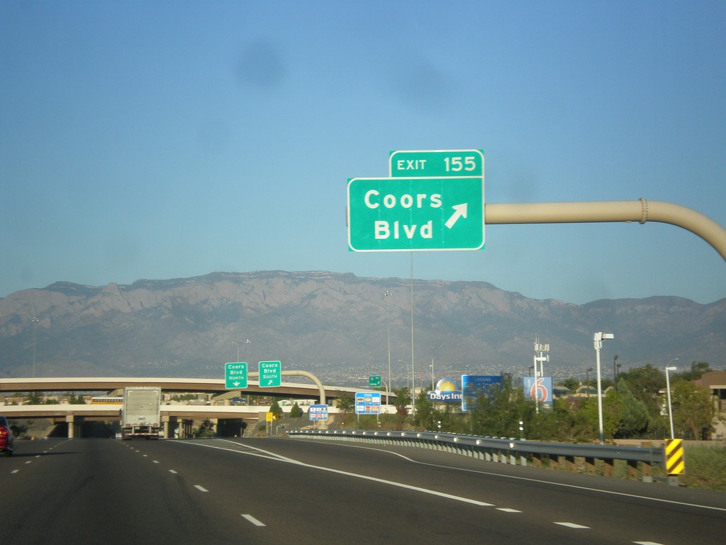
I-40 East - Exit 155
I-40 east at Exit 155 - Coors Blvd.
Taken 10-10-2012
Albuquerque
Bernalillo County
New Mexico
United States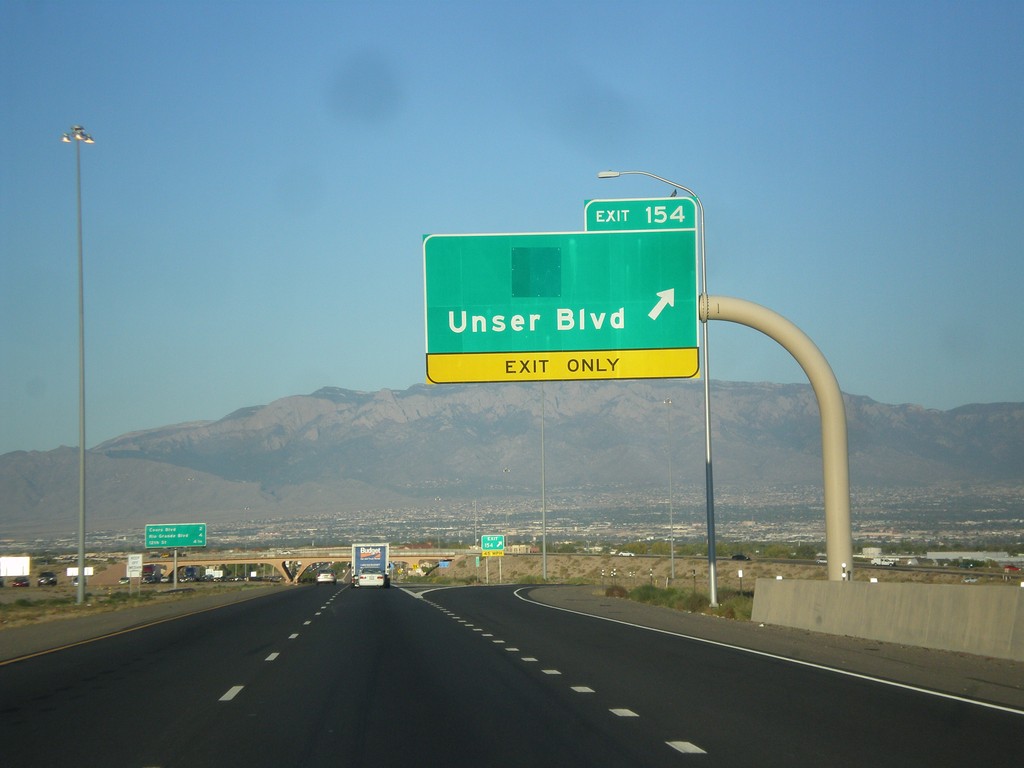
I-40 East - Exit 154
I-40 east at Exit 154 - Unser Blvd.
Taken 10-10-2012
Albuquerque
Bernalillo County
New Mexico
United States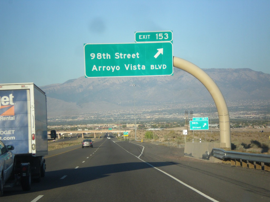
I-40 East - Exit 153
I-40 east at Exit 153 - 98th St./Arroyo Vista Blvd.
Taken 10-10-2012
Albuquerque
Bernalillo County
New Mexico
United States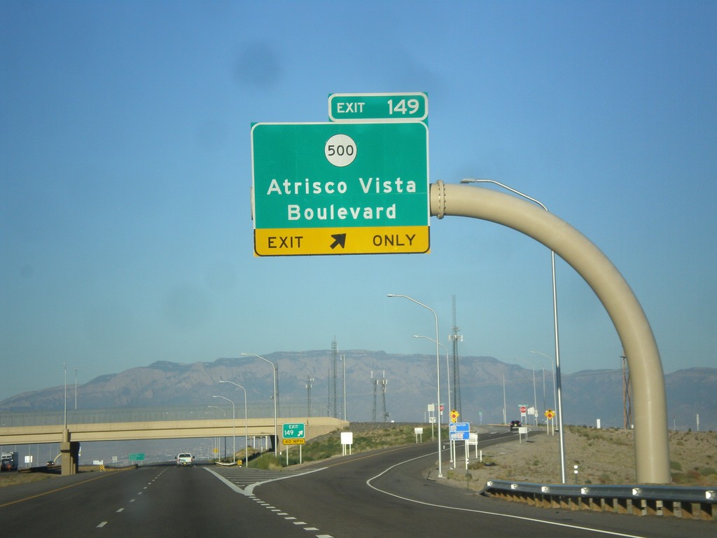
I-40 East - Exit 149
I-40 east at Exit 149 - NM-500/Atrisco Vista Blvd.
Taken 10-10-2012
 Albuquerque
Bernalillo County
New Mexico
United States
Albuquerque
Bernalillo County
New Mexico
United States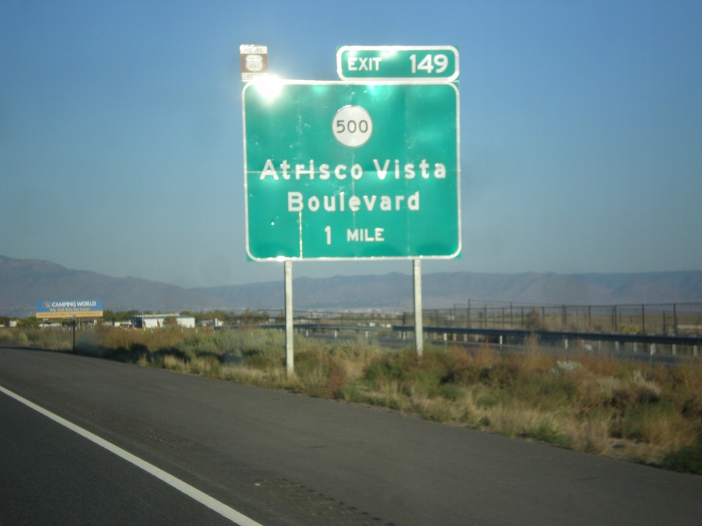
I-40 East Approaching Exit 149
I-40 east approaching Exit 149 - NM-500/Atrisco Vista Blvd. Use Exit 149 to follow the route of historic US-66 into downtown Albuquerque via Central Ave.
Taken 10-10-2012
Albuquerque
Bernalillo County
New Mexico
United States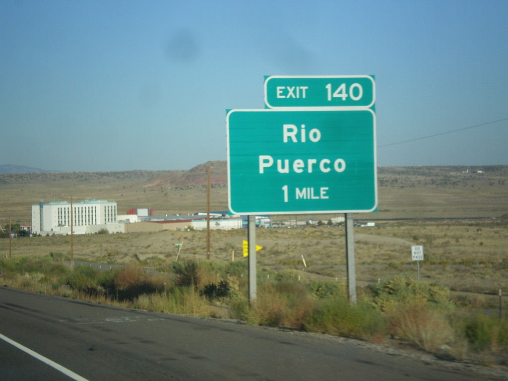
I-40 East Approaching Exit 140
I-40 east approaching Exit 140 - Rio Puerco.
Taken 10-10-2012
Albuquerque
Bernalillo County
New Mexico
United States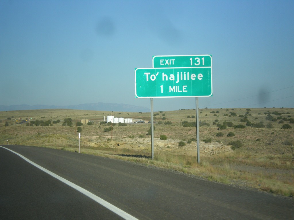
I-40 East Approaching Exit 131
I-40 east approaching Exit 131 - To’hajiilee.
Taken 10-10-2012
Albuquerque
Bernalillo County
New Mexico
United States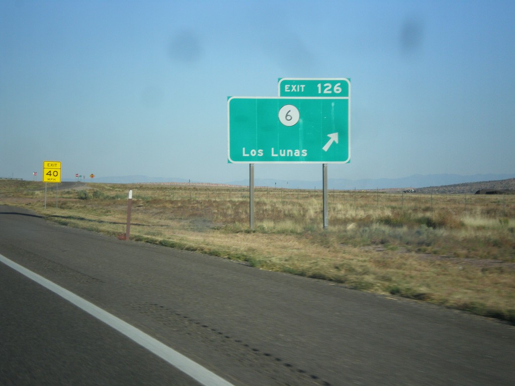
I-40 East - Exit 126
I-40 east at Exit 126 - NM-6/Los Lunas.
Taken 10-10-2012
 Laguna
Cibola County
New Mexico
United States
Laguna
Cibola County
New Mexico
United States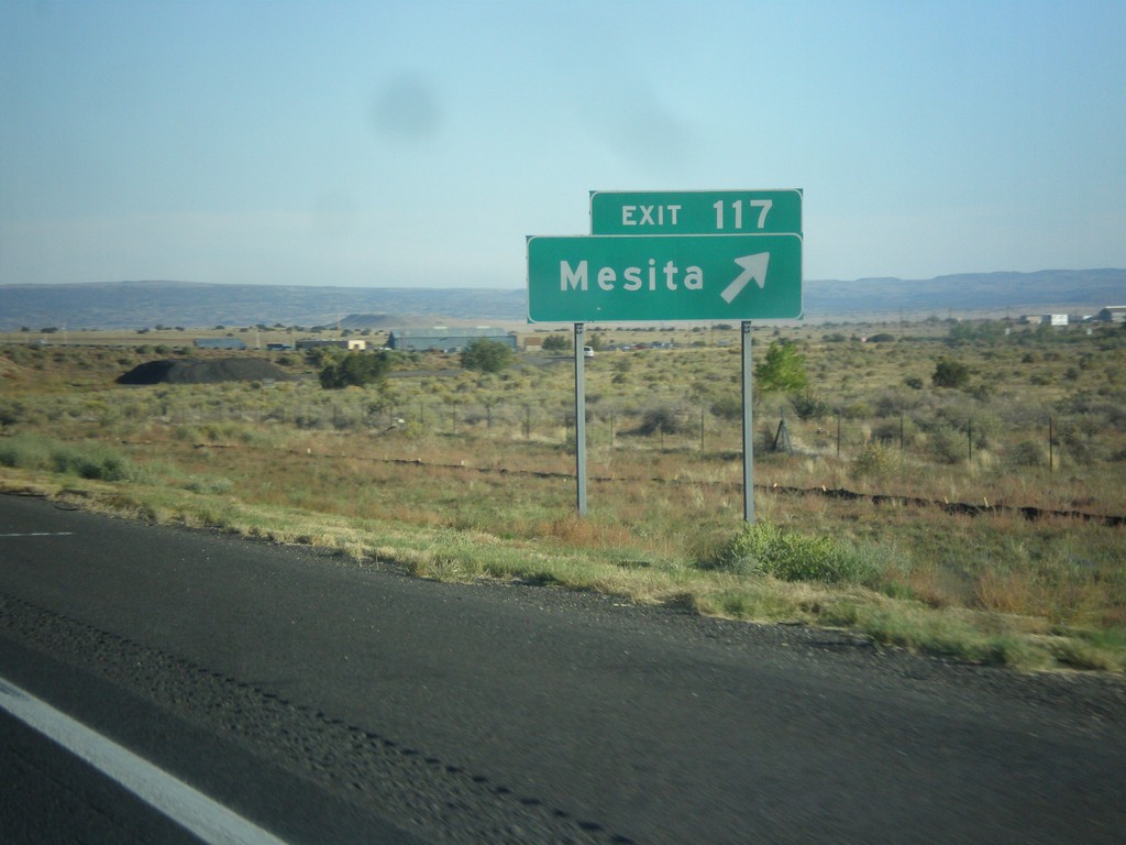
I-40 East - Exit 117
I-40 east at Exit 117 - Mesita.
Taken 10-10-2012
Mesita
Cibola County
New Mexico
United States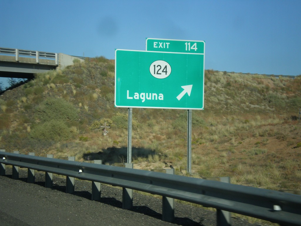
I-40 East - Exit 114
I-40 east at Exit 114 - NM-124/Laguna.
Taken 10-10-2012
 Laguna
Cibola County
New Mexico
United States
Laguna
Cibola County
New Mexico
United States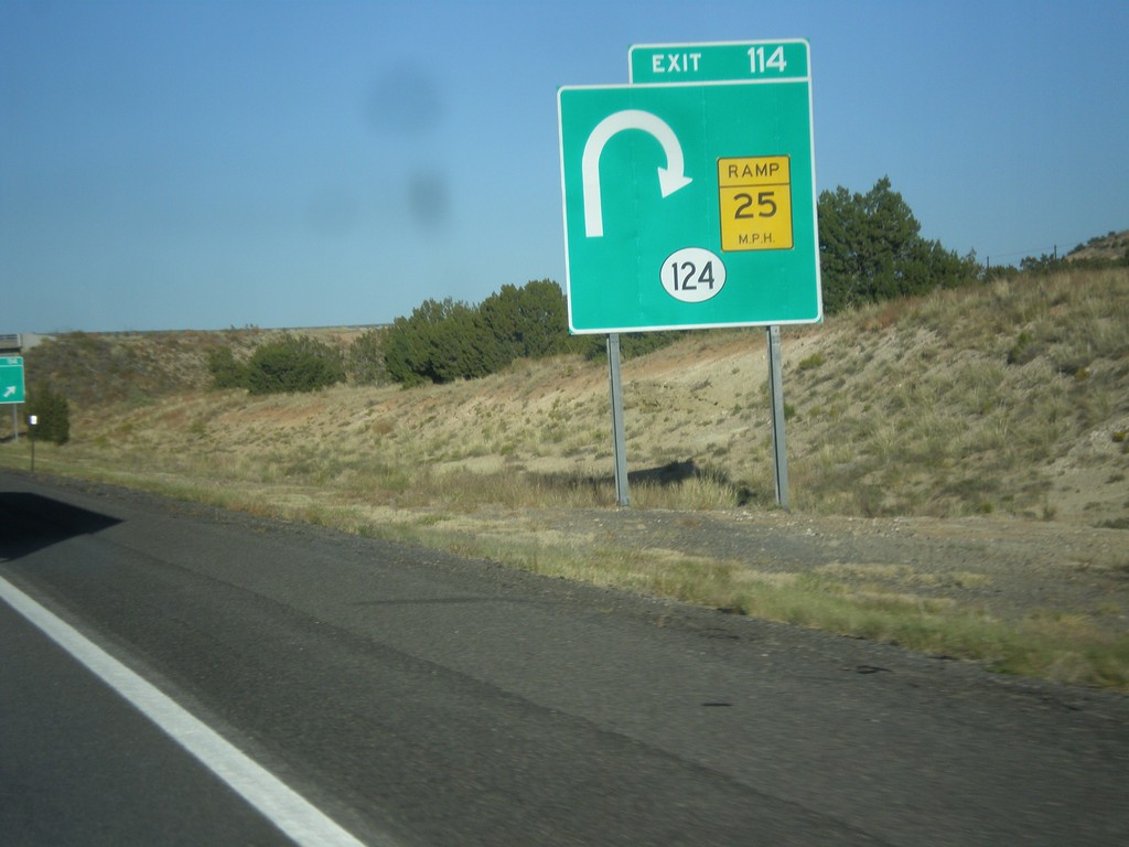
I-40 East Approaching Exit 114
I-40 east approaching Exit 114 - NM-124. The NM-124 interchange is a trumpet style interchange, and involves a loop from eastbound I-40 to NM-124. This is depicted on the sign diagram.
Taken 10-10-2012
Cibola County
New Mexico
United States