Signs Tagged With Big Green Sign
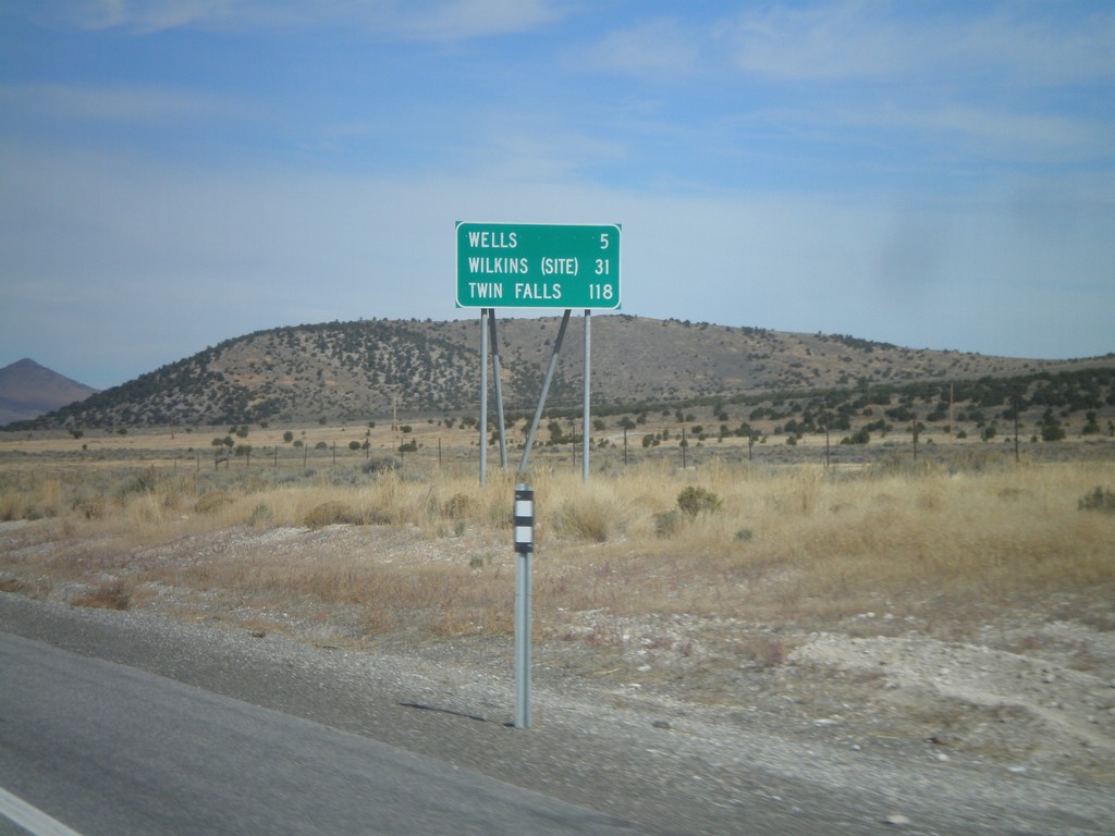
US-93 North - Distance Marker
Distance Marker on US-93 north to Wells, Wilkins (Site), and Twin Falls. Taken just north of NV-232 junction.
Taken 10-15-2011
 Wells
Elko County
Nevada
United States
Wells
Elko County
Nevada
United States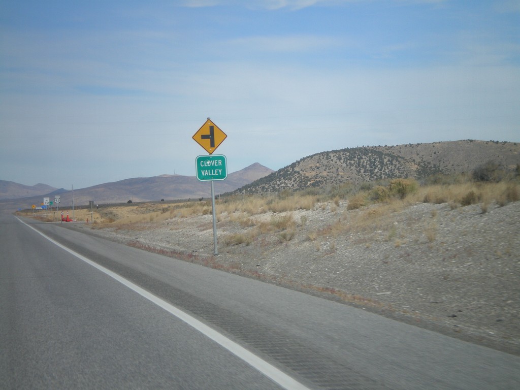
US-93 North at NV-232
US-93 north at NV-232 (unsigned northbound) to Clover Valley.
Taken 10-15-2011
 Wells
Elko County
Nevada
United States
Wells
Elko County
Nevada
United States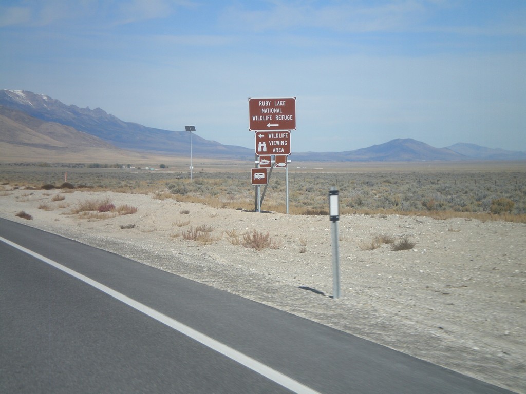
US-93 North at NV-229
US-93 north at NV-229. Turn right on NV-229 for Ruby Lake National Wildlife Refuge.
Taken 10-15-2011
 Wells
Elko County
Nevada
United States
Wells
Elko County
Nevada
United States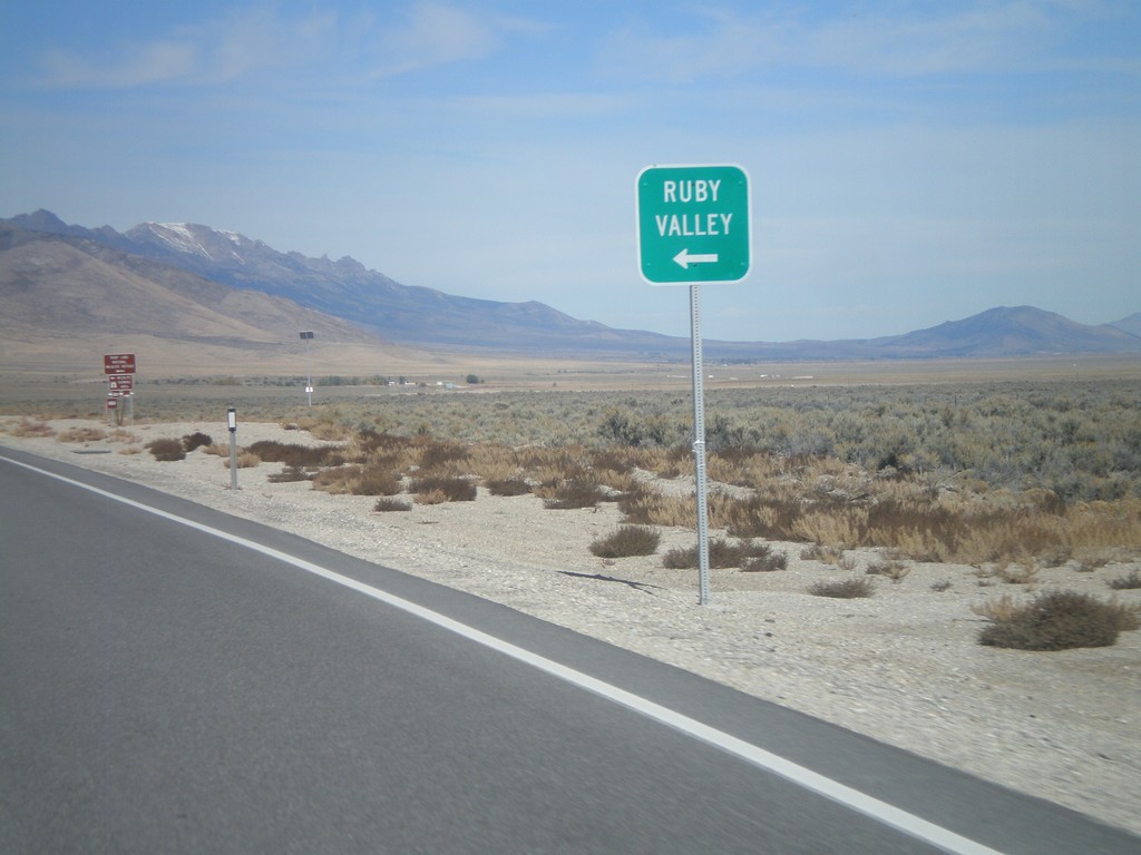
US-93 North Approaching NV-229
US-93 north approaching NV-229 north to Ruby Valley.
Taken 10-15-2011
 Wells
Elko County
Nevada
United States
Wells
Elko County
Nevada
United States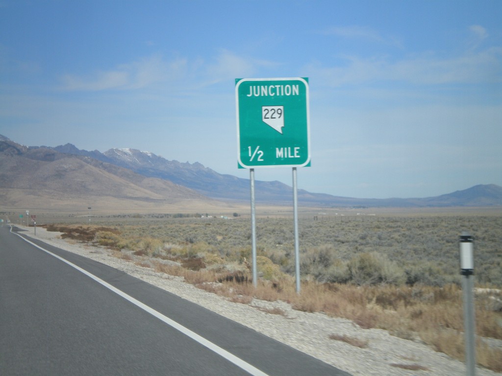
US-93 North Approaching NV-229
US-93 north approaching NV-229 junction.
Taken 10-15-2011
Wells
Elko County
Nevada
United States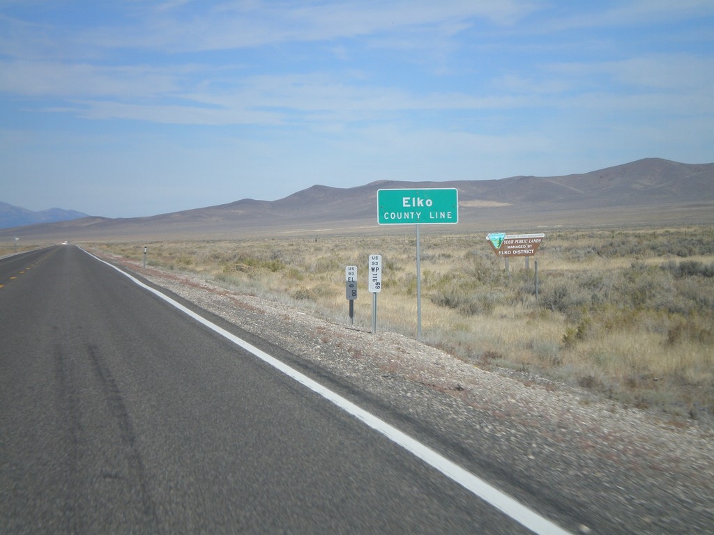
US-93 North - Elko County
Entering Elko County on US-93 north. Elko County is the fourth largest county by area in the lower 48 states.
Taken 10-15-2011
Ely
Elko County
Nevada
United States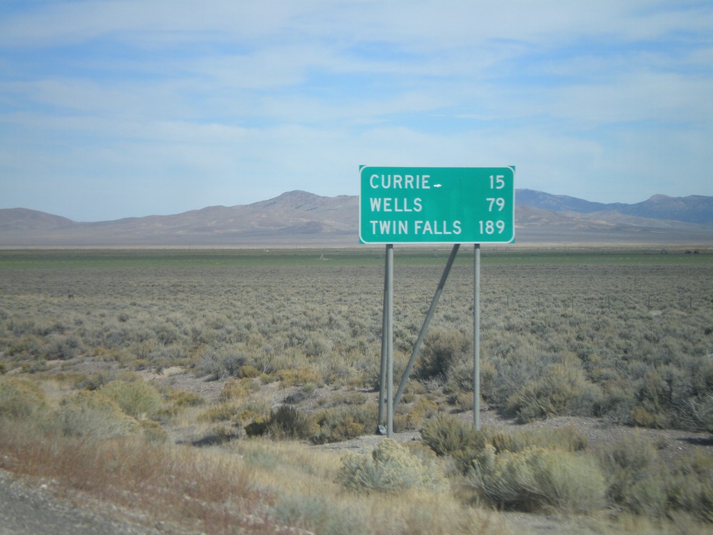
US-93 North - Distance Marker
Distance marker on US-93 north to Currie, Wells, and Twin Falls (Idaho). Taken just north of US-93/Alt. US-93 split.
Taken 10-15-2011
Ely
White Pine County
Nevada
United States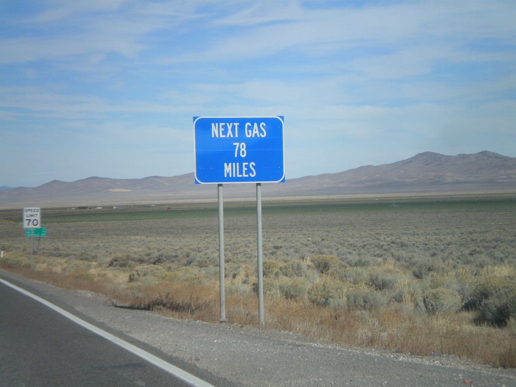
US-93 North - Next Gas 78 Miles
Next Gas 78 Miles on US-93 north. Taken just north of the Alt. US-93/US-93 intersection. Wells is the next city with gas.
Taken 10-15-2011
Ely
White Pine County
Nevada
United States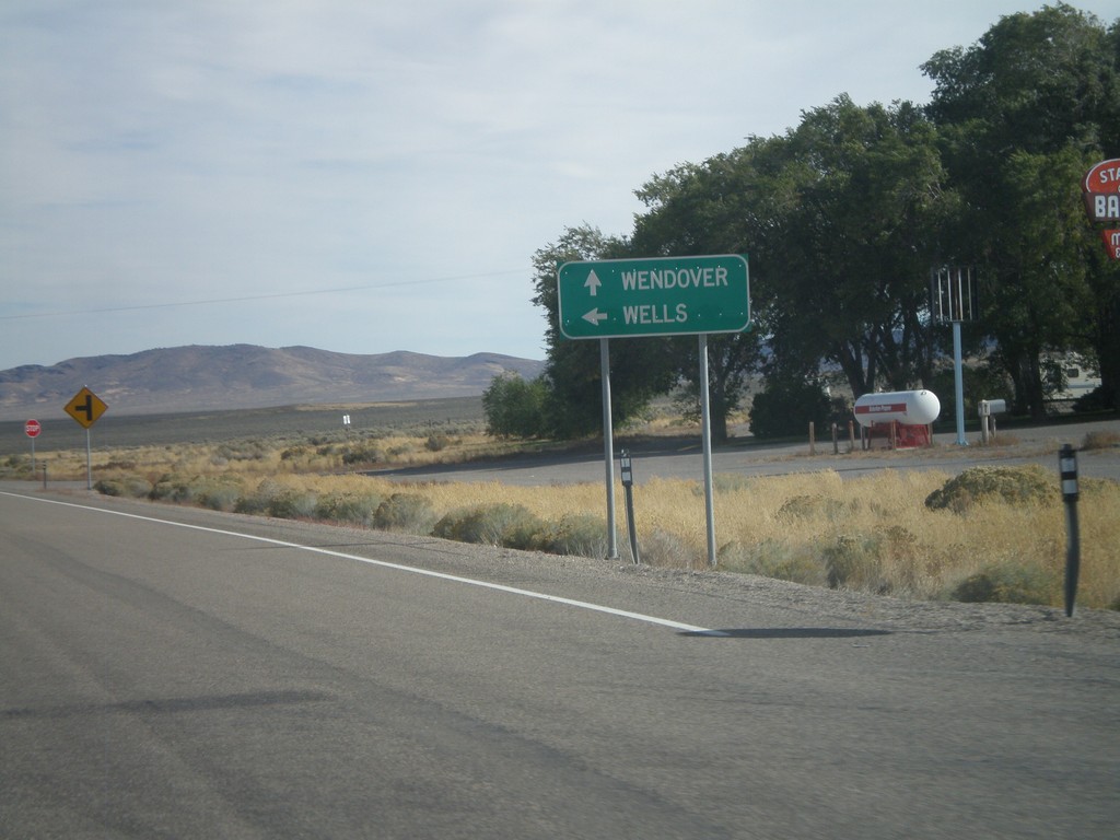
US-93 North at US-93 Alt. North
US-93 North at US-93 Alt. North. Continue straight for US-93 Alt. north to Wendover; turn left for US-93 north to Wells.
Taken 10-15-2011
 Ely
White Pine County
Nevada
United States
Ely
White Pine County
Nevada
United States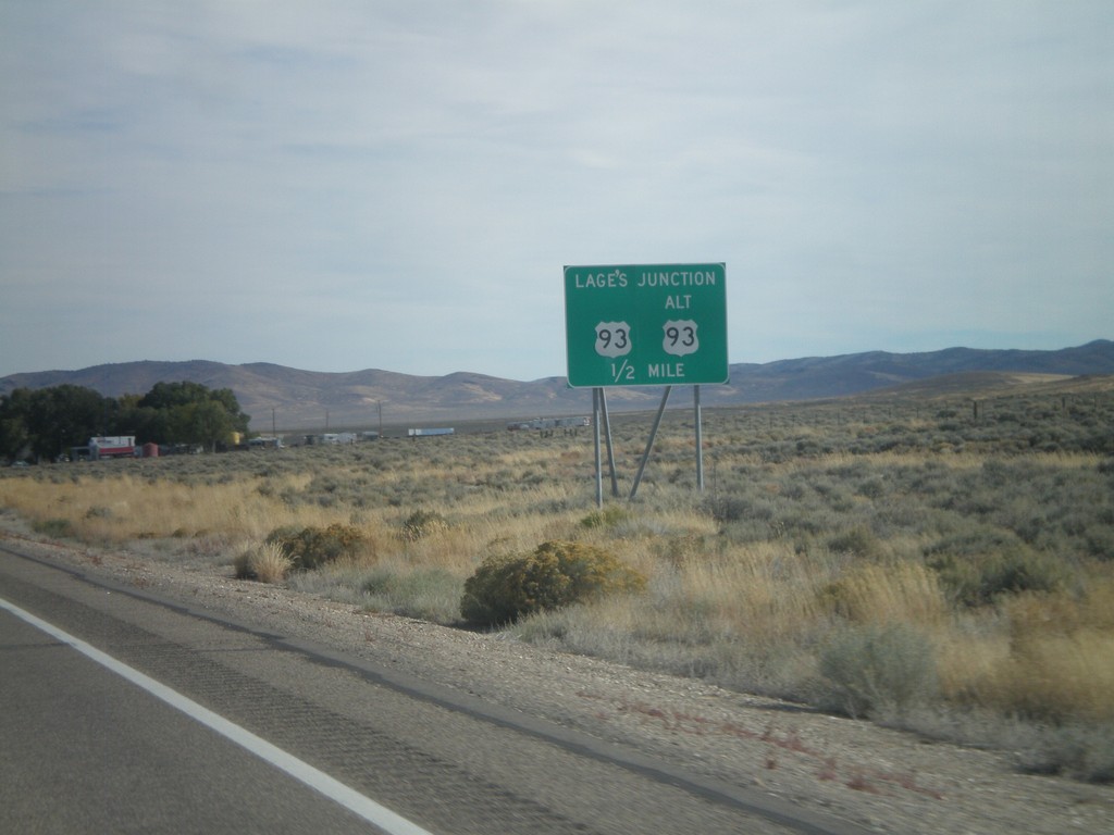
US-93 North Approaching Lages Junction
US-93 North approaching Lages Junction - US-93/Alt. US-93 Jct.
Taken 10-15-2011
Ely
White Pine County
Nevada
United States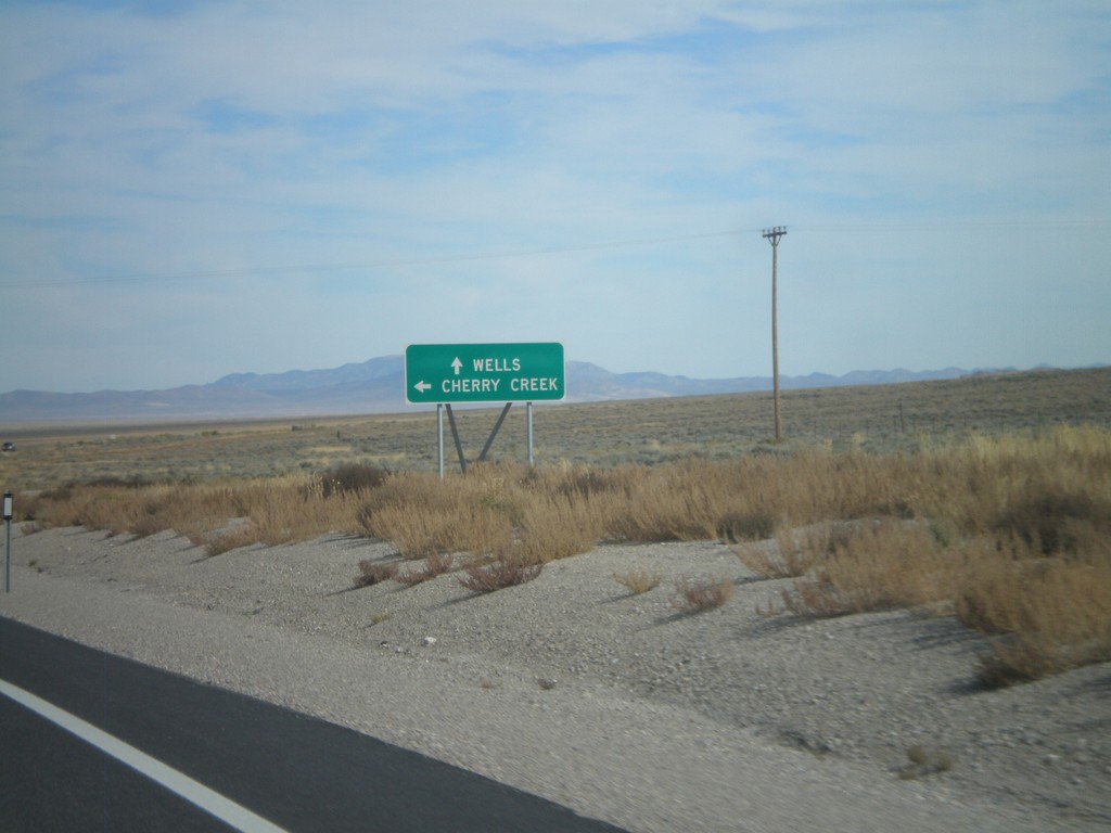
US-93 North at Clover Creek Jct.
US-93 north at Clover Creek Jct. Continue north on US-93 for Wells.
Taken 10-15-2011
Schellbourne
White Pine County
Nevada
United States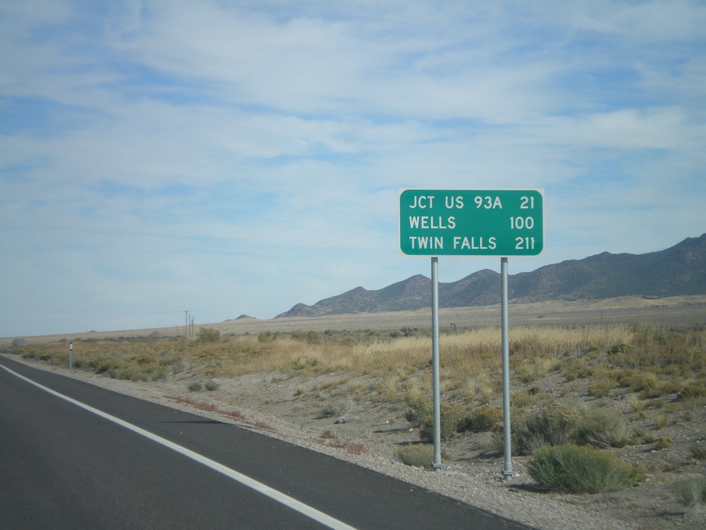
US-93 North - Distance Marker
Distance marker on US-93 north. Distance to Jct US-93A, Wells, and Twin Falls (Idaho).
Taken 10-15-2011
Schellbourne
White Pine County
Nevada
United States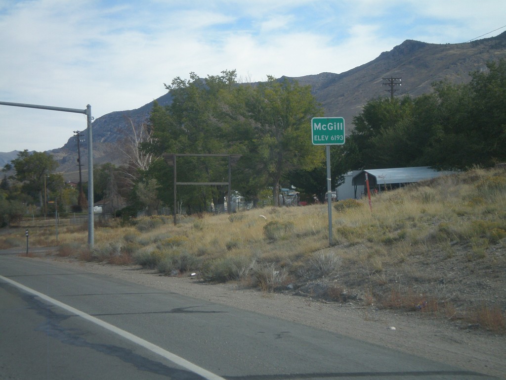
US-93 North - Mc Gill
Entering Mc Gill - Elevation 6193 Feet, on US-93 north.
Taken 10-15-2011
Ely
White Pine County
Nevada
United States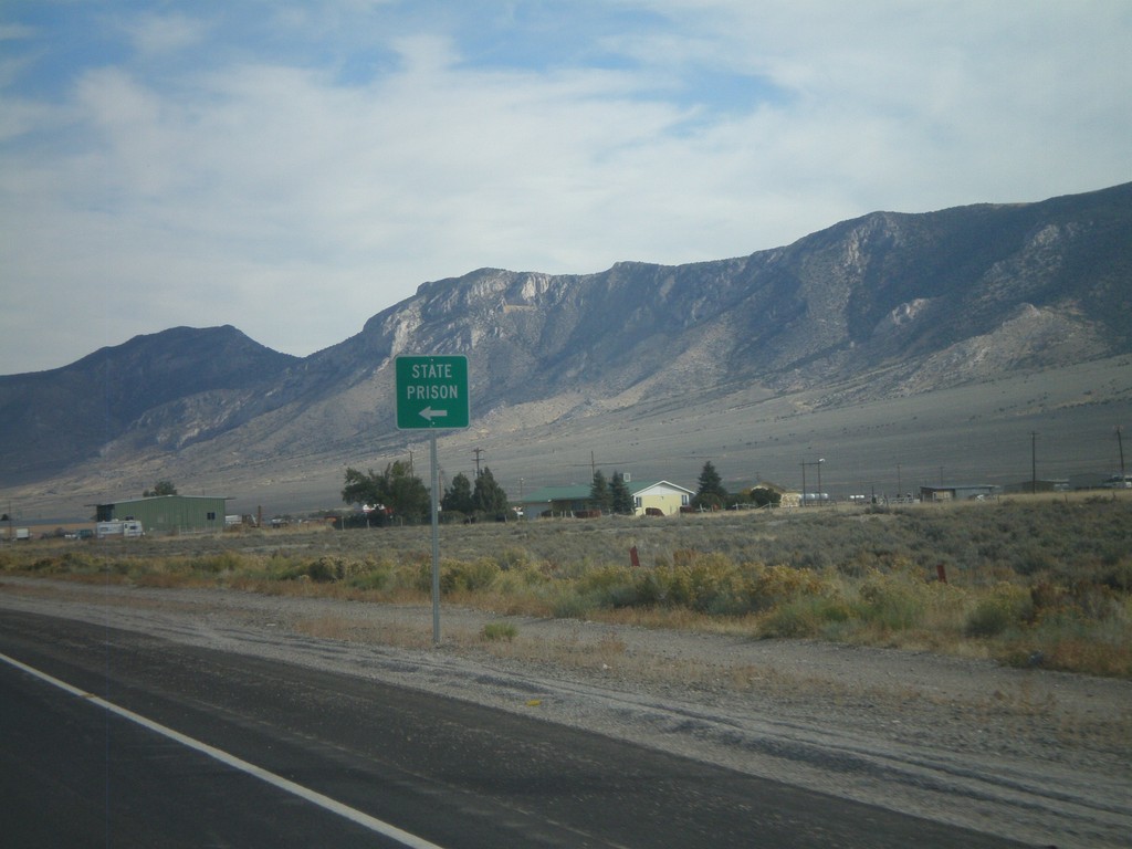
US-93 North Approaching NV-490
US-93 North Approaching NV-490 to State Prison (Ely State Prison).
Taken 10-15-2011
 Ely
White Pine County
Nevada
United States
Ely
White Pine County
Nevada
United States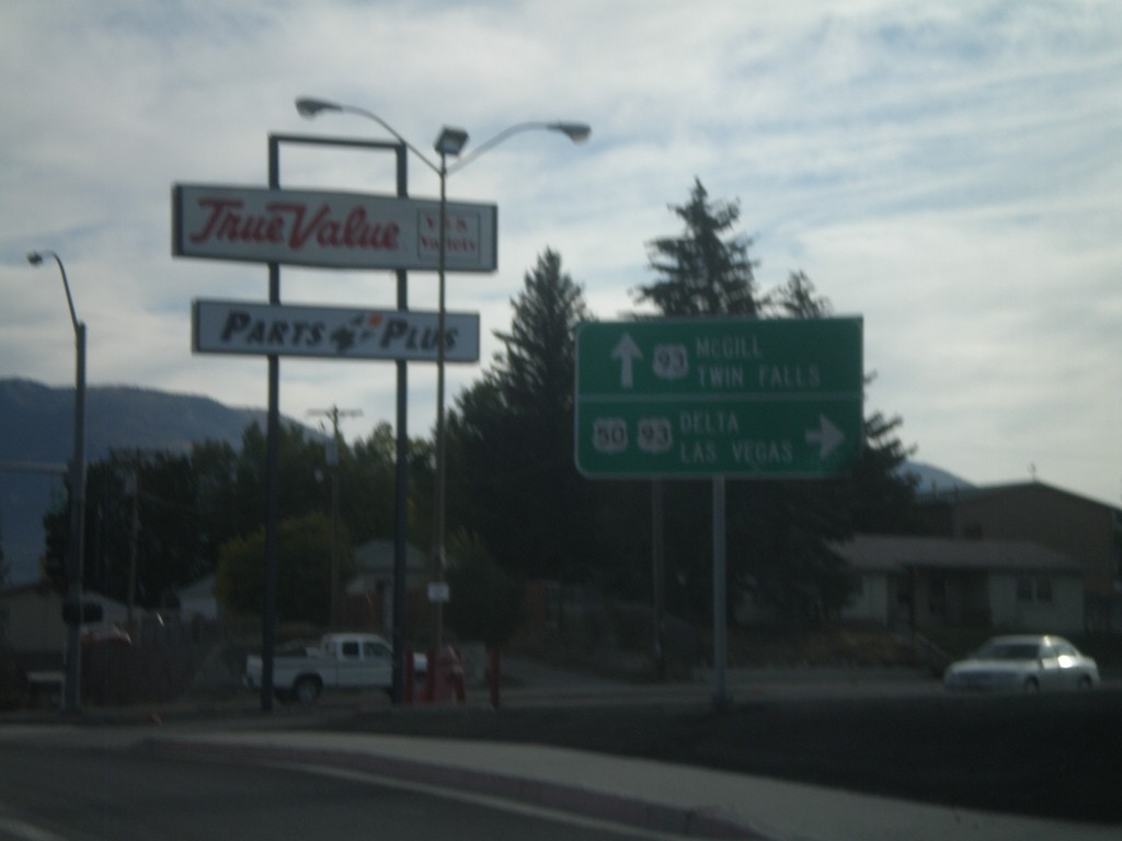
US-50 East at US-93
US-50 east at US-93. Continue ahead for US-93 north to McGill and Twin Falls (Idaho). Turn right for US-93 and US-50 for Delta (Utah) and Las Vegas. US-50 joins US-93 south over Sacramento Pass.
Taken 10-15-2011
 Ely
White Pine County
Nevada
United States
Ely
White Pine County
Nevada
United States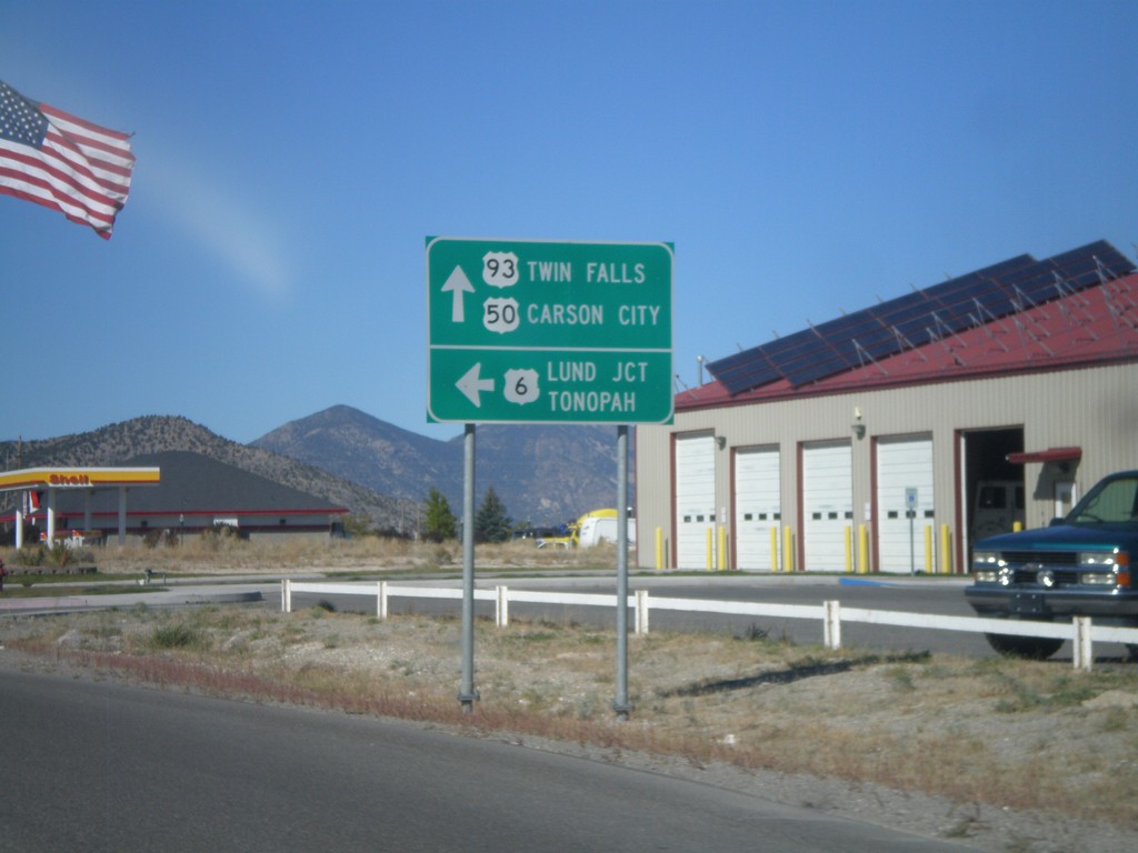
US-93 North/US-6 West/US-50 West at US-6
US-93 North/US-6 West/US-50 West at US-6 West junction. Use US-6 west for Lund Jct. and Tonopah. Use US-93 North/US-50 West for Twin Falls (Idaho via US-93) and Carson City (via US-50).
Taken 10-14-2011
 Ely
White Pine County
Nevada
United States
Ely
White Pine County
Nevada
United States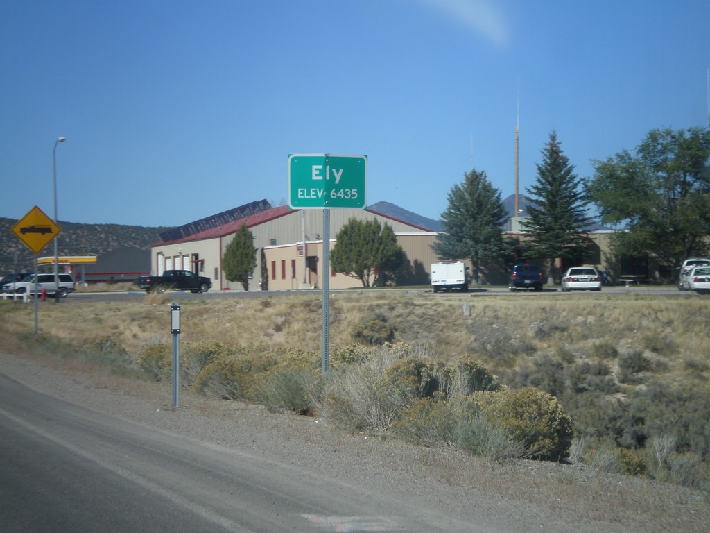
US-93 North - Entering Ely
Entering Ely - Elevation 6435 on US-93 North. Ely is the county seat of White Pine County.
Taken 10-14-2011
Ely
White Pine County
Nevada
United States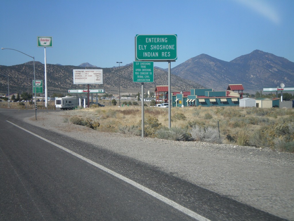
US-93 North - Entering Ely Shoshone Indian Reservation
US-93 North - Entering Ely Shoshone Indian Reservation. The Ely Shoshone Indian Reservation is a small reservation on the outskirts of Ely.
Taken 10-14-2011
Ely
White Pine County
Nevada
United States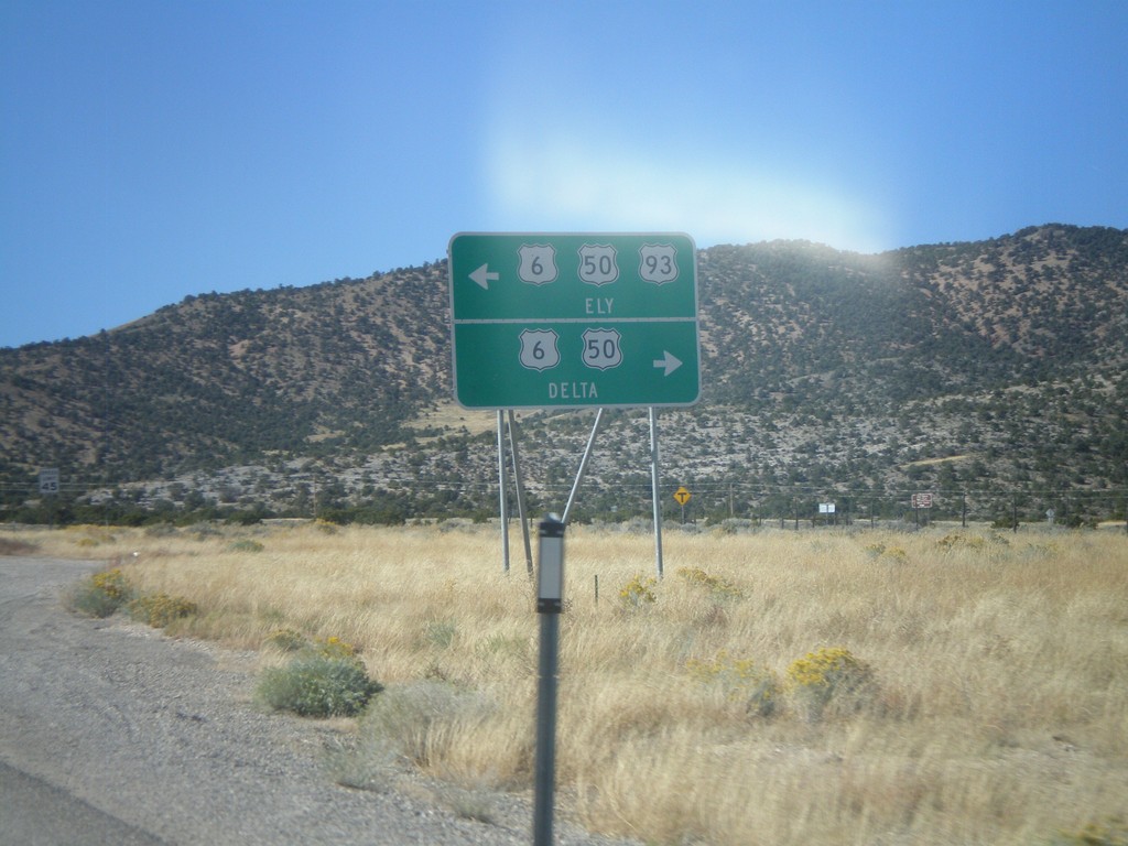
US-93 North at US-6/US-50
US-93 north at US-6/US-50 Jct. US-93 joins US-6/US-50 west into Ely. Turn left for US-93 North/US-6 West/US-50 West for Ely; left for US-6/US-50 East for Delta (Utah).
Taken 10-14-2011
Majors Place
White Pine County
Nevada
United States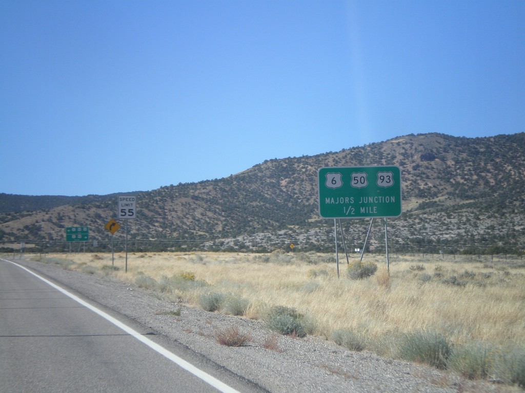
US-93 North Approaching Majors Jct.
US-93 North Approaching Majors Jct with US-50 and US-6.
Taken 10-14-2011
Ely
White Pine County
Nevada
United States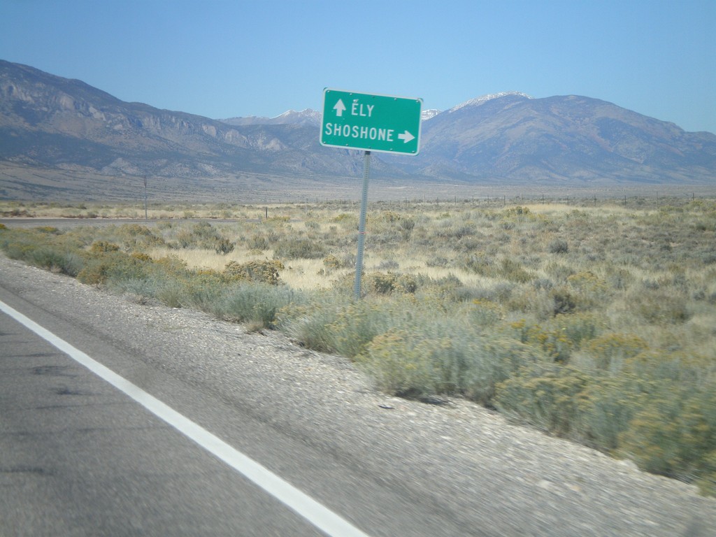
US-93 North at NV-894
US-93 north at NV-894 east to Shoshone.
Taken 10-14-2011
 Ely
White Pine County
Nevada
United States
Ely
White Pine County
Nevada
United States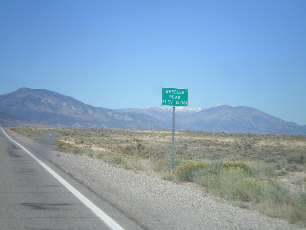
US-93 North - Wheeler Peak
US-93 North at Wheeler Peak sign - Elevation 13,061. Wheeler Peak is the snow covered mountain behind the sign. Wheeler Peak is within Great Basin National Park, and is the second highest mountain in Nevada.
Taken 10-14-2011
Ely
White Pine County
Nevada
United States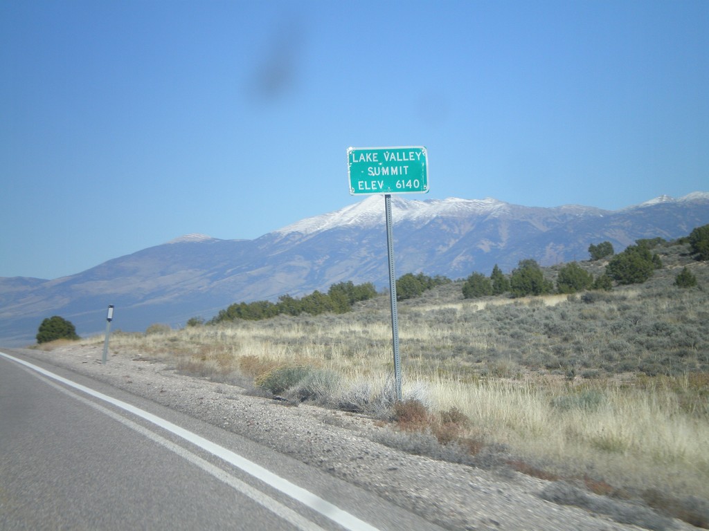
US-93 North - Lake Valley Summit
Lake Valley Summit - Elevation 6,140 Feet on US-93 north. Wheeler Peak is the snow covered mountain in the background.
Taken 10-14-2011
Ely
White Pine County
Nevada
United States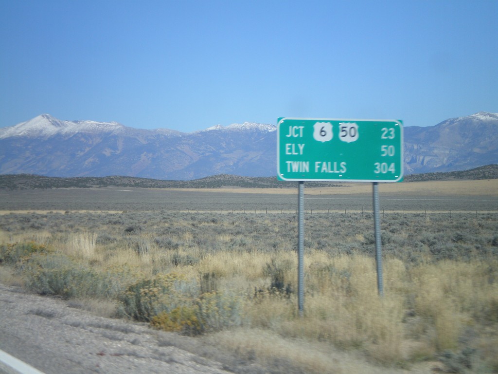
US-93 North - Distance Marker
Distance marker on US-93 north. Distance to US-6/US-50 Jct., Ely, and Twin Falls (Idaho).
Taken 10-14-2011
Pioche
White Pine County
Nevada
United States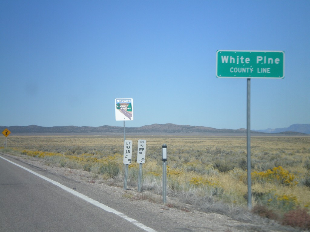
US-93 North - White Pine County Line
White Pine County Line on US-93 north. The sign behind the county line designates this stretch of US-93 as a Nevada Scenic Byway.
Taken 10-14-2011
Pioche
White Pine County
Nevada
United States