Signs Tagged With Big Green Sign
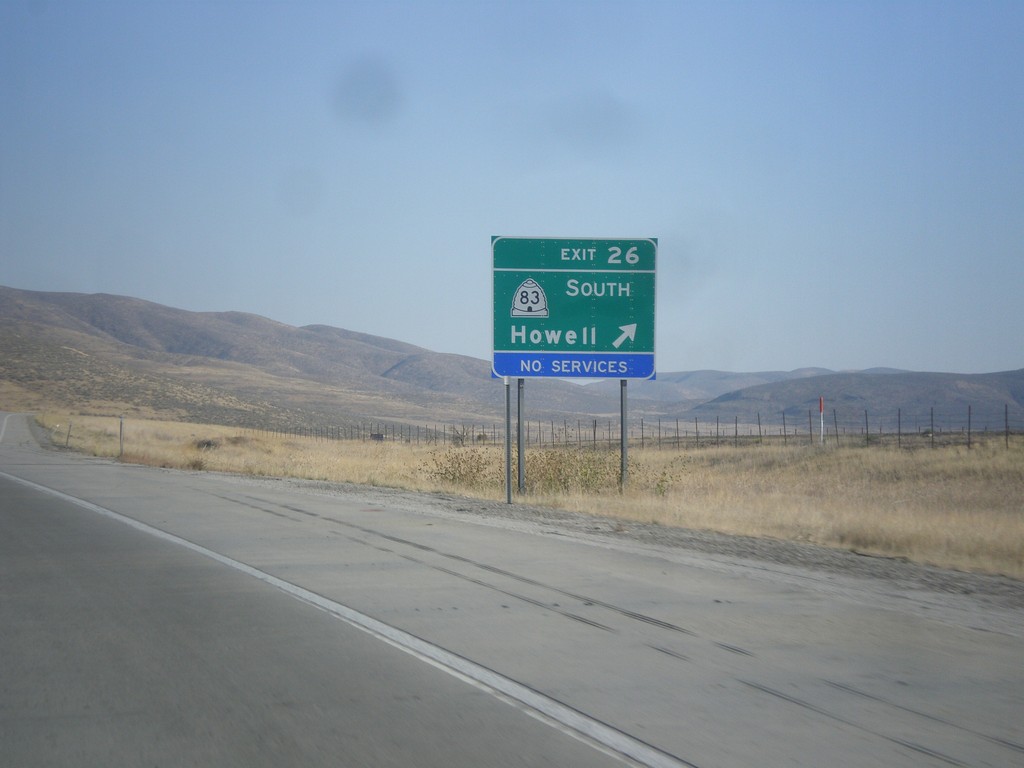
I-84 East - East 26
I-84 east at Exit 26 - UT-83 South/Howell.
Taken 10-06-2012

 Howell
Box Elder County
Utah
United States
Howell
Box Elder County
Utah
United States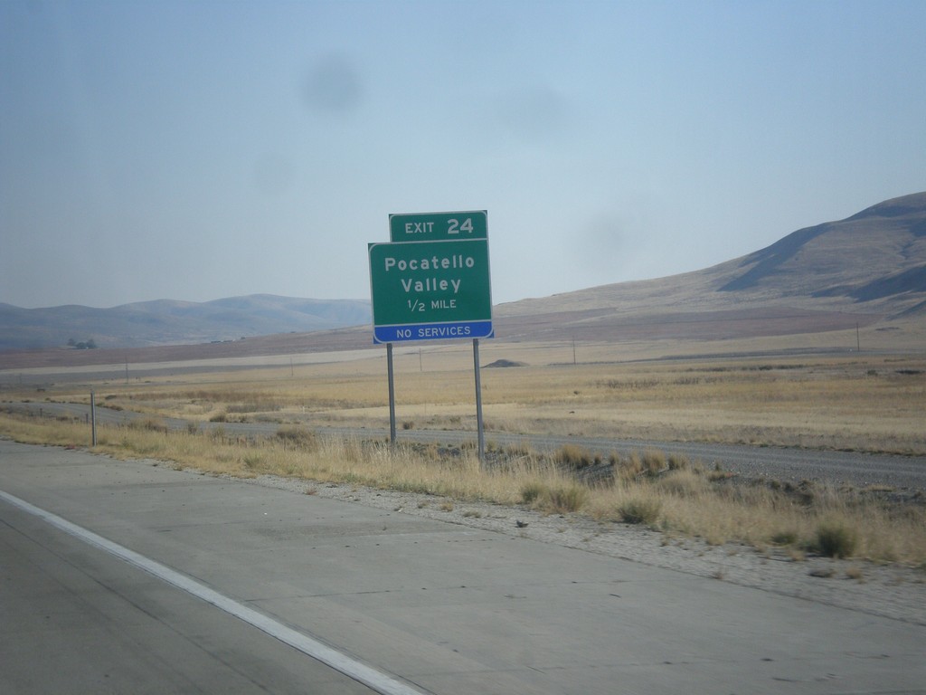
I-84 East - Exit 24
I-84 east approaching Exit 24 - Pocatello Valley. This interchange has recently been renamed from Valley.
Taken 10-06-2012
Howell
Box Elder County
Utah
United States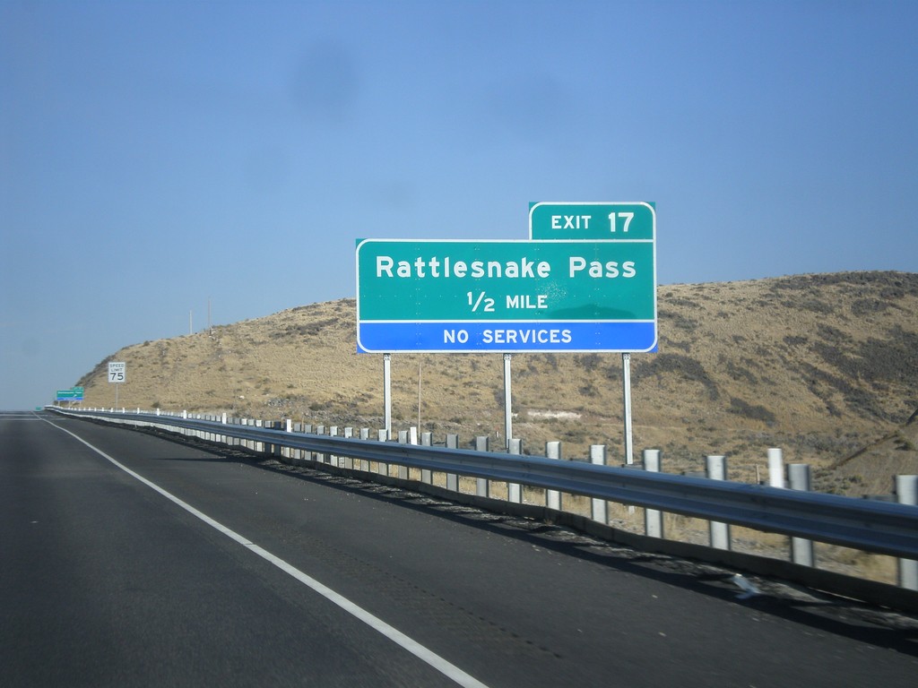
I-84 East - Exit 17
I-84 east approaching Exit 17 - Rattlesnake Pass. This exit was formerly called Ranch Exit.
Taken 10-06-2012
Snowville
Box Elder County
Utah
United States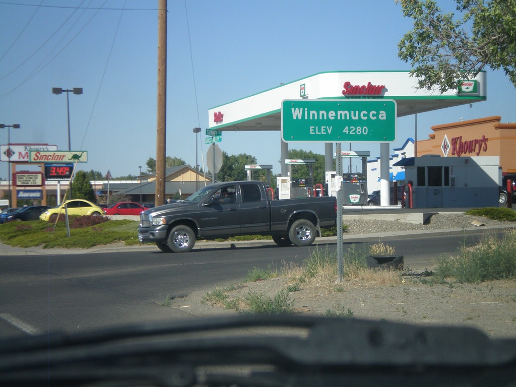
Winnemucca - Elevation 4280
Entering Winnemucca - Elevation 4280 on NV-294 North (Grass Valley Road).
Taken 07-28-2012
 Winnemucca
Humboldt County
Nevada
United States
Winnemucca
Humboldt County
Nevada
United States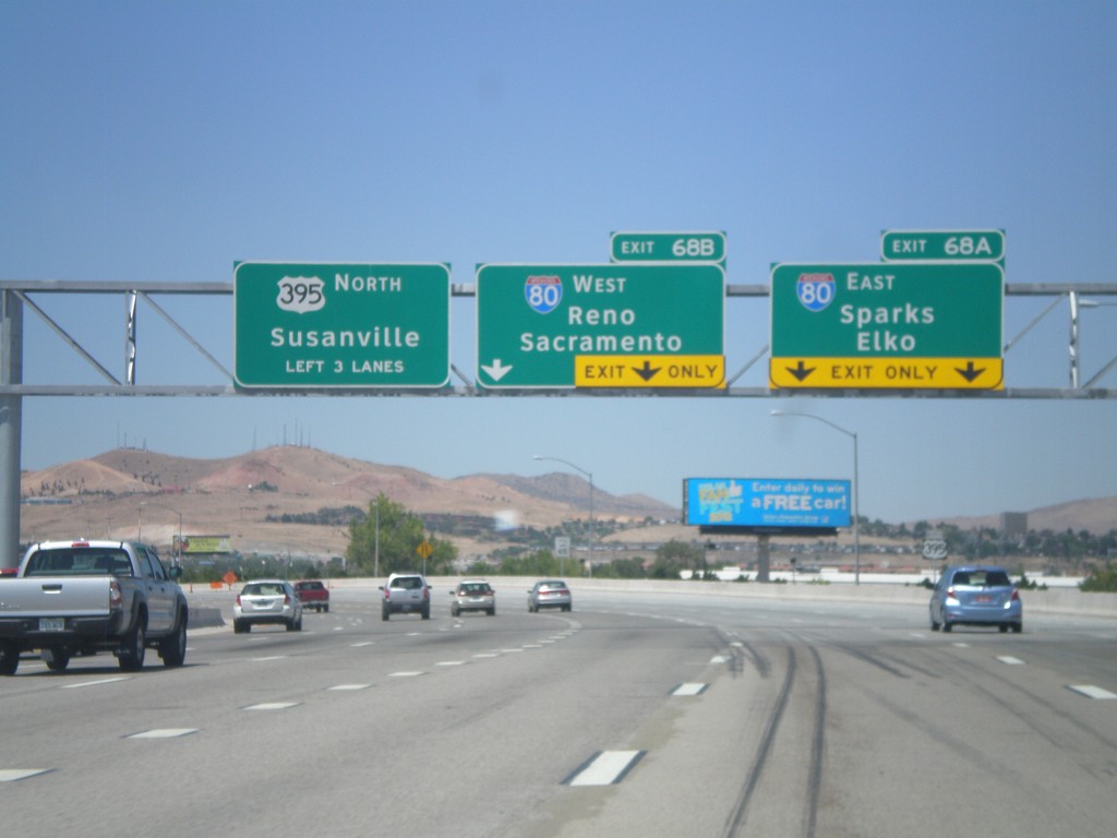
US-395 North - Exits 68A and 68B
US-395 north approaching Exits 68A and 68B. Exit 68A - I-80 East/Sparks/Elko. Exit 68B - I-80 West/Reno/Sacramento (California). US-395 continues north towards Susanville (California). The new signs along the US-395 freeway are using the Clearview font.
Taken 07-28-2012

 Reno
Washoe County
Nevada
United States
Reno
Washoe County
Nevada
United States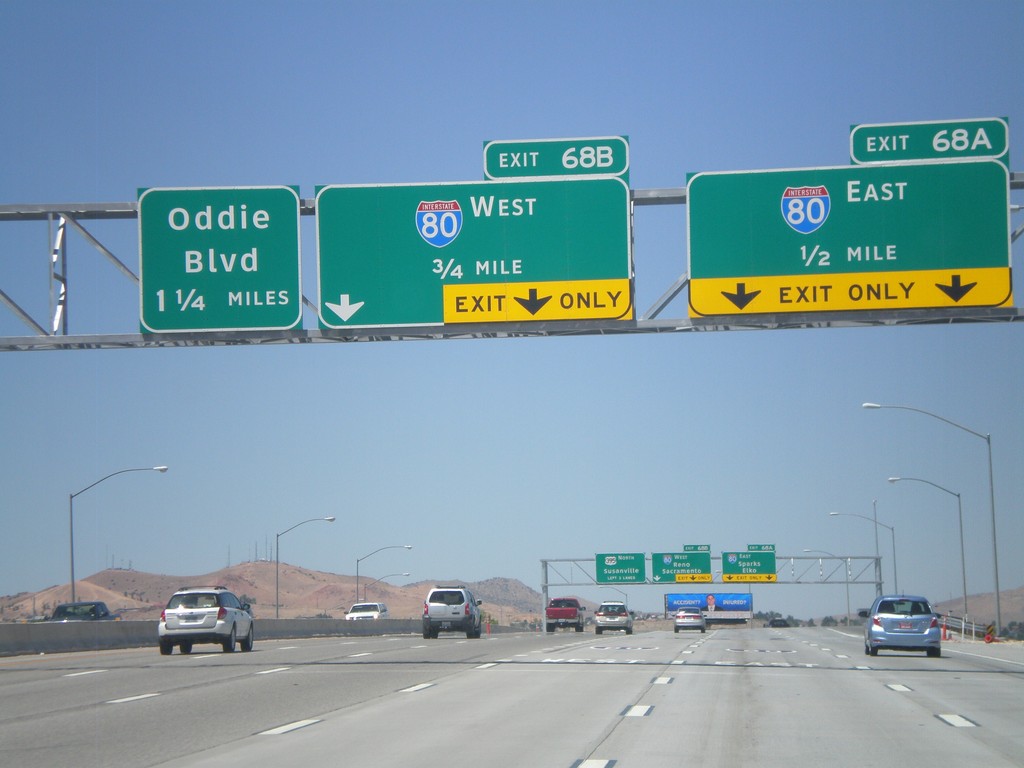
US-395 North Approaching Exits 68AB and 69
US-395 north approaching Exit 68A - I-80 East; Exit 68B - I-80 West, and Exit 69 (exit number not shown) - Oddie Blvd.
Taken 07-28-2012
Reno
Washoe County
Nevada
United States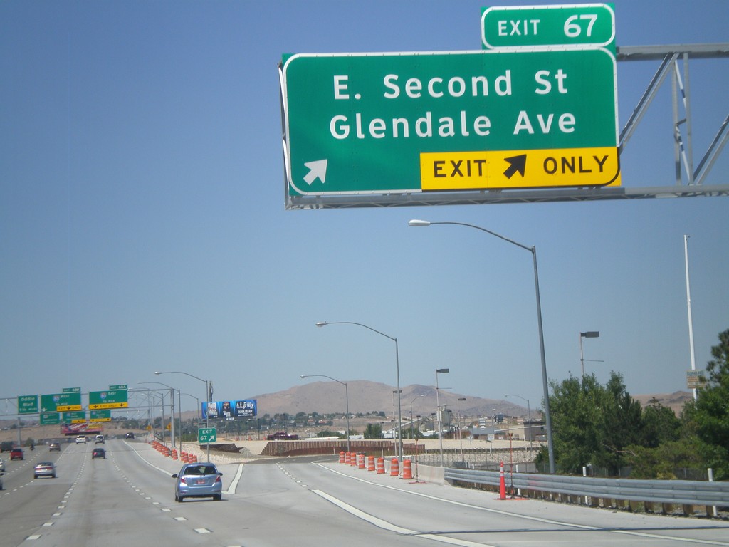
US-395 North - Exit 67
US-395 north at Exit 67 - E. Second St./Glendale Ave.
Taken 07-28-2012
Reno
Washoe County
Nevada
United States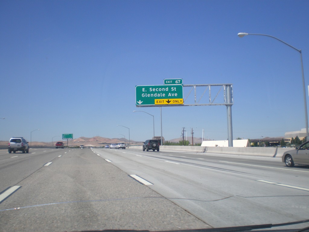
US-395 North Approaching Exit 67
US-395 north approaching Exit 67 - E. Second St./Glendale Ave.
Taken 07-28-2012
Reno
Washoe County
Nevada
United States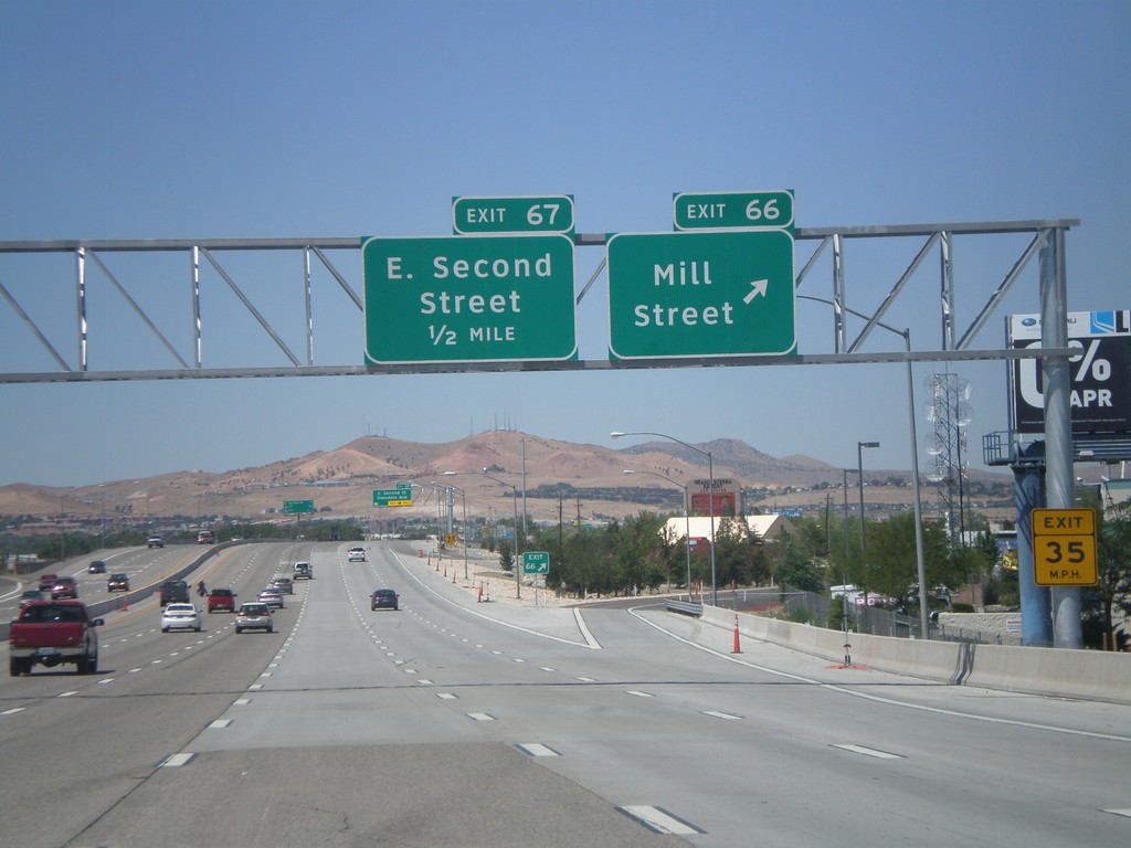
US-395 North - Exits 66 and 67
US-395 north at Exit 66 - Mill St. Approaching Exit 67 - E. Second St.
Taken 07-28-2012
Reno
Washoe County
Nevada
United States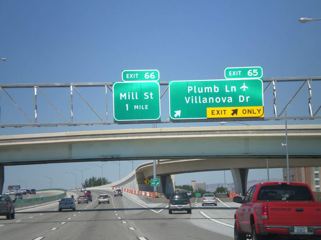
US-395 North - Exits 65 and 66
US-395 north at Exit 65 - Plumb Lane/Villanova Drive. Approaching Exit 66 - Mill St. Use Plumb Lane for the Reno-Tahoe International Airport.
Taken 07-28-2012
Reno
Washoe County
Nevada
United States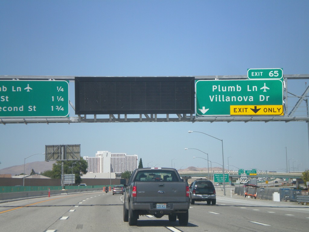
US-395 North Approaching Exit 65
US-395 north approaching Exit 65 - Plumb Lane/Villanova Drive. A distance marker showing the next three Reno exits is on the left side of the picture. The next three exits are: Plumb Lane, Mill St., and E. Second St. Use the Plumb Lane exist for the Reno-Tahoe International Airport.
Taken 07-28-2012
Reno
Washoe County
Nevada
United States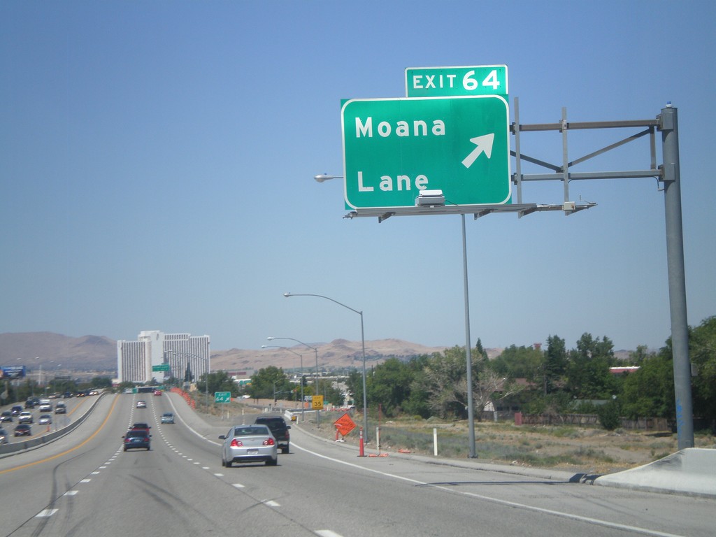
US-395 North - Exit 64
US-395 north at Exit 64 - Moana Lane.
Taken 07-28-2012
Reno
Washoe County
Nevada
United States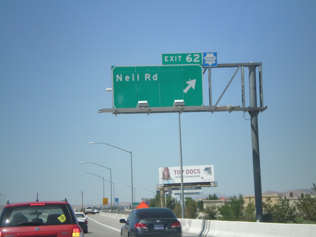
US-395 North - Exit 62
US-395 north at Exit 62 - Neil Road.
Taken 07-28-2012
Reno
Washoe County
Nevada
United States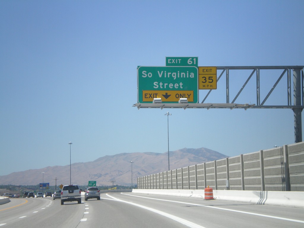
US-395 North - Exit 61
US-395 north at Exit 61 - South Virginia St.
Taken 07-28-2012
Reno
Washoe County
Nevada
United States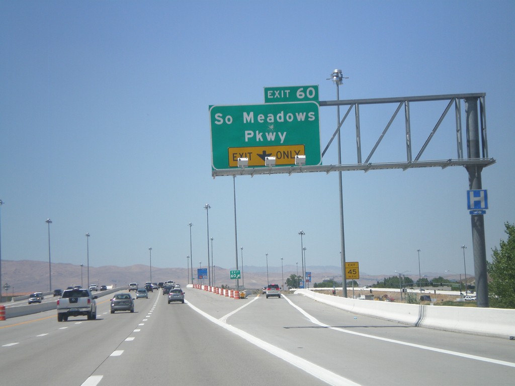
US-395 North - Exit 60
US-395 north at Exit 60 - South Meadows Parkway.
Taken 07-28-2012
Reno
Washoe County
Nevada
United States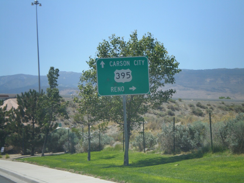
Damonte Ranch Parkway West at US-395
Damonte Ranch Parkway West at US-395. Turn right for US-395 north to Reno. Continue under highway for US-395 south to Carson City.
Taken 07-28-2012
Reno
Washoe County
Nevada
United States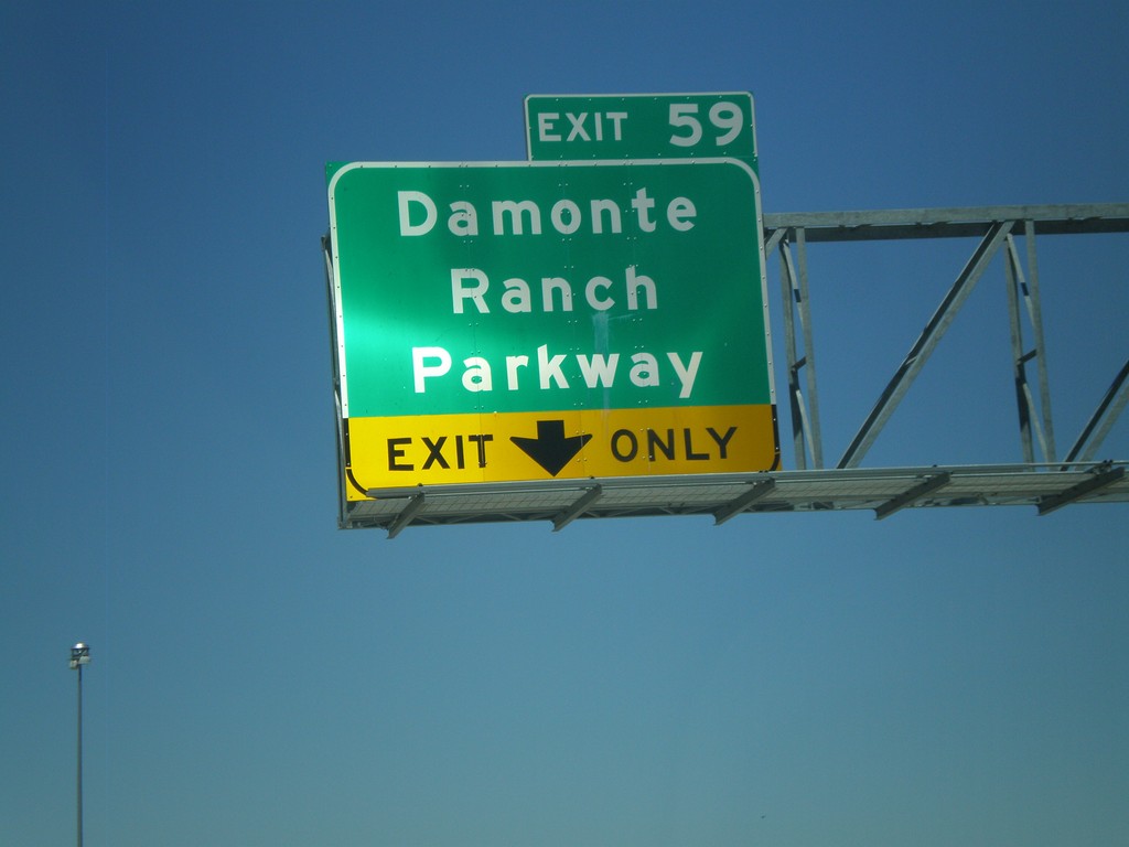
US-395 North - Exit 59
US-395 north at Exit 59 - Damonte Ranch Parkway.
Taken 07-28-2012
Reno
Washoe County
Nevada
United States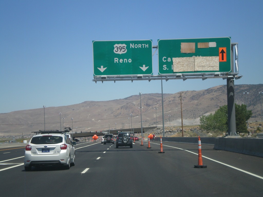
NV-431 East at US-395
NV-431 east at US-395. This is the southern end of the current US-395 freeway. The section between NV-431 and Washoe Lake is expected to be completed in late 2012. For US-395 north to Reno continue straight. In late 2012, the right lanes will be for US-395 south to Carson City and South Lake Tahoe.
Taken 07-28-2012
 Reno
Washoe County
Nevada
United States
Reno
Washoe County
Nevada
United States
NV-431 East - Mount Rose Summit
NV-431 East at Mount Rose Summit - Elevation 8900 Feet. Mount Rose Summit is one of the few Sierra Nevada passes in Nevada, and is the highest pass open year round in the Sierra Nevada.
Taken 07-28-2012
Reno
Washoe County
Nevada
United States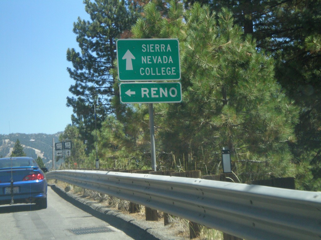
NV-28 East Approaching NV-431
NV-28 east approaching NV-431. Use NV-431 for Reno (the Mount Rose Highway); continue east on NV-28 for Sierra Nevada College.
Taken 07-28-2012
 Incline Village
Washoe County
Nevada
United States
Incline Village
Washoe County
Nevada
United States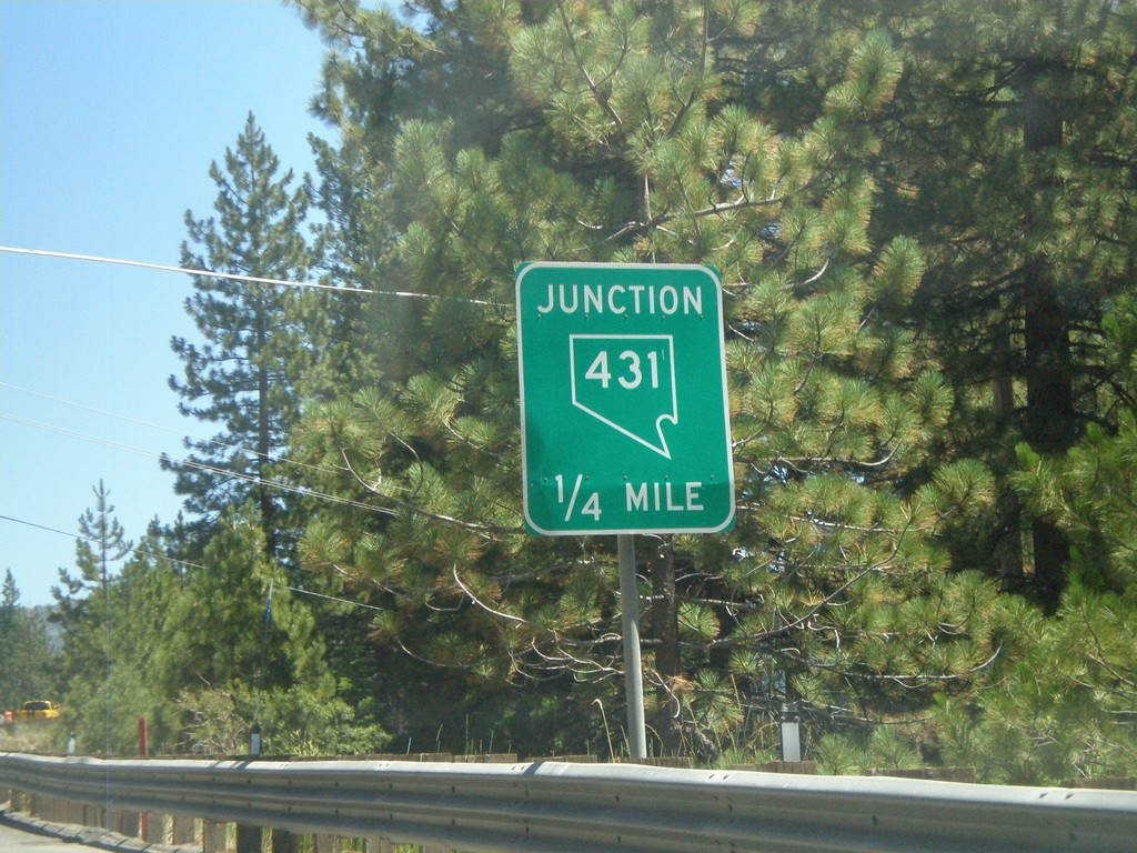
NV-28 East Approaching NV-431
NV-28 east approaching NV-431 (Mount Rose Highway).
Taken 07-28-2012
Incline Village
Washoe County
Nevada
United States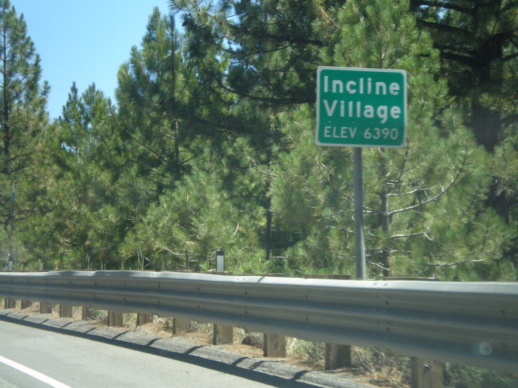
NV-28 East - Incline Village
Entering Incline Village (Elevation 6390) on NV-28 east. Incline Village is a community on the Nevada side of Lake Tahoe on the north shore.
Taken 07-28-2012
Incline Village
Washoe County
Nevada
United States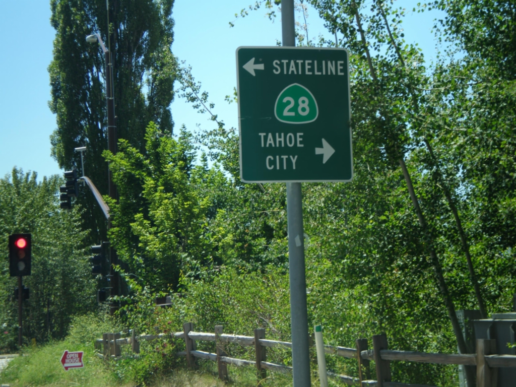
End CA-267 South at CA-28
End CA-267 south at CA-28 in Kings Beach. Turn right for CA-28 west to Tahoe City; turn left for CA-28 east to Stateline.
Taken 07-28-2012

 Kings Beach
Placer County
California
United States
Kings Beach
Placer County
California
United States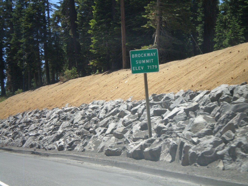
CA-267 South - Brockway Summit
CA-267 South - Brockway Summit (Elevation 7179 Feet). Brockway Summit divides the Truckee area from the Tahoe Basin. CA-267 south quickly descends into Lake Tahoe.
Taken 07-28-2012
Truckee
Placer County
California
United States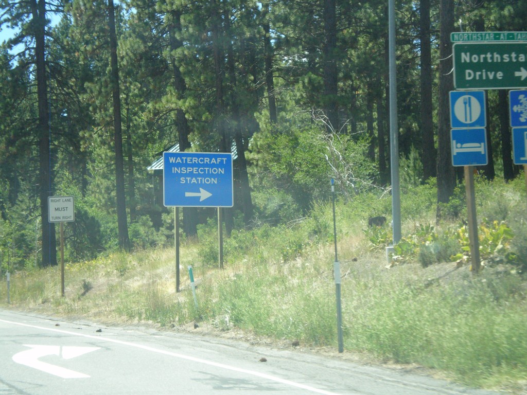
CA-267 South at Northstar Road
CA-267 South at Northstar Road. Turn right for Northstar-At-Tahoe Ski Area and for (Lake Tahoe) Watercraft Inspection. All watercraft launching in Lake Tahoe need to be inspected prior to launching.
Taken 07-28-2012
Truckee
Placer County
California
United States