Signs Tagged With Big Green Sign
WY-24 East at WY-110
WY-24 East at WY-110 to Devils Tower.
Taken 07-01-2025

 Devils Tower
Crook County
Wyoming
United States
Devils Tower
Crook County
Wyoming
United States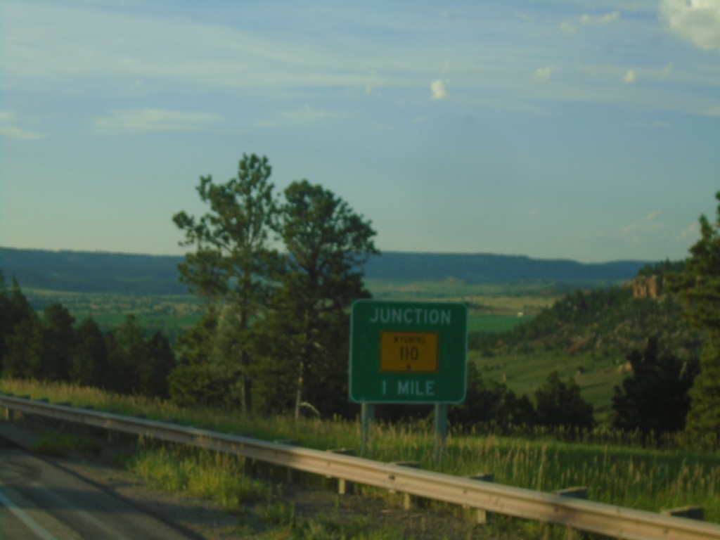
WY-24 East Approaching WY-110
WY-24 East approaching WY-110 junction.
Taken 07-01-2025
Devils Tower
Crook County
Wyoming
United States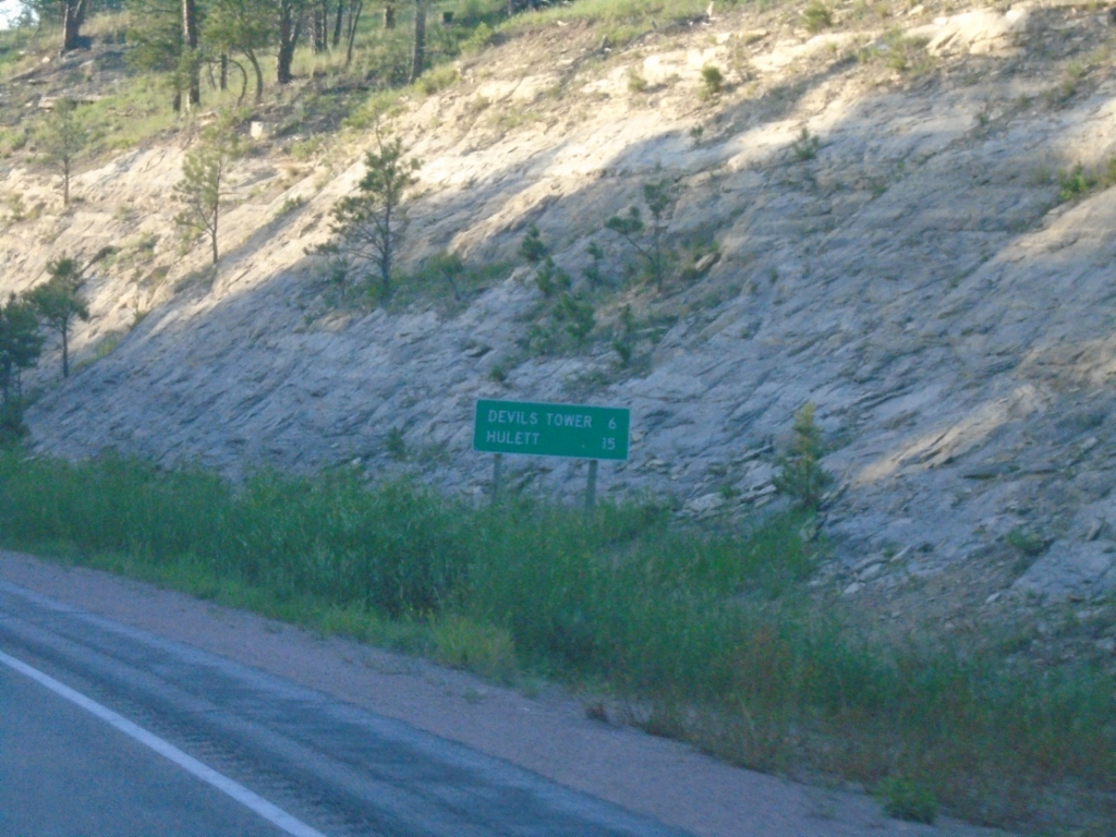
WY-24 East - Distance Marker
Distance marker on WY-24 east. Distance to Devils Tower and Hulett.
Taken 07-01-2025
Sundance
Crook County
Wyoming
United States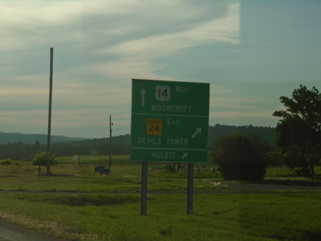
US-14 West at WY-24 East
US-14 West at WY-24 East - Devils Tower Junction. Use WY-24 east to Devils Tower and Hulett. Continue west on US-14 to Moorcroft.
Taken 07-01-2025
 Sundance
Crook County
Wyoming
United States
Sundance
Crook County
Wyoming
United States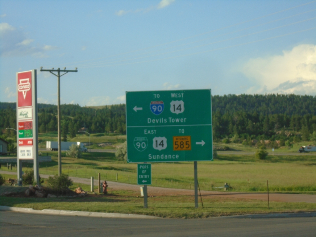
WY-116 North at BL-90/US-14
WY-116 north at BL-90/US-14. Turn right on BL-90/US-14 East for WY-585 and Sundance (City Center). Turn left for US-14 West to I-90 and Devils Tower.
Taken 07-01-2025


 Sundance
Crook County
Wyoming
United States
Sundance
Crook County
Wyoming
United States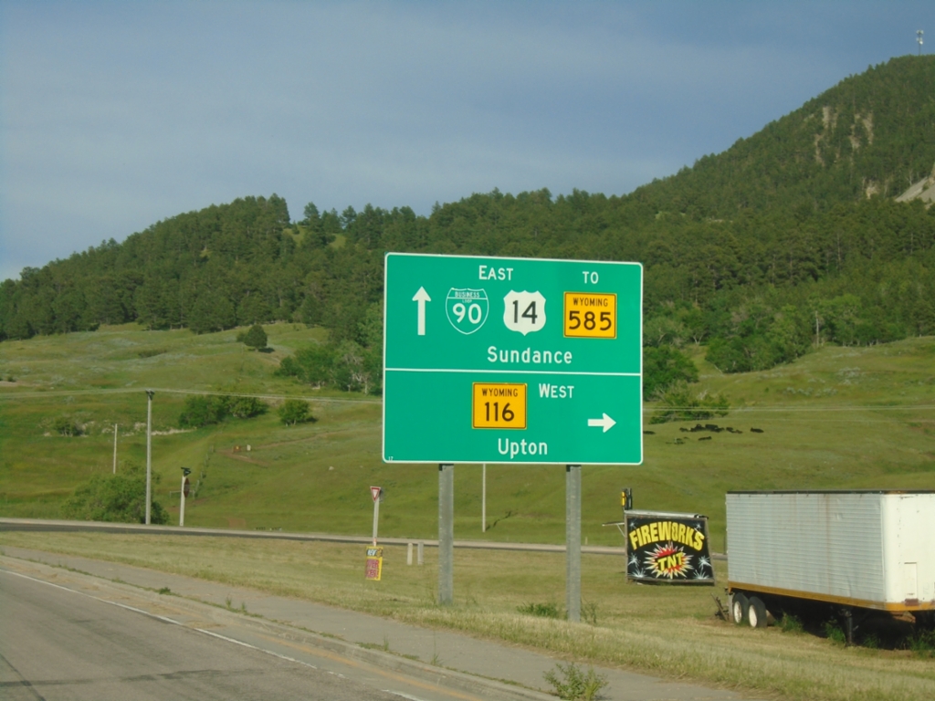
BL-90/US-14 East at WY-116
BL-90/US-14 East at WY-116 junction. Turn right for WY-116 south to Upton; continue straight for BL-90/US-14 East/To WY-585 to Sundance.
Taken 07-01-2025
Sundance
Crook County
Wyoming
United States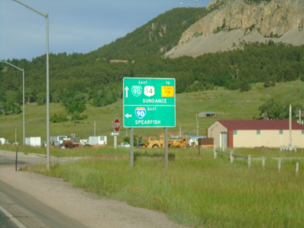
US-14 East at I-90 East (Exit 185)
US-14 East at I-90 East (Exit 185) to Spearfish (South Dakota). Continue on road for BL-90/US-14 East/To WY-116 to Sundance.
Taken 07-01-2025
Sundance
Crook County
Wyoming
United States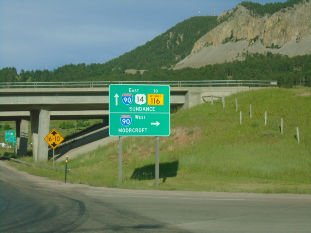
US-14 East at I-90 (Exit 185)
US-14 East at I-90 (Exit 185) in Sundance. Turn right for I-90 West to Moorcroft. Continue under the freeway for I-90/US-14 East/To WY-116/Sundance.
Taken 07-01-2025
Sundance
Crook County
Wyoming
United States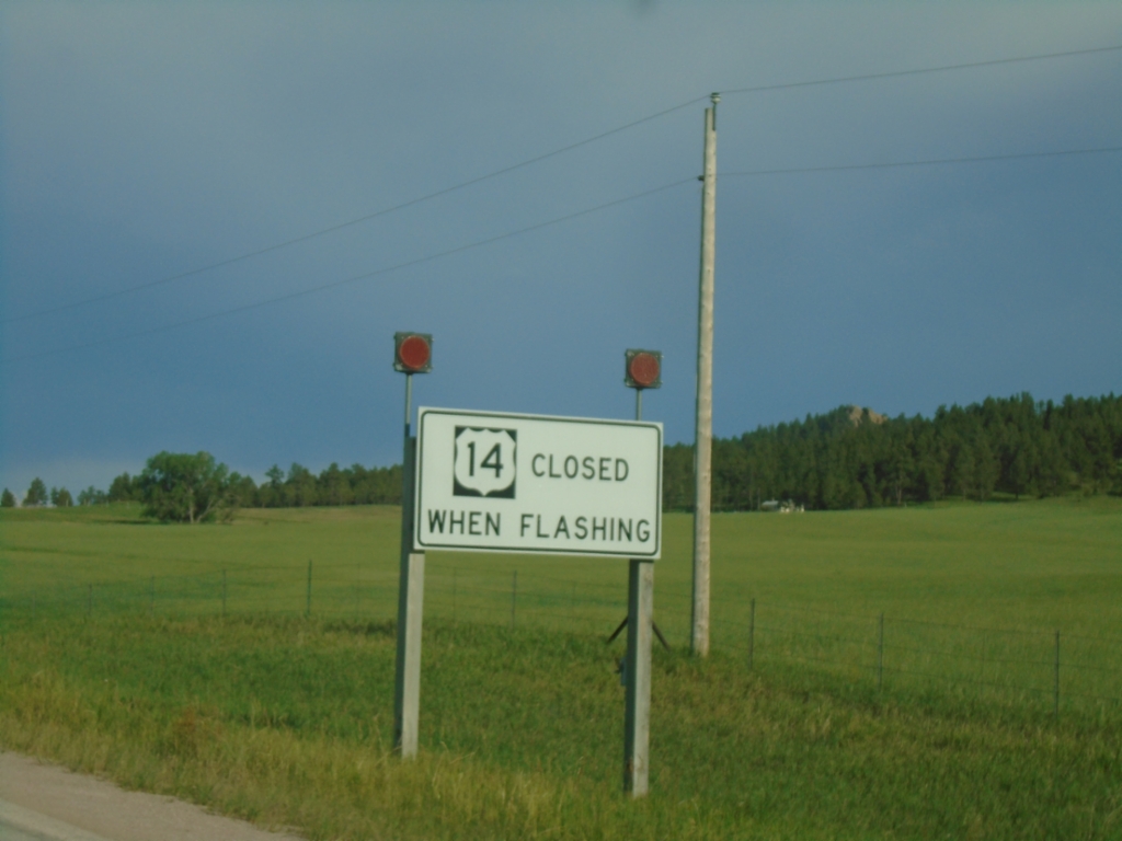
US-14 East - Closed When Flashing
US-14 East Closed When Flashing at Devils Tower Junction.
Taken 07-01-2025
Sundance
Crook County
Wyoming
United States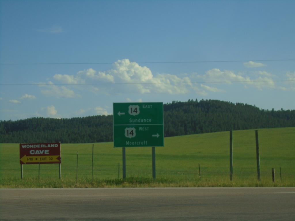
End WY-24 West at US-14
End WY-24 West at US-14 at Devils Tower Junction. Use US-14 west to Moorcroft; US-14 east to Sundance.
Taken 07-01-2025
Sundance
Crook County
Wyoming
United States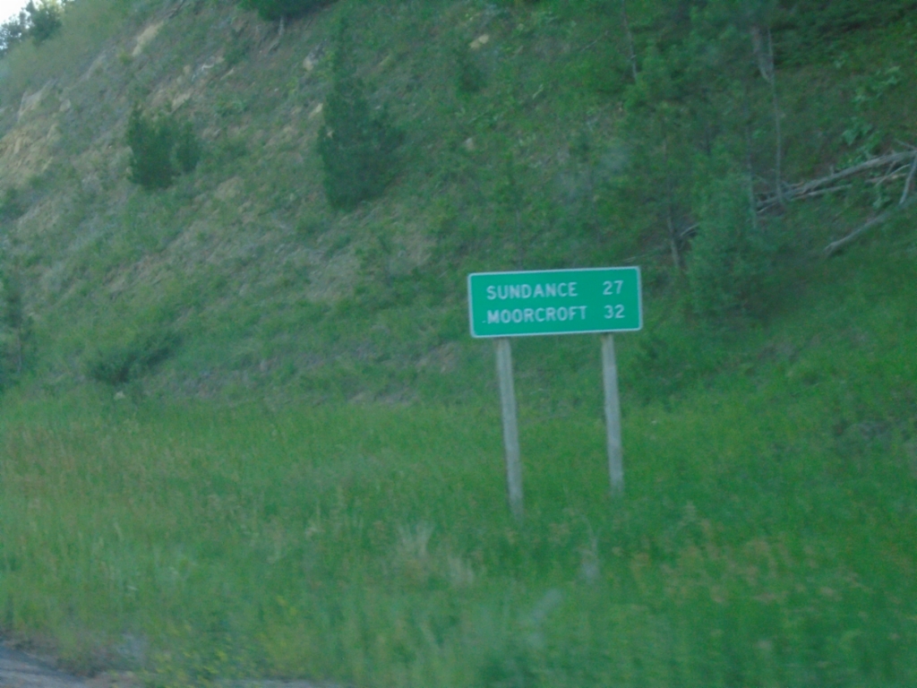
WY-24 West - Distance Marker
Distance marker on WY-24 west. Distance to Sundance and Moorcroft.
Taken 07-01-2025
Devils Tower
Crook County
Wyoming
United States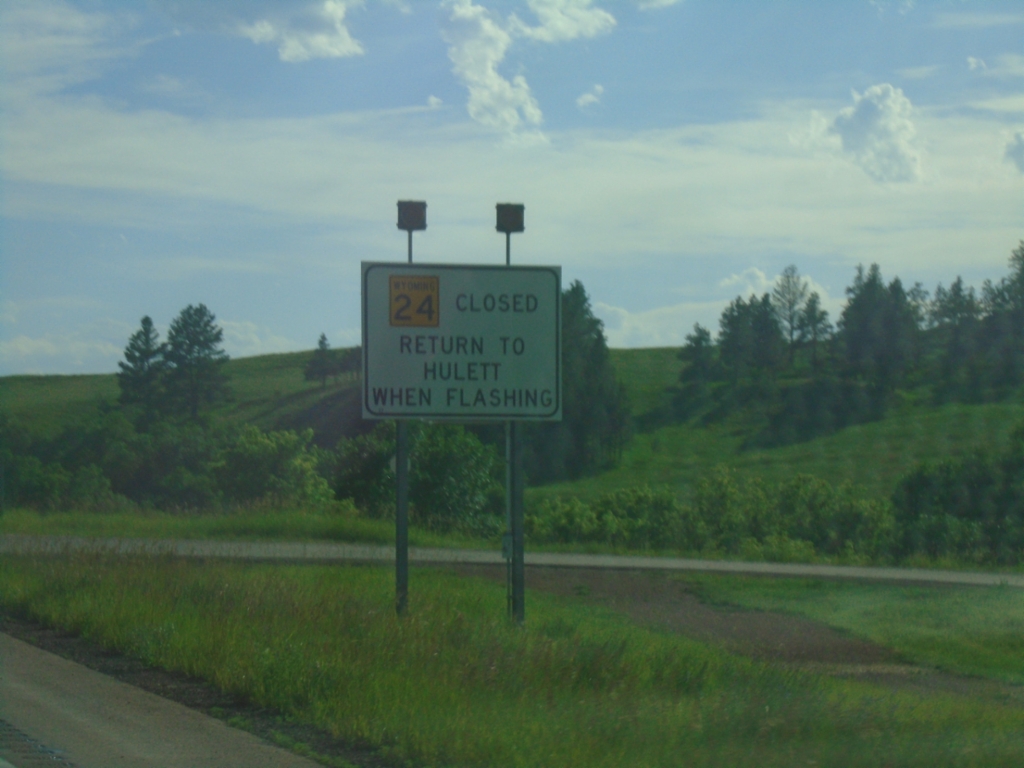
WY-24 West - Winter Closure
WY-24 West is closed when lights are flashing. Return to Hulett.
Taken 07-01-2025
Hulett
Crook County
Wyoming
United States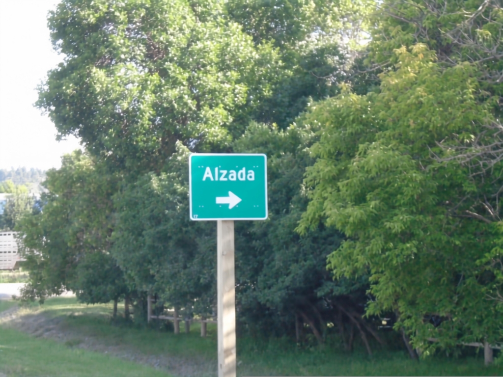
WY-24 West Approaching WY-112
WY-24 West approaching WY-112 to Alzada (Montana).
Taken 07-01-2025
 Hulett
Crook County
Wyoming
United States
Hulett
Crook County
Wyoming
United States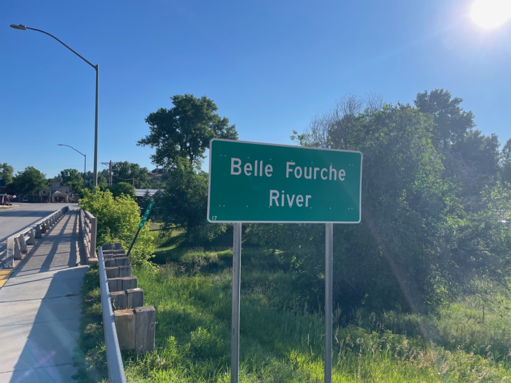
WY-24 East - Belle Fourche River
Belle Fourche River on WY-24 east in Hulett.
Taken 07-01-2025
Hulett
Crook County
Wyoming
United States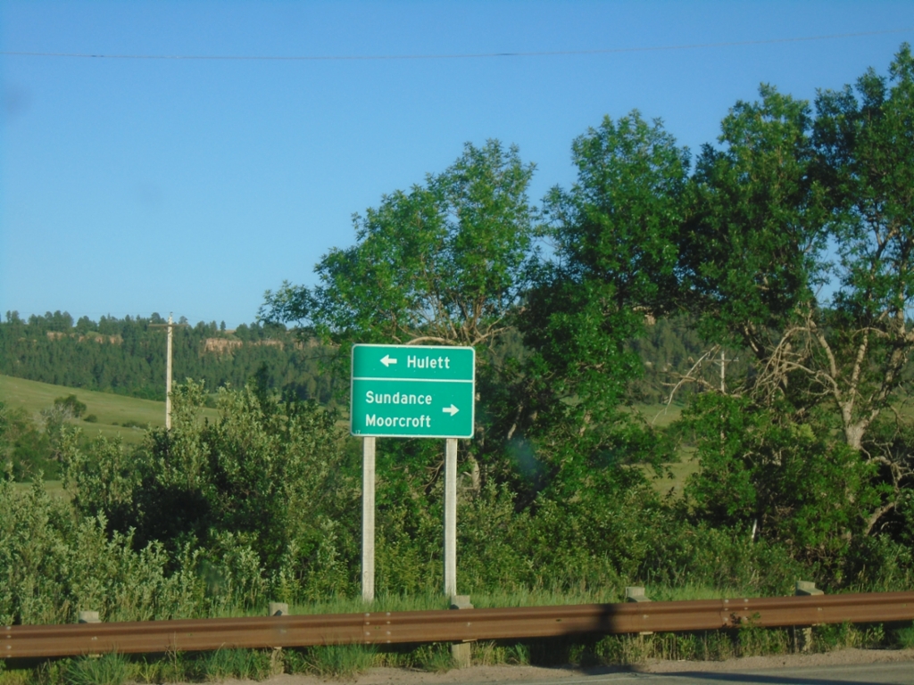
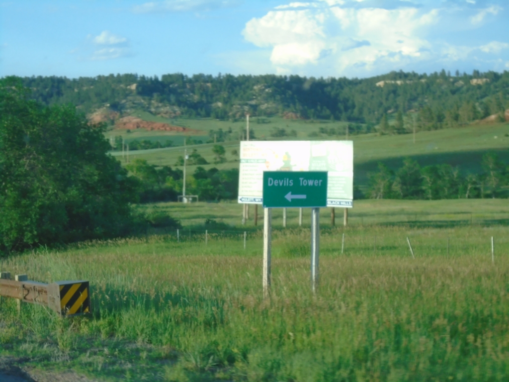
End WY-110 East at WY-24
End WY-110 East at WY-24. Use WY-24 east to Hulett; WY-24 west to Sundance and Moorcroft.
Taken 06-30-2025
Devils Tower
Crook County
Wyoming
United States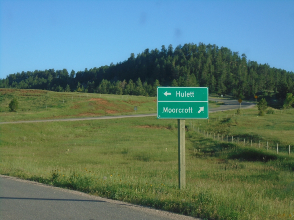
End WY-110 East at WY-24
End WY-110 East at WY-24 at Devils Tower. Use WY-24 west to Moorcroft; WY-24 east to Hulett.
Taken 06-30-2025
Devils Tower
Crook County
Wyoming
United States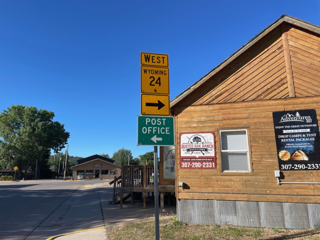
WY-24 West - Hulett
WY-24 west in Hulett. Turn right to continue west on WY-24. Turn left on Hill St. for Post Office.
Taken 06-30-2025
Hulett
Crook County
Wyoming
United States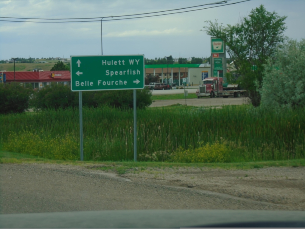
SD-34 West at US-85
SD-34 West at US-85. Use US-85 south to Spearfish; US-85 north to Belle Fourche. Continue west on SD-34 for Hulett, Wyoming.
Taken 06-29-2025

 Belle Fourche
Butte County
South Dakota
United States
Belle Fourche
Butte County
South Dakota
United States
US-85 South at SD-34
US-85 South at SD-34. Use SD-34 east to Whitewood; SD-34 west to Hulett, WY. Continue south on US-85 to Spearfish.
Taken 06-29-2025
Belle Fourche
Butte County
South Dakota
United States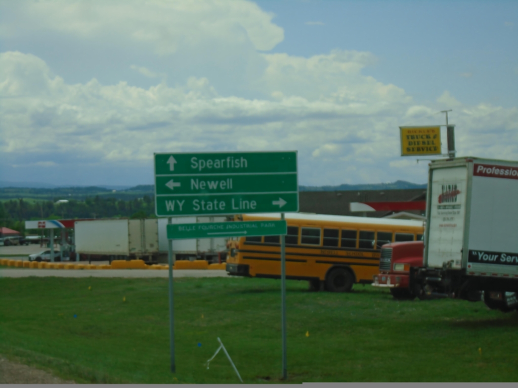
US-85 South Approaching US-212
US-85 South approaching US-212 in Belle Fourche. Use US-212 West to Wyoming State Line; US-212 East to Newell. Continue south on US-85 to Spearfish.
Taken 06-29-2025
 Belle Fourche
Butte County
South Dakota
United States
Belle Fourche
Butte County
South Dakota
United States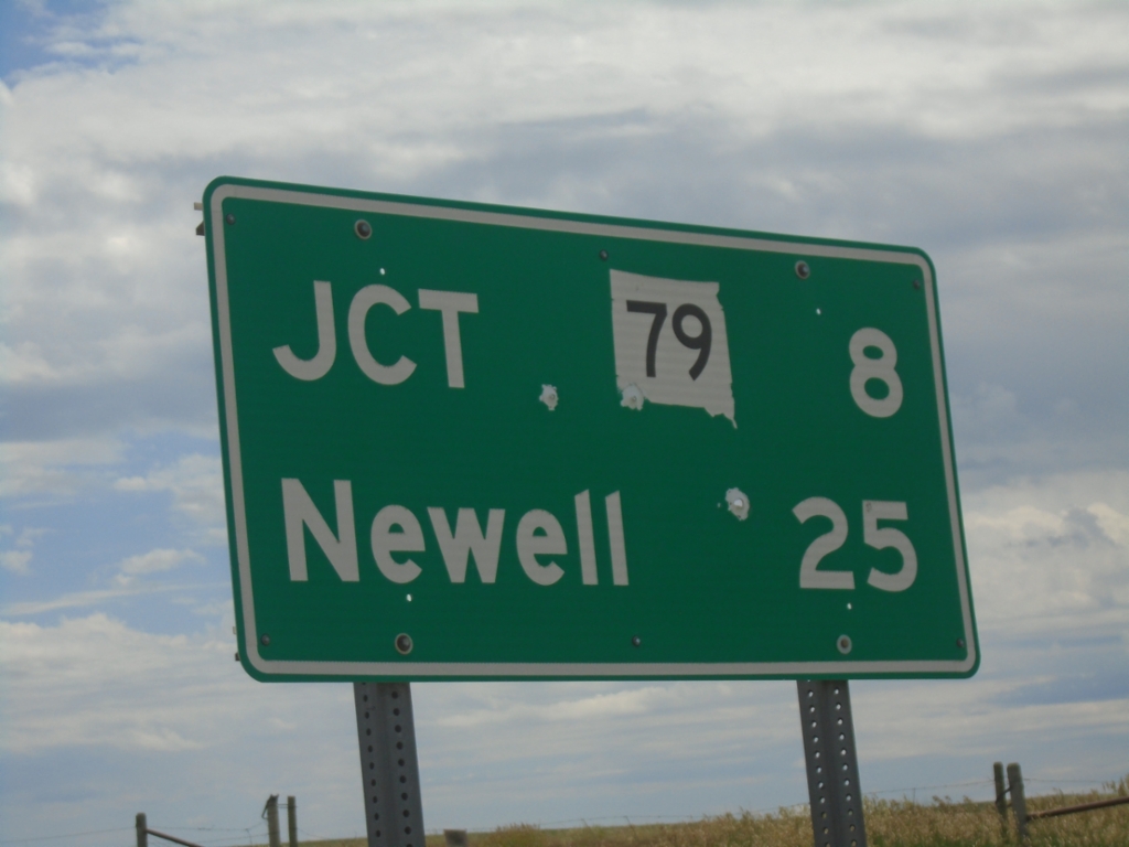
SD-168 East - Distance Marker
Distance marker on SD-168 east. Distance to SD-79 and Newell.
Taken 06-29-2025

 Castle Rock
Butte County
South Dakota
United States
Castle Rock
Butte County
South Dakota
United States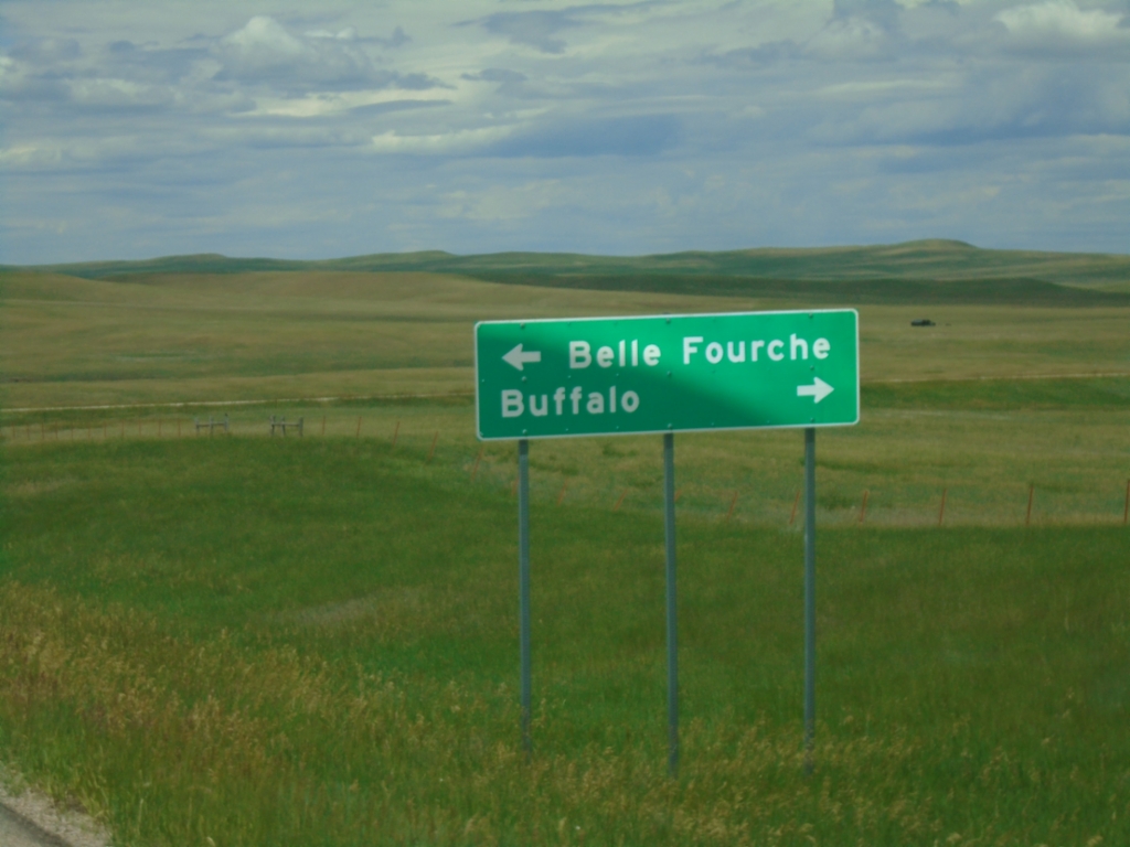
End SD-168 West at US-85
End SD-168 West at US-85. Use US-85 North to Buffalo; US-85 South to Belle Fourche.
Taken 06-29-2025
Castle Rock
Butte County
South Dakota
United States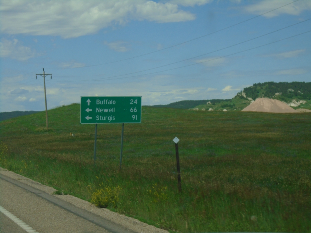
SD-20 West/SD-79 South at SD-20/SD-79 Split
SD-20 West/SD-79 South at SD-20/SD-79 split. Use SD-79 South to Newell and Sturgis; use SD-20 West for Buffalo.
Taken 06-29-2025
 Reva
Harding County
South Dakota
United States
Reva
Harding County
South Dakota
United States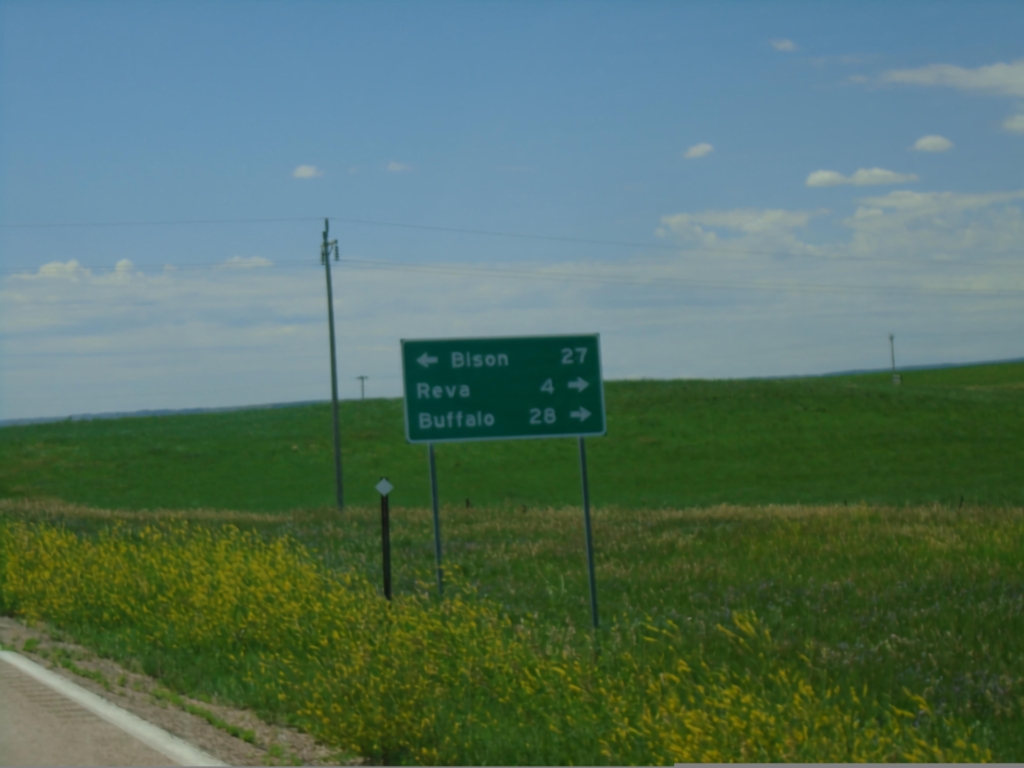
SD-79 South at SD-20
SD-79 South at SD-20 in Harding County. Use SD-20 East for Bison; SD-20 West/SD-79 South to Reva and Buffalo.
Taken 06-29-2025
Reva
Harding County
South Dakota
United States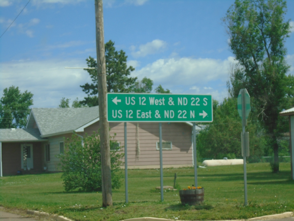
Main St. and 2nd Ave. - Reeder
Main St. north at 2nd Ave. in Reeder. Use 2nd Ave. West for US-12 West and ND-22 South; 2nd Ave. East for US-12 East and ND-22 North.
Taken 06-29-2025

 Reeder
Adams County
North Dakota
United States
Reeder
Adams County
North Dakota
United States